 |
Whitfell from Corney Fell Road Summit |
 |
 |
2nd April 2017 |
 |
|
I had a free weekend to complete two Outlying walks although the weather had other plans which saw me switch Saturdays walk to Sunday with hopefully a drier day forecast. It would seem that almost every Outlier that I have completed so far has been done in cloud, rain or drizzle and it was starting to look that like that I would only walk the Outlying fells when the weather wasn't fair enough to get higher, infact this couldn't have been further from the truth often saying that I had been so impressed with the routes I had already undertaken that I would come back and do them again under better conditions, well today we had them.
Todays walk takes in Whitfell from the top of Corney Fell road collecting Buck Barrow, Burn Moor and Kinmount Buck Barrow along the way all of which I have only ever observed from a distant fell side or from the road side. I guess it's fair to quote Wainwright when he said that these particular fells are often unfrequented even now some forty years since A.W completed the Outlying Fells they remain very much deserted where even grazing sheep will run a mile on the sight at a human alone. Because of how these particular fells are secluded from Lakeland I can relate to them as to what the Shap fells are to the far east of the district and for me to come out with such a statement knowing how particularly fond I am of far east Lakeland can only mean one thing, I think I've found an alternative to the Shap fells and once more, I was hooked so much so I've already planned my return visit but for now, this is Whitfell from Corney Fell Road summit. |
|
| Wainwright Guide Book |
 |
| The Outlying Fells |
-Whitfell
Consequently this is an unfrequented region but it is good walking country unimpeded by fences, and its demerits are fully compensated by the excellence of the views. |
 |
|
|
|
| |
|
Overview |
|
|
| Ascent: |
1,100 Feet - 335 Metres |
| Outlying Fells: |
Whitfell |
| Visiting: |
Buck Barrow - Burn Moor - Kinmont Buck Barrow |
| Weather: |
Sunny Throughout With Some Summit Cloud, Highs of 13°C Lows of 7°C |
| Parking: |
Corney Fell Road Summit |
| Area: |
Western |
| Miles: |
5.75 |
| Walking With: |
David Hall |
| Ordnance Survey: |
OL6 |
| Time Taken: |
2 Hours 40 Minutes |
| Route: |
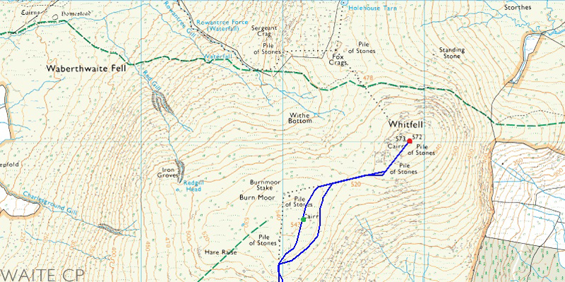
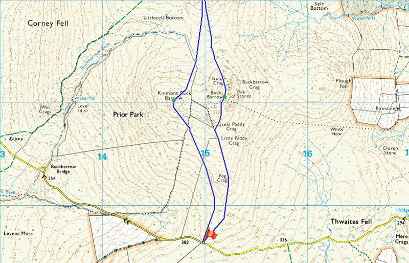
Corney Fell Road Summit - Peg Crag - Great Paddy Crag - Buck Barrow - Burn Moor - Whitfell - Burn Moor - Kinmount Buck Barrow - Corney Fell Road Summit
|
|
| |
|
Map and Photo Gallery |
|
|
  |
| |
| |
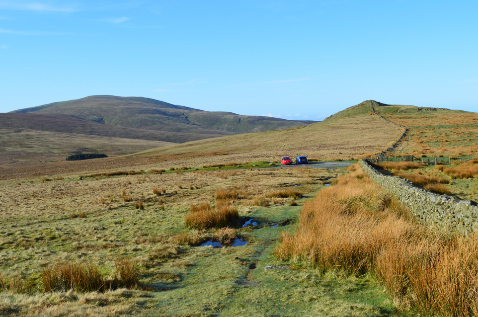 |
| Looking back on Corney Fell Road summit towards Stoneside Hill and Black Combe 7°C 9:00am |
We had arranged to meet later than our usual meeting time which saw me arrive at the top of Corney Fell Road a little before at 09:00am where I found David had already parked up and was waiting for me besides his car, as it turns out David had taken a quick walk to the top of Stoneside Hill if only to take in the fantastic views over the top of the summit pass. I however, would have been much earlier and could have possibly joined David had I not have taken a wrong turn which saw me realise my mistake quite quickly but I simply couldn't turn around for a good mile owing to the road being so narrow D'oh!
I arrived with just minutes to spare and greeted David with the usual handshake while feeling a slight nip in the air not helped by the fact that today I am dressed in just shorts and T-shirt, I guess I just couldn't wait to bare skin. Minutes later I am lacing up while chatting and I can see the cold air in David's breath and with that, I add an extra layer. We take in our surroundings while commenting on just how nice the morning was with distant summits seen in full panorama. With the cars locked we head out towards our first Outlying summit of the day in Buck Barrow which soon comes in to view. |
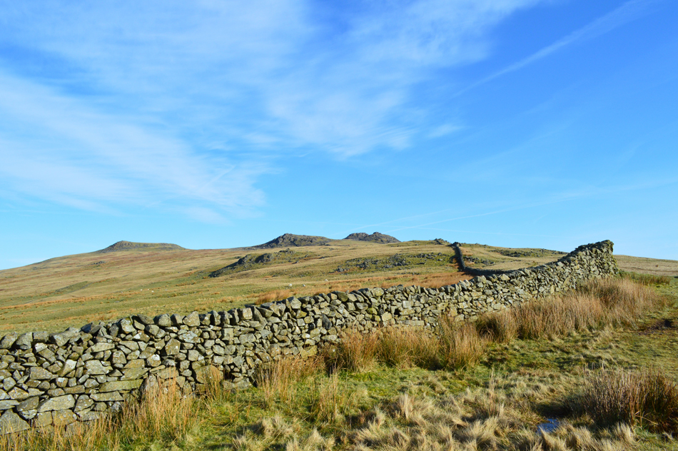 |
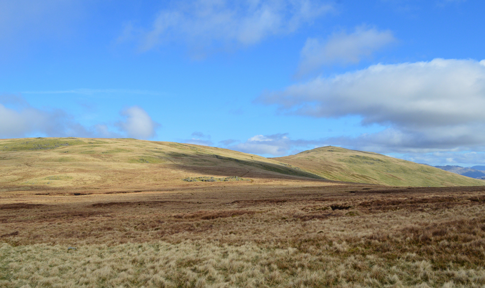
| Kinmount Buck Barrow, Great Paddy Crag and Buck Barrow. |
From the top of Corney Fell Road it was just a simple case of following the stone wall over a gentle rise all the way towards Buck Barrow summit seen in the right of the photograph.
Incidentally, that's Kinmount Buck Barrow over on the far left which we summit on our return, just as A.W had after he recommended this route in his guide book The Outlying Fells. |
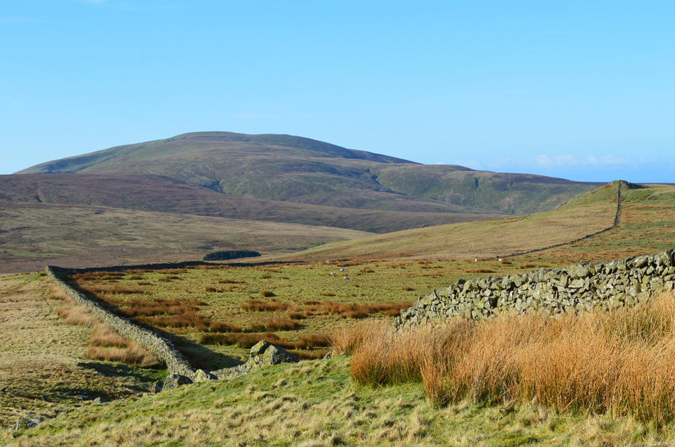 |
| Views back over towards Stoneside Hill and Black Combe from higher up the path. |
| It's hard to tell that there's a road running right through the middle of this view, what a fantastic place. |
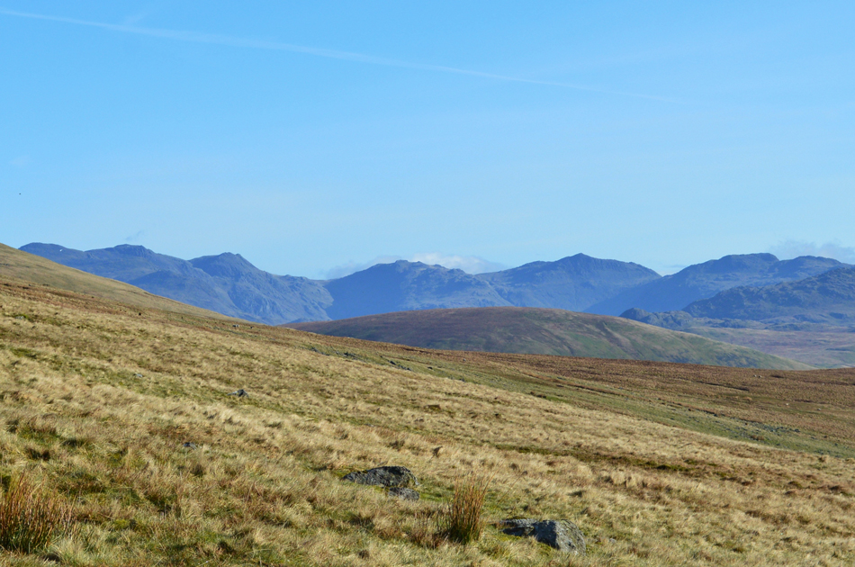 |
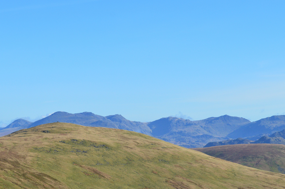
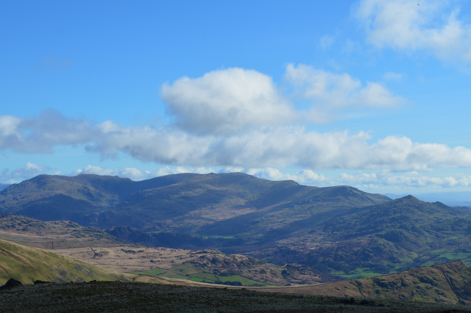
| Distant views towards the Scafells, III crag, Esk Hause, Esk Pike, Bow Fell and Crinkle Crags. |
| Outstanding views into the Upper Eskdale Valley as we approach Great Paddy Crag. |
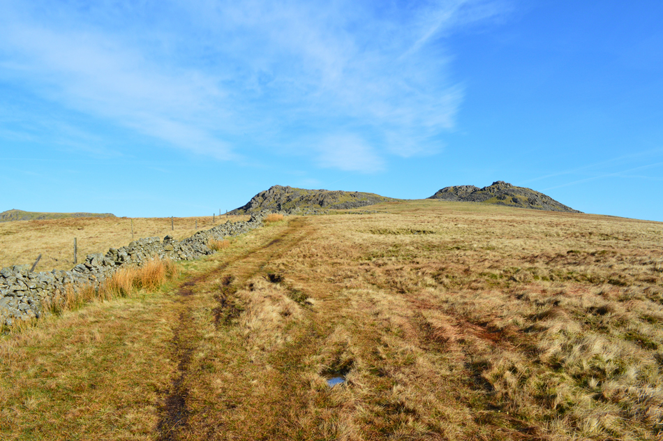 |
| Great Paddy Crag seen with Buck Barrow over on the right. |
| Despite conditions feeling quite moist underfoot we couldn't have found ourselves in a more perfect setting, the sun is out, there are views as far as the eye can see and the birds are tweeting, what a perfect Spring day. |
 |
| Kinmount Buck Barrow from Buck Barrow Summit. |
| Our path continued to rise steadily until Great Paddy Crag and Buck Barrow was presented before us, oddly this is where the scenery changes underfoot in favour of a short rocky climb towards Buck Barrow summit as our grassy trod forms a 'Y' with options to pay a visit to Great Paddy Crag, Buck Barrow's neighbouring summit, however todays route follows Wainwrights original route which will see us summit just Buck Barrow today. |
 |
| Burn Moor and Whitfell from Buck Barrow summit. |
| With views as good as this why I ask myself, have I left it so long to visit these summits. |
 |
| Closing in on Great Gable, Slight Side, The Scafells, III Crag, Esk Hause, Esk Pike, Bow Fell and Crinkle Crags seen over the summits of Whitfell and Hesk Fell from Buck Barrow summit. |
| |
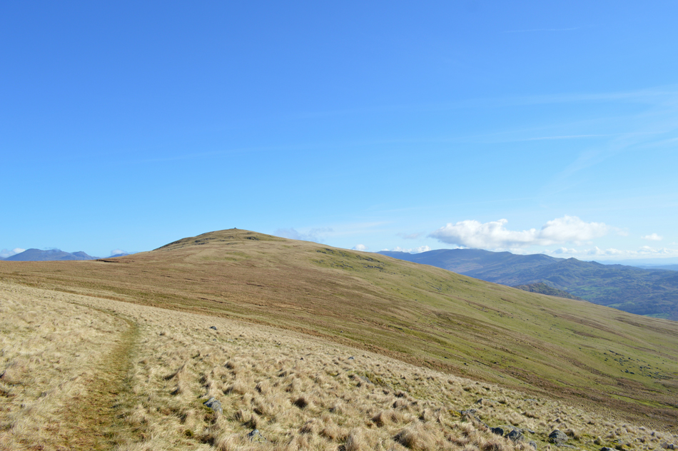 |
| Whitfell is just ahead. |
| Instead of heading towards Burn Moor which is just over to our left we steer a path east flanking its summit which we will collect after summiting Whitfell seen just up ahead over swollen ground in places but that didn't matter, here is a place where you are rewarded for your efforts, no matter how small they are. |
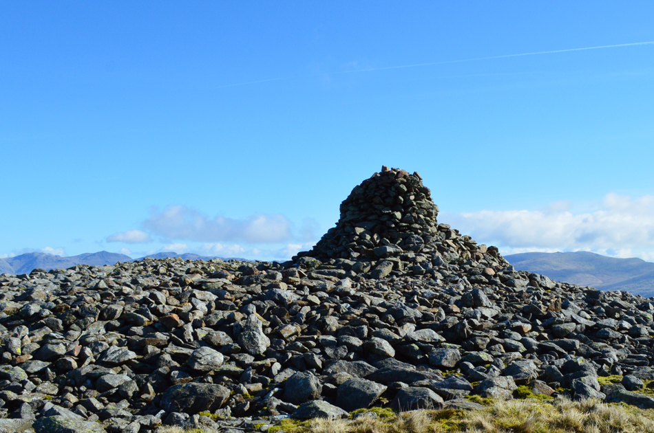 |
| Whitfell summit cairn complete with shelter. |
| |
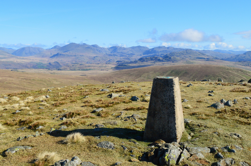 |
| Commanding views once more from the summit Trig Point. |
There are moments when you are lost for words, when your heart palpitates inside your chest but you say nothing, everything comes together here. with the exception of a distant bird tweeting over the top of a cooling breeze, nothing broke the silence, a time for thought, a time to plan. |
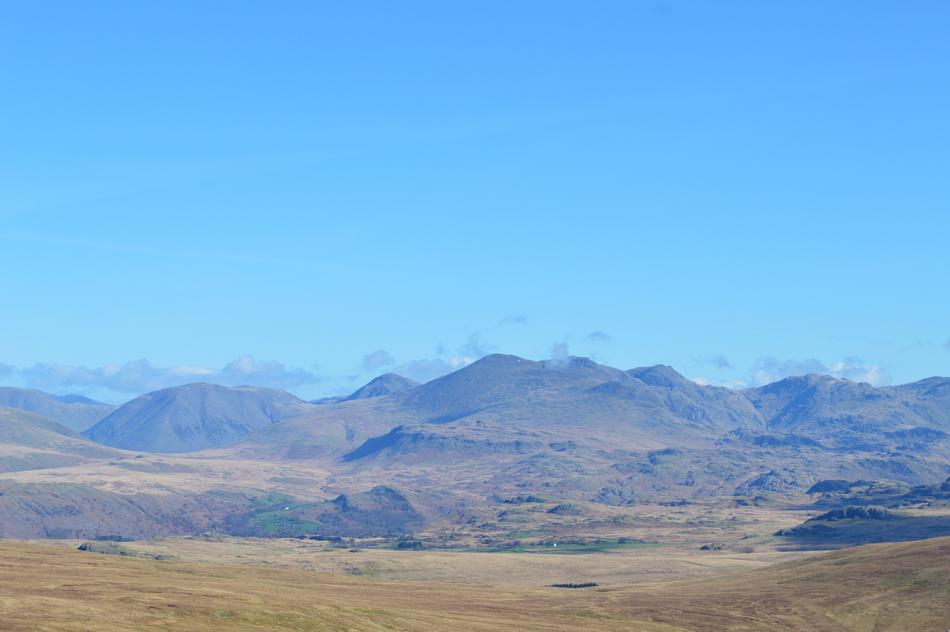 |
| A close up towards Kirk Fell, Great Gable, Slight Side, Sca Fell, Great How, III Crag, Esk Hause and Esk Pike from Whitfell summit. |
| |
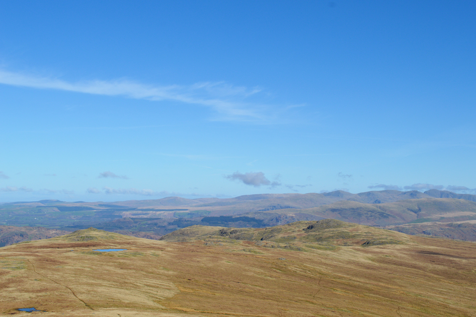 |
| Views further north over Holehouse Tarn, Stainton Pike, Yoadcastle and Woodend Height while in the distance, Dent, Ponsonby Fell, Whin Rigg, Illgill Head, Buckbarrow (Wasdale) Middle Fell, Haycock, Scoat Fell, Red Pike (Wasdale) and Pillar. |
| |
 |
| The Coniston and Duddon Group. |
| Here taking in the view over the distant Coniston and Duddon valley fells firstly towards Grey Friar, Great Carrs, Coniston Old Man, Dow Crag, Buck Pike, Brown Pike, White Pike, Caw, Stickle Pike and Great Stickle. |
 |
| Time to head back now as we head towards Burn Moor. |
| From the summit of Whitfell we re-trace our path before diverting towards Burn Moor summit, you can see the path we used earlier over on the left. |
 |
| Looking back on Whitfell from Burn Moor subsiduary summit cairn. |
| It may not look it... |
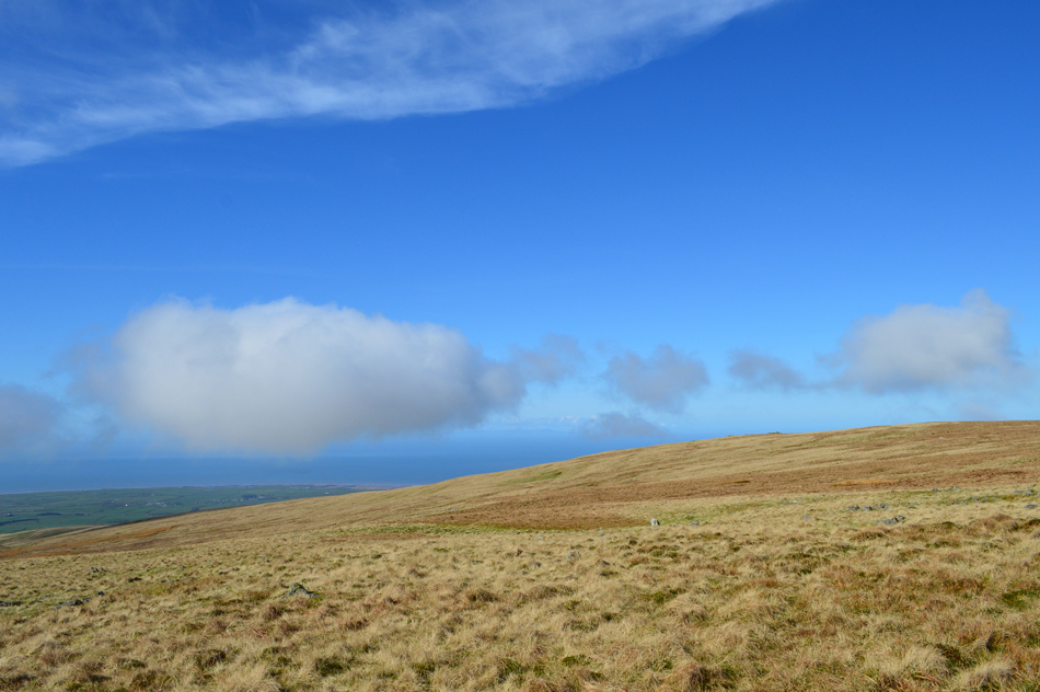 |
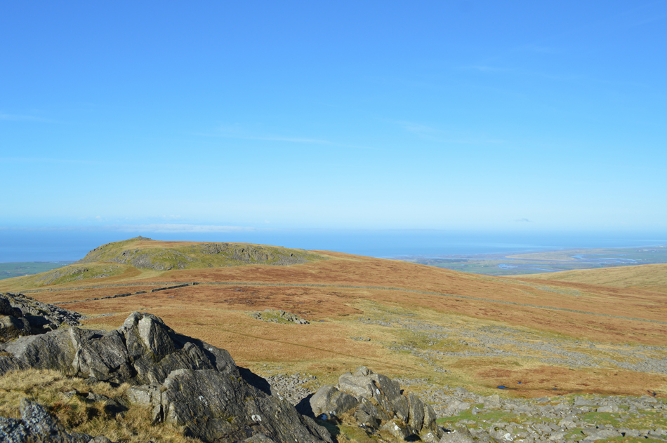
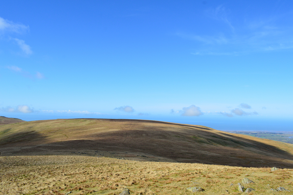
| Views west towards the Cumbrian coast. |
| ...But the cloud is really starting to build up, especially from the west. |
 |
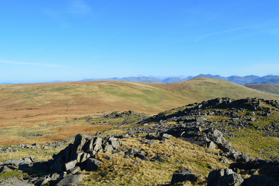
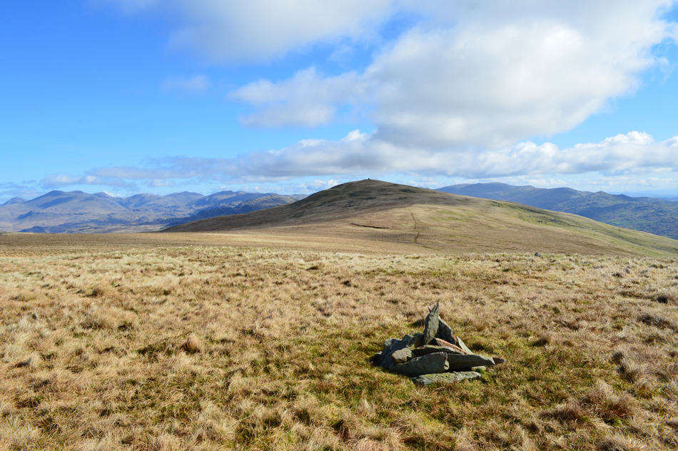
| Views back towards Burn Moor and Whitfell before starting our ascent on Kinmount Buck Barrow. |
| Well, it was spoken of earlier before we descended Buck Barrow that we could just about see a build of cloud forming up the summit of Black Combe, non of which looked too threatening although before we had the chance to start our ascent on Kinmount Buck Barrow we witnessed a barrage of low cloud rolling in from the direction of the coast and before we knew it our view had all but disappeared. |
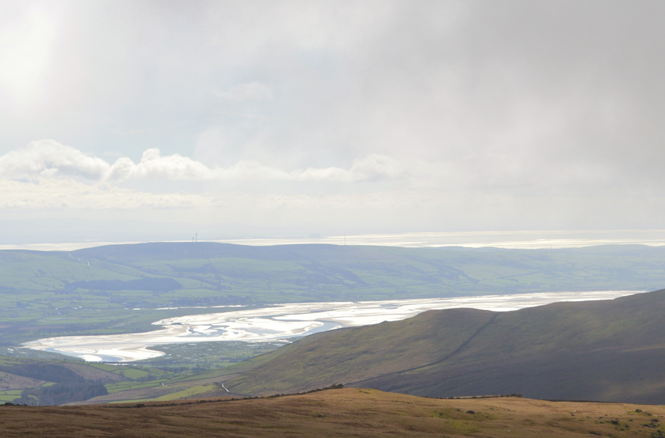 |
| A close up of the Duddon Estuary with Morecambe Bay in the distance from the summit of Kinmount Buck Barrow. |
With a sudden drop in temperature met with a cool breeze we summited Kinmount Buck Barrow while in cloud which thankfully passed after waiting for a few moments at the summit from where as quickly as they disappeared our views started to return but this sadly this still wasn't the case for Black Combe which had a substantial amount of cloud over its summit. |
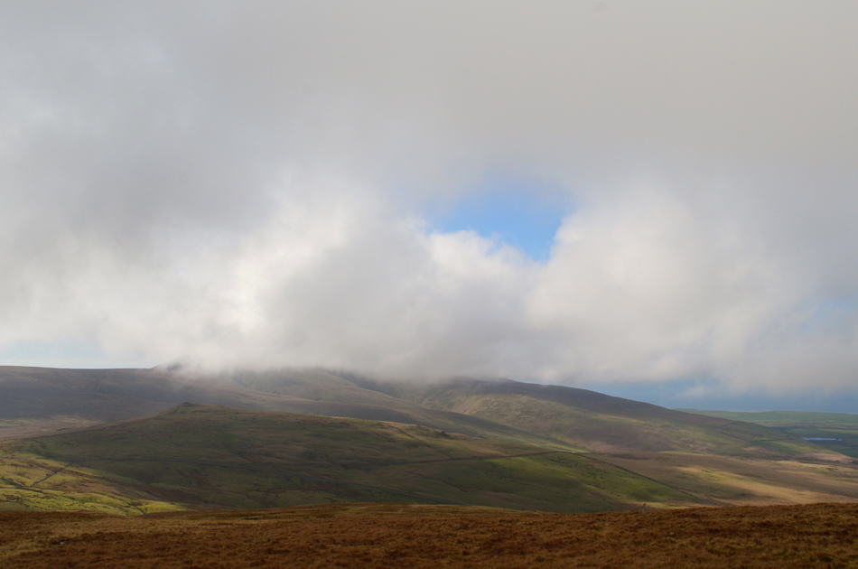 |
| Black Combe as we head back towards our cars at the top of Corney Fell Road. |
| There's still time, and more importantly there's promise in that cloud, let's not get too worried just yet. |
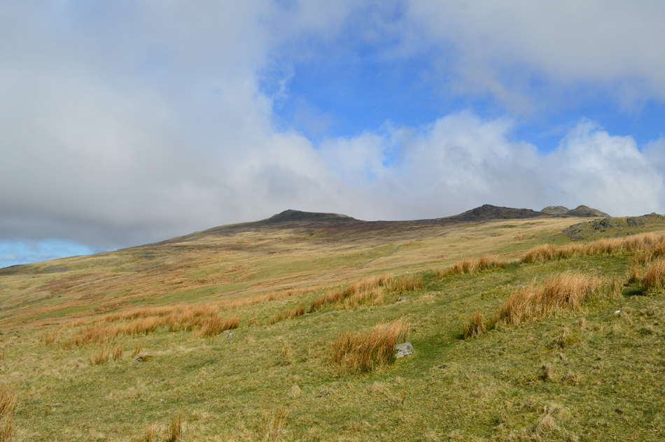 |
| Looking back on Kinmount Buck Barrow, Great Paddy Crag and Buck Barrow from Corney Fell Road Summit. |
After summiting Kinmount Buck Barrow we descended back to the top of Corney Fell road via a pathless road observing the cloud over the top of Black Combe knowing full well within the hour we'd be up there and high hopes remained as we each grabbed snacks to eat whilst taking in the drive towards Whicham from where walk two of the day will start all the while still reflecting on a walk that totally blew me away.
|
|
| |
| Back to top |
 |
|
