|
Fairfield via Deepdale and The Step |
 |
 |
15th April 2017 |
 |
|
Its was fellow walker Ian Sharples who first suggested this route to me some years ago and ever since the route has sat there on the shelf waiting to be picked out where for one reason or another, mainly due to projects over the last two years I just never got around to completing the route. Fast forward to October 2016 when David and I completed 'A Deepdale Horseshoe' on a day when we sat overlooking Link Cove whilst studying a route onto The Step and Link Hause, it was here the route took a definite hold again and it was agreed that once Winter was out of the way we would give it a go. Over Winter David came up with his mini Fairfield project where he would summit Fairfield by a dozen different routes which he started just a few weeks ago and in those routes David did not forget to include Fairfield via The Step which I guess is where the walk was reborn.
Despite it being Spring this particular walk hinged on a dry if not bright forecast and right up to the eleventh hour didn't get the go ahead due to showers and possible snow forecast across the summits, it wasn't so much that we didn't want to walk in snow, it's the fact that visibility would have been reduced which was the put off, it was agreed that we would make the call whether to go ahead with the ascent of The Step until we were in the Deepdale valley where we would have had the choice to continue or abort and ascent via Deepdale Hause and Cofa Pike, thankfully the rain held off, that was until the hail arrived by which time we were already looking back on The Step over the top of Hog Hole feeling mighty pleased with ourselves. |
|
| Wainwright Guide Book One |
 |
| The Eastern Fells |
-Greenhow End
The towering cliffs of Greenhow End and the mile long facade of imposing crags and deep ravine gullies on Fairfield's north east face are ample recompense for the immediate dreariness of Deepdale. |
 |
|
|
|
| |
|
Overview |
|
|
| Ascent: |
3,627 Feet - 1,106 Metres |
| Wainwrights: |
3, Fairfield - St Sunday Crag - Birks |
| Weather: |
Overcast With Sunny Spells, Rain, Hail & Strong Winds Across The Summits, Brighter Later Afternoon. Highs of 15°C Lows of 7°C Feels Like -7.3°C |
| Parking: |
Roadside Parking, Deepdale Bridge |
| Area: |
Eastern |
| Miles: |
10 |
| Walking With: |
David Hall, Tim Oxburgh and Rod Hepplewhite |
| Ordnance Survey: |
OL5 |
| Time Taken: |
6 Hours 35 Minutes |
| Route: |
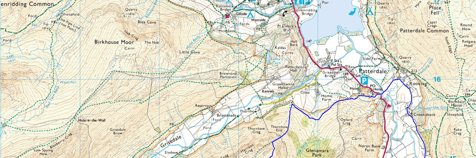
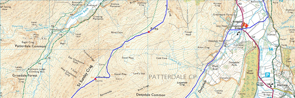
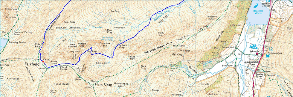
Deepdale Bridge – Wallend – Deepdale – Mossydale – Link Cove – The Step – Link Hause - Fairfield – Cofa Pike – St Sunday Crag – Birks – Thornhow End – Patterdale – Rooking – Deepdale Bridge
|
|
| |
|
Map and Photo Gallery |
|
|
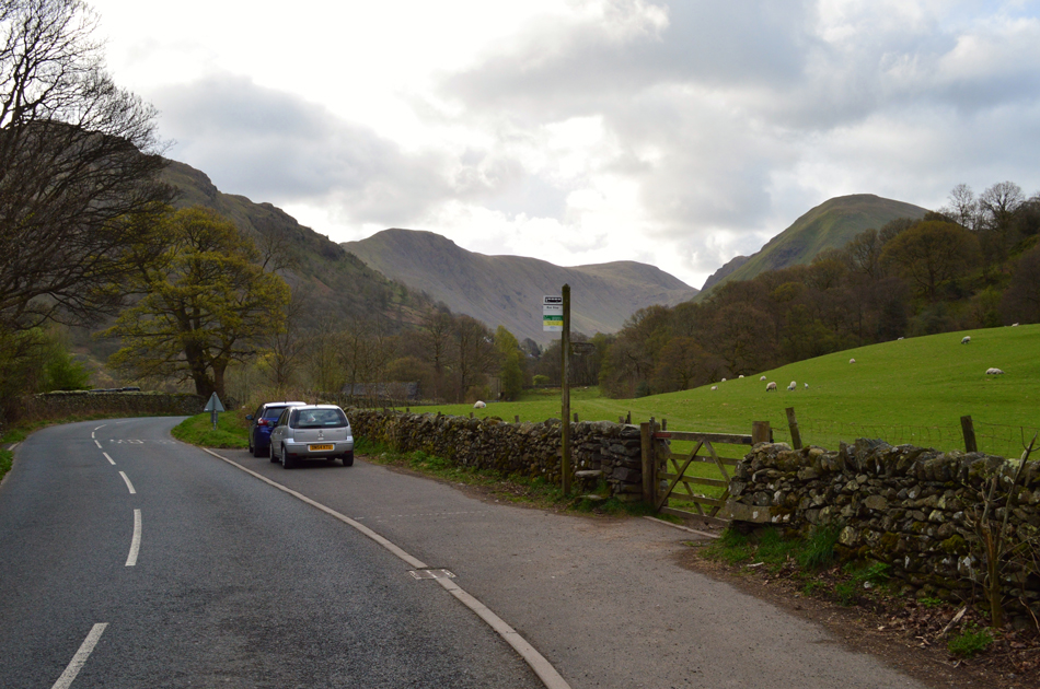 |
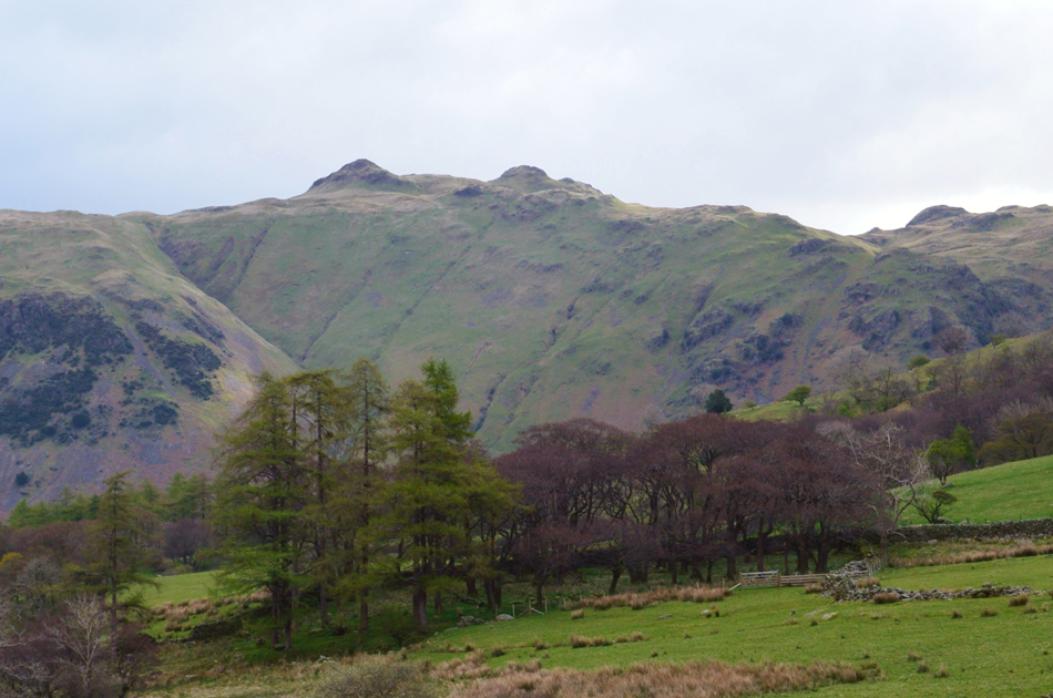
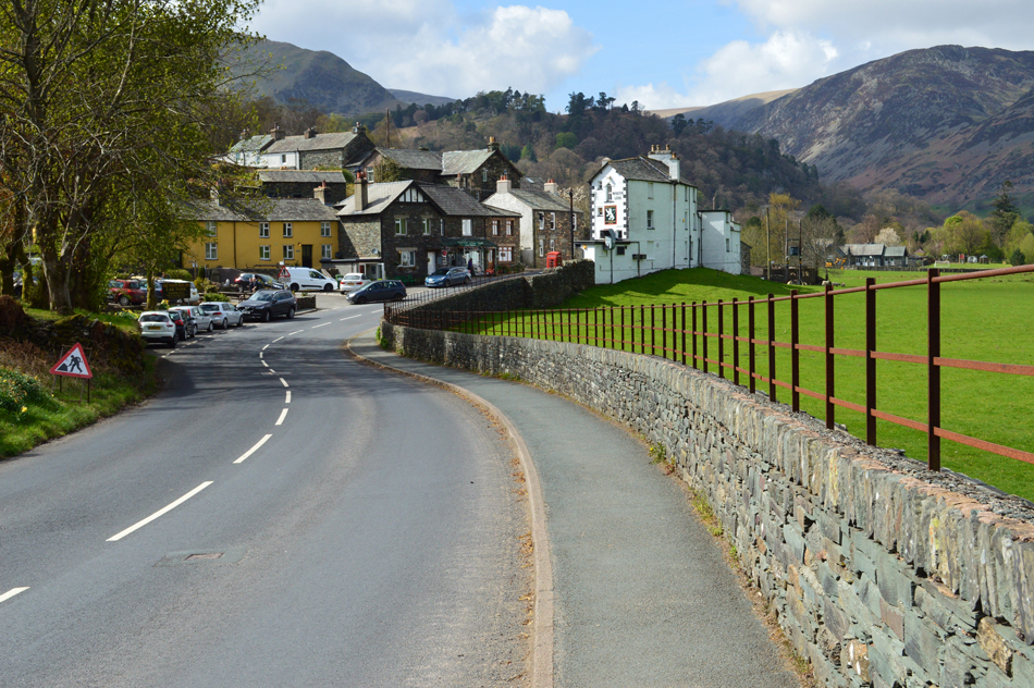
| Middle Dodd and Caudale Moor from Deepdale Bridge 08:40am 7°C |
We had arranged to meet at Deepdale Bridge at 08:30am where we found Rod had already arrived and was almost ready for the off. David, myself and Tim arrived together separately and parked easily along the layby. It was quite mild and yet breezy here in the valley and strong winds had been forecasted over the summits throughout the day, something that we would later experience but more on that later. David had managed to pull up alongside Rod's car while Tim and I kit up a little further up where we layer up for a blustery chilled day on the fells which kinda feels surreal after walking two consecutive weekends in just shorts and T-shirt.
We group back together making sure cars are locked before crossing over Deepdale Bridge and passing through a gate onto open farmland before heading towards Deepdale Hall. |
 |
| Heading towards Deepdale Hall with views of the Hartsop above How ridge on the skyline. |
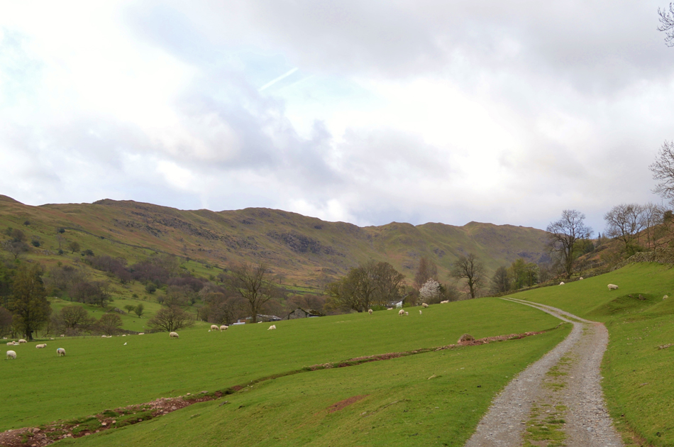
| This really is a pleasant start to the walk as we head into the Deepdale valley where as Tim puts it "is a nice leg stretcher before the tough ascent begins" Tim was right, it really was a relaxing start to the walk but we might not get anywhere at all... |
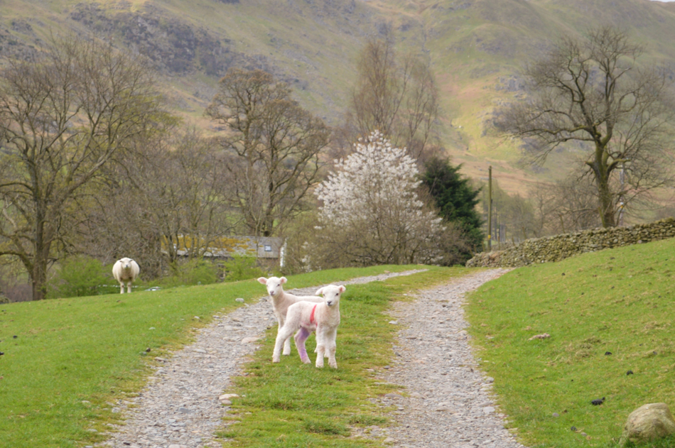 |
| ...If we're not allowed to pass. |
| Showing no fear the two Lambs held their ground until we were almost upon them before running off back to mum who was watching from afar. |
 |
| The Deepdale Valley from Wall End. |
| Hart Crag makes its first appearance as we pass through Wall End seen in the distant left while on the right Latterhaw Crag provides the Gavel Pike/Lords Seat route onto St Sunday Crag. |
 |
| Views out of the valley towards Angletarn Pikes and Brock Crags. |
| |
 |
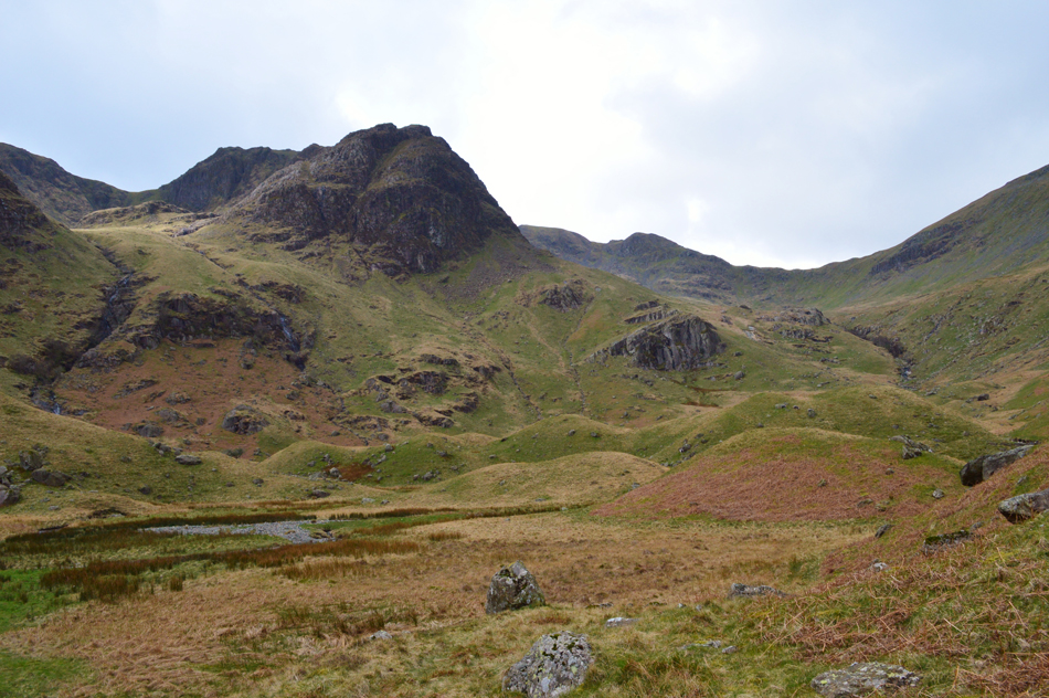
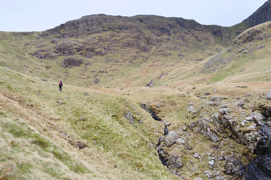
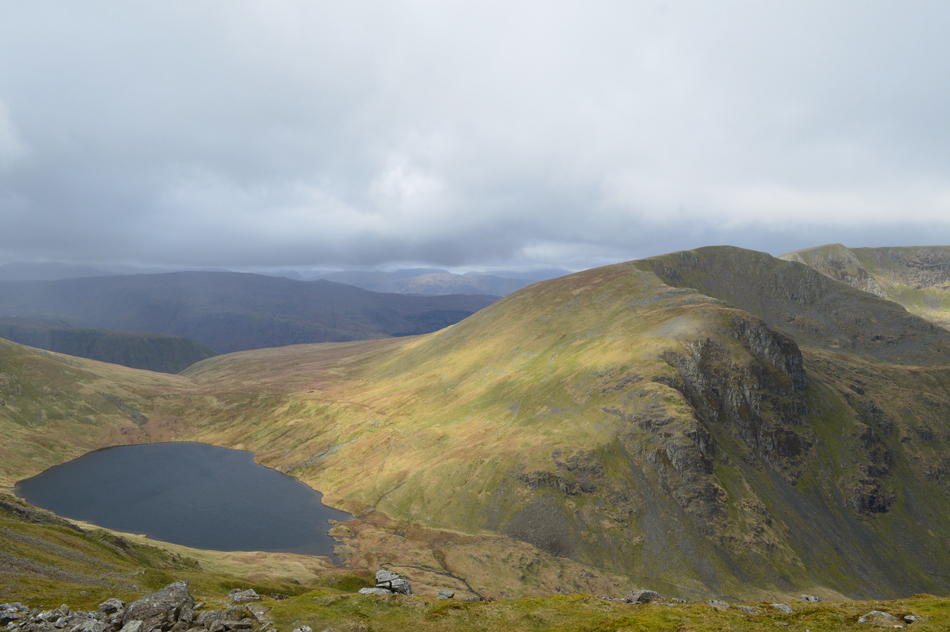
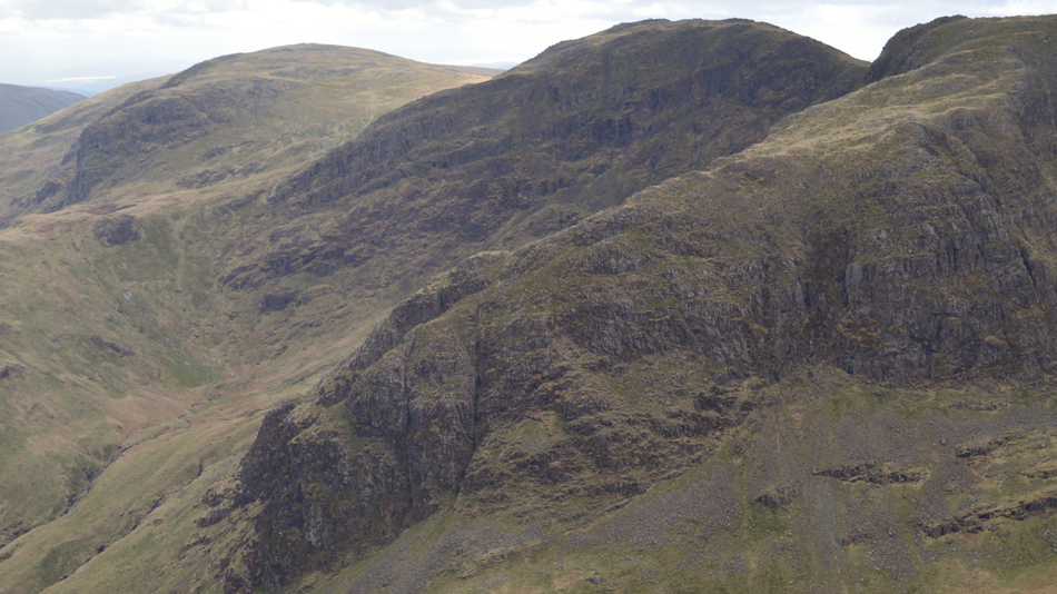
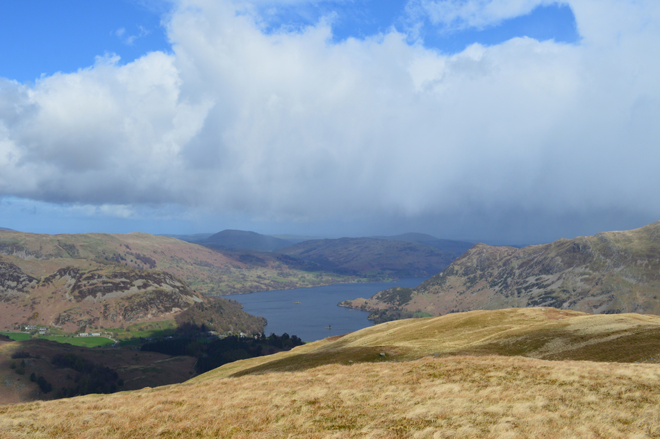
| Hart Crag, Link Cove, Greenhow End/The Step, Fairfield Cawk Cove, Cofa Pike and Deepdale Hause. |
| After rounding Latterhow Crag our views towards the head of the valley open out revealing Greenhow End and The Step, it was from here we confirmed the steep ascent route into Link Cove. |
 |
| Greenhow End, The Step, Link Cove, Cofa Pike and Cawk Cove. |
| It was agreed that our ascent route into Link Cove would be towards the left of the ravine but first we had to negotiate through the Drumlin field while trying not to get drawn in by needless ascent. |
 |
| The hanging valley of Link Cove. |
There was a few spots of rain in the air by the time we reached the head of the valley at which point we had already committed to the route, thankfully the shower passes leaving the odd bright spell from above.
Our route into Link Cove can be seen more clearly in this image where we head between the two Drumlins below Erne Nest Crags while maintaining ascent towards the three large boulders at the bottom left of the Ravine, I guess this is where the hard work starts! |
 |
| Classic glacial territory. |
| |
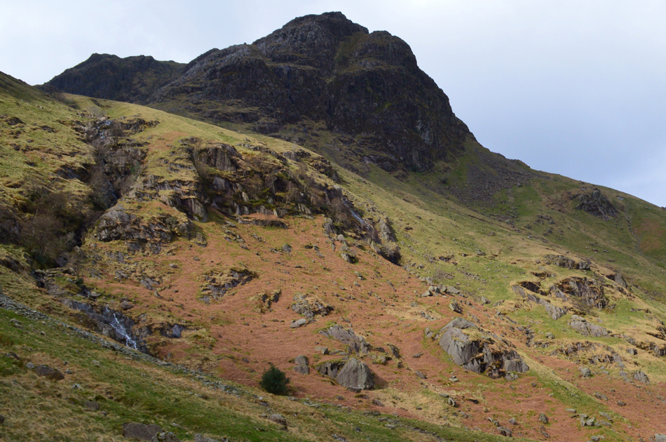 |
| Greenhow End domineers the start of the climb into Link Cove. |
| There's those bright spells again, what a fantastic place. |
 |
| Ruled by Greenhow End. |
Tim goes off to explore the Ravine while Rod's "go for it attidude" sees him take on the steep ascent with incredible pace soon leaving the pack and disappears up ahead beyond many a false summit.
David and I take the ascent in our stride all the while a blister is starting to form on my right heel caused by wearing a different pair of boots on yesterdays trio of walks, I wouldn't mind but they are the same boots I completed my Lakeland 2,000 footers in and should be well used to my feet by now, I guess it's the boots way of saying thanks for hanging me up on the airing cupboard!
I press on. |
 |
| From half way into the ascent I took this photo looking out over the Drumlin field back through the Deepdale Valley. |
| A good reason to stop for a breather too. |
 |
| Rod adds scale to Link Cove while Hart Crag domminates from above. |
Rod waited at the top of the Ravine which Tim chose to ascend the last few hundred feet before coming to a hault at a Waterfall seen in the bottom right of the photo. We shout down to Tim and ask him to climb out the Ravine where we would meet him on the other side.
What a place! |
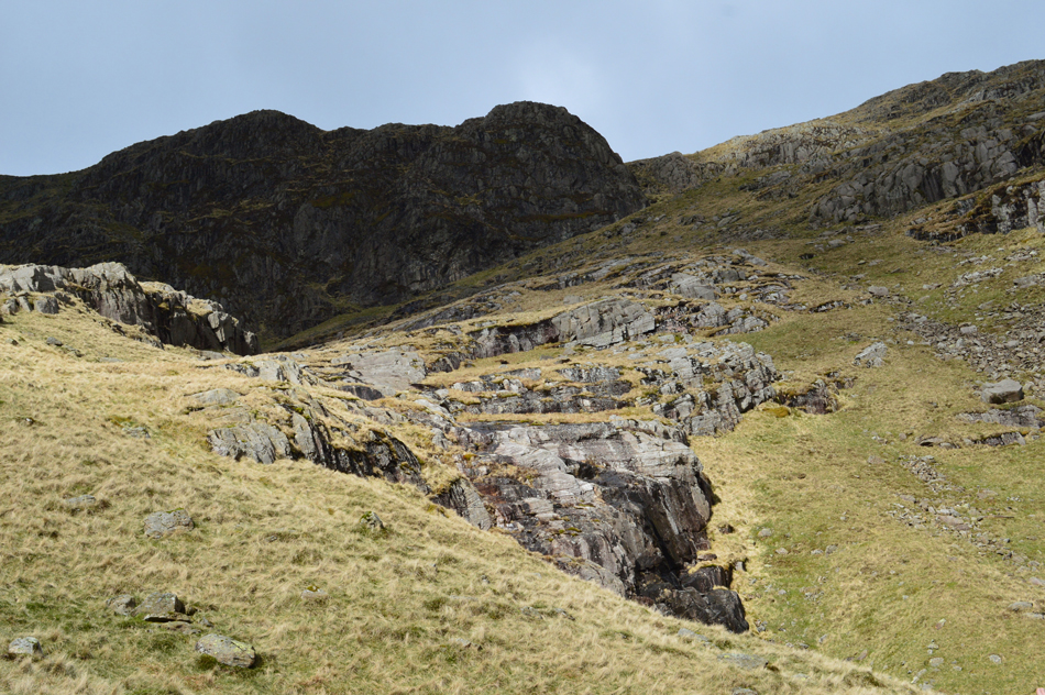 |
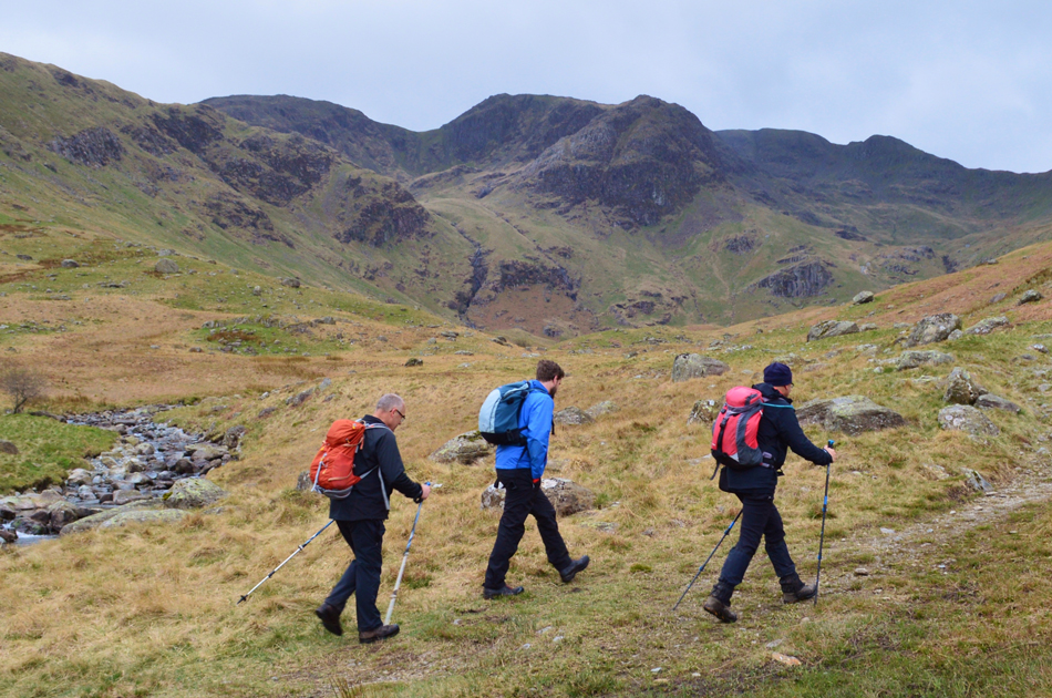
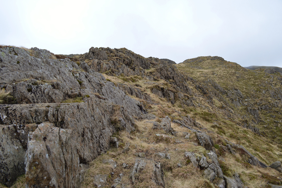
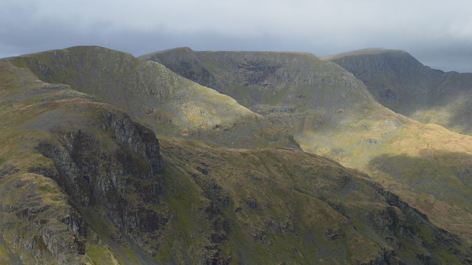
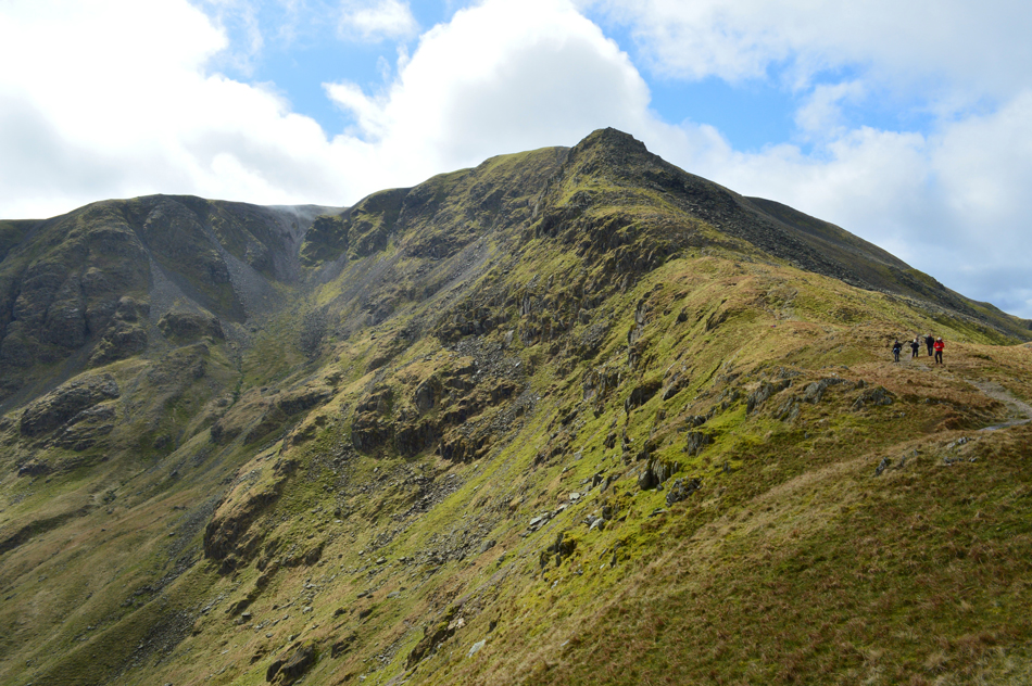
| Scrubby Crag seen above our ascent route onto The Step. |
After meeting back up with Tim who by now has de-layered to shorts we cross over to the start of a grass rake (seen right) which will ascend us onto The Step, it was agreed that once at the base of the Scrubby Crag we would head right if only to get the true effect of The Step ridge.
Best make a start I guess, it really is as steep as it looks. |
 |
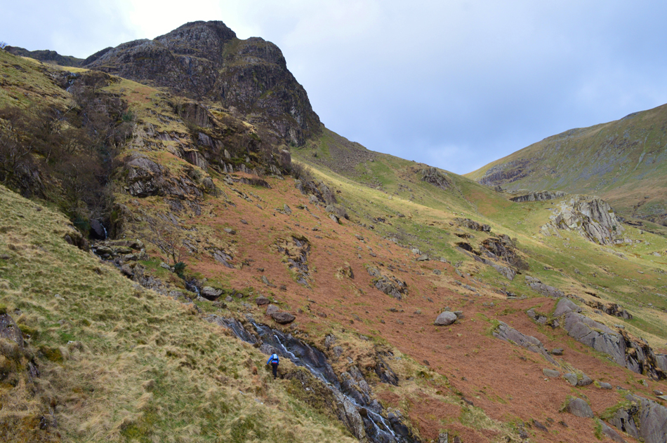
| Hartsop above How seen over Erne Nest Crags from the ascent onto The Step. |
It was no good I had put up with the niggling pain of the blister for too long and knew if I continued without treating it I may well ruin my whole walk. Rod by now is up ahead and gaining ground towards the base of Scrubby Crag while I begin the task of unlacing my boot if only to place a plaster over the blister which David thankfully provided meaning I didn't have to de-shoulder my own pack and start routing through my first aid kit.
Laced back up again I rejoin the ascent feeling the comfort of the plaster instantly, well worth the stop.
Rod waits at the foot of the ever imposing Scrubby Crag and we soon join him and use the time to get our breaths back, by now that wind which was forecast is starting to make a show as the temperature starts to drop and exposed skin soon starts to feel the pinch. |
 |
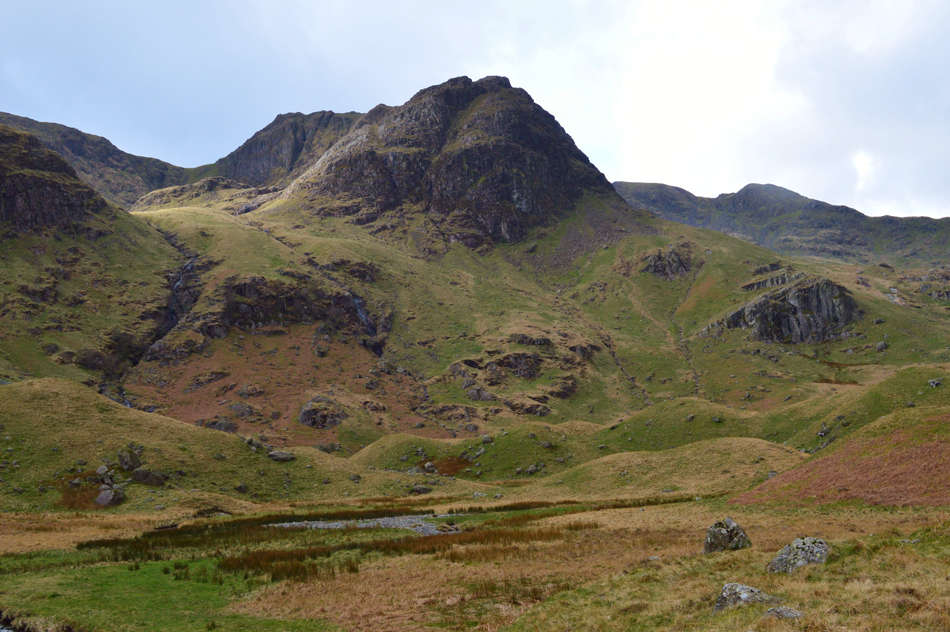
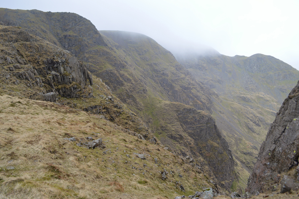
| Cofa Pike seen over Cawk Cove from top of The Step. |
| After a short rest below Scrubby Crag we knew the summit of The Step was close, here we traverse towards the Greenhow End of The Step where the strength of the wind was just lying in wait. |
 |
| The Step from Greenhow End. |
Having made it to the top of Greenhow End we were treated to the full on strength of not just the wind but a rain shower too, it sure felt like a miniature shock to the system.
It was agreed we would layer up while making the use of the outcrops as a wind break where hats and gloves are added. |
 |
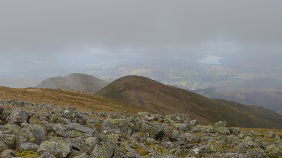
| Fairfield and Cofa Pike seen over Hog Hole from Greenhow End. |
| The cloud appears to moving over from the summit rushed along by those ever strengthening winds. |
 |
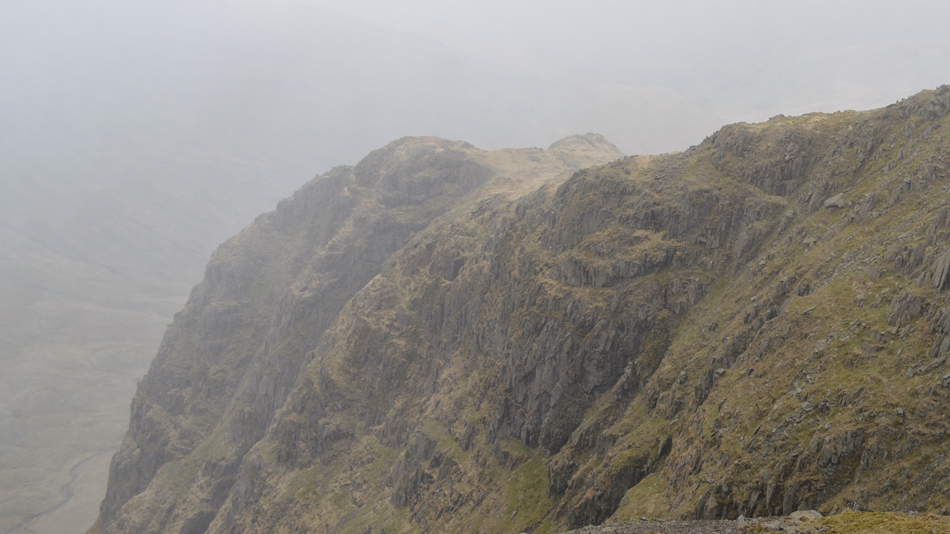
| Looking back on The Step and Greenhow End. |
| |
 |
| Reflection time during a hail shower. |
Tim had gone ahead and by now was seeking sanctuary behind an outcrop of rock whilst looking back on The Step, by now the rain had turned to hail which fell like waves, yet from our vantage point overlooking Hog Hole it gave us reflection time as we stood there while the hail pelted at our jackets whilst looking back on The Step.
Those few moments for me were some of the best taken from the whole day. |
 |
| Looking down on Great Rigg and Heron Pike from Fairfield summit. |
| From the top of Hog Hole we made our way towards the summit all head tipped if only to avoid the wind and rain which by now seemed to be increasing with each step. Once at the summit the cloud broke revealing Great Rigg and a distant Windermere, further west Seat Sandal and Steel Fell is seen through broken cloud but it's no time to hang around but before we leave we help out two young walkers who are looking for Grisedale Tarn using Google Maps would you believe, they are young, perhaps naive and it did no harm whatsoever to point them in the right direction. |
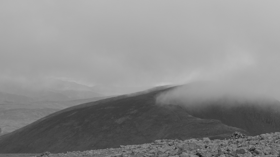 |
| Dollywagon mono. |
| |
 |
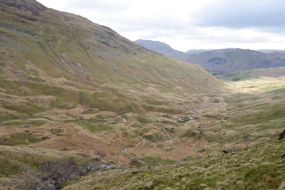
| Descending Fairfield towards Cofa Pike with views over St Sunday Crag and the Deepdale Valley. |
| We leave the summit of Fairfield hoping for perhaps a respite from the wind but if anything the wind remained as strong as ever, it's an almost silent descent making sure we each descend safely. |
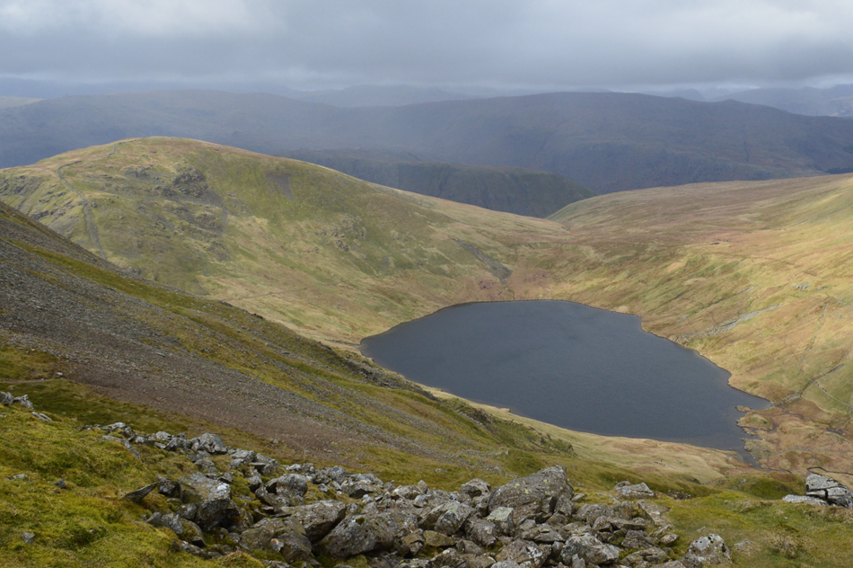 |
| Looking back over Grisdale Tarn towards Seat Sandal. |
| |
 |
| Dollywagon Pike seen above Grisedale Tarn. |
| |
 |
| Dollywagon Pike, The Tongue, Ruthwaite Cove, Nethermost Pike, Nethermost Pike East ridge, Nethermost Cove and Helvellyn. |
| |
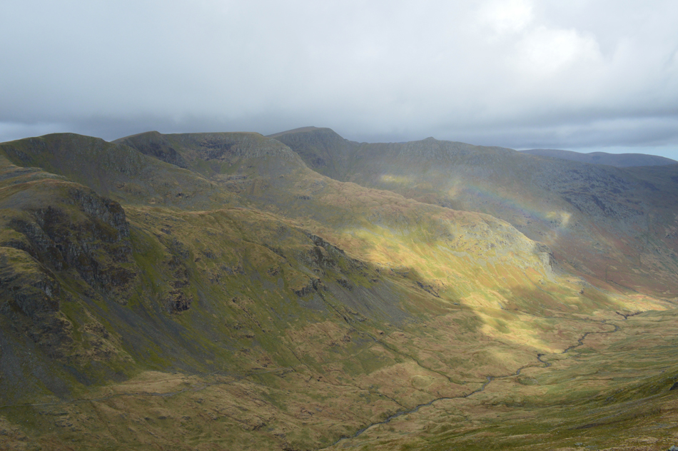 |
| In this view a rainbow appears over the Grisedale Valley. |
| |
 |
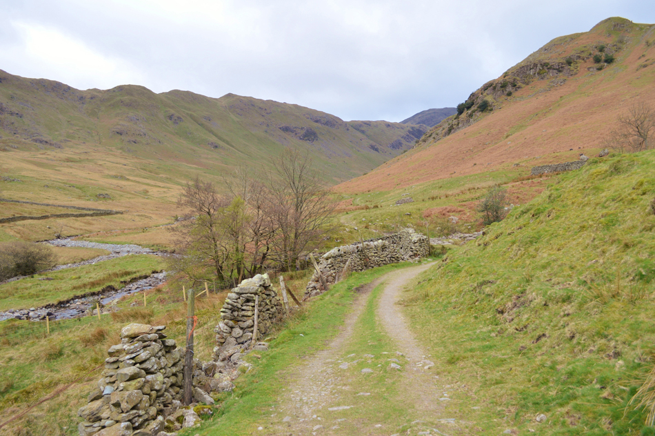
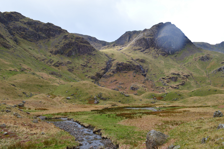
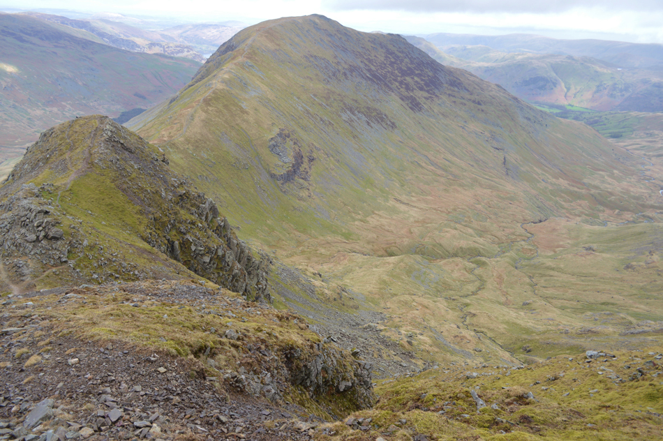
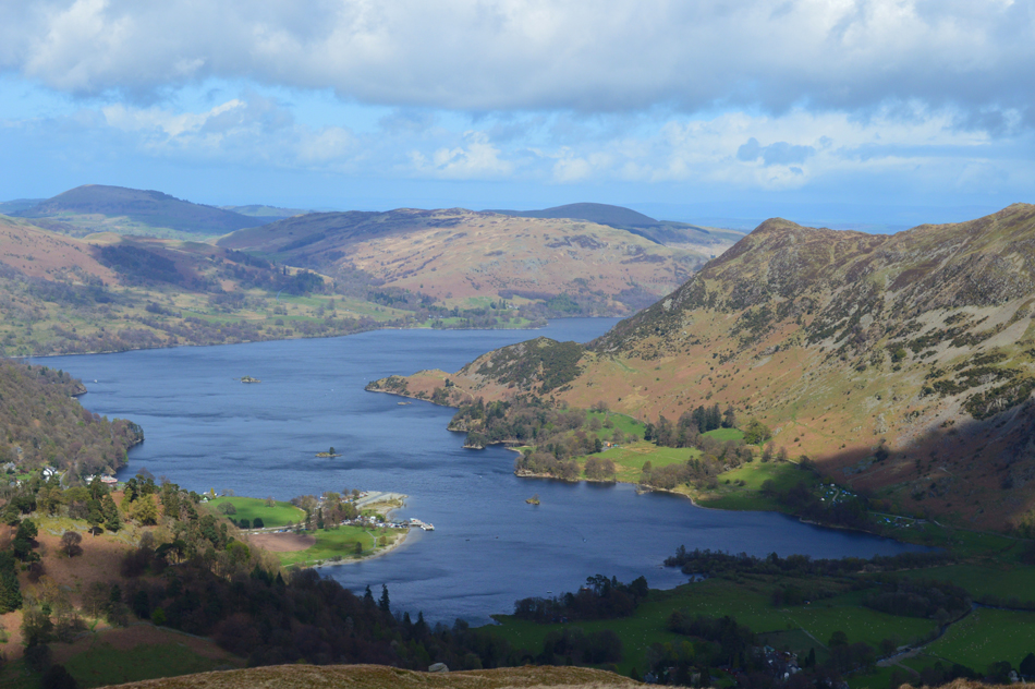
| Fairfield seen over Deepdale Hause having descended Cofa Pike. |
| It had stopped raining by the time we reach Deepdale Hause, the wind was still strong but at least the sun was starting to break through the cloud leaving the wind a little easier to cope with. |
 |
| Stopping to look back on Cofa Pike and Fairfield. |
| Looks like we are in for a bright afternoon. |
 |
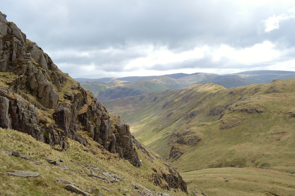
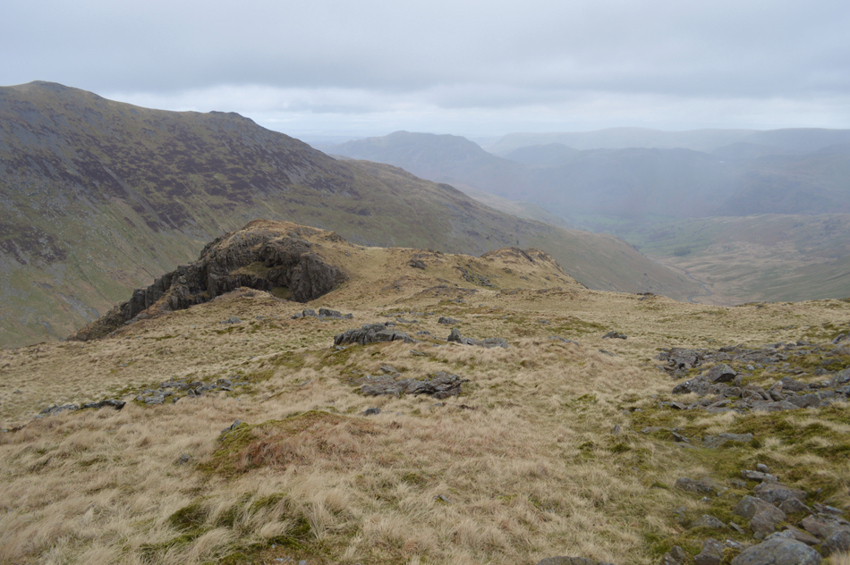
| Views over Cawk Cove towards Greenhow End, Link Cove, Hart Crag and Dove Crag. |
| |
 |
| Nethermost Pike, Nethermost Pike East ridge, Nethermost Cove, Helvellyn and Striding Edge from St Sunday Crag summit. |
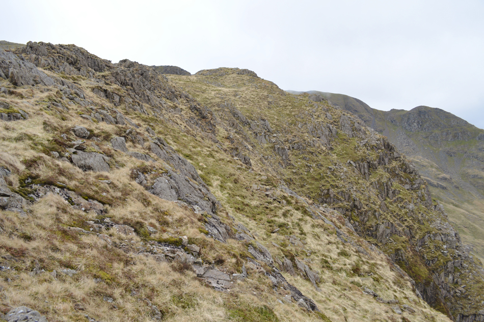
| The wind was now a major feature as we crept our way onto St Sunday Crag passing many a walker all of whom including ourselves are in great spirits. A walker occupies the area around the summit cairn but to be honest it didn't really matter as there was no plan to hang around in these winds, before we head down to break for lunch David takes a reading on the strength of the wind which recorded 29.9mph with a -7.3°C Windchill, we were quite surprised by the windchill reading but expected more from the wind, perhaps it wasn't as strong here despite the summits exposure, either way we're all starting to get hungry and it was agreed that we would descend half way towards Gavel Pike and hopefully find a spot out of the wind from where we could break out lunch. |
 |
| Lunch with a view. |
| And thankfuly out of the wind, well for now that is. |
 |
| Descending St Sunday Crag with views over Birks, Place Fell, Gowbarrow Fell and Ullswater. |
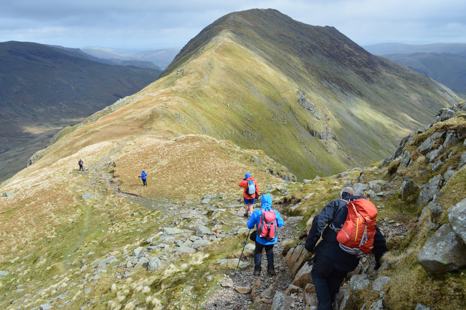
| After lunch we re-shouldered packs and started to make our way towards Birks where despite the sun being out in all its glory those winds still made it feel on the cool side so for now, gloves will remain firmly on. |
 |
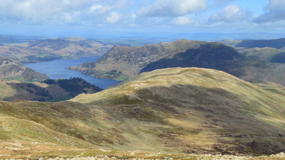
| Place Fell, Glenridding Dodd, Gowbarrow and Ullswater from Birks summit. |
| The wind remained as strong as ever, in fact its strength seemed to get stronger as we made our way towards Birks summit cairn where we each struggled to keep our feet on the ground, I'm not surprised really... |
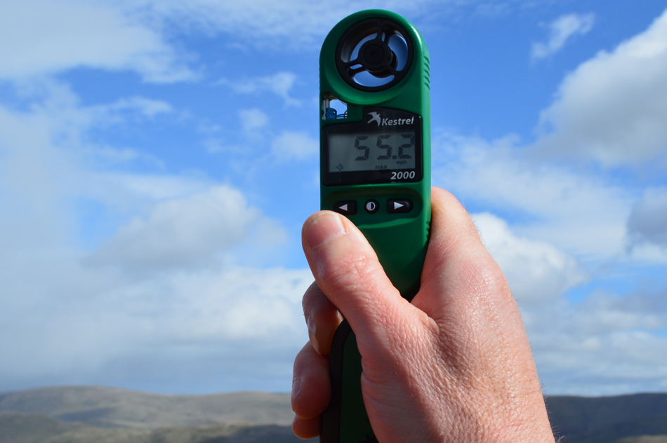 |
| Wowzers! |
| That's 55.2mph. David goes on to say that this was the strongest wind reading he'd ever taken. |
 |
| I guess you can take the wind all day long with views as good as this. |
| |
 |
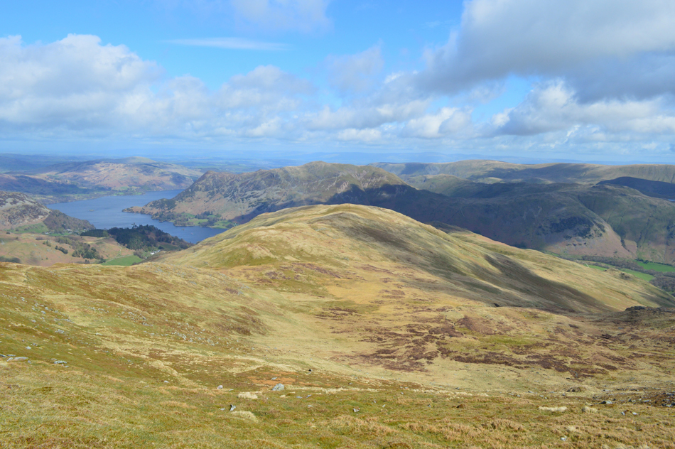
| Sheffield Pike, Heron Pike and Glenridding Dodd seen over the Grisedale Valley from Thornhow End. |
| Accompanied by the sound of barking dogs from the Ullswater Kennels seen as the white building below. |
 |
| Passing through Patterdale. |
Having descended the steep path at Thornhow End, and kicked ones toes back into boots we de-shouldred and removed any remaining layers including gloves, hats and waterproofs. The valley was now under a hot afternoon sun and those winds that had been with us for the best part of the walk were confined to the summits.
Two women walk by and we strike up conversation as they ask us of our route as they wait for their children who dawdle behind, they told us they were on route to Ruthwaite Lodge who were holding a cake stall there for charity.
We soon arrive back into the normality of Patterdale passing drinkers who sit outside on the wooden benches before crossing the road and heading for the bridge over Goldrill Beck and Rooking. |
 |
| Sheffield Pike from Goldrill Beck. |
| |
 |
| The walk is almost over as we pass through Crookabeck. |
| |
 |
| A Kirkstone Skyline from Beckstones. |
It's almost hard to believe how much we all enjoyed this walk which is reflected by the gentle last mile we took through Rooking which hosts some of Lakelands most beautiful countryside with pastures full of new born lambs and Spring flowers. The temperature is starting to feel Spring like and it's difficult to imagine those few moments we spared overlooking The Step whilst a fierce wind roared above our heads while at the same time being pelted by hail, it was only a few hours ago but thanks to moments like that it will remain one outstanding memory for years to come.
|
|
| |
| Back to top |
 |
|