|
Fairfield via Rydal Head |
 |
 |
28th May 2017 |
 |
|
After a fantastic week of dry and hot weather which came to an end just in time for the Bank Holiday weekend, this however wasn't going to stop me getting my fell time with two walks planned over the weekend, one of which was High Street via the Rough Crag ridge with a return via Small Water, a rather short route owing to the walk that I had planned with David on the Sunday.
With my High Street walk was drafted I set about getting ready for a evening meal out with my family but before I left the house for one reason or another I checked my e-mail where I found David had e-mailed me 21 hours earlier which was odd because said e-mail wasn't there just an hour ago, as it turns out there was a glitch but that's by the by. David had e-mailed to ask would I mind swapping our Monday walk to Sunday due a wet forecast, this meant that I would miss out on my High Street walk but on the plus side I would join David on his last Fairfield walk and on a route that I have been looking forward to doing for sometime, and as I later found out, David too was also planning a walk up High Street amongst others meaning it all worked out for both of us in the end.
David suggested we meet at the rather later time of 09:00am if only to let any lingering cloud clear which as it turned out we had to wait until lunchtime for that to happen but by then the walk was already turning out to be a contender of the year anyway, heres how we got on. |
|
| Wainwright Guide Book Four |
 |
| The Eastern Fells |
-Fairfield
The whole mass constitutes a single geographical unit and the main summit is Fairfield, a grand mountain with grand satellites in support. |
 |
|
|
|
| |
|
Overview |
|
|
| Ascent: |
3,763 Feet - 1,146 Metres |
| Wainwrights: |
2, Fairfield - Seat Sandal |
| Weather: |
Overcast to Start With Low Cloud Shrouding Summits. Turning Dry Bright & Sunny towards Midday. Highs of 21°C Lows of 13°C |
| Parking: |
Lay-by A591 Outside Grasmere |
| Area: |
Eastern |
| Miles: |
10.3 |
| Walking With: |
David Hall |
| Ordnance Survey: |
OL5 |
| Time Taken: |
7 Hours 10 Minutes |
| Route: |
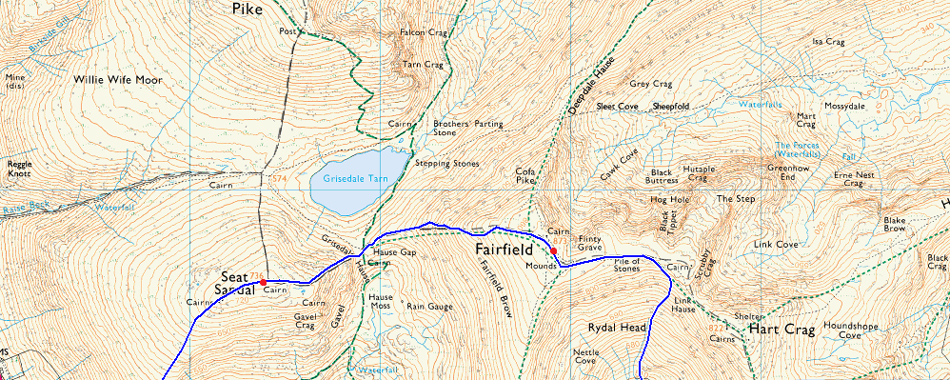
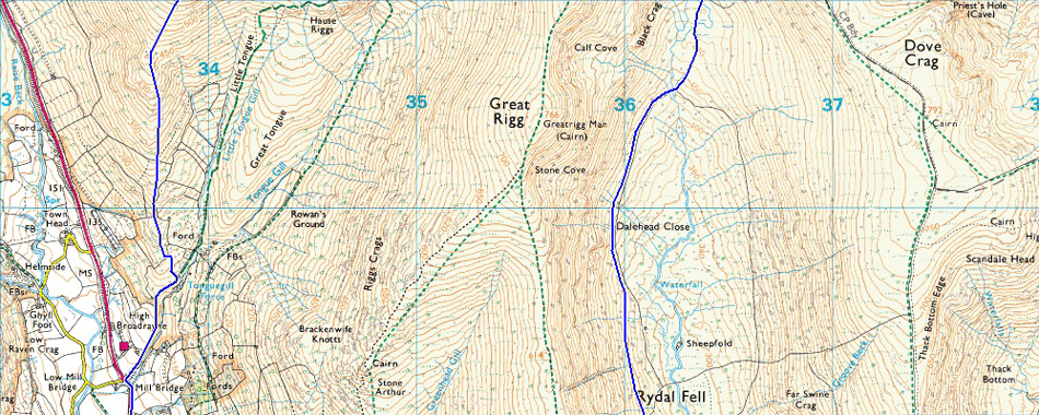
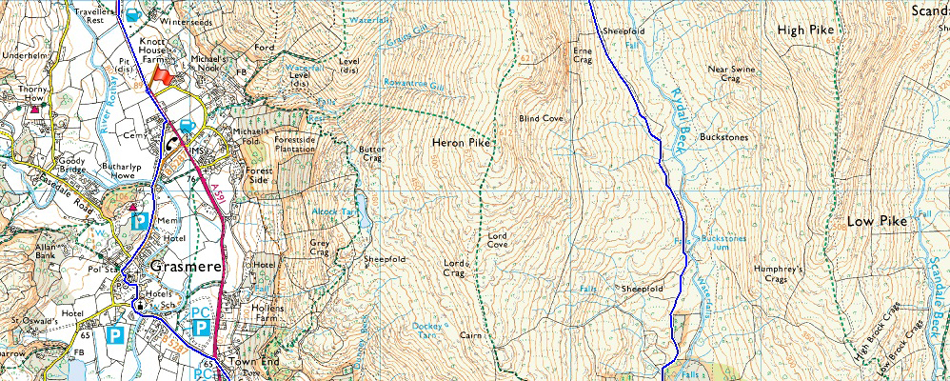
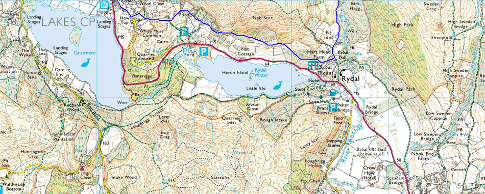
A591 - Grasmere - Rydal Coffin Route - Rydal - Rydal Valley - Rydal Beck - Rydal Head - Link Hause - Fairfield - Grisedale Hause - Seat Sandal - Seat Sandal South Ridge - Mill Bridge - A591 |
|
| |
|
Map and Photo Gallery |
|
|
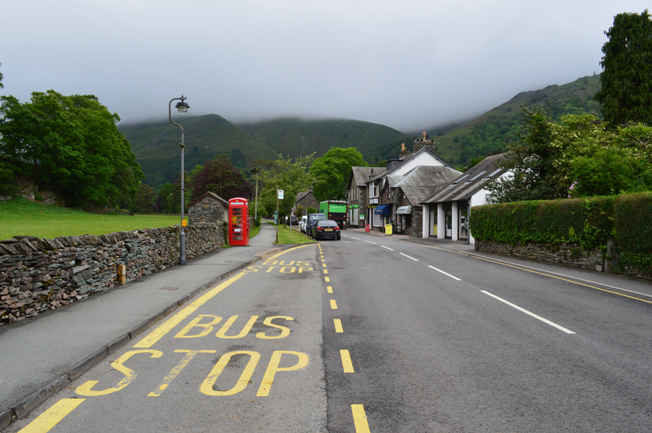 |
| Grasmere 09:40am 13°C |
At the time of leaving the house this morning it was drizzling leaving my drive north quite a dreary one. I couldn't even see the Telecoms Mast at Rivington Pike just under ten miles away from my house meaning the cloud was low which was what was forecast for Lakeland too but would start to break up by latest mid morning, there was even talk of a temperature inversion which seemed odd the day after heavy rain but what do I know. With this we had a greed to meet just outside Grasmere at the lay-by not far from the Travelers Rest. The lay-by was understandably busy but there was enough spaces left for up to six cars, possibly even more, I hadn't had the chance to take the key out of the ignition when I saw David arrive who then span his car around and then parked up behind me. Due to attending a stag do and wedding this month its been around six weeks since we last walked and despite regular e-mails it was great to catch up after greeting with our usual handshake.
Shorts are the order of the day and I entertain David by showing him my suntan line just above my knees, were brown legs meet white flesh . The last time my knees looked this mucky I laughed I was four years of owd! I kit up in just shorts and a short sleeved baselayer but softshells are added if only to take the nip out the morning air. It looks like it could pour it down at any minute with low cloud just above the tree tops but there is promise all around as a distant view of Loughrigg Fell appears with highlights of sunshine across its slopes. With the cars locked we head out towards Grasmere still catching up on the six weeks since we last walked.
We enter Grasmere via Broadgate and are passed by a elderly couple out for a fell walk, nearing the infamous Red Phone Box (now home to a a Defibrillator) we notice large groups of walkers heading up Easdale Road towards Easedale Tarn and beyond. From the village we look back on Stone Arthur and Great Rigg who's ridges still linger below the cloud line. At Sam Reads Book Store we turn left passing busy hotels who are serving breakfast for their guest who look on through the windows before we pass St Oswald's Church by which time the sun was starting to burn through the thick cloud. |
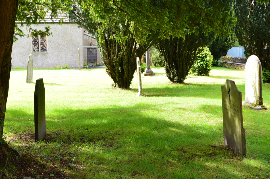 |
| Gravestones, St Oswald's Church, Grasmere. |
| |
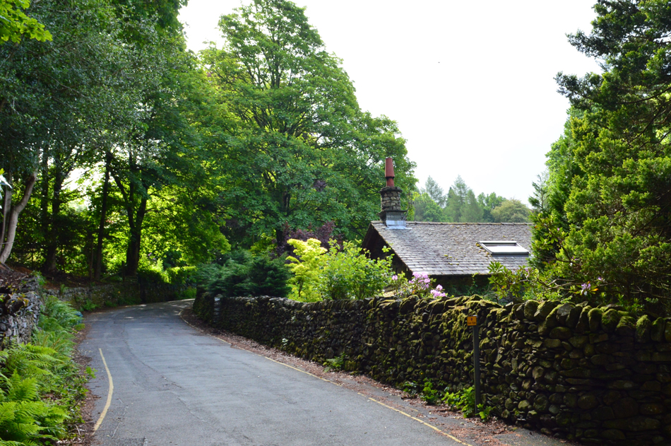 |
| Heading towards the Rydal Coffin Route. |
The campsites of Grasmere appear full alongside an event being held in a nearby field. Grasmere, despite its empty streets will be bustling no doubt within the hour.
With the A591 crossed close to the roundabout Dove Cottage is passed, once home to poet William Wordsworth and his sister Dorothy. Continuing along the road until we arrived at a junction sign posted "Coffin Route" were we take a right towards Whitemoss Tarn. |
 |
| Sunlight breaks though the cloud cover over Loughrigg Fell and Loughrigg Terrace. |
| |
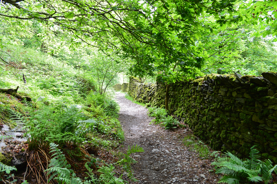 |
| The Rydal Coffin Route. |
Used like many other 'Coffin Routes" in the Lake District to carry the bodies from villages that don't have a Church to the nearest Church which would of been St Oswald's in Grasmere back in the day. It was also along the Coffin Route did we start to see more people who were mainly families out for the day.
We continued along the Coffin Route sometime stopping to admire the views all the while it was noted that it was starting to get brighter which of course was a bonus as we had expected to be walking in low cloud without the hint a sunshine. At the Rydal end of the Coffin Route we head left passing Rydal Mount and continue to climb steadily up the hill towards Hart Head Farm. Access to the Rydal Valley can be found here were instead of heading left through the gate towards Nab Scar, we head right and follow a stone track were we arrive at a walled lane which marks the beginning of the Rydal Valley. |
 |
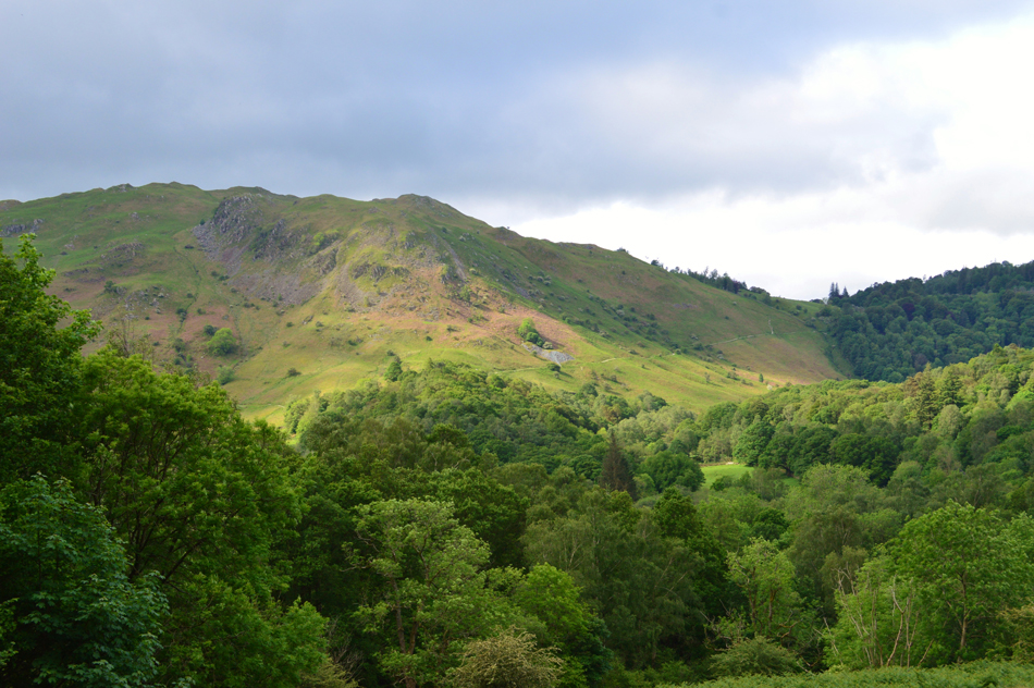
| Low Pike over the Rydal Valley. |
| Note how low the cloud still is further along the ridge towards High Pike, fingers crossed if the brightness continues the cloud should burn away quite quickly. |
 |
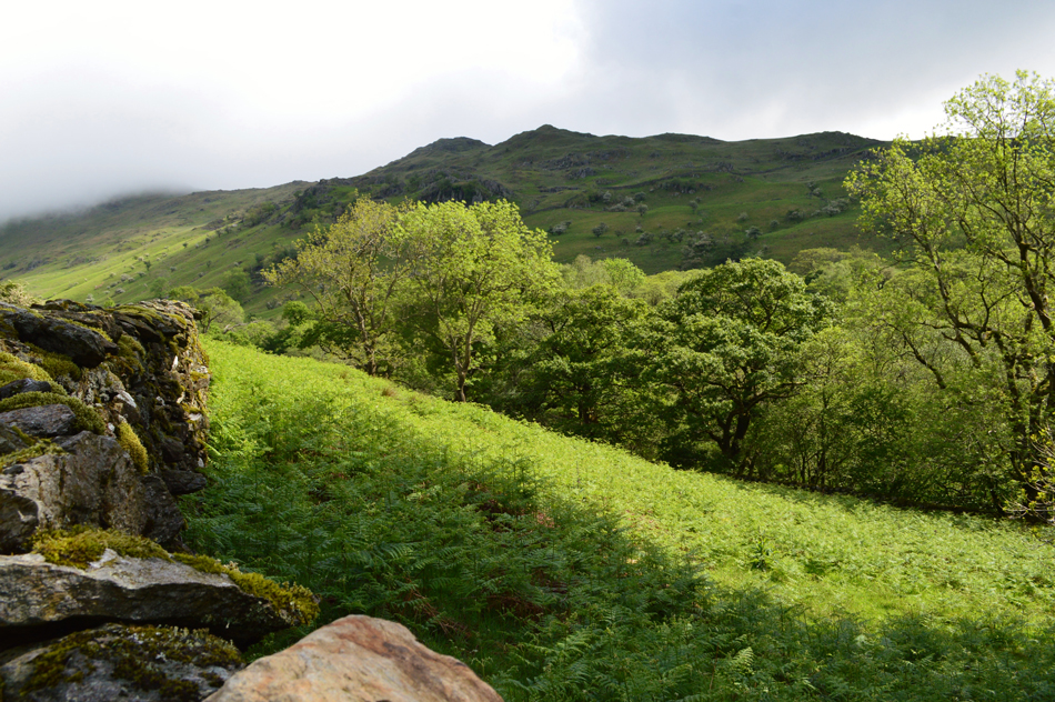
| Looking towards High Pike below the cloud as we head into the Rydal Valley. |
| The rarely seen bulk of Heron Pike commanded the view from the west of the valley floor who's summit remains topped in cloud, nevertheless we can see a succession of walkers ascending towards Nab Scar which up until now is the only summit throughout the Fairfield Horseshoe below the cloud. |
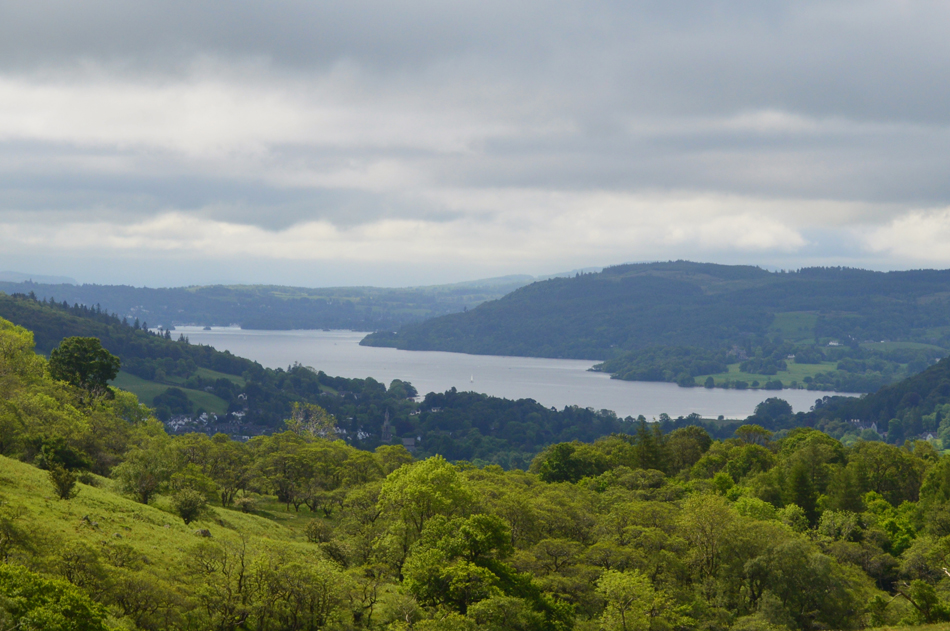 |
| Views back over High Park and Rydal towards Windermere. |
| |
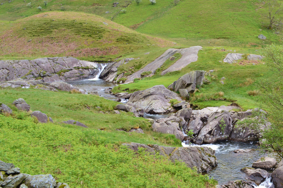 |
| Buckstones Jum. |
| A twist in Rydal Beck followed by a series of miniture waterfalls claims the unusual name of Buckstones Jum which was observed from the path just nearby. |
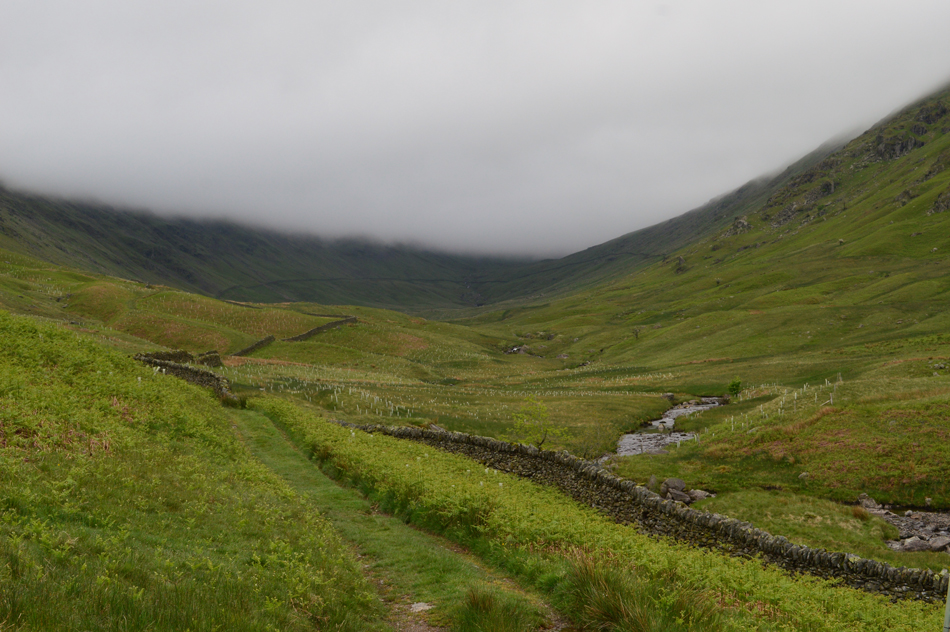 |
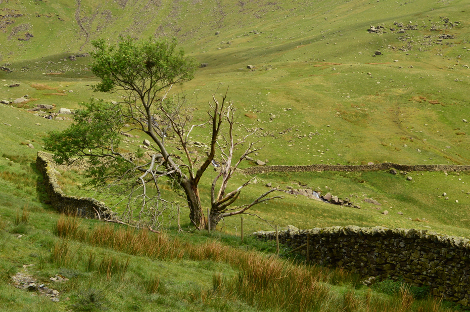
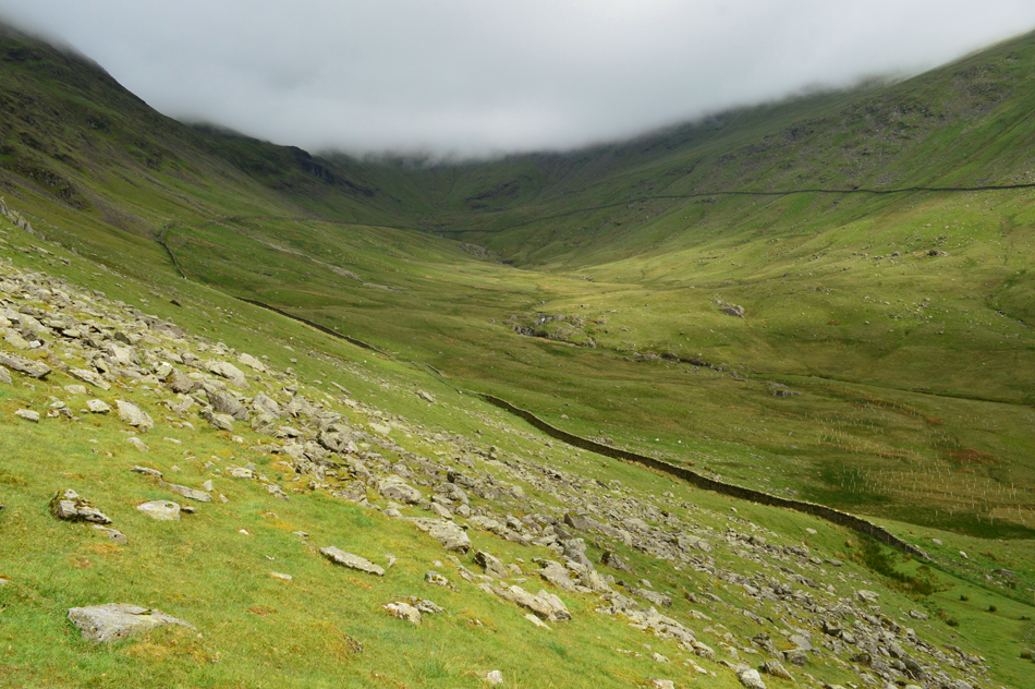
| Rydal Head as we continue through the valley. |
| Despite heavy rainfall over the last twenty four hours the ground underfoot remained relatively dry only having to negotiate around the deeper puddles we encountered along the path. Due to the low cloud, and a bright sun which we seemed to be leaving behind we continued into the valley soon passing the whereabouts of High Pike to our right and Heron Pike to our left, up ahead however the cloud was still think and stagnant. Here it was unsure if the cloud would lift or even if we might climb out of it once Rydal Head had been ascended but in the grand scheme of things none of that mattered as Rydal Valley was providing all the wow factor we needed for now. |
 |
| Views back through the valley with Low Pike over on the left. |
| |
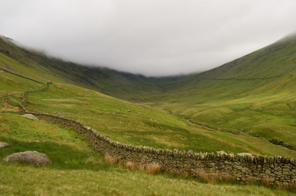 |
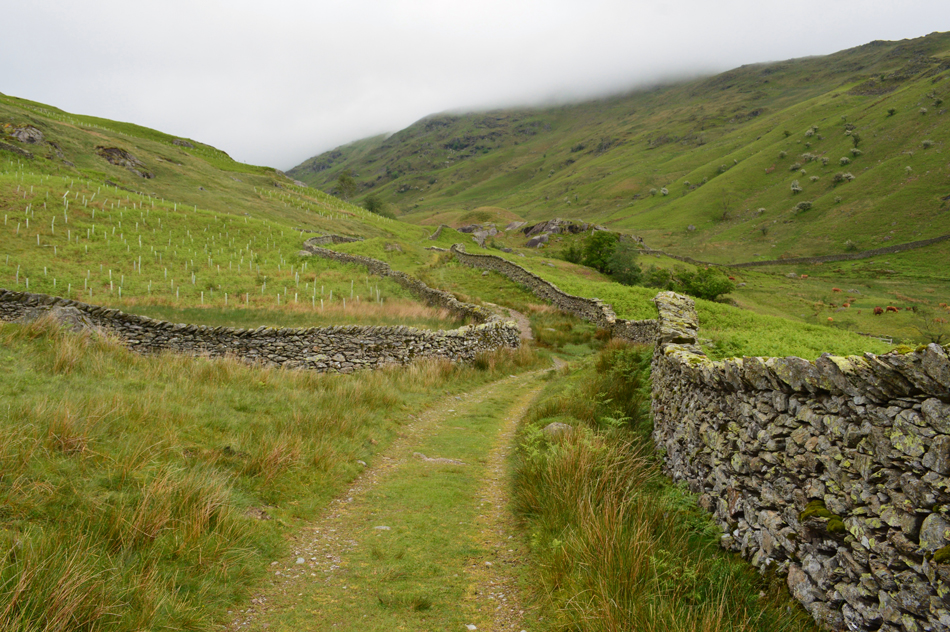
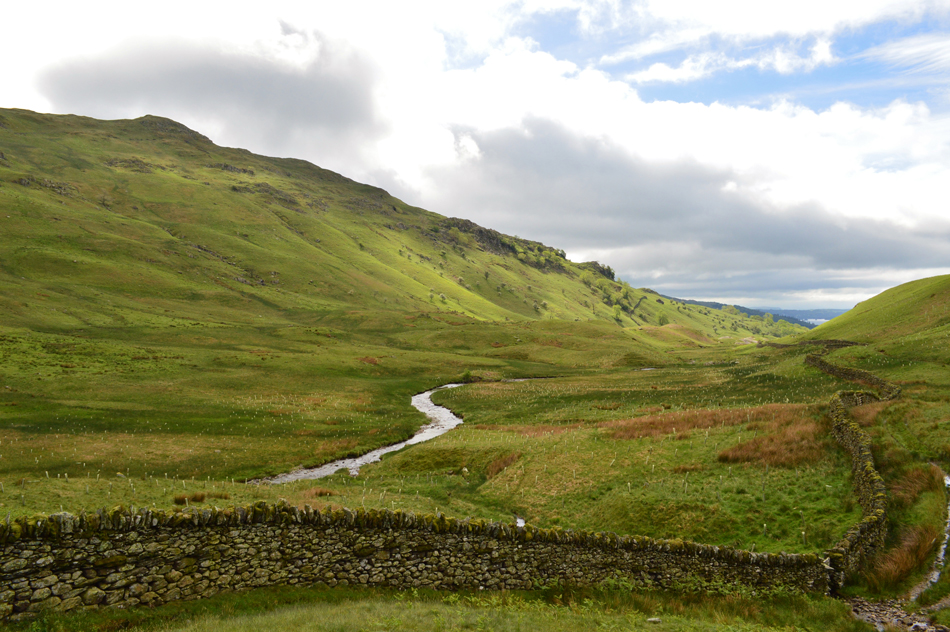
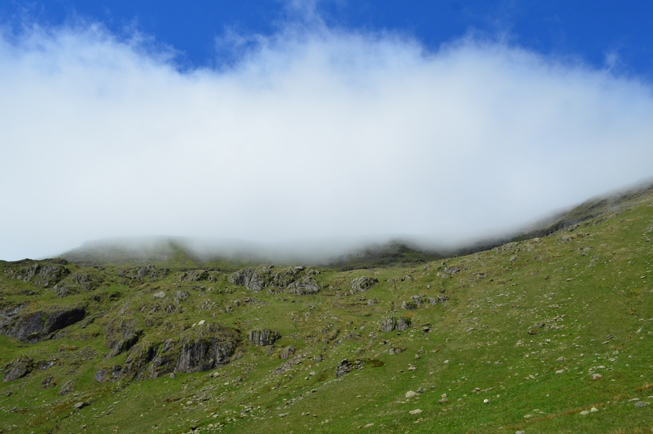
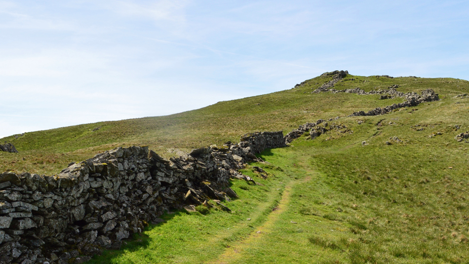
| Continuing to follow the stone wall towards the head of the valley. |
| While the head of the valley and Fairfield remaining firmly below cloud along the ridges the cloud started to lift away revealing the ridge tops and in some cases walkers could be seen between Heron Pike and Erne Crag which is situated directly below the stone wall seen in the centre left of this photograph. |
 |
| Views out of the valley towards Low Pike. |
| There's no doubt sunshine is heading our way which means with the higher temperatures the low cloud shouldn't be around for much longer now. |
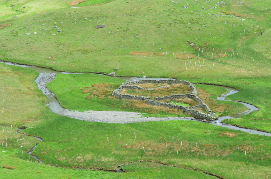 |
| Sheepfold, Rydal Valley. |
| "Is it me or is that Sheepfold shaped like a giant ice cream cone" |
 |
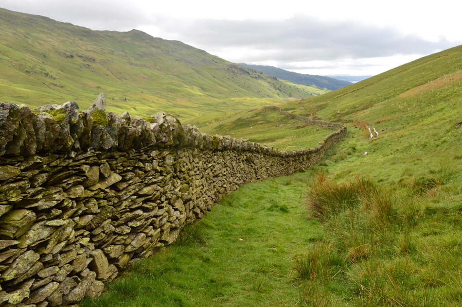
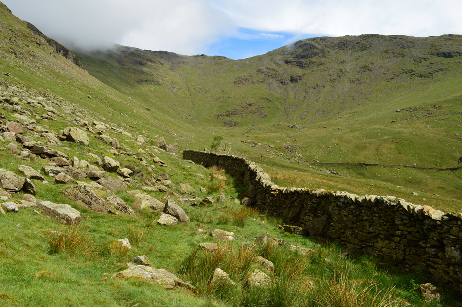
| The distinctive stone wall is a key feature to the Rydal Valley and is of fine credit to its builder. |
| The stone wall we had been following abruptly steers right along the valley floor and continues in ascent all the way to the top of the opposite ridge close to Thack Bottom Edge. Here we could of dropped in height and followed the stone wall seen lower right but in doing this some re-ascent would of been required further into the valley, instead we opt to take a pathless route while maintaining height keeping a bearing where we will pick up the wall further ahead, it may look like a easy stroll but it was hard work side stepping the route much of the way. |
 |
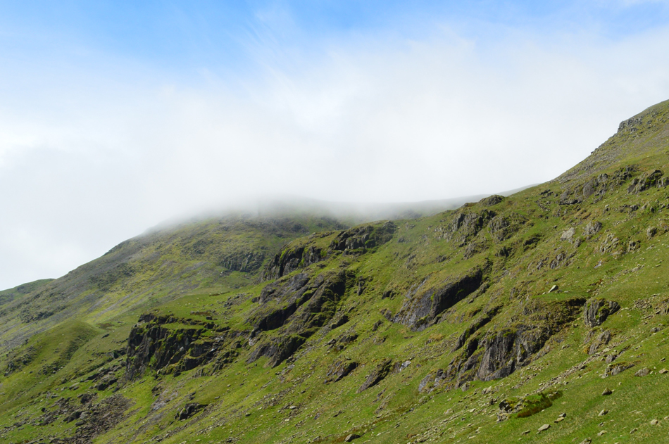
| Jubilation as the cloud clears just in time revealing Rydal Head, Link Hause and Hart Crag. |
| We couldn't of timed it better if we had tried! |
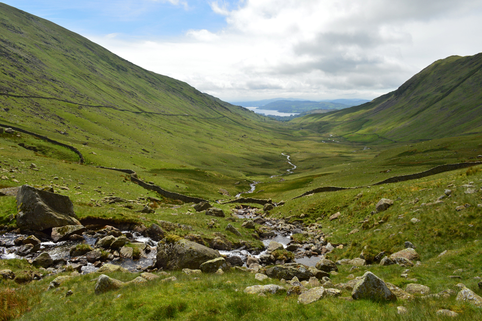 |
| Crossing Rydal Beck with views of a distant Windermere. |
| An easy crossing made easier by lots of stepping stones in the beck. Incidently that's the bulk of Dove Crag on the left with a distant Heron Pike seen right. |
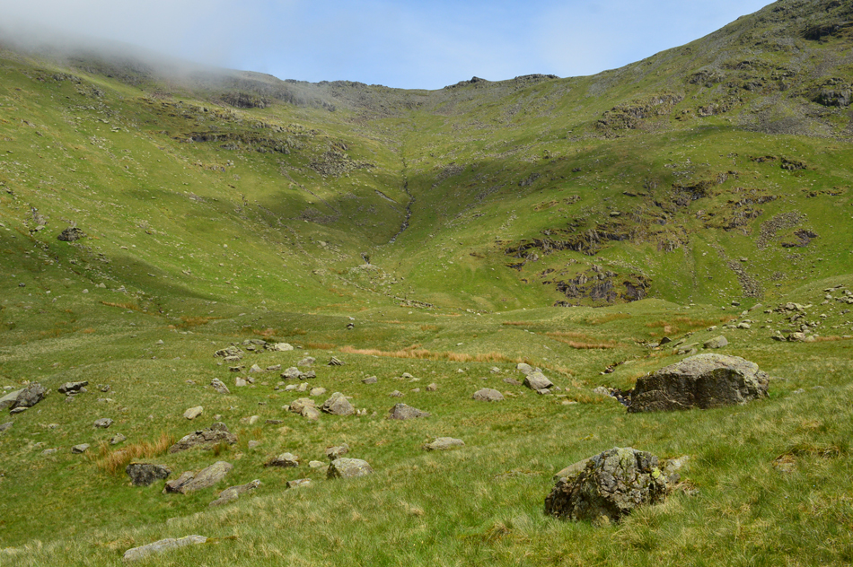 |
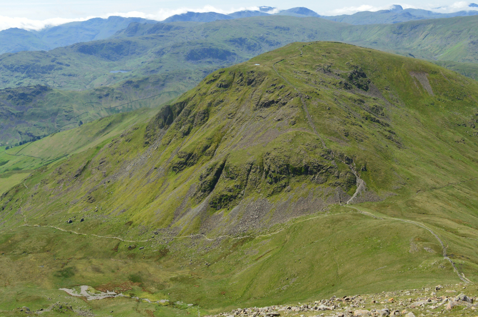
| Rydal Head and Link Hause is up ahead. |
| Well I say up up ahead, first there's over 1,000 ft of steep ascent to gain first. Our line of ascent will follow the course of the stream seen centre before steering right below the scree before stopping just short of Link Hause for some well earned lunch. |
 |
| Blue skies breaking above Black Crag, Nettle Cove and Fairfield. |
It was during the ascent did the cloud start to fully lift revealing Fairfield and Great Rigg. We had picked a route as mentioned but this was difficult to stick by as David says "the hill is determining our ascent" and not the other way around, quite right! You know when its steep when your walking poles come up to shoulder height, phew its hard, but enjoyable work. |
 |
| A close up of the cloud clearing over Black Crag and Great Rigg. |
With 99% of the ascent behind us we chose the protection of outcrop of rocks from where we would break out lunch by. With packs de-shouldered we sat and admired the view while refueling, just behind us, Link Hause connecting Fairfield with Hart Crag as people walk just feet away totally oblivious of our presence.
With bellies fed we re-shouldered instantly feeling the cold sweat on my back against my pack, a feeling that I love but have never been able to get used to the "initial shock of" We climb the last few feet and emerge directly into the traffic of the Fairfield Horseshoe (ers), its busy but it feels pleasant at the same time. |
 |
| Fairfield from Link Hause. |
| |
 |
| Views back along Link Hause towards Hart Crag and Dove Crag. |
| Blimey, its clear too with the High Street fells in clear view. |
 |
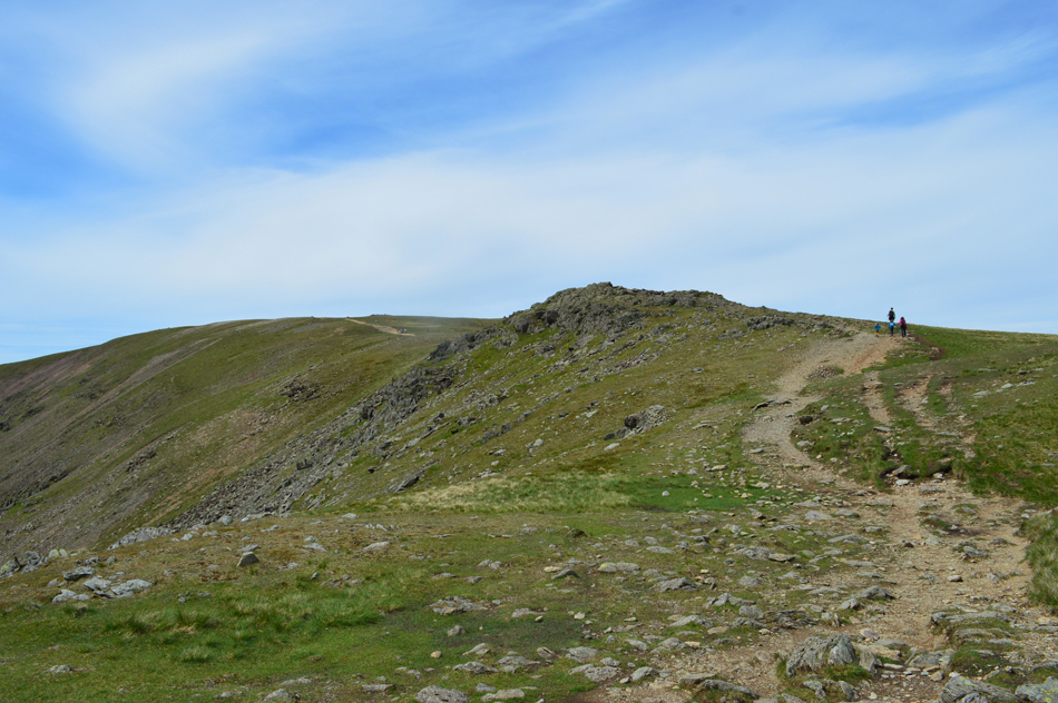
| Fairfield is just up ahead. |
| Pace is dropped when conversation turns to Davids Fairfield project and the fact that within minutes its going to come to an end. David proceeds to go through his eleven previous summits most of which he was on the summit of Fairfield by 09:00am in the morning "this is only the second time I've been here when there's been other people at the summit" most times it was just me and the summit shelter, at times David went onto say, the wind was so strong I would poke my hand above the shelter wall to take a reading using my weather barometer which was the case when I joined David on his third project walk via The Step when on that day we recorded a wind speed of 55.2mph |
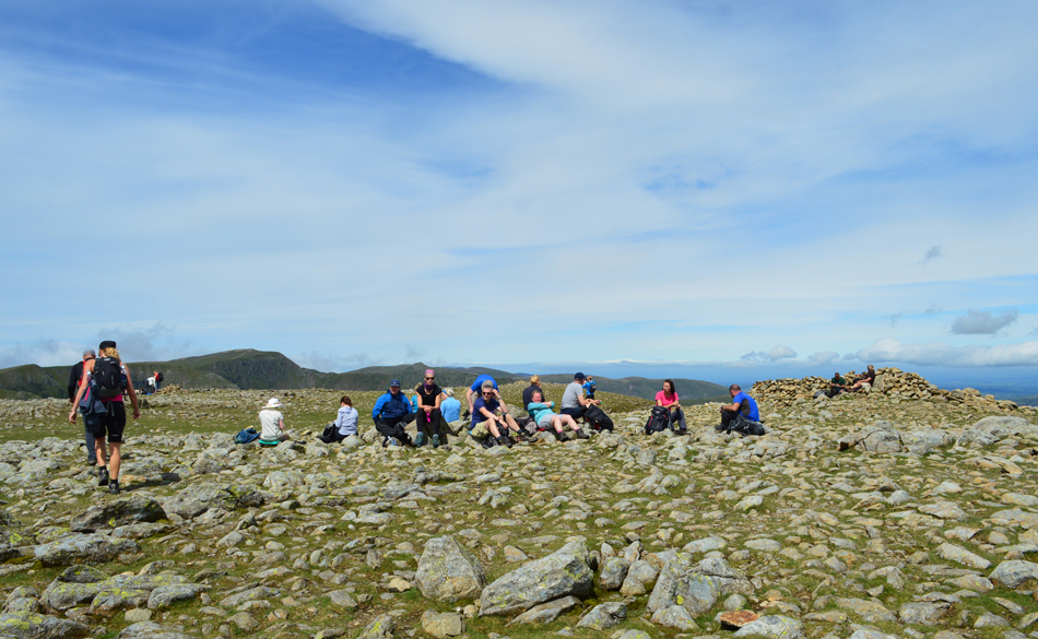 |
| Fairfield summit. |
Spirits were most certainly high as I congratulated David on achieving his final Fairfield summit as he spoke fondly of getting to know Fairfield much more than he already thought he knew, a special closeness had been forged. Davids original route up until a minute ago was to descend to Stone Arthur via Great Rigg and make our way back to Grasmere before David asked "Fancy Seat Sandal Paul?" its only a short ascent and what with the day turning out so nice "aye I smiled, why not" |
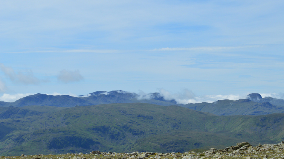 |
| Cloud Inversion over the South and Western fells. |
During our ascent of Rydal Head we had seen the cloud inversion which was much more substantial than it was by the time we reached Fairfield summit, nevertheless the inversion seemed to concentrate around the areas of Coniston, Great Langdale and Wasdale but it seems to be retreating somewhat now, still, anyone ascending Scafell Pike about half an hour ago might of wished they hadn't bothered until they peaked out at the summit. |
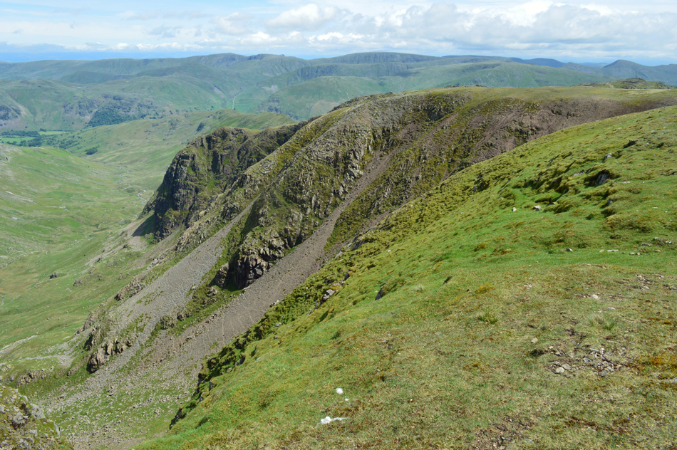 |
| Distant views over Deepdale, Fairfield, The Step towards the Far Eastern fells |
| |
 |
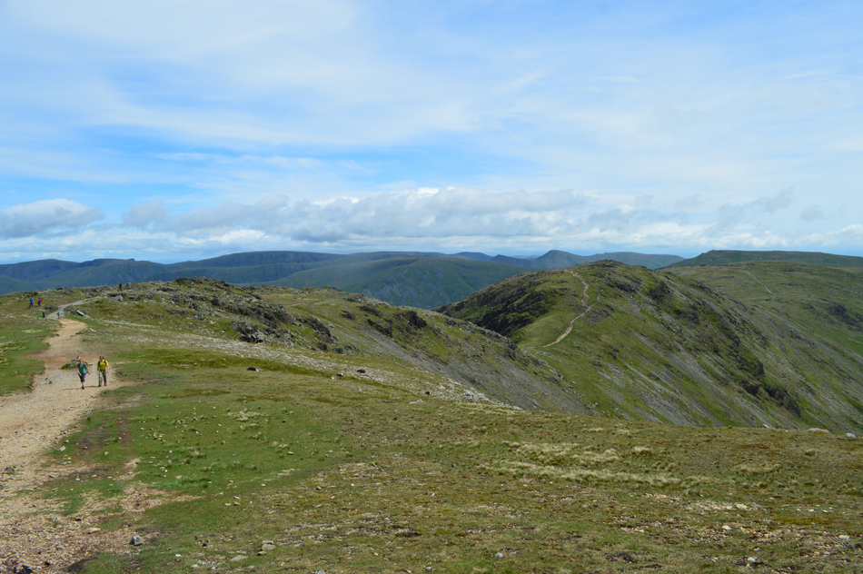
| Views towards Dollywagon Pike, The Tongue, Nethermost Pike, Nethermost Pike East Ridge, Helvellyn, Stridng Edge and Catstye Cam. |
| As we start to make our Fairfield descent towards Grisedale Hause. |
 |
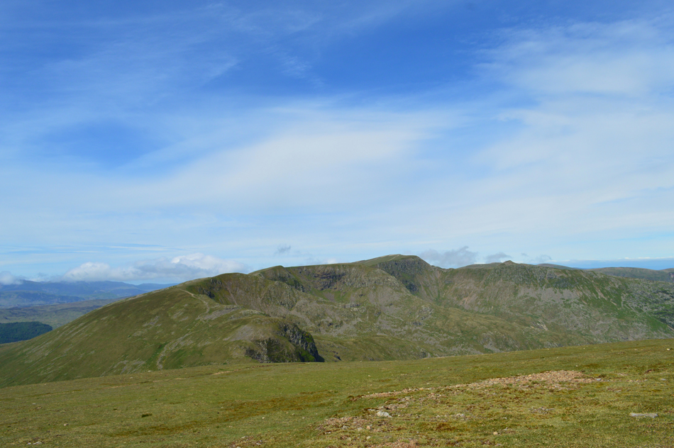
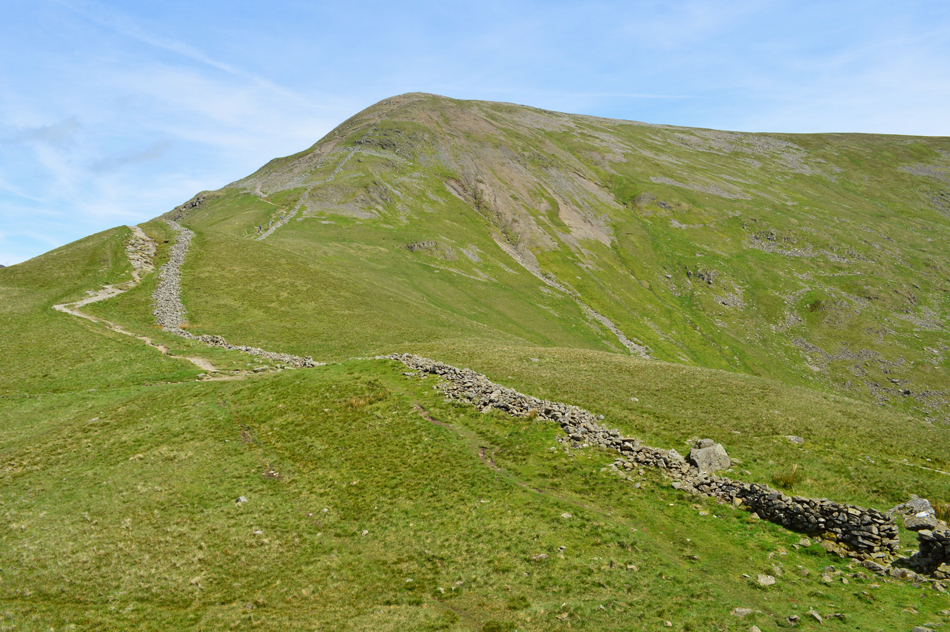
| Seat Sandal seen over Grisedale Hause. |
| |
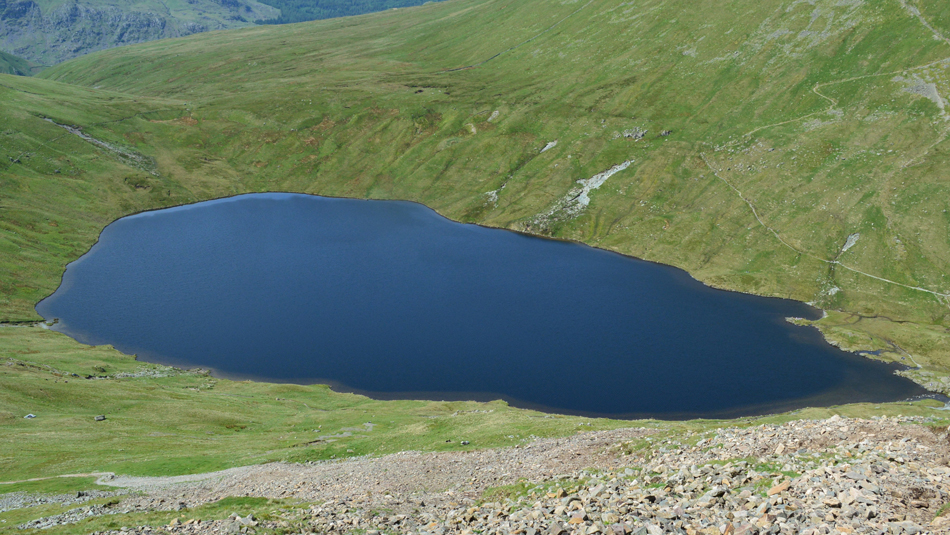 |
| Grisedale Tarn taken during the descent. |
| The walkers who had gathered at the summit of Fairfeild were now making their descent behind us. Down below at Grisedale Tarn it was looking very busy with people gathered around the Tarns outflow and who could blame them, what a day and in such warm sunshine too, its difficult to believe that its the same day we set off from this morning. |
 |
| Looking back on Fairfield from Grisdale Hause. |
| |
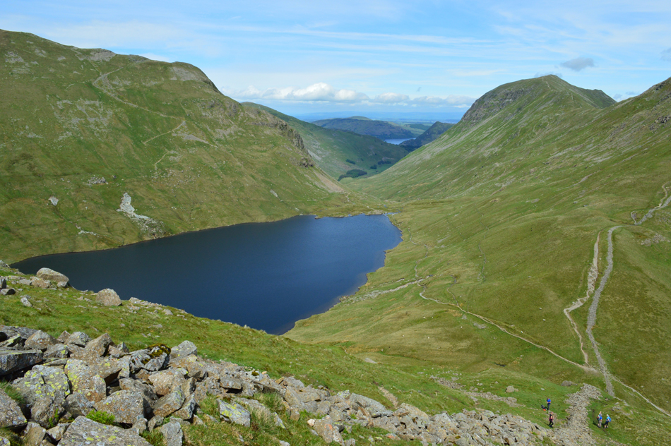 |
| A distant view of Ullswater seen beyond the Grisedale Valley. |
| With Dollywagon Pike to the left and Fairfield and St Sunday Crag over on the right, blimey those walkers have soon caught us up, we best stop nattering then! |
 |
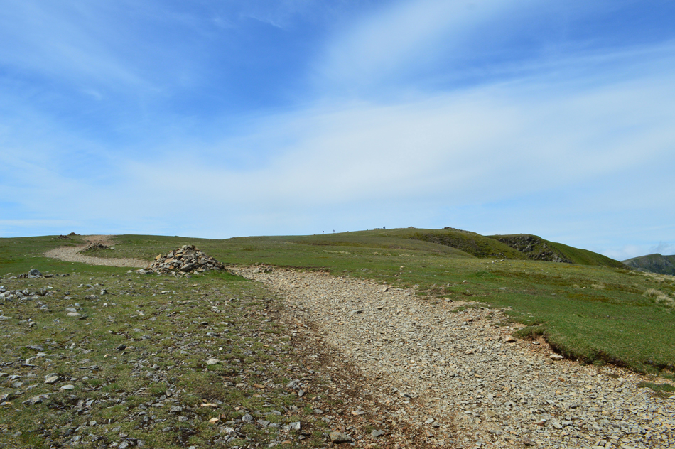
| Seat Sandal summit isnt far now. |
The afternoon air was really starting to warm up and at times we could only describe the heat as the instant heat you feel when you open the oven door, and we seemed to be walking in and out of pockets of 'instant heat' if that makes any sence.
Not complaining mind. |
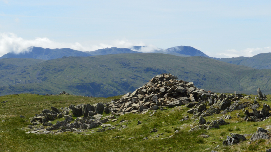 |
| Distant views towards Bow Fell, Great End, Scafell Pike and Broad Crag from Seat Sandal summit cairn. |
| Only a few moments was spent admiring the view before making a direct decent via the South Ridge but before we did leave David informs me that Seat Sandal was his first, and now last summit of the project which he had only realised just a few moments ago, we agreed that visiting Seat Sandal was the fitting end to the Fairfield project. |
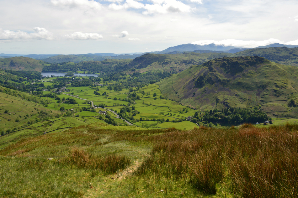 |
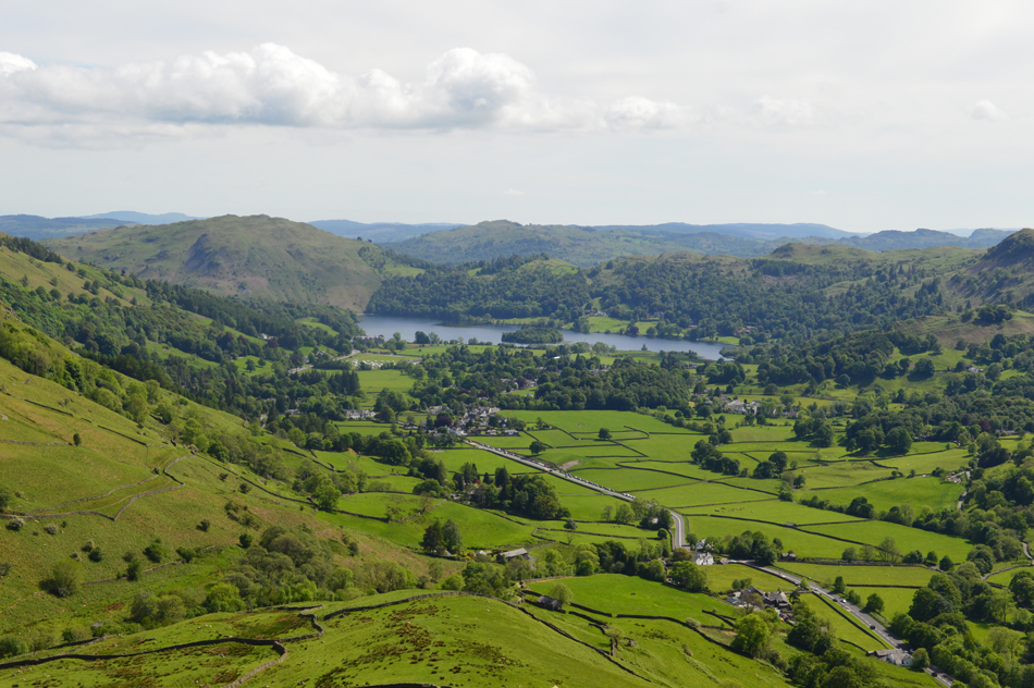
| Sun drenched views over Loughrigg Fell, The Vale of Grasmere, Silver How, Blea Rigg, Helm Crag and the distant Coniston Fells. |
| |
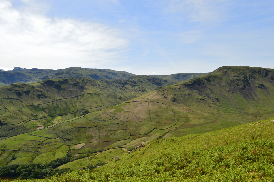 |
| From the Seat Sandal South Ridge views over Steel Fell, Gibson Knott, Greenup Edge and Sergeant Man. |
| The Bracken really is changing the scenery of the fellside now with Summer just around the corner. |
 |
| An unsheduled stop with a jaw dropping view. |
The glare from the car windscreen parked up along the lay by would dazzle the eye while those pockets of hot air, just too enticing to miss, so much so David takes out his weather barometer again and records a temperature of 21°C but to be fair, it felt much hotter with the first reading recorded at 26°C before steadily dropping. While David does this I sit down and I'm soon joined by David who breaks out the Satsuma's, bloody perfect.
Time was creeping on but it didn't matter with a view as good as this. |
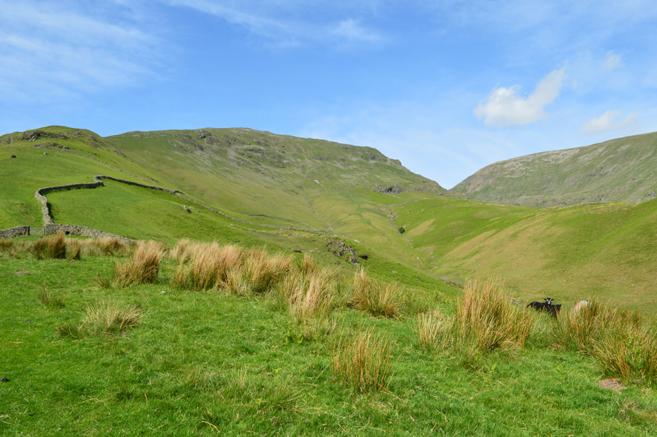 |
| The view back up the Seat Sandal South Ridge, Grisedale Hause, Fairfield and Great Tongue. |
Dried sweat had formed over my forehead, the tell tale sign of a great day on the hill. We finally descend back into reality at Mill Bridge from where David takes a last look at Fairfield, so too do a young family who we had earlier passed. The A591 is bustling with cars and bikes and for me I kinda like the sound of traffic after a walk, it brings an end to a day and closes the walk. Soon the Travelers Rest is passed, its car park full to brimming and I feel a little envious of the guys sitting down about to down a cold one. Up ahead the 555 draws in at the bus stop and out jumps around eight lads dressed as tennis players, its a stag do of course and they ask would I mind I take their picture with "that" in the background pointing towards Helm Crag, I take around five snaps on one lads Iphone before we part with a loud "have a really really good walk" from the lads, they mean no arm as they head off towards the Travelers Rest who don't know whats about to hit them.
Paragliders are spotted in the skies above Fairfield which is unusual to see as we kit down behind our cars, one paraglider is loosing height fast and lands perfectly in a field opposite the Travelers Rest while another lands just outside Grasmere who I watched from my car window, perhaps the thermals weren't as strong as they thought.
I lock hands with David while looking back at Fairfield who's summit by now is under a cloudless sky and say, thanks for a great walk mate. |
|
| |
| Back to top |
 |
|