|
High Street via the Ill Bell Ridge from Troutbeck Bridge |
 |
 |
5th August 2017 |
 |
|
After quite an exhausting week in work before I hit the fells this weekend I figured I had earned myself a bit of a lie-in meaning todays walk would start at a slightly later time of around 09:00am. Couple this with another unsettled forecast it was up in the air on where should I walk, my preferred choice would have been to take in the High Stile ridge from Red Pike to Fleetwith Pike but to be honest I really needed that extra hour in bed this morning.
My second choice would to have been able to take in the Newlands fells but with strictly limited parking I didn't want to risk a late arrival meaning finding a parking spot might have been neon impossible. Instead as my mind wondered during my drive north I came up with this route which would take in the splendid III Bell ridge and then basically make the route up as I went along, the only issue being was the weather which had been forecasted to remain dry throughout the morning before showery outbreaks of light rain would arrive from noon onwards, I reckoned I could cope with that.
As it turned out the forecasted had got todays forecast completely the wrong way around which meant instead of being prepared for the rain to arrive from midday it arrived early morning then cleared from noon onwards, by all means I'm not quite sure if this totally inaccurate forecast was replicated across the district but it certainly caught a few fell walkers out including myself who by in large, had left wearing just shorts and T-shirts. |
|
| Wainwright Guide Book Two |
 |
| The Far Eastern Fells |
-III Bell
The walker who toils up the top of Ill Bell may be pardoned for feeling that he has achieved a major climb that has played a part of some consequence in mountaineering history, for he finds confronted by an imposing array of fine cairns that would do credit to a Matterhorn. |
 |
|
|
|
| |
|
Overview |
|
|
| Ascent: |
3,817 Feet - 1,164 Metres |
| Wainwrights: |
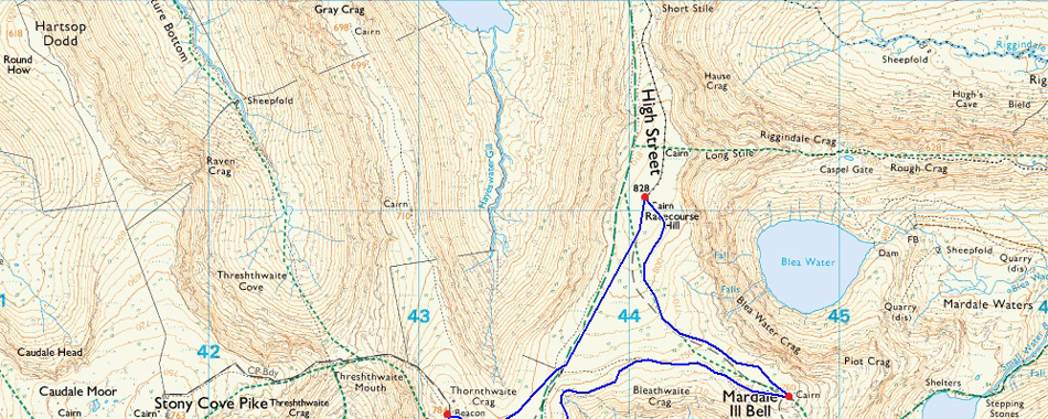
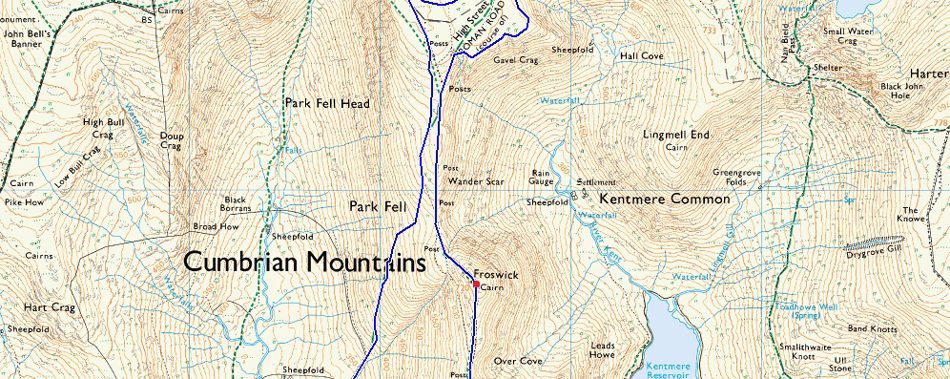
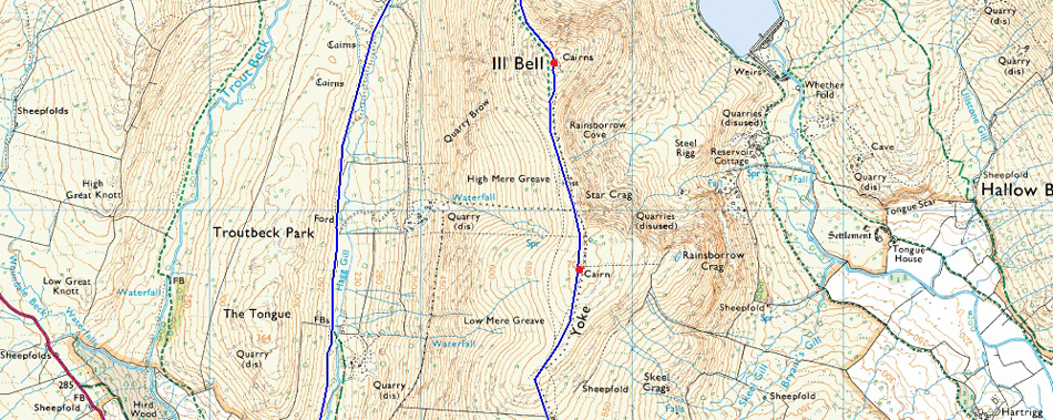
5, Yoke - Ill Bell - Froswick - Mardale III Bell - High Street |
| Weather: |
A Dry Start Before Prolonged Rain Showers Arrived Lasting The Duration Of The Morning. Turning Brighter PM. Highs of 22°C Lows of 15°C |
| Parking: |
Car Park, Troutbeck Bridge |
| Area: |
Far Eastern |
| Miles: |
14 |
| Walking With: |
On My Own |
| Ordnance Survey: |
OL5 |
| Time Taken: |
6 Hours 10 Minutes |
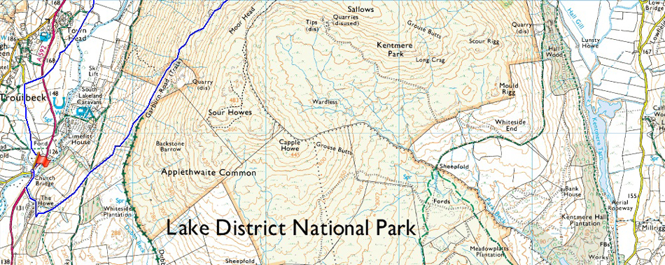
| Route: |
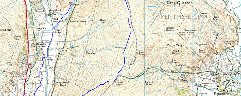
Troutbeck Bridge - Garburn Pass - Garburn Nook - Yoke - Ill Bell - Froswick - Top of Hall Cove - Mardale III Bell - High Street - Thornthwaite Crag - Scotts Rake - Hagg Gill - Hagg Bridge - Ing Bridge - Ing Lane - Truss Lane - A591 - Troutbeck - Jesus Church - Troutbeck Bridge |
|
| |
|
Map and Photo Gallery |
|
|
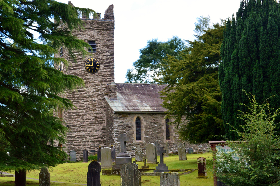 |
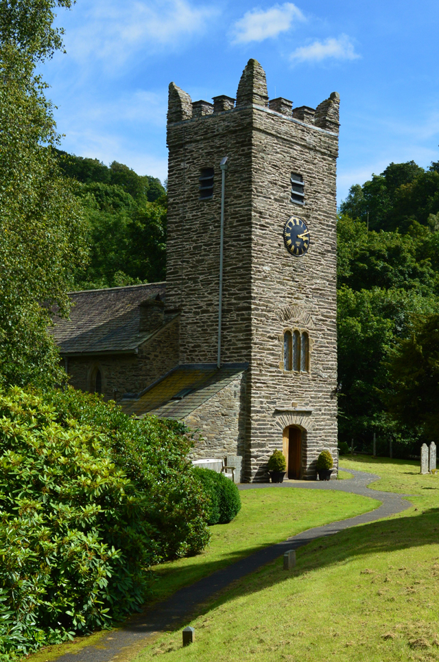
| Jesus Church, Troutbeck Bridge 09:00 15°C |
It's amazing what one extra hour can do in terms of how much traffic is on the road, this of course I know from my daily weekday commute but on weekends I normally have the motorway to myself with the exception of a couple dozen wagons or so. I arrived in Troutbeck feeling a little apprehensive hoping that I'd still be able to grab a parking spot which I did by finding just two left wedged between a large gap in the trees. With my parking sorted I start to kit up behind my car and smile at a large group of walkers who are just about ready to leave, I watch as they disappear in the direction of the Church yard.
It's quite mild here in Troutbeck but the forecast as previously mentioned is for rain to arrive later with high winds predicted over exposed summits so I pack my waterproofs and extra layers ready for whatever the forecast may bring. With my car locked I too head out towards the Church yard just around the corner which seems the accustomed thing to do when starting a walk from Troutbeck Bridge before doubling back and picking up the Garburn Pass a little further up the road. |
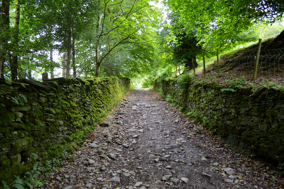 |
| Garburn Track/Pass. |
| The Garburn track twist and rises steadily between twined stone walls before emerging onto open fell side above Limefit Holiday Park where it merges with the Garburn Pass. |
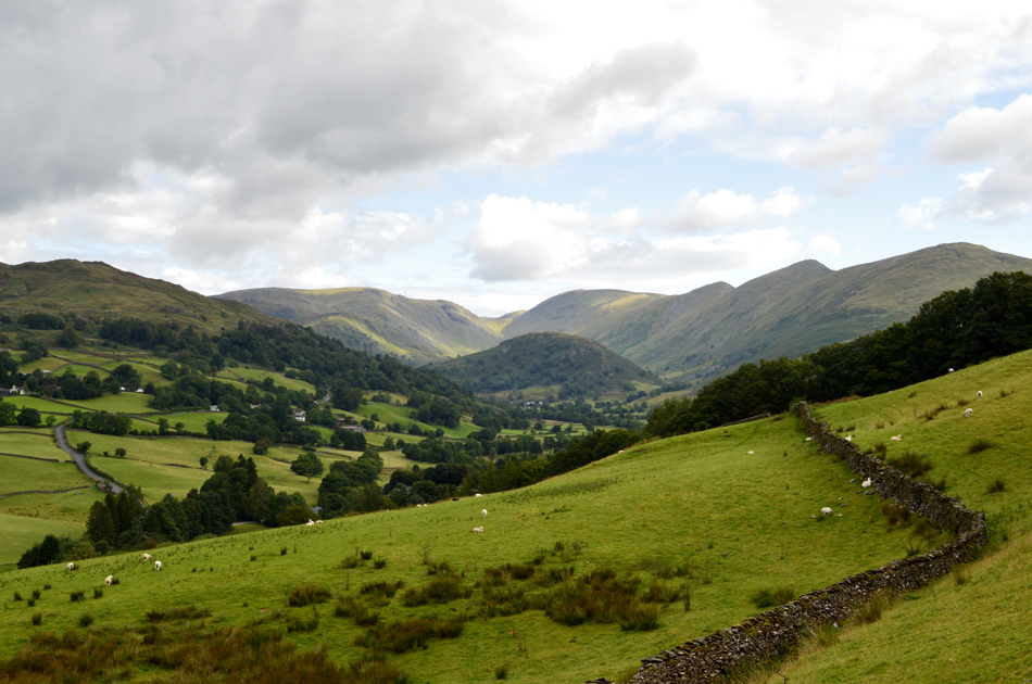 |
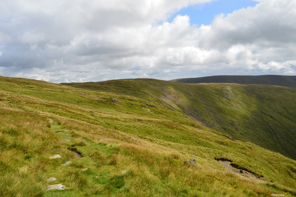
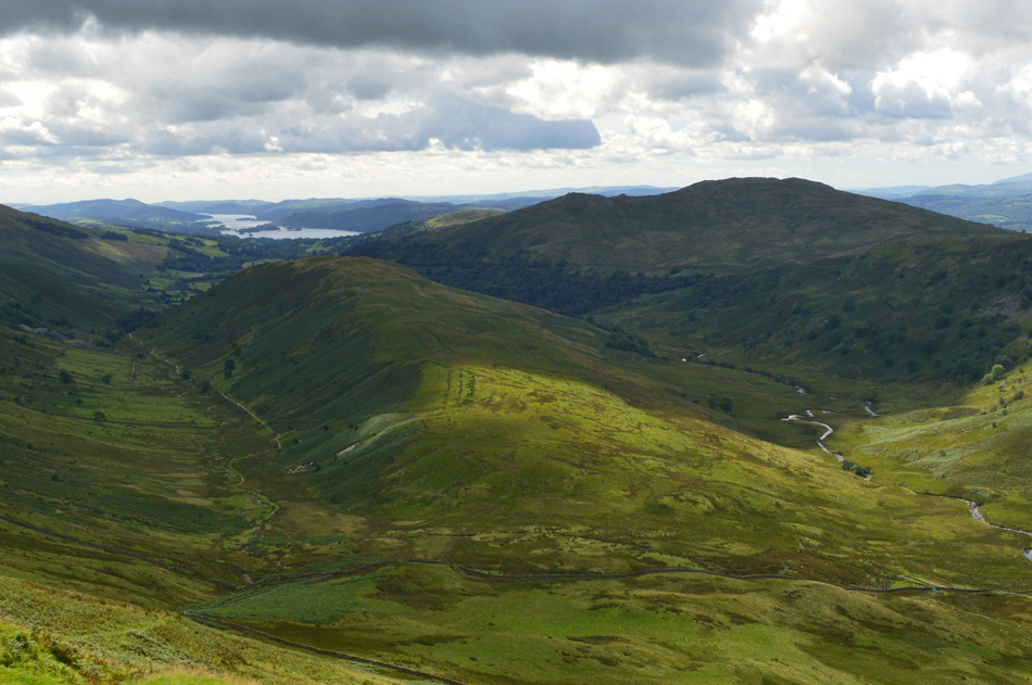
| The commanding view into Troutbeck Park with the III Bell Ridge seen over on the right. |
I still hadn't confirmed which route I would be taking today up until round about now where I decided to leave out Sour Howes and Sallows in favour of Mardale III Bell and High Street which meant I would taking in the best part of the Troutbeck side of the Garnburn Pass all the way towards it summit at Garburn Nook.
There's plenty of sunny spells around at the moment but I fear all of that is about to change. |
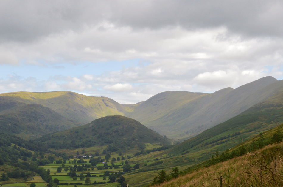 |
| A closer look into Troutbeck Park with Troutbeck Tongue, Caudale Moor (Stony Cove Pike) Threshthwaite Mouth, Thornthwaite Crag and the III Bell Ridge. |
| It didn't take long for the skies to mist over and by the looks of it the first of many sporadic showers is falling between III Bell and Yoke, from the Pass it seems I'm lucky enough to just feel the spray as its carried by the wind which is odd really because the rain wasn't supposed to arrive until around lunchtime. |
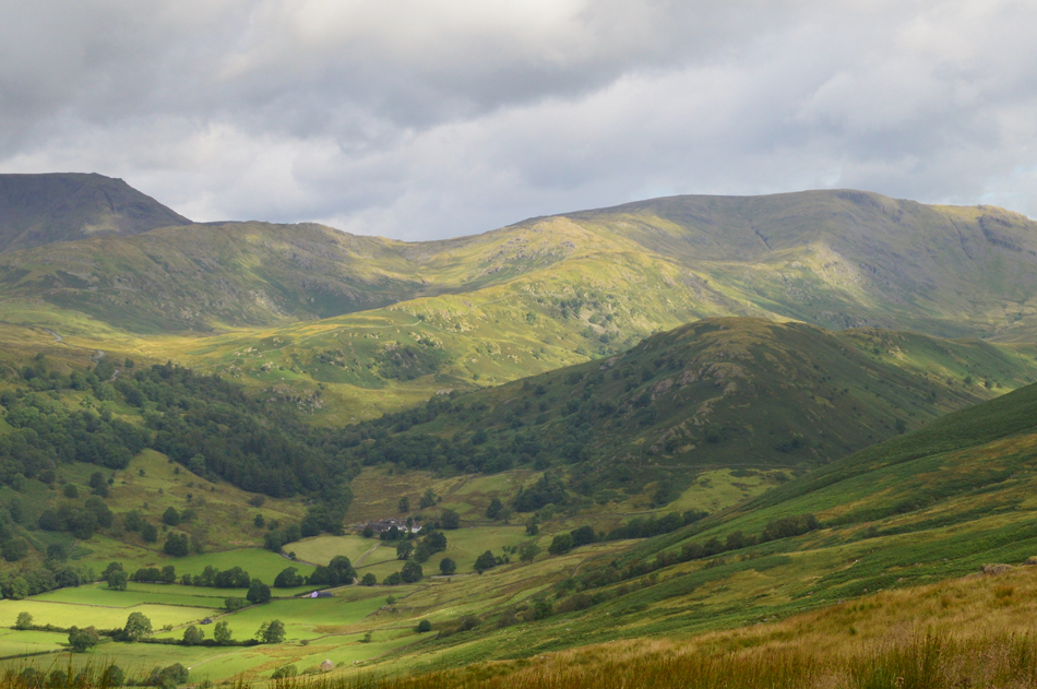 |
| The view over Troutbeck Park towards Troutbeck Tongue, Woundale, Red Screes and the mass of Caudale Moor (Stony Cove Pike) |
| |
 |
| Now without the zoom. |
| |
 |
| Here comes the rain. |
With the space of around fitteen minutes I had been watching the cloud slowly bubble up and before I knew it I had lost any means of a long distant view, on a good note however, this shower also passed me but by the looks of those clouds there were plenty more on the way.
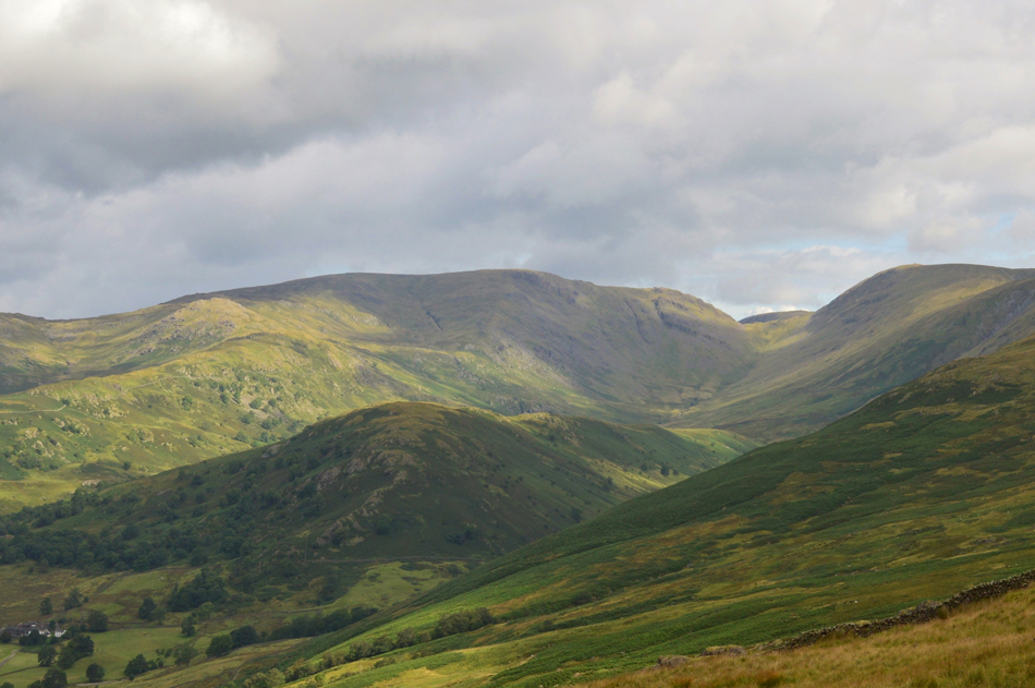
You might just be able to make out the Kirkstone Pass snaking its way through the centre of the photo with Red Screes and Woundale taking the brunt of what can only be described as an isolated shower, well for now that is. |
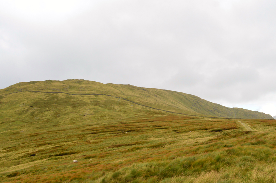 |
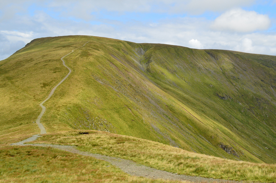
| Yoke is ahead. |
By the time I had reached the top of the Garburn Pass the misting had turned to light rain which I must say was still quite sporadic and not enough to see me reaching for full waterproofs just yet. It was also here at did I start to see more walkers who had ascended from the Kentmere side of the Garburn Pass who just like me are wearing shorts.
A large group are just up ahead and with two walkers behind me I set off for the ascent of of Yoke not before adding my waterproof jacket and tucking away my camera into its case to save it from getting wet.
The large group stopped to add waterproofing and I soon pass while passing on a "morning" |
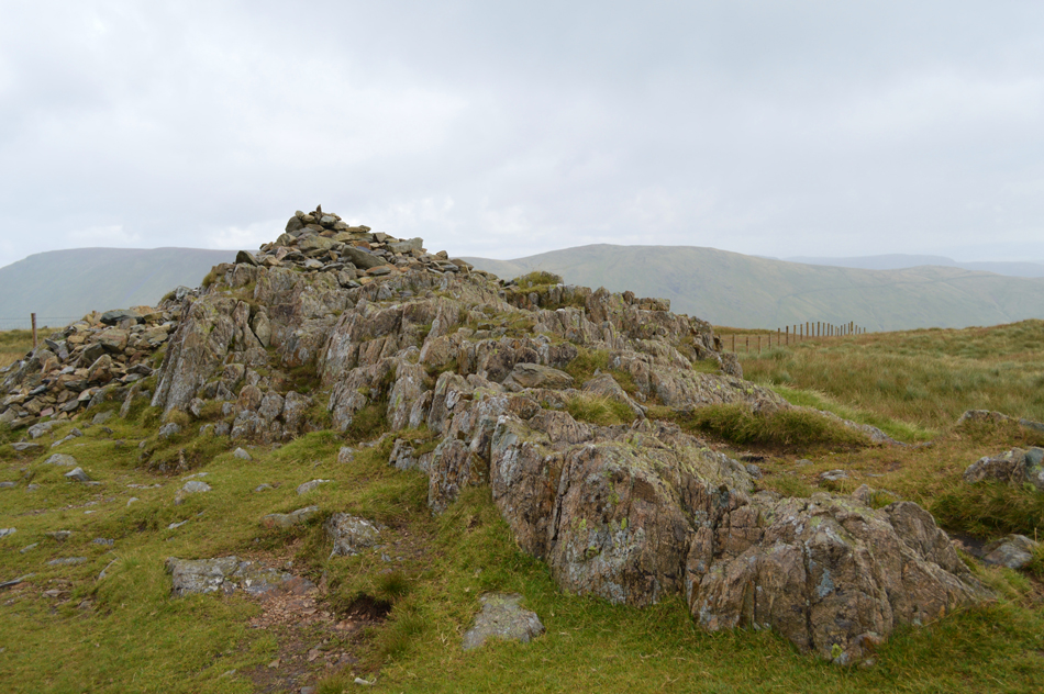 |
| Yoke summit cairn. |
| The isolated showers soon turned to full on vertical rain and the drudge onto Yoke was done mostly by keeping my eyes fixed on my boots. The large group would at times be in and out of ear shot before a large gap was formed on arrival of the shoulder of the summit. Ahead of the large group by now is the couple who I had seen at the top of Garburn Pass and ahead of them, two fell runners and their dog who are covering ground quickly. |
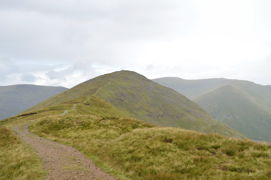 |
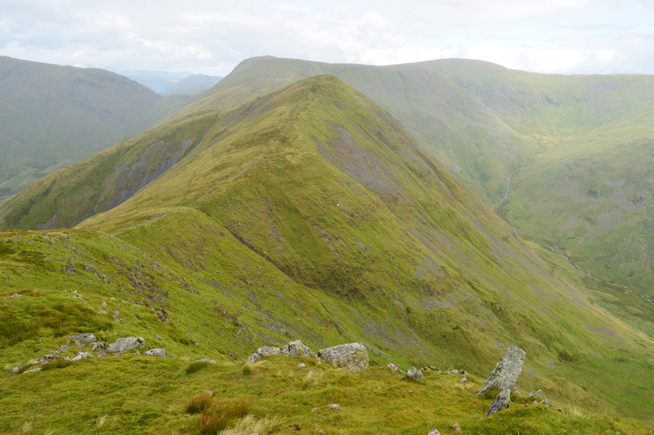
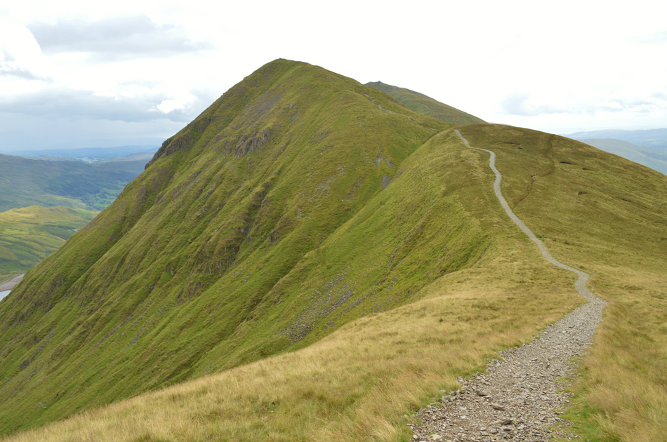
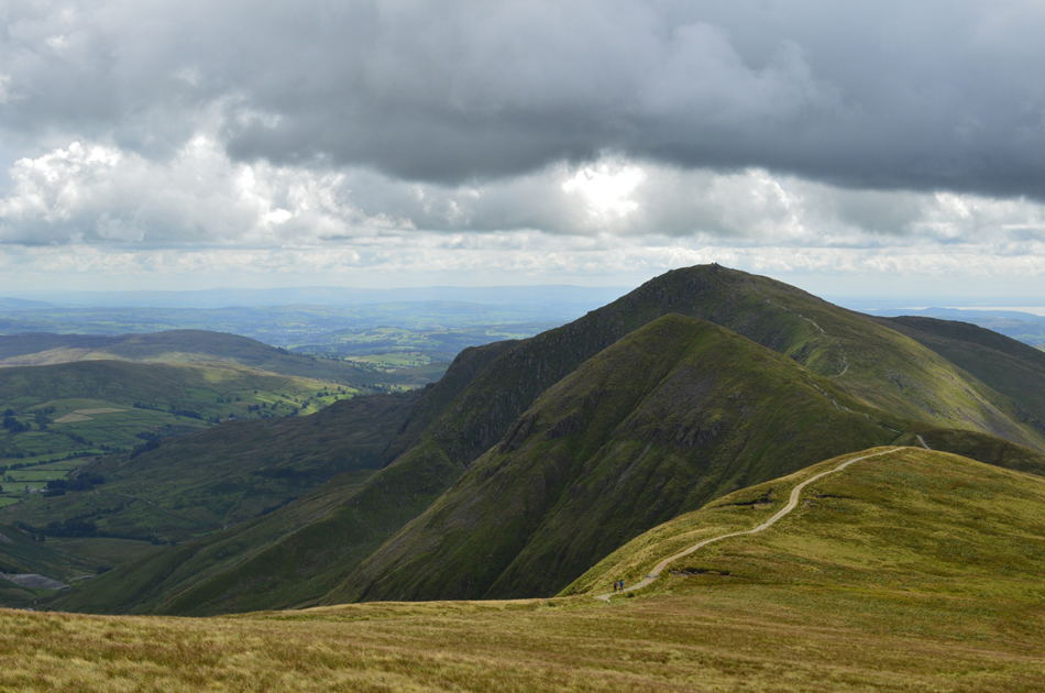
| III Bell ahead seen shortly after leaving Yoke summit. |
| Despite the vertical downpour at least the cloud was still cleared the summits ahead but there just didn't see a let up from the rain just yet which caused me to realise that I'm still walking in shorts, oh well its too late to add my waterproof trousers now, I'll just have to put up with wet shorts and legs. |
 |
| Looking back over Rainsborrow Cove towards Yoke. |
There was only one walker heading from III Bell and I watched him stand about the summit for a while before he descended and we crossed paths half way between Yoke and III Bell, his opening words were " where did all of this come from" well at least it just wasn't me I thought I was going mad, I'm sure it was forecasted to rain during the afternoon and not the morning!
He went onto say after looking at my wet shorts that he too was wearing his shorts underneath his waterproofs and unlike myself he added his overtrousers back on III Bell, well I laughed I'm wet now so sod it...to which he replied, well if you want a pee no one will be able to tell! I laughed out loud which kinda lightened my mood which for the last half hour or so had taken a beating with all this rain about.
The rain continues to land in the puddles and sweep across the ridge in mist like waves, despite this Im still enjoying every minute of it. |
 |
| Windermere from III Bell summit. |
| |
 |
| Caudale Moor (Stony Cove Pike) Threshthwaite Mouth, Thornthwaite Crag and High Street from the descent of III Bell. |
Whilst crossing the summit of III Bell I am overtaken by the two fell runners and they leap down by avoiding the path and use the grassy bank on either side. By now the ground is of course saturated and I am wary of the steep descent where I knew a few small insignificant rock steps close to the summit had to be negotiated but soon found that these had all but vanished due to erosion which left the path mostly made of up of just grit and chipped away stone.
This meant for a safer descent in wet weather yet it just goes to prove how popular this ridge actually is and continues to be. |
 |
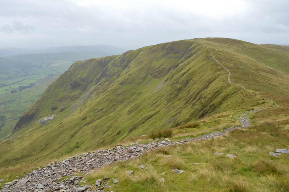
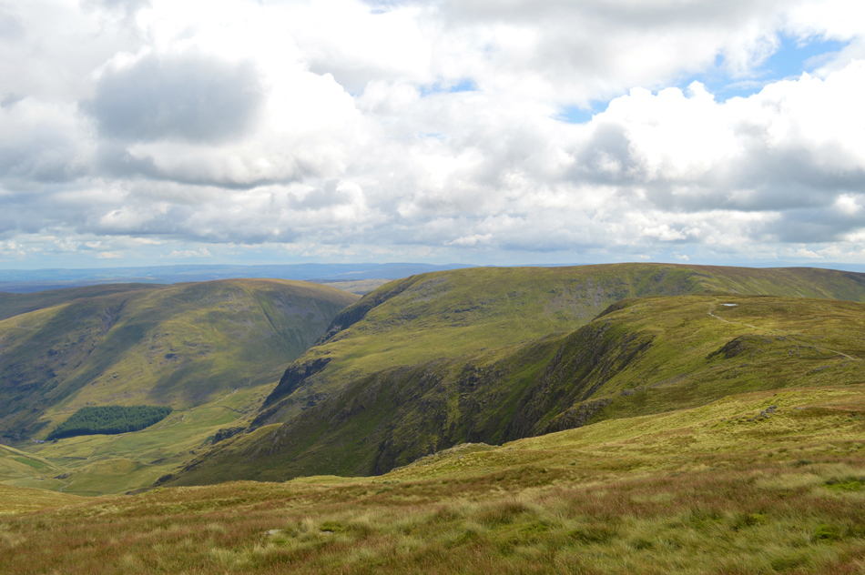
| Looking back over Over Cove towards III Bell and III Bell East Ridge. |
| I think it's actualy stopped raining now and the sun is trying to come out. |
 |
| The view into Hall Cove towards Mardale III Bell and Lingmell End. |
| Well, that was great timing because up until around ten minutes ago had it not have stopped raining I was leaning towards just heading for Thornthwaite Crag summit then to head back down into Troutbeck but now that it has stopped I'm going to keep with my original plan and head for Mardale III Bell via a traverse over the top of Hall Cove. |
 |
| Sunlit views over Caudale Moor (Stony Cove Pike) and Thornthwaite Crag. |
| It's a pretty special feeling when it stops raining and the sun comes out. |
 |
| Thornthwaite Crag. |
| I still need to ascend Thornthwaite Crag to within a whisker of its summit before traversing east over the head of Hall Cove. |
 |
| Looking back on Froswick and III Bell from my ascent on Thornthwaite Crag. |
| |
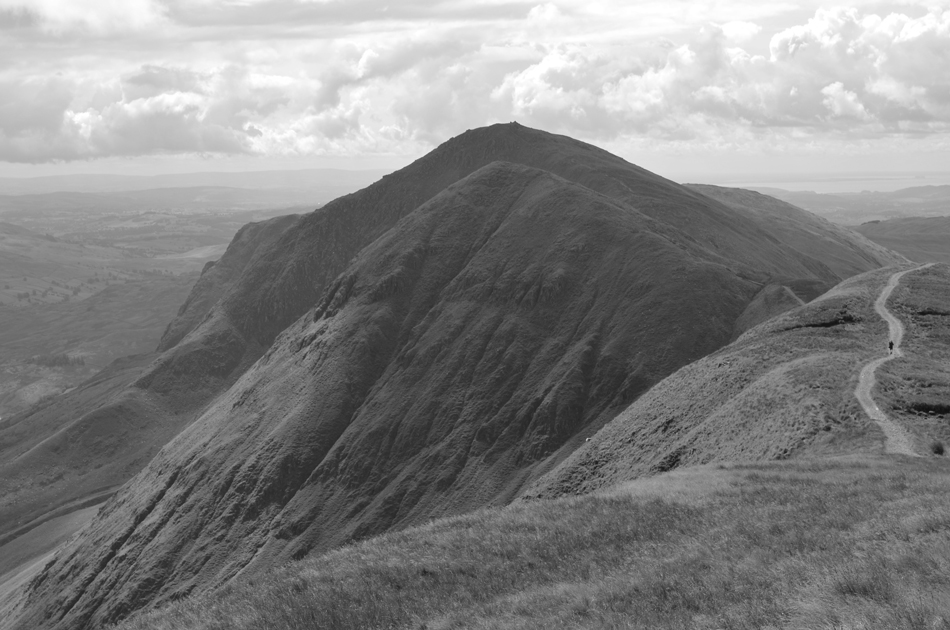 |
| III Bell Ridge mono. |
| |
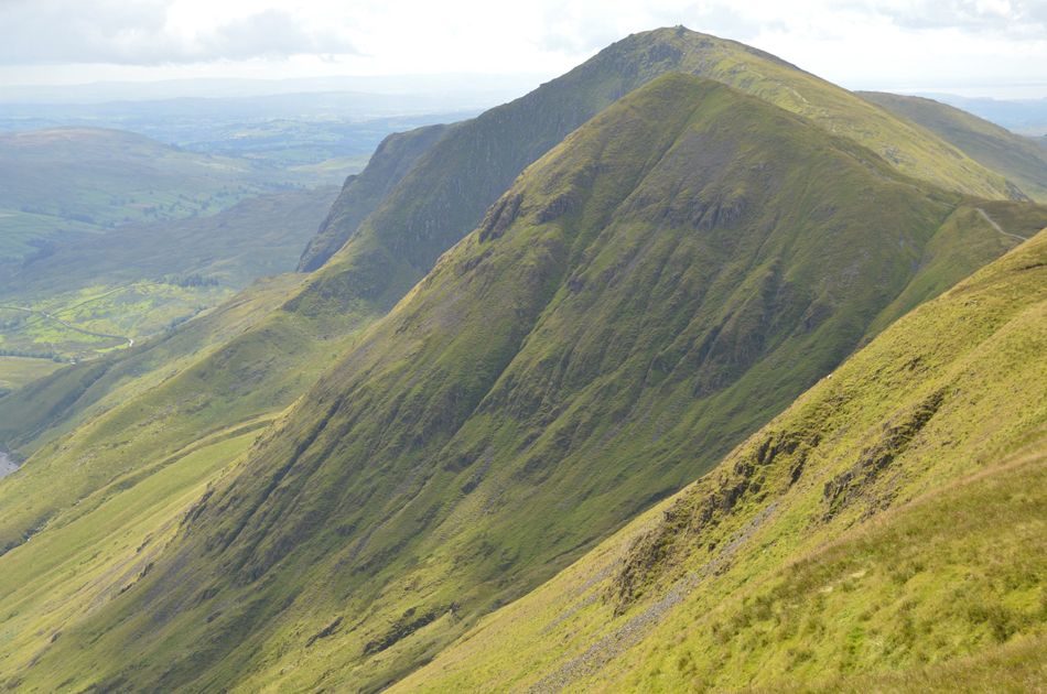 |
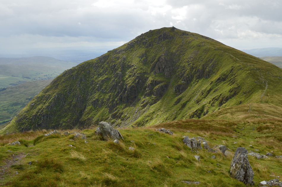
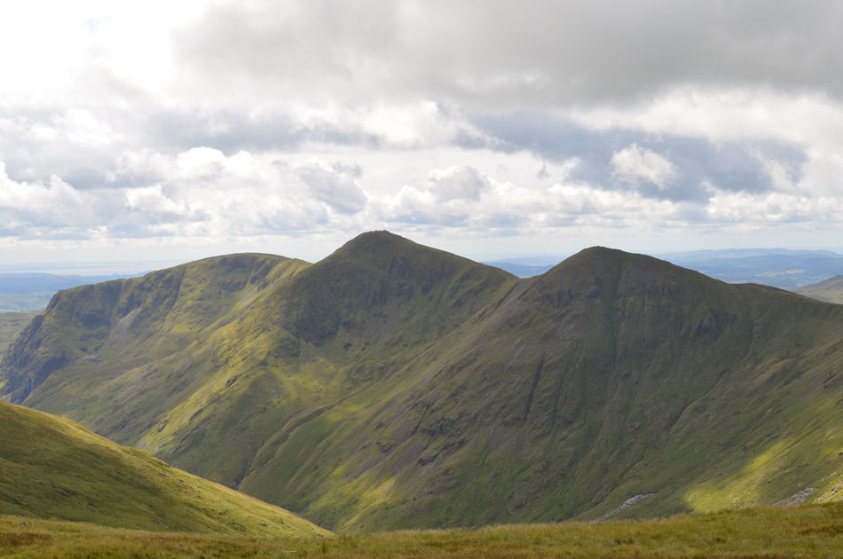
| Froswick, III Bell, III Bell East Ridge and Yoke. |
| No takers on III Bell east ridge this morning. |
 |
| Feeling alive. |
| With the ascent of Thornthwaite Crag behind me I steer right at a fork in the path marked by an old wrought Iron gate post, here after a short steady ascent I follow a singular track over the head of Hall Cove whilst my gear dries under a now warming sun, what a day this is turning out to be, bloody fantastic. |
 |
| Views over Froswick, III Bell East Ridge, III Bell and Yoke with the Kentmere Reservoir and valley seen below. |
| That's the source of the River Kent which eventually flows twenty miles south into Morecambe Bay via Staveley and Kendal. Long before I started fell walking my father in law who lived in Overton near Morecambe Bay would at low tide show me where the Kent would flow into Morecambe Bay below the treacherous mud flats, it's a fond memory that I will always look back on every time I see the River Kent and will always brings back fond memories of a special father-in-law. |
 |
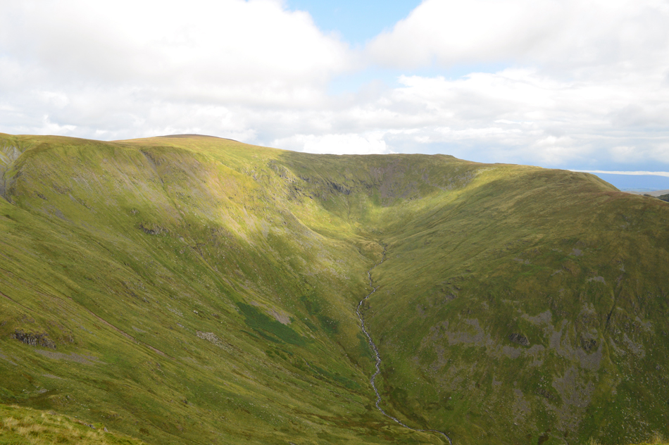
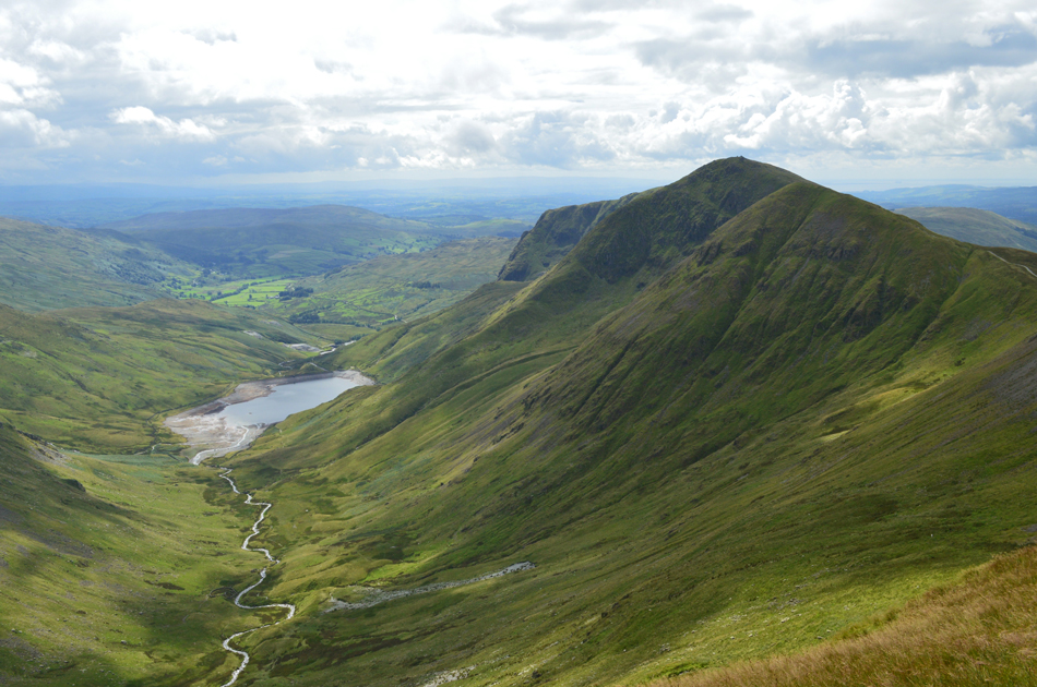
| Lingmell End, Harter Fell (Mardale) Kentmere Pike, Smallthwaite Knott and the Kentmere valley seen from the top of Hall Cove. |
| |
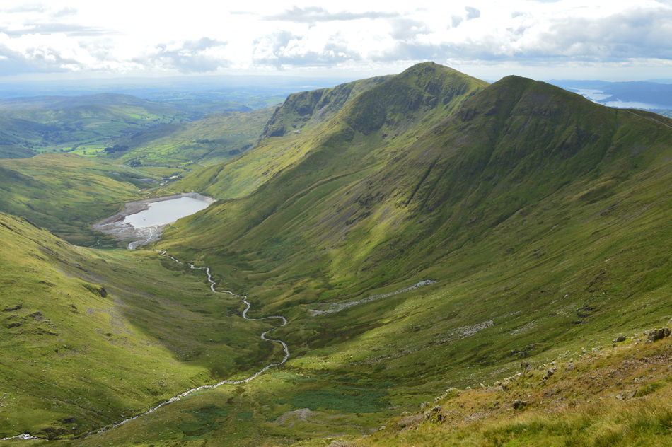 |
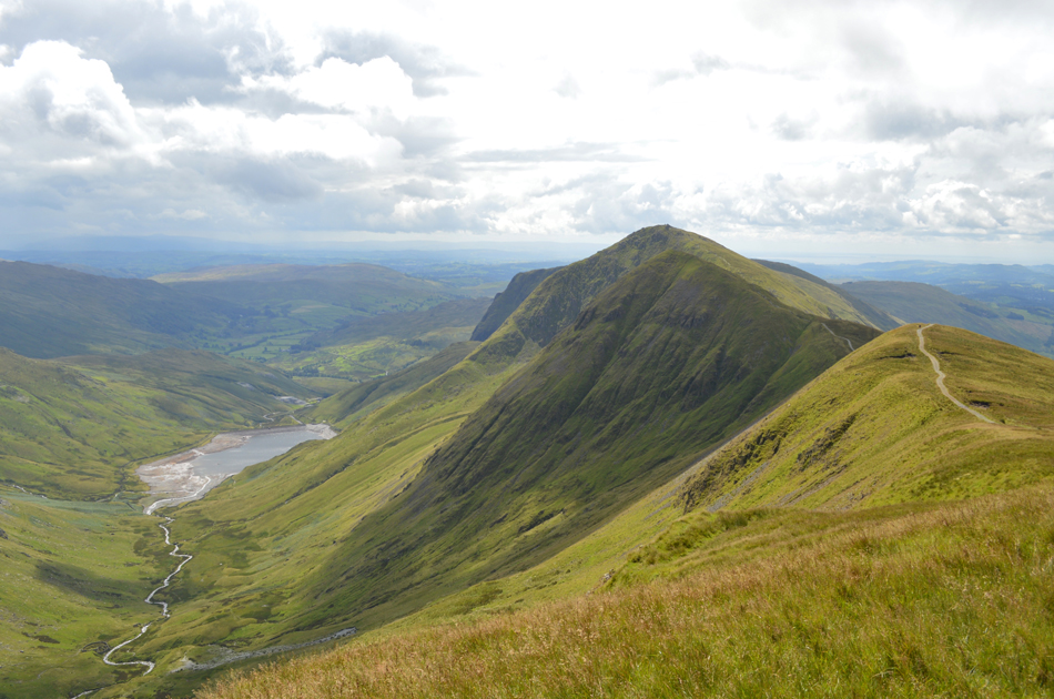
| That classic view of the III Bell Ridge and the Kentmere Reservoir. |
| |
 |
| Mardale III Bell is just ahead. |
The summit can be seen as the high point just up ahead, much of the way is by a singular path but you do have to leave at the right point as the path continues to descend towards the top of Nan Bield Pass.
It was at this point did I start to completely dry out, in fact looking at me now you wouldn't have thought just under an hour ago it was bucketing down. |
 |
| The III Bell Ridge seen over Hall Cove. |
| "Like the knuckles of a clenched fist" Alfred Wainwright. |
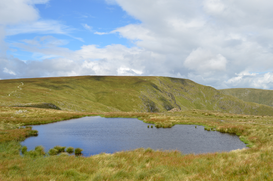 |
| High Street and Long Stile and Kidsty Pike from a small pool close to Mardale III Bell summit. |
| I had spotted two walkers standing next to the summit cairn as I crossed over the top of Hall Cove who by now are making an ascent on High Street, I join a large walking group who are taking selfies at the summit as one member consults his map, as I arrive they leave in the direction of Harter Fell (Mardale) |
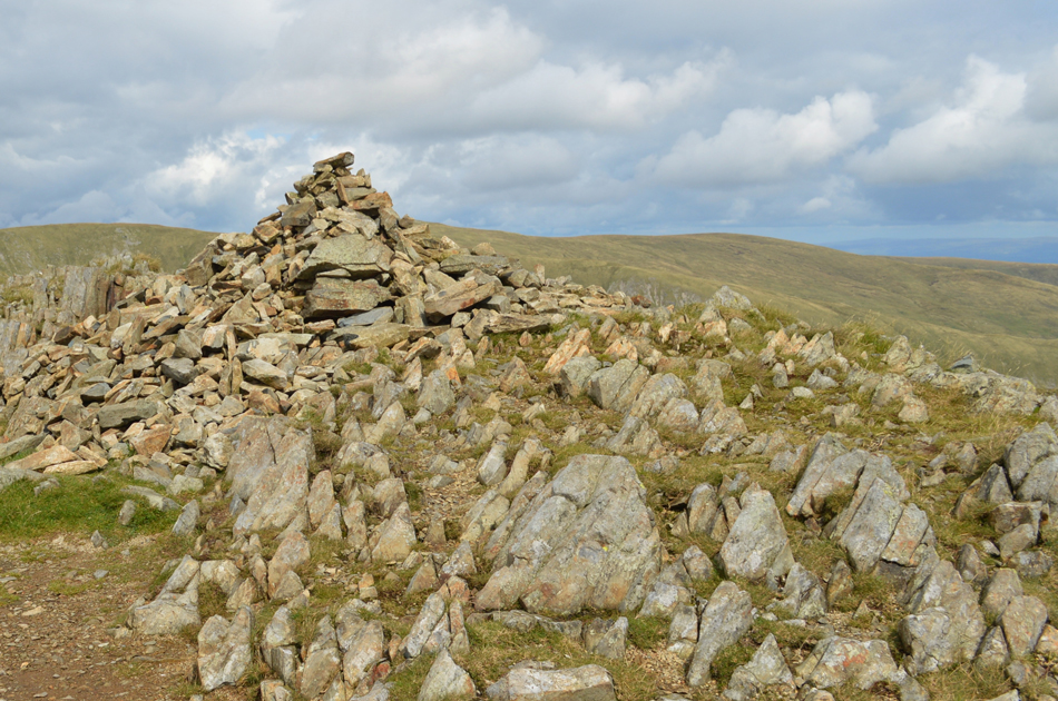 |
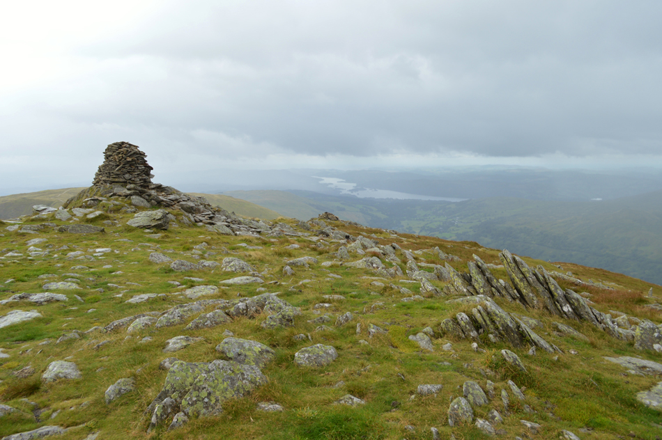
| Mardale III Bell summit cairn. |
| It was noted despite a warming sun that the summit temperatures during my last two outings had taken a considerable dip especially when a cool wind is added leaving sometimes raw finger tips and todays walk felt much the same, it's a special time to up on the high hills as the summits feel the cusp of an approaching Autumn well before the valleys do. |
 |
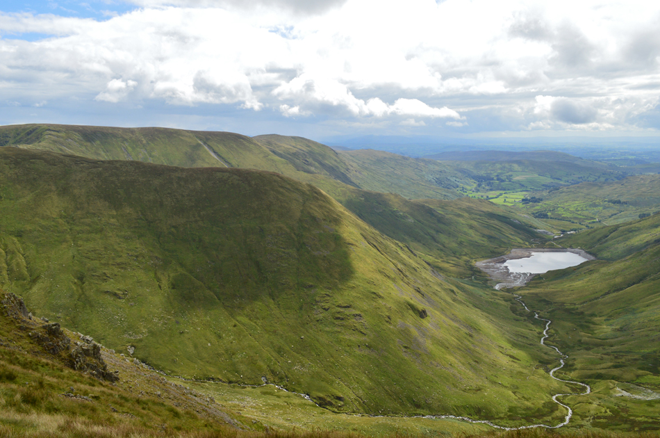
| Splendid views as I look back over Mardale III Bell, Harter Fell (Mardale) and Branstree. |
| |
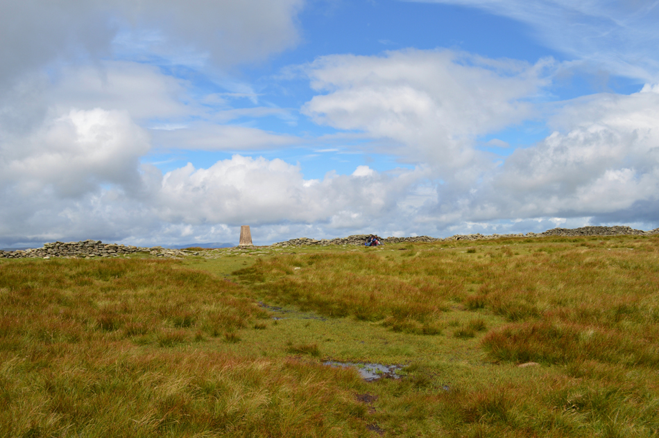 |
| High Street summit Trig Point appears. |
Having left Mardale III Bell I arrived at High Street summit having ascended via the grassy shoulder of the fell which brought me out directly opposite the summit Trig Point. It's dry and bright but those summit winds keep an edge on matters as I decide to break for lunch choosing a quiet spot out of the wind on 'this side' of the summit wall.
It's the usual chicken flavoured rice with chopped tomatoes for lunch and for afters a bag of M&M's but I seemed to have mis-laid my fork so I go straight to the M&M's instead. |
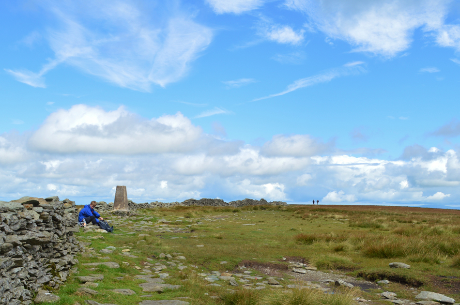 |
| Lunch with a view from my favourite summit. |
| |
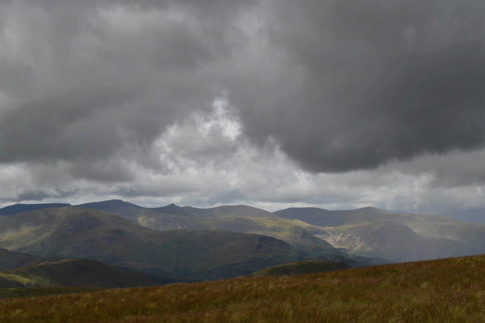 |
| Dark clouds brood over the Eastern fells. |
| Wowzers I wish I hadn't popped my head over the wall now, in-fact I think that's a shower approaching from the direction of Glenridding which with any luck should miss me. |
 |
| The III Bell Ridge from Thornthwaite Crag summit beacon. |
I managed to escape the worse of the shower but I could feel its misting carried on within the wind. I had descended High Street keeping the summit wall now to my left before joining the main path at the col above Hayeswater Gill. I could see that Thornthwaite Crag summit was busy especially on the east side of the wall where no doubt walkers were sheltering from the cutting wind.
I arrive at the same time as two old boys who I had watched ascend from Gray Crag, they are in good spirits and set an otherwise quiet summit into lively conversation, I'm sure I recognise one them from merely bumping into them in the past but I can't remember from where or when.
I leave Thornthwaite Crag and start to head south back over the summit shoulder from where Ill pick up Scotts Rake before my descent into Troutbeck. |
 |
| The III Bell Ridge. |
| Now looking much moodier than earlier. |
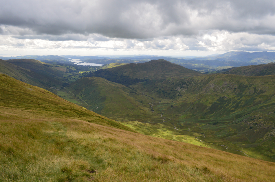 |
| Troutbeck Tongue, Troutbeck Park, Wansfell Pike and Windermere from the top of Scotts Rake. |
| No matter the direction of travel the Scotts Rake route is steep and can be tricky underfoot at times especially after rain, it pays not to rush if only to save ones ankles from being turned. |
 |
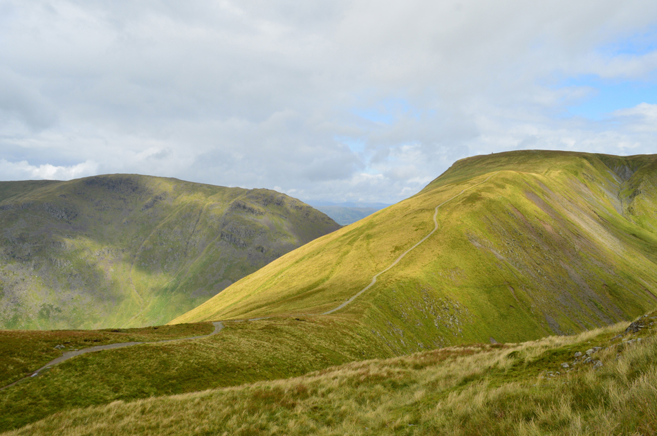
| Looking back towards Caudale Moor (Stony Cove Pike) Threshthwaite Mouth and Thornthwaite Crag from the desecnt of Scotts Rake. |
| It looks like the sun is back out now and with any hope for the rest of the duration and now that the winds are confined to the summits I'm really starting to heat up so off come the layers and out come the sunglasses. |
 |
| A distant Windermere seen over Troutbeck Tongue and Wansfell Pike. |
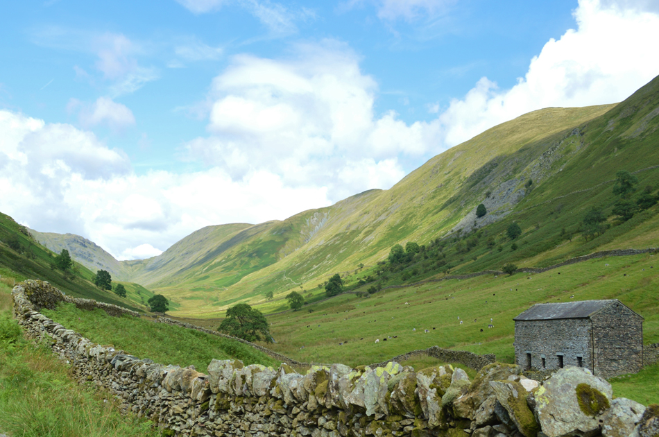
| Including an ascent on Troutbeck Tongue would have certainly completed this walk yet with time ticking on I think I'll much prefer the splendid path alongside Hagg Gill (seen to the left of the Tongue) to bring my walk into Troutbeck to an end by. |
 |
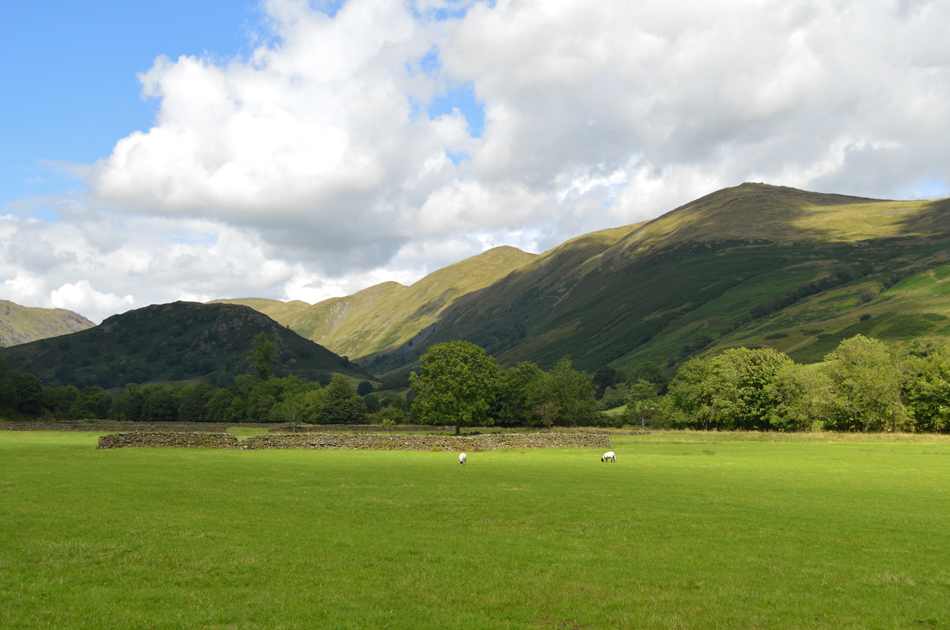
| Looking back towards Caudale Moor (Stony Cove Pike) and the III Bell Ridge from Troutbeck Park / Hagg Gill. |
| |
 |
| Troutbeck Tongue and the III Bell Ridge from Ing lane. |
| The path heading into the valley was quite busy passing many a tourist all of whom are enjoying the unexpected warm afternoon sun (after all by now it should be raining if we were to believe the forecast) but instead it's glorious, the birds are singing and the sheep are grazing while boisterous lambs call out from the lush bracken covered fell side below the Kirkstone Pass as the sound of car engines high above starts to bring me slowly back into reality. |
 |
| Troutbeck Tongue and the III Bell Ridge. |
| Taken shortly before I head through Truss Lane. |
 |
| Jesus Curch, Troutbeck. |
| |
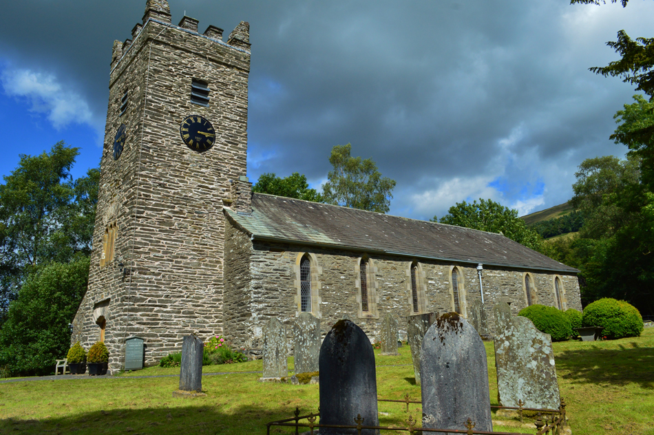 |
| Jesus Church, Troutbeck. |
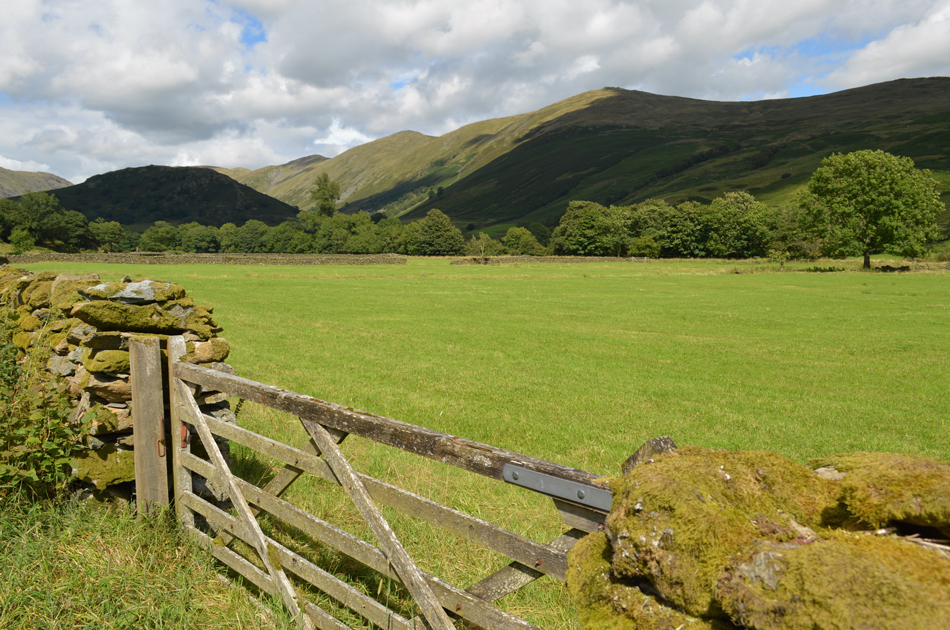
On leaving Troutbeck Park behind also goes my final view of the spectacular III Bell ridge as I head through the delightful Truss Lane while newly clipped Sheep peer through gaps in the thick bramble, the sight of Sour Howes with the Garburn Pass below appears over the greenest of pastures before Truss Lane comes to an abrupt end at the Kirkstone Pass. I have the option to walk back along the Pass or do as I always do and follow the sign posted for the Mortal Man pub before turning left along a bridleway where views open out over Troutbeck and its idyllic farm cottages. I arrive at the rear of Jesus Church and begin to walk through the Church yard sometimes stopping to read the headstones some of which date back to the early eighteenth century.
Clouds begin to gather yet as for the forecast of rain, I'm not so sure. The car park is still busy with some of the same cars still parked as they where this morning but new have also replaced the ones that have left. My car appears below a canopy of trees and all that divides it with Trout Beck is just a few feet of river bank. Cars come and go as do one large group of walkers who start to walk up the lane towards Troutbeck village, dog in toe.
It's time to head home now but all that occupies my mind as I kit down in the cool wind that I experienced up on summits and the fact that for another year I'm lucky enough to know how these small changes in the seasons feel when one season is within the cusp of the next. |
|
| |
| Back to top |
 |
|