|
Lingmell via Piers Gill |
 |
 |
7th May 2018 |
 |
|
With my break coming to an end I thought I'd break the mould as of late and try something a little different. My original intention was to repeat a route that I did back in June 2014 where I ascended the Scafells via Piers Gill, Lord's Rake and Deep Gill only back then had the misfortune to have completed the whole route in fog due to a misleading forecast.
Every now and again the route would pop back into my head where it stayed up until this week and I thought I'd end the week by repeating this epic route, it was only by chance I might add that the best day forecast happened to be the Bank Holiday but I could live with the hustle it brought.
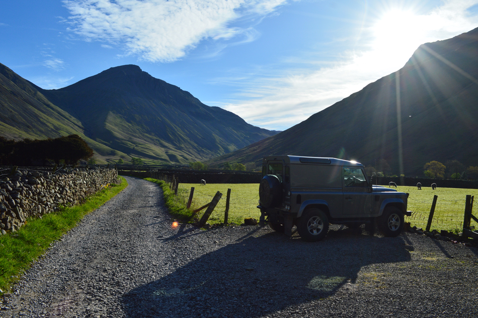
I set my alarm for 4.50am and by 5.30am I was on my way to Wasdale, during that drive west my mind was occupied by just how hot today was going to get and was I possibly taking too much on a school day knowing I have to live with the aches and pains without a recovery day afterwards. By the time I arrived at Wasdale Head some two and a half hours later I had already made my mind up, why not gain just Lingmell by its grandest ascent. |
|
| Wainwright Guide Book Four |
 |
| The Southern Fells |
-Piers Gill
A thousand foot drop which again is not nearly so vertical as it appears at first site to the startled beholder. |
 |
|
|
|
| |
|
Overview |
|
|
| Ascent: |
2,600 Feet - 793 Metres |
| Wainwrights: |
Lingmell |
| Weather: |
Warm Dry and Sunny, Cool Across The Tops. Highs of 22°C Lows of 12°C |
| Parking: |
Car Park, Wasdale Head |
| Area: |
Southern |
| Miles: |
5.7 |
| Walking With: |
On My Own |
| Ordnance Survey: |
OL6 |
| Time Taken: |
3 Hours 30 Minutes |
| Route: |
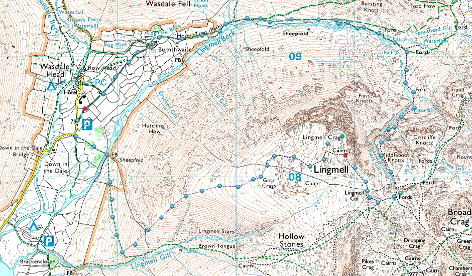
Wasdale Head - Burnthwaite - Moses Trod - Lingmell Beck - Piers Gill - Lingmell Col - Lingmell - Lingmell Crags - Goat Crags - Lingmell West Ridge - Down-in-the-Dale -Wasdale Head |
|
| |
|
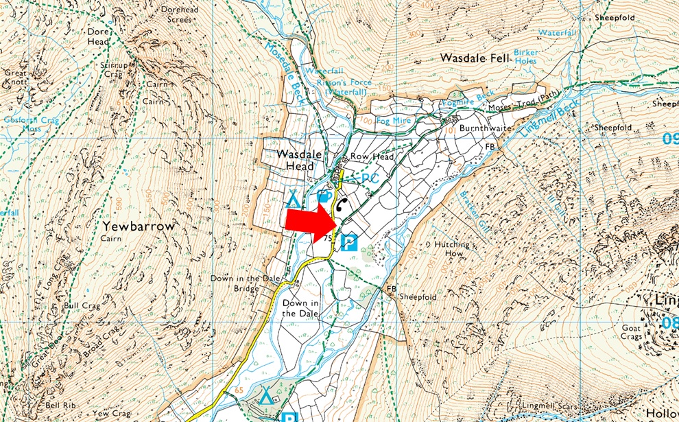
Parking Details and Map |
|
|
| Nearest Post Code: |
CA20 1EX |
| Grid Reference: |
NY 186 708 |
| Notes: |
Probably one of the more popular car parks in Lakeland due to its proximity to Scafell Pike meaning that the car park at Wasdale Head is very popular all year around and is large enough to accommodate around forty cars and mini buses. Despite its popularity you may only struggle to park here during mid Summer or late into the afternoon. |
|
| |
|
Map and Photo Gallery |
|
|
 |
| |
| |
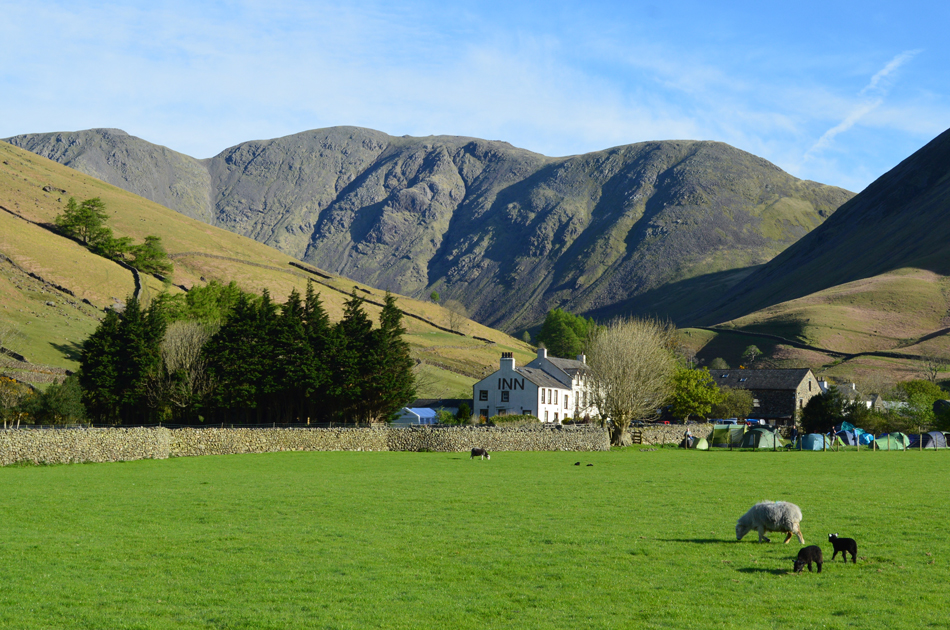 |
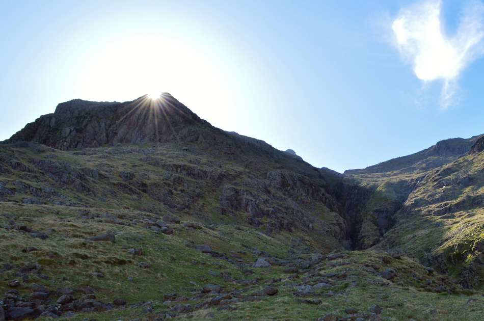
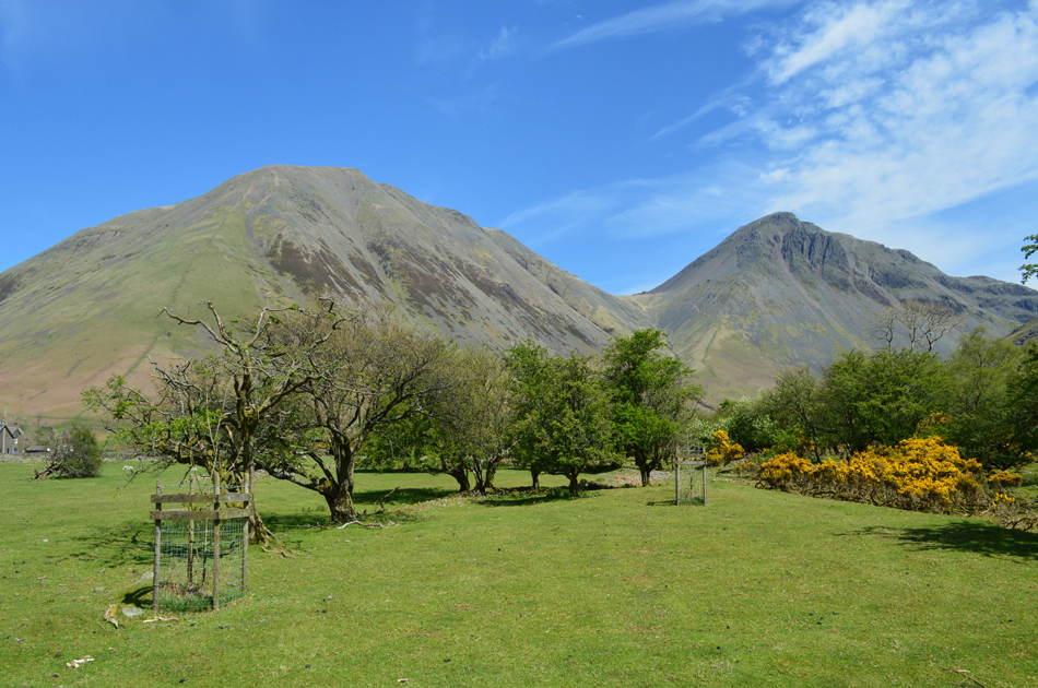
| Black Crag, Wind Gap and Pillar from Wasdale Head 08:10am 12°C |
Okay, I admit it didn't at first sit right, I kinda felt like I'd weasled my way out of a dam good walk but after only a few minutes kitting up in the heat and humidity that sinking feeling quickly started to fade knowing I could now take it easy and for a change, maybe even do a little exploring. Despite altering my route whilst still stood behind my car I figured I'd still take the four litres of hydration that I had packed for the Scafell walk along with half a dozen Satsuma's which would help quench my thirst in the heat of the day.
Despite today being a Bank Holiday Wasdale Head wasn't as busy as expected with the car park being mostly occupied by motor homes, a chap to the left of me kits up then heads out towards Down-in-the-Dale while another chap who arrived after me packs ropes and harnesses into a large climbing pack who then walks of in the direction of Mosedale, there was no question he was heading to climb Pillar Rock. |
 |
| Kirk Fell from Wasdale Head. |
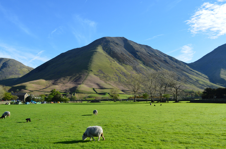
| The campsite at Wasdale Head is looking full. |
 |
| Great Gable and Lingmell's north ridge taken shortly after passing Lingmell House B&B |
With my car locked I threw my pack over my shoulder, placed my sunglasses on and set about enjoying the first Satsuma of the day. Only a few weeks ago I exchanged the items in my pack from Summer to Winter and you'd think that the pack would be much easier to carry around, well in theory yes, but when you add four litres of hydration your shoulders really feel the difference, the only way to combat this is to hydrate, but not too quickly mind. |
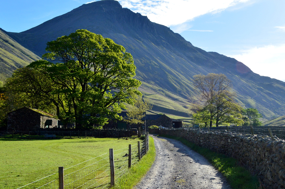 |
| Passing through Burnthwaite as Great Gable dommineers the view. |
| What a glorious morning. |
 |
| Great Gable from Burnthwaite. |
I joined Moses Trod after leaving Burnthwaite behind and followed the stony track towards Sty Head passing over Gable Gill at the footbridge while both Gable and Lingmell domineered both my flanks. To my right I can hear Lingmell Beck as it cascades through waterfall after waterfall some of which are well worth exploring if only to see the emerald pools which flow so clear and vivid.
I continued to the follow the track which then starts to rise slightly, to my right I'm joined by a stone wall where a path runs alongside, it can get quite boggy here but today I faired well only managing to dampen the caps of my boots. The path then branches right again, this time much closer to Lingmell Beck where it's worth to keep an eye out for a suitable crossing, here the beck is often deep and wide and isn't worth taking a soaking so early into the walk, I persevere while using my hand to shade my eyes from the strong sunlight, up ahead the beck narrows while on the other side I spot the start of the path for Piers Gill distinguished by its rising zigzags straight from the banks of Lingmell Beck. |
 |
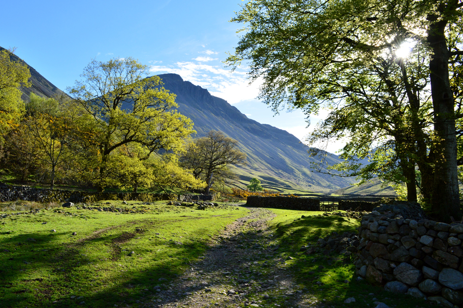
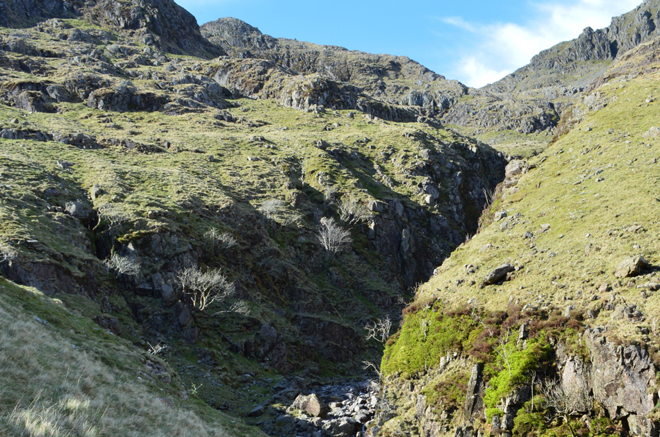
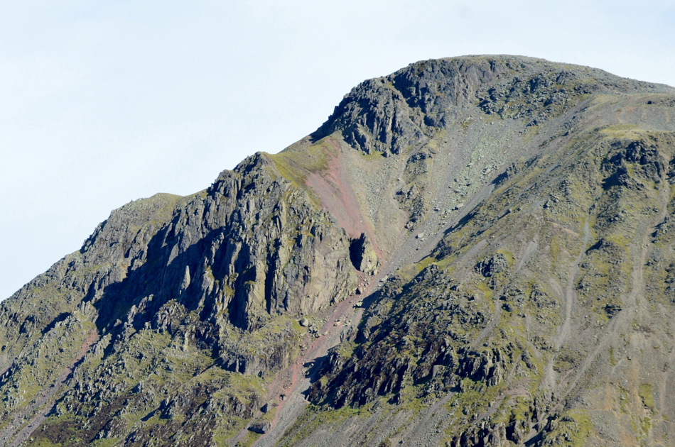
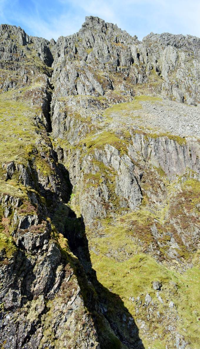
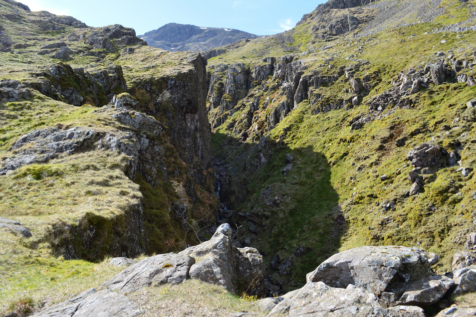
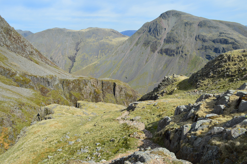
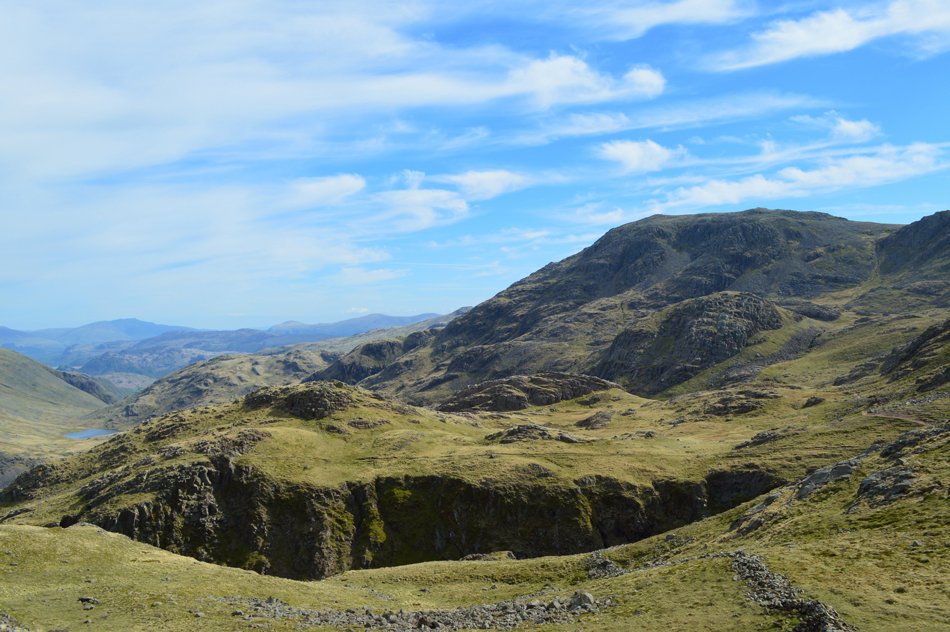
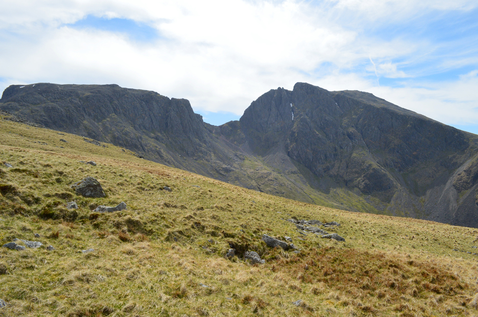
| Piers Gill seen below Criscliffe Knotts (left) and Middleboot Knotts (right) |
You can see Piers Gill in the lower right of the photograph which looks like the rock bed of any gill in Lakeland, it's only when you start to climb does the bed turn into a ravine, the start of which can be seen up ahead in the centre of the picture.
Just in case you were wondering if I look 'off path' you'd be quite right, a good path navigates (with the odd scramble thrown in) all the way to the top of Piers Gill but please be advised for the less experienced walker please stay with the path at all times and do not attempt in bad weather. |
 |
| Sunlight breaches Stand Crag. |
| Walking into the shade was definitely a plus point after the steady pull from the valley as the sweat now oozing out of me reflects this. It's very humid and very hot, or at least it feels that way! |
 |
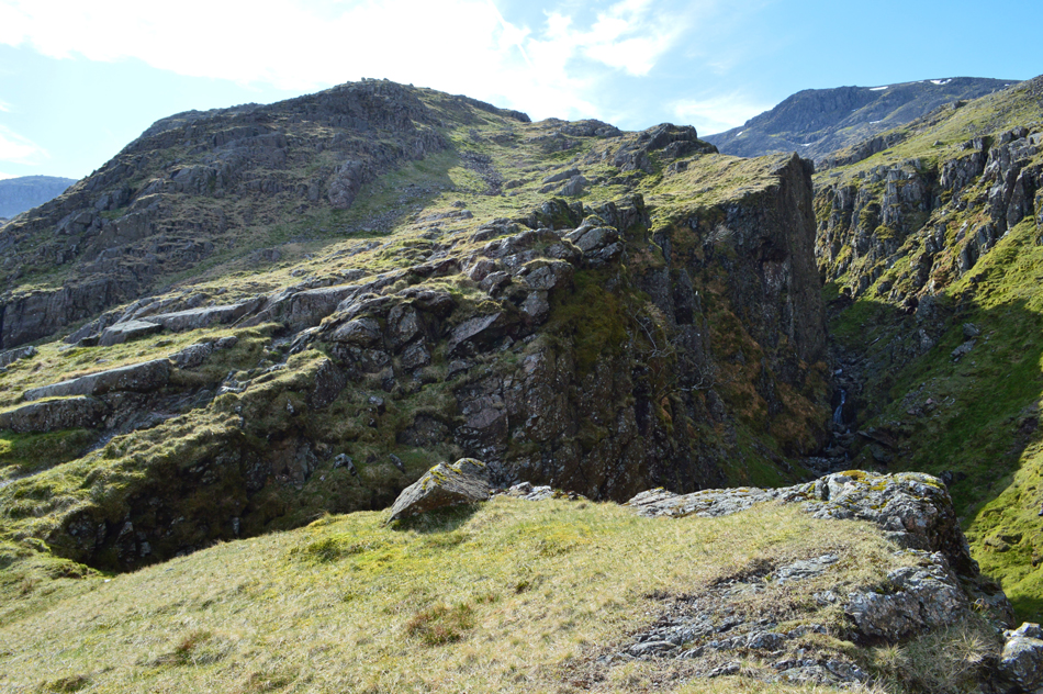
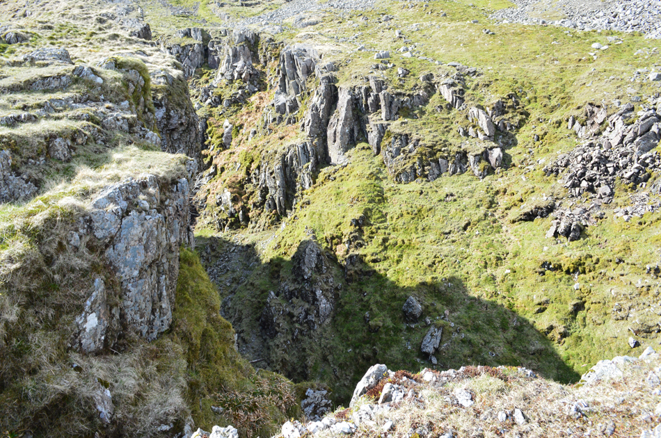
| Piers Gill lower ravine. |
The path keeps to the north east or, left of the ravine, should you find yourself on the right, please with care make your way back, there is no path, nor a safe route nor by the actual river bed itself.
The views... |
 |
| ...are outstanding. |
| That's Lingmell Crag up there with the upper cleft of the ravine rising all the way towards the summit, I'll be up there soon. |
 |
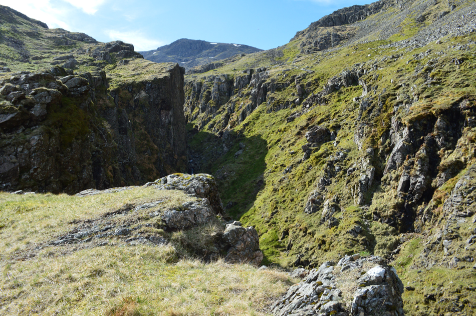
| Looking back over Piers Gill (lower) ravine. |
The path levels out a little before a short descent over Greta Gill, crossing the gill with ease via a series of stepping stones made for little to no effort, it's worth a look left here as you find yourself looking deep into Greta Gill. I easily ascend out of the gill from where the path starts to steepen.
It wasn't only Greta Gill which takes you by surprise, the views back to Great Gable were outstanding. |
 |
| A close up of The Napes and Tophet Bastion surrounded by Great Hell Gate (right) and Little Hell Gate (far left) |
From the summit of Great Gable the Westmoorland cairn is situated to the lower left (above the Tophet Bastion ridge) Both little and Great Hell Gate distinctive red scree sections are navigable to the experienced walker as is Gable's South traverse which runs parallel below the Napes from Sty Head or Beck Head, a route that I aim to walk within my Birkett project. |
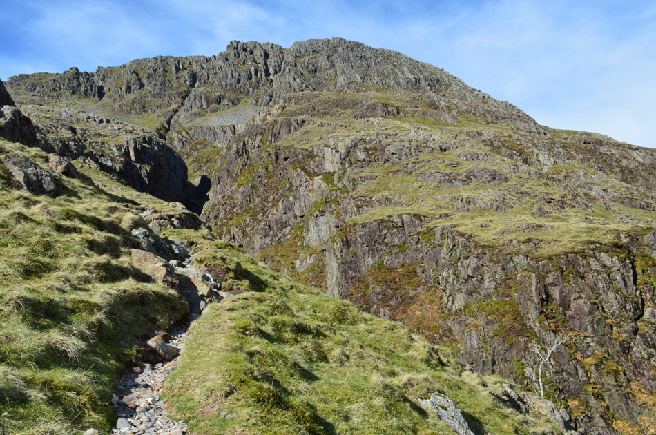 |
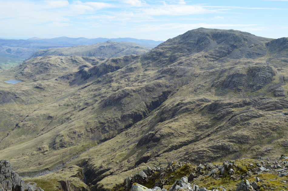
| Continuing alongside Piers Gill while the summit of Lingmell domineers from up above. |
| The path at times, does come quite close to the top of the ravine while at the same time offering leg wobbling views. Up ahead, towards the far left, a short 'hands on' scramble is required in order to continue along the path. |
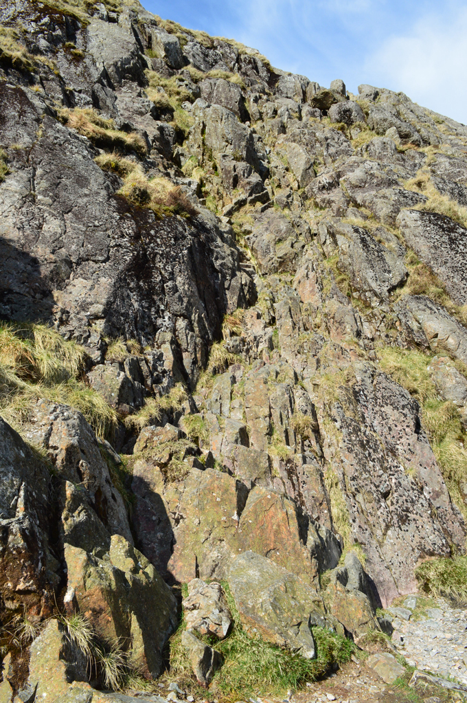 |
| The scrambley bit. |
My apologies if this photograph makes this short section of scramble look something from the Eiger, it really isn't as daunting as it looks but I would advise to only attempt if you are comfortable with a little 'hands on' scrambling and have attempted similar beforehand, please also be advised that some parts of this rock wall are prone to slime and moss, today due to conditions I only encountered dry moss across across the upper section.
I packed my walking poles away here, hardly worth the effort in the time it took to get to the top but much safer knowing my hands were both free without the disadvantage of trailing poles. |
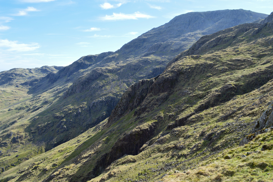 |
| Fantastic views towards The Band on Great End. |
| |
 |
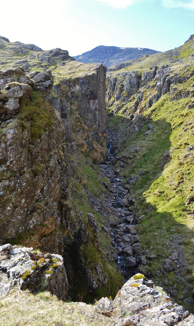
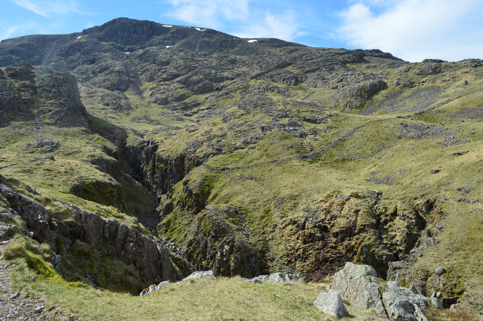
| Here, following the upper ravine below Lingmell Crags. |
| Note the large scree section below Lingmell Crags over on the right. |
 |
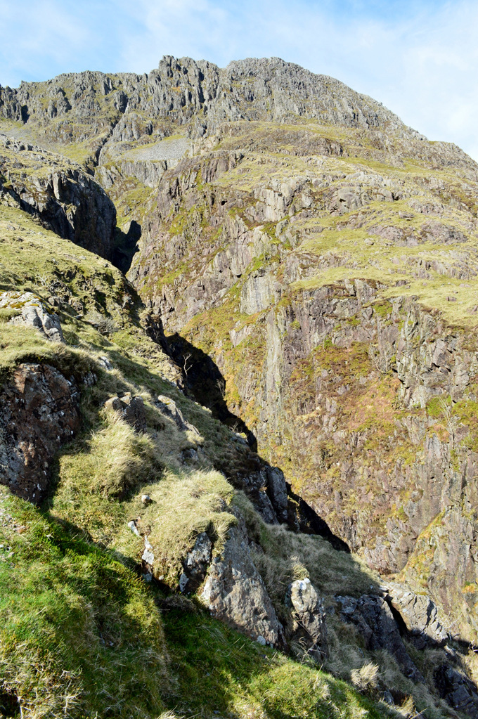
| Middleboot Knotts and the summit of Scafell Pike from Piers Gill. |
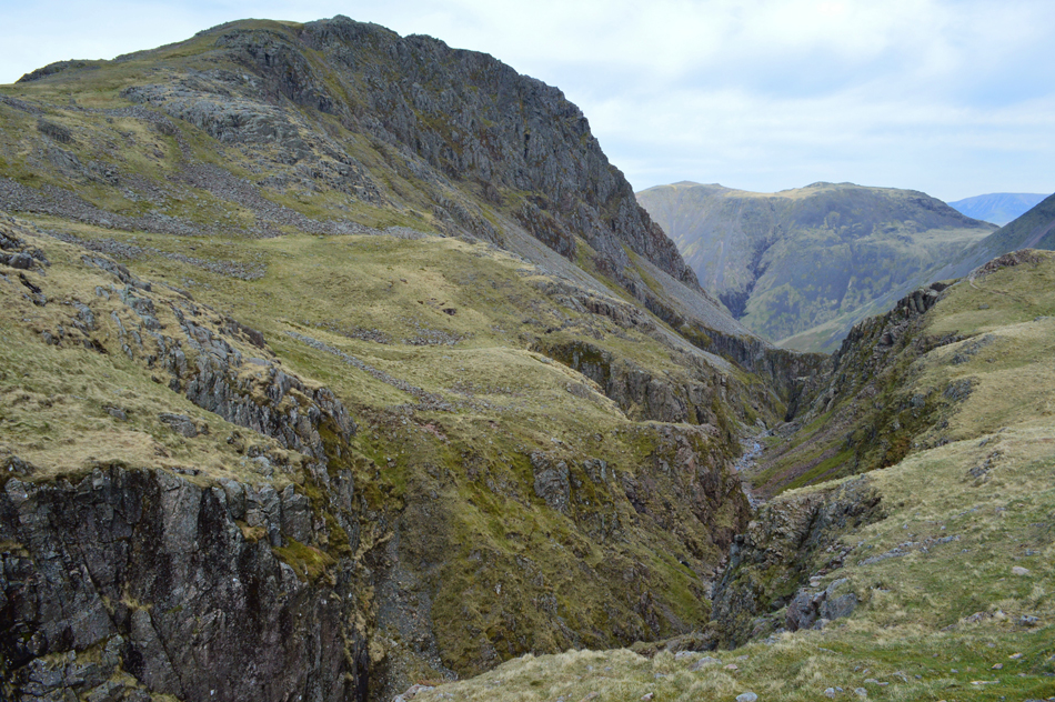
| After the scramble I rejoined the path where the ravine takes a distinct left turn, it's from here in my own personal opinion do you get the best view of the Piers Gill. The steepness of those cliffs are just jaw dropping. |
 |
| Scafell Pike from Piers Gill. |
| It's from the edge do you experience the true feeling of how deep the gill is while at the same time your stomach is doing somersaults while informing you that "that's close enough" |
 |
| It's a long way down. |
| Not many sections of the ravine offer a view straight down to the river bed with the exception of this one, even if one is used to heights and exposure standing here brings it to a new level. |
 |
| Scafell Pike from Piers Gill. |
| I can't believe I missed out on these incredible views the last time I was here. |
 |
| The view into Piers Gill. |
| |
 |
| Kirk Fell, Beck Head and Great Gable from Piers Gill. |
| |
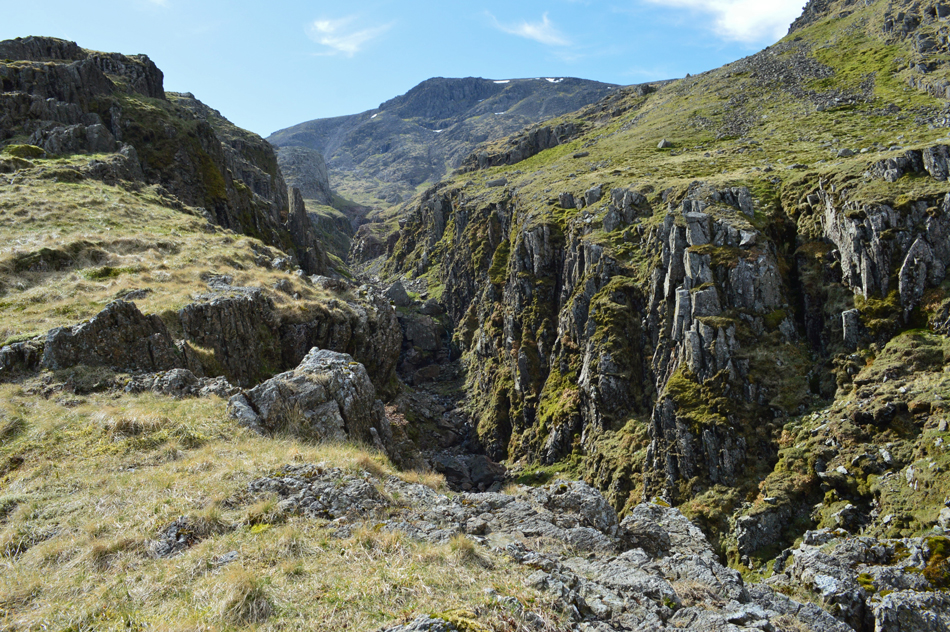 |
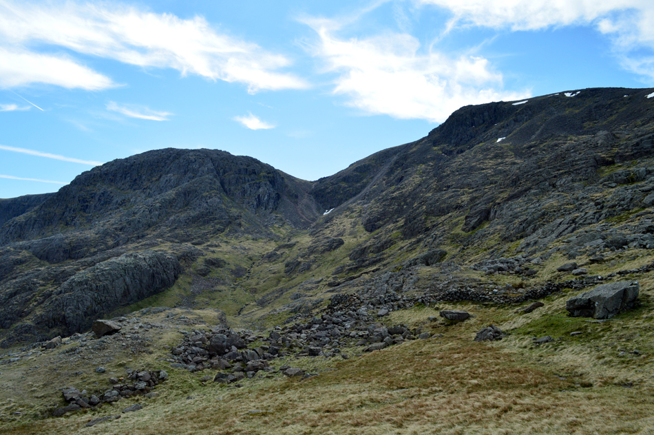
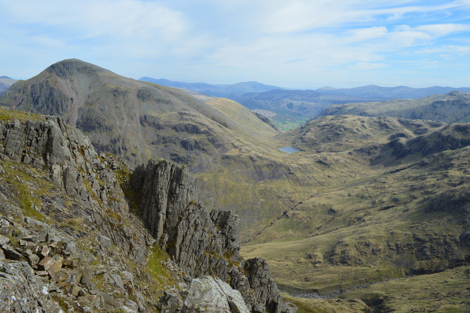
| Scafell Pike and Dropping Crag from Piers Gill. |
| The head of Piers Gill comes into view now which forms part of the Corridor Route |
 |
| Kirk Fell and Great Gable seen over Piers Gill. |
| |
 |
| Scafell Pike from the head of Piers Gill. |
| Had I have been following my intended route onto Scafell Pike I would have continued ahead into the cove below Broad Crag Col which is out of shot but 'behind' the craggy outcrop centre left. |
 |
| Lingmell seen with a distant Kirk Fell from the head of Piers Gill/Corridor Route. |
| Time to head for Lingmell summit now which I'll do by following the Corridor Route briefly. |
 |
| Middleboot Knotts, Kirk Fell and Great Gable seen over the head of Piers Gill. |
| |
 |
| Middleboot Knotts, Stand Crag, Round How and Great End seen over the head of Piers Gill. |
| With Sty Head, Styhead Tarn and Seathwaite Fell seen centre left. |
 |
| Broad Crag, Broad Crag Col and Scafell Pike from the Corridor Route. |
| It might have been nice and warm down in the valley but with a sudden dip in temperature, not helped by cloud cover I find myself rolling my sleeves down. |
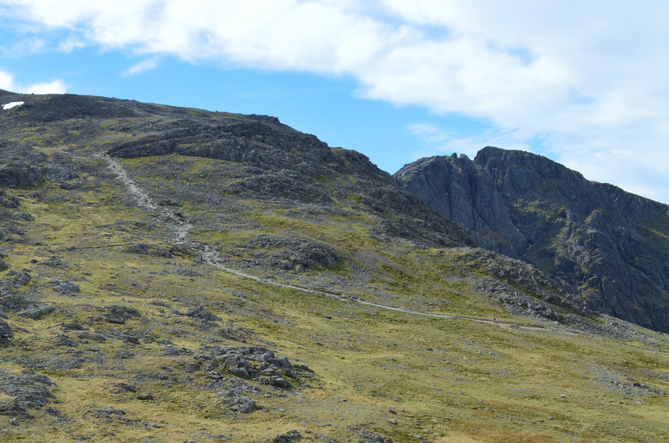 |
| Scafell Pike and Scafell seen over Lingmell Col. |
| It's approaching mid-morning now and I can see the 'tourist path' onto Scafell Pike is starting to get busy already. |
 |
| Scafell, Pulpit Rock and Black Crag from my ascent of Lingmell. |
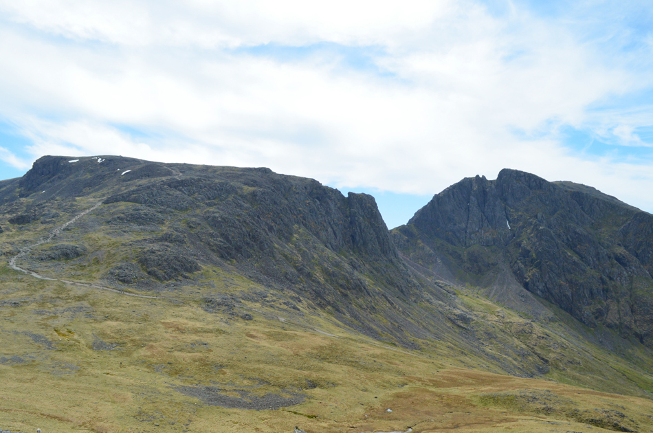
| Wowzers is that snow I see in Lord's Rake. |
 |
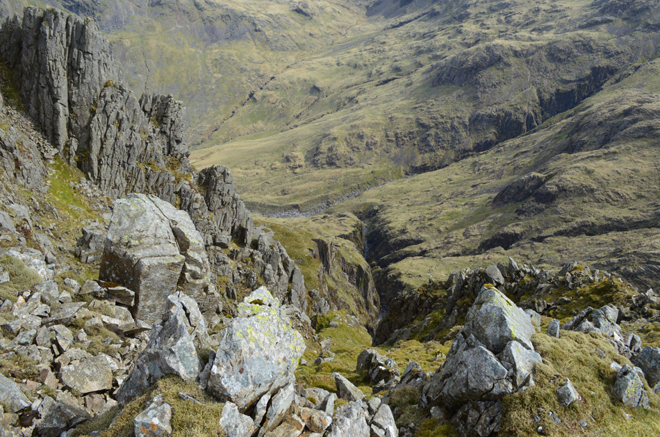
| Views along the Corridor Route dominated by Great End. |
| Piers Gill is seen below while the ravine of Greta Gill is seen centre dropping lower left, it's hard to imagine that when I crossed Greta Gill earlier it was no wider than your average beck. In this image Glaramara can be seen behind Seathwaite Fell with the east ridge from Clough Head to Fairfield silhouetted in the distance. |
 |
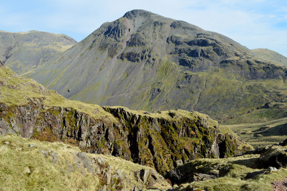
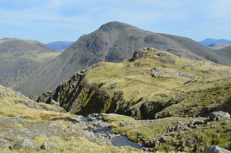
| The classic view of Great Gable and Sty Head from Lingmell. |
| |
 |
| Looking down on Piers Gill and Greta Gill from Lingmell summit. |
| This image shows the Greta Gill lower ravine more clearly at the point where I crossed (centre right) before continuing my ascent alongside Piers Gill. |
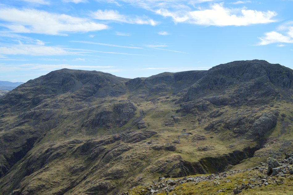 |
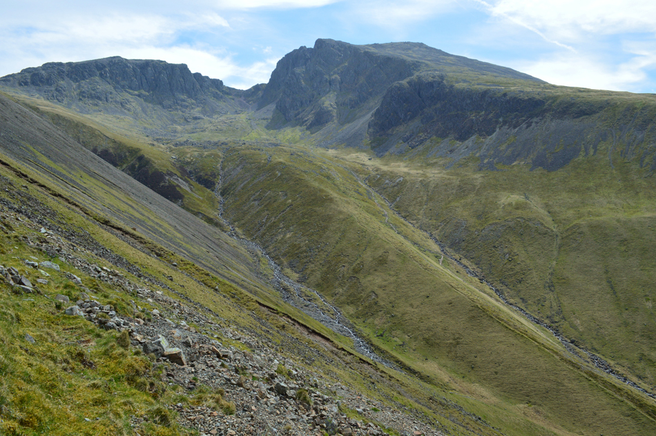
| Great End, Stand Crag, Round How, Criscliffe Knotts, Middleboot Knotts, Piers Gill and Broad Crag from Lingmell. |
| The course of the Corridor Route can be seen more clearly from the summit of Lingmell running almost parrallel between the head of Greta Gill (far left) and the head of Piers Gill (far right) |
 |
| Great Gable from Lingmell summit. |
| Besides the breath taking climb alongside Piers Gill what I was really looking forward to was an early lunch at the beacon at the top of Lingmell Crags where despite numerous visits to the actual summit I always tend to miss the main reason being that this is the first time in three years I've actually had a view from the top. |
 |
| Outstanding. |
| |
 |
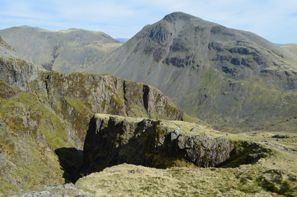
| Great Gable from what was the summit beacon at Lingmell Crag summit. |
Well, I can't repeat what I actually said on arriving at once was one of the finest beacons in the Lake District, I could only hope that the beacon fell naturally and wasn't the result of mindless vandalism.
With that said, I promised myself an early lunch (chicken salad on granary bread) which I ate while gazing over to Great Gable and Sty Head, with lunch finished I even had the opportunity to close my eyes and soak in my surroundings while tucked below the coolness of a faint summit wind. |
 |
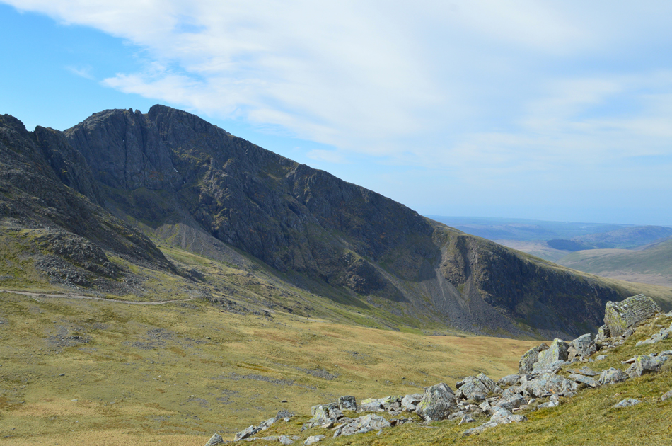
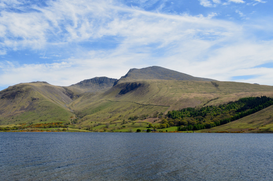
| Scafell Pike, Mickledore and Scafell seen over Hollow Stones. |
| From here I got a much better view of the snow in Lord's Rake. |
 |
| Starting my Lingmell descent. |
From the top of Lingmell Crags I traced my way towards the top of Goat Crags while avoiding the hollow found between the summit of Lingmell and Lingmell Crag. A stone cairn appears on the opposite side of the hollow as does the summit wall which descends steeply back to Lingmell Beck.
With the wall crossed I found myself looking down on the prominent path over looking the top of Goat Crags, it was somewhere around here did I pass a Facebook friend Amanda Armstrong who with her husband were making their way into Scafell Pike via Lingmell. It was only later that evening after Amanda had posted that she and her husband had been on Lingmell did I realise I had passed her (and said hello) between the summit and the top of Goat Crags. |
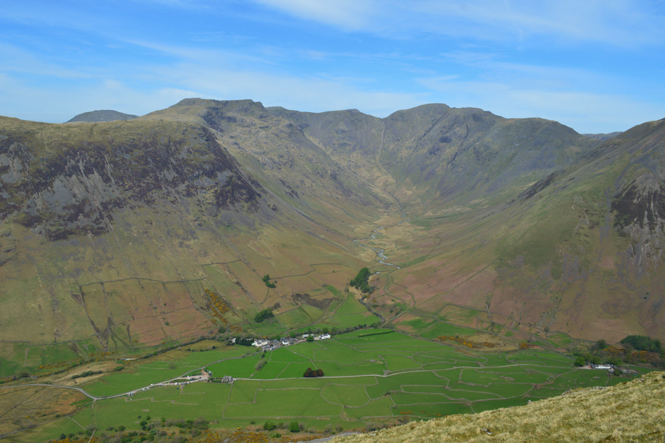 |
| The view over Wasdale Head into Mosedale. |
| It's hard to believe that the car park still doesn't look too busy, not for a sunny Bank Holiday anyway. |
 |
| Brown Tongue with the Scafells domineering from above. |
| |
 |
| Fine views from my Lingmell descent with IIIgill Head, Wast Water, Yewbarrow's Dropping Crag, Middle Fell and Buck Barrow. |
| From the top of Goat Crags I made a hasty descent creating little plumes of dust in doing so. The descent is steep from top to bottom with hardly any let up, despite leaving the rocky stony section behind I still found myslelf kicking my heels back into my boots if only to ease a little pressure. Soon the familar stone wall is reached which is crossed via a ladder style, as I approach a couple who are about to cross the style and soon we break into conversation about our love of fell walking and everything inbetween, it turns out they were staying at Wasdale Head and are from Ilkley in Yorkshire, it was very nice to meet you both Rob and Sharon. |
 |
| Kirk Fell and Great Gable from Down-in-the-Dale. |
| |
 |
| That view. |
I made my way back to Wasdale Head once again while passing the odd walker heading to and from the mountain and for the first time this year I could look down on dust that had collected over my boots, a true sign of Summer even though I might have slightly over estimated how much fluid I would need but at least I could gulp it down at free will.
The car park is a little busier now but not hectic and no hustle, just folk minding their own business doing their own thing. The smell of cooked meat wafts across from the campsite which brings a grand mornings work to an end but the one thing I'll never forget about today was sitting at the summit of Lingmell with my eyes closed, and as I opened them Great Gable was the first thing I saw, I guess I must have actually dosed off for a few minutes there. |
|
| |
| Back to top |
 |
|