|
Walking the Birketts, Branstree |
 |
 |
11th June 2018 |
 |
|
Walking the Birketts really suits my busy lifestyle, my Birkett project has come just at the right time after completing both the Harry Griffin 2,000 footers then my Wainwrights in 30 walks project from which I reckon I developed the foot injury in my right foot, with the Birkett walks averaging between 5-8 miles per walk walking the Birketts just seems the right thing to do on so many levels. My other projects have been no more than a year long but with the Birketts, well I estimate a good three years until completion and that's if I keep to schedule and that's the projects only drawback, I miss walking at freewill, I miss Mardale and I'm missing my beloved High Street.
There are two Birkett walks which include High Street and I guess anytime would be a good time to walk them but I want to wait until I'm much further into the project which means I'll just have to hold on that bit longer, until then there's walks like this, a fantastic circular walk taking in Branstree via its steep North ridge with epic views over Haweswater, Rough Crag, and High Street for the duration. |
|
| The Complete Lakeland Fells |
 |
| By Bill Birkett |
-A mild mannered round providing an excellent vantage point from which to view the grandeur around Mardale Head. |
|
|
|
| |
|
Overview |
|
|
| Ascent: |
1,750 Feet - 533 Metres |
| Birketts: |
4, Branstree - High Howes - Selside Pike - Brown Howe |
| Weather: |
Warm, Dry & Sunny With Little To No Wind. Highs of 22°C Lows of 16°C |
| Parking: |
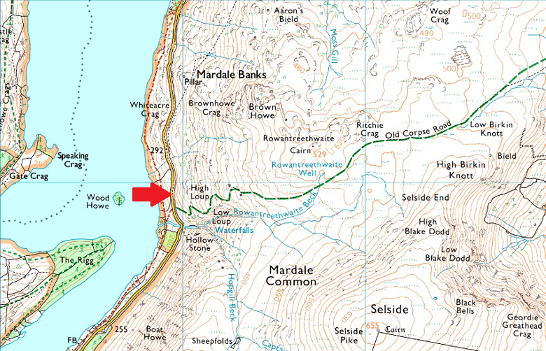
Roadside Parking, Rowantreethwaite Beck, Mardale |
| Area - Group: |
Far Eastern - E/BRA |
| Miles: |
5 |
| Walking With: |
On My Own |
| Ordnance Survey: |
OL5 |
| Time Taken: |
3 Hours 10 Minutes |
| Route: |
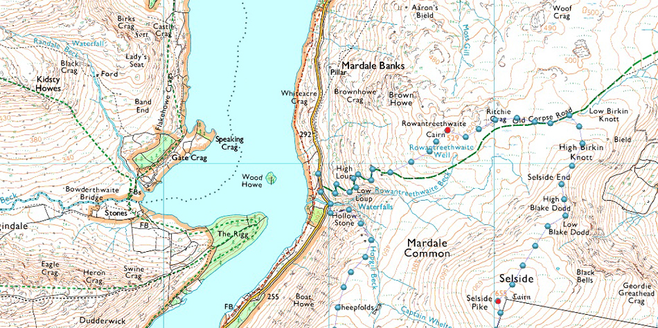
Mardale - Rowantreethwaite Beck - Branstree North Ridge - Branstree - Artle Crag - Survey Pillar - High Howes - Captain Whelter Bog - Selside Pike - Selside End - Old Corpse Road - Brown Howe - Rowantreethwaite Beck - Mardale |
|
| |
|
Parking Details and Map |
|
|
| Nearest Post code: |
Lakeside, Road Bampton CA10 2RP - NY 479 119 |
| Notes: |
There is roadside parking with room to park around five cars close to the bridge over Rowantreethwaite Beck, if you have driven over the bridge you've gone too far, look out for Wood Howe Island where the parking is almost adjacent too, parking is free. |
|
| |
|
Map and Photo Gallery |
|
|
 |
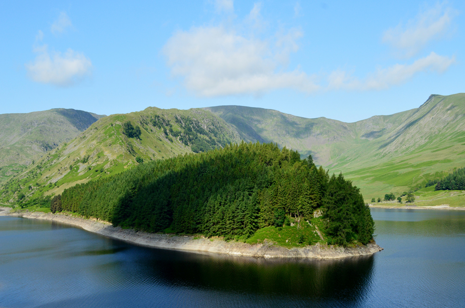
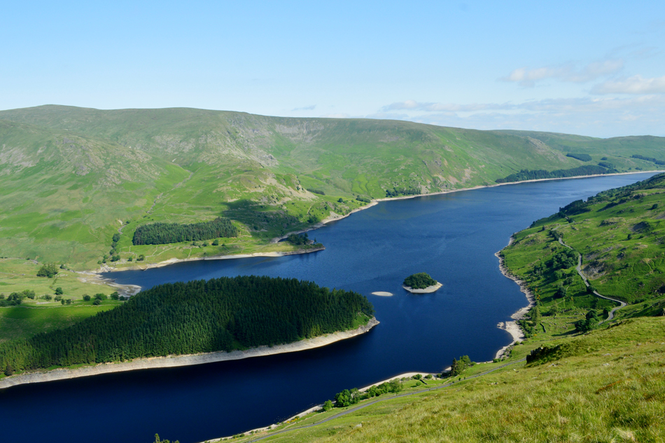
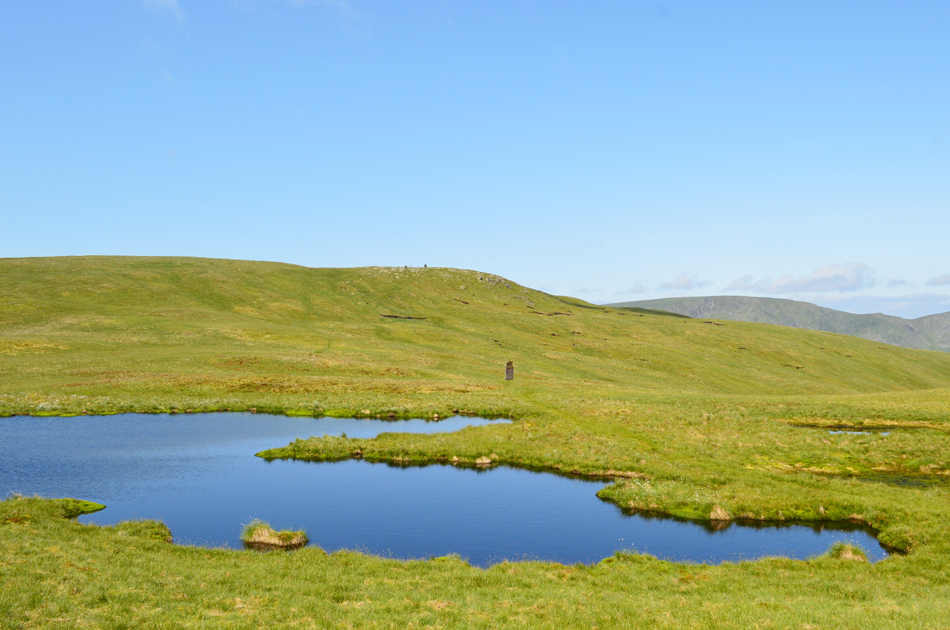
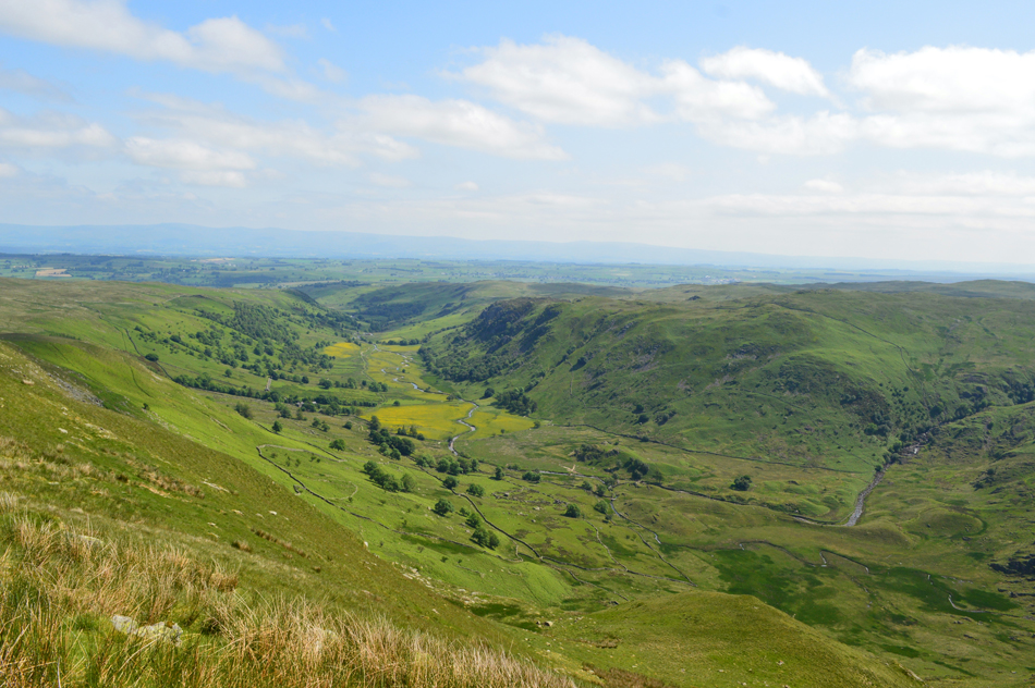
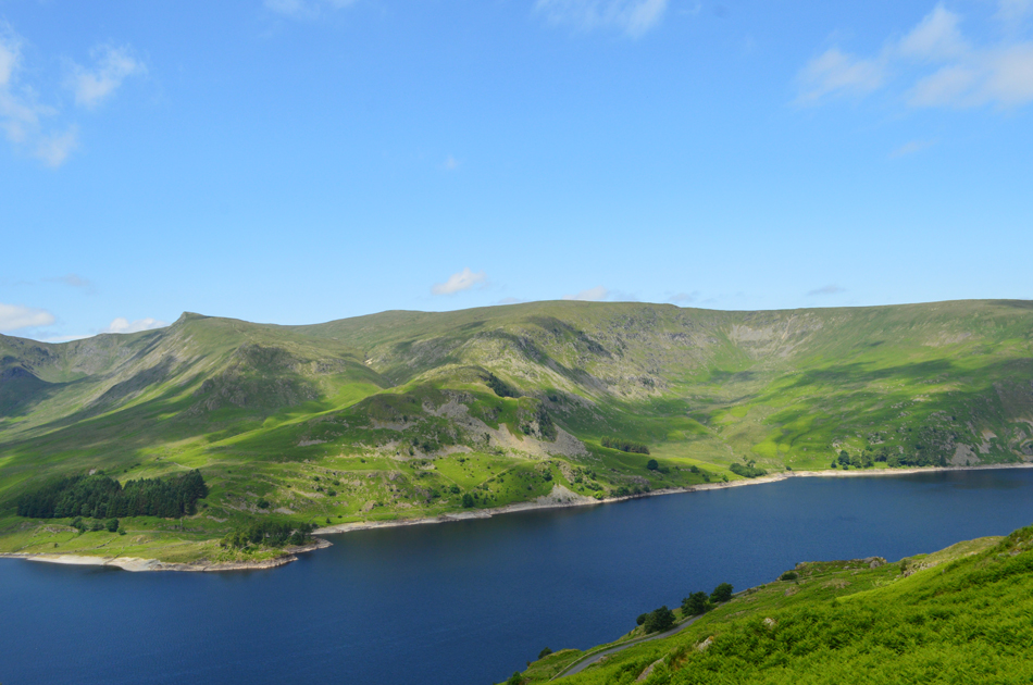
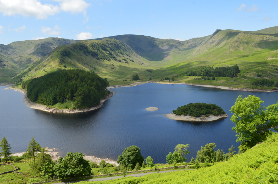
| Views over Haweswater towards Harter Fell (Mardale) The Top of Nan Bield Pass and Mardale III Bell 09.00 16°C |
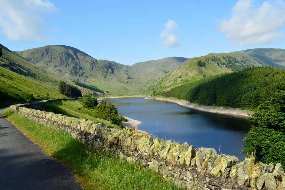
With time off work I was able to set my alarm clock that bit later which saw me arrive at an almost deserted Mardale Head around 08.50am. Its another beautiful Lakeland morning and the only thing disturbing the silence are the Gulls squawking away over Wood Howe island...no change there then. Todays walk starts just over a mile away from Mardale Head back up the Lake Road at Rowantreethwaite Beck where conveniently there is roadside parking for up to five cars. It was back in 2012 when I first climbed Branstree north ridge and if I recall one memory from that day it was how steep gaining the ridge was, today will be no different with the only exception being that experience will be on my side.
Before I officially start the walk I have a wander down the Lake Road to capture a few shots of The Rigg and High Street's Rough Crag Ridge which are looking splendid this morning. |
 |
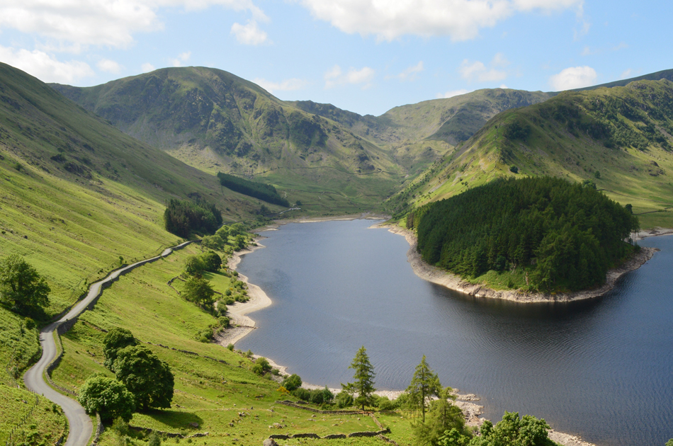
| The Rigg, High Street, Riggindale and Kidsty Pike seen over Haweswater. |
The last time I was in Mardale was during a walk back in October 2017, Snow was on fells and the Lake road if I remember correctly was layered with ice meaning it was a pretty precarious drive to Mardale Head that morning, this morning the sun is beaming down and it feels just how a Summers day should with midges in the air while a light dew drapes over new bracken, it couldn't be more perfect.
After around ten minutes it was time to put the camera away and make my way back towards the bridge over Rowantreethwaite Beck. |
 |
| Looking back on Haweswater towards Mardale Head, Rough Crag and High Street from the start on the ascent. |
Just in case you were wondering how's the blister coping, well it's much softer now thanks to the wifes moisturiser and hopefully it's ready to peel but for now it's still hanging in there like a good-un. During the drive up I had wishful thoughts where after completing this walk I might actually take a walk over High Street via Rough Crag then descend via Mardale III Bell north ridge, a favoured route of mine but within minutes of starting my ascent my blister, despite being packed with a Compeed plaster reminded me that I best keep my mileage low and at least give it a chance to heal...sorry, no pun intended.
There is access to the north ridge via a gate to the right of Rowantreethwaite Beck from where the steep ascent starts, today, it being Summer the path is almost overgrown with bracken which is still a little dewy causing the tops of my shorts to feel damp, my walking poles do a good job of steering through the undergrowth where the bracken is at its thickest. |
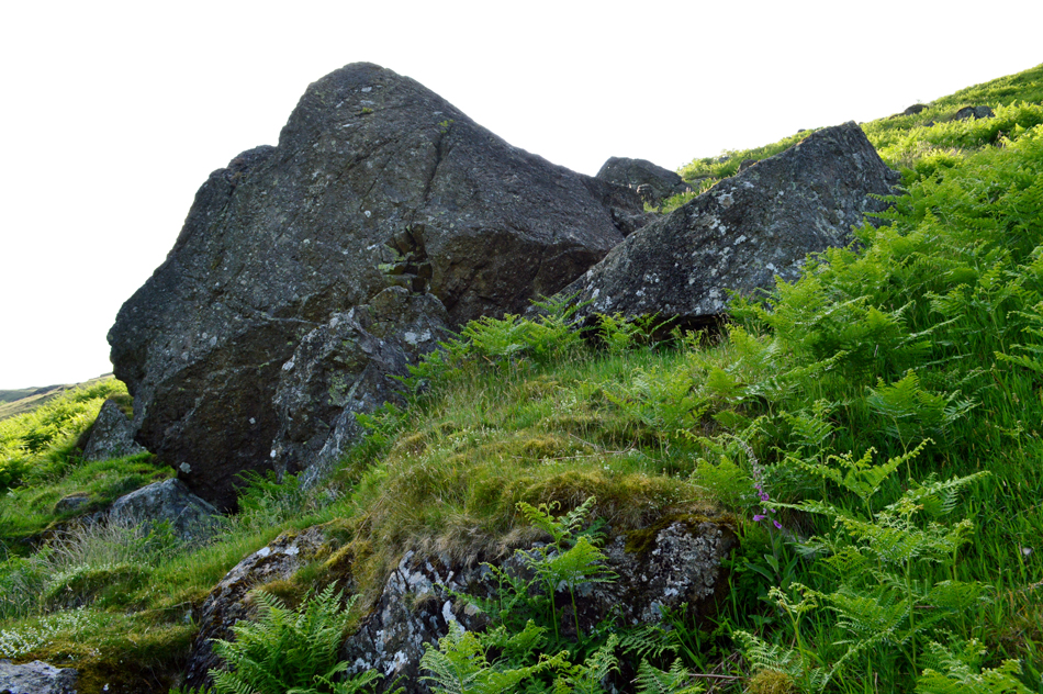 |
| The Hollow Stone. |
| The path twist and turns steeply alongside Rowantreethwaite Beck before the Hollow Stone is reached, named 'Hollow' because the larger boulder came to rest on a smaller boulder creating a hollowed area below, it has been know that walkers have used the Hollow Stone as a shelter and even a bothy. This morning the huge boulder is blocking the sun which is right behind, from here on in I'll be ascending straight into beaming sunlight. |
 |
| The view over Haweswater into Riggindale with High Street (L) and Kidsty Pike (R) |
| |
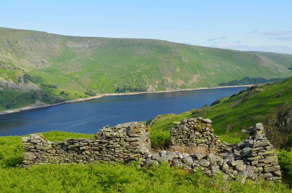 |
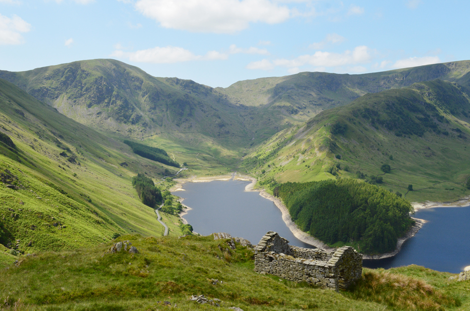
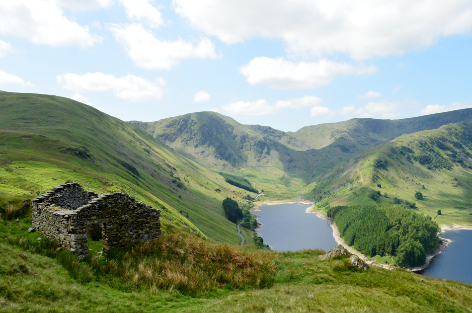
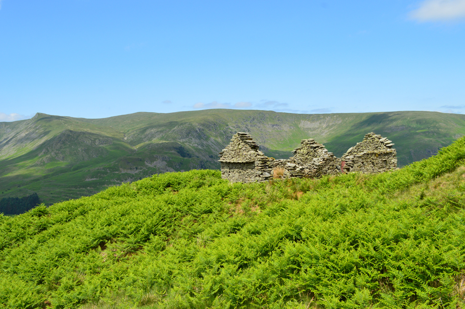
| Reaching the ruined building with views over Haweswater towards Castle Crag Fort. Whelter Bottom and Measand End. |
| There are actually two ruined buildings, one of which had almost succumbed to the bracken which are shown on the 1:25,000 maps. These buildings mark the top of the steep ascent alongside Rowantreethwaite Beck where the path joins the lowest point of Branstree north ridge. |
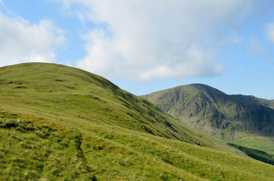 |
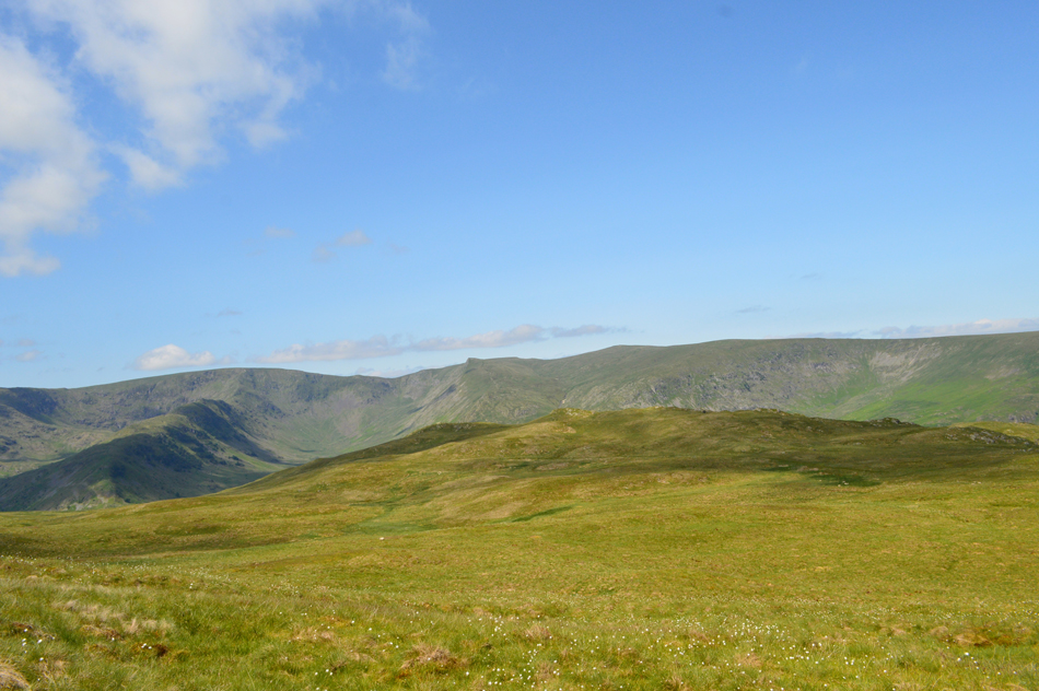
| Branstree North Ridge with Harter Fell (Mardale) seen over on the right. |
| The hard work isn't over just yet with a steady and at times, pathless slog up the north ridge. From the lower section of the ridge the view over Mardale Head is exceptional. It's tempting to follow the path seen in the foreground but this doesn't actually follow the ridge route but flanks alongside the fell side to the right instead. I need to break away from the path a couple of hundred yards up ahead but for now I use it to get my breath back while wiping the sweat away from my forehead. |
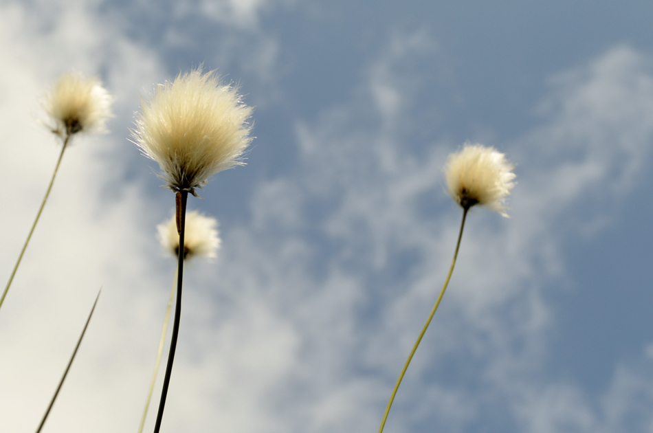 |
| Fields of Cotton Grass found along the north ridge. |
| Just beautiful. |
 |
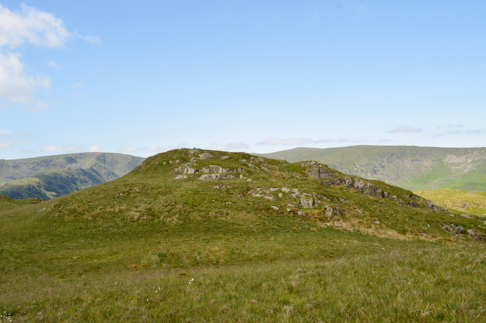
| The view back along North Ridge with the last summit of day Brown Howe, seen centre right. |
| It's never good for morale when your sweating like a trouper and you can still see your car! |
 |
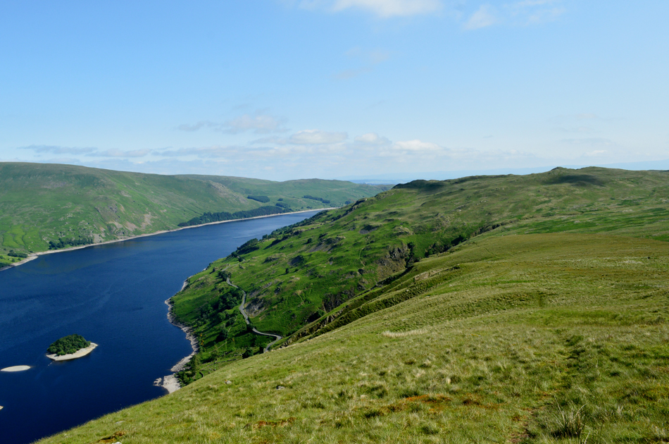
| Views over The Rigg and Wood Howe Island with High Raise, Low Raise, Castle Rock Fort, Whelter Bottom and Measand End in the distance. |
| Time to break away from the path now and continue my ascent via the north ridge. |
 |
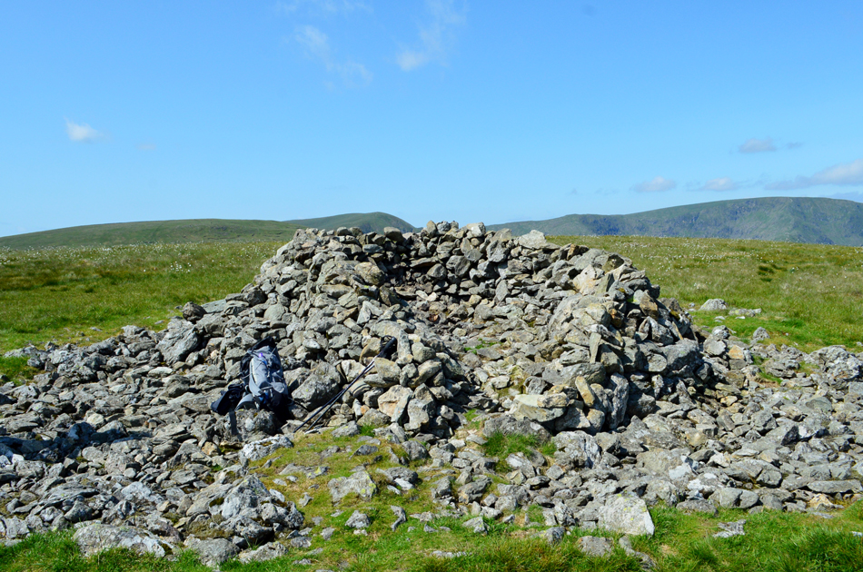
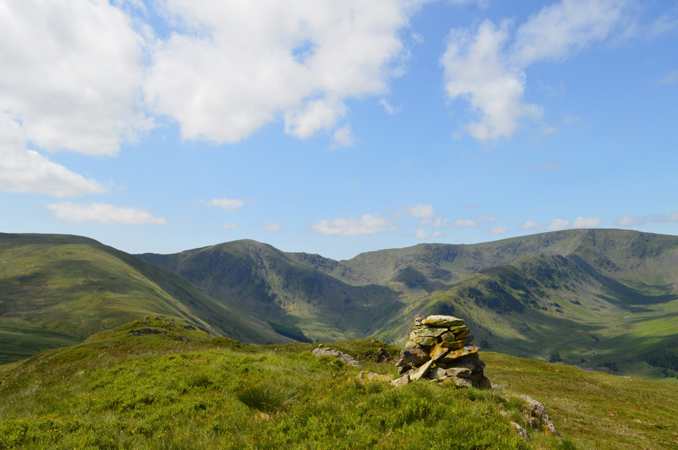
| Branstree circular summit trig point. |
Having left the flank of the north ridge I made a sometimes pathless ascent up the north ridge passing through pockets of Cotton Grass and grazing sheep. Soon, and over to my left the familiar sight of the two large cairns on Artle Crag which meant I was close to the summit, todays ascent was made easier due to the bogs being 'cracked dry' underfoot, I simply walked right through them.
With the summit shoulder reached I first sighted the familiar fence with Tarn Crag and Kentmere Pike in the shimmering distance, I soon picked up the faint summit path and made my way over to the sunken trig point, there wasn't a breath of wind, it was just me, a stunning vista and the Skylarks.
I jabbed my walking poles into the ground then took this shot, leaving my poles I made my way over to the fence where I sat down on a wooden sty and treated myself to the first Satsuma of the day. |
 |
| The view towards High Howes (R) and Selside Pike (L) from Artle Crag. |
| From Branstree summit it's an easy walk towards the stony summit of Artle Crag from where I took in the view over my next two summits, the first one being High Howes (nameless on the map) before continuing onto Selside Pike. Bill Birkett recommends to follow a natural line first crossing the fence below Artle Crag before continuing on towards the Survey Pillar seen in the distance. |
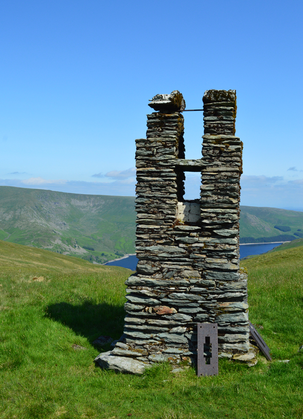 |
| Haweswater Survey Pillar. |
| |
 |
| Looking back on the Survey Pillar towards Artle Crag from the unnamed Tarn below High Howes. |
| |
 |
| Kentmere Pike from High Howes summit. |
| From High Howes I follow a prominent grassy path north easterly towards Selside Pike with the Skylarks for company. |
 |
| Selside Pike is just ahead. |
I descend the shoulder of High Howes into an area known as Captain Whelter Bog, I have no idea who Captain Whelter was but I reckon he'd be surprised to find that his bog has completely dried up!
It's not very often you can cross this area without squelching your way through but today, like earlier,I walked right over the cracks. |
 |
| Selside Pike summit shelter. |
With ease I arrived at Selside Pike summit to find a solo walker by the shelter, we broke into conversation and he told me that his father had recently passed away after collecting 196 Wainwrights, I'm not a fell walker he explained but I'm going to finish what my Dad started, he went on to joke that his Dad had left the last few Wainwrights dotted about all over the Park! No wonder he didn't get to them he laughed.
i had planned a short stop here but I didn't want to disturb the guy and after a goodbye, I left him at the summit shelter. |
 |
| Splendid views over the Swindale Valley from Selside End. |
| Having not stopped at Selside Pike I made my way down via Selside End and came to a stop over looking the untouched valley of Swindale, it's only 10:30am but I reckon I've earned myself a early lunch so I tuck into two sandwiches whilst listening to Force Falls at the head of the valley from over a mile away. |
 |
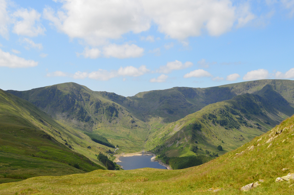
| Views over the Old Corpse Road towards Brown Howe with High Street, Kidsty Pike and High Raise on the skyline. |
| |
 |
| The familiar wooden stake, Old Corpse Road. |
| Having descended Selside End I arrived on the Old Corpse Road with views extending back towards Hare Shaw and beyond, I take a left here and join the path bound for my final summit of Brown Howe. |
 |
| Brown Howe from the Old Corpse Road. |
| The Old Corpse Road was once used to carry the dead from Mardale to the nearest Church in Shap, on a day like today it's hard to imagine that I'm walking in the footsteps of the dead who were wrapped in cloth and placed on horseback, it's unclear if the dead were carried in coffins but resting stones can be found along the route. The last person to be carried out of Mardale for Shap was John Holme back in June 1736. |
 |
| Brown Howe (Rowantreethwaite) |
| Known as 'Rowantreethwaite' on the OS Map at 529' The cairned summit is just over to the left with a obvious path from the Corpse Road leading towards it. |
 |
| Mardale Head skyline from Brown Howe summit. |
| That's Branstree north ridge over on the far left with Harter Fell, the Top of Nan Bield Pass, Mardale III Bell and High Street all in one view. |
 |
| Descending towards the old Peat Huts above the Old Corpse Road. |
| Bill Birkett recommends to descend below Rowantreethwaite Well before rejoining the Corpse Road close to the ruined peat huts, it's a pathless descent with fabulous views over Mardale Head and High Street. |
 |
| Haweswater and Mardale Head from the descent of Brown Howe. |
| You can just about make out the tops of the old peat huts coming into view on the foreground of the picture. |
 |
| Mardale Head, Mardale III Bell and the Rough Crag Ridge from the ruined Peat Huts on the Old Corpse Road. |
| The huts were used to store peat which was commonly used as fuel in the once thriving Mardale valley. |
 |
| The view over Mardale Head from one of the ruined Peat Huts. |
| That's Branstree north ridge in the far left of the photograph. |
 |
| In the other direction, Kidsty Pike, High Raise, Low Raise and Whelter Bottom. |
| With the peat huts left behind It's time to start my descent back to the road. |
 |
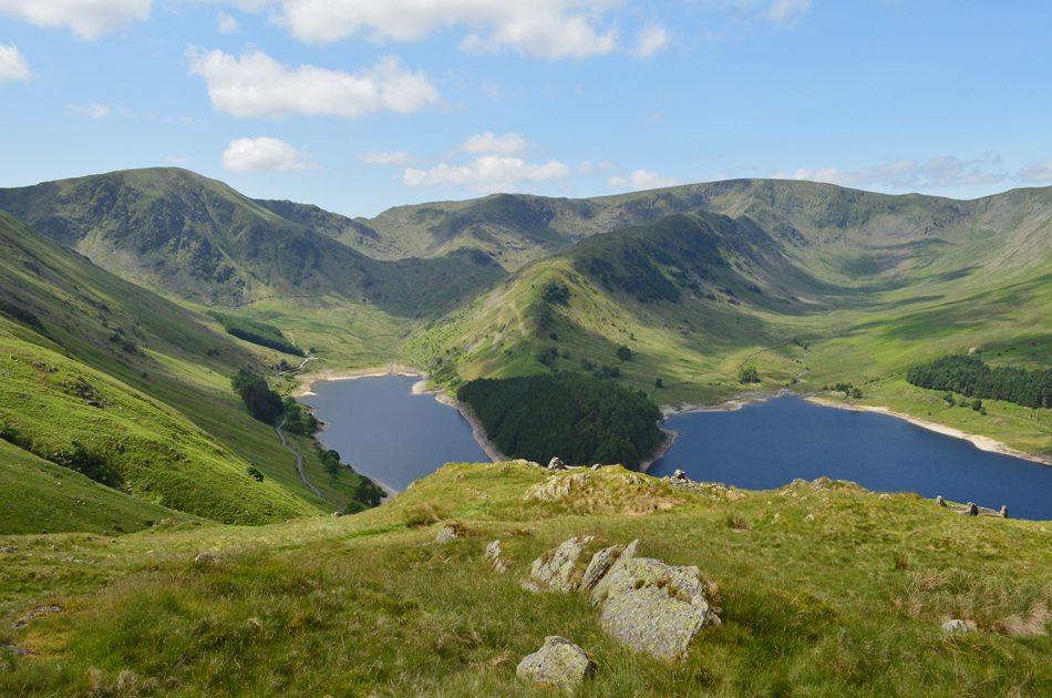
| Fabulous views over Haweswater towards Kidsty Pike, High Raise, Low Raise, Castle Rock and Whelter Bottom. |
| You can just about see the road in the lower half of the picture where my car is parked close by. |
 |
| That view again. |
| Is it just me or does The Rigg and Rough Crag remind you of a sleeping serpent? ... I'll get my coat...!! |
 |
| Mardale Head. |
| I started my descent via the zigzags accompanied by the sound of Rowantreethwaite Beck to my left, I could still see sections of the steep path I had used this morning between the bracken together with the ruined huts at the start of the north ridge. In the midday heat I arrived back at my car and drop all the windows then untied my boot laces, crossed the road and sat on the opposite wall in my socks. Haweswater, despite the lack of rain as of late is still looking full as I gaze down at the shoreline. A single Gull circles high above the lake set against the bluest of skies as I make my way back to the car and pull on my mids before flaking into the drivers seat, performed a three point turn and say goodbye to Mardale through my rear view mirror. |
|
| |
| Back to top |
 |
|