|
Walking the Birketts, Kentmere Horseshoe |
 |
 |
15th June 2018 |
 |
|
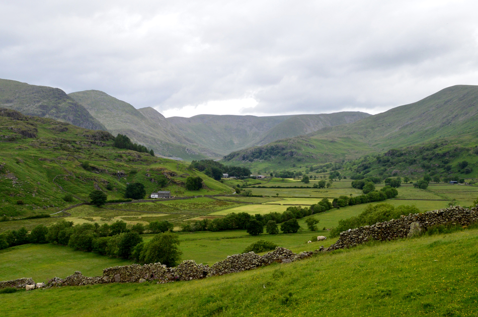
Despite my ongoing foot issues I thought I'd end my week off with a classic round on the Kentmere Horseshoe, a walk that shouldn't be under estimated by any means and one that I hadn't officially walked since April 2015
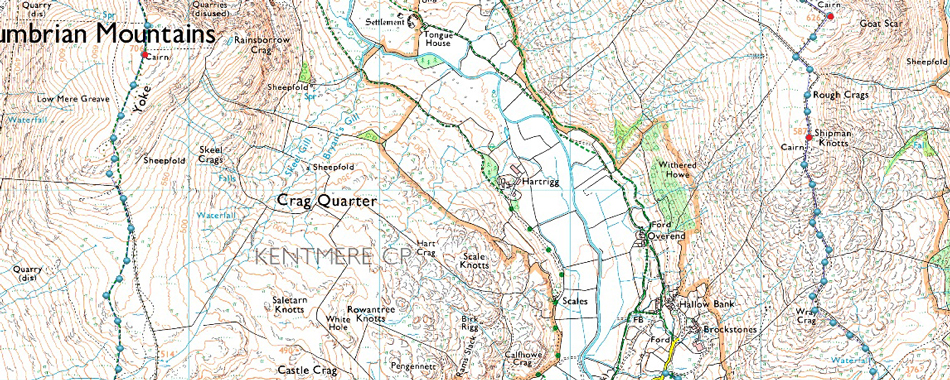
Bill Birketts version walks the Horseshoe in an anti-clockwise manner still starting in the heart of Kentmere but slightly altering the route to gain the Longsleddale Pass via Rook Howe from which High Lane is gained, this start avoids the tarmac lanes out of Kentmere and was a first time for me.
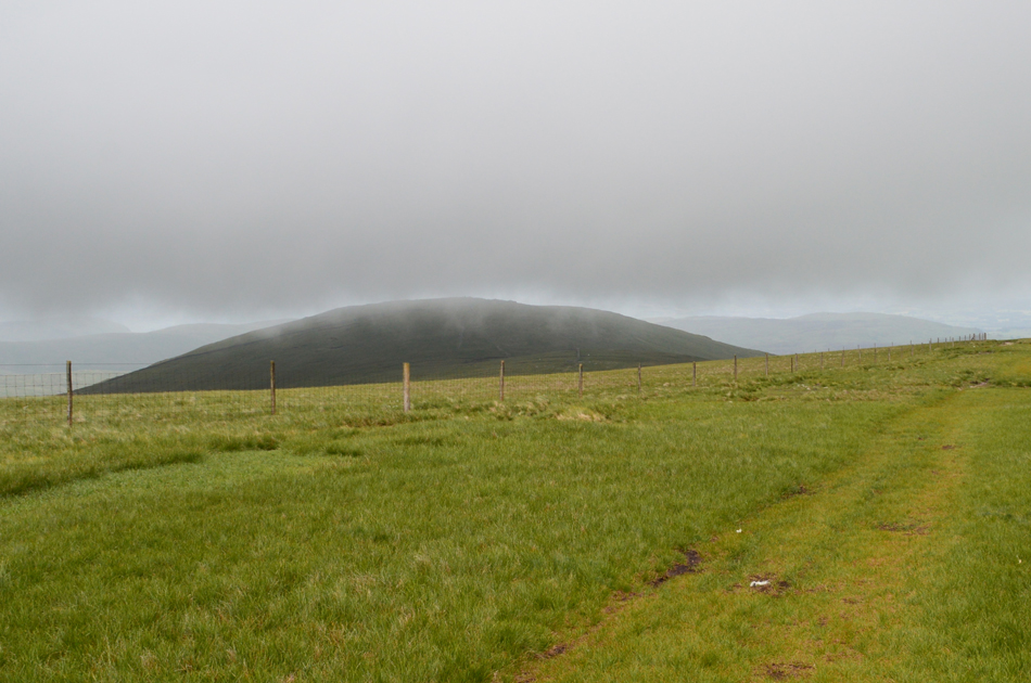
The next slight alteration to the route is Goat Scar, a high level spur offering long distance views back over the Longsleddale valley found between Shipman Knotts and Kentmere Pike, which when viewed from the valley of Longsleddale offers impressive views towards Goat Scar vertical cliffs. With the rest of the route falling back in the original horseshoe all that was left was the perfect Summers day to walk it under, this sadly I did not get nor do I remember ever having to wear gloves in the middle of June. |
|
| The Complete Lakeland Fells |
 |
| By Bill Birkett |
-This walk represents one of the classic walks of the Lake District |
|
|
|
| |
|
Overview |
|
|
| Ascent: |
3,724 Feet - 1,135 Metres |
| Birketts: |
9, Shipman Knotts - Goat Scar - Kentmere Pike - Harter Fell - Mardale III Bell - Thornthwaite Crag - Froswick - III Bell - Yoke |
| Weather: |
A Cloudy, Dull Day On The Fells With Strong Summit Winds, Light Rain. Highs of 16°C Lows of 14°C |
| Parking: |
Kentmere Village |
| Area - Group: |
Far Eastern - E/HST |
| Miles: |
12.8 |
| Walking With: |
On My Own |
| Ordnance Survey: |
OL7 |
| Time Taken: |
6 Hours 10 Minutes |
| Route: |
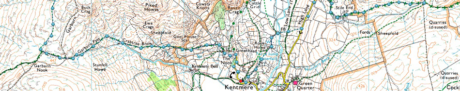
Kentmere Church - Rook Howe - Low Lane - High Lane - Longsleddale Pass - Shipman Knotts - Goat Scar - Kentmere Pike - Harter Fell - Top of Nan Bield Pass - Mardale III Bell - Top of Hall Cove - Thornthwaite Crag - Froswick - III Bell - Yoke - Garburn Pass - Kentmere |
|
| |
|
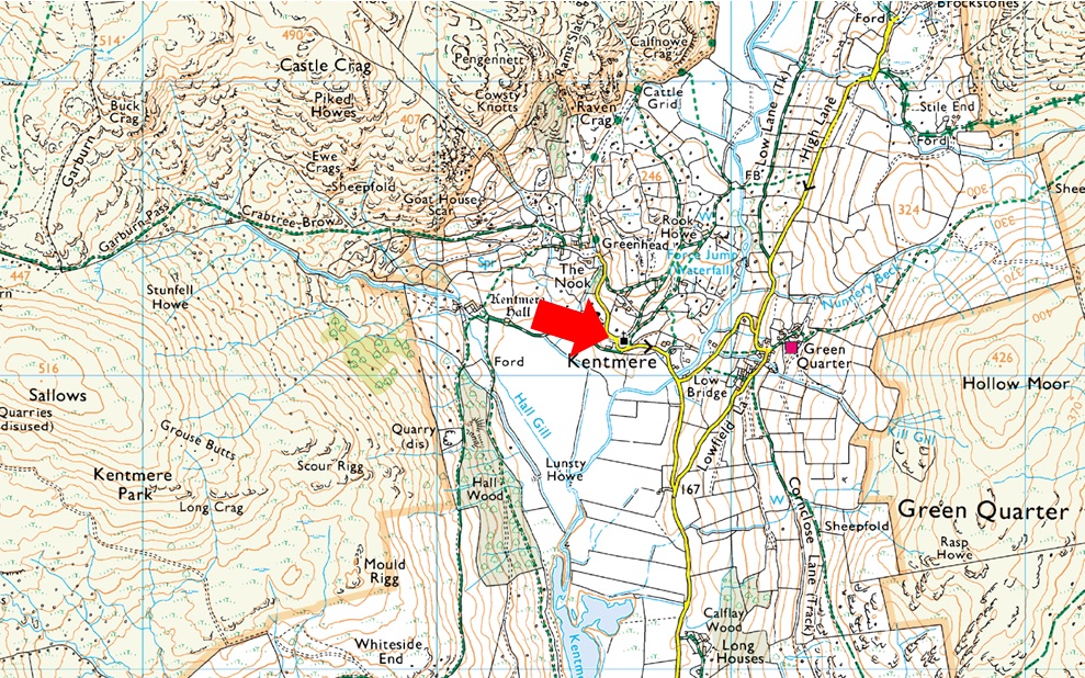
Parking Details and Map |
|
|
| Nearest Post Code: |
LA8 9JL |
| Grid Reference: |
NY 456 004 |
| Notes: |
The car park in the village of Kentmere is quite small with room for only around five well parked cars meaning arriving early is a must. The car park is found on Hollinrigg Lane on the left after passing St Cuthberts Church opposite a phone box. Donation Box on the wall of the Kentmere Institute. |
|
| |
|
Map and Photo Gallery |
|
|
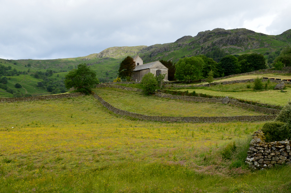 |
| St Cuthberts Church, Kentmere 08:15am 14°C |
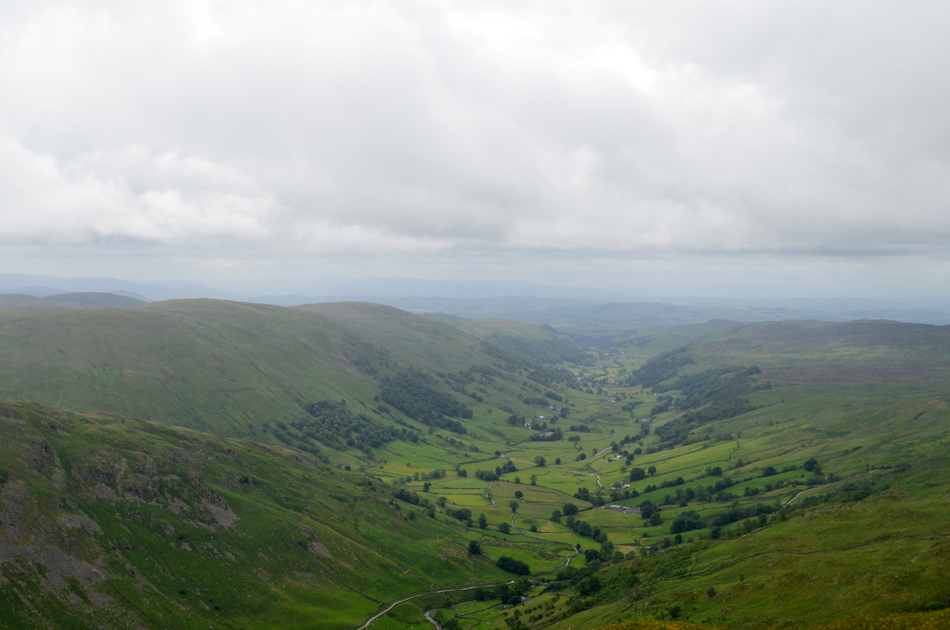
I estimated my arrival for around 08:30am and after an uneventful drive north I arrived in Kentmere a little earlier than expected, leaves and small branches scattered the lane into the village no doubt left behind by Storm Hector the previous day but nothing too significant. Knowing I wouldn't be back at this exact spot I stopped at Low Bridge to take this photograph looking towards St Cuthberts Church with Cowsty Knotts in the distance...a much liked view of mine.
The parking spaces are just to the left inbetween St Cuthberts and the Kentmere Institute, these normally fill up very quickly on a weekend but with today being a week day I parked easily next to the familiar phone box. This morning, the temperature is markedly lower than of late and by the feel of it the remnants of Storm Hector still hasn't passed which only adds to the cooler than cool feel here in the valley, it's here whilst kitting up do I add my Rab Windproof which I wouldn't remove until I returned to my car some six hours later.
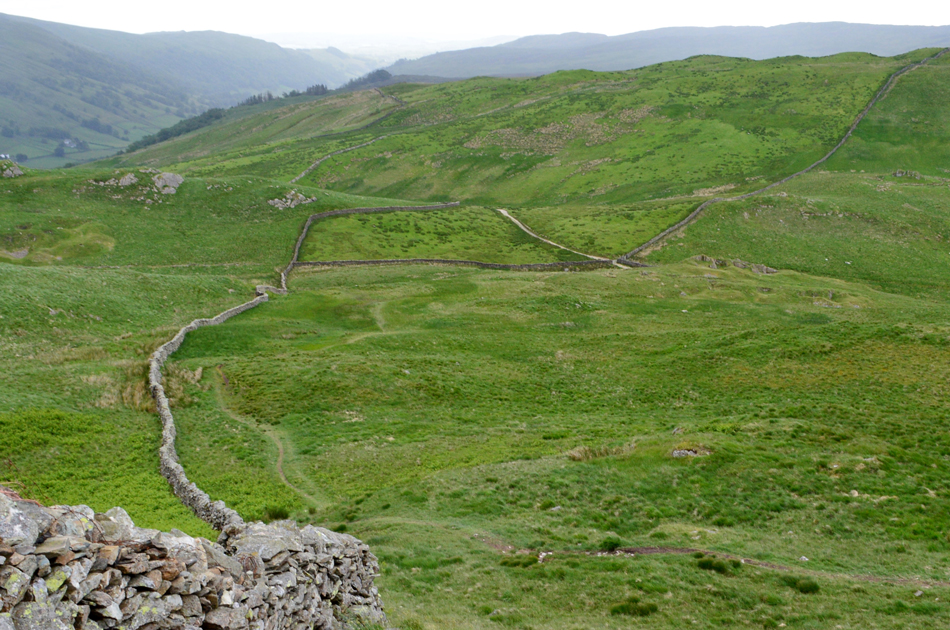
Todays start will see me drop just below the Church and then head left (right in the photograph) and pass through the car park before heading towards Rook Howe Farm, I was a little dubious about this route because I've joined up with the path below High Lane in past walks and the ground here, even after weeks without rain, does not drain well, but seen as I'm following the official route I guess it's best to stick to it.
With my car locked I passed through the Church car park and began the slight descent towards Rook Howe, it was here my camera started acting up displaying a message that my memory card was formatting, having seen this message times before and usually after less than a minute the camera is good to go, what I hadn't realised was that I had forgotten to delete my last walks images which were still on the memory card hence the longer delay.
This being new territory I left the camera to do its thing passing Rook Howe Farm to my left before crossing the River Kent via a wooden footbridge before a steep grassy climb first crossing Low Lane via a stepped wall then continuing my ascent towards High Lane were I crossed a second stepped wall. |
 |
Looking back on Cowsty Knotts and Low Lane from High Lane.
I arrived at High Lane via a prominent path (not shown best in this image) and crossed over the stone wall whilst looking down on Low Lane, you might just be able to make out the stone wall in the centre left by which time, my camera seemed to be working fine again.
The memory card issue has happened to me before since upgrading from a SanDisk 4GB to a SanDisk 16GB the issue not helped by me forgetting to delete around 200 images I'd left on D'Oh! |
|
|
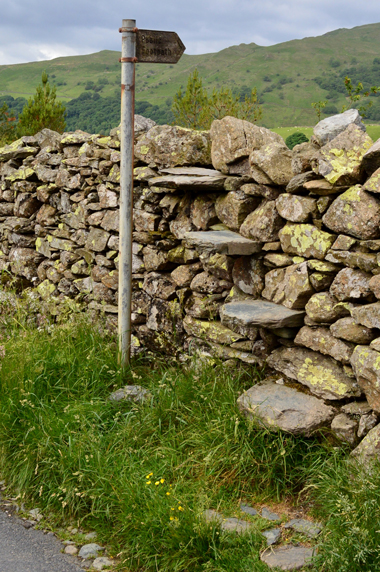 |
| Stepped wall, High Lane. |
|
 |
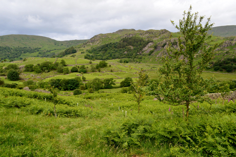
| From High Lane the view over Hartrigg into upper Kentmere. |
| Whilst on High Lane I am passed by a taxi taking two young children to school which I open the gate for before continuing towards the Kentmere side of the Longsleddale Pass, which is where I found these two beauties. |
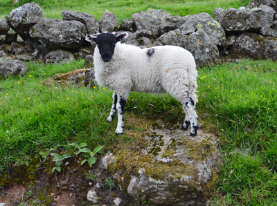 |
| This Lamb is too young to know any better than to pose for photographs...mum won't be pleased. |
|
|
 |
| ...Okay you can stop showing off now. |
|
 |
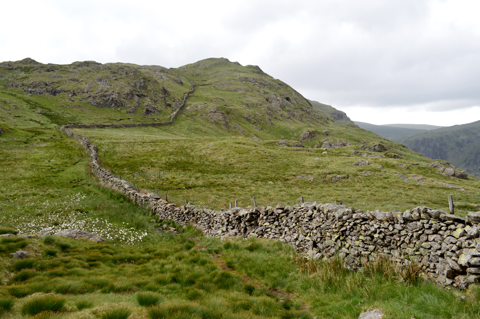
| The Kentmere side of the Longsleddale Pass offers this splendid view into upper Kentmere. |
I hadn't the best of forecasts today, certainly nothing compared to my previous two walks with light showers predicted which could only mean low cloud which at times came as a shock to the system after walking in sweltering heat these last six weeks. |
 |
| Looking down on the top of the Longsleddale Pass from the ascent of Shipman Knotts. |
| The first of the light showers soon arrived which were nothing more than 'rain in the air' helped along by the blustering winds, there was plenty more to follow. |
 |
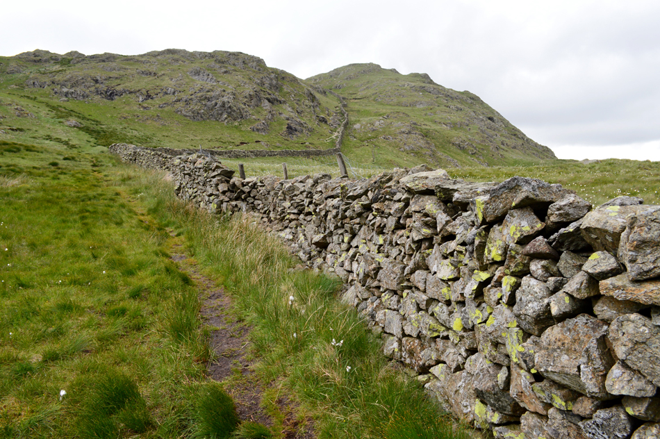
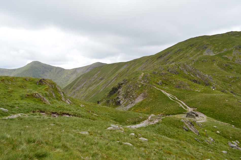
| Shipman Knotts from the top of Wray Crag. |
| From the bottom of the pass a well trodden path follows the stone wall via Wray Crag onto Shipman Knotts summit. The top of Wray Crag can be quite boggy sometimes having to divert widely away from the wall in order to avoid the bogs, but today it was completely dry and a real pleasure to ascend by. |
 |
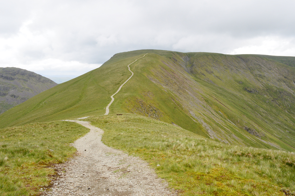
| Shipman Knotts from the top of Wray Crag. |
| You can probably make out the grassy/stone rake in the centre of the photograph just below Shipman Knotts summit, this rake to me (and many others no doubt) is as familiar to Shipman Knotts as Striding Edge is to Helvellyn. |
 |
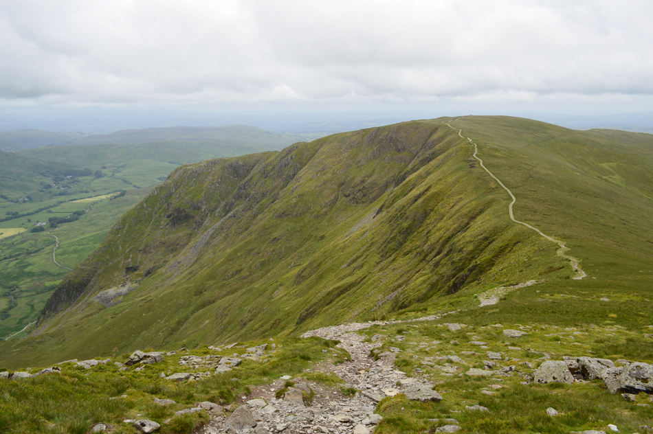
| The low cloud has arrived quickly engulfing the III Bell ridge. |
| I guess that's a shower just around the corner then. |
 |
| A lone rock marks Shipman Knotts summit highest point. |
| I was right, more showers arrived as you can see by my speckled camera lens, thankfully I was ascending the stone rake just below the summit which acted as a wind and rain break. By the time I had arrived at the summit it had just stopped raining and that low cloud was moving slowly across the valley towards Kentmere Pike, it's any ones guess if this weather is in for the day, let's hope not because I'm still struggling to let it sink in, my tanned skin being the only reminder that this is actually Summer. |
 |
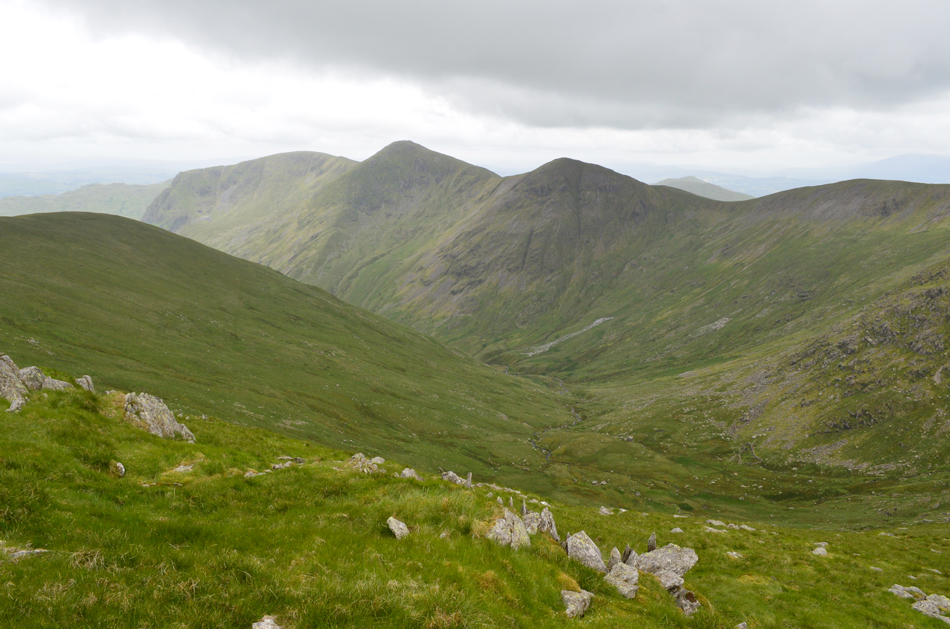
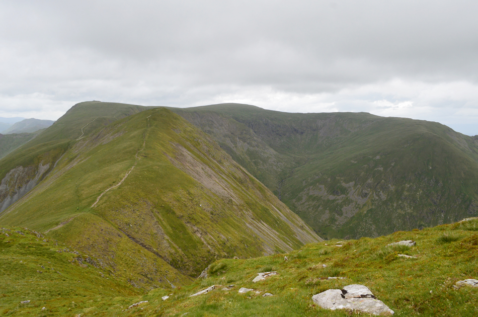
| Goat Scar from Shipman Knotts summit. |
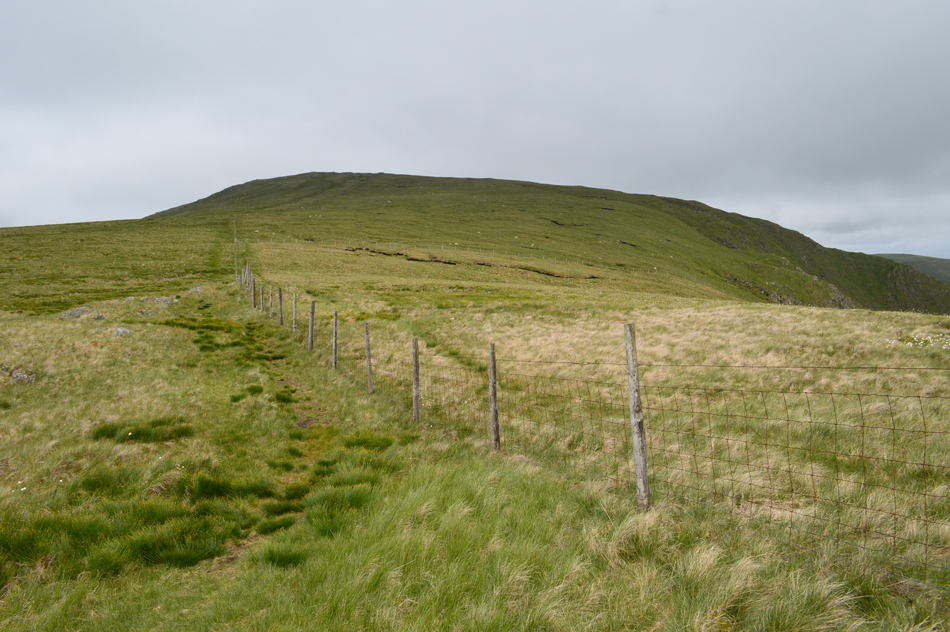
| The cloud for now was behaving even though I was about to lose my view towards Kentmere Pike I could see that there wasn't much cloud behind which was good news, well for now anyway. Up ahead a quick 'out and back' is required to gain Goat Scar seen in the right of the photograph, the easiest way to gain the summit is by following the stone wall to another stone wall which crosses the ridge, here a ladder style is crossed before following a faint path which gently rises to Goat Scar. |
 |
| Kentmere Pike from Goat Scar. |
| There's still a little cloud on Thornthwaite Crag over in the distance but thankfuly the ridge ahead is clear for now. |
 |
| Tarn Crag (Longsleddale) from Goat Scar summit. |
| Having gained the summit I was fully exposed to the summit winds which are starting to become an issue with windchill (yes windchill) making my hands and face feel pretty raw! Still, I couldn't complain about this view though...I couldn't see a soul down there today. |
 |
| A long distance view down the Longsleddale Valley from Goat Scar summit. |
| |
 |
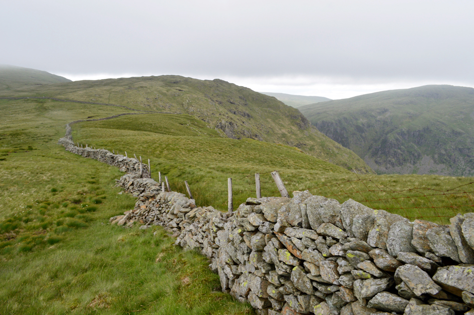
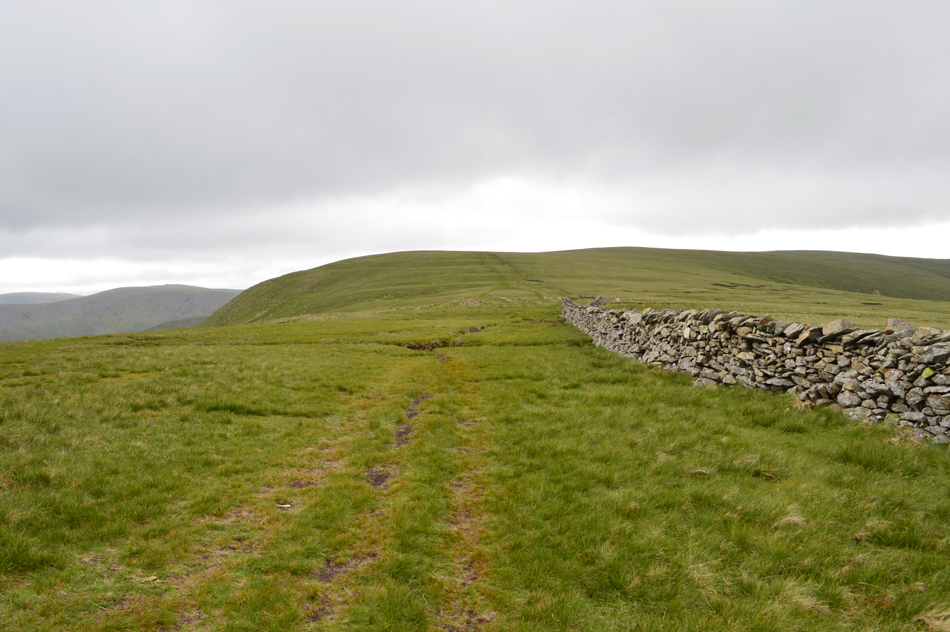
| Continuing to follow the fence all the way to Kentmere Pike summit. |
| I retraced my steps back to the fence where I'd broke away for Goat Scar summit, having crossed the fence by a dodgy style I was back on the ridge and headed for Kentmere Pike summit, to the left, the prominent ridge path which I didn't cross over to instead I stuck to the lesser trodden path alongside the wire fence. |
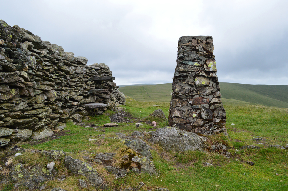 |
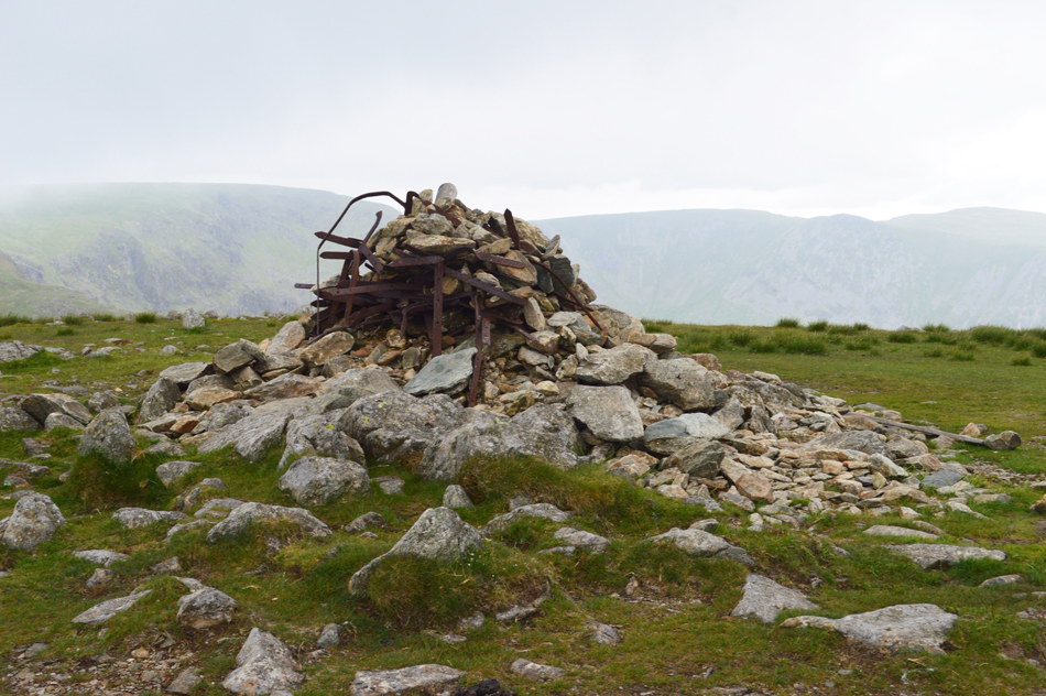
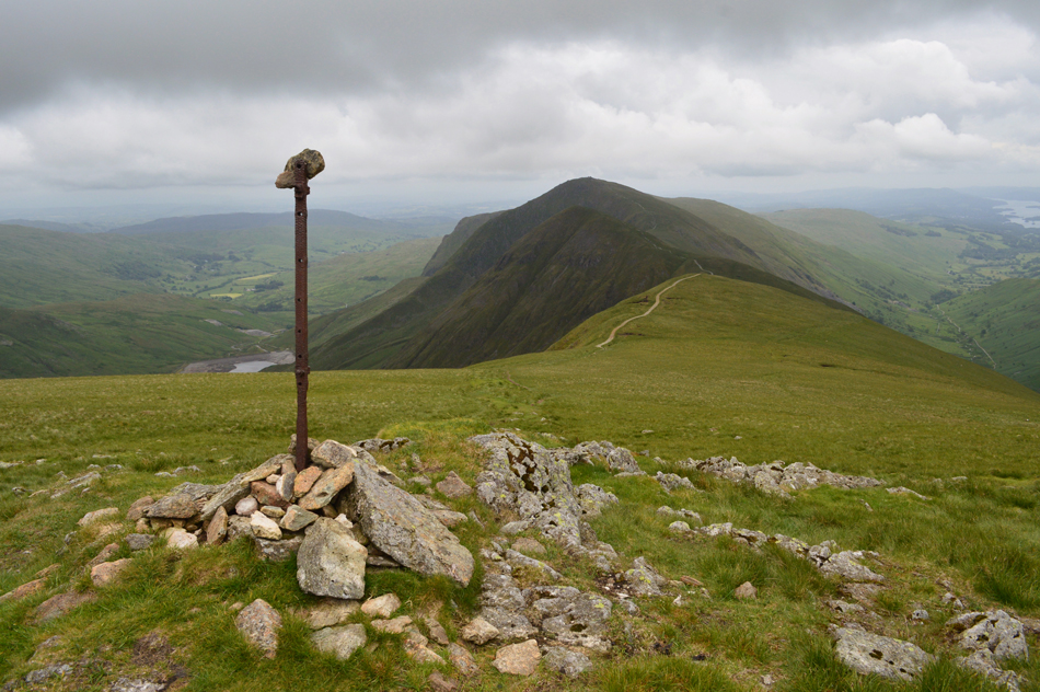
| Kentmere Pike summit Trig Point. |
I followed the wire fence on to the summit shoulder but was forced wide in order to avoid pools of familiar standing water which were being whipped in to waves by the strong summit winds. Having reached the summit cairn I crossed the stone wall via the steps remembering that the top slab wobbles, it still does.
Around half a dozen sheep were seeking shelter just behind the wall who on seeing me trotted off a short distance away. For just a few moments I remained low letting the stone wall shelter me from the wind which was blowing in from the west. |
 |
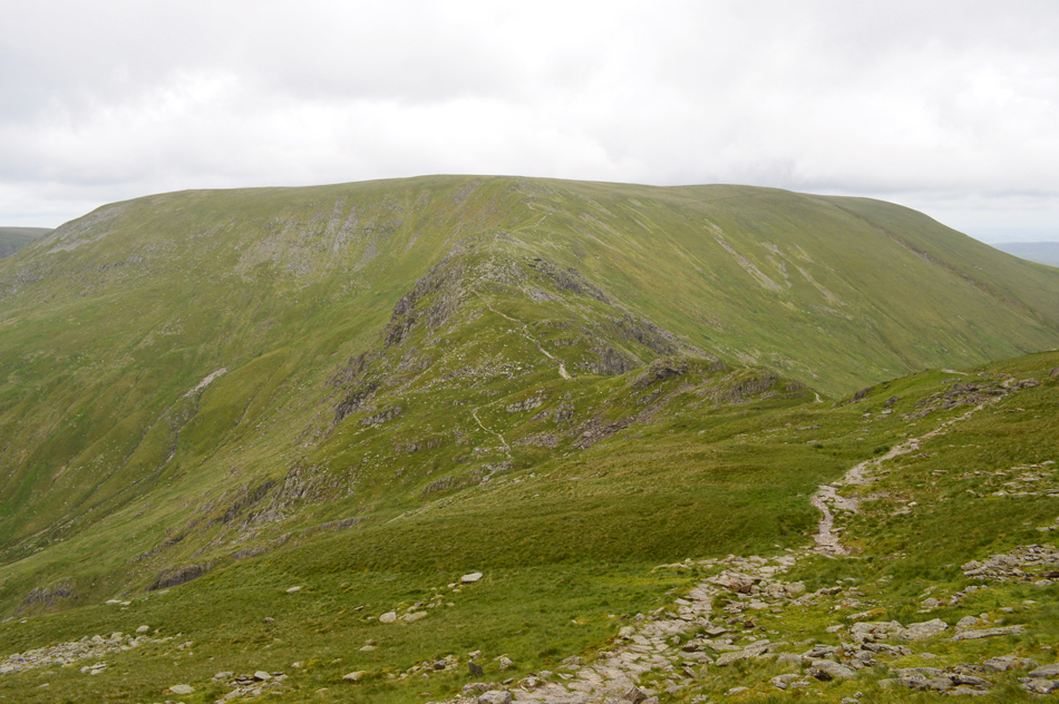
| Harter Fell (Mardale) from Brown Howe. |
I'm no 'David Hall' who is known to withstand mind numbing cold but I must admit it has to be cold in order for me to add extra layers, having crossed over the stone wall back at Kentmere Pike summit I was subjected again to the windchill, which I might add wasn't freezing, but wasn't far above either...or at least it felt that way, having stopped for no more than a minute back on Kentmere Pike my body core temperature felt like it had plunged while at the same time the windchill seemed to tear through my windproof.
That was it, I de-shouldered and added my windproof gloves, easing them down on cold fingers felt like the first brew of a morning, the rest of me would warm up as I went along while trying to pick up my pace over the now, easy ground. |
 |
| Looking back on Kentmere Pike from The Knowe (Harter Fell) |
I was back on track and feeling tip top despite the niggling blister on my right heel which only affected me during steep ascents, at this point I try not to look over at Froswick and III Bell too much!
It was on the approach to Harter Fell did I encounter the heaviest of the showers, I stubbornly refused to add more layers but was forced to stop and de-shoulder at least to take my camera bag out from my pack, having strapped my camera bag around me I re-shouldered my pack before continuing towards Harter Fell summit. |
 |
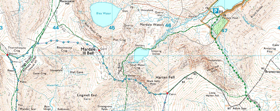
| Harter Fell (Mardale) summit cairn. |
By the time I reached Harter Fell summit it had stopped raining but it was still blowing a royal hoolie, from the Gatescarth side, two walkers are approaching both kitted out in long trousers wearing thier hoods up while I look down on my semi tanned legs, sock lines an all.
Time to descend towards the top of Nan Bield Pass now. |
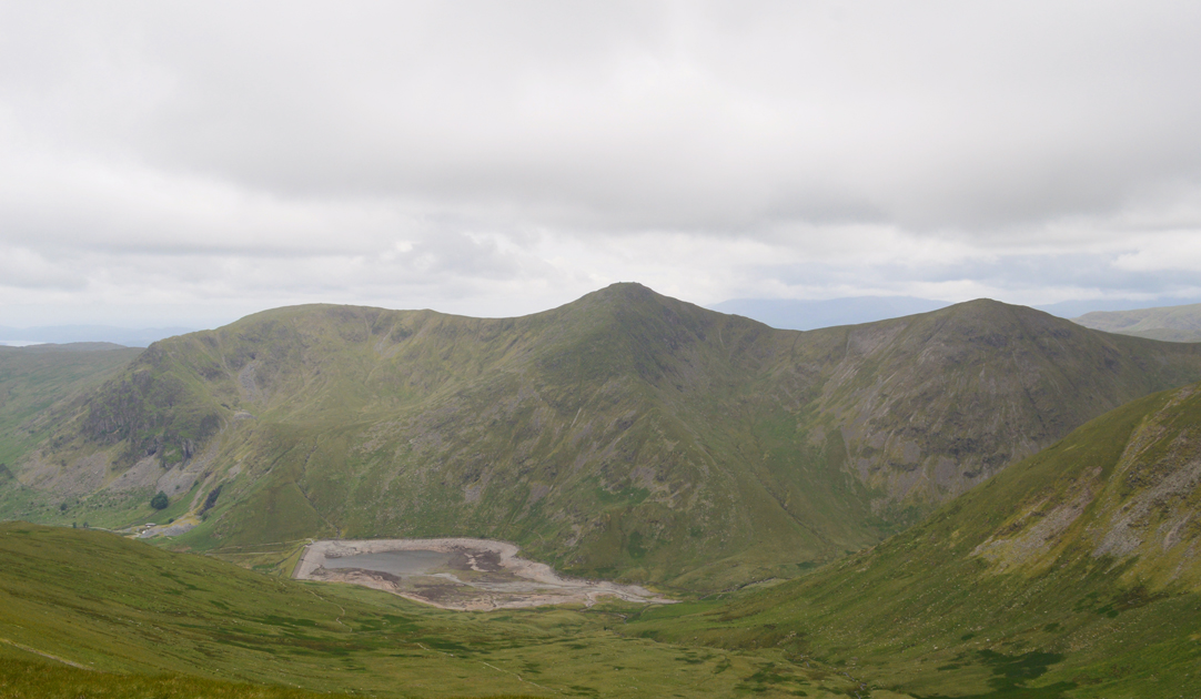 |
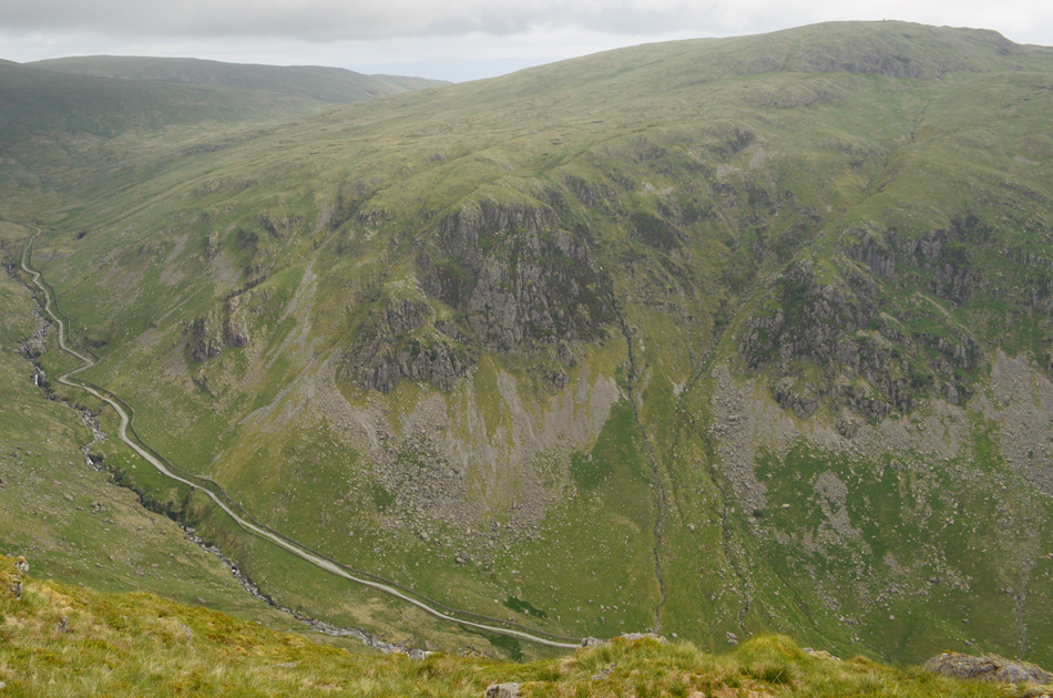
| View over Kentmere Reservoir towards Yoke, III Bell and Froswick from the descent of Harter Fell. |
| Recently when David and Rod walked these fells they told that Kentmere Reservoir had been drained, that was a couple of months ago now and it's still looking almost empty, I I once read that the reservoir was privately owned and that maintenance and inspections were down to the owners, let's hope it isn't left empty for too long. |
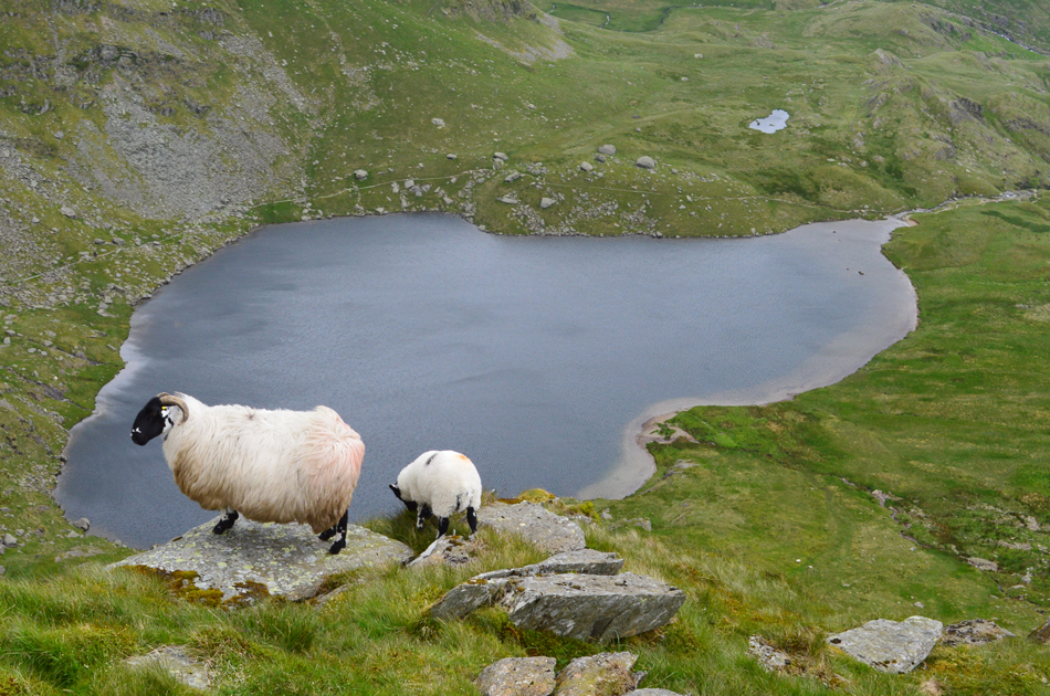 |
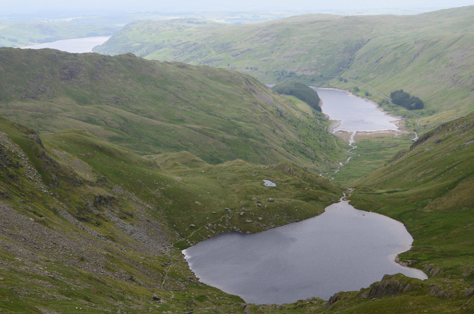
| The view down on Small Water as I approach the top of Nan Bield Pass. |
| I was kinda hoping for a little shelter from the winds knowing that this high level pass is known for how windy it can get (hence the shelter at the top of the pass) So you can imagine my surprise when I found little to no wind during my descent although judging by how windy it looked down on Small Water I'm not quite out of the woods just yet. |
 |
| III Bell, Yoke and Lingmell End from the top of Nan Bield Pass. |
| The wind returned once I passed the shelter and remained with me during the ascent of Mardale III Bell. |
 |
| Views over Small Water, Mardale Head and Haweswater from the ascent of Mardale III Bell. |
| That's High Street's Rough Crag ridge over on the left with The Rigg seen below which looked pretty bleak in todays low light and a world away from my trip on Branstree and Selside Pike at the beginning of the week, views like this are not uncommon in June, mind you, wearing gloves might be! |
 |
| Looking back over the top of Nan Bield Pass towards Harter Fell (Mardale) |
| Is it me or is it starting to get a little brighter. |
 |
| Mardale III Bell summit. |
| I made Mardale III Bell in good time passing a Mountain Biker who was in descent, said a cheery Hi as we passed one another. Next I'm to follow the path above the head of the Kentmere Valley passing Hall Cove before intercepting the High Street Roman Road at the head of Bleathwaite Crag. |
 |
| Views over Hall Cove towards Froswick, III Bell and Yoke. |
| That's the summit plateau of Lingmell End you can see over in the far left of the photograph. |
 |
| Thornthwaite Crag is just up ahead. |
| Having left the traverse of Hall Cove/Bleathwaite Crag behind I followed a faint grassy trod and met the High Street Roman Road above Pasture Bottom. I was back in the firing line with the wind howling once again, it was an eyes down look at your boots hundred yards approach to Thornthwaite Crag where I passed two German girls seen ahead who broke into excellent English as we chatted briefly in passing. |
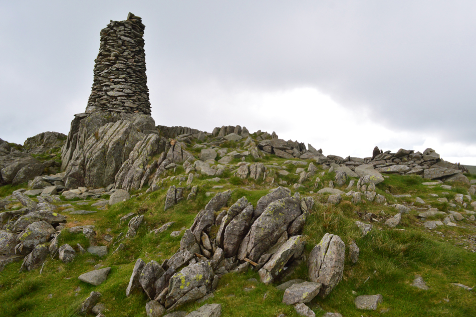 |
| Thornthwaite Crag summit beacon. |
I arrived at the beacon finding four chaps sat huddled behind the stone wall, one Hi with eye contact to all four made for summit pleasantries before taking the grassy descent towards Froswick and the III Bell ridge.
Oddly, and for some strange reason I felt at my best when earlier I had been worried about how much the ascent of Froswick and in particular III Bell would affect the blister, I'm not sure why but here, all that worry had gone. |
 |
| The III Bell Ridge from the 'Post' |
| |
 |
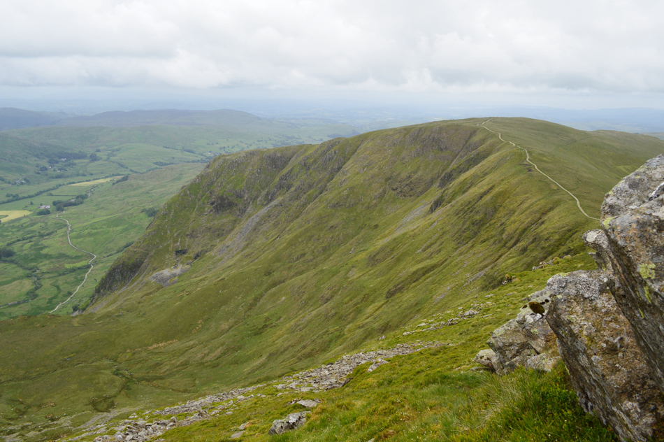
| Looking back on Thornthwaite Crag during the start of Froswick's ascent. |
| The wind has switched sides now from the left to my right, at least my face will look evenly weathered by the time I get back to the car! |
 |
| The view back over Over Cove, Froswick, Thornthwaite Crag, High Street, Hall Cove and Mardale III Bell. |
| Having made the ascent of Froswick relatively pain free I continued my descent passing the top of Over Cove in preparation for the ascent of III Bell, it was here I got talking to a gent who had started from Hartsop this morning experiencing the same sporadic showers as I had only he looked much more prepared in full kit including woolly hat and gloves, a little excessive for the likes of me who stubbornly wears shorts in Summer and long trousers in Winter! Joking aside I would have absolutely no quarrel with anyone wearing full kit here today with the windchill feeling just above freezing. |
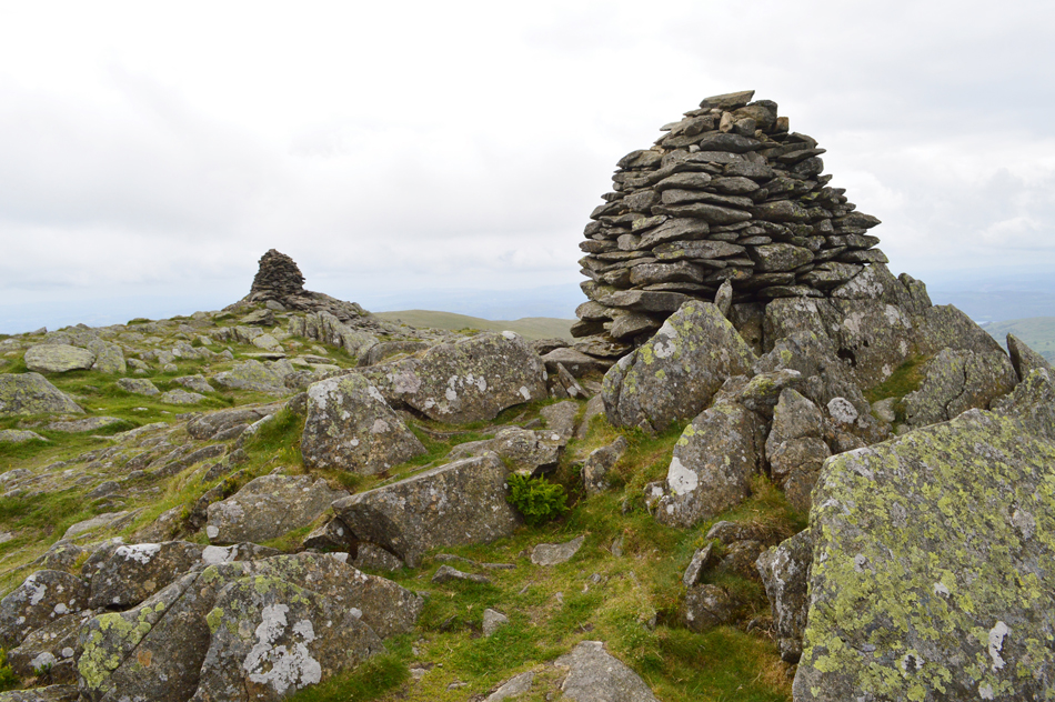 |
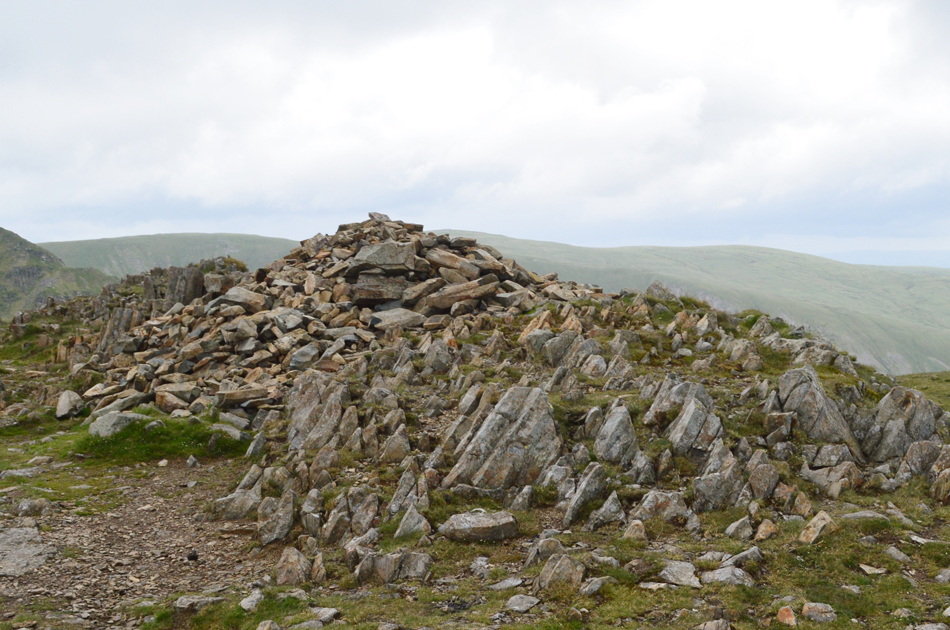
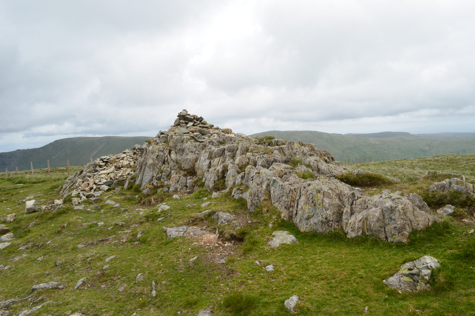
| III Bell summit cairns. |
Sadly gone are the three distinctive summit cairns to just two after the south facing cairn was either suspect to the elements or vandals who had dismantled it, I'm hoping it wasn't the latter.
It's lunchtime now as I search for a shelter from the wind. |
 |
| Lunch with a view. |
| I dropped from the summit on the east side of III Bell and found shelter overlooking Rainsborrow Cove. The forecast predicted rain to arrive by early afternoon but I had been lucky only experiencing showers throughout the morning. The cloud moved at pace high above my head and while I was sheltered by a cluster of rock to my right my lunch comprised of a sandwich triple pack bought from the garage forecourt although after realising that one of the sandwiches contained egg which I'm not very partial too I was left with just two sandwiches followed by a small container of strawberries which I had nabbed from the fridge before leaving this morning. |
 |
| Yoke seen over Rainsborrow Cove from the descent of III Bell. |
| With lunch packed away I re-shouldred and made my way back onto III Bell summit, by now the sweat on my body had cooled down and I was treated to a similar blast as I'd experienced back on Kentmere Pike summit once exposed to those summit winds again. |
 |
| Yoke summit cairn. |
| Standing on the familiar plinth of summit rock. |
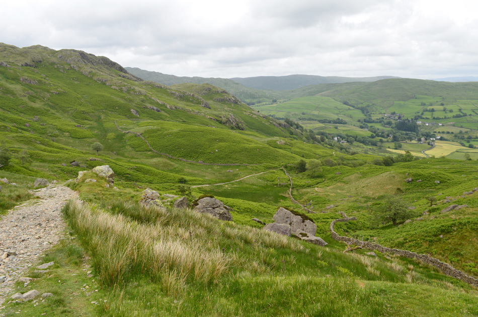 |
| Descending Garburn Pass. |
Still exposed to the winds I left the summit of Yoke behind soon feeling the winds ease as I descended further down the south ridge, the gradient also eased once through the gate a bleak Wansfell Pike appeared over the Troutbeck valley to the west. Ahead, at Garburn Nook a group of walkers shelter behind a stone wall presumably stopping for lunch. My foot has faired well feeling pretty unscathed while my mind is starting to feel occupied by the descent back into Kentmere via the Garburn Pass.
It's not technical, exposed nor steep, just extremely rocky underfoot and no place to have a two week old blister on your heel. |
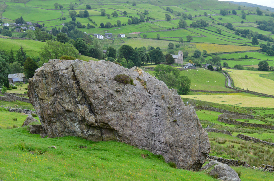 |
| Passing Badger Rock alongside Crabtree Brow. |
| With St Cuthberts Church just over on the right, not far to go now. |
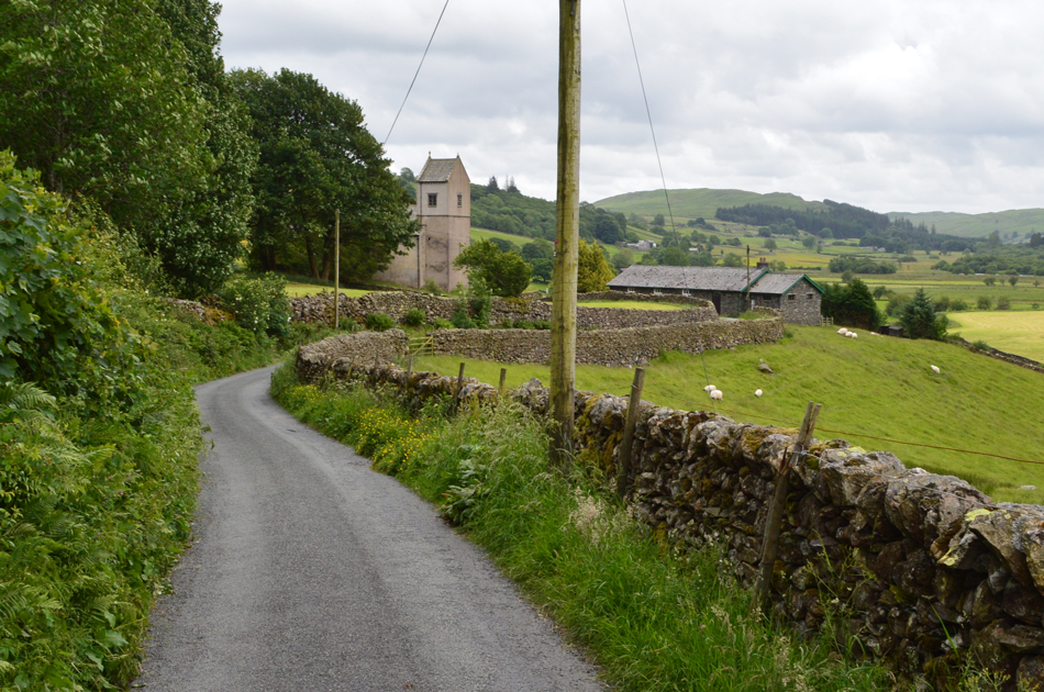 |
| Back at St Cuthberts, Kentmere. |
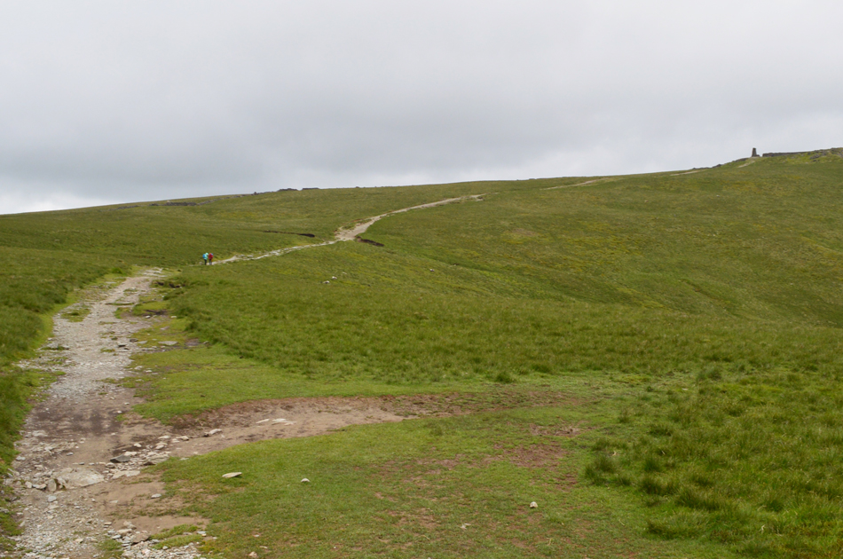
I was passed by a young man on a Mountain Bike close to the top of Garburn Pass and Hi's were exchanged, I've seen this pass destroy bikes leaving the likes of mudguards, reflectors and other bike parts scattered from top to bottom. The pass starts level from the top but soon descends twisting steadily while views over Kentmere village entertain the eye, but I find it's best keeping both eyes on the ground during this descent. I pass the young man who by now is walking his bike back up the pass after a successful descent, it wasn't one of those expensive bikes nor was he wearing what you'd expect a Mountain Biker to wear just paint stained track suit bottoms and trainers but he was pleasant and we spoke as he wheeled his bike back up "was worth it" he laughed, it was good enough for me.
With the descent of Garburn Pass almost behind me the huge boulder that is Badger Rock appeared over the stone wall above 'The Nook' and I peeped over the wall to take a closer look. Gravel turned to tarmac as I pushed my feet into the backs of my boots and for the countless time today I used the edge of a convenient rock from which I bent my right heel down which momentarily eased the pressure on my foot tendon. After the purchase of two expensive insoles I'm still not convinced I have the right ones and sometime later this week Ill be purchasing a third pair just so I can continue my fell walking.
With my car reached I opened the tailgate and placed my pack neatly inside, sat on the rear bumper and eased my boots off with the longest aha your likely to hear. It's still blowing a gale in the valley but the wind is much more pleasant and just as you'd expect for a June afternoon. |
|
| |
| Back to top |
 |
|