|
Walking the Birketts, Helm Crag to Steel Fell Horseshoe |
 |
 |
24th June 2018 |
 |
|
Birketts Helm Crag to Steel Fell Horseshoe, affectionately known as the Greenburn Horseshoe has been on my radar for sometime and the reason for this is because during my last visit during my Wainwrights in 30 walk the day ended with a sour taste in that I found myself in a whiteout and benighted on Steel Fell summit. The day started off so well with bright blue wintery skies and a sunrise you could die for which left a pink afterglow over the snow covered fells, the weather changed rapidly around midday and I lost visibility during the ascent of Sergeant Man via Broadstone Head, this, after battling through thigh high snow. After summating Sergeant Man in appalling weather I made my way back down Broadstone Head against the clock, I had an hour to make Steel Fell before the sun went down losing light prior to reaching the summit. Still in a whiteout and utterly exhausted I descended Cotra Breast soon sighting the lights of Raise Cottage which guided me down, at this time the A591 was still closed after Storm Desmond leaving my walk back to Grasmere eerily quiet, it was a walk I will never forget for so many reasons and up until this day, I've never been back, it's time to put those demons to bed. |
|
| The Complete Lakeland Fells |
 |
| By Bill Birkett |
-The Howitzer Little will be lost in terms of view or pleasantness of surroundings by not tackling those final few feet. |
|
|
|
| |
|
Overview |
|
|
| Ascent: |
2,277 Feet - 694 Metres |
| Birketts: |
4, Helm Crag - Gibson Knott - Calf Crag - Dead Pike (Steel Fell) |
| Weather: |
Hot & Sunny. Highs of 14°C Lows of 25°C |
| Parking: |
Parking Spaces, A591 Outside Grasmere |
| Area - Group: |
Central - W/LAN |
| Miles: |
8.1 |
| Walking With: |
On My Own |
| Ordnance Survey: |
OL5 - OL7 |
| Time Taken: |
5 Hours |
| Route: |
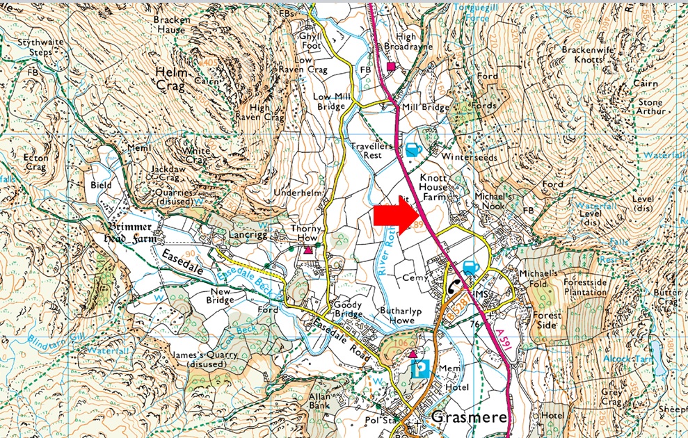
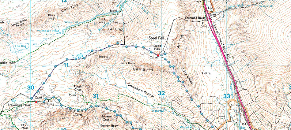
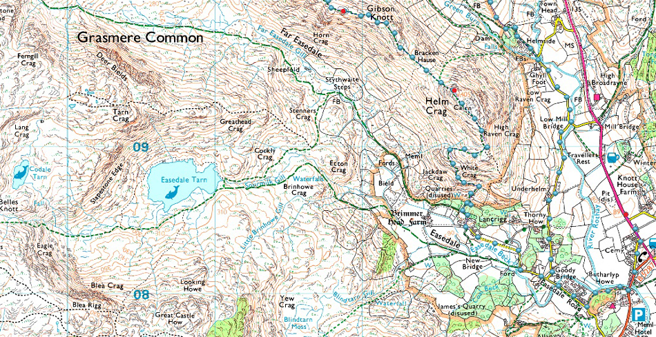
A591 - Butharlyp Howe - Easdale Road - Lancrigg - Helm Crag - Bracken Hause - Gibson Knott - Pike of Carrs - Calf Crag - Steel Fell Tarn - Steel Fell - Cotra Breast - Ghyll Foot - Underhelm - Easedale Road - Butharlyp Howe - A591 |
|
| |
|
Parking Details and Map |
|
|
| Nearest Post Code: |
LA22 9RF |
| Grid Reference: |
NY 337 408 |
| Notes: |
Possibly the most convenient, and popular layby in Lakeland! The layby is found just outside Grasmere in between the village and the Swan Hotel. Despite this being a rather long layby parking here is very popular mainly because of the position and access to Helm Crag, Far Easdale and the Fairfield fells. Parking is free. |
|
| |
|
Map and Photo Gallery |
|
|
  |
| |
| |
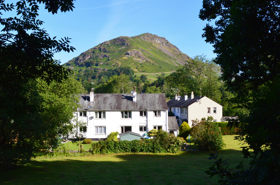 |
| Helm Crag from Butharlyp Howe 08:20am 14°C |
Anyone familiar to Bill Birketts version of the Greenburn Horseshoe (Helm Crag to Steel Fell) may notice that the official start to the walk; grid reference NY 334 080 is located on Easedale Road close to the residential homes at Highfieldside, at the time of publication this area would have been a car park hence why Birkett chose to start the walk from here. Because of this I had a varied choice on where to leave my car while at the same time making sure I passed the official start to the walk, the layby on the A591 just outside Grasmere suited perfectly and I even added a walk through Butharlyp Howe from where I took this photo which brings you right out on Easedale Road.
Ok, now that's cleared up.
It was a beautiful start to the morning with bright blue clear skies overhead and with the temperature already into the mid-teens there was no need to add any extra layers, it was a shorts and T-shirt kind'a day while the rest of my gear gets stuffed into my pack. Today I'm minus my hydration bladder and bite valve after I cracked the lid after I stood on it, I thought the plastic would have been made of much tougher stuff but there you go. Instead my hydration for the day consist of two one litre water bottles one of which gets tucked into my pack side pocket while the other is stuffed inside
While kneeling down to fasten my boot lace I'm passed by a couple who had arrived before me who head north on foot, their destination at this point unknown but it wouldn't be the last I would see of them. Despite the glorious morning the A591 is still pretty quiet which kind'a reminded me of the last time I set off here only the temperature isn't well below freezing! With my car locked I head into Grasmere via Pye Lane, crossed the Rothay then turned right at a sign posted Easedale Road, this is a lovely wooded area known as Butharlyp Howe. |
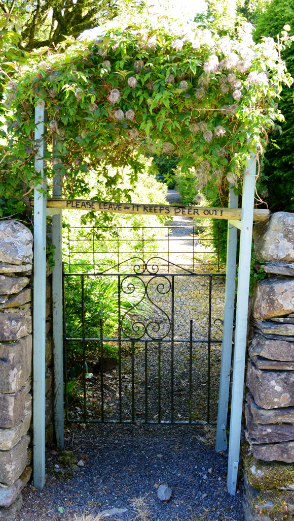 |
| "Please Leave - It keeps Deer Out" |
| Having passed through Butharlyp Howe I passed through a gate then turned right onto Easedale Road soon passing the area around Highfellside, the official starting point of the walk while up ahead, Goody Bridge. |
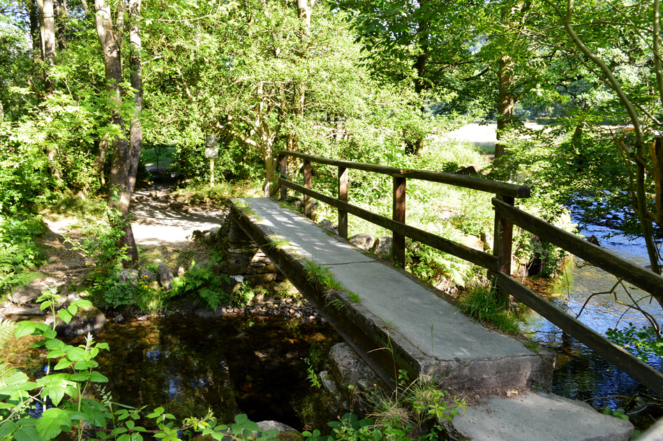 |
| Goody Bridge. |
Was just as I remembered it. One memory from Goody Bridge which always tickles me was when I was half way across and a chap on the other side decided he didn't want to wait and instead made a rather awkward pass right in the centre of the bridge, he must have got a good whiff of me as I'd been on the fells all day, there sure is some impatient people out there.
Here I pass the bridge on route to Lancrigg with three young lads and two dogs in tow. |
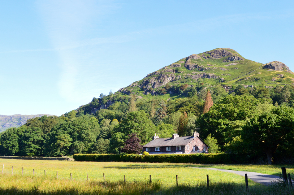 |
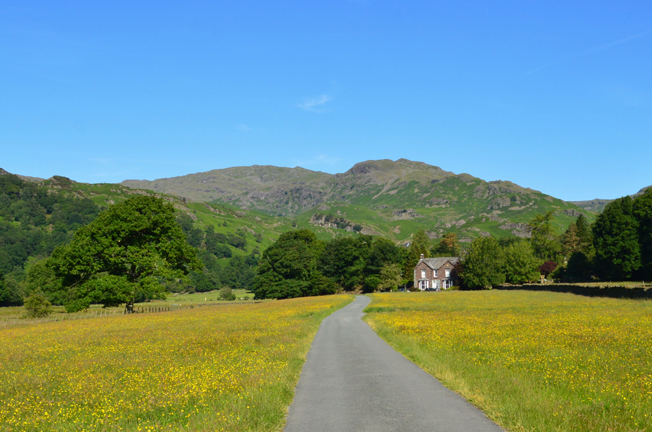
| Helm Crag seen over Lancrigg. |
| Helm Crag is todays first objective but first I pass through... |
 |
| ...fields of Buttercups. |
| With Tarn Crag (Easedale) (R) and Coledale Head (L) in the distance. |
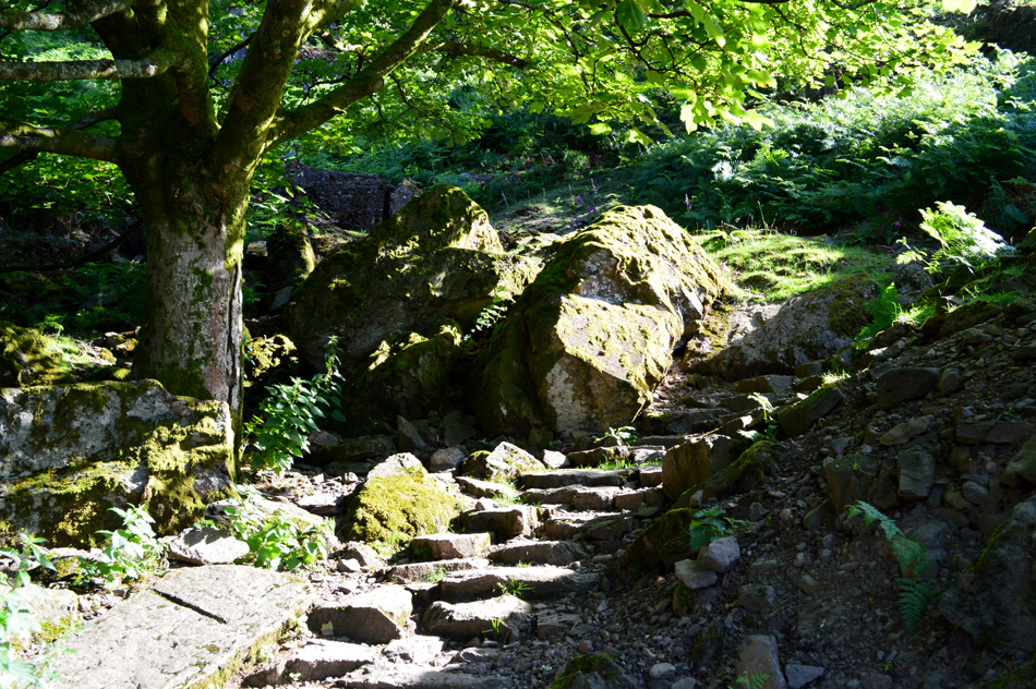 |
| The stone path above the old quarries. |
| The tarmac path continues as far as the Guest House seen in the previous photo from where the path turns stony underfoot, having passed the Guest House bare right and pass an old quarry just above ground level over the left, the path continues quite steeply in places soon spurting you out above a tree canopy with grand views over Easedale. |
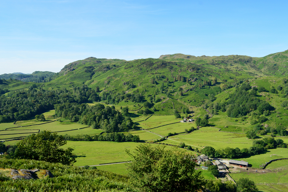 |
| Lang How (C) and Silver How (L) seen over Brimerhead Farm and the Easedale Valley. |
| The path rose steeply through the trees into an opening from where I took this photograph. At this point I was still being tailed by the three young lads who I could hear where closing the gap on me at a point when I felt a decision had to be made, I could either let them pass or brace myself for a sudden burst of energy in which I'd try to widen the gap , I went with the latter. |
 |
| Looking into Far Easedale towards Gibson Knott and Calf Crag. |
My sudden burst only half heartedly worked and soon the heat got the better of me after my ears filled up with my own sweat, by now I'd have took a few gulps from my bite valve but I guess I'll have to wait until I summit before I quench my thirst.
Just in case you were wondering if I'm some kind of anti-social moron I'm far from it, in fact, I'd talk the hind legs of a donkey as two walkers I would later meet found out, the reason for my sudden burst was simple, I wanted the summit to myself, sadly for me it was all to no avail. |
 |
| Not far from the summit now. |
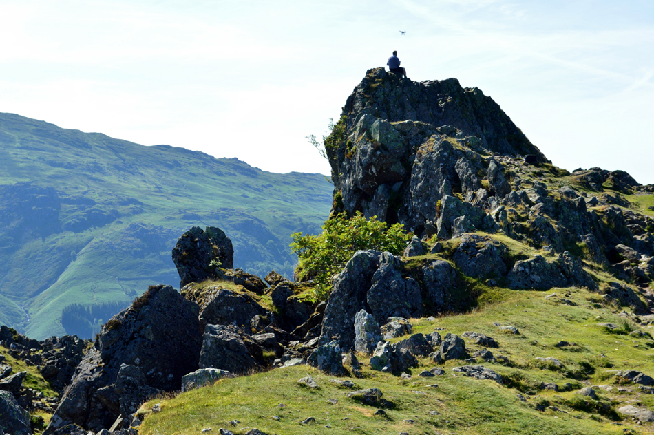
| Those of you with a keen eye might be able to spot a white object just above the summit rocks. |
 |
| The view over Far Easedale towards Blea Crag, Easedale Tarn and Tarn Crag (Easedale) |
With just a hundred foot to go I scrambled the summit shoulder to find a old gent looking down on me "come on thee first" he said, thanks I smiled "yer gotta take your time when tha's 83 tha knows" You must have left early I says "before breakfast" he replied.
On reaching the summit one of the main reasons why I wanted to the area to myself was to hopefully get a decent shot of the Lion and the Lamb together with the Howitzer in this glorious sunshine. The white object that I had referred to earlier was in fact a drone whose operator was sat perched right on top of Helm Crag's star attraction. |
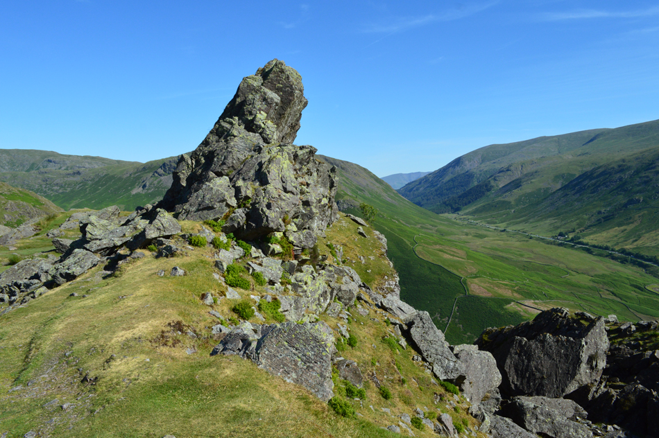 |
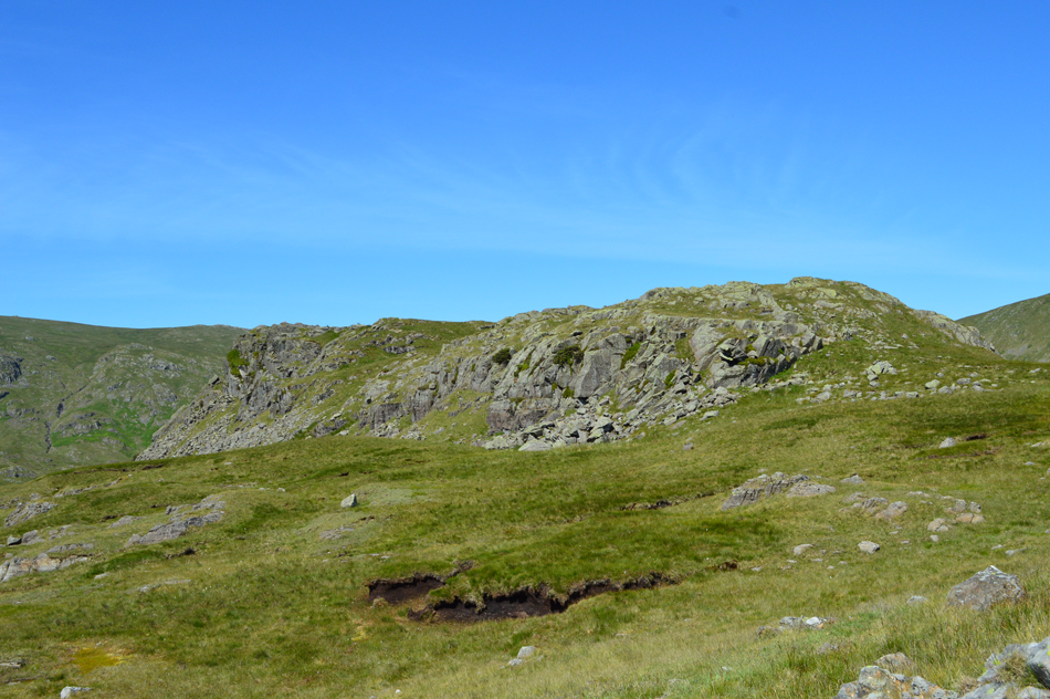
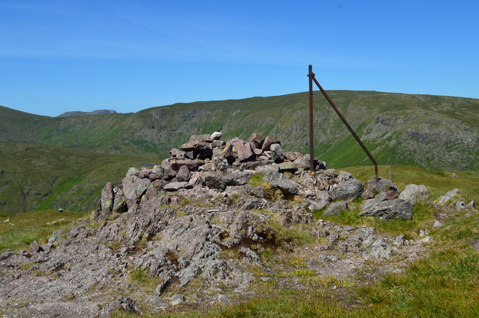
| The Howitzer, Helm Crag. |
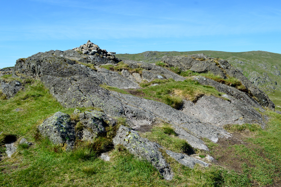
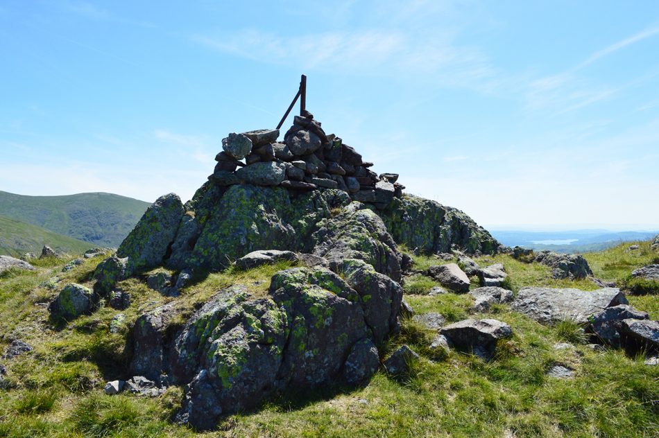
| The true summit of Helm Crag. |
 |
| The Lion and the Lamb, Helm Crag. |
| I'm saying nowt. |
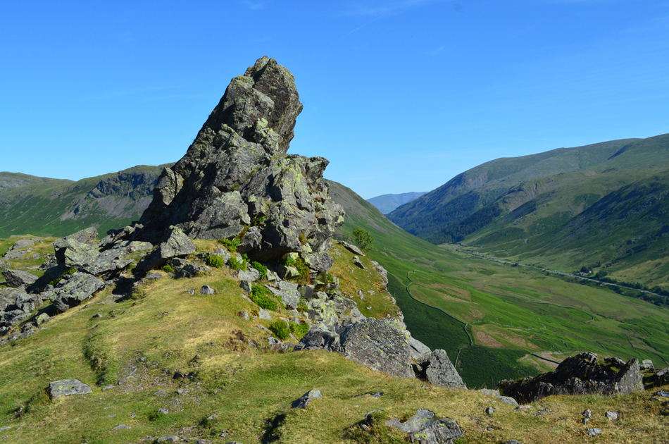 |
| The Howitzer, Helm Crag. |
Having made my way towards The Howitzer I then returned to the Lion and the Lamb after taking the photo seen previously, I'm not against drones although this one wasn't one of the quietest I've heard, it was the fact he was sat there oblivious to everyone around him including the three lads who had by now caught up with me on the summit, we laughed and agreed summating Helm Crag in this heat was hard work this morning.
In passing we spoke of our route as the lads confirmed they were also doing the Horseshoe with the exception that they were heading for the pub afterwards to watch the England - Panama game, me? I'd catch it on the radio on the way home. |
 |
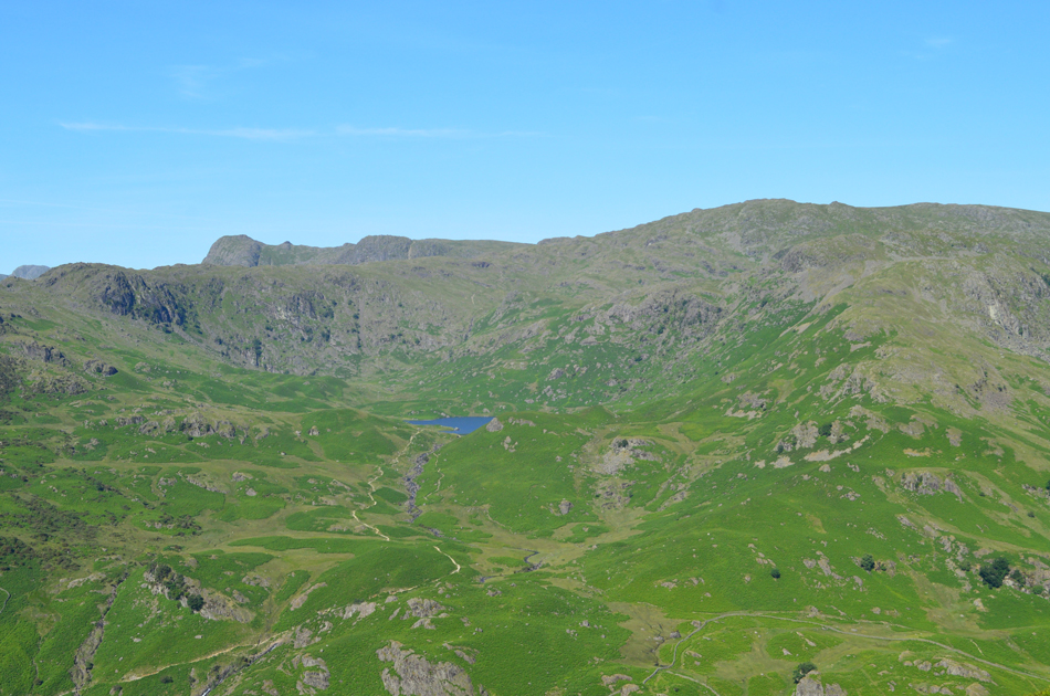
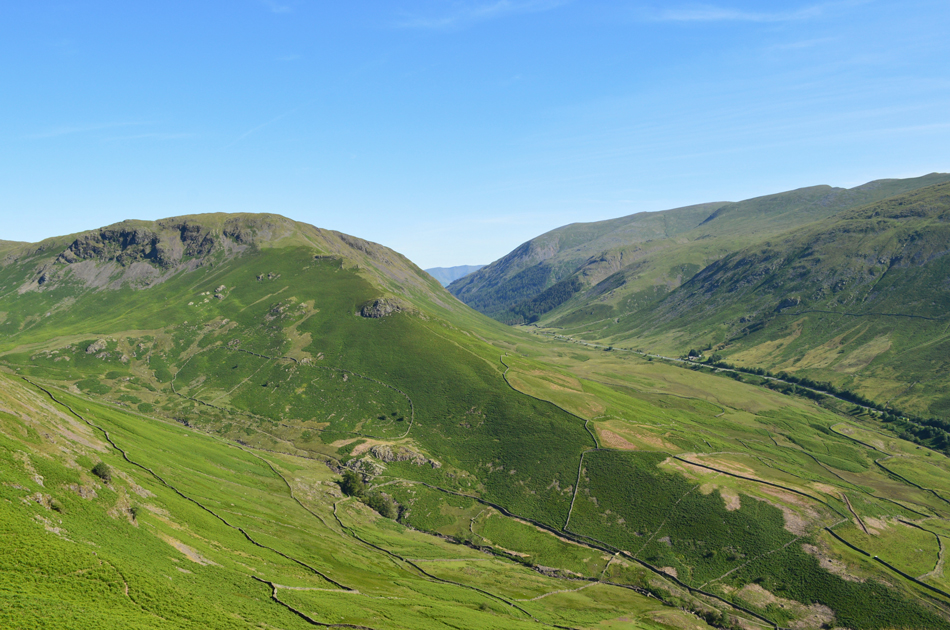
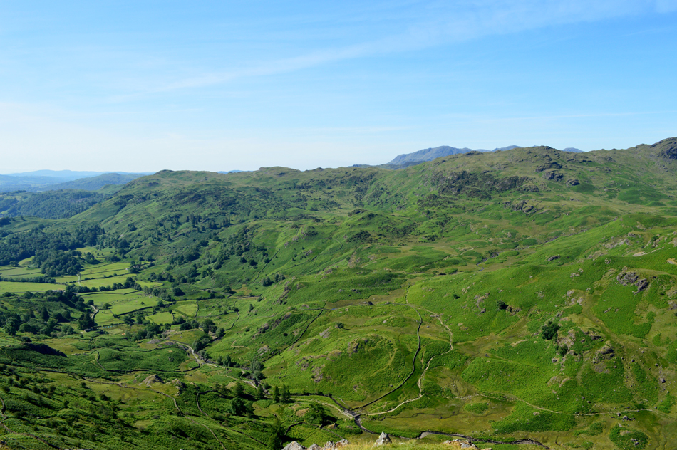
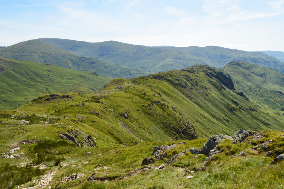
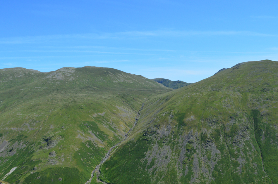
| Views over Bracken Hause towards Gibson Knott and Calf Crag with Greenup Edge on the skyline. |
| |
 |
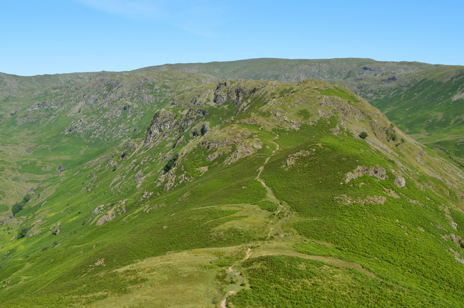
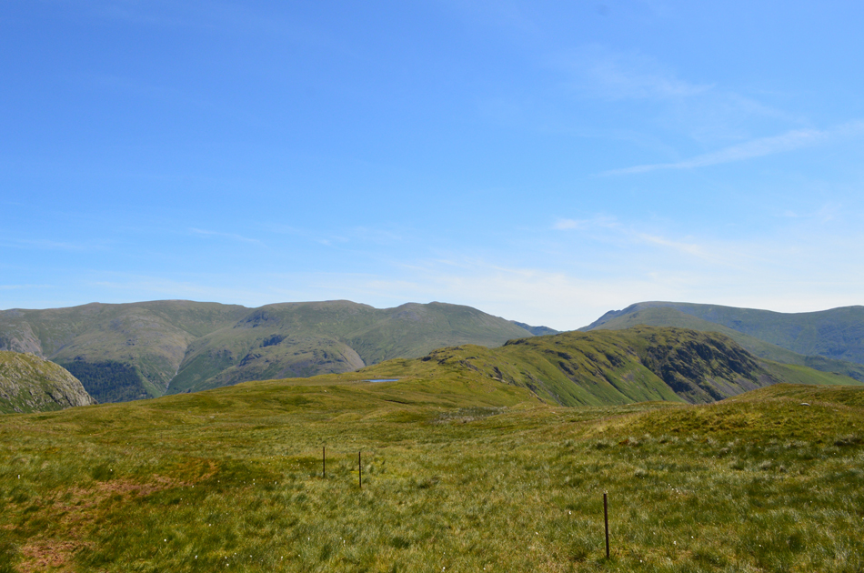
| Steel Fell and Cotra Breast from Bracken Hause. |
| |
 |
| While towards the north, Seat Sandal, Dollywagon Pike, Nethermost Pike and Helvellyn. |
| |
 |
| Gibson Knott bound. |
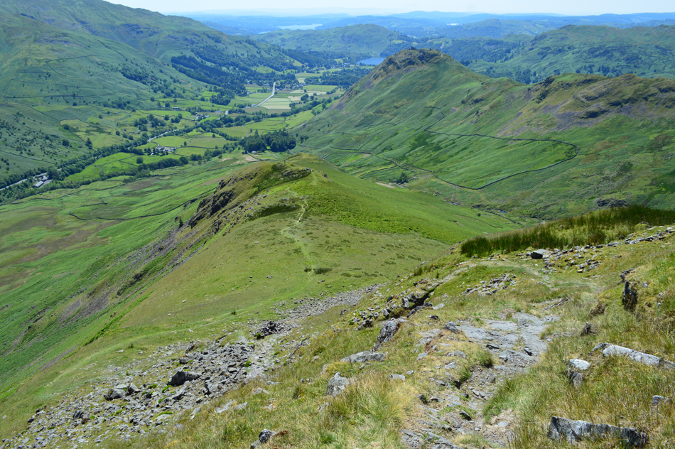
| Having descended Helm Crag I crossed an unusually dry Bracken Hause and followed the ridge path towards Gibson Knott which you can see as the large craggy outcrop in the centre left of the photo, the valley looked so lush with every imaginable shade of green on show. |
 |
| Views into the Easedale Valley taken close to Gibson Knott summit. |
| With Wetherlam and the Coniston tops in the distance. |
 |
| Calf Crag and Greenup Edge from Gibson Knott summit. |
After a steady ascent over more dry ground (the area between Bracken Hause and Calf Crag is notably boggy all year around) I arrived at Gibson Knott summit. By now there is the coolest of winds in the air which just about took the edge off the heat. |
 |
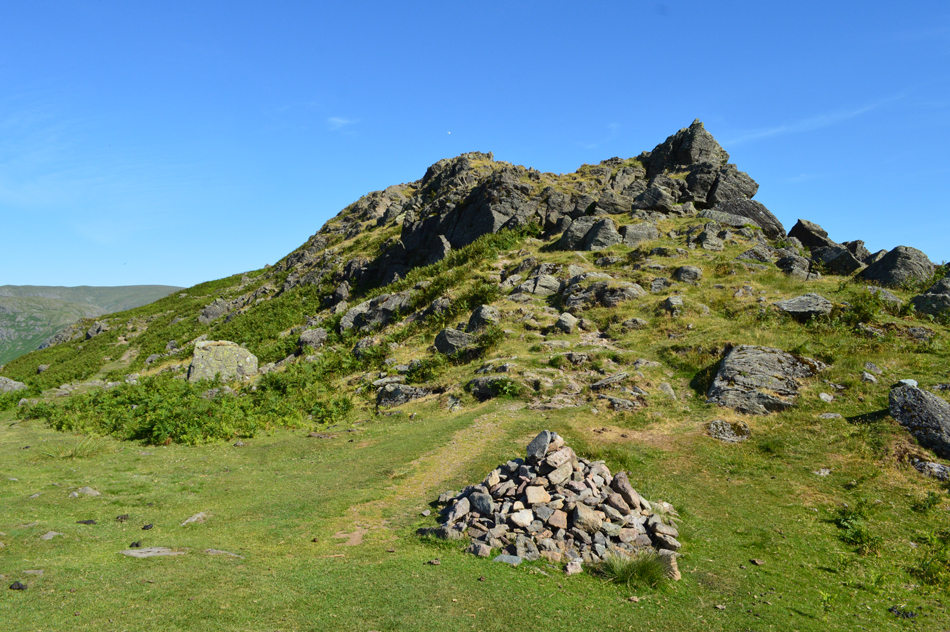
| Calf Crag seen from Pike of Carrs. |
| It's just case of following the path all the way to Calf Crag summit. |
 |
| Far Easedale. |
| With Tarn Crag (Easedale) High Raise (Langdale) and Calf Crag seen right. |
 |
| Looking back along the the ridge towards Gibson Knott and Helm Crag. |
| While in the distance the western spur of the Fairfield Horseshoe including Nab Scar, Heron Pike, Great Rigg, Fairfield and Seat Sandal. |
 |
| Calf Crag is just ahead. |
| It was while crossing the area just below Calf Crag did I pass two walkers who had just left the summit, we pass with a Hi before I make the steady plod towards the summit cairn. |
 |
| Calf Crag summit. |
| I wasn't quite sure of the temperature but it must be in the low to mid twenties by now, without any real ardous walking the heat was making this pleasant ridge walk feel like something a whole lot more spectacular, it wasn't so much the humidity as the heat sapped at my energy levels. I made the summit, downed my pack and finished off my first litre of hydration before replacing it for the second bottle. after some minor adjustments ie pulling my shorts up and slackening off my lower boot laces I was ready for the return leg of the walk. |
 |
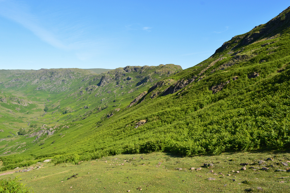
| Broadstone Head and Brownrigg Moss from Calf Crag summit. |
| Before I left I took a walk to the edge of the summit which overlooked Broadstone Head and Brownrigg Moss, it was during my last walk did I start to lose my timings here due to the thigh high snow, today Brownrigg Moss looked positively scorched but I was pleased to find the tarn hadn't dried up just yet although I suspect like many others in the district it may over the next coming week. |
 |
| Distant views over Nethermost Pike, Dollywagon Pike, and Fairfield. |
| No guessing where I'm heading next. |
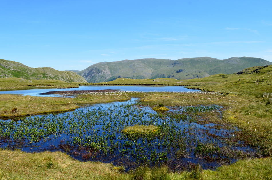 |
| Steel Fell Tarn. |
Having left Calf Crag I picked up the singular trod which crosses the outer edge of Brownrigg Moss where I encountered areas of boggy ground, it was the first time in weeks the soles of my boots have been wet! I spotted a couple prior to reaching Steel Fell Tarn who I later learned was the same couple who had left before me back at the cars "you've done well to get here so fast" the chap says, aye I don't think I've been moving at any pace so I put it down to the good conditions underfoot. We stood here overlooking this splendid view and chatted for a good half hour so much so the three lads who had been tailing me caught up and passed with Hi's.
It was really nice to meet you both John and Jane. |
 |
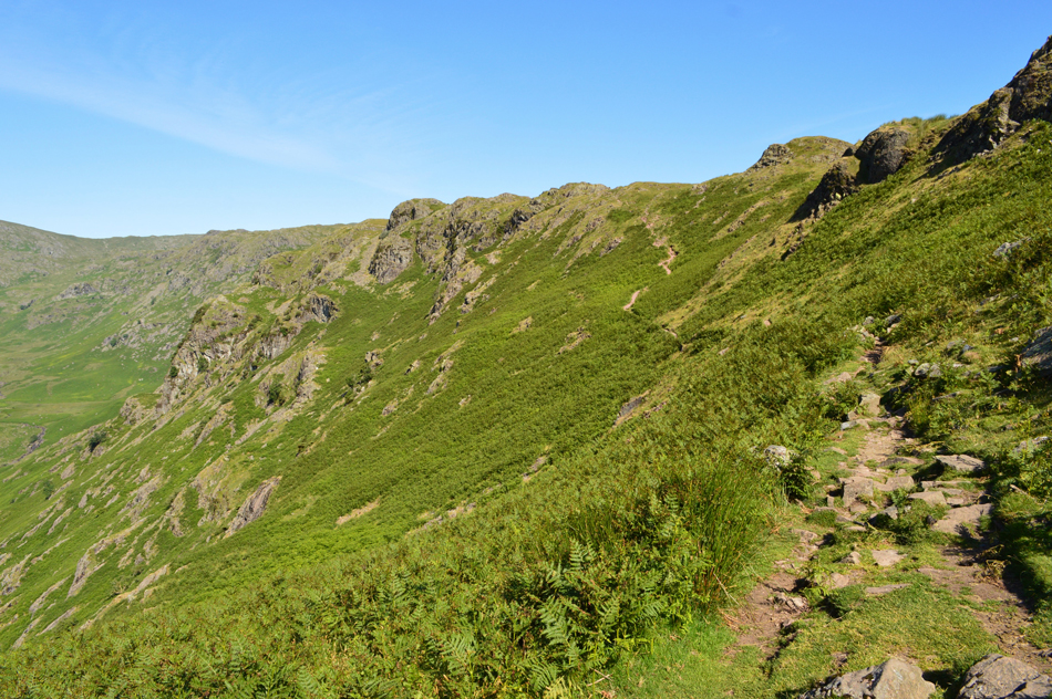
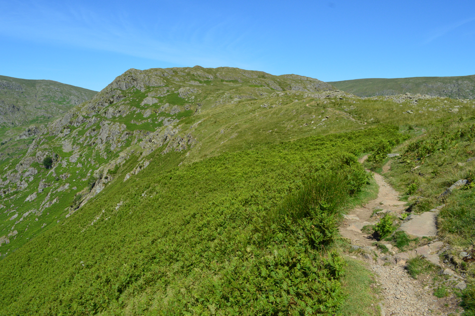
| The ridge to Steel fell. |
| |
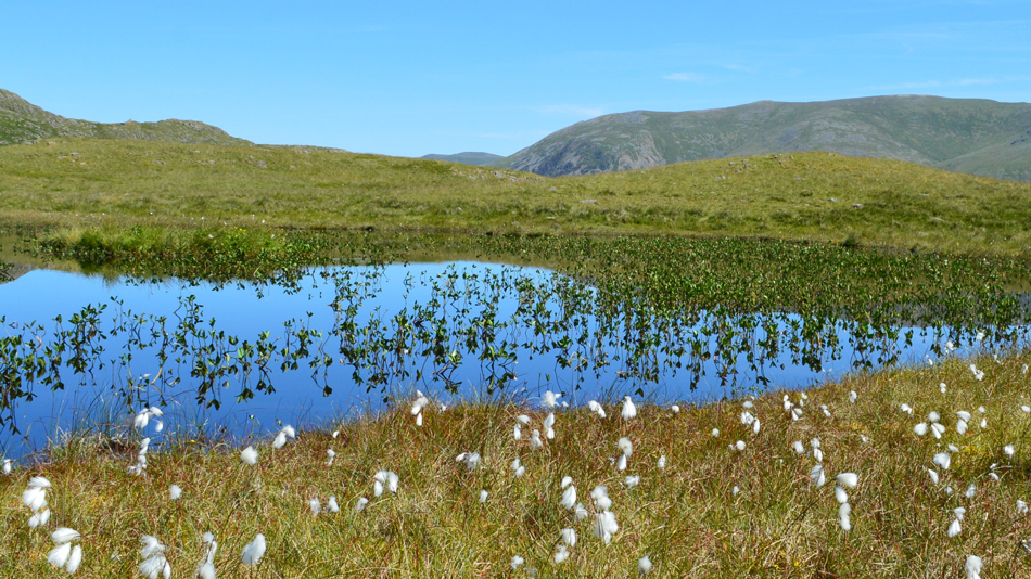 |
| Steel Fell Tarn. |
| The tarn is actually split into two by a short section of marsh, this was the second half and according to Jane, the nicest, yep I'm really loving the cotton grass. |
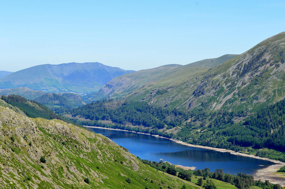 |
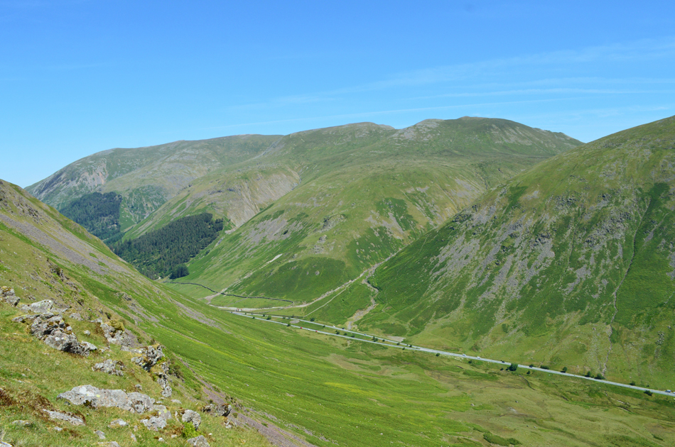
| The view over Thirlmere as I approach Steel Fell summit. |
| In the distance a murky Blencathra which this morning was being graced by David and Jennifer Hall. You can see that the water level is starting to look low with apparent sightings of old walls and structures of of Armboth and Wythburn before they were submerged to make way for Thirlmere Reservoir. |
 |
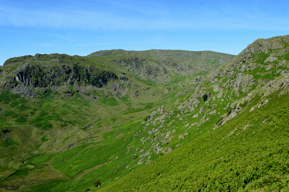
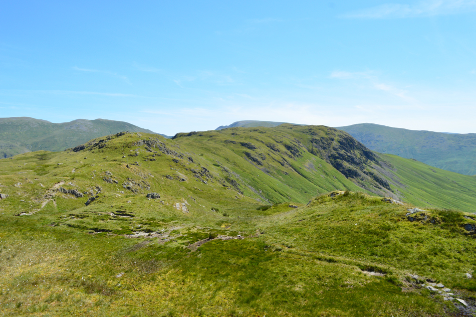
| Greenup Edge from Steel Fell summit. |
| |
 |
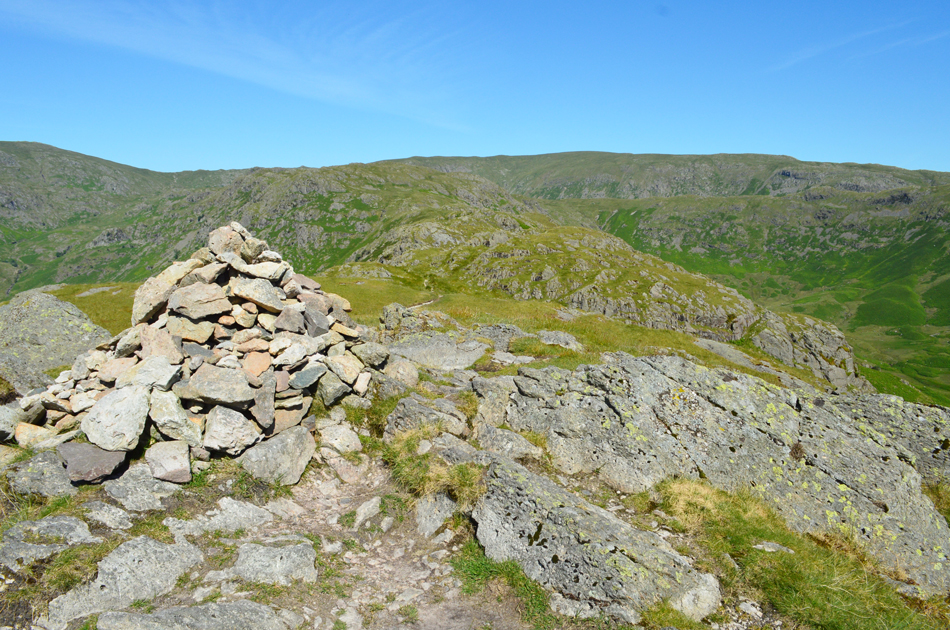
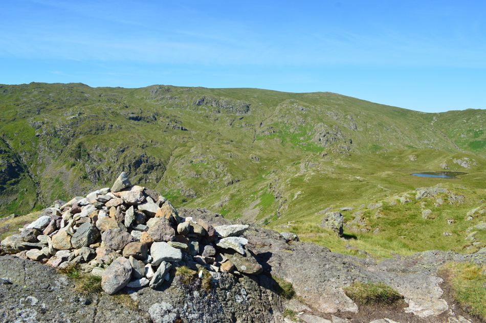
| Dead Pike (Steel Fell) summit. |
A small wander from Steel Fell summit sits the summit cairn of Dead Pike (it's the actual area of the fell which is named Dead Pike) as opposed to the summit which is known as Steel Fell.
Ok, time for an early lunch. |
 |
| Lunch with a view. |
It's chicken and bacon sandwiches today as I take in this wonderful view over Dunmail Raise towards Seat Sandal, Raise Beck, St Sunday Crag and Great Rigg.
I guess I can put up with the noise of traffic when the view is as good as this. |
 |
| The view towards Dollywagon Pike, Raise Beck, St Sunday Crag and Seat Sandal. |
| |
 |
| Starting my descent down Cotra Breast. |
| |
 |
| Looking back on Dollywagon Pike, High Crag, Nethermost Pike and Helvellyn. |
| With the the top of Dunmail Raise seen below. |
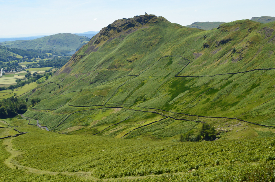 |
| The Howitzer dominates the summit of Helm Crag during my descent of Cotra Breast. |
I'd like to say that memories came flooding back after my last descent but to be honest back then it was pitch black and I couldn't see a thing! The only similarity is that I'm descending over the same ground but it's 30°C warmer!
In trying to keep with the original walk plan I aim to head towards Underhelm via Low Bridge, whereafter I would arrive back on Easedale Road, the route passes through the narrow tree lined lanes you can see in the centre left of the photo. |
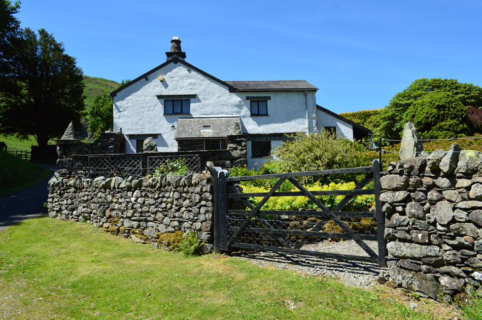 |
| Turn Howe Cottage, Helmside. |
| |
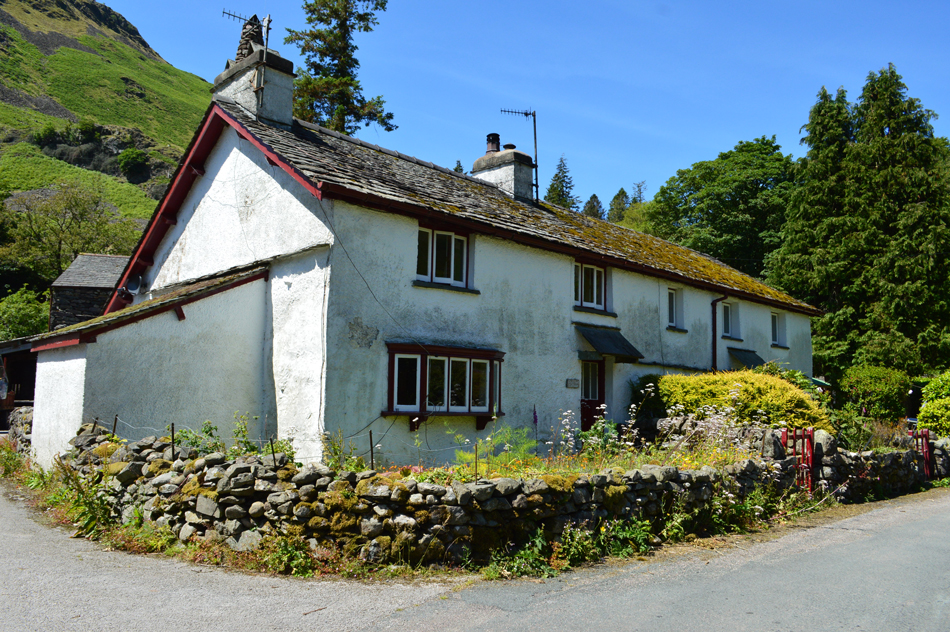 |
| Ghyll Foot Cottages. |
| |
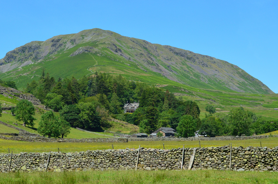 |
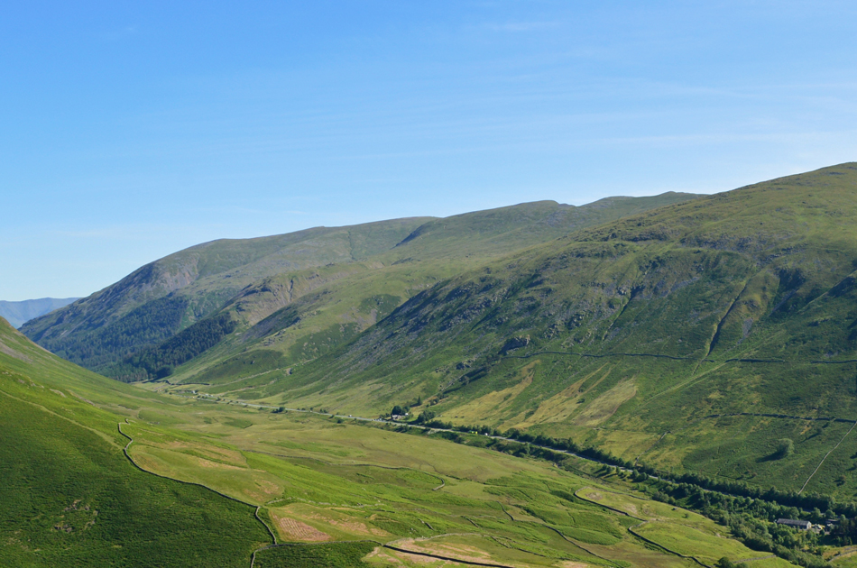
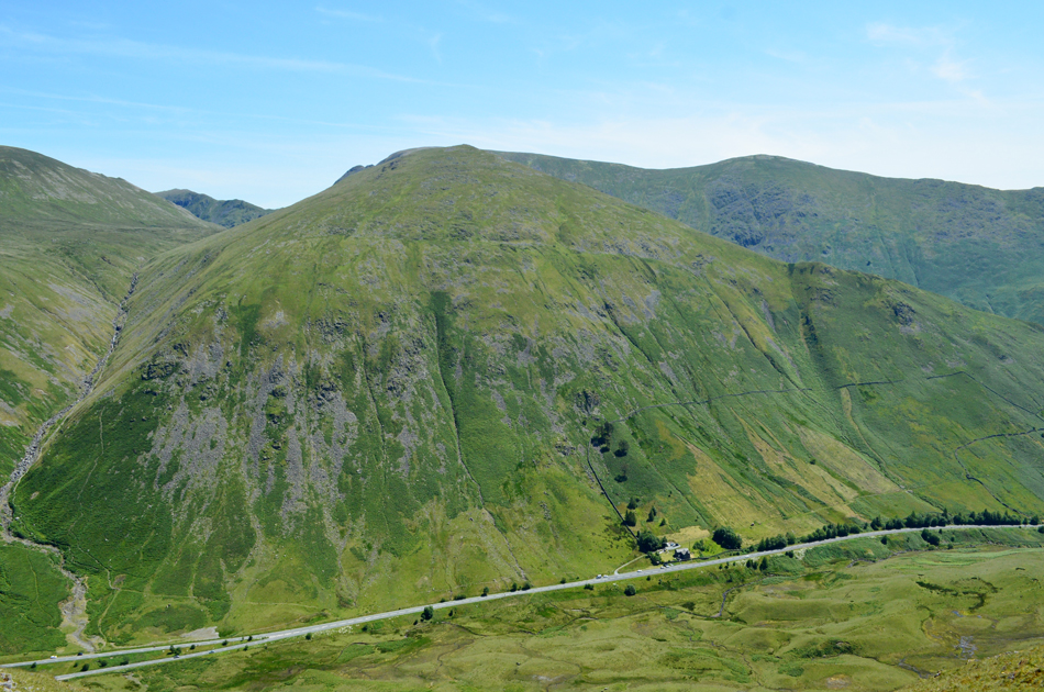
| Steel Fell seen over Helmside. |
Having left Underhelm behind for the tree lined lanes bound for Easedale Road I had time to reflect and what a belter of a day todays walk turned out to be, having not been back since that January day were I beat myself up after finding myself benighted I thought todays walk would help to quash those demons that every time I looked up at Steel Fell, haunted me. There simply was no comparison, no sooner had I reached my first summit those demons were well and truly laid to rest and forgotten about.
Under a scorching midday sun I walked the narrow lanes undisturbed with only the last few hours of walking occupying my mind. Easedale Road was reached after where I expected to find myself within the hustle of Grasmere but nothing could have been further from the truth, I walked back to Butharlyp Howe only passing a family of five with the exception of a graceful old lady who walked towards me with her hands clasped behind her back passing with a silent hello. After rejoining the A591 I made my way back to the car where my first objective was to unlock it, down all the windows and switch the air conditioning on.
Today my feet had fared well and I'm pleased to report that my blister is all but healed and that I've found my happy medium insoles. Back in the car I perform a three point turn and start my journey home whist listening to the England game through my radio which kept losing signal, after passing through Ambleside the traffic halted right outside the Churchill Inn, the bar suddenly erupted which I guessed was when Harry Kane's penalty hit the back of the net. |
|
| |
| Back to top |
 |
|