|
Harter Fell, Kentmere Pike and Longsleddale from Mardale Head |
 |
 |
21st July 2018 |
 |
|
After a week away I'm back where it all started for me, the Mardale valley. Mardale has had quite alot media coverage this last fortnight due to how low the reservoir water level has dropped after lack of rainfall which I guess goes all the way back to May; wow! did I just say that, it's unprecedented isn't it but you know what, I'll put up with a hose pipe ban if it would guarantee more hot weather until the end of Summer, and I know I speak for many when I say it.
David came up with this route a couple of months ago but with holidays and and what not the walk was put on hold until the middle of this week when I emailed David and Rod about a couple of route suggestions, David replied with this route and I replied with a rather short email which simply read "count me in"
We kinda knew after experiencing both social media and TV coverage which Mardale has seen this past week that the the valley would be busy with visitors wishing to see "the once hidden remains of Mardale Green" with water levels at an all time low, I understand why people would want to come and see the remains but sadly the same coverage also turned Mardale into a fairground attraction. |
|
| Wainwright Guide Book Two |
 |
| The Far Eastern Fells |
-Harter Fell
This northern face is Harter Fell's chief glory, for here a shelf too cradles Small Water, which is the finest of Lakeland's tarns in the opinion of many qualified to judge. |
 |
|
|
|
| |
|
Overview |
|
|
| Ascent: |
3,385 Feet - 1,032 Metres |
| Wainwrights: |
3, Harter Fell (Mardale) - Kentmere Pike - Shipman Knotts |
| Visiting: |
Goat Scar |
| Weather: |
A Bright Start Turning Cloudy With Cloud Across The Summits. Highs of 23°C Lows of 15°C |
| Parking: |
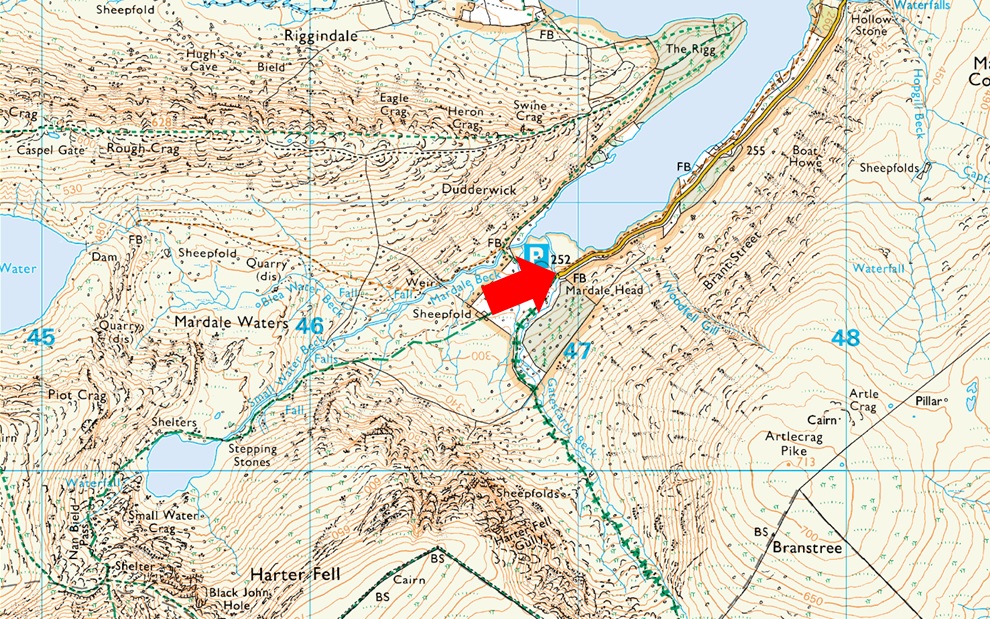
Car Park, Mardale Head |
| Area: |
Far Eastern |
| Miles: |
10.1 |
| Walking With: |
David Hall & Rod Hepplewhite |
| Ordnance Survey: |
OL7 |
| Time Taken: |
6 Hours 50 Minutes |
| Route: |
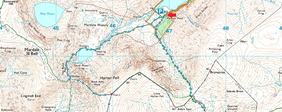
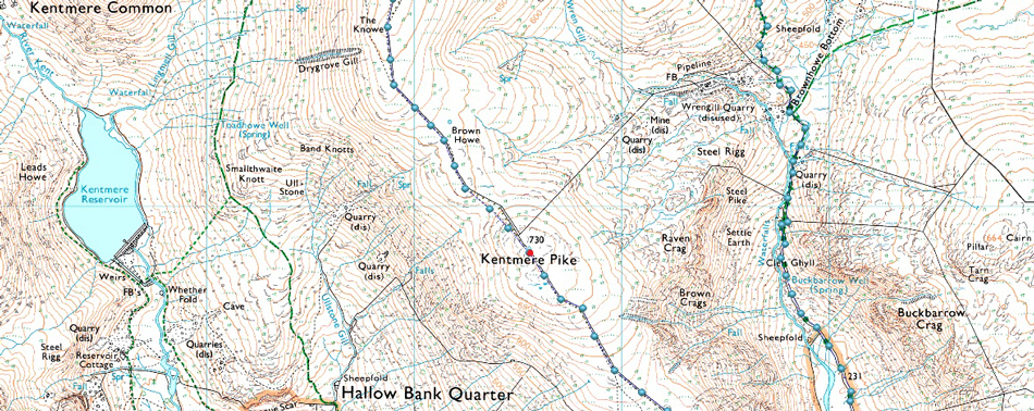
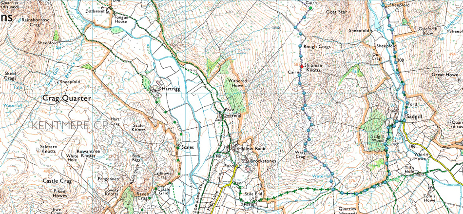
Mardale Head - Small Water - Top of Nan Bield Pass - Harter Fell (Mardale) - Brown Howe - Kentmere Pike - Shipman Knotts - Wray Crag - Longsleddale Pass - Sadgill - Longsleddale - Gatescarth Pass - Mardale Head |
|
| |
|
Parking Details and Map |
|
|
| Nearest Post Code: |
CA10 2RP |
| Grid Reference: |
NY 469 310 |
| Notes: |
Probably one of the most scenic car parks in Lakeland found at the head of the Mardale Valley offering easy access onto the High Street fells plus many more. The car park during Summer can fill up quickly but with most car parks in Lakeland if you time your arrival early enough you're always guaranteed a parking place. Parking is free. |
|
| |
|
Map and Photo Gallery |
|
|
 |
| Harter Fell (Mardale) The Rigg, the Rough Crag Ridge and High Street seen over Haweswater 07:45am 15°C |
| When starting a walk from Mardale Head I always allow a little extra time so I can stop to take a few photos on route, here looking over Haweswater towards the Rough Crag ridge, High Street with Harter Fell and the head of the Mardale valley seen far left. |
 |
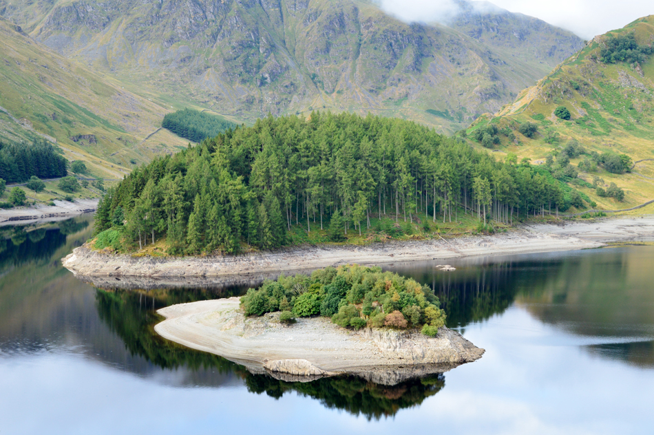
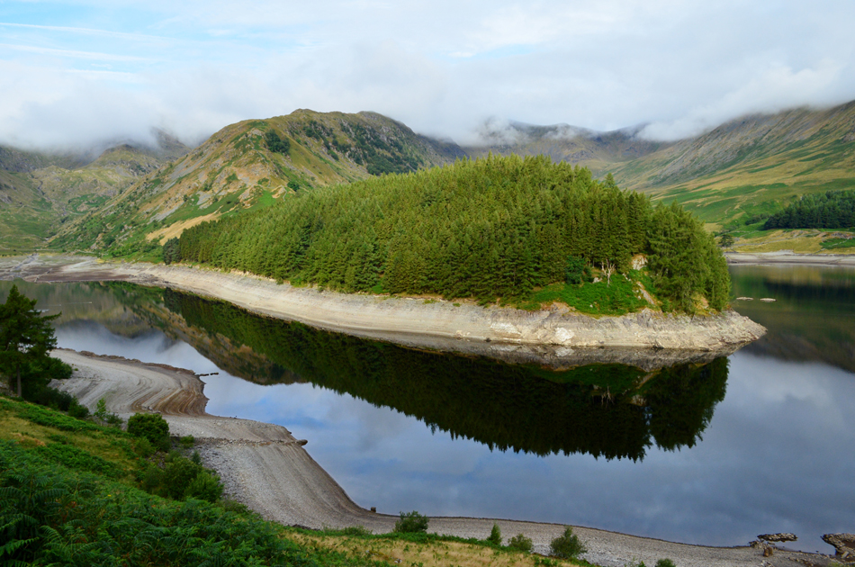
| Wood Howe Island, The Rigg, The Rough Crag Ridge and High Street. |
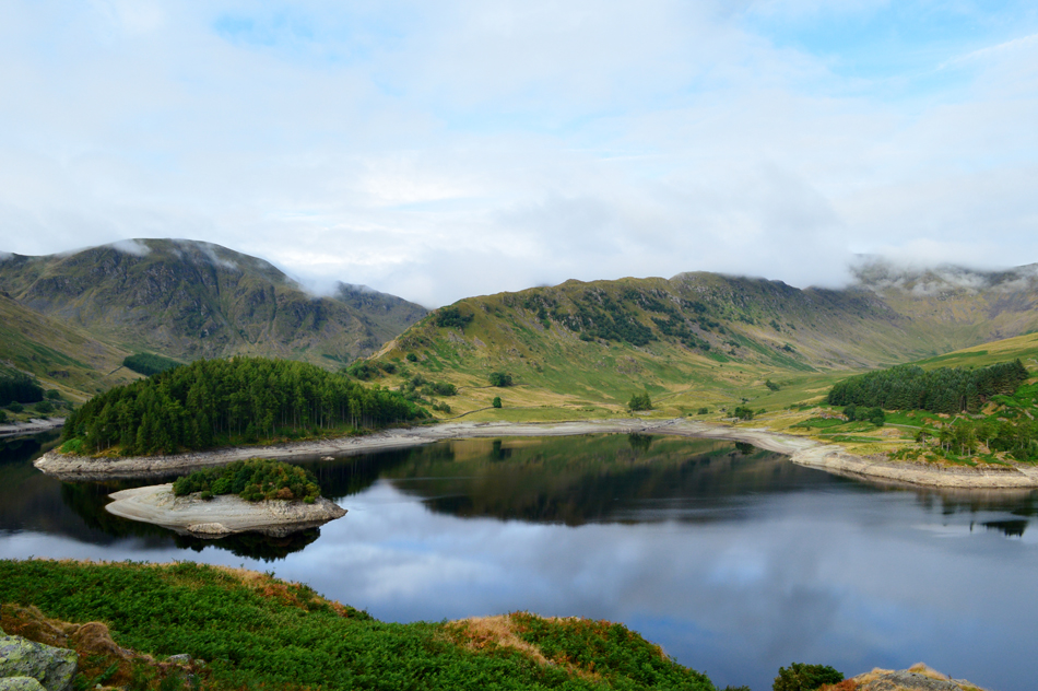
| The area of reservoir towards the right of the photograph is the whereabouts of Mardale Green village. Mardale Church would have been found close to Wood Howe Island which back then was known as Church Hill. |
 |
| Wood Howe and The Rigg. |
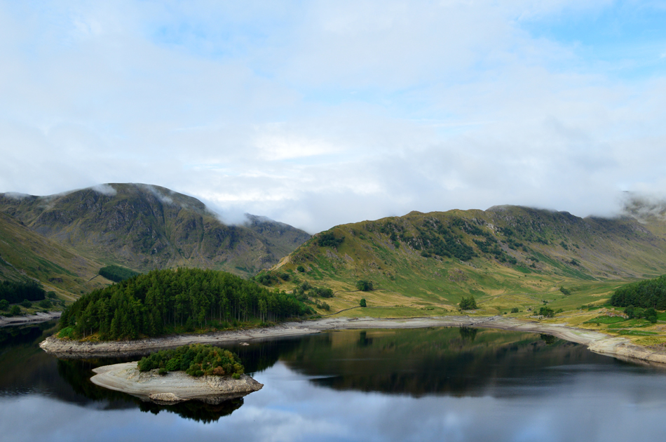
| I was last here at the beginning of June and I can see that since then the water level has dropped considerably, for instance the craggy outcrop in the foreground of the Island was below the waterline five weeks ago. |
 |
| Looking towards Mardale Head. |
This image shows the extent of how much the water level has dropped over recent weeks with the tide marks clearly visible on the rocky shoreline, I wouldn't like to think how many thousands of gallons of water has just evaporated into thin air.
These tide marks remind me of the rings on Saturn. |
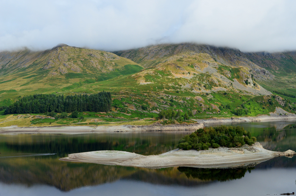 |
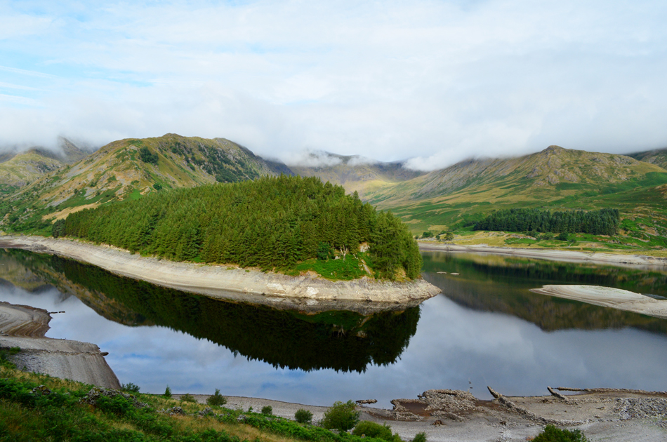
| Kidsty Howes and Castle Crag with Wood Howe Island in the forground. |
| On the southern spur of Wood Howe more land has appeared, this is usually below the waterline although during my last visit in June it appeared as a second Island with water separating both Islands, today this new land even has grass growing on it. |
 |
| The Rigg and the Rough Crag Ridge with the summits of Mardale III Bell, High Street and Kidsty Pike below cloud. |
| |
 |
| Mardale Head. |
| Well, the forecast was for a wet start with low level cloud, I'll take present conditions as a bonus! Fantastic. |
 |
| The Rigg, the Rough Crag Ridge, High Street, Riggindale and Kidsty Pike. |
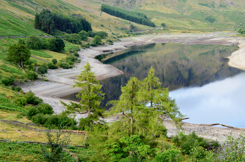
From the road we were able to look down on the receding waterline now displaying ruined walls, sheep pens and even tree trunks felled by Manchester Corporation during the construction of the Reservoir.
Time to get a move on, unbeknown to myself and David Rod was waiting for us at the car park. |
 |
| Mardale III Bell North Ridge from Mardale Head. |
The car park was already half full by the time myself and David arrived and we managed to reverse our cars back against the perimeter wall. Rod was almost geared up deep in discussion over the low water level with a lady who afterwards set off in the direction of Small Water. With the route sort of confirmed Rod asked would we be gaining Harter Fell via the Gatescarth Pass or Small Water? "you know what David explained, I haven't thought about it" we all agreed that the Small Water route would suit noting that we wouldn't have to use the Gatescarth Pass in ascent as well in descent.
It's a mild morning with little to no wind although in the short time it took us to gear up at Mardale Head cloud had started to bubble over the top of Nan Bield Pass and appeared to be going nowhere, ahh that's the forecast we expected.
Having geared up we locked the cars and passed through the gated Deer Fence, the lady Rod had been speaking to moments earlier had a good lead on us as we catch up on gossip like three washer women since we last walked together. The past few days has seen Lakeland experience some rainfall the evidence of which resulted in a wet path underfoot. |
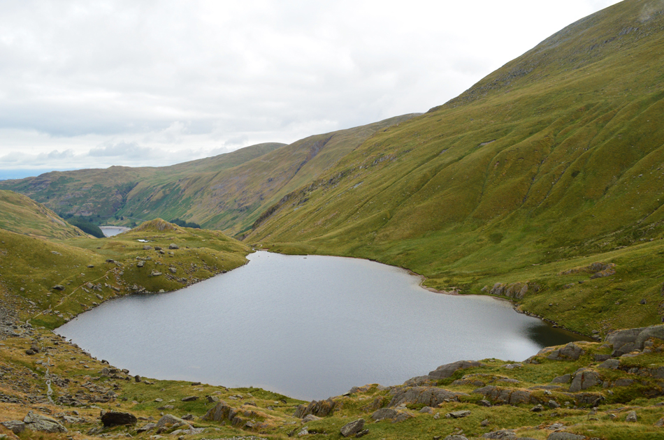 |
| Looking back on Small Water, Haweswater and Selside Pike. |
With more height gained we left the swollen footpath behind in favour of dry rock underfoot, to our right Small Water Beck comes back into view minus its waterfalls which have been replaced by bare rock. Soon after the outflow is reached and from here we can see the extent of cloud which is waiting for us at the top of Nan Bield Pass, it's looking pretty grim. |
 |
| Looking back on the shelter and the top of Nan Bield Pass. |
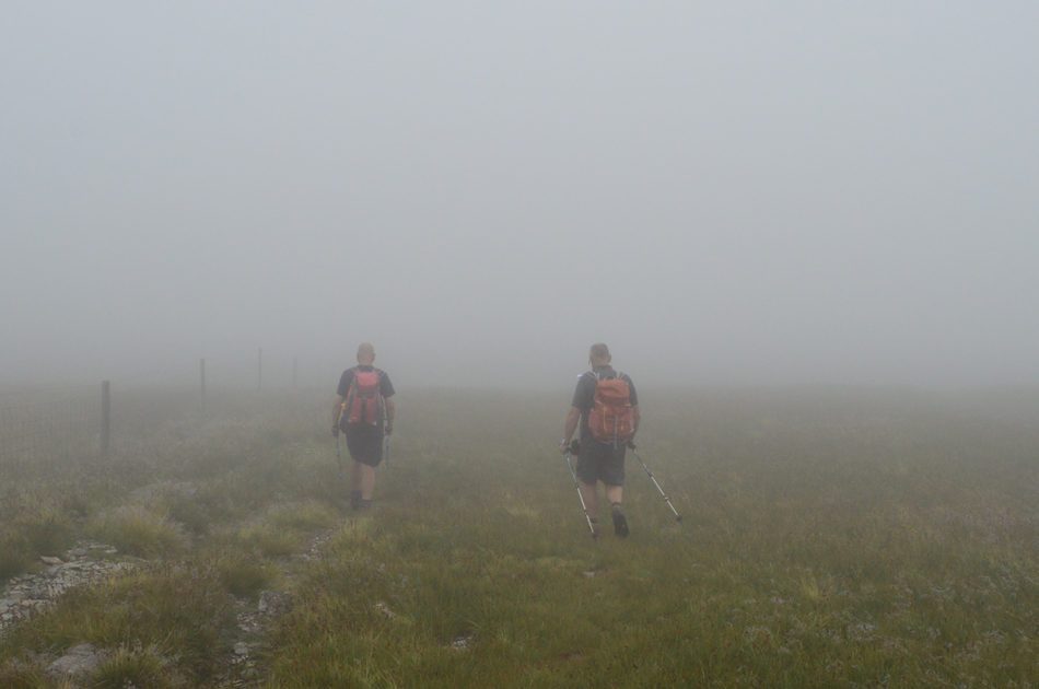
| The lady we had seen earlier was sitting down on the bank of Small Water were it looked she had settled for the day "it's looking wet up there" she explained, tongue in cheek we agreed and continued passing the three stone shelters before starting the steep ascent towards the top of Nan Bield Pass. The cloud, as enthralling as it was to watch started to creep down the hillside and by the time we reached the stone shelter we were well and truly in the thick of it. |
 |
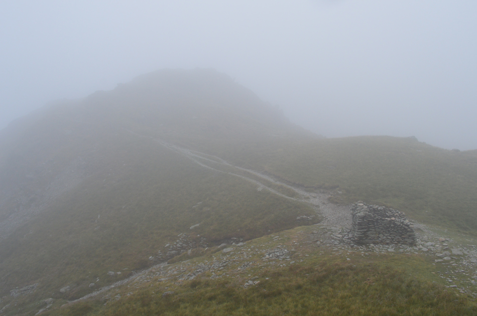
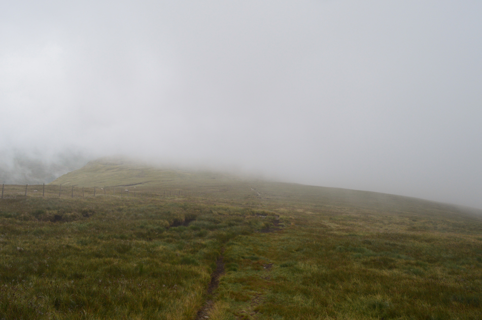
| Not far from Harter Fell (Mardale) summit now. |
| The cloud had reduced visibility to around fifteen metres, lower in places but this did nothing to stop conversation so much so this couple who we had a healthy lead on over took us during one of our many 'conversation stops' After a shared 'morning' they faded into the cloud and had gone by the time we reached the summit. |
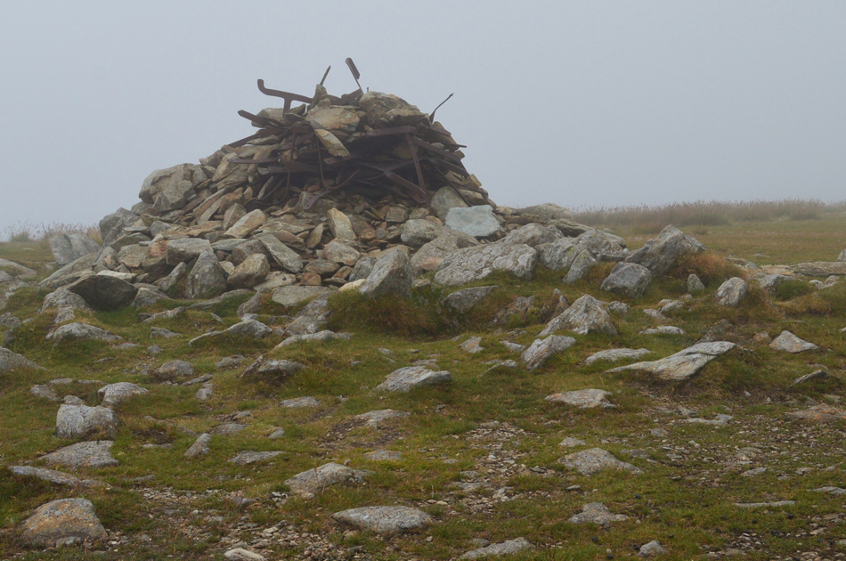 |
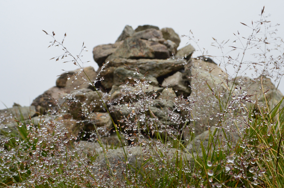
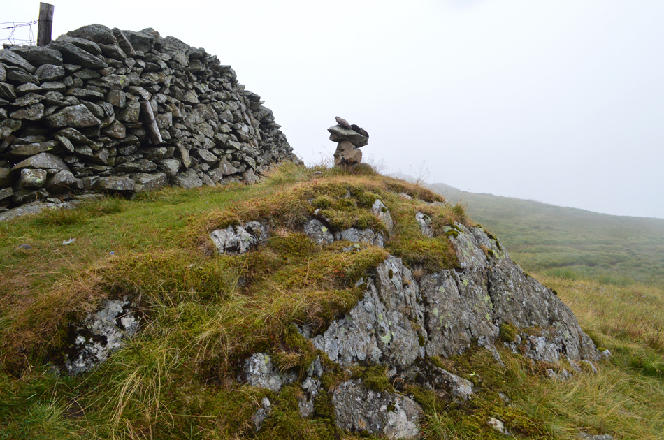
| Harter Fell summit cairn. |
| Sorry, not much to see here. After de-shouldering we took swigs from our water bottles and bladder packs before heading into the cloud towards Kentmere Pike... |
 |
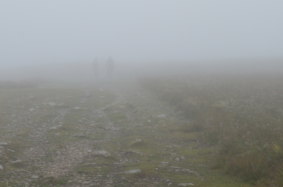
| ...its eerily quiet as we pass over The Knowe. |
| |
 |
| Rod and David, Brown Howe. |
| Despite walking in low cloud it's still incredibly muggy as a mix of dew and sweat forms over exposed skin. |
 |
| Still in the thick of it. |
| Kentmere Pike summit. |
 |
| A break in the cloud reveals Goat Scar. |
| Which is where we're heading next. |
 |
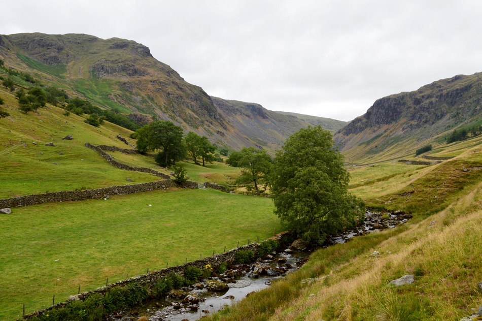
| Peering down into Longsleddale. |
| That's Buckbarrow Crag over on the right with Tarn Crag in the cloud, we'll be down there soon as we make our way back to Mardale via the Gatescarth Pass. |
 |
| Mountain Dew. |
| Goat Scar summit. |
 |
| Shipman Knotts is up ahead. |
| Having left the summit of Goat Scar behind we continued along the ridge towards Shipman Knotts, by now the cloud was starting to break as the ridge lost height and soon we could hear (but not see) groups of walkers chatting and laughing as they made their way towards Kentmere Pike. |
 |
| Shipman Knotts summit. |
| A large group of children and adults had just left Shipman Knotts summit as we approached, we pass with Hi's before watching them fade into the cloud as they too ascended towards Kentmere Pike. With Shipman Knotts being our last summit it was time to make our descent towards the top of the Longsleddale Pass. |
 |
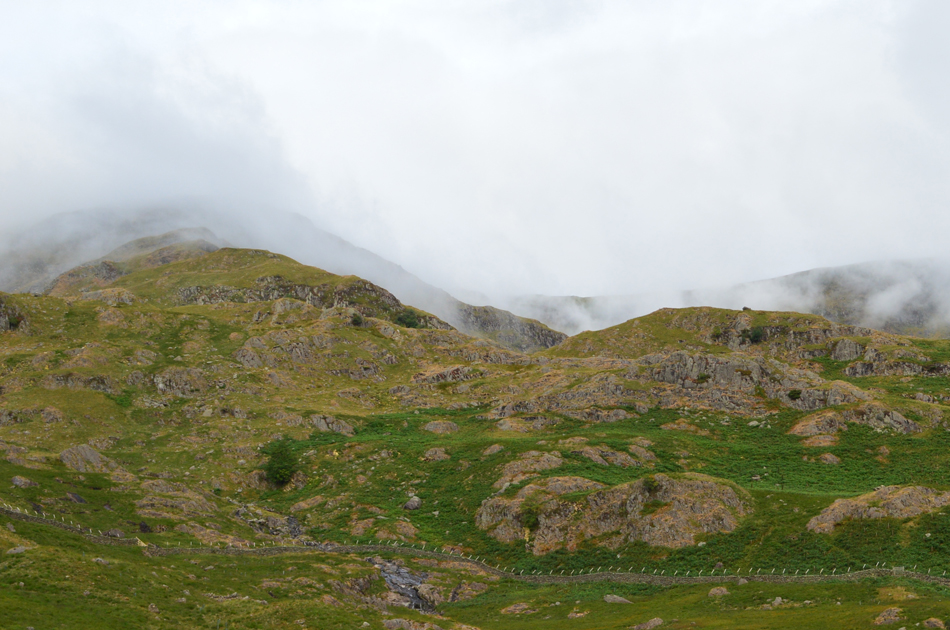
| Wray Crag as we descend the stone rake below Shipman Knotts. |
| We all agreed it was possibly here, during this descent did we experience that 'autumnal feel' gone was the mild breeze in favour of a much cooler air which made the hairs on your arm stick up, adding to this we could also feel rain in the air. |
 |
| Looking back towards Shipman Knotts. |
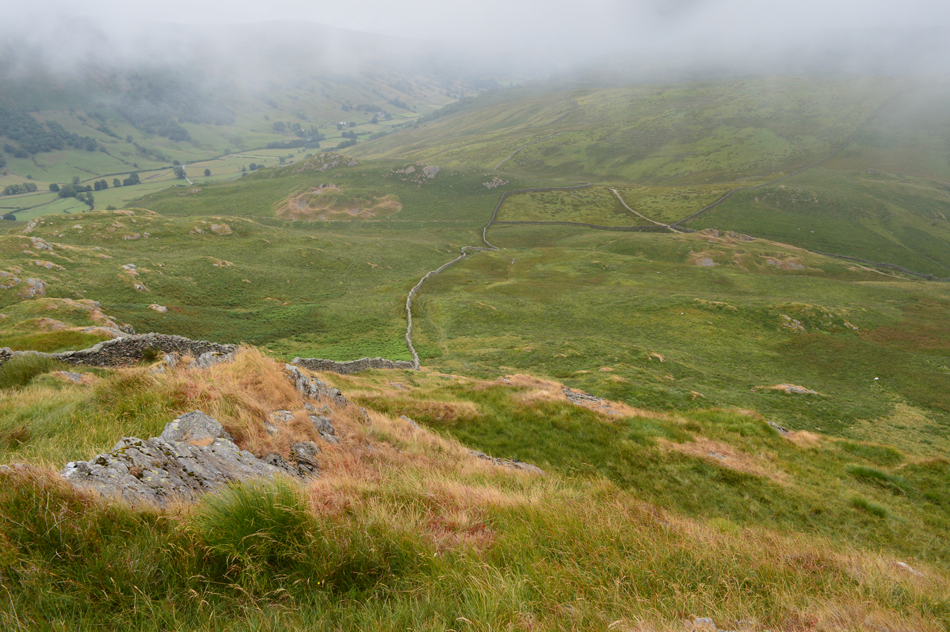
| With the cloud still clinging to even the lowest of todays summits, here at around 1,500ft. |
 |
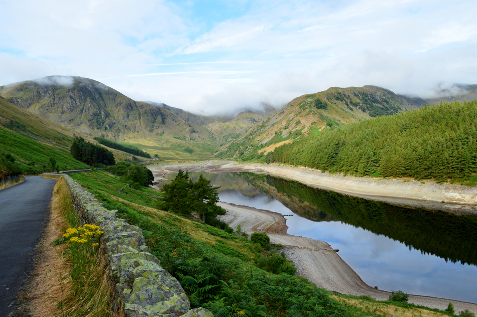
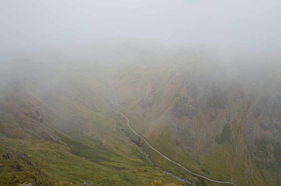
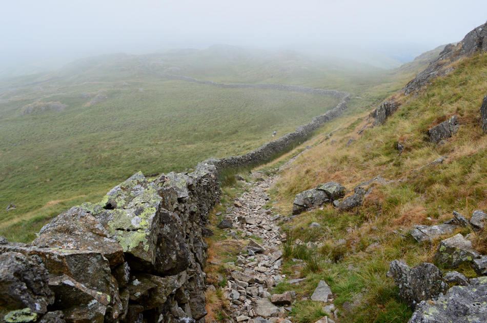
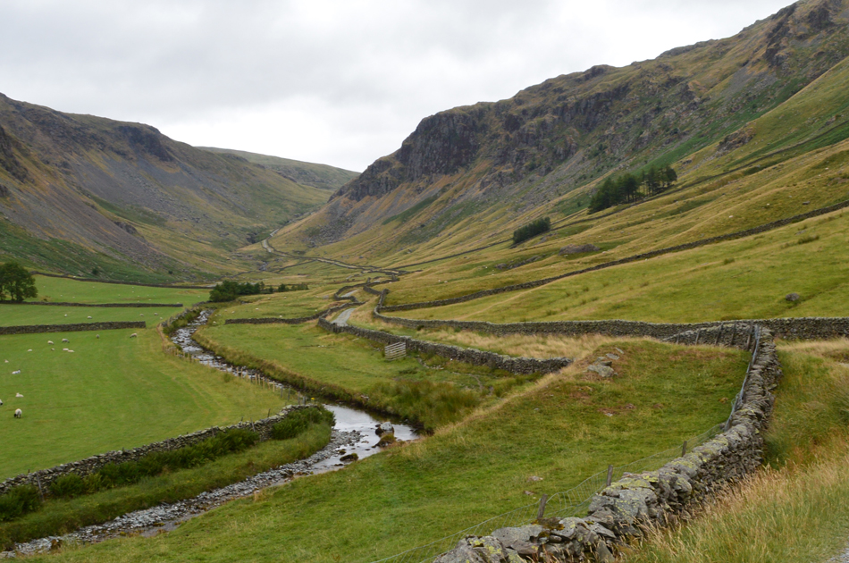
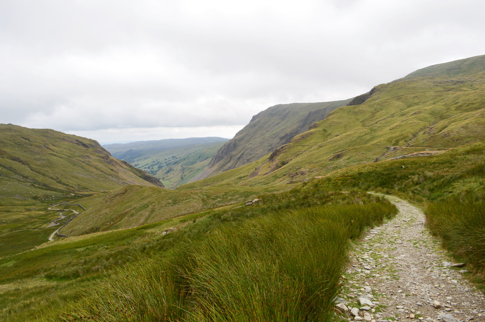
| Looking down on the top of Longsleddale Pass. |
| Which you can just make out in the centre right of the photograph with the Longsleddale valley over on the left. |
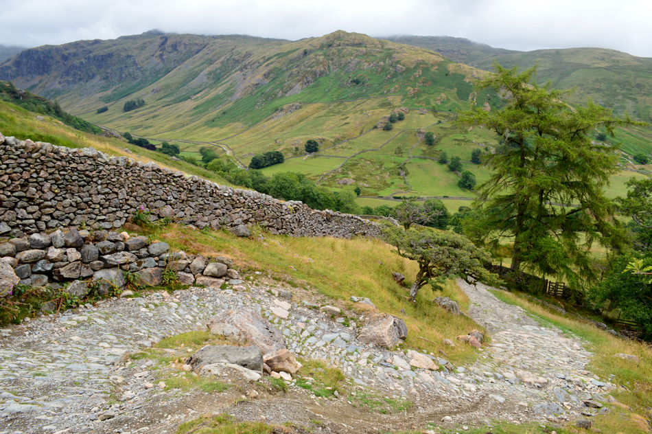 |
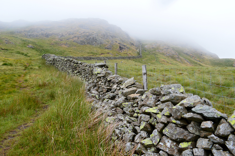
| Great Howe, Grey Crag and Longsleddale from the Longsleddale Pass. |
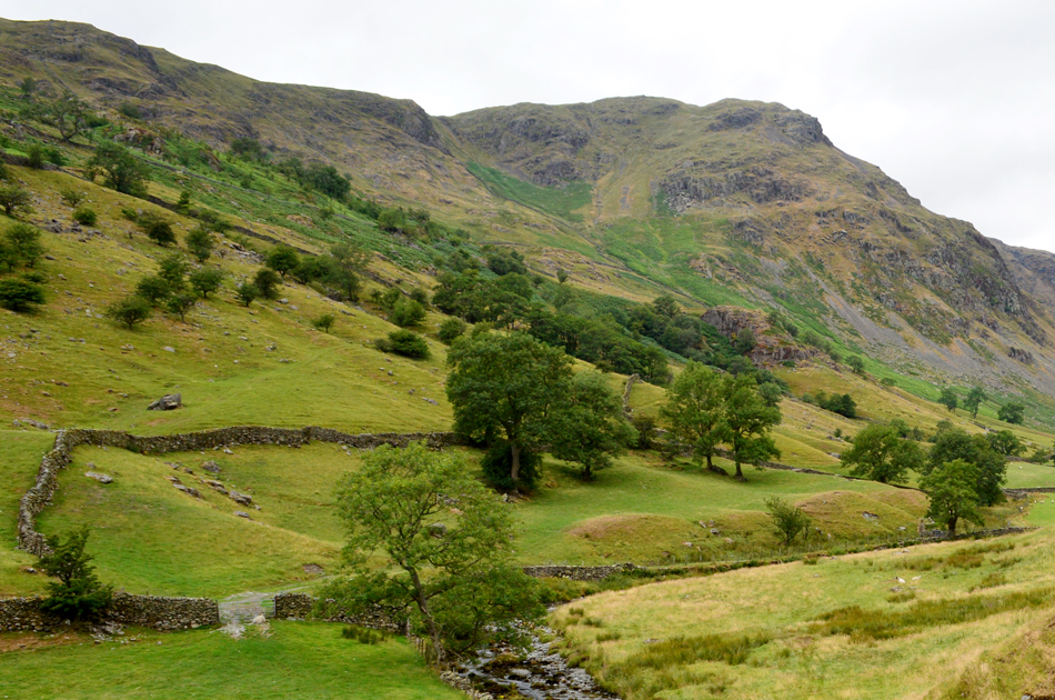
| Here, the final twist in the pass before it descends towards Sadgill and the Longsleddale valley. We agreed that the stonework along this section of path could be original and possibly served the farming communities and towns folk between Kentmere, Longsleddale, Mardale and Kendal dating back hundreds of years. |
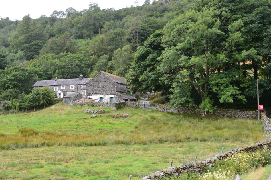 |
| Low Sadgill. |
| Marking the end of the Longsleddale Pass we arrive in the Longsleddale Valley. |
 |
| Goat Scar from Sadgill. |
It was almost 12:30pm by the time we arrived in Sadgill where we agreed to stop and break out lunch, anyone who is familiar to the bench which over looks the carpark will know it seats two adults quite comfortably but three blokes, ahh sod it we're all mates.
|
 |
| Goat Scar (L) and Buckbarrow Crag (R) from Sadgill. |
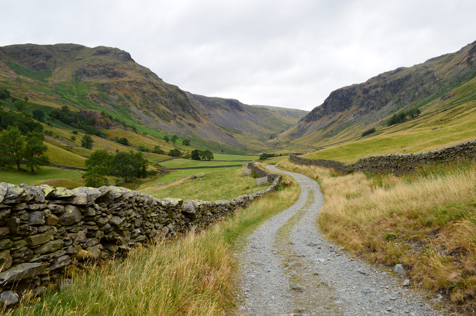
| With lunch over we re-shoulder and start the long and winding walk back through Longsleddale, between here and the top of the Gatescarth pass we'll gain another 1,500 foot of ascent, it's a challenging end to a great walk and one that I had been looking forward to. |
 |
| Goat Scar. |
| Now completely free from cloud. |
 |
| Longsleddale. |
There's only one way to keep momentum when there's rain in the air and your preparing to dig deep...recite chapters from Monty Pythons Holy Grail and the Life of Brian while I watch on totally bemused as David and Rod get into character.
Bloody crackpots pair of em. |
 |
| Buckbarrow Crag dominates the head of the Longsleddale Valley. |
| You can just see below Buckbarrow Crag where the path starts to rise first gently before gaining steepness prior to reaching a sharp zigzag in the track, it's here the same pitch of rock can be found as we had seen earlier back on the Longsleddale Pass. |
 |
| Looking back into Longsleddale with Grey Crag (L) Kentmere Pike and Goat Scar (R) |
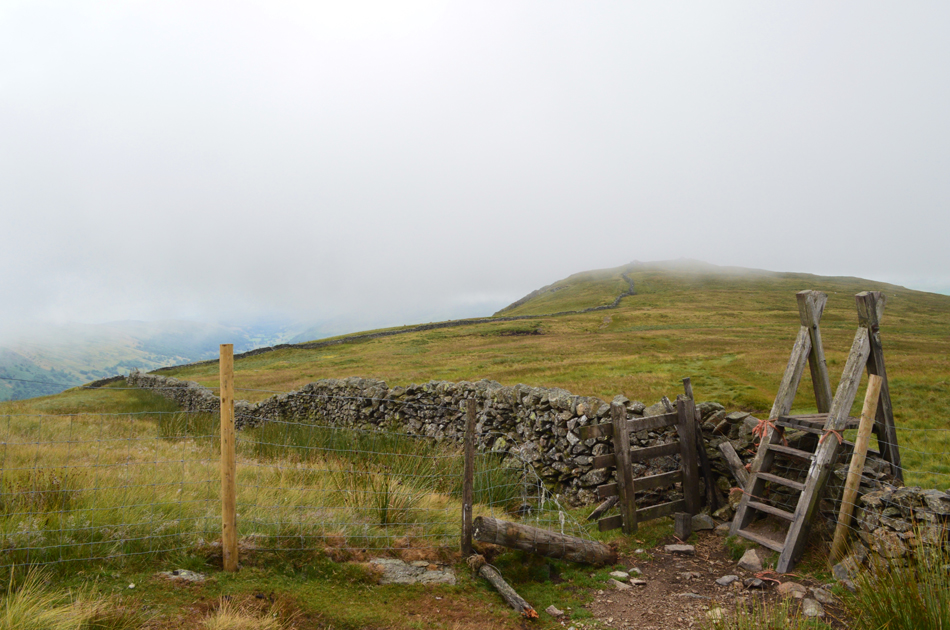
The rumble of a farmers quadbike accompanied our ascent which overtook us at the sharp zigzags I had mentioned previously, it was here the path was at it steepest and was where we were required to dig deep, silence followed. The path levelled by which time my back was soaked through in sweat, so much so I had developed a rather annoying, and painful sweat rash across the lower half of my back, there was nowt I could do but ignore the discomfort. The start of Gatescarth Pass passes through Brownhowe Bottom, it was here we could regain strength ready for the ascent on Gatescarth Pass which we did in almost in silence. By now a warm afternoon sun was trying to break through which made an already muggy ascent feel even harder but we persevered without stopping until we reached the top of the pass, it was a hard pull but we all throughly enjoyed it.
Harter Fell and Branstree filled our vision as did the High Street range whose summits were still below dark grey cloud, the contrast between light and dark was enough to stop us in our tracks. At the top of the pass we passed through a gate and began the descent back into Mardale passing walkers both in ascent and descent, by now the sun had broke through leaving the afternoon feeling hot and humid as the conversation turned to how busy we're going to find Mardale Head.
The soles of my feet pulsate as I looked up at Harter Fell gully, It was Ron Black who sadly passed away last September who asked me would I one day try and ascend the gully but as I looked up this afternoon, even during this dry spell all I can see is black sheer rock, maybe another time eh Ron. |
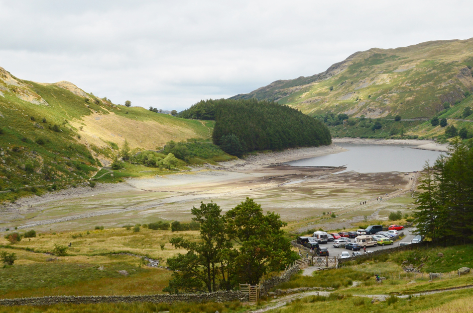 |
| Mardale Head from the Gatescarth Pass. |
With Harter Fell flanking our rear Mardale Head soon came into view, a busy car park is nothing unusual, it's the cars that you can't see that choke the narrow lane which invites the shock. There's a fairground feel to Mardale and after ten years plus visiting the valley, strangely I don't feel welcome.
Beyond the car park a steady stream of sight seers are privileged to be walking on the Mardale side of the Gatescarth Pass I just wonder how many of them realise they are walking on a piece of history, one of two links between Mardale Green and the outside world. |
|
| |
| Back to top |
 |
|