|
Walking the Birketts, Tarn Crag East Ridge to Sergeant Man |
 |
 |
7th October 2018 |
 |
|
Today I'm back in Lakeland after taking advantage of the driest day from the weekend which worked out well seeing I was working the Saturday. Like most of my walks around mid week I get a hankering for a particular area or a certain summit and this week that summit was Sergeant Man. Back in Summer David and Rod had completed a similar round to this walk which I couldn't attend due to work commitments meaning todays visit was well over due. The best of the weather appeared to be further east which I had driven through before arriving in Grasmere where I was met by overcast skies and lingering cloud.
The official starting point to this walk is on the Easedale Road, however that particular car park no longer exist so I decided to park on the trusted Layby on the A591 just outside the village. We're still within the cusp of Autumn right now but the signs are all there with crisp light one minute and brooding cloud the next, and despite the odd storm or too, the leaves are still hanging in there, but not for long I suspect. Today I was treated to a wonderful Autumnal display of light, cloud, frozen fingers all the while the wind nipped at my ears while rushing through the grasses, it was the kind of walk were every once in a while I found myself stood still, just absorbing it all in. |
|
| The Complete Lakeland Fells |
 |
| By Bill Birkett |
-Codale Head It is a top in its own right but one often bypassed by those intent oftern the more obvious attraction of Sergeant Man, now only a short stroll away. |
|
|
|
| |
|
Overview |
|
|
| Ascent: |
2,165 Feet - 660 Metres |
| Birketts: |
3, Tarn Crag - Codale Head - Sergeant Man |
| Weather: |
A Chilly Start Remaining Overcast Throughout, Some Bright Spells. Highs of 12°C Lows of 2°C |
| Parking: |
Parking Spaces, A591, Grasmere |
| Area - Group: |
Central - W-LAN |
| Miles: |
7.5 |
| Walking With: |
On My Own |
| Ordnance Survey: |
OL4 |
| Time Taken: |
4 Hours 30 Minutes |
| Route: |
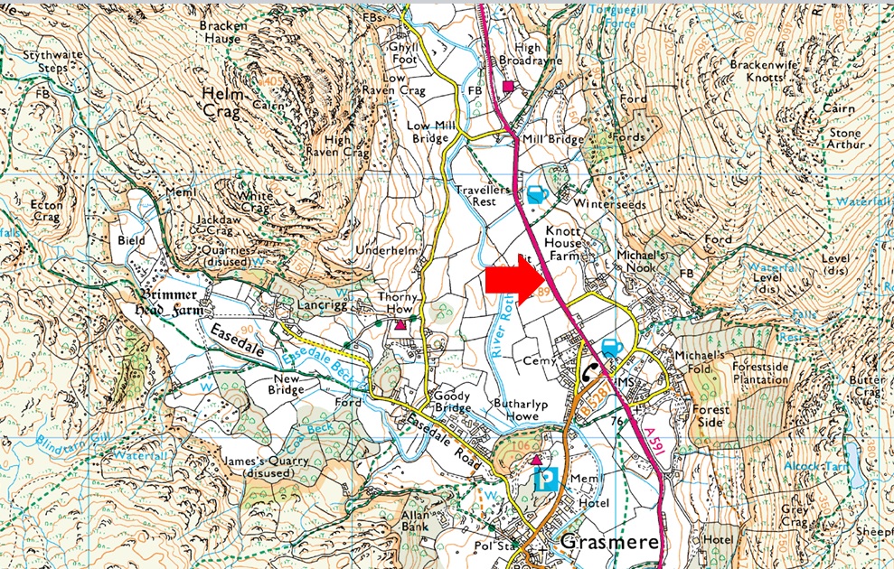
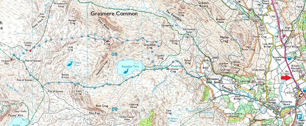
A591 - Grasmere - Easedale Road - Goody Bridge - Sourmilk Gill - Tarn Crag East Ridge - Tarn Crag - Codale Head - Easedale Tarn - Sourmilk Gill - Easedale Road - Grasmere - A591 |
|
| |
|
Parking Details and Map |
|
|
| Nearest Post Code: |
LA22 9RF |
| Grid Reference: |
NY 337 408 |
| Notes: |
Possibly the most convenient, and popular lay by in Lakeland! The layby is found just outside Grasmere in between the village and the Swan Hotel. Despite this being a rather long lay by parking here is very popular mainly because of the position and access to Helm Crag, Far Easdale and the Fairfield fells. Parking is free. |
|
| |
|
Map and Photo Gallery |
|
|
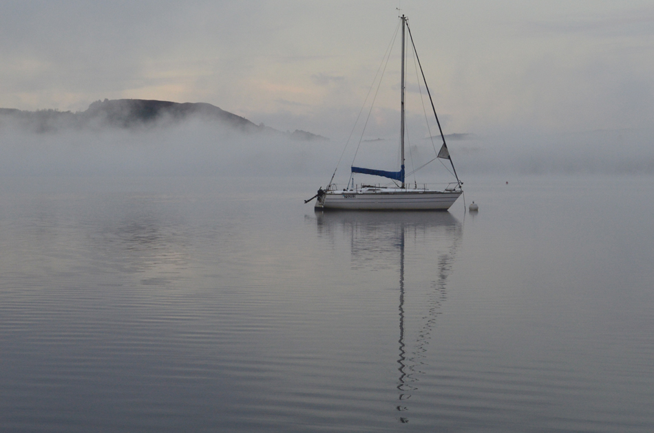 |
| Morning mist over Windermere. |
| The temptation to stop after seeing the mist over the lake surface got the better of me so I pulled over at Waterhead at the northern tip of Windermere to take a few photos. |
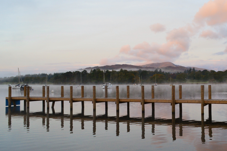 |
| Waterhead jetty, Windermere. |
| |
 |
| Helm Crag from Pye Lane, Grasmere 07:50am 2°C |
I had been hoping for a brighter start with high level cloud and sunny spells forecast which seemed to be reserved towards the east of the park but what the hey, it's dry. The A591 had been quiet all the way through to Grasmere and I was first to arrive at the parking spaces just outside the village. It's a cold morning with temperature hovering just above freezing and the nip in my fingers while tieing my boot laces reflected this, high winds are also forecast but here at valley level there's nowt but the lightest of breezes. I'd packed my boots into the boot of the car the night before which had frozen overnight and I could feel the cold as I slipped my feet inside. I'm actually still wearing my new Scarpa Delta's which is something I'm not used to having trusted my Meindl's for the last four years although I can report after half a dozen walks in the Scarpa's they are starting to free off around the toe area.
With my car locked I walked back towards Grasmere with Helm Crag over my shoulder, there's a light coating of dew in the fields and soon I found myself blowing warm air into clenched fist. The top of Pye Lane is the first turning on my right which I take towards Forge Bridge before passing through Butharlyp Howe wood thereafter. As mentioned the actual starting point which Birkett recommends is a car park that once existed next to the Glenthorne Quaker Guest House which is reserved for guests only hence my parking just outside the village, extra time added to the official starting point is around ten to fifteen minutes. |
 |
| Easedale Road, Grasmere. |
| With Easedale Beck flowing beside me I passed through Butharlyp Howe and soon emerged onto Easdale Road where I passed an old gent walking his Labrador and mornings are exchanged. Goody Bridge is just up ahead just past the building seen on the right which is where I'm heading next. |
 |
| Goody Bridge seen over Easedale Beck. |
| It's time to leave Easedale Road now and cross Easedale Beck then follow the path towards Easedale Tarn. |
 |
| Helm Crag seen over a rather Autumnal Lancrigg. |
| After crossing Goody Bridge I continued along the stone path with Easedale Beck falling away to my right, the path soon narrows and turns rockier underfoot as it passes through a canopy of trees before emerging onto open fields where the sound of the cascades and waterfalls of Sourmilk Gill dominates the valley. |
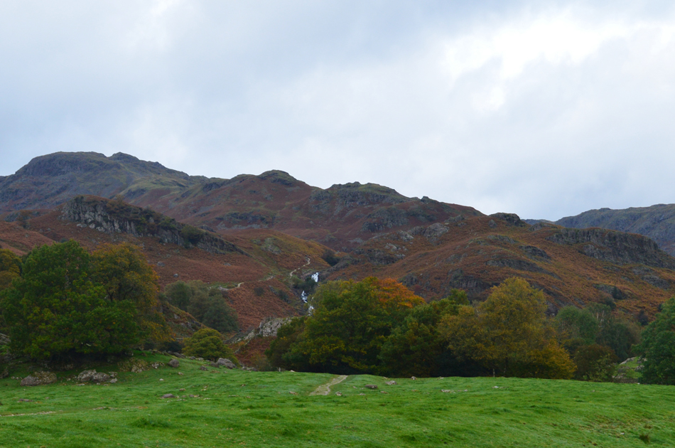 |
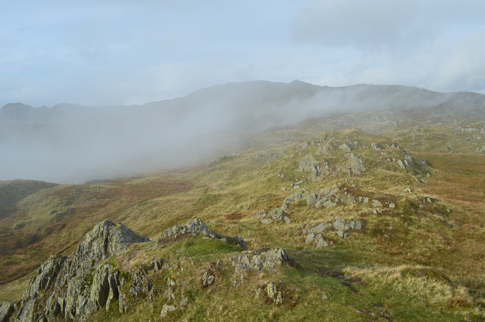
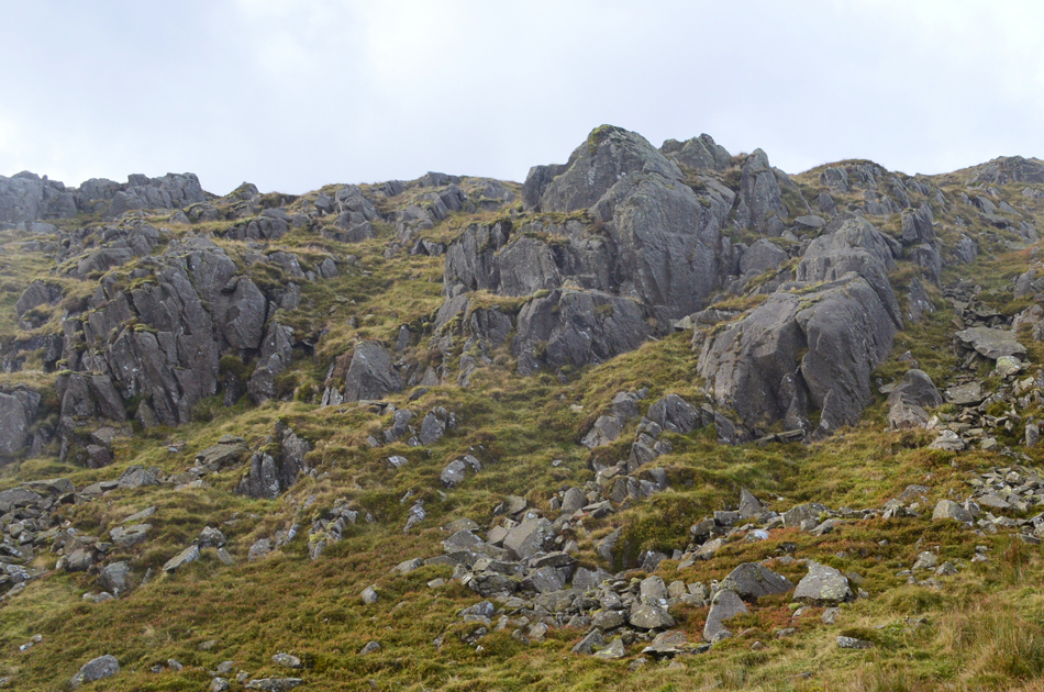
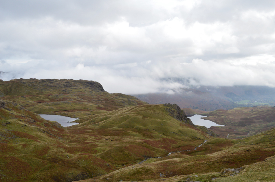
| Tarn Crag East Ridge. |
| Today I will be picking up the East ridge just below the upper falls seen in this photo from where I'll be able to take in the full length of the ridge beyond Greathead Crag. |
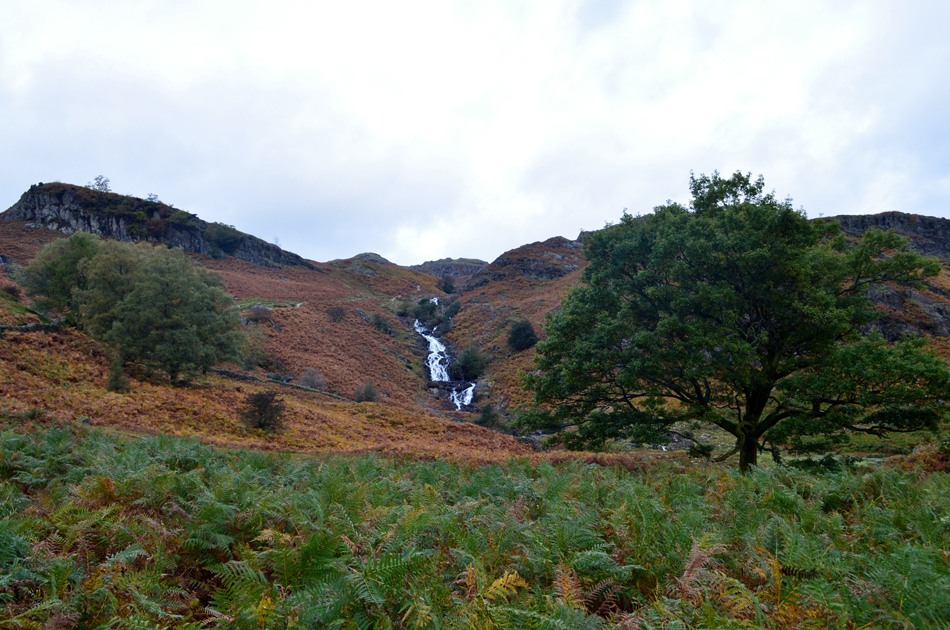 |
| Sourmilk Gill. |
| The path starts to rise up alongside Sourmilk Gill which I follow until the upper falls are reached. Birkett recommends to cross the gill if not in spate at the stepping stones where the 'Juniper grows' thats the green prickly bush to me and you. |
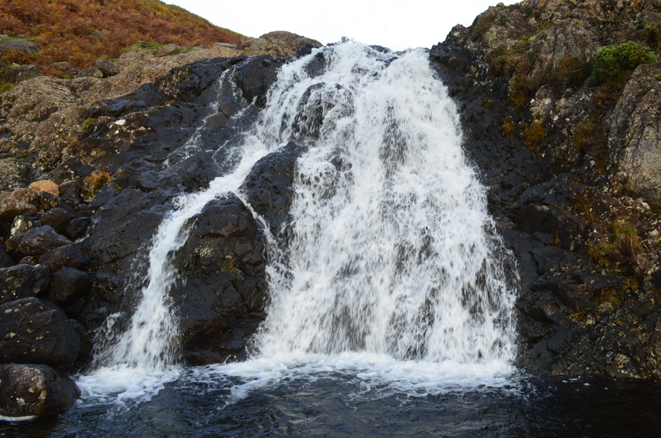 |
| Crossing Sourmilk Gill upper falls. |
| Having arrived at the upper falls I followed a faint path which branched off right to a series of stepping stones where despite Sourmilk Gill being in top form this morning the stones still provided easy access protruding well above the waterline where I felt confident enough half the way across to take this photo, easy does it. |
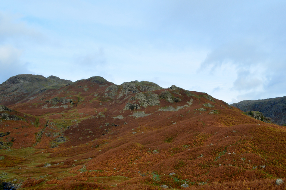 |
| Tarn Crag East Ridge. |
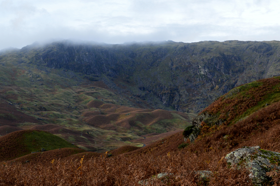
Having climbed above Sourmilk Gill I crested the summit of Cockly Crag from where I took in this view overlooking Tarn Crag's east ridge, it was from here I spotted a second possible crossing point where the east ridge could also be gained although from my vantage point no Juniper or stepping stones could be seen.
The sun is still low at this point and is peaking out between the cloud leaving the bracken rich in autumnal colour, it's here I decide to de-shouder and take off my jacket, it really is starting to warm up now. |
 |
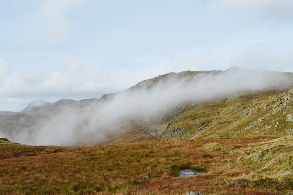
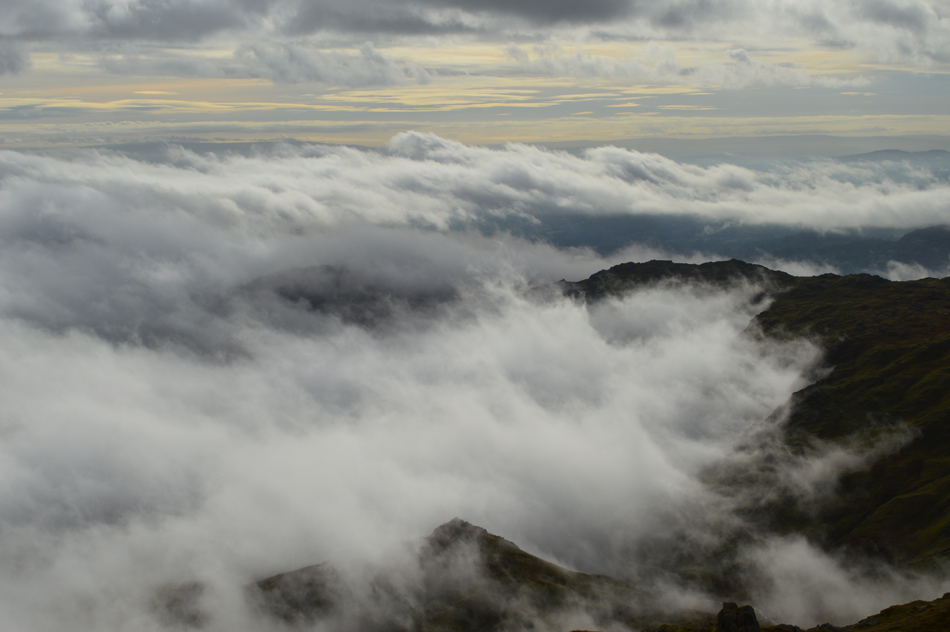
| The view over the drumlins towards Blea Rigg from Tarn Crag East Ridge. |
| For the last ten minutes or so I've started to notice cloud gathering over the summit of Blea Rigg while behind me more cloud is gathering over the village of Grasmere and to the north over Far Easedale extending as far as the Fairfield group, this I merely thought to be just low cloud and to be honest I was more disappointed that I was going to lose any brightness that I was expecting, oh well, I continue following the east ridge while views of Tarn Crag's summit up ahead slowly succumb to the cloud. |
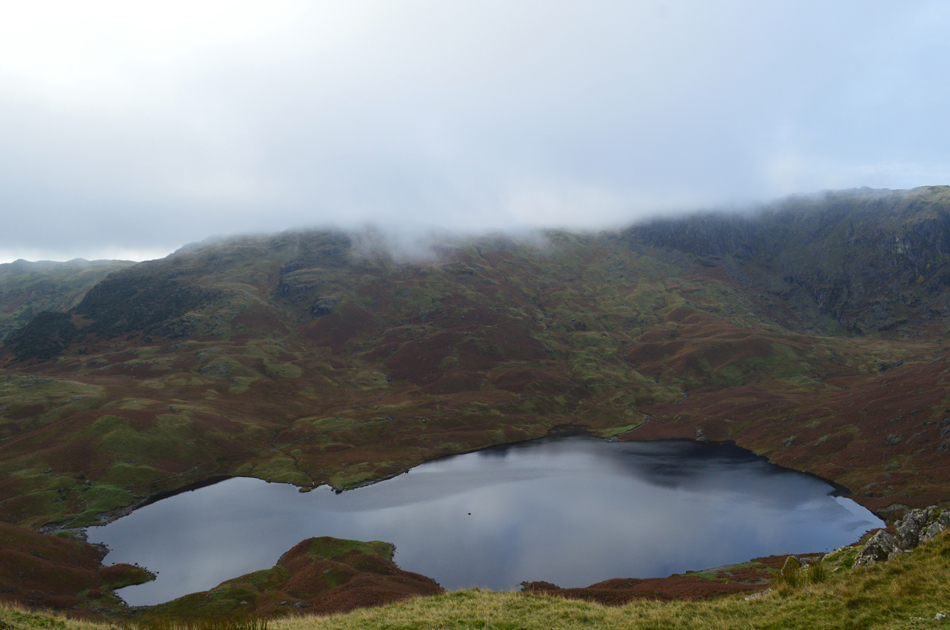 |
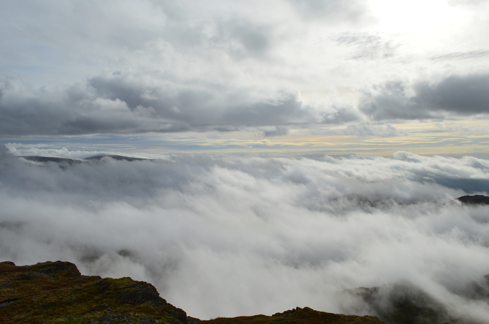
| Looking down on Easedale Tarn from Tarn Crag East ridge. |
| Blimey it didn't take long for the cloud to catch up with me as I prepare for the last push towards Tarn Crag summit. |
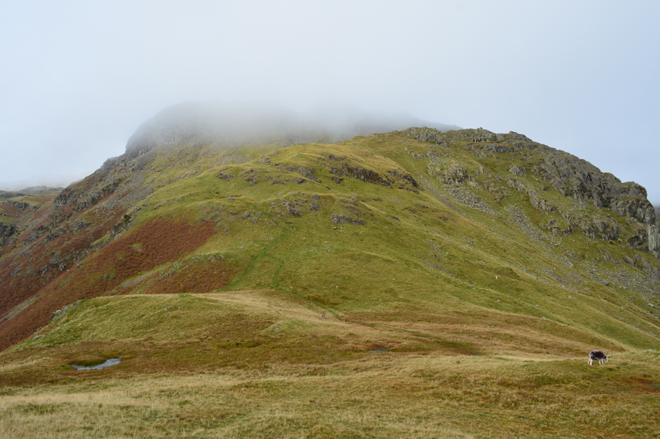 |
| Tarn Crag is just up ahead. |
| It goes without saying that the east ridge is quite undulating with many a grassy outcrop to negotiate some of which are steep but thankfully short. Predominently I traversed the Far Easedale side of the ridge only diverting towards the Easedale Tarn side once this grassy col was reached. Up ahead another short but steep pull onto the summit which if you look carefully can just be seen through the cloud over on the right. |
 |
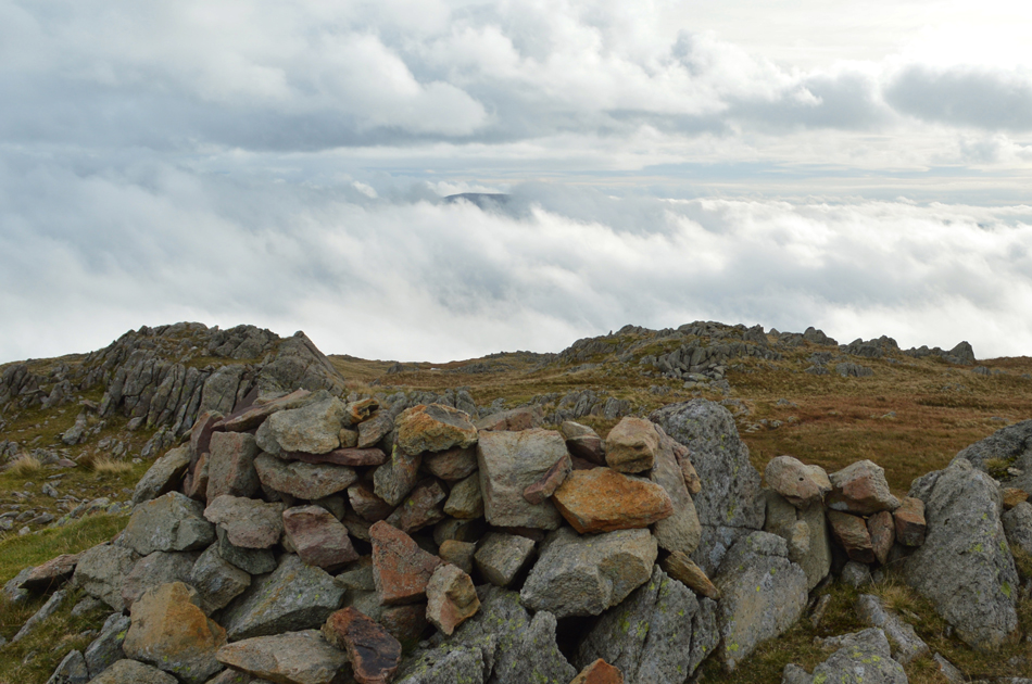
| Tarn Crag summit. |
| With the col crossed I began the short but steep ascent on Tarn Crag summit not before stopping to add my jacket owing to the cool winds that I was ascending into. The east face of the summit is craggy and although a narrow path winds its way up through the crag the easier option is to keep left and follow a grass rake until the going levels from where the summit is just a short distance away over to the right. I had ascended in silent cloud sometimes stopping to look back at my surroundings but visibility was cut to around 50 yards, gone was Blea Rigg and Calf Crag on the other side of valley, I was in cloud and I told myself that once at the summit I'd survey my route to my next summit of Codale Head but no sooner had I looked again and I realised that wouldn't be necessary as the butterflies in my stomach starting doing loop the loops. |
 |
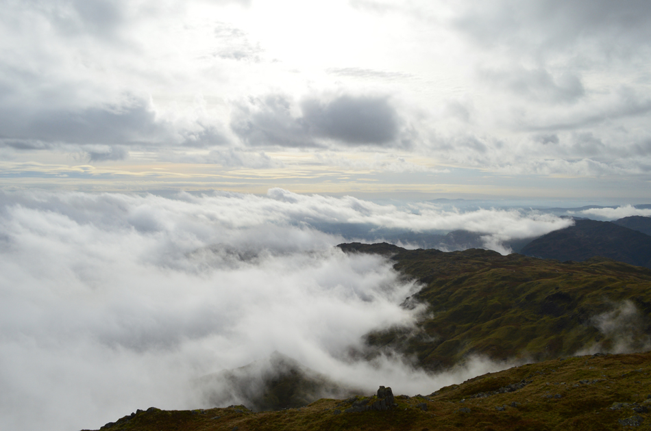
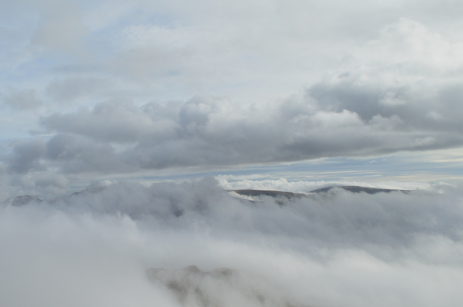
| The Langdale Pikes and Codale Head from Tarn Crag summit. |
| It appeared I'd climbed myself out of a cloud inversion, this for me are what dreams are made of, the silence, the cloud the wind sweeping through the grasses I was in heaven but I couldn't be swayed too much by the inversion, it would be unwise of me not to get the map out and plot my ascent on Codale Head while I had this window, after all, for all I know the cloud cover could return as quickly as it parted. |
 |
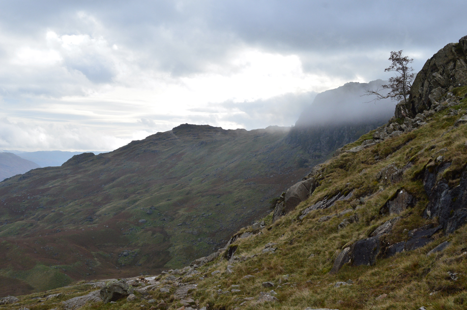
| Harrison Stickle, Pavey Ark and Codale Head. |
| With Tarn Crag behind me I followed a faint path over marshy ground all the while keeping my eye out for a grass rake which Birkett had mentioned to gain Codale Head by which isn above the stream in the right of the photo which takes on agrass rake (not seen behind the cloud) further up the fell side. |
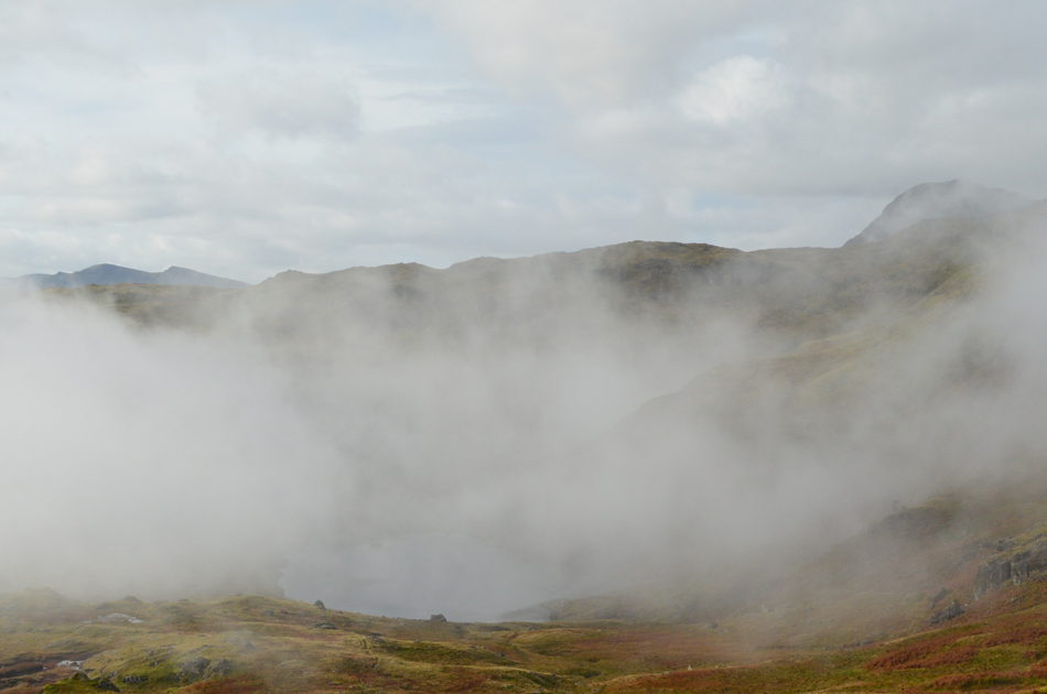 |
| Here I look over Codale Tarn with Harrison Stickle in the distance. |
| This was the clearest image I managed to get of Codale Tarn as more cloud starts to gather but with any luck, I may just climb out of it for a second time. |
 |
| Great Castle How and Blea Rigg are about to succumb to the inversion. |
| |
 |
| Gone. |
| This views looks east towards Heron Pike to Nab Scar ridge which have been swallowed up by the inversion, well for now anyway. |
 |
| Ascent on Codale Head. |
| I continued to follow the faint path which navigates alongside the stream to the right but to keep with Birketts route as much as possible I head left, cross the narrow stream and ascend via the grass rake seen far right. |
 |
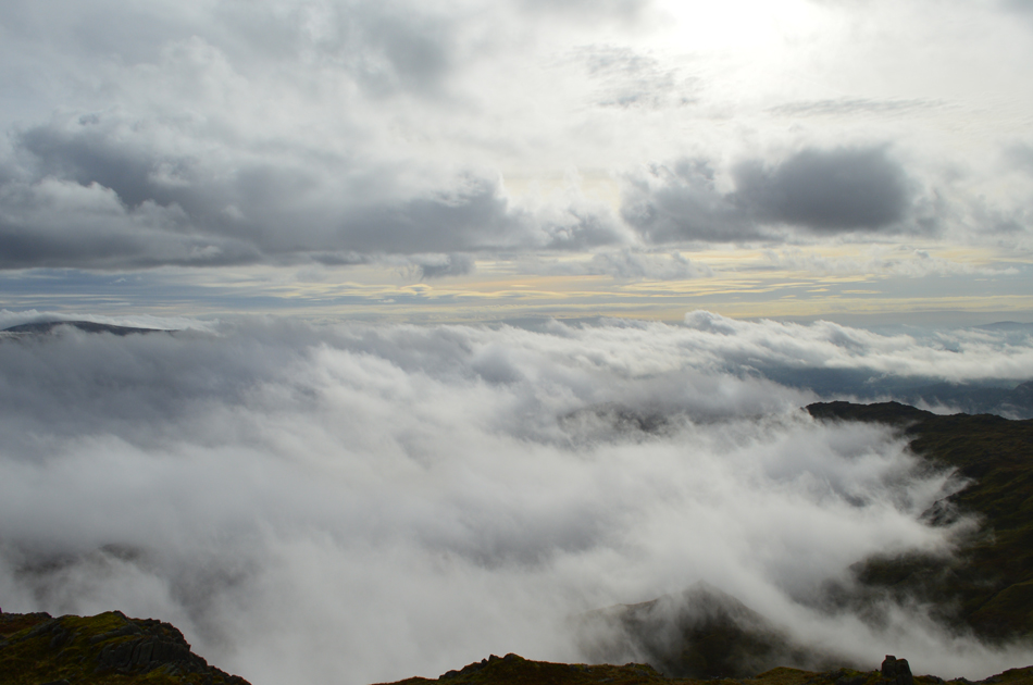
| Blea Rigg from Codale Head. |
With the summit shoulder gained I collected myself made a bearing for the highest ground to the far right of the grassy plateau, the ground is dry with the odd trod to follow which predominently steers away from the edge of the summit but after spotting some high ground I thought I should have a wander over.
The view I recieved was jaw dropping. |
 |
| I stood there as the wind drew the heat away from my body just absorbing the view. |
| |
 |
| What a treat. |
| |
 |
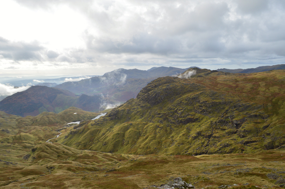
| Here looking over Dunmail Raise towards Dollywagon Pike, Fairfield, Hart Crag and Dove Crag |
| |
 |
| The cloud is clearing southwards as I look towards Pike O'Blisco the Coniston Fells. |
| |
 |
| The cloud inversion clears temporarily revealing Belles Knott below. |
| "The Matterhorn of the Langdale fells" Bill Birkett. |
 |
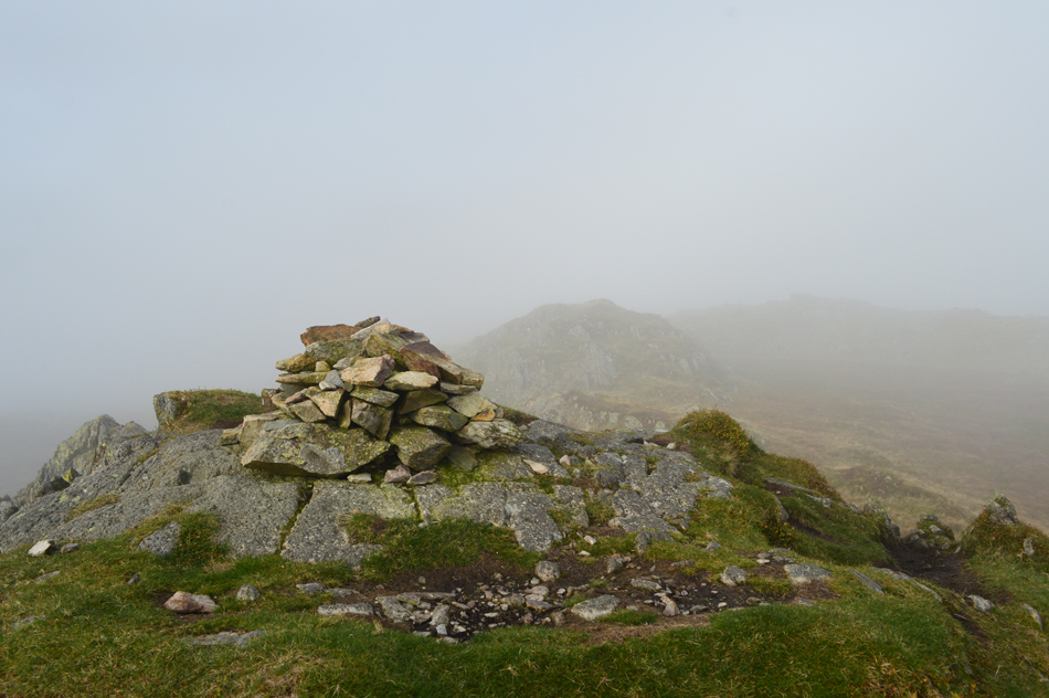
| Codale Head summit shelter. |
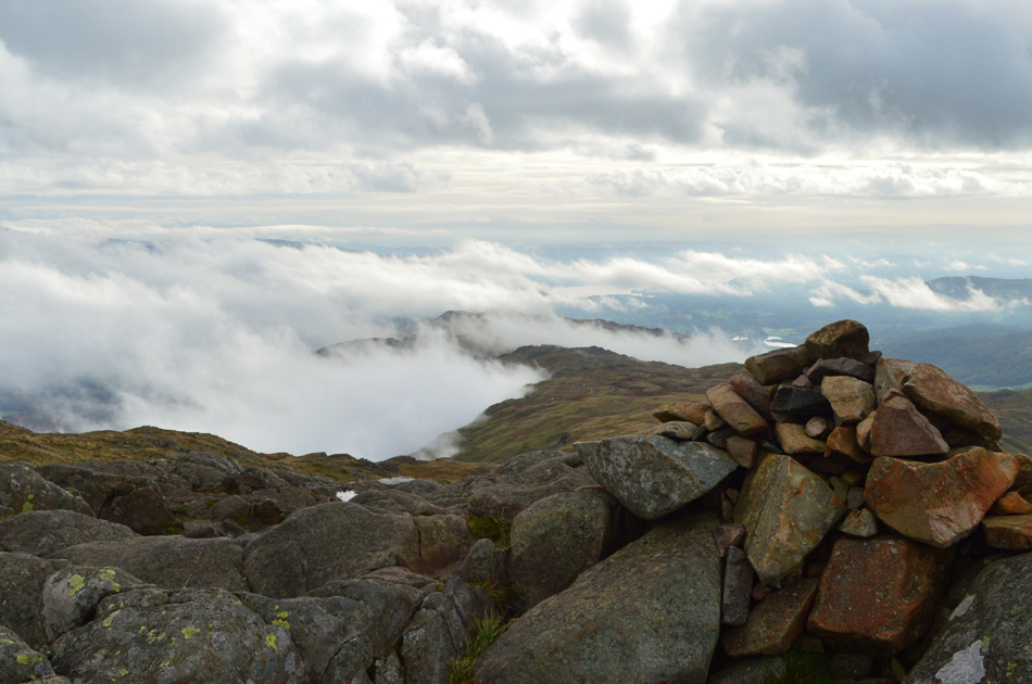
| Somehow I managed to pull myself away from the edge of Codale Head from where I started to make my way towards the summit while behind me more cloud gathered at the head of Far Easedale, strangely there was no one around to experience this wonderful phenomenon. I turned my back on the inversion once again and gained steady ground sighting two prominent rocky outcrops one of which sat the summit cairn to Codale Head. By now the temperature is close to freezing and being the stubborn git that I am I'd rather inherit cold hands than to stop and add my gloves. |
 |
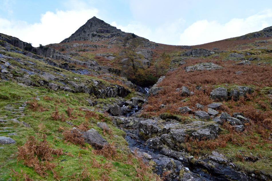
| Pavey Ark and Sergeant Man from Codale Head. |
| Time to head southwards towards Sergeant Man which is just a short distance away. |
 |
| Blea Rigg from Sergeant Man summit. |
Having left Coedale Head I had gained Sergeant Man within no time once again blowing warm air into clenched fist. From the summit I look down on mass of Pavey Ark and Harrison Stickle then spot around half a dozen people standing next to Stickle Tarn but for now, I couldn't see a soul on either fell. From the path between Codale Head and Sergeant Man two walkers emerge and soon join me at the summit where over the wind 'mornings' are exchanged, |
 |
| Pavey Ark and Harrison Stickle from Sergeant Man summit. |
| |
 |
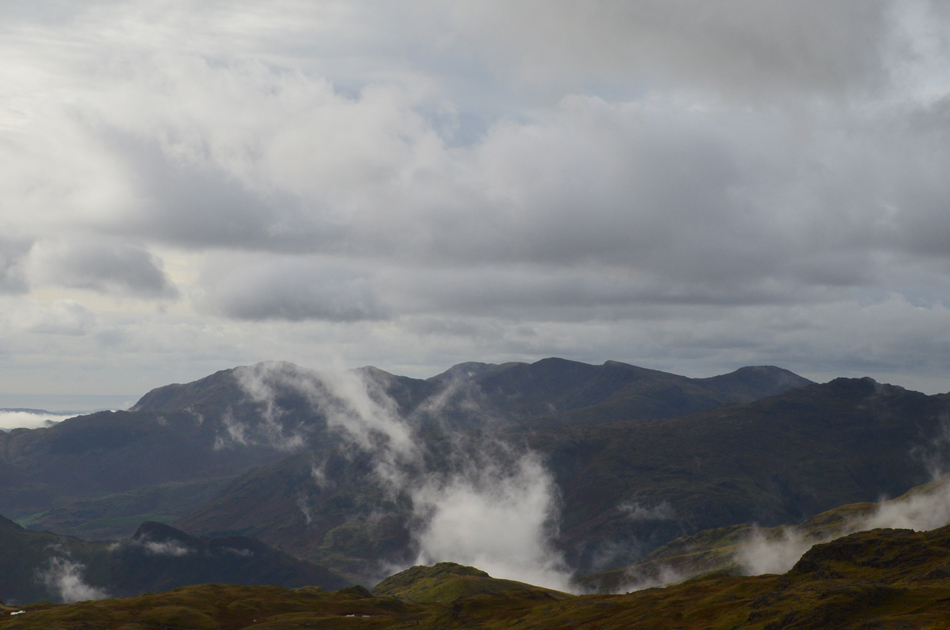
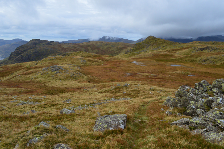
| Views over towards Tarn Crag, Codale Tarn, Belles Knott and Easedale Tarn. |
| Having descended Sergeant Man I retraced my steps now keeping Codale Head to my immediate left, here the path can heads south easterly and care must be taken not to drift off path where a navigational error could see you descend into Great Langdale. I continued to follow the path clenching my fist around my walking pole handles hoping for a respite in the windchill, I didn't have to wait too long until I came across the cairn awhere the path continues towards Blea Rigg or descends left towards Easedale Tarn, I descend left. |
 |
| Blea Rigg (in cloud) and Great Castle How taken during my descent. |
| |
 |
| The view back up towards Belles Knott and my descent route via the stone slabs. |
Care must be exercised during this descent especially once the stone slabs are reached which can be slippery when wet, treacherous when icy. Having descended the stone slabs and from out of nowhere I am joined by a lone Collie who passes me, then kinda waits for me at the bottom of the path where the valley levels, before I had chance to reach the dog a chap in ascent stops to talk, he's a chatty guy who asked the whereabouts of the path from High Raise to the top Stake Pass which I assure him of "never found it in five attempts" he laughed. I switch conversation to "is that your dog mate" "thought it was yours he replied" no she's just passed me but I can't see any signs of the owner...
We continue conversation before going our separate ways all the while a group of walkers are about to start their ascent on the slabs but are stopped by the Collie who has taken a shine by pawing at one particular young girl in the group and as I pass I can see their concerns as I ask "is this your dog?" to which they replied "no, we thought it was yours" I look back towards the top of the stone slabs expecting any minute for the owner to appear but spot no one, initial observations saw a dog which was quite skinny but agile, no tags and no collar, her tail is hidden between her back legs and my gut instinct tells me I could have a lost dog on my hands.
I'm still with the group and one of them says "we're sorry, but your going to have to take this dog back to Grasmere with you and report her missing" I let out a sigh while looking back towards the top of the path, still no owner, the young girl goes onto say she looks starving and I half agreed but the other half told me that this could be at best, a sheep dog that's just wandered off, after all I've been around long enough to know that they can be skinny, they work hard, but the dog lover inside me also said what if she wasn't, what if she had lost her owner, what if she had been on the fell for days and if so, could I leave her to fend for herself, the answer was no I couldn't so I went against my instinct and treated her as lost.
Coaxing the dog to follow me was becoming an issue, I know dogs are very wary of strangers and this one dug in her tail always between her legs, after tempting her with my lunch we arrived at Easedale Tarn which was busy with visitors, most of whom had dogs, most of whom were interested in my newly adopted Collie! So as not to make a fuss I fashioned a lead with my camera strap but she was having non of it, she was more interested in the visitors rather than me and a gap formed. It had taken me the best part of two hours to walk less than half a mile and with the heaviest of hearts I decided to leave the dog knowing that I was just half an hours walk from Grasmere from where I'd be able to at least report the dog missing. No more photographs were taken and seemingly my walk ended at those stone slabs. |
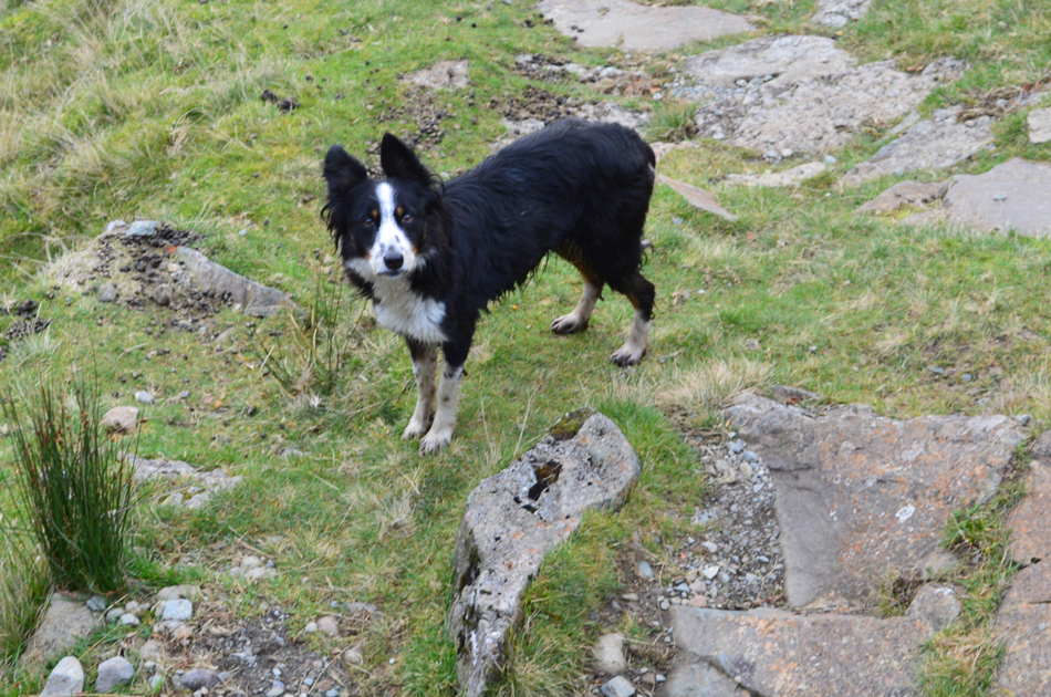 |
| Meet Flo. |
During my walk back into Grasmere I was able to connect to the net and found that the nearest Police Station was in Windermere just twenty minutes drive away where on arrival I found the station closed, parked between two Police vans I shared one of photos I had taken advising my friends to share into various social groups then I rang the Emergency 101 number who after kindly listening to me advised that if they contacted Mountain Rescue, they too would have trouble coaxing the dog down, the advice to me was share through social media and surely someone would pick it up.
My photo received over 1,100 shares and during my drive home I was contacted by a Police Control handler who turned out to be one of my Facebook friends reassuring me that I had done all I could, on arriving home I drove my car on to the drive to open one message from Emily, the dogs owner who kindly thanked me for all my efforts but informed me that Flo was a working dog working the fells that morning, who wasn't lost and that she was home.
That drive home for me was gut wrenching, soul destroying I'd gotten it in me that the dog was a domestic pet and that I'd left it on the hill, after reading that message my self being returned to normal, I was since thanked again later by Emily stating that if Flo ever did get lost she hoped it would be me who found her. I could kick myself for not seeing the signs that Flo was a working dog but as any dog owner would know, once those ears go back and the sad eyes come out, your putty in their hands and my natural instinct just followed. |
|
| |
| Back to top |
 |
|