|
Walking the Birketts, Dale Head Horseshoe |
 |
 |
27th October 2018 |
 |
|
With a mix of unsettled weather October hasn't been the brightest of months which is understandable given that this is Autumn and we're almost on the cusp of Winter. On the days where the did sun shine I've normally been in work probably dreaming I was somewhere else meaning a blue sky weekend was long overdue.
This weekend we finally got our wish and it didn't take long to come up with a walk because this particular walk, Birketts 'Dale Head Horseshoe' was planned for last weekend only we thought the route deserved a drier, clearer forecast owing to the fact that both Rod and I are particularly fond of the area which is also known as the 'Newlands Horseshoe'
The forecast had stayed true throughout the week giving us our green light with the exception that the forecasters had predicted an arctic blast of cold air which would accompany any brightness also adding that we may even see snow which fell predominantly over the Scottish ranges, well we weren't lucky enough to see snow but we did get our first taste of a severe windchill accompanied by some long overdue sunshine. |
|
| The Complete Lakeland Fells |
 |
| By Bill Birkett |
-Catbells The summit is a slate dome worn clear of vegetation by millions of walkers boots. Nevertheless, the beauty of the scene defies description. |
|
|
|
| |
|
Overview |
|
|
| Ascent: |
2,855 Feet - 871 Metres |
| Birketts: |
9, Skelgill Bank - Cat Bells - Maiden Moor - High Spy (Scawdel Fell) - Dale Head - Hindscarth - High Crags - Red Knott - Scope End |
| Weather: |
Overcast to Start Turning Bright & Sunny, Feeling Bittererly Cold In The Summit Winds, Milder PM. Highs of 6°C Lows of 2°C Feels Like -7°C |
| Parking: |
Parking Spaces, Gutherscale |
| Area - Group: |
North Western - NW/DAL |
| Miles: |
10 |
| Walking With: |
Rod Hepplewhite |
| Ordnance Survey: |
OL4 |
| Time Taken: |
5 Hours 50 Minutes |
| Route: |
Gutherscale - Skelgill Bank - Catbells - Maiden Moor - High Spy (Scawdel Fell) - Dalehead Tarn - Dale Head - Hindscarth Edge - Hindscarth - Red Knott - Scope End - Low Snab Farm - Newlands Beck - Little Town - Skelgill - Gutherscale |
|
| |
|
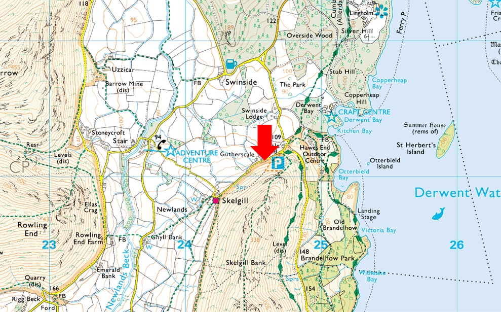
Parking Details and Map |
|
|
| Nearest Post Code: |
CA12 5UE |
| Grid Reference: |
NY 246 121 |
| Notes: |
There is room for around ten well parked cars at Gutherscale which is perfectly postioned for a quick walk up Cat Bells or a full day on the Newlands Fells. Leave the A66 for Portinscale and pass through the village before the entrance to Nicol End (Derwent Water) appears on the left, continue to follow the road which forks right signposted (Stair and Newlands Valley) Keep left here and continue to follow the road which sweeps around a right hairpin bend before passing over a cattle grid. The parking spaces will appear around 300 yards further on the left. Parking is free. |
|
| |
|
Map and Photo Gallery |
|
|
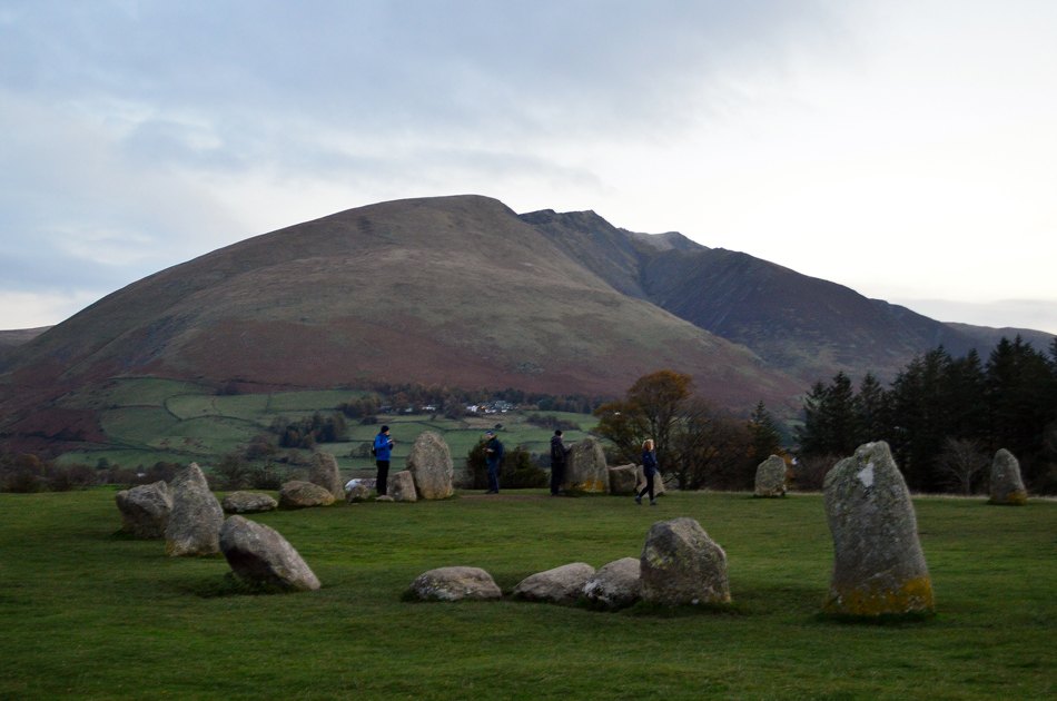 |
| Blencathra from Castlerigg Stone Circle 07:0am 2°C |
I hadn't slept well and was up well before my alarm so after confirming to meet Rod at Gutherscale at 08:15am I thought I'd detour slightly and pay a visit to Castlerigg and maybe get a peep of the sunrise. Having arrived before sunrise and, under quite a lot of cloud cover it looked like I wasn't going to get that 'perfect shot' and so too weren't the fourteen other photographers that I'd counted who were patiently waiting with camera's and tripods at the ready.
After chatting to one local guy, who to be honest was getting annoyed with people who were wondering into his view I walked back to my car, camera in one hand while blowing warm air into clenched fist with the other. |
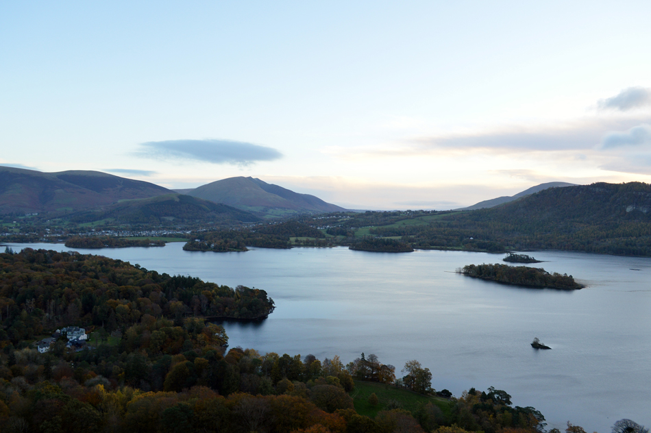 |
| The view over Derwent Water towards Blencathra from the ascent of Skelgill Bank (Catbells) 08:30am 2°C |
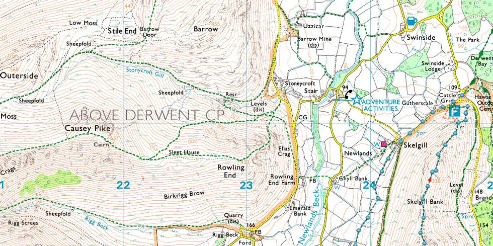
i rejoined the A66 at Keswick and took the left turn sign posted Portinscale and noticed the car behind me did too, it only took a few seconds to confirm it was Rod's car who then followed me through to Gutherscale. Todays official starting point are the parking spaces at Hawes End which have since been double yellow lined meaning the parking spaces at Gutherscalem a little further up the road were the next obvious choice. We grabbed two of three last spaces and were surprised to find the car park looking so busy.
With Winter approaching I've packed a half Winter kit leaving out the likes of spikes, crampons and snow goggles for now but adding my winter gloves, spare base layers, neck gaiter and spare socks, I figured I might just need them after looking at todays forecast. It feels cold and hat and gloves are added from the start, it's pretty calm for now but it wouldn't take long until we feel the affects of the wind and thereafter the windchill. Having locked the cars we struck out for Skelgill Bank and followed a couple who had left shortly before us, I kind'a got the feeling I'd forgot something but after a pat down I couldn't work out what it was, after followng the path we rose steadily which was when I realised I'd forgoten my mobile phone which I knew was laying there on the passenger seat, had it have been out of view I might not have bothered to turn back but I just couldn't take the risk "Rod, give me five mate"
A massive D'oh!! followed mainly due to the fact that I had to de-shoulder my pack and remove my keys from the dry pocket which is tucked away in the inside hood of my pack. Re-shouldred I marched back up the path and linked back up with Rod.
With little height gained and still well below Skelgill Bank we soon started to feel the affects of the wind and more notably, the windchill which already felt well below zero. |
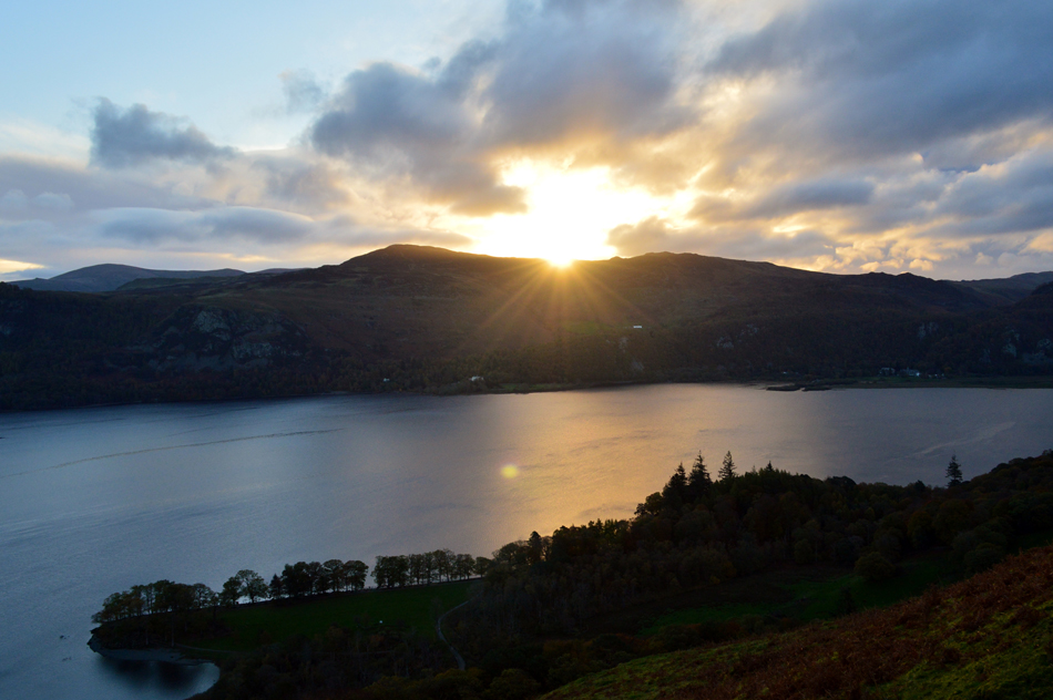 |
| Sunrise breaches the Central ridge over Derwent Water. |
| Even though it wasn't spoke of I think the pair of us were eagerly awaiting the sunrise which sadly didn't bring any extra heat but did cause some dramatic scenery over Derwent Water. We continued up the north ridge and ascended the zigzags and somehow managed to pass the couple who had left just before us. |
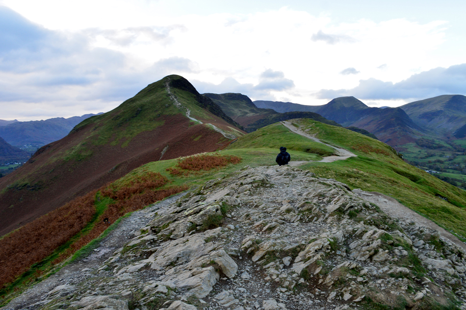 |
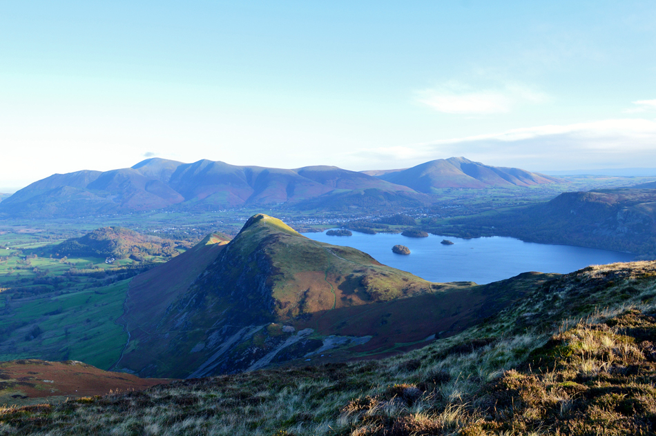
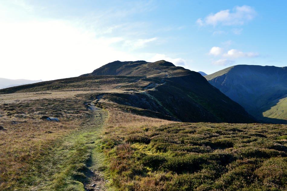
| Catbells from Skelgill Bank. |
| With the steep zigzags behind us we scrambled over rock passing the Thomas Arthur Leonard memorial plaque just below Skelgill Bank then eased our way towards the summit. By now the hope was to be blinded by direct sunlight however, the reality was, menacing low cloud was preventing this. |
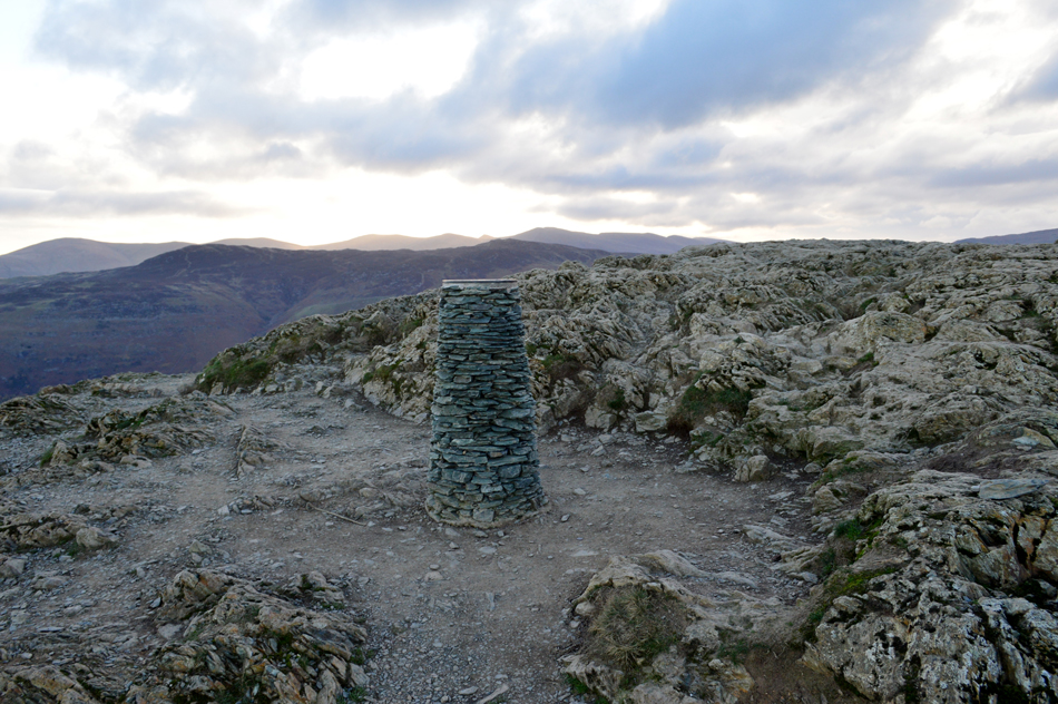 |
| Catbells summit. |
Still adjusting to the wind and windchill which was thankfully on our backs we continued along the ridge and started the steep pull onto the summit. Due to the popularity of the fell there are many worn paths to follow and most involve the odd scurry over rock and depending on choice there's also the odd scramble should the mood take you.
Footnote: Please be advised that the rock below the summit is polished and can be treacherous when wet. |
 |
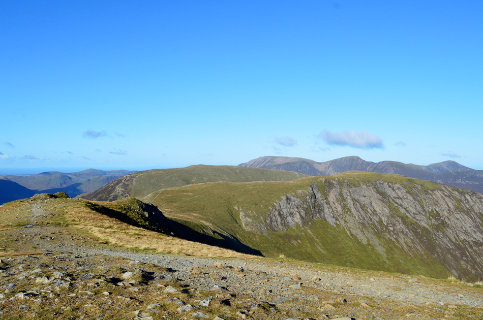
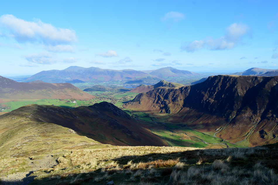
| The view over Hause Gate towards Maiden Moor, High Crags and Hindscarth from Catbells. |
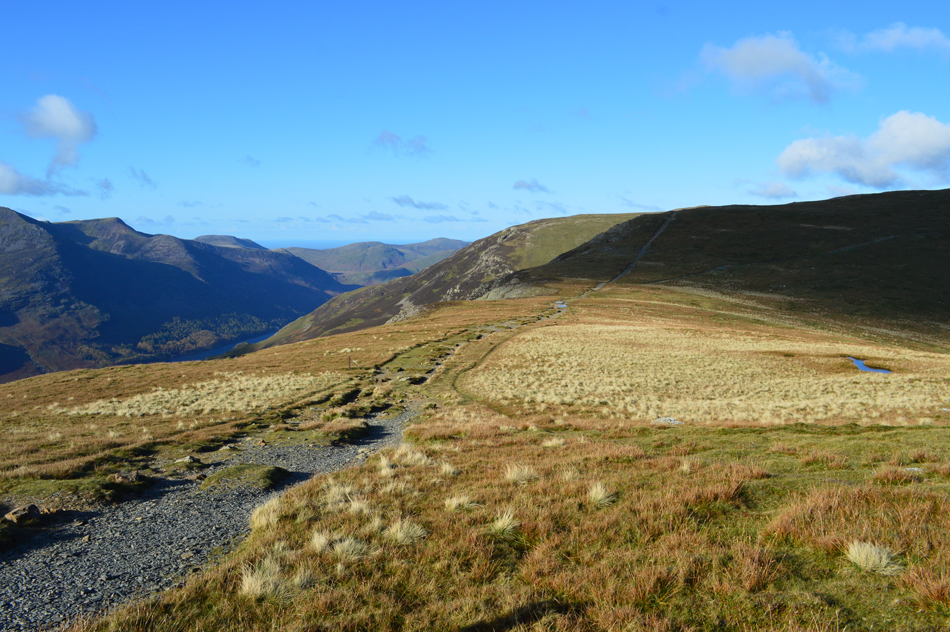
| Maiden Moor is next on the agenda which will be gained by the path seen over on the left which has had some recent repairs carried out as opposed to the old path which was heavily eroded. |
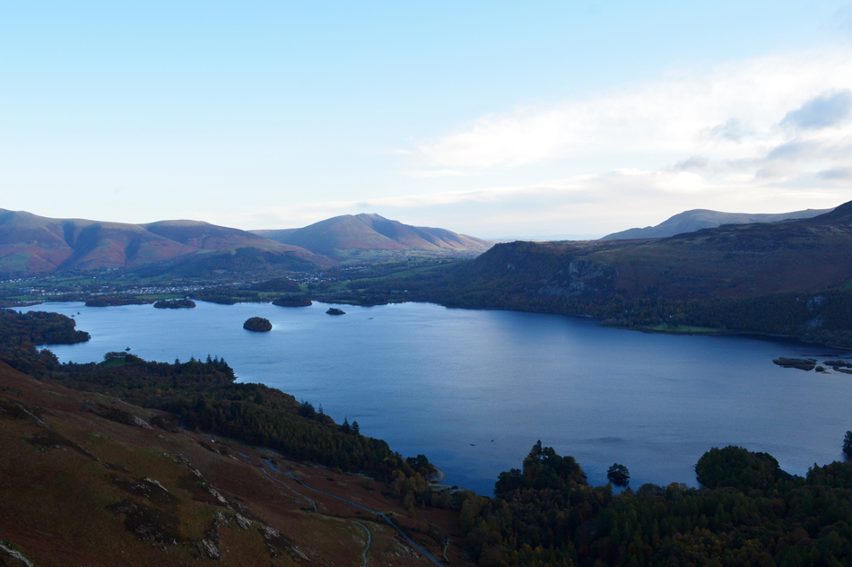 |
| Looking north over Derwent Water towards a distant Blencathra. |
| Wowzers it's starting to clear up further nort now.. |
 |
| Looking back over Yewthwaite Comb towards Catbells, Derwent Water, Skiddaw, Blencathra and Walla Crag. |
| Having crossed Hause Gate we started the steady but pleasant slog up onto Maiden Moor's north ridge by which time we were sheltered from the wind and indeed the chill that came with it, by the time we shouldered Bull Crag the cloud over in the east had cleared revealing nothing but blue skies. |
 |
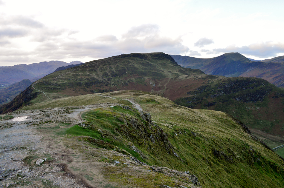
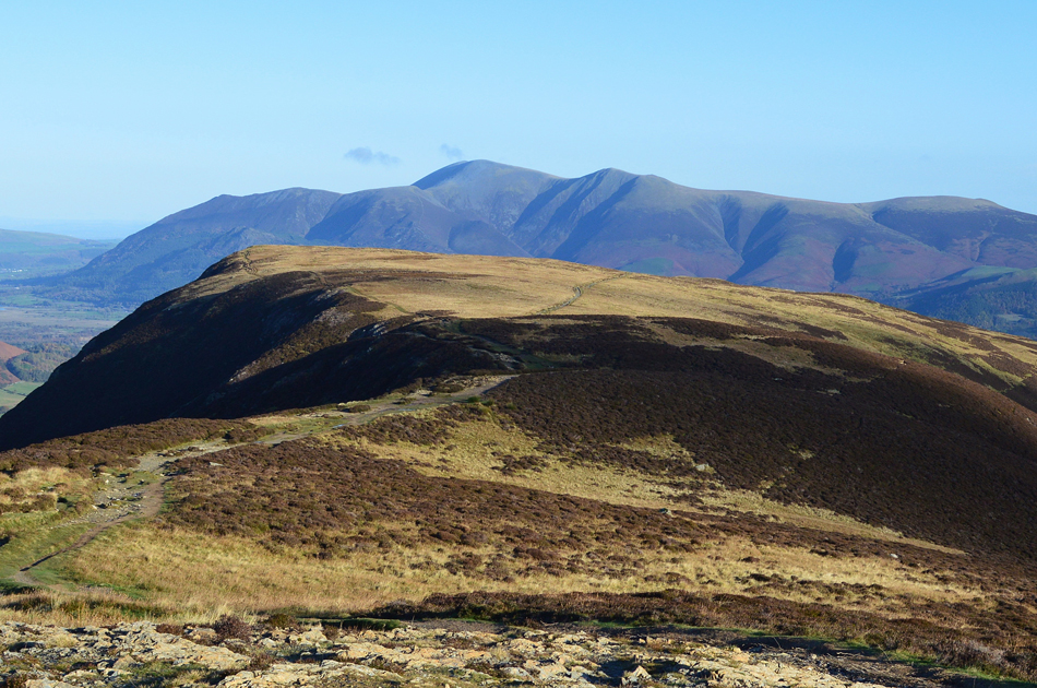
| High Spy and Dale Head from Maiden Moor summit. |
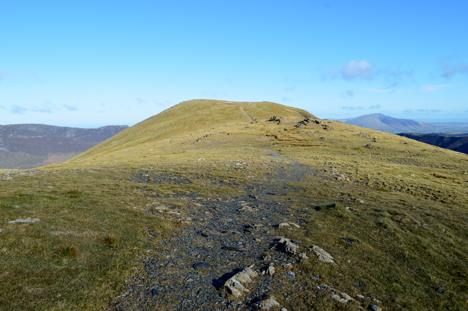
| On reaching Bull Crag it would seem the natural thing to do was to continue along the path which passes over the broad expanse of the summit plateau, this well trodden path misses out on the actual summit which can be found by keeping to the right then by following a narrower path on the western shoulder of the fell. |
 |
| Looking over High Crags towards Scar Crags, Causey Pike, Barrow and Grisedale Pike. |
| While in the distance, The Lord's Seat Fells, Bassenthwaite and Binsey. |
 |
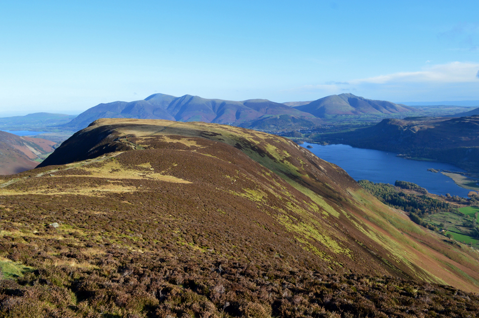
| A close up of Hindscarth seen with Robinson in the distance. |
| From Maiden Moor we look over Newlands towards Hindscarth with its prominent stone shelter on the northern tip of the summit were in a couple of hours time we would stop and eat lunch. If you look along the centre of the ridge towards the right you might be able to spot High Crags (seen above the retreating bracken) which features as todays seven out of nine summits we're to visit, best get a crack on. |
 |
| Perfect walking conditions as we head over Narrow Moor towards High Spy. |
| Apart from the mind numbing windchill that is! |
 |
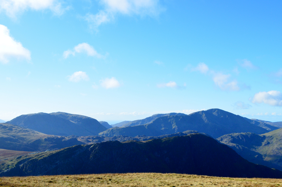
| Looking back on Narrow Moor towards Maiden Moor with Skiddaw in the distance. |
| This image shows the path I was referring to earlier seen running straight through the summit plateau with the actual summit seen over on the left. |
 |
| Now with less zoom which also features Bassenthwaite, Derwent Water and Blencathra. |
| Absolutely glorious, I love this view! |
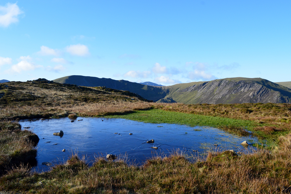 |
| Dale Head and Hindscarth from a frozen pool not far from High Spy summit. |
| That's Pillar in the distance with the little peak of White Pike seen to the right seen from a distance of five miles away which goes to show how clear the clarity is today. |
 |
| Skiddaw and Blencathra from High Spy summit. |
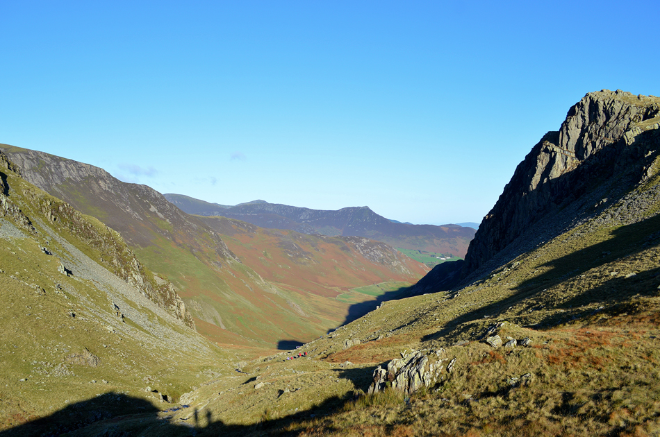
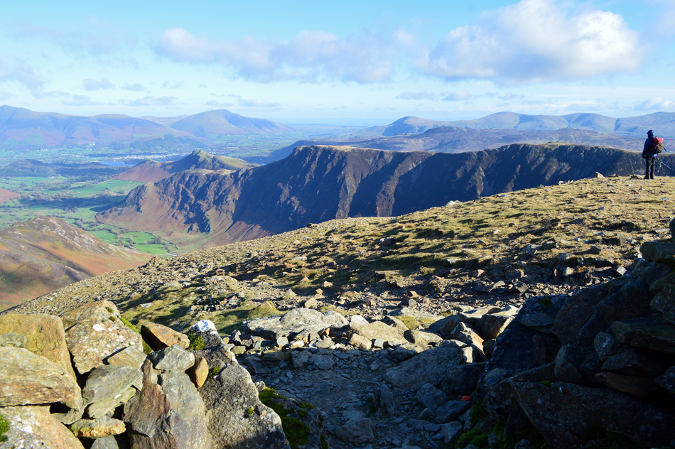
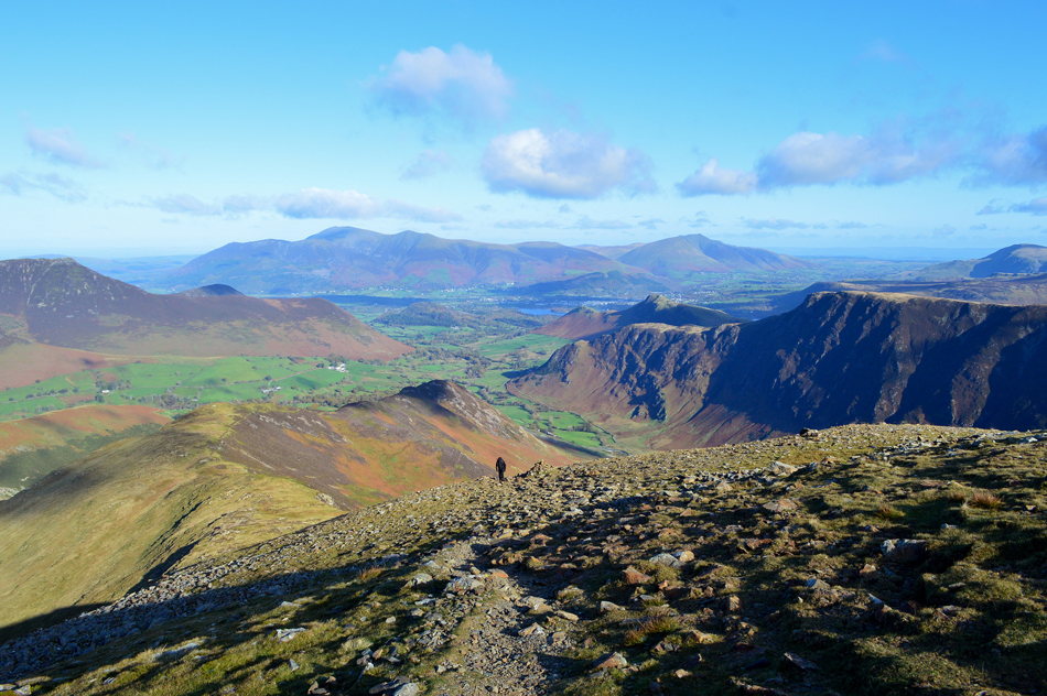
| Feeling the exposure we arrived at High Spy summit while on the tail of one chap who had just left, behind us a fell runner along with his dog is catching up inbetween pausing to look down into Newlands, those with a keen eye might be able to spot him above Eel Crags over on the left. We soon came to the conclusion that summit time had to be kept to an absolute minimum due to the windchill which felt as if it was cutting through you once we had stopped moving. Next it's all down hill towards Dalehead Tarn. |
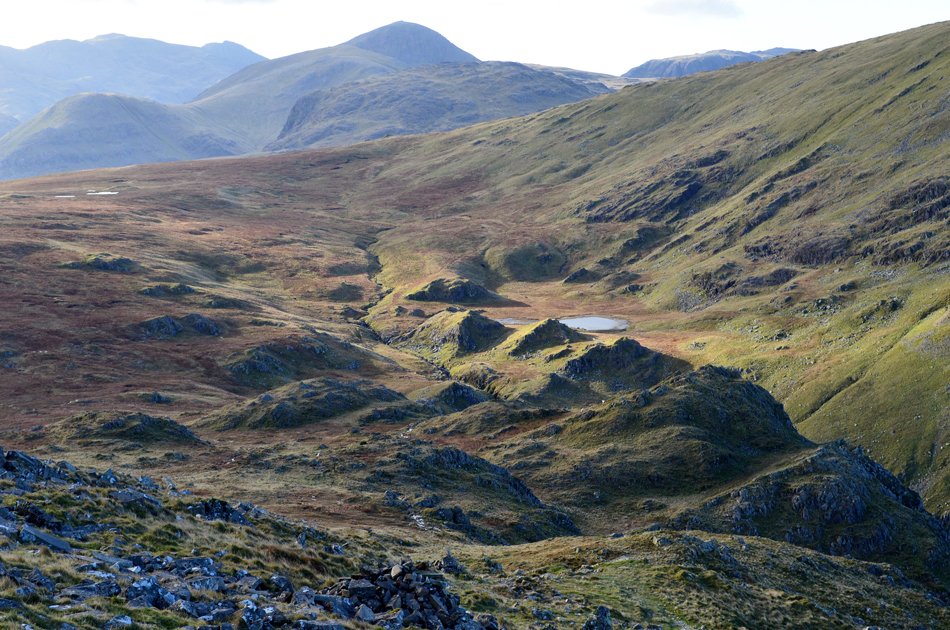 |
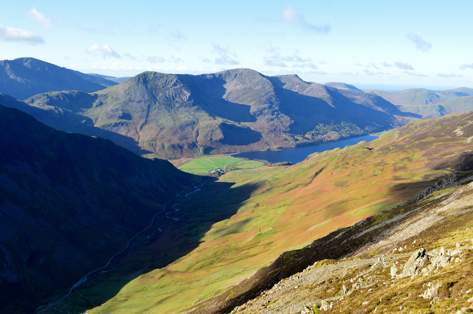
| Descending towards Dalehead Tarn with views of Great Gable and the top of Kirk Fell in the distance. |
| Once again we had left the winds confined to the summits during our descent to Dalehead Tarn and conversation could return to normal! It was around here we spotted half a dozen Duke of Edinburgh students descending into Newlands were it figured by the size of their packs they'd wild camped possibly at Dalehead Tarn. |
 |
| More frozen pools with Dale Head and Dalehead Crags in the distance. |
| |
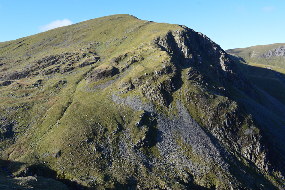 |
| Here's a less obscured view of Dale Head with the aptly named Great Gable (crags) seen directly below the summit. |
For anyone completing the Newlands Round only one thing must occupy their mind once this point is reached which must be the ascent of Dale Head from Dalehead Tarn. The path approaches from the left then tops out on the lower north ridge before continuing towards the summit, and yes, it's as steep as it looks. |
 |
| The view through Newlands with the magnificent Miners Crag seen upper right. |
| Rod "there's two blokes staring at us down there" |
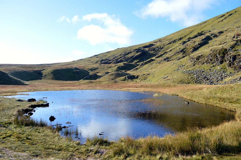 |
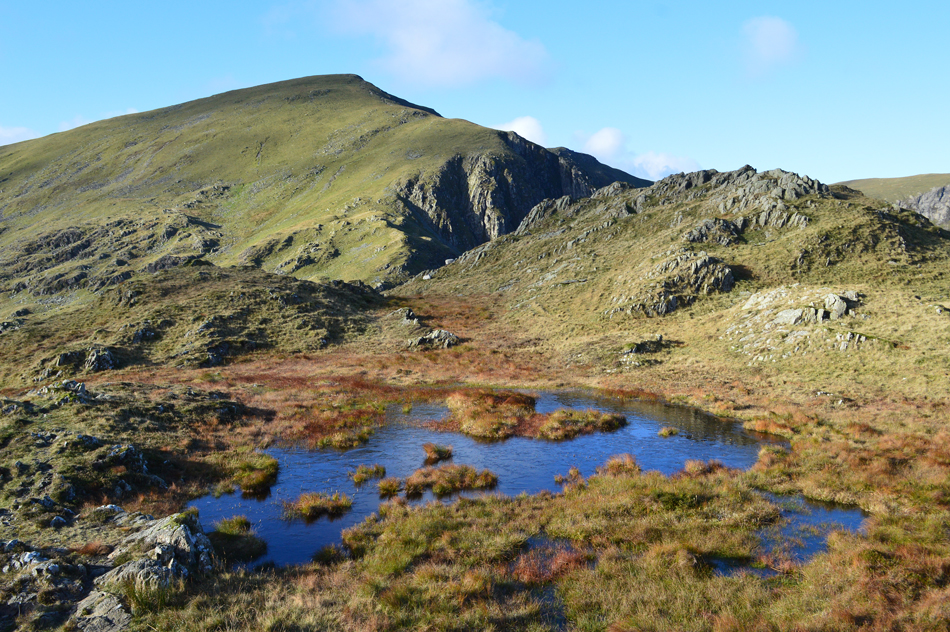
| Dalehead Tarn. |
We arrived at Dalehead Tarn after crossing Newlands Beck and the first thing that struck us was just how overgrown the tarn was with reeds, here the problem isn't too apparent both further back on the east side the tarn is choked with reed so much so it was difficult to spot the water in between.
Okay, time to make our ascent on Dale Head, hey ho lets go. |
 |
| Looking back on High Spy, Castle Nook and Maiden Moor from the ascent of Dale Head. |
Having left Dalehead Tarn we spotted the walker who we had seen ahead of us back at High Spy summit, he seemed to be making good ground during his ascent as was the fell runner and his dog ahead of him. We picked up the path and got our heads down into the ascent noting the new stone steps that complement the ascent all the way to the lower north ridge, the steps although steep, help incredibly with the ascent, we faired well only stopping to hydrate from our bite valves which by now had semi-frozen. During the Summer heat wave I'd have performed back flips to have sipped anything as chilled as the contents of my hydration pack right now. |
 |
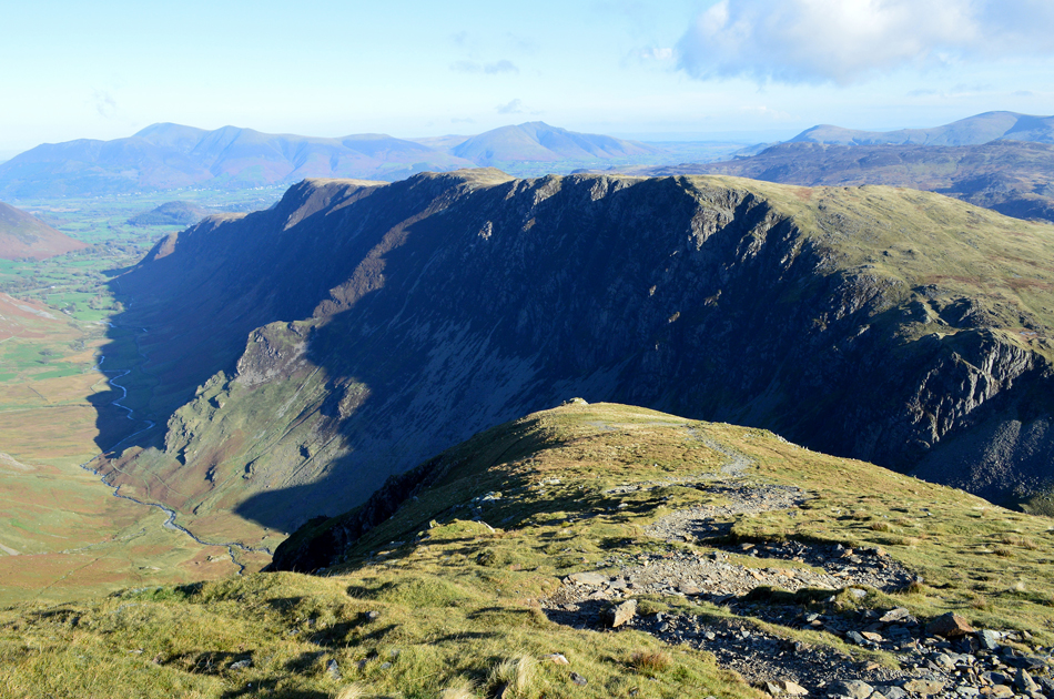
| Skiddaw, Blencathra, Catbells, Maiden Moor and High Spy from Dale Head. |
We ascended the north ridge with, for the last time today the wind on our backs, incredibly once the summit was reached we both noticed there wasn't a breath of wind around as the most surreal calmness descended on the summit, it was strange but no one complained. We arrived at the stone cairn at the same time a couple who had ascended from Honister, they arrived first and were taking selfies with Newlands in the distance before Rod offered to take a proper picture who then obliged. |
 |
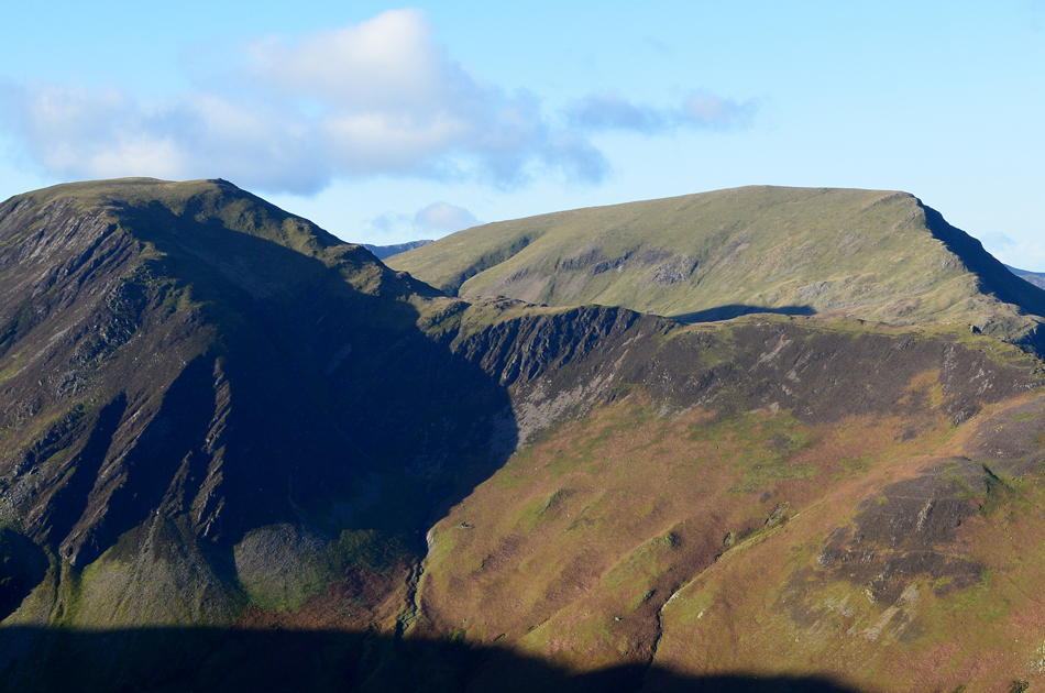
| Hindscarth and Robinson from Dale Head. |
| With Whiteless Pike, Grasmore, Crag Hill (Eel Crag) Sail, Scar Crags and Grisedale Pike in the distance. |
 |
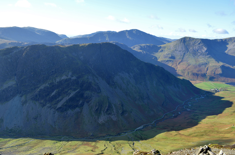
| The view over Fleetwith Pike towards Haystacks, the Gables, Kirk Fell and Pillar from Dale Head. |
| |
 |
| Looking down on the Honister Pass with the High Stile ridge and Buttermere domineering the distance. |
| |
 |
| The mass of Fleetwith Pike. |
| Later this evening walkers and professional photographers will light up Fleetwith Edge (seen right) on behalf of the local charity Cumbria Youth Alliance. This morning however, I am more than impressed with the enormity of Fleetwith Pike's shadow. |
 |
| Robinson from Hindscarth Edge. |
After taking in the impressive views over Honister and beyond we rejoined the path and started to make our way over Hindscarth Edge where it is said that Borrowdale slate makes way for Skiddaw slate. All we found were a couple of iced up puddles which Rod insisted he walked through. Up ahead two paths can be seen from where the summit of Hindscarth can be gained by, Birkett recommends to take the left path which will not only give you views of Honister Pass down below but also retains that 'ridge feel' before Hindscarth summit is reached.
Left it is. |
 |
| Approaching Hindscarth summit. |
| |
 |
| Lunch with a view. |
Having gained Hindscarth summit in full exposure to the windchill we didn't hang around and agreed to see if the north summit shelter would offer any protection from the wind, the distance between both summits was short but it was enough to realise that we were walking heads into the wind, queue the brain freeze.
The wind was blowing from the north and with a north facing shelter we reckoned we'd be best sheltered around the rear of the shelter but me being me I thought I'd try the shelter first, on entering the shelter the wind seemed to follow me in, feeling slightly discouraged I lowered my backside onto a flat stone which left my head just below the top of the shelter wall, by-eck its flippin worked, Rod soon followed. |
 |
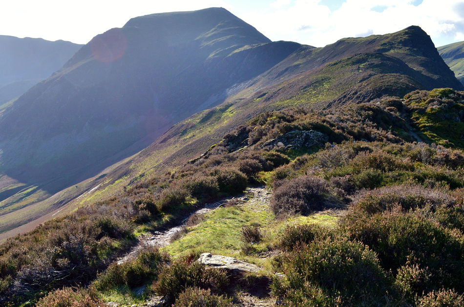
| Descending Hindscarth North ridge with views of our final three summits of High Crags, Red Knott and Scope End. |
| |
 |
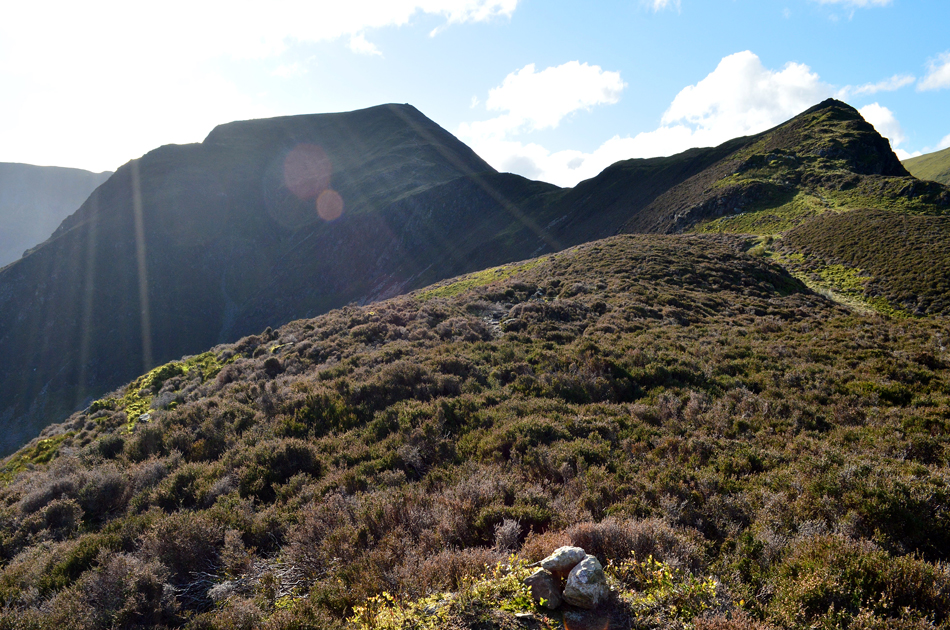
| Light and shadow. |
| |
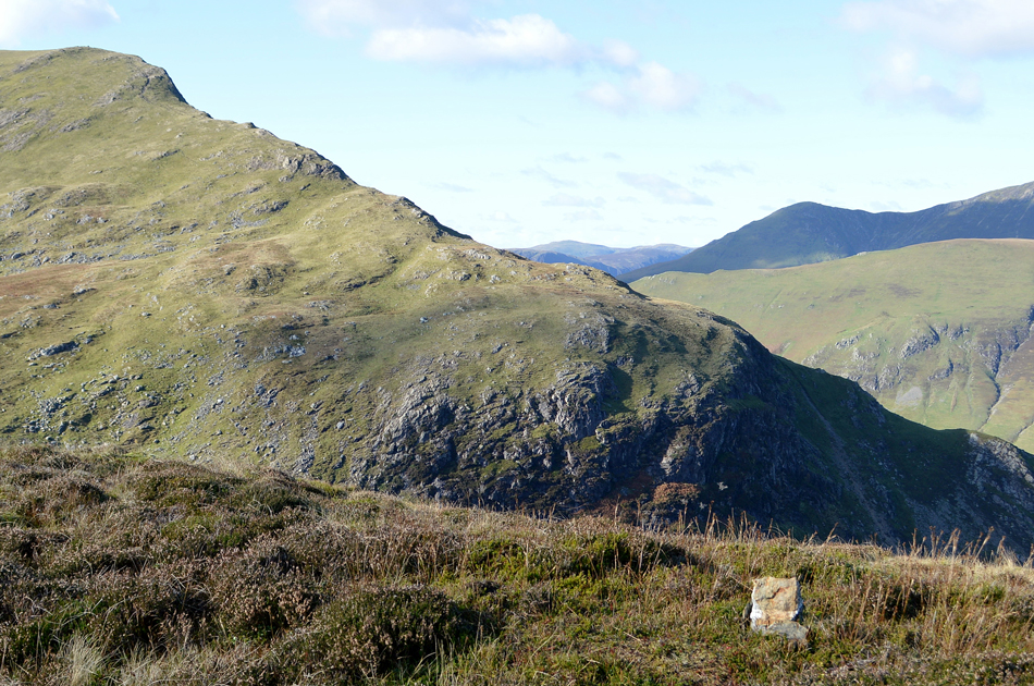 |
| Robinson North East ridge from High Crags summit. |
| Headed into a severe windchill we descended Hindscarth's north ridge all the while noses leaked and exposed skin pained. Having descended the best part of 600ft / 183m we left the severity of the wind above our heads, here it was positively delightful and conversation once again returned. I've descended/ascended this ridge many times but I've never actually gained High Crags respectively who's summit can be found to the left of the path soon after passing a small reedy tarn on the right, its highest point marked by just a couple of rocks. |
 |
| Hindscarth and High Crags from Red Knott summit. |
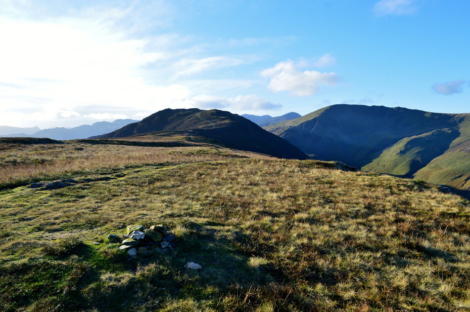
Continuing along the ridge we re-joined the path and just under half a mile later we took a bearing and found that we were actually stood on Red Knott summit, but initially found no cairn, Rod tracks back just two or three steps and spots the cairn marked by a small cluster of rocks to the left of the path and found we'd walked straight past it.
Red Knott, the slightly trickier cairn to spot owing to the path being lower and off to the right. |
 |
| Hindscarth, Red Knott and High Crags from Scope End. |
| We continued once more and rejoined the path sighting Scope End, as the name suggests at the northerly end of the ridge, finding no cairn I took this picture looking back at a sun dazzled Hindscarth. |
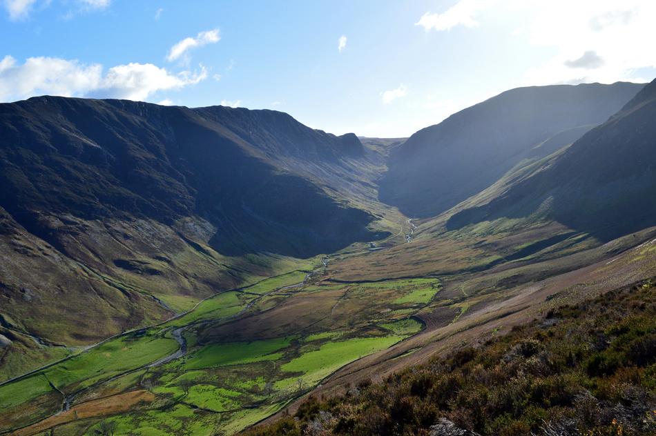 |
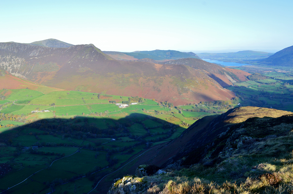
| Magnificent Newlands. |
| With High Spy and Dale Head forming the barrier at the head of the valley. |
 |
| Causey Pike with High Snab Farm in the foreground. |
Descending Scope End wasn't without its trickiness and we were both thankful that the polished rock we had to scramble down was dry rather than wet, concentration is a must during this descent which is why Rod and I fell silent! |
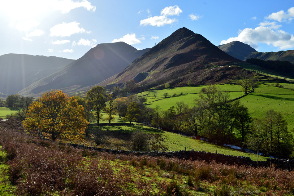 |
| Sun drenched autumnal views of Dale Head, Hindscarth, Robinson and Scope End from Newlands. |
| |
 |
| The view towards Rowling End, Causey Pike, Scar Crags, Sail, Rigg Beck, Ard Crags and Knott Rigg. |
With the descent of Scope End behind us I kicked my feet into the back of our boots and crossed Newlands Beck after passing Goldscope Mine. The sun was now on our backs and the windchill, a distant memory.
I remove my gloves. |
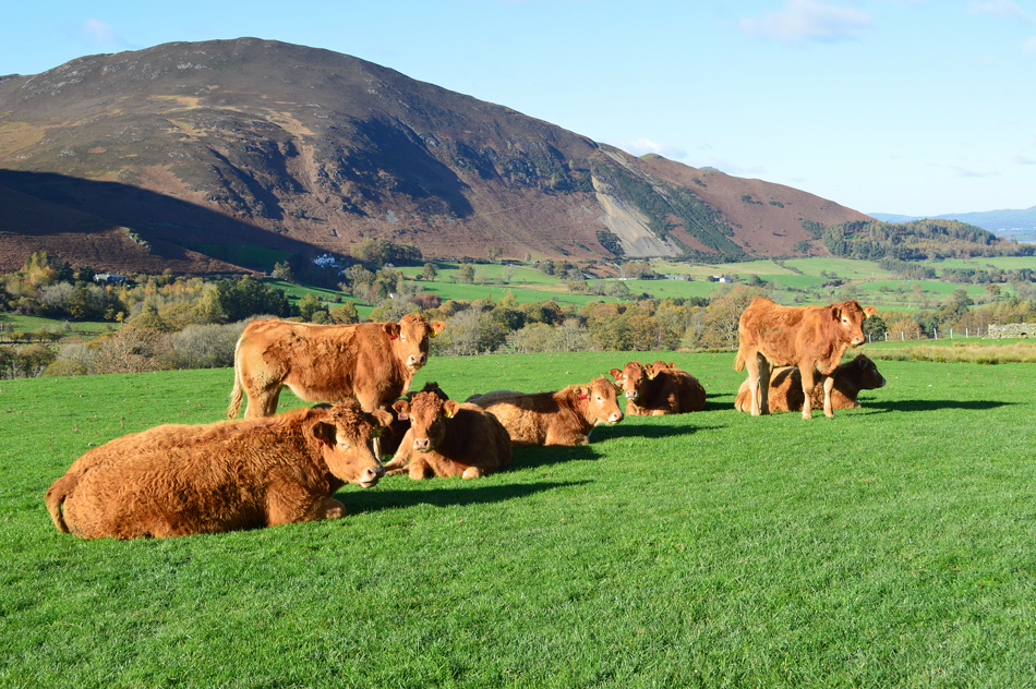 |
| Passing this young and inquisitive herd of brown cows. |
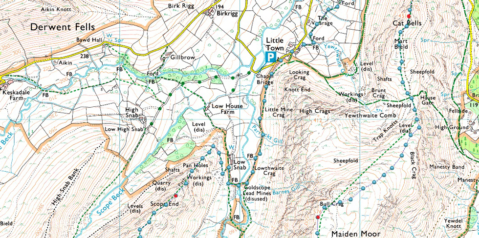
Under what felt like a blazing sun we left Newlands behind and made a bearing for Little Town where instead of making our way back to Gutherscale via the old Yewthwaite Mine path Birkett recommends the footpath through the fields below. After passing through Little Town at the end of the lane we turned right and followed the footpath which was flanked by thorn bushes either side. Once Yewthwaite Gill is crossed at a footbridge the footpath opens out into open fields and the views back over the valley explode into view, I hadn't used this footpath before but after today in the conditions we had it comes highly recommended.
After passing through our final gated field Gutherscale Farm is reached and from canopy of trees I took one last view into Newlands. The sound of shots ring out over the valley accompany our half mile walk back to the cars and despite their barbarity I recongnise this as a sound familier to Lakeland. The car parking spaces are as busy as we had left them with one family squeezing their car along side mine who then left with their dog in tow. With my boots replaced for my North Face mid's I shake Rod's hand until next time then drive towards Portinscale while slowing down for walkers who like us couldn't resist taking advantage of this fine Autumn day. |
|
| |
| Back to top |
 |
|