Walking the Birketts, Naddle Fell above St John's in the Vale

1st December 2018

This weekend was never going to be a strong forecast which scuppered plans to walk three seperate Birkett walks on the Uldale fells. Because of the poor forecast we at least still managed to get out and take advantage of a five mile walk taking in three Birkett summits over High Rigg.

I couldn't blame Rod for pulling out of todays walk having to travel all the way from the north east to walk five miles in the rain, it isn't everybodys cup of tea but I do have David with me who after weeks of taking it easy on the fells due to an on going foot injury is back with a vengeance and I'll have to admit, it's great to be walking with David again.

It's not essential to include Castle Rock along with High Rigg but it would be the 'thing to do' owing to the proximity of both fells yet due to the large block of rock which fell from the north buttress last Tuesday (27th) we thought it best to steer clear of the area until it was deemed safe, this along with a shortage of daylight owing to the fact that we started todays walk mid morning if only to allow for the rain to clear.

 
The Complete Lakeland Fells
By Bill Birkett

-Naddle Fell The cairned rocky knoll has an unbroken view of Skiddaw and Blencathra


Overview
Ascent: 1,115 Feet - 340 Metres
Birketts: 3, Wren Crag - High Rigg - Naddle Fell
Weather: Light Rain And Drizzle Turning, Drier Towards The End Of The Walk. Highs of 8°C Lows of 5°C
Parking: A591 Roadside Parking, Legburthwaite, Head of St John's-in-the-Vale
Area - Group: Central - C/DOD
Miles: 5
Walking With: David Hall
Ordnance Survey: OL5
Time Taken: 3 Hours 30 Minutes
Route: Legburthwaite - Smaithwaite Bridge - Wren Crag - High Rigg - Naddle Fell - St John's Church - St John's-in-the-Vale - Low Bridge End Farm - Smaithwaite Bridge - Legburthwaite
 

Parking Details and Map, A591 Roadside Parking, Legburthwaite, Head of St John's in the Vale
Nearest Post Code: CA12 4TH
Grid Reference: NY 318 195
Notes:

Up to a dozen parking spaces can be found opposite the entrance to the Thirlmere Dam Road, this is a very popular area and these spaces, especially through the Summer months can be taken up quite quickly. At the time or writing this (Dec 2018) the west road around Thirlmere remains closed meaning that anyone wishing to park at Armboth or at the north end of Thirlmere will have to park using these spaces which may prove them to be very popular. Parking is free.


Map and Photo Gallery


Castle Rock with the north buttress circled where the rock fall occured.

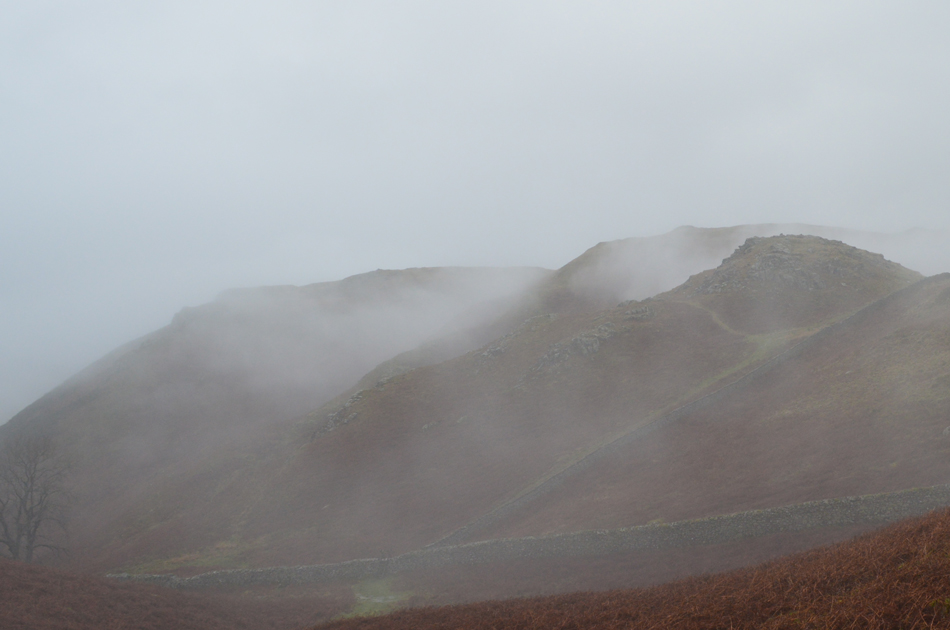
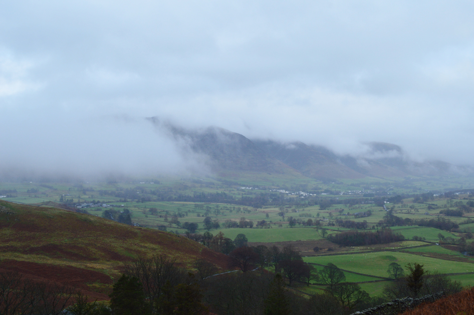
Unfortunately even with our later than late start we didn't escape the downpours which meant kitting up into full waterproofs behind our cars as the rain continued to fall. I arrived at the parking spaces to find David already there and unsurpisingly it looked like the wet weather had kept most people away passing just the one car parked at Scales which was mirrored again as I drove through Wanthwaite, St John's-in-the-Vale. Despite the rain it feels mild with little to no wind here at valley level just pockets of cloud which formed above the tree line turning more extensive over the Dodds and the Helvellyn range.

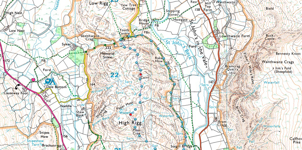
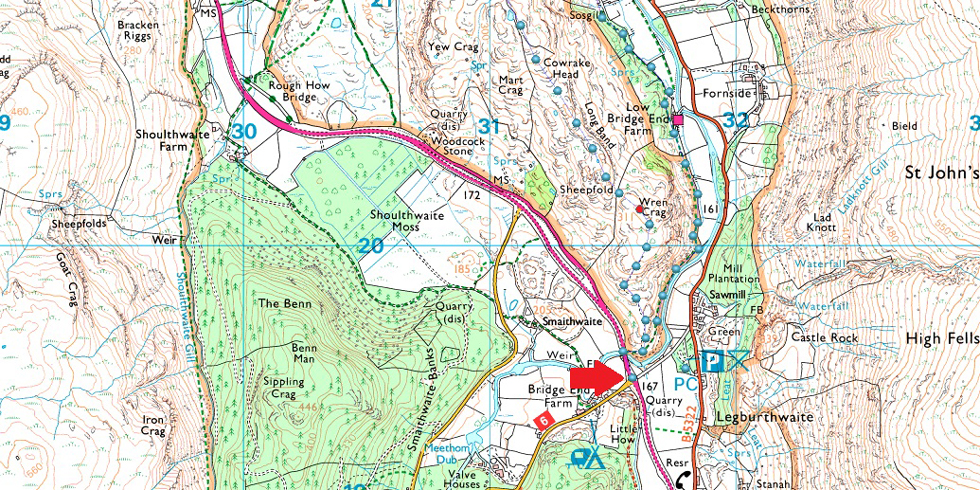
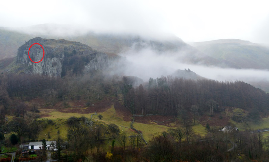
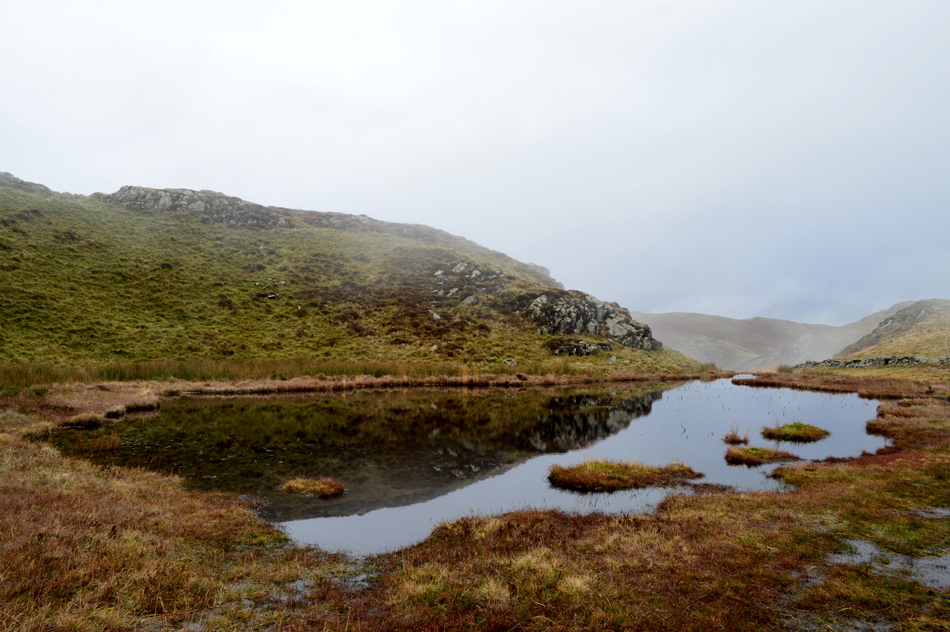
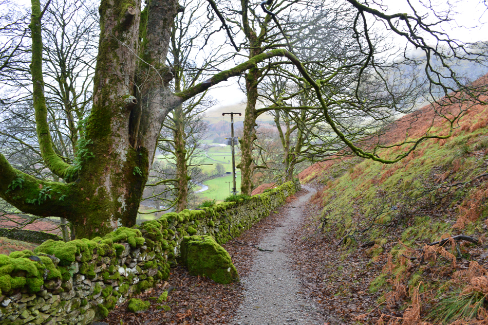
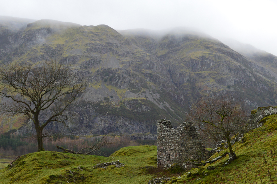
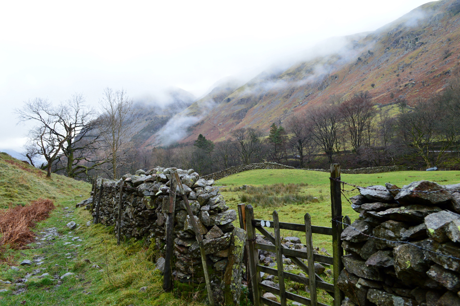
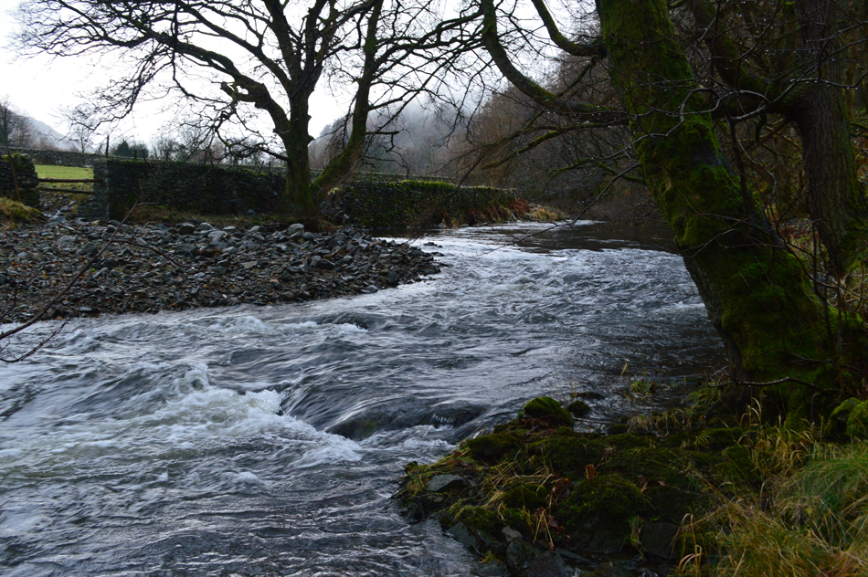
With the cars locked we took in the view over towards Castle Rock who's lowly summit was shrouded in mist and swirling cloud before passing over Smaithwaite Bridge then through the wooden gate and onto the wooded slopes below Wren Crag. Having only communicated through email and the odd phone call over the last few months this morning it would seem we couldn't walk ten steps without stopping to catch up...It's been close to two years since I was last here and it appears previous Winter storms have felled many a tree including numerous Scots Pines which just laid where they fell, some across the path causing slight detours around the debris while we gazed at the flooded holes left behind where the trees once stood.

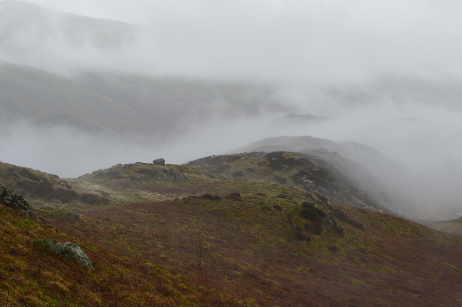
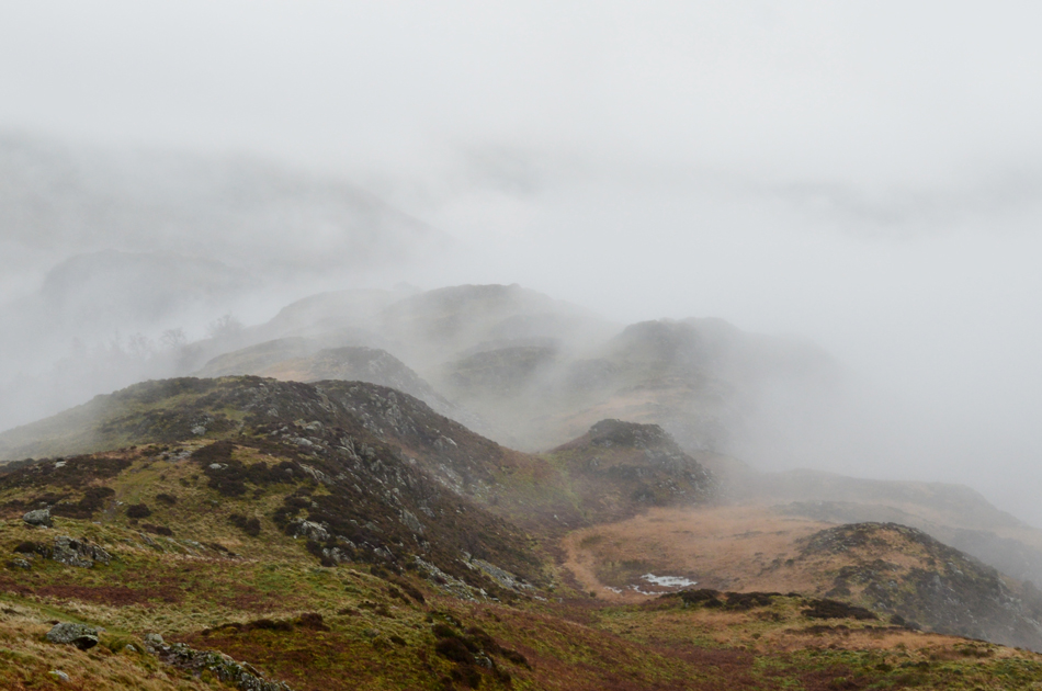
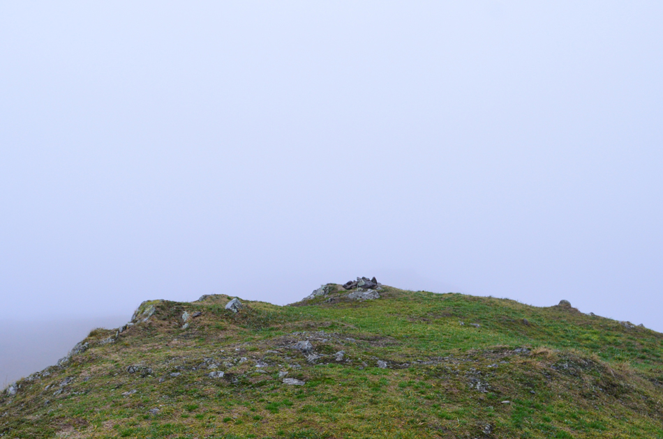
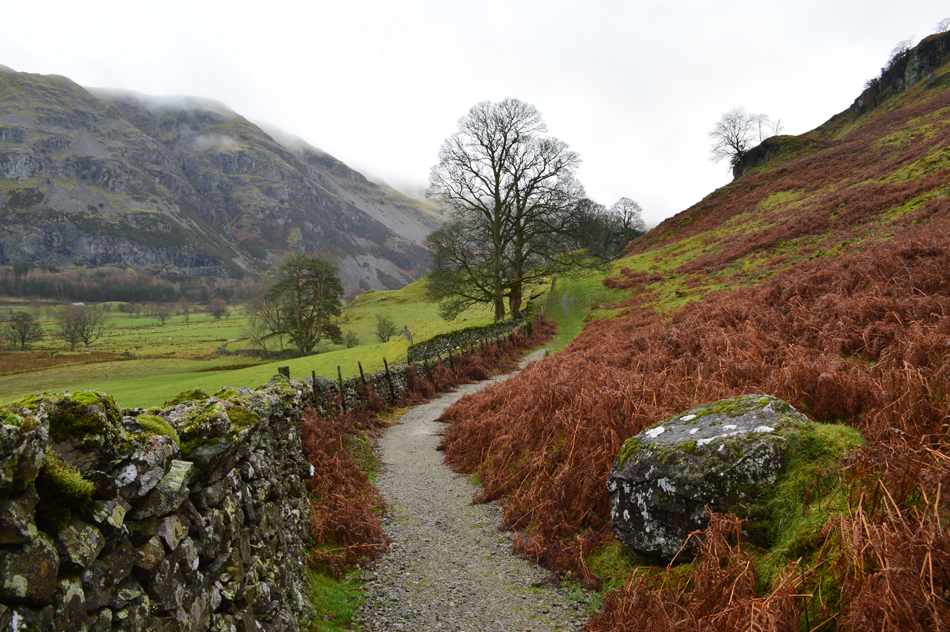
We ascended through the tree line and tried to take in the view south but the visibility was so low it wasn't worth trying to capture a photo. Wren Crag was soon reached not before passing a fell runner along with her Jack Russell, a few fleeting words were passed mainly on the subject of how atmospheric the low cloud was before topping out at the summit marked only by high grassy ground to the right of the path, on a clear day from Wren Crag unbroken views over St John's in the Vale towards Blencathra can be seen but sadly not today.


Looking back on Wren Crag.
We may not have any long distant views but the fell runner was right, our walk was turning out to be very atmospheric.


The familiar tarn found around half way along the ridge.
Were we squelched our way past in the drizzle.

The cloud clears revealing Birketts High Rigg summit at 343m seen centre.

Now here's the confusing part of the walk, Birkett claims the summit seen centre as High Rigg at 343m which can be easily gained after passing through the wooden style below before continuing to follow the stone wall past the grassy knoll seen far right, after the knoll is passed easy access onto the summit can be gained by diverting around a familiar bog before a gentle slope ascends towards the summit.

However, Wainwright claims High Rigg summit at 357m which is still around half a mile away which Birkett refers to as Naddle Fell, yes it took me a few minutes to get my head around that too!


Birketts High Riggs summit marked by this small stone cairn at 343m

Having left the stone wall we detoured around the bog and picked up the path from where we gained High Rigg easily right about the time the drizzle turned to light rain, the wind increased and visibility drew closer.

From the summit we picked up the unfamiliar grassy ridge path which after a few moments fell back in line with the summit path before High Rigg (Naddle Fell) came into view.


High Rigg (Naddle Fell) at 357m
We were still catching up which meant lots of regular stops which probably allowed time for an old gent to catch us up below High Rigg summit, he appeared to come from nowhere and conversation was kept direct but polite, we continued the last few yards of ascent both wishing that when we reached the gents age which was around his mid eighties that we would still be walking the fells in all weathers, well done that man.

The clearest view of Blencathra we'd seen all day!
 

St Johns Church.

With all three summits gained we continued north and descended steeply while taking in the limited views over Low Rigg towards Lonscale Fell and Blencathra, the tarmac hause was soon reached and waterproofs were adjusted. Here I take a quick peek over the wall to take this photo of St Johns Church seconds before a couple would have walked into the shot.

We press on down the lane from which we'll gain the footpath which straddles the lower slopes of High Rigg through St John's-in-the-Vale.


Taking the footpath close to St Johns Church.
 

Bram Crag and St John's in the Vale.
A later start meant we'd just passed lunch and by now my stomach was making all sorts of growling noises. The rain had stopped for now but the drizzle was always in the air so after de-shouldering to unpack something to eat we continued to walk while eating lunch at the same time.

A closer view of Bram Crag.
 

Looking back along the path with Bram Crag over on the right.
With a quick lunch over we continued to follow the path which expectably was swollen underfoot passing a young couple half catered for a rainy day in the valleys. Low Bridge Farm was reached where we stopped to admire the self serve menu along with a rather impressive three inch thick solid wood dining table complete with bark edgings and to top that, a wood stove in the corner.

St John's Beck.

Having left Low Bridge End Farm we continued along the path which by now fell adjacent to St Johns Beck, the beck was swollen and we wondered the water levels at Thirlmere from which St John's Beck originates. The path rises and soon the beck fell steeply forty foot below the footpath as Castle Rock came into view between the tree branches, we were only five minutes from the cars but we did touch on the subject of making its summit before we lost the light of which I'm sure we may just of had enough time but due to recent events and todays conditions we decided against.

The path turned abrubtly towards the right as did St Johns Beck below and within a few seconds the sound of the flowing water was replaced by cars speeding along the A591. Notably our pace slowed and we took in the view over towards Raven Crag whose summit and surrounding woodland still had those pockets of cloud swirling around the crags and tree tops just as we had left it three hours earlier.


Back to top