|
Walking the Birketts, Over Base Brown and Green Gable to Great Gable |
 |
 |
13th April 2019 |
 |
|
After a good week of dry and sunny weather Lakeland is all but void of snow with the exception of a few pockets that are lingering due to freezing summit temperatures where even though the valleys are very much Spring like across the tops is a different story just as we found out today as we followed Bill Birkett's classic Base Brown to Great Gable walk.
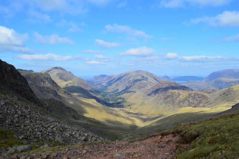
The walk starts from the heart of Lakeland in Seathwaite instantly gaining height along Sourmilk Gill which provided the sound track to our ascent easily negotiating Seathwaite Slab below the hanging glacial valley that is Gillercomb. A steep rocky ascent is required in order to gain the northern spur of Base Brown where the Hanging Stone watches other the Seathwaite valley. We proceed south westerly passing the pleasant grassy col which divides Base Brown form its neighbouring Green Gable, here fine views into Gillercomb can be found. From Green Gable we look down on Ennerdale to the west and the Buttermere and Lorton valleys to the north.
After crossing Windy Gap Great Gable is gained where panoramic views over Wasdale and the Cumbrian coast dominate the skyline before descending the breast of Gable to Sty Head. We followed Styhead Gill through to Taylorgill Force and ended the walk with a classic view of the Seathwaite Valley under brilliant afternoon sunshine. |
|
| The Complete Lakeland Fells |
 |
| By Bill Birkett |
-The Breast Route
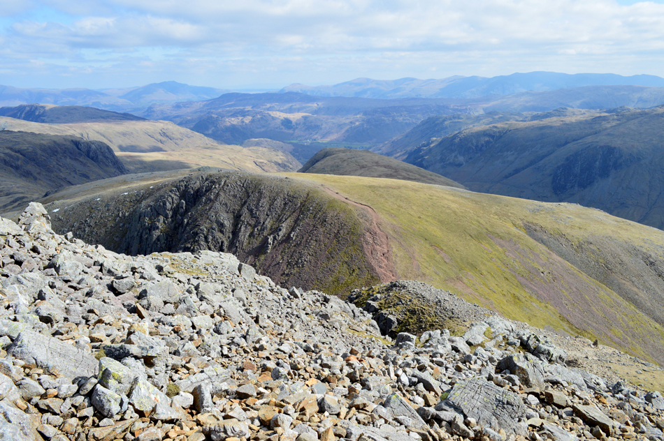
Returing to the summit cairn a well worn path heads off to Sty Head down the broad south eastern edge of the mountain. |
|
|
|
| |
|
Overview |
|
|
| Ascent: |
2,855 Feet - 870 Metres |
| Birketts: |
3, Base Brown - Green Gable - Great Gable |
| Weather: |
Overcast To Start Turning Brighter But Remaining Cold Both In The Valleys And Across The Summits. Highs of 12°C Lows of 3°C Feels Like -3°C |
| Parking: |
Roadside Parking, Seathwaite, Borrowdale |
| Area - Group: |
Western - W/GRG |
| Miles: |
5.6 |
| Walking With: |
David Hall & Rod Hepplewhite |
| Ordnance Survey: |
OL4 |
| Time Taken: |
5 Hours 50 Minutes |
| Route: |
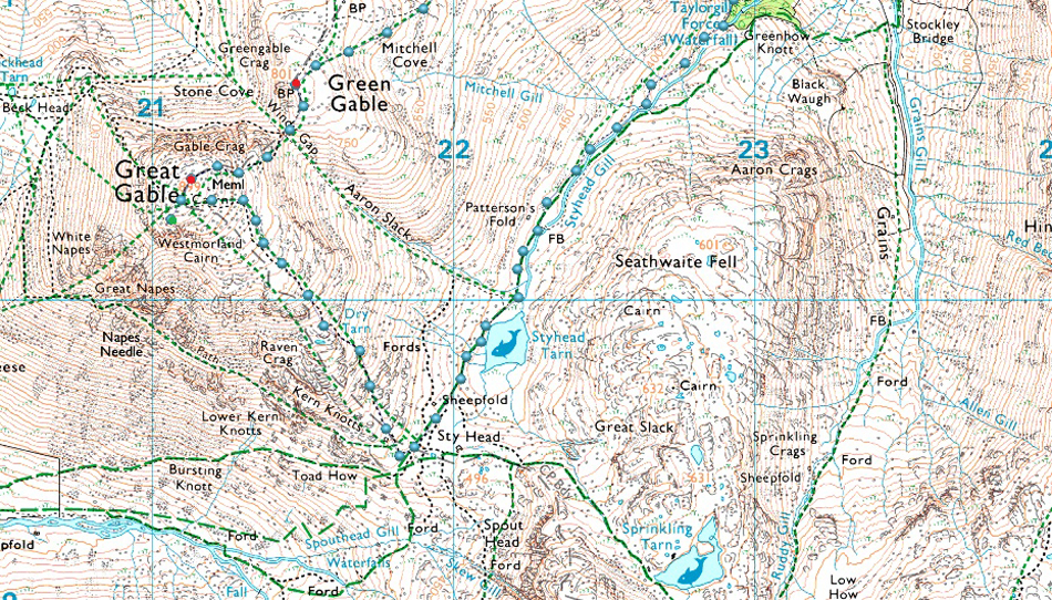
Seathwaite - Sourmilk Gill - Gillercomb - Hanging Stone - Base Brown - Green Gable - Great Gable - Westmoorland Cairn - Breast Route - Styhead - Sty Head Gill - Taylorgill Force - Seathwaite |
|
|
|
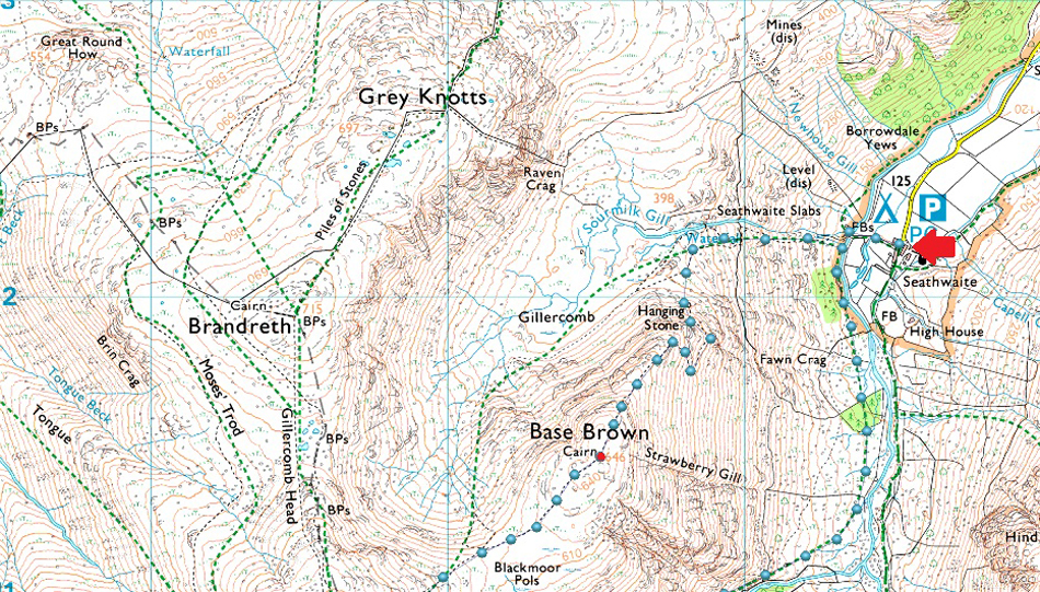
Parking Details and Map |
|
|
| Nearest Post Code: |
CA12 5XJ |
| Grid Reference: |
NY 235 712 |
| Notes: |
I guess it's fair to say that Seathwaite is to Lakeland what Times Square is to New York. Set within the heart of Borrowdale in the heart of the Lake District Seathwaite is the walkers hub of Lakeland. Seathwaite is the starting point for many a walker heading for the highest ground in England when during the Summer hundreds of 'Three Peakers' visit Scafell Pike. There is room for ample parking yet it's quite difficult to put a figure on how many cars and mini buses park in the valley at any one time but it is recommended to arrive early if you want to secure a parking space. During peak seasons such as Summer the farmer has known to allow parking on both sides of the valley with a small charge close to Seathwaite Farm. Please park courteously and do not block any gates, remember Seathwaite Farm is a working farm meaning the land owner will require access to any gates by any means, you have been warned! Parking is free. |
|
| |
|
Map and Photo Gallery |
|
|
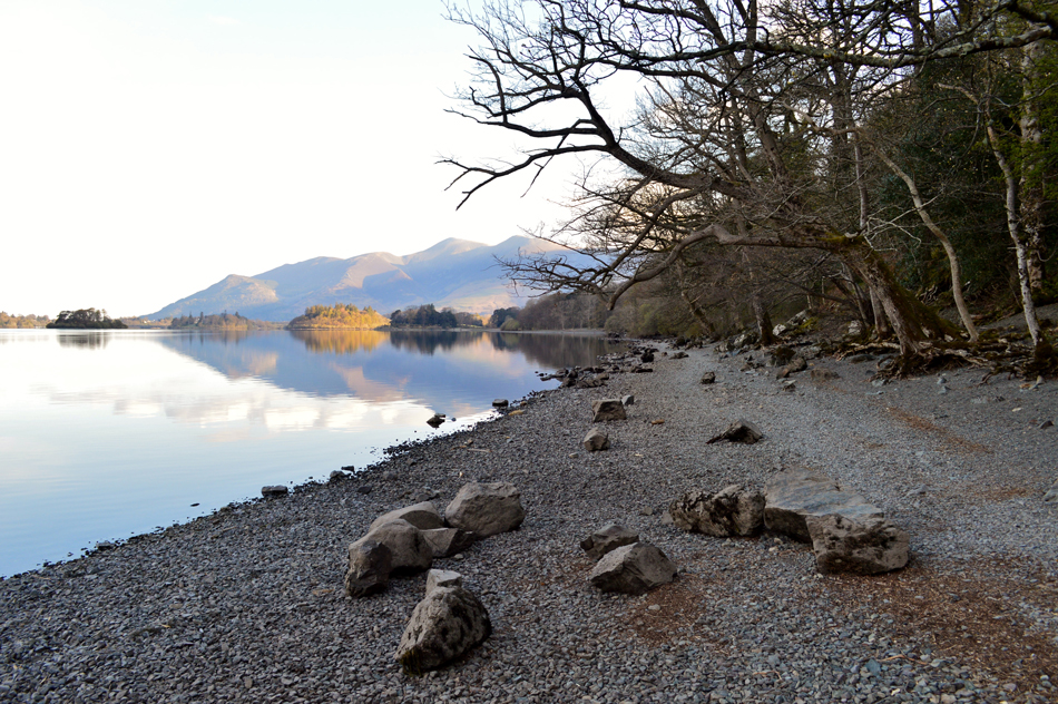 |
| Skiddaw from Ashness Jetty. |
| After spotting how calm Derwent Water looked through the trees this morning I stopped off at Ashness Jetty to take a few photos. |
 |
| Grisdale Pike and Barrow from Ashness Jetty. |
| |
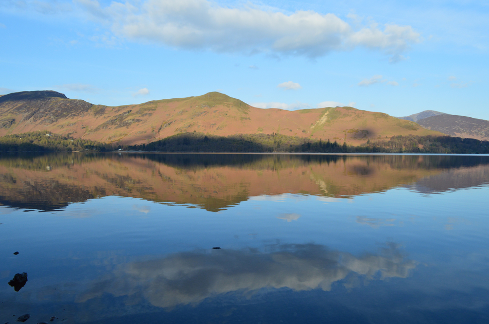 |
| Maiden Moor and Catbells reflecting into Derwent Water. |
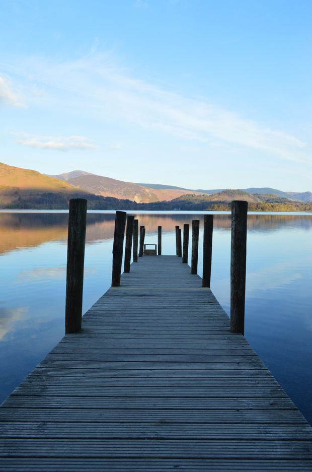
| I have been known to stop off at Ashness Jetty while on my way through to Seathwaite but normally I'd be sharing the views with a heap of photographers but today I have the place to myself, what a treat and what a view! |
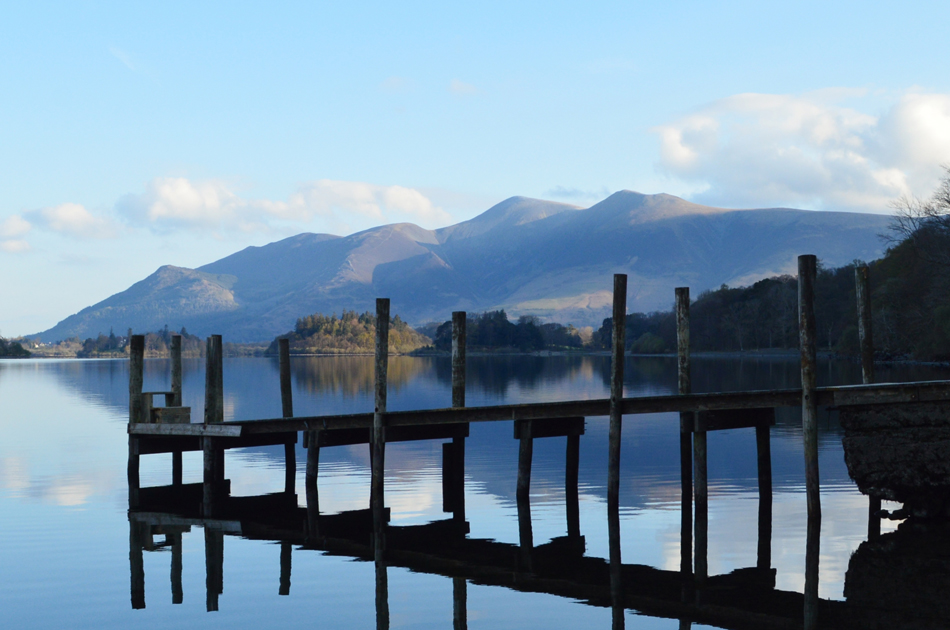 |
| Skiddaw from Ashness Jetty. |
| Time for one last photo or I'm going to be late meeting the guys. |
 |
| Base Brown from Seathwaite 08:20am 3°C |
I arrived soon after David who had already driven down towards Seathwaite Farm only to have to turn around finding all the parking spaces taken so he drove back and we parked on the grass verge within sight of Seathwaite Bridge instead. Rod soon followed after he also stopped to take photographs from Kettlewell Car Park on the shores of Derwent Water. I guess we were all expecting wall to wall sunshine right about now and not the clouded skies above our heads which seemed to be getting darker every minute, adding to this the temperature is close to zero and a brisk wind is making things feel a whole lot cooler too, It's probably best I leave the shorts in the boot today.
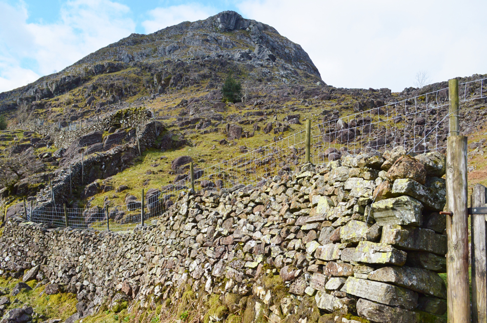
With the cars locked we walk towards Seathwaite Farm passing a lone camper who was braving elements whilst eating breakfast besides his tent on one of those portable tables. Sourmilk Gill is seen as we draw closer to the farm where it was noted that "not much water was flowing down the falls" even so we can still hear them from the valley which will accompany our ascent into Gillercomb shortly. |
 |
| Now above the trees our views open out over the Seathwaite Valley. |
| It had been a chiiled and dull start with the odd light breaking through here and there and with any brightness came instant warmth which was most welcome, whilst it lasted that is. |
 |
| The northern spur of Base Brown (Hanging Stone) appears as we leave Sourmilk Gill for Gillercomb. |
We had to wait until we reached Gillercomb for the cloud to break and the sun to appear where we spent a good half hour trying to remember the theme tune to eighties children's classic Rainbow followed by Button Moon which David and Rod had never heard off...how can anyone not remember Button Moon? it was my favourite childrens programme whilst faking sickies off from school.
Don't ask me how we got started on this all I know is I spent the next hour replaying "paint the whole world with a rainbow" and "we're off to Button Moon to follow Mr Spoon...Button Moon...Button Moon.. looping around in my head.
Crackpots the lot of us. |
 |
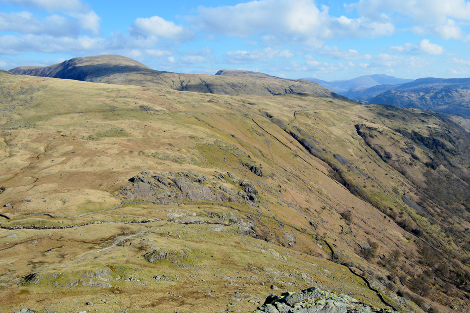
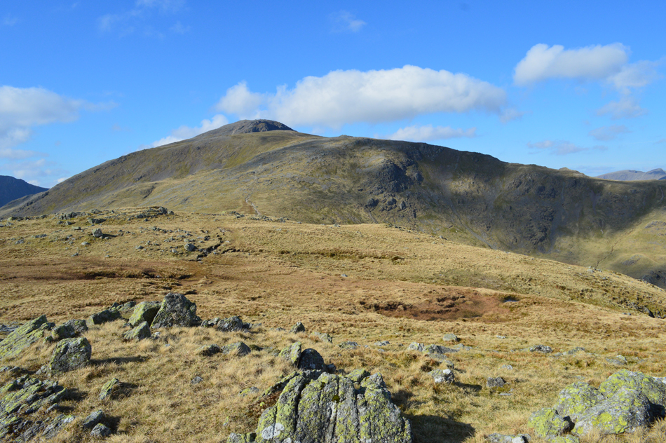
| Base Brown, Gillercomb and Green Gable. |
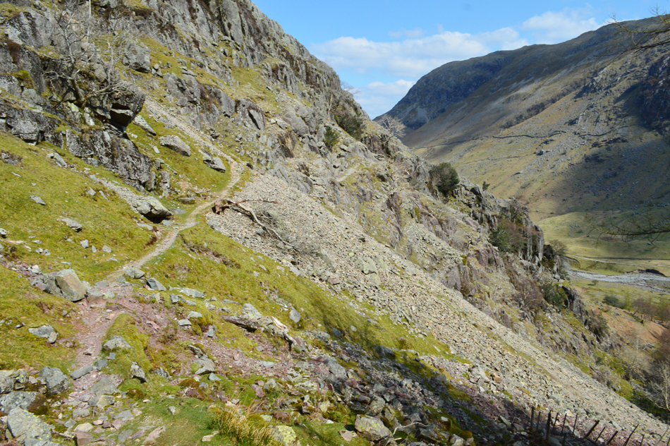
| We track to the left and each pick our way towards the crags below the Hanging Stone. |
 |
| The Hanging Stone, Base Brown. |
| We ascend steeply through grass and boulder before arriving below the Hanging Stone, pass the crags to the left to get the best view. |
 |
| Seathwaite from the Hanging Stone. |
| From the crags below the Hanging Stone we trace left along a well defined path where a series of grassy ledges combined with the odd scramble allow acess to the top of the crags where I stopped to take in this fine view over the Seathwaite valley. |
 |
| Looking over Seatoller Fell towards Dale Head, High Scawdel and High Spy from the Hanging Stone. |
| |
 |
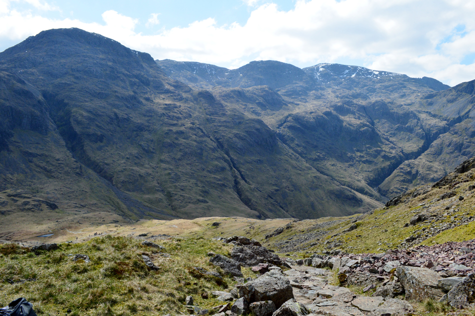
| Distant views of Blencathra as we take in the final ascent towards Base Brown summit. |
| With Grange Fell and the High Tove ridge seen in the foreground and the Dodd to Helvellyn Range over on the right in the distance. It's turning into a fine morning with distant fells clearly seen but it's also feeling very bitter, |
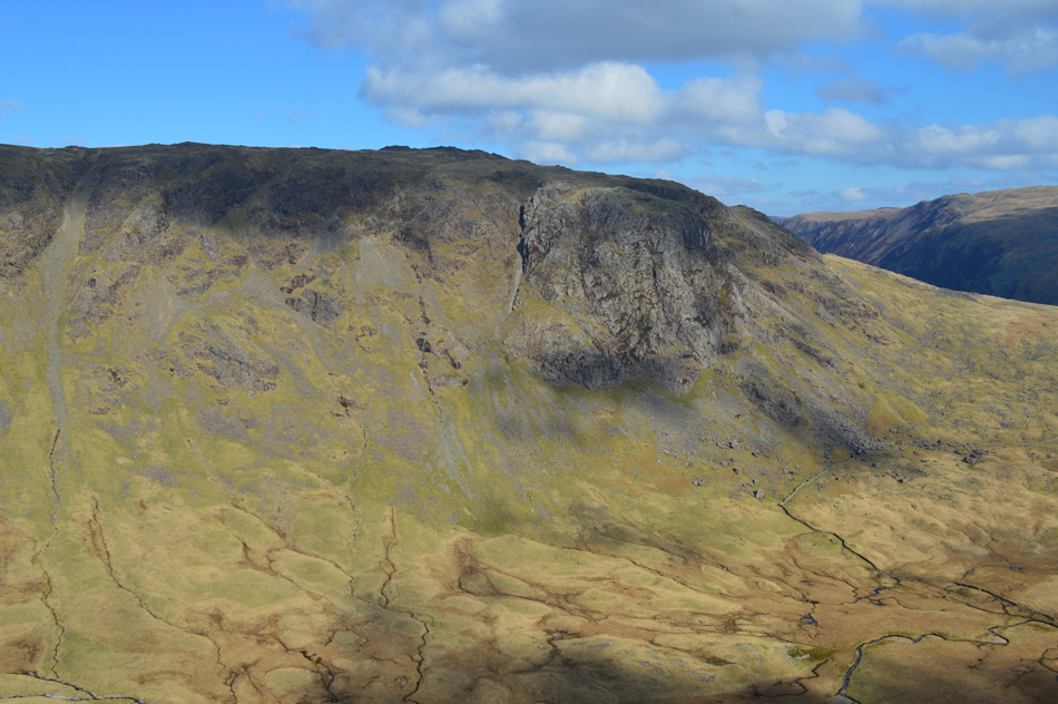 |
| Raven Crag above Gillercomb. |
| |
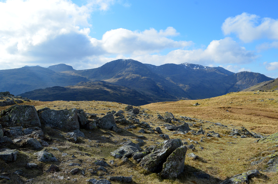 |
| Seathwaite Fell, Esk Pike, Great End, Broad Crag, Scafell Pike, Sca Fell and Lingmell from Base Brown summit. |
We continued with ascent and soon arrived at the summit cairn sighting this fine view of England's highest ground, and possibly...coldest ground. We had hoped that we may get a null from the windchill but what we actually got was full exposure which caused eyes to water and my nose to leak like a tap.
Worth it for the views alone though. |
 |
| Green and Great Gable seen across Blackmoor Pols |
| Fantastic walking territory whatever the conditions. |
 |
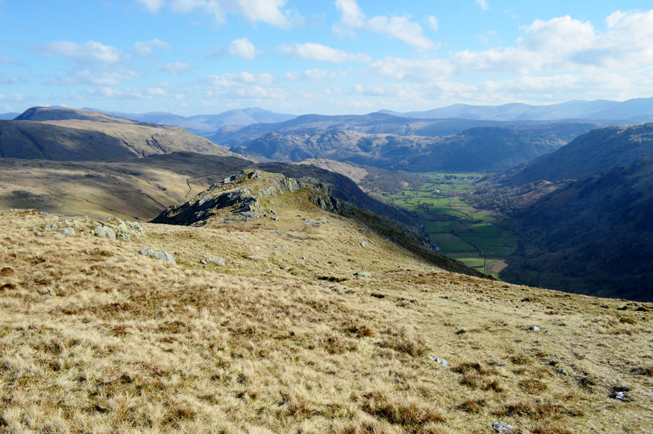
| Approaching the col at Gillercomb. |
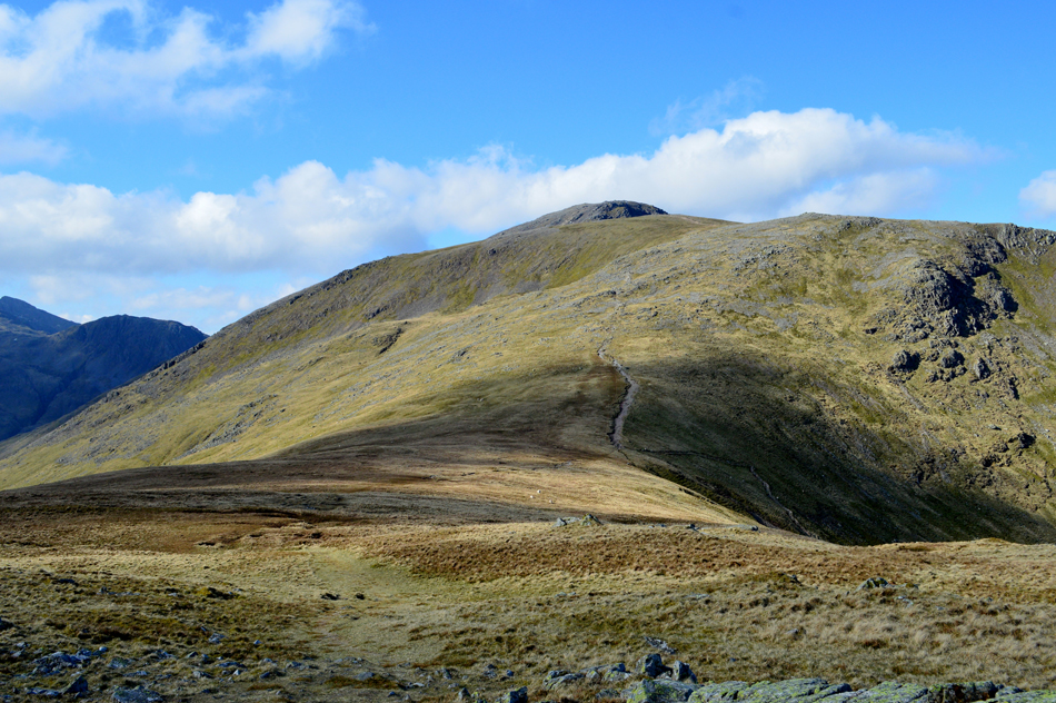
| With Great Gable summit peaking out above Green Gable. |
 |
| The view back into Gillercomb towards Raven Crag. |
| With Dale Head, High Scawdel and High Spy in the distance. |
 |
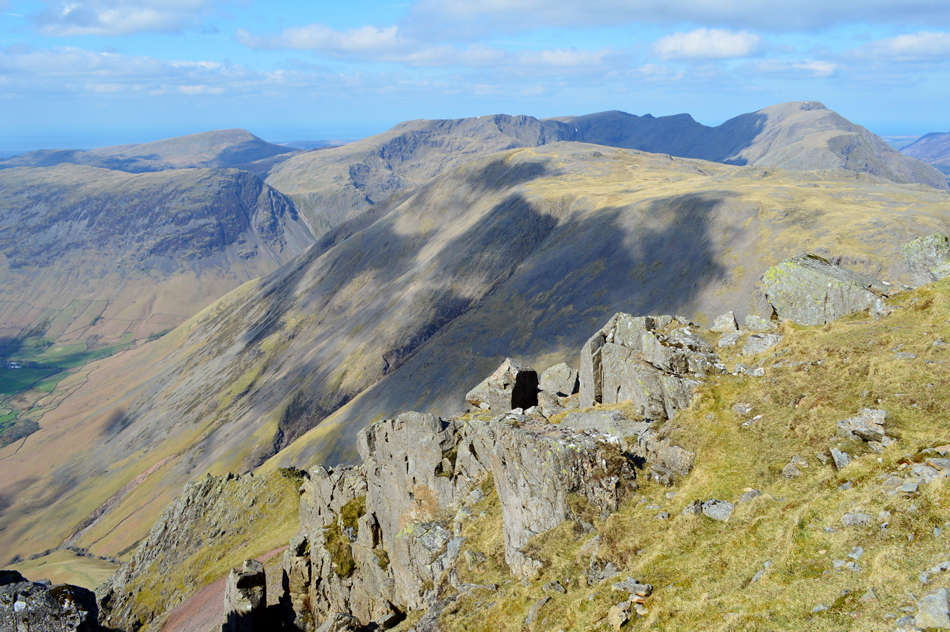
| Here we look back on Brandreth, Grey Knotts, Fleetwith Pike, Dale Head, Robinson, The Grasmoor Group and finally Skiddaw. |
| After crossing the col overlooking Gillercomb we began our ascent onto Green Gable while being watched by a trio of walkers from above who then doubled back possibly after realising they were about to descend in the wrong direction. The cold blast continued but we were soon rewarded with this fine view north with summits such as Skiddaw seen over 11 miles away. |
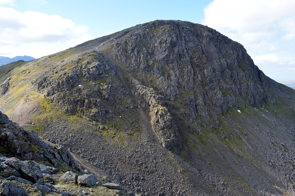 |
| Great Gable from Green Gable. |
Finding two walkers occupying the shelter on arrival at Green Gable we decided to take in and capture the magnificent views from the summit, here we spend time trying to locate the remains of a stone hut hidden within the crags which was once used by climbers in times gone by. David tells us he has a book at home with the location of the hut so next time were here we'll hopefully be able to pin-point its location. |
 |
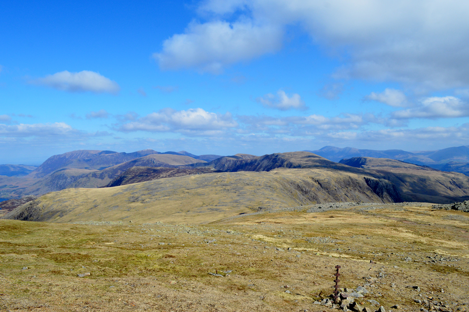
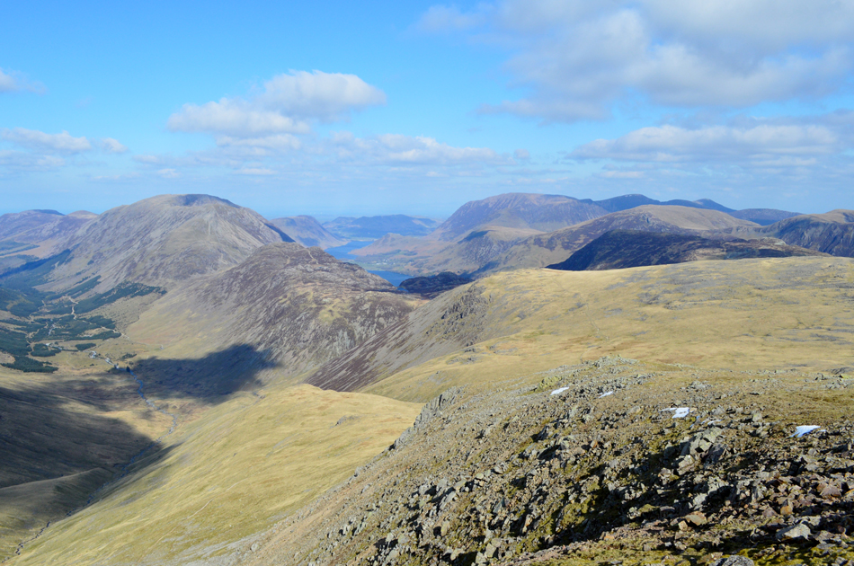
| Here's Kirk Fell seen over Dore Head with Looking Stead, Pillar, Pillar Rock, Wind Gap, Black Crag, Scoat Fell and Red Pike making up the Mosedale Horseshoe. |
| |
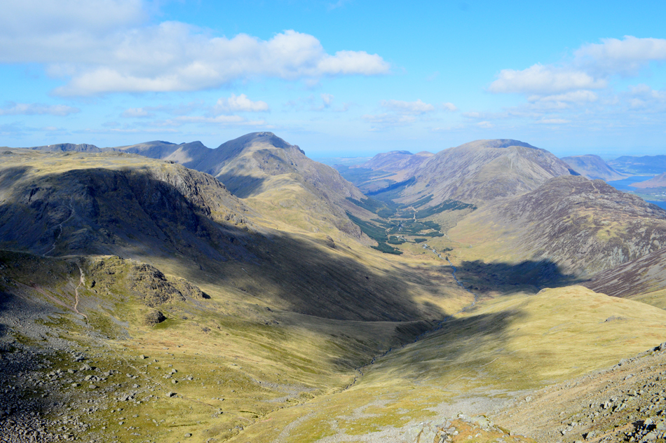 |
| The Ennerdale valley from Green Gable. |
| That's Haystacks and the High Stile ridge seen over on the right with a dash of Buttermere and Crummock Water seen far right. |
 |
| Magnificent. |
| |
 |
| The Ennerdale Valley from Windy Gap. |
We left the summit of Green Gable and started the descent into Windy Gap which today was living up to its name sake which I renamed "My eyes are streaming, snotty nose, frozen face windchill gap"
It just rolls of the tongue! |
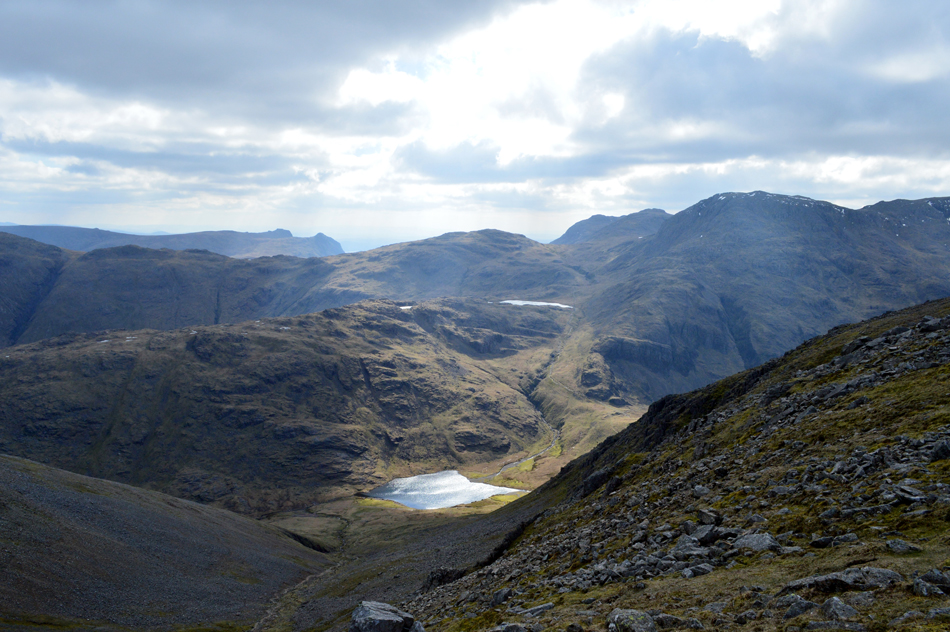 |
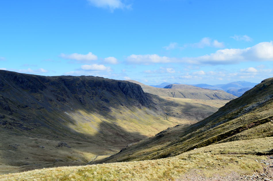
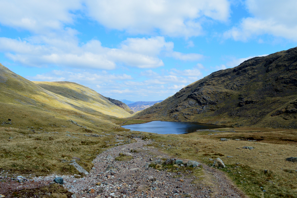
| The view over Aaron Slack towards Styhead Tarn, Seathwaite Fell, Sprinkling Tarn, Allan Crags, Esk Pike, Great End and III Crag. |
| With the Langdale Pikes in the distance. |
 |
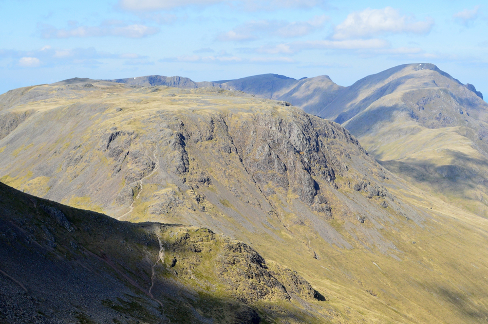
| Looking back on Green Gable and Base Brown taken close as we approach the summit of Great Gable. |
| |
 |
| Almost there. |
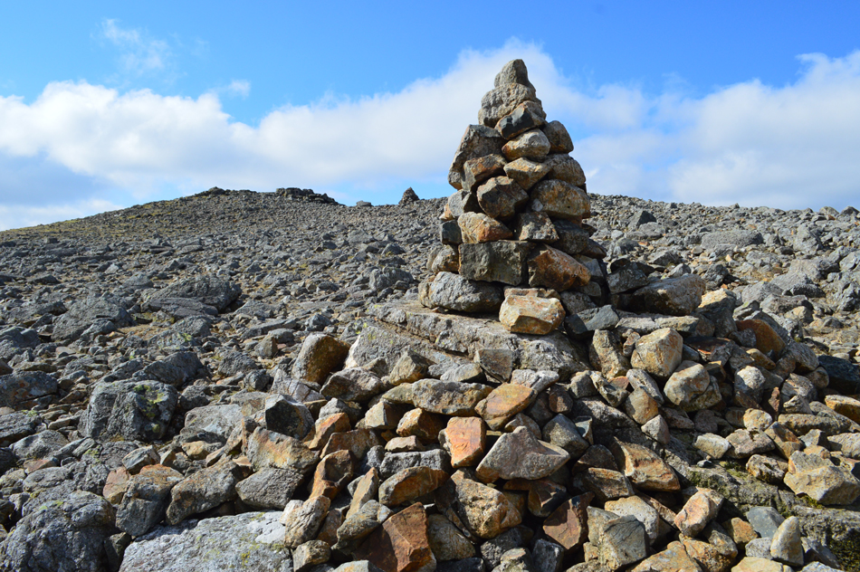
It wasn't far from the summit when we spotted around half a dozen new cairns (new to us since our last visit) these stone cairns weren't just thrown together either they were built with care and thought and should see out a few years if left undisturbed.
We couldn't help but wonder who built them and perhaps would they mind having a wonder over to Lingmell and rebuild the cairn overlooking this very summit. |
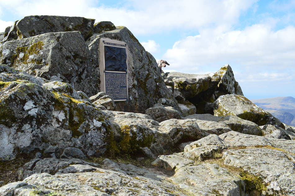 |
| The World War I Memorial, Great Gable summit. |
| We followed the new cairns and soon arrived at the summit memorial thinking that we had the summit to ourselves before realising we had just been photo bombed by a dog with floppy ears whose owner was taking shelter behind the summit rocks. It was by far the most severe windchill we'd felt all morning causing Rod to change his gloves into his full Winter gloves while David and I eagerly watched on, summit time was brief and as recommended by Birkett next we descend westerly to the Westmoorland Cairn. |
 |
| Kirk Fell with Mosedale Horseshoe beyond. |
| |
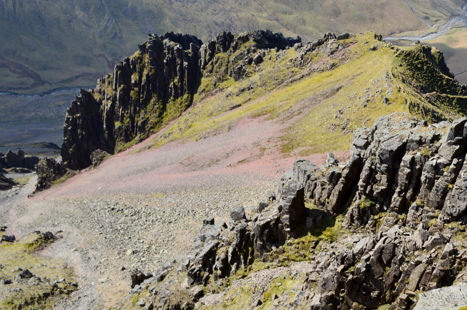 |
| Looking down on Great Napes and Great Hell Gate from the Westmoorland Cairn. |
| To get a shot this close involved lying down on ones belly over the edge while knees trembled behind. |
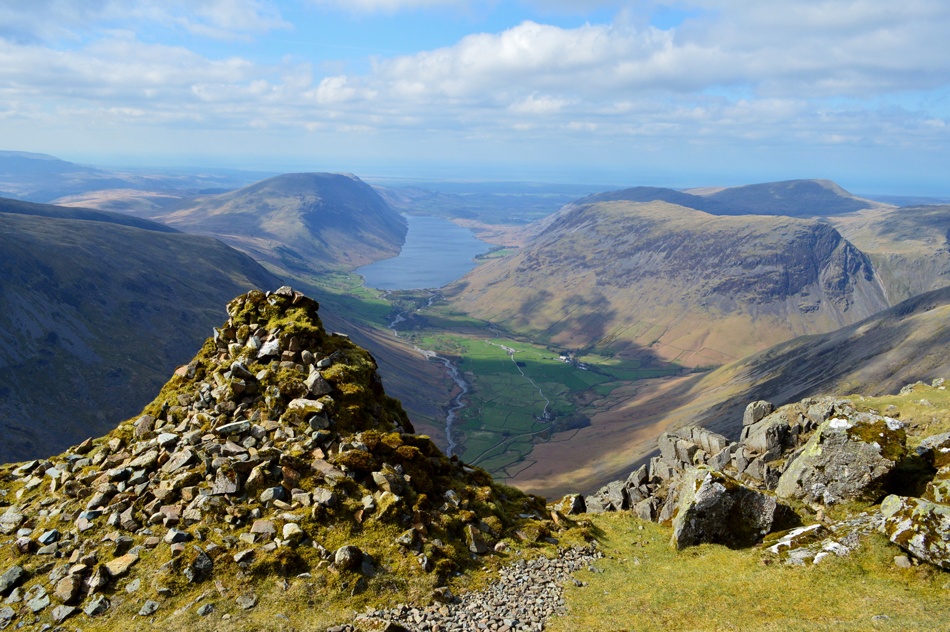 |
| Wasdale from the Westmoorland Cairn. |
| Thought to be one of the finest views in the Lake District, I couldn't agree more. |
 |
| Lunch with a view. |
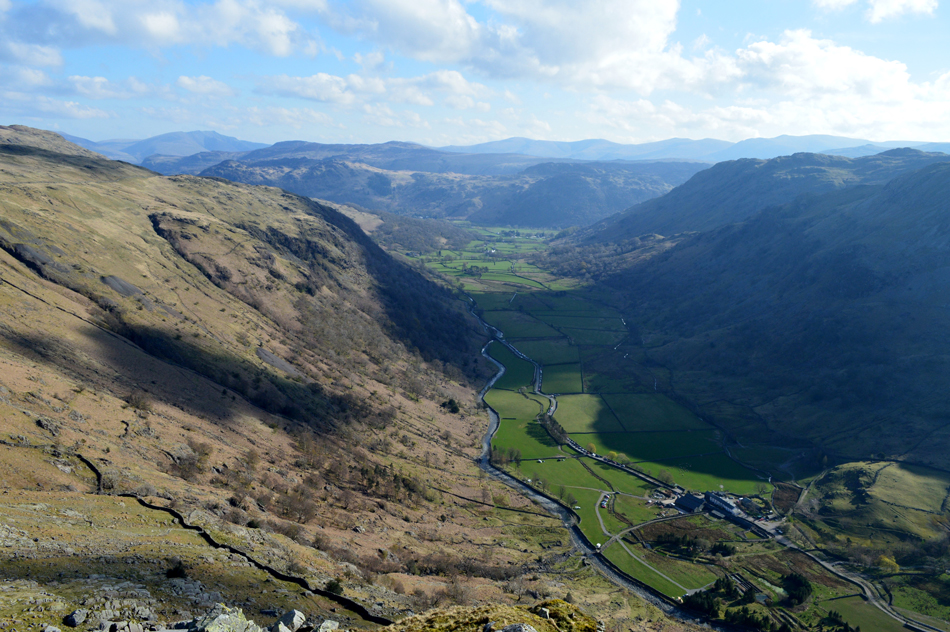
The Westmoorland Cairn did provide some much needed respite from the wind and it was nice to able to speak without shouting while taking in one of the countries best views, but there was no time to hang around so with that in mind we retraced our steps slightly and took in the shoulder path towards the Breast route which was reached soon after.
As our altitude lessened the windchill dropped and soon we started to feel the affects of the midday sunshine which we decided to take advantage of in a sheltered hollow besides the path where we broke out lunch. With Sty Head below we people watched taking note just how busy Sty Head was and was amazed to count well over fifty walkers on, or approaching the Corridor Route which isn't a place for hold ups.
Soon we are passed by a local chap who had set off from Seathwaite this morning and had already climbed Scafell Pike and had made his way back to Sty Head via the Corridor Route, he too couldn't believe how busy it was noting that quite alot of people he had passed were totally unprepared, this was an all to common conversation that is taking place too often. |
 |
| Styhead Tarn from Sty Head. |
With lunch packed away we continued our descent and found ourselves at a very busy Stretcher Box at Sty Head. Only Days earlier David was stood here at 6pm while taking advantage of last weeks warm weather noting that he never saw a soul after crossing the wooden footbridge over Gable Beck.
Sounds like bliss to me. |
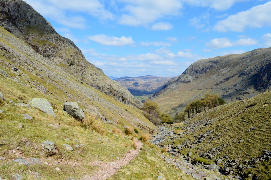 |
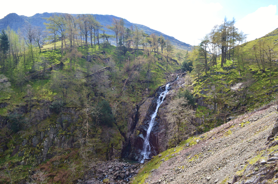
| Descending back to Seathwaite via Taylorforce Falls. |
| Another fine recommendation by the great Bill Birkett. |
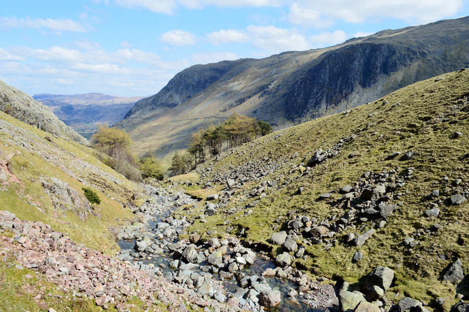 |
| Sty Head Gill prior to reaching Taylorgill Force. |
Instead of crossing the footbridge over Styhead Gill we keep left and follow a narrow footpath which then rises above the steep ravine. This route although not technical requires a scramble after passing the falls (when heading back towards Seathwaite) and would only be recommended to atempt in dry, clear conditions.
Alternatively, the steep scree alongside a fence can be descended in order to avoid the scramble once Taylorgill Force is reached. |
 |
| Following the footpath above the ravine. |
| This photo was taken after passing Taylorgill Force, note the scree and the fence to the right which descends into the gill then rejoins the path further on. |
 |
| Taylorgill Force. |
| With the silhouette of Seathwaite Fell behind. |
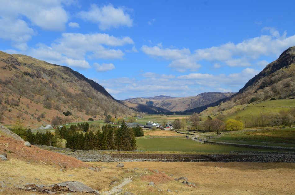 |
| Almost back in Seathwaite. |
| Under a mild afternoon sun we followed the narrow footpath back into Seathwaite then the course of Grains Gill on the western side of the valley before arriving at the footbridge we had crossed just under six hours earlier. |
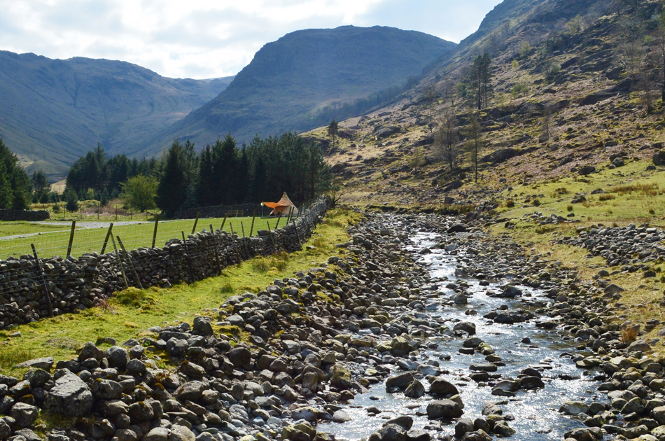 |
| Seathwaite Fell from the footbridge over Grains Gill, Seathwaite. |
While David removed his jacket Rod and I left ours on for the duration reaping the benefits of a warm sun on our backs whilst going over the highlights of the day which included the respite at the Westmoorland Cairn and the fine views we took from "my eyes are streaming, snotty nose, frozen face windchill gap"
We cross Grains Gill then passed through the familiar Barn and thereafter Seathwaite Farm. Despite the lane being clogged from end to end with parked cars only one fell runner passes us before we arrived back at our cars whose windows were glistening in the afternoon sunshine. |
|
| |
| Back to top |
 |
|