|
Walking the Birketts, Mellbreak |
 |
 |
6th May 2019 |
 |
|
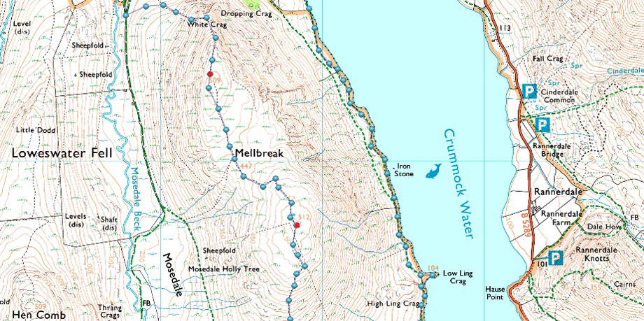
I've summated Mellbreak many times but I don't feel like I've took advantage of everything Mellbreak has to offer until I'd walked below her steep slopes along the shores of Crummock Water, today I did that.
The route is genius and easy to follow although care must be exercised especially when negotiating the path around the top of 'Big Gully' found on the north ridge. Once the north summit is reached it's hard to comprehend that you are now standing level with the summit of Hen Comb across the Mosedale valley. Continuing south along the saddle of the fell best described by my walking buddy Tim Oxburgh as "the arch of a ladies back" height is lost and then regained to the south, and main summit separated in height from the north summit by just ten feet.
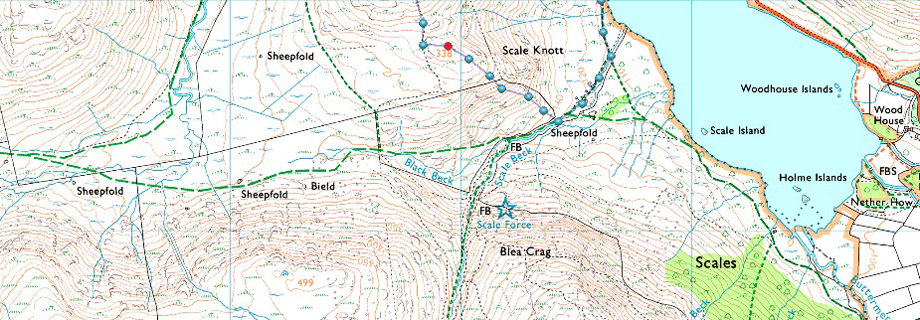
Continuing south down the ridge the sound of Scale Force accompanies the descent easily to Scale Knott where today, I broke out lunch. Birkett recommends to continue descent to the right of a wire fence before heading to the Crummock Water shoreline where impressive views of Ranerdale Knotts, Grasmoor and Whiteside demand attention. |
|
| The Complete Lakeland Fells |
 |
| By Bill Birkett |
-Mellbreak
Twin topped and saddle-backed Mellbreak is a moody and slightly mysterious hill. |
|
|
|
| |
|
Overview |
|
|
| Ascent: |
1,950 Feet - 594 Metres |
| Birketts: |
3, Mellbreak North Top - Mellbreak South Top - Scale Knott |
| Weather: |
High Level Cloud And Warm Sunshine. Highs of 14°C Lows of 8°C |
| Parking: |
Parking Spaces, Loweswater |
| Area - Group: |
Western - W/LOW |
| Miles: |
5.6 |
| Walking With: |
On My Own |
| Ordnance Survey: |
OL4 |
| Time Taken: |
3 Hours 20 Minutes |
| Route: |
Mosedale - White Crag - Mellbreak North Top - Mellbreak South Top - Scale Knott - Crummock Water Shore Path - High Park - Church Bridge - Loweswater |
|
| |
|
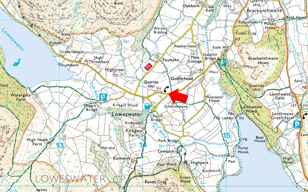
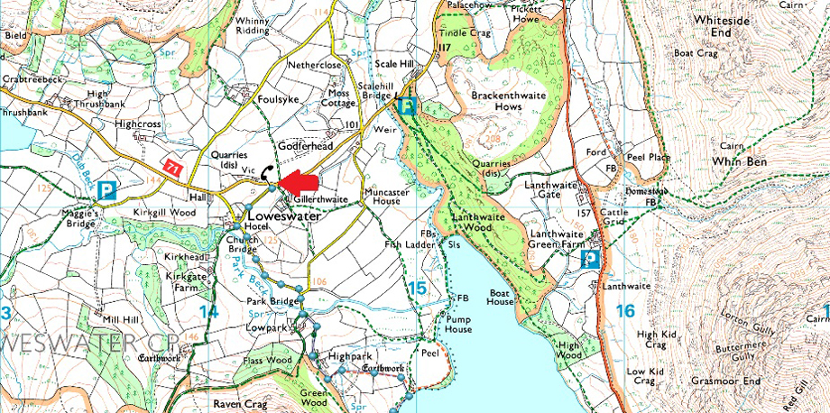
Parking Details and Map |
|
|
| Nearest Post Code: |
CA13 0RU |
| Grid Reference: |
NY 143 021 |
| Notes: |
Despite the popularity of the Loweswater Fells parking can be difficult due to limited spaces. The Red Phone Box in the centre of the village is what the Wasdale Inn is to Wasdale Head and here you will find parking spaces for around five well parked cars. The Phone Box now had a defibrillator inside as are most rural phone boxes. My advise as with many other premium parking spaces is to arrive early and you shouldn't have any trouble parking. The parking spaces provide access to of course the whole of the Loweswater fells or just walks around Loweswater with the Kirkstile Inn close by for food and drink. Parking is free. |
|
| |
|
Map and Photo Gallery |
|
|
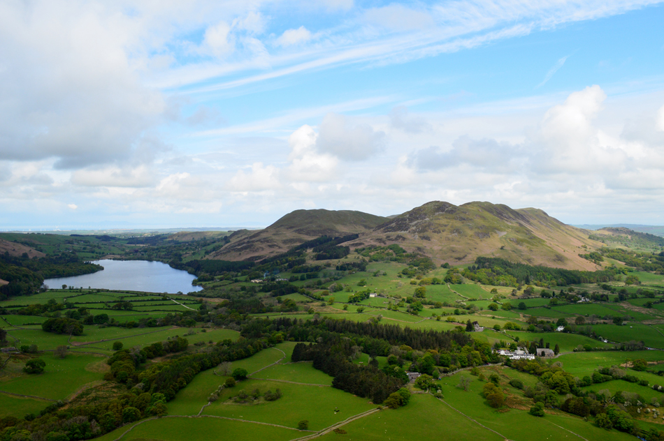 |
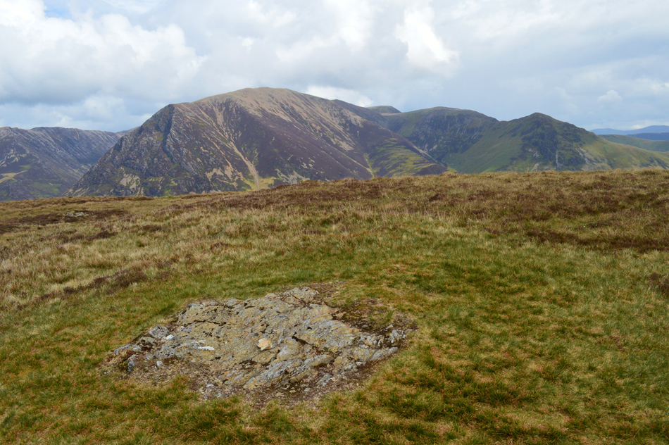
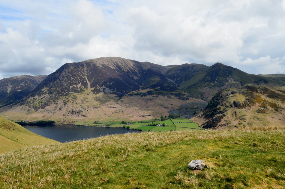
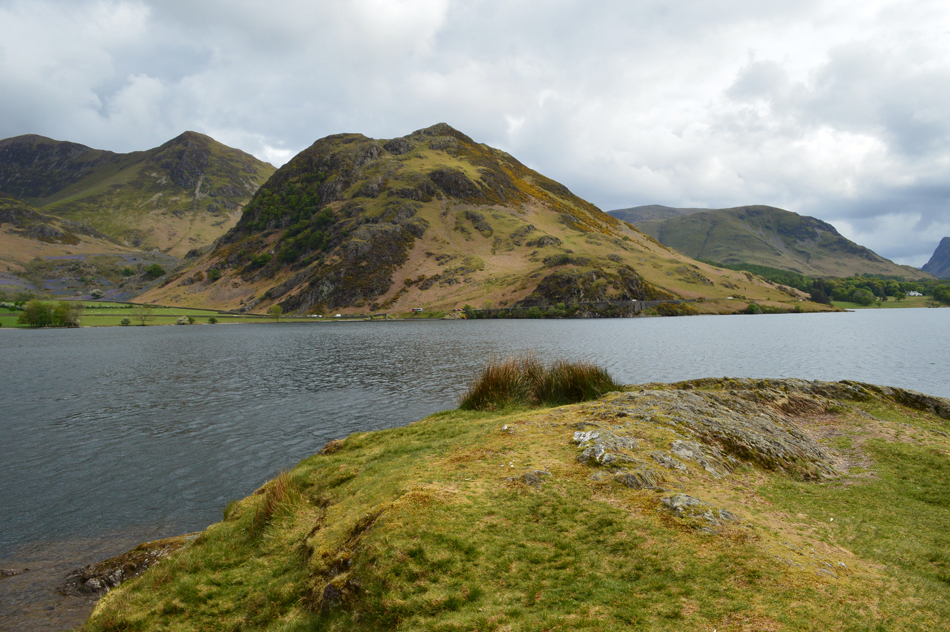
| Loweswater, Darling Fell, Low Fell and Fellbarrow from the ascent of Mellbreak north ridge. |
I began the steep climb out of Mosedale and kept to my intended ascent route passing below the tree I had seen from Hen Comb earlier, I knew this ascent would be steep and I wasn't wrong. Soon the north ridge and its steep path came into view, I look left and spot no one on the approach although around half the way up the ridge I spot a solo walker, possibly a fell runner making their own ascent while a dog scurried on up ahead. I pass through a flock of grazing sheep while my thighs scream, I burn through the pain which quickly subsides. I'm in good stead after my thigh burn and I hit the steep rocky path controlling my breathing not stopping until I am below the first promontory. I feel my subconscious has worked well for me which seems strange after struggling up the steep flanks of Hen Comb just two hours earlier. |
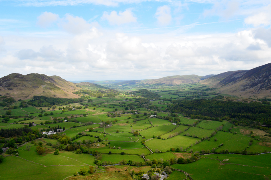 |
| Lorton Vale. |
| With Low Fell, Darling Fell and Fellbarrow over on the left and Whiteside, Dodd and Kirk Fell on the right. I can also see the bonnet of my car in this photo if I squint! |
 |
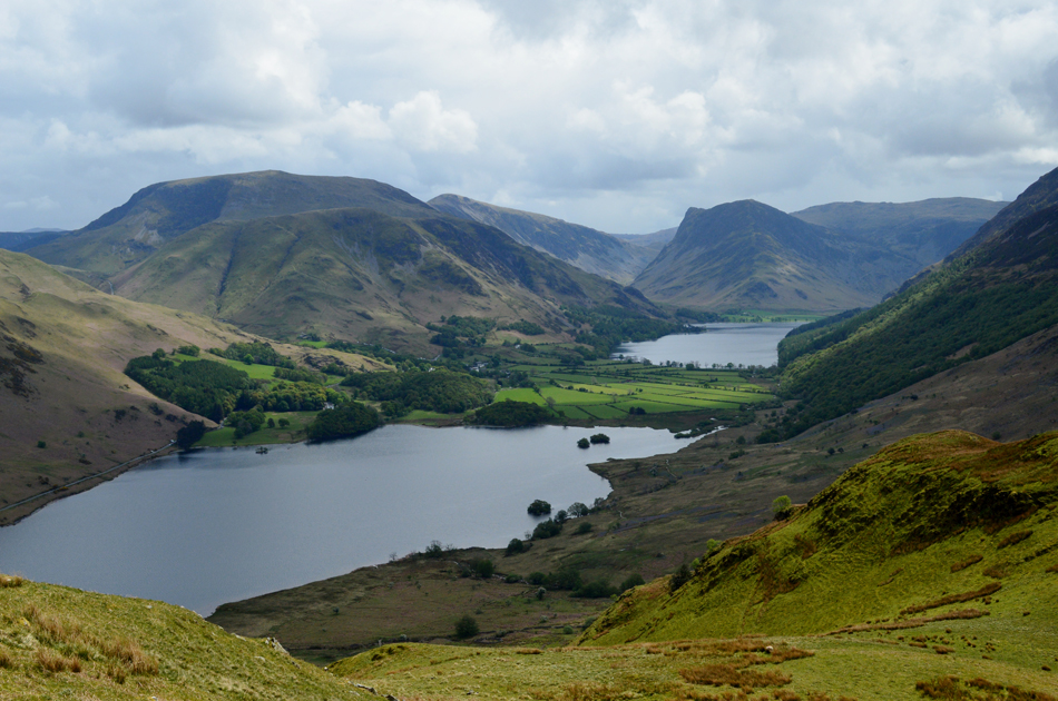
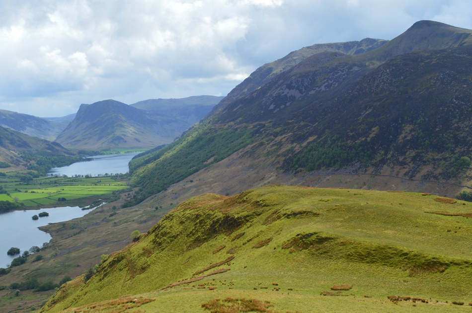
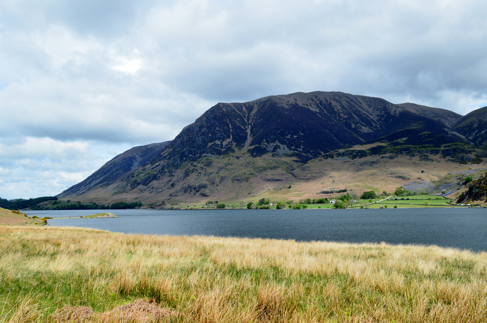
| From the first promontory views over Crummock Water towards Grasmoor, the Lad Hows ridge, Whiteless Pike, Rannerdale Knotts, High Snockrigg, Robinson, Fleetwith Pike and Buttermere. |
| It's been five years since I last stood at this spot and the view still makes the hairs on my arms stand on end. |
 |
| Loweswater, Darling Fell, Low Fell and Fellbarrow form Mellbreak summit. |
Having taken in the fabulous views from the first promontory I skipped a visit to the second and continued with my ascent leaving the steep twisting path as I reach the north summit shoulder flanked by heather on all sides. The solo walker I had seen earlier was long gone finding I had the summit all to myself I stopped to compose myself while taking in the views.
I really have missed Mellbreak. |
 |
| Heading over the saddle towards the South summit. |
| With distant views of Red Pike (Buttermere) High Stile, Fleetwith Pike and Pillar (in shadow far right) |
 |
| I stop to take this close up of the west face of Grasmoor (Grasmoor End) |
| With the summit seen top right. |
 |
| Hen Comb from Mellbreak. |
| It's looking a whole lot brighter on Hen Comb now, in fact I've been observing two walkers who have been on the summit for sometime now, I reckon they've broke for lunch which reminds me I'm kinda feeling hungry now too. |
 |
| Grasmoor, Lad Hows, Eel Crag (Crag Hill) Wandope and Whiteless Pike from Mellbreak summit. |
| While over in the far left we have Whiteside and the Whiteside ridge leading towards Hopegill Head. |
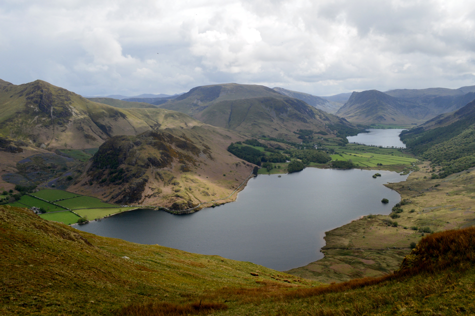 |
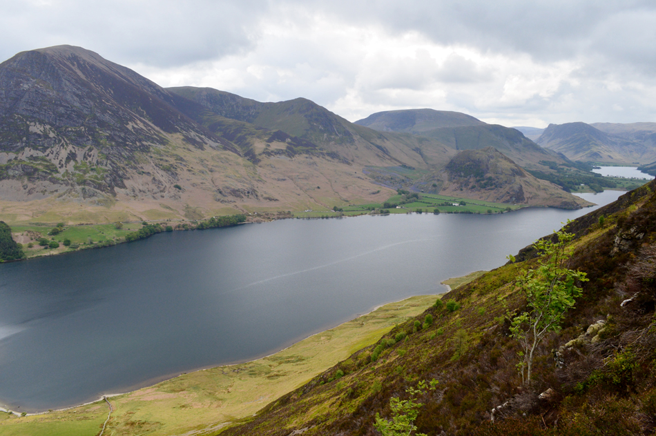
| Views over Crummock Water towards Whiteless Pike, Rannerdale Knotts, High Snockrigg, Robinson, Dale Head, Fleetwith Pike and Buttermere. |
| With most of the ascent now behind me I could now enjoy views such as this as I make my descent towards todays final summit Scale Knott found on Mellbreak's south ridge. |
 |
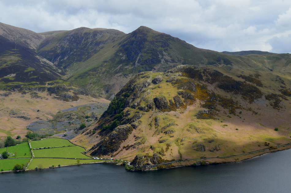
| Scale Knott. |
| Which had lunch break written all over it! |
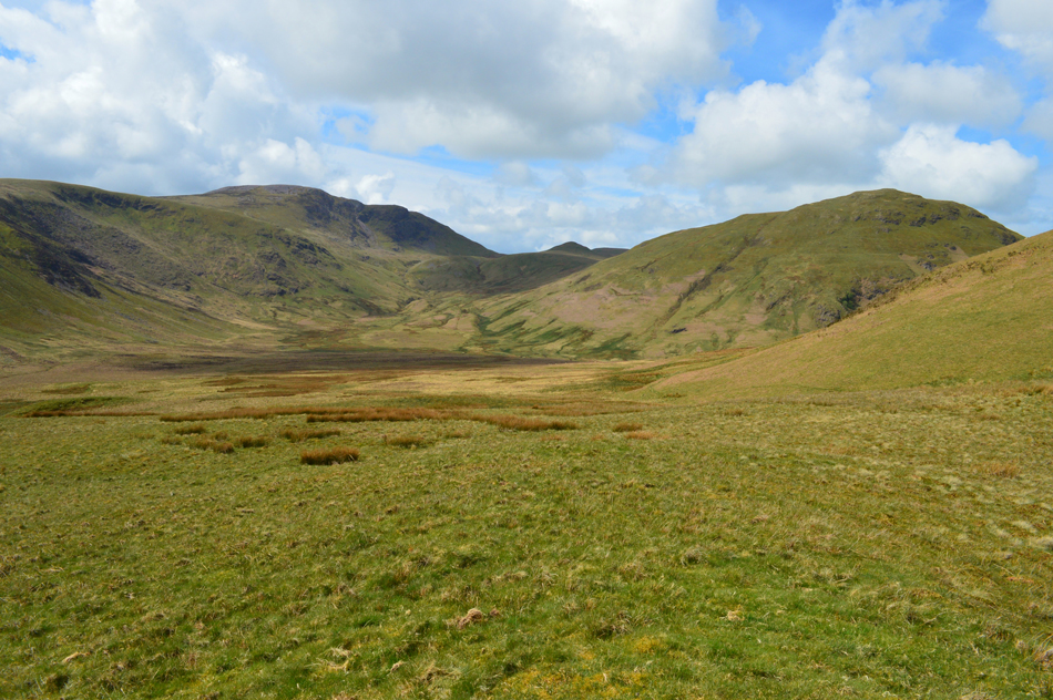 |
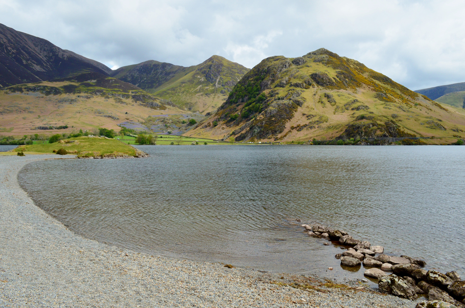
| The view into Mosedale towards Great Borne, Gale Fell, Floutern Cop and Hen Comb. |
I half expected to find a few walkers walking through here but there wasn't a soul which strongly leads me to believe that a lot of folk (including myself) had been fooled by the incorrect forecast.
Oh well, not to worry it's lunch time now. |
 |
| Whiteside, Grasmoor, Lad Hows, Wandope, Whiteless Pike and Rannerdale Knotts from Scale Knott summit. |
The south ridge of Mellbreak is much less steeper than the north and is predominantly made up of grass which made the descent quite enjoyable. Scale Knott was easily gained by turning left off the path and onto its grassy summit.
I'm now on the look out for a sun-trap to take advantage of this misleading forecast. |
 |
| Lunch with a view. |
| It didn't take long to find my little sun-trap free from wind, I broke out lunch while taking in the view over Crummock Water towards the thriving Rannerdale Bluebells. It's fair to say that I couldn't spot a single car space with people double parking not allowing tractors or small buses through which makes me feel kinda glad I'm up here and not down there. |
 |
| Low Ling Crag, Whiteside, Grasmoor and Lad Hows seen over Cinderdale Common. |
It was a steep descent via Scale Knott and I kicked my feet into the back of my boots once Scale Beck was reached when I'm shouted at "Oi!! where's the waterfall?" by a chap who starts to walk towards me but he's too far away and I'm all of a sudden too annoyed to walk towards him "it's behind you, in the trees" I shouted back, the drowning sound of cascading water down kinda gives it away wouldn't you think "thanks mate" the guy shouts back, I'm not impressed by this guys conduct but I shrug it off anyway.
The craggy out crop connected by the causeway is Low Ling Crag, which is where I'm heading next. |
 |
| Lad Hows, Whiteless Pike and Rannerdale Knotts from Low Ling Crag. |
| I can almost smell the Bluebells. |
 |
| Lad Hows, Whiteless Pike, Rannerdale Knotts and High Snockrigg from Low Ling Crag. |
| |
 |
| Low Fell and Fellbarrow from Low Ling Crag, Crummock Water. |
| There's a fresh wind blowing down the lake causing me to roll my sleeves down pretty swiftly! |
 |
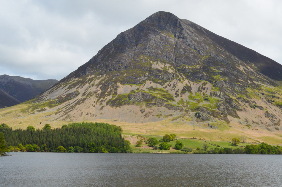
| Grasmoor and Whiteside from the Iron Stone, Crummock Water. |
| I left Low Ling Crag and picked up the shore path passing many a walker heading from the north end of the lake. The path is sometimes rocky underfoot and stepping stones have been put in place where it's naturally boggy or wet but this soon gives way for a gentle grass path as the northern tip of the lake looms closer. |
 |
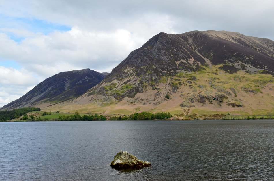
| Grasmoor from the lake path. |
| It's fair to say that Grasmoor has dominated the entirety of this walk which left me planning my next venture onto its summit. |
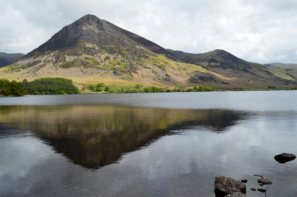 |
| Grasmoor and Whiteless Pike reflections. |
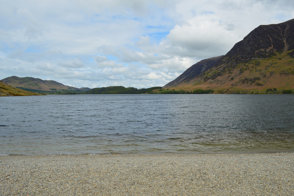
| I'd been walking in the shadow of Mellbreak's steep eastern flanks while a continuing fresh wind blew down the lake. After passing more walkers heading south I arrvied at the pebbled beach at the same time the sun broke out leaving some welcomed warmth and not to mention fabulous reflections over Crummock Water. |
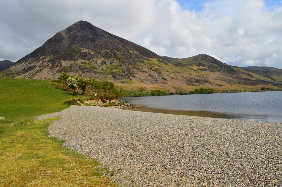 |
| Grasmoor and Whiteless Pike from the northern tip of Crummock Water. |
| |
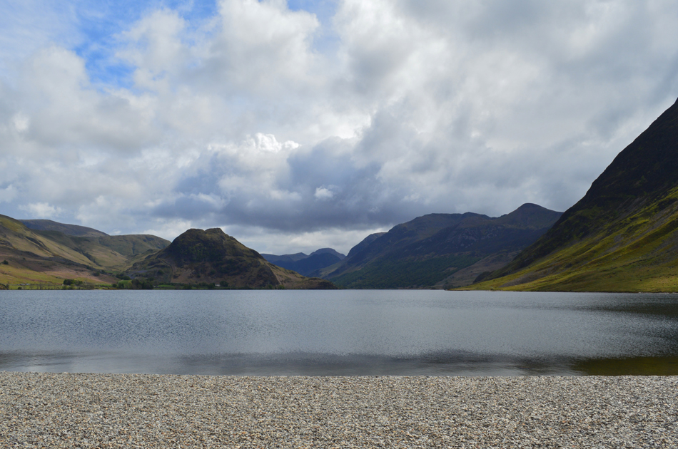 |
| Looking south towards Rannerdale Knotts and the Buttermere skyline. |
I had a good excuse not to leave just yet as I had to consult my Birkett almanac book to double check the route back to Loweswater which was confirmed via High Park, Park Bridge and Church Bridge. I left the shoreline and passed through a gate then made the short ascent through a field of sheep and lambs. I pass through High Park which lead me over Park Bridge. The lane is narrow, tree lined but through breaks in the canopy Mellbreak's north ridge looms.
It's feeling hot as I head left for Church Bridge before arriving at the signpost Wainwright described as the "negative signpost" I can hear children playing in the beer garden at the Kirkstile Inn where this morning I thought about treating myself to a pint after the walk was over but there doesn't appear to be a seat in the house. I arrive back at my car which is now basking in the sun and before I do anything I open the windows to let the heat escape. I've not done too bad for time but my feet are aching and I'm ready to finish off my lunch before the long drive home.
What a fabulous day though. |
|
| |
| Back to top |
 |
|