|
Grasmoor Direct |
 |
 |
22nd June 2019 |
 |
|
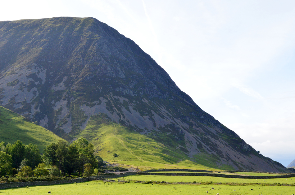
The ascent of Grasmoor's north west ridge looks impregnable from the ground but early Lakeland pioneers would have blazed a route up this ridge during their early explorations resulting in one of Lakelands finest, yet toughest ascents condemned to the sadistic walker inept on reaching Grasmoor End.
I've known about this route for as long as I've been walking the Lakeland fells in fact Alfred Wainwright in his guidebook the North Western Fells 'Grasmoor 6' compares the direct ascent to the north wall of the Eiger, for anyone including myself yet to ascend the direct route reading Wainwrights comparison was enough to leave a gulp in anyones throat, mine included.
It was only after my Mellbreak walk back in May did Rod suggest giving the 'Grasmoor Direct' route a bash and I of course replied to Rod with a pretty enthusiastic email explaining that Grasmoor's Direct route had been on my Lakeland bucket list for sometime and how like many other routes, it had just fallen through the net.
Until today, this is Grasmoor Direct. |
|
| Wainwright Guide Book Six |
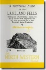 |
| The North Western Fells |
-The Direct Route
On the whole, however, the climb is probably less difficult than the North wall of the Eiger. |
 |
|
|
|
| |
|
Overview |
|
|
| Ascent: |
3,384 Feet - 1,032 Metres |
| Wainwrights: |
4, Grasmoor - Eel Crag (Crag Hill) - Hopegill Head - Whiteside |
| Visiting: |
5, Grasmoor End - Sand Hill - Gasgale Crags - Whiteside East Top - Whin Benn |
| Weather: |
A Bright Start Soon Turning To Patchy Sunshine With Brightness Returning PM - Feeling Cool Over The Summits. Highs of 19°C Lows of 12°C |
| Parking: |
Car Park, Lanthwaite Green |
| Area: |
North Western |
| Miles: |
6.4 |
| Walking With: |
Rod Hepplewhite |
| Ordnance Survey: |
OL4 |
| Time Taken: |
5 Hours 40 Minutes |
| Route: |
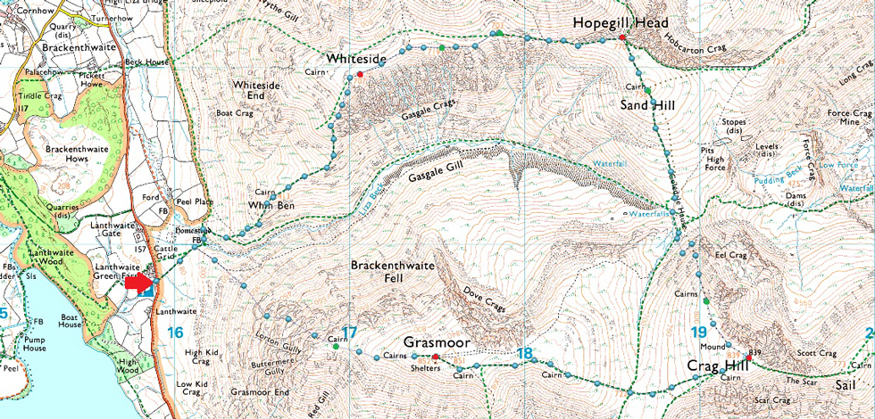
Lanthwaite Green - Grasmoor North West Ridge - Grasmoor End - Grasmoor - Eel Crag (Crag Hill) - Eel Crag - Coledale Hause - Sand Hill - Hopegill Head - Whiteside East Top - Gasgale Crags - Whiteside - Whin Benn - Liza Beck - Lanthwaite Green |
|
| |
|
Parking Details and Map |
|
|
| Nearest Post Code: |
CA13 9UY |
| Grid Reference: |
NY 159 020 |
| Notes: |
Found next to Lanthwaite Green Farm this car park has room for over a dozen well parked cars and offers easy access to Whiteside and the Grasmoor Fells. There is a phone box in the corner of the car park and parking is free. |
|
| |
|
Map and Photo Gallery |
|
|
 |
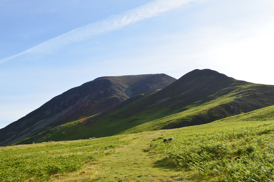
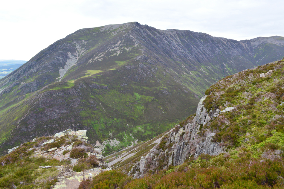
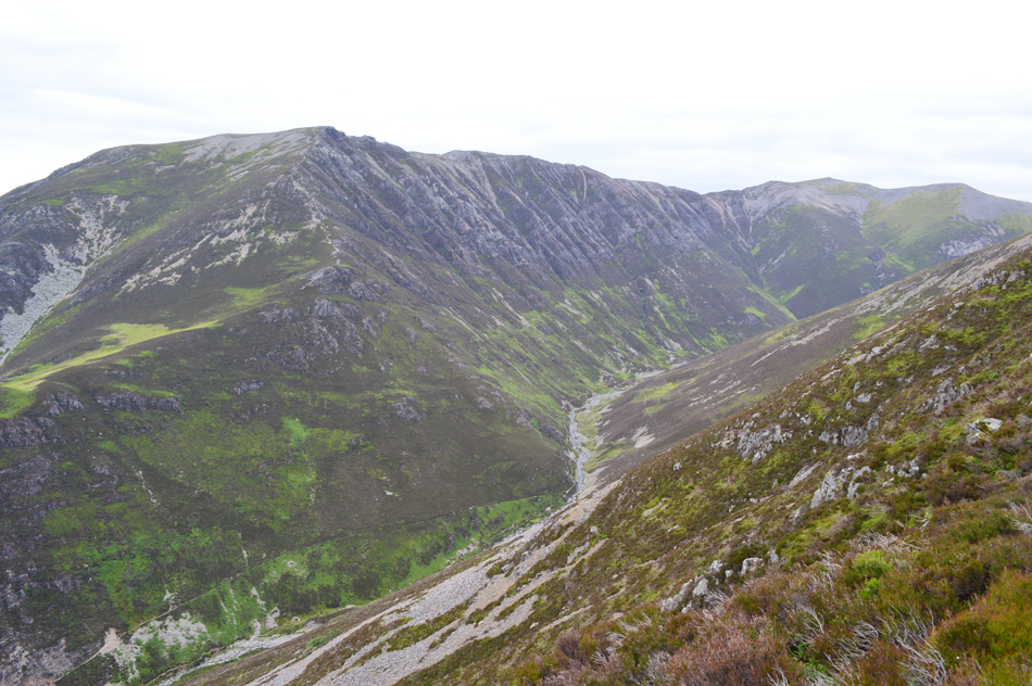
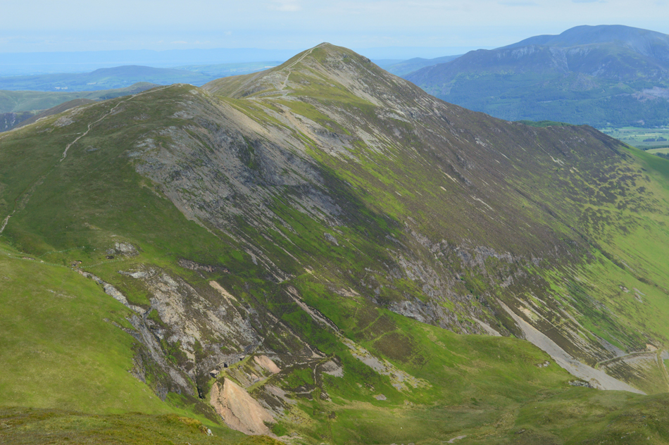
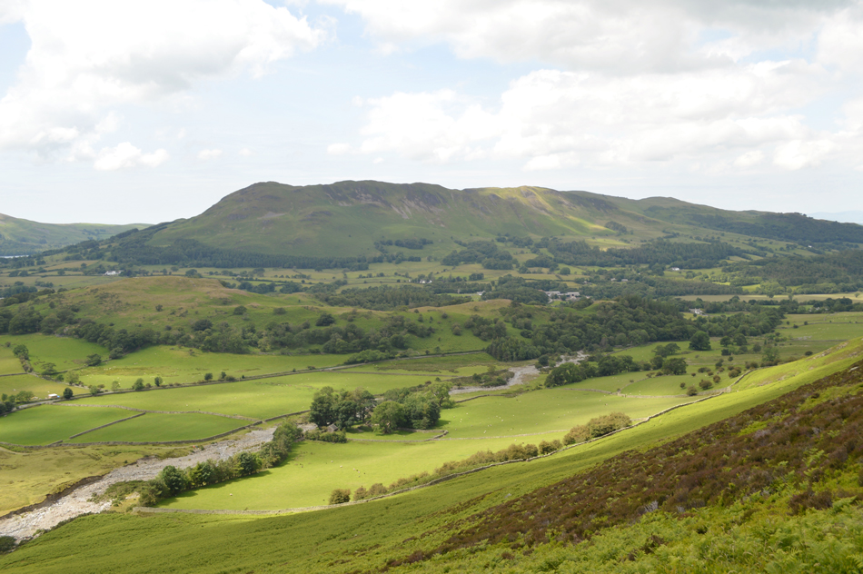
| Grasmoor's North West ridge from Brackenthwaite. |
| With plenty of time to spare I stopped the car at Brackenthwaite not only to take this photo but to let the enormity of Grasmoor's north west ridge sink in. We've already done our research on the route yet aside the steep grass approach followed by the equally steep scree section it's almost impossible to spot the route onwards.
Gulp! |
 |
| Whiteside and Whin Ben from Lanthwaite Green 08:15am 12°C |
As I was taking the previous photo Rod drove past me and arrived at Lanthwaite Green first soon followed by myself minutes later, I was surprised to find the car park full and feared I might have to find somewhere else to park before spotting the very last space next to the exit. After parking up I wandered over to Rod passing a group who were cooking breakfast on a BBQ behind their car, undeterred by the smell of bacon the first words we spoke after a firm handshake were "if the car park is this full then where is everyone?" It was odd to see the car park so busy so early but an explanation will come later which would explain it all but for now we're left a little puzzled.
It's mild without so much as a breath of wind which makes todays conditions perfect to climb Grasmoor's north west ridge. With Rod kitting up on the opposite side of the car park I kit up while being tortured by the smell of cooking bacon. My kit is kept to a minimum to save on weight (unchanged from my Ennerdale Horseshoe) with only 1.5ltrs of hydration as opposed to the 3ltrs I carried that day.
Wearing just shorts and a long sleeve base layer I locked my car and wondered back over to Rod this time joking "was there any bacon going spare" "wait around they laughed!" We left the carpark and picked up the smooth grassy path where Whiteside and Whin Ben stood ahead while Grasmoor's north west ridge dominated the corner of my right eye. |
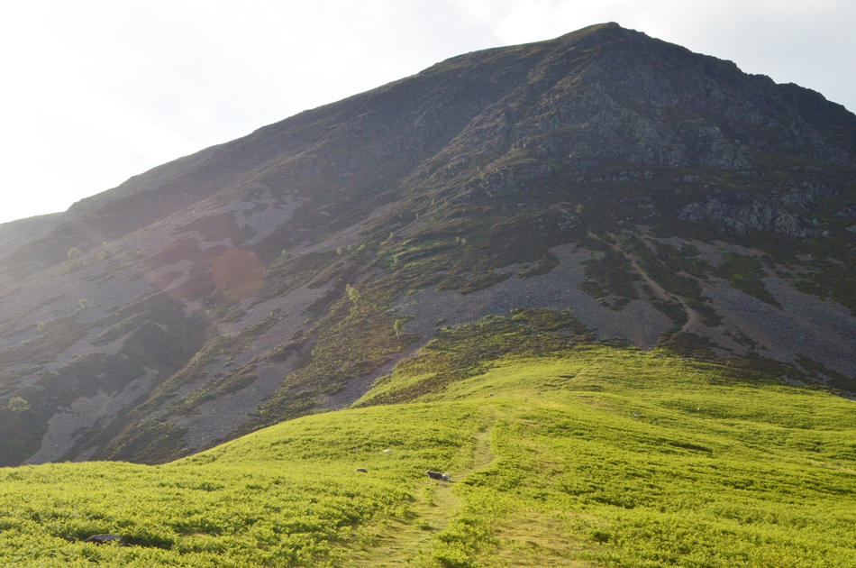 |
| It's straight up. |
| We reached the crossroads in the path and turned right then followed the steep grass bank to the base of the scree, the grass bank gave us the first taster of how steep this ascent is going to be. |
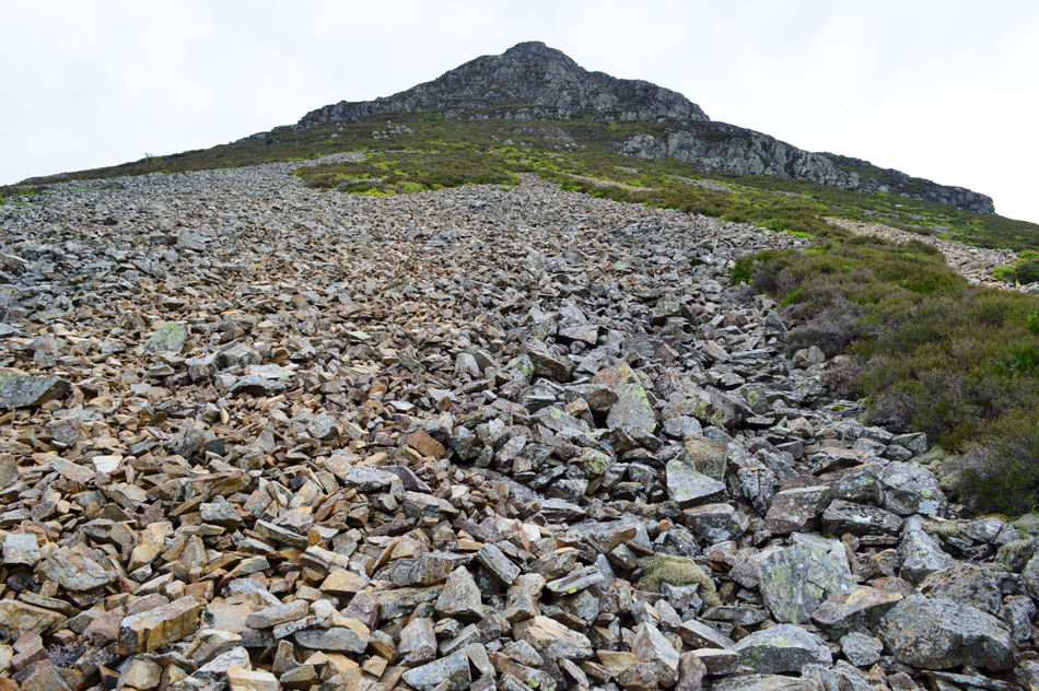 |
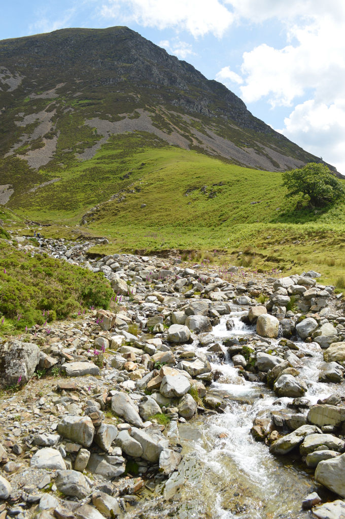
| Reaching the base of the scree. |
Both myself and Rod are familiar with rough scree having both previously descended the notorious Dorehead Screes and Windgap Screes plus various other scree rakes such as Lord's Rake and Deep Gill on Sca Fell most of which are at some point in regular use, however the scree here doesn't see the same usage meaning it feels like 'virgin scree' underfoot with all the larger boulders at the base giving a false sense of security with firm footings to start leaving the medium to small size rocks found half way up the slope, this is where the scree becomes incredibly loose and tiresome and there's a good 1,400ft of it to pick at until the heather is reached below the vast crags which in terms of scale would equal that of a four story building.
We followed Wainwrights advice by keeping to the centre of the scree despite spotting a scree path to the far right of our location - this path was mostly shale and would have been as equally loose and difficult to ascend by so we decided to ascend by the larger to medium size rocks rather than take our chances with the shale.
Our point of contact is to the left of the crags ahead from where we would ascend a grass rake which reminded Wainwright of Lord's Rake but before we make any comparisons we need to reach the heather up ahead. |
 |
| The Grass Rake, Grasmoor North West Ridge 1,500 - 1,600 ft ABSL |
I'm not sure if my body is still getting over the Ennerdale Horseshoe or it's a combination of how busy I've been in work over the last two weeks but the scree was sapping away at energy levels so early into the walk. With Rod ascending like the power horse he is I started to fall behind and this caused me to feel frustrated, I just couldn't find my 'happy medium' and I started to curse under my breath. The scree at this point was woo-full finding to ascend just one step took an energy sapping three and I knew it was exactly the same for Rod.
By now I was probably 30ft behind Rod and I told myself that it was 'good practice' to maintain such a distance just in case of rock fall which helped self morale. By the time we had reached the heather we were ascending at a forty degree angle clutching (and trusting) the heather in order to gain the next step, this despite the steepness meant I was able to catch Rod up and with the scree confined behind me I was soon joking again although inside I think we both felt like we'd just done a round with Mike Tyson.
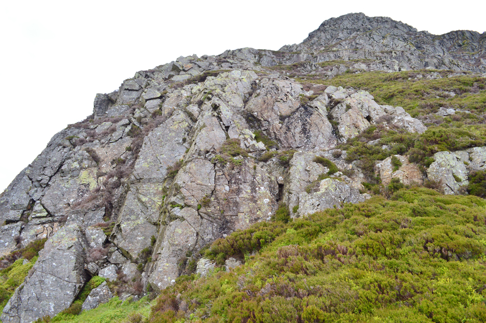
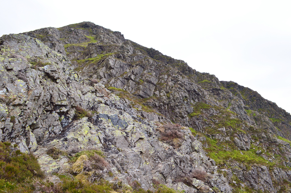
We negotiated the crag by means of two or three 10/15ft scrambles to start, these were at times quite vertical and reminded me of the rock wall at Piers Ghyll and the rock wall on the north side of Glaramara's summit, quite easy but concentration required at all times as exposure was never too far away. |
 |
| Whin Benn, Whiteside, Gasgale Crags and Hopegill Head from the head of the Grass Rake. |
| I could agree slightly with Wainwright when he compared the Grass Rake to that of Lord's Rake on Sca Fell, with the feeling of enclosure as the Rake was flanked by high crags on both sides and although shorter than Lord's Rake its steepness was similar. |
 |
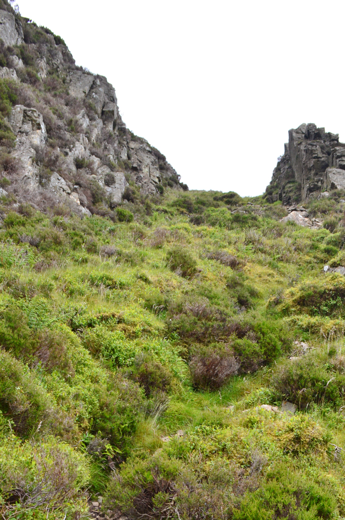
| We look up towards the location of 'Fat Man's Agony' and 'The Pinnacle' located behind the rock towers ahead. |
| Although Fat Man's Agony and The Pinnacle cannot be seen in this image we knew it was located behind the crags on our horizon. We locate a singular path - quite distinct and followed it through the heather while at the same time negotiating more scrambles. |
 |
| Familiarising ourselves with the terrain. |
| Even though we were only half way into the ascent we were kept grounded by the noise of traffic as it passed over the cattle grid at Lanthwaite Green far below. |
 |
| Views over Gasgale Gill towards Whin Benn, Whiteside and Gasgale Crags. |
| It hadn't gone unnoticed that it started to cloud over which in actual fact is helping to keep body temperature down. |
 |
| The view into Gasgale Gill towards Hopegill Head and Sand Hill. |
Despite agreeing to walk Grasmoor's north west ridge we hadn't thought of what to do afterwards so I suggested we return via Whiteside which would mean traversing the Hopegill Head to Whiteside ridge to which Rod replied in his email "you took the words out of my mouth" |
 |
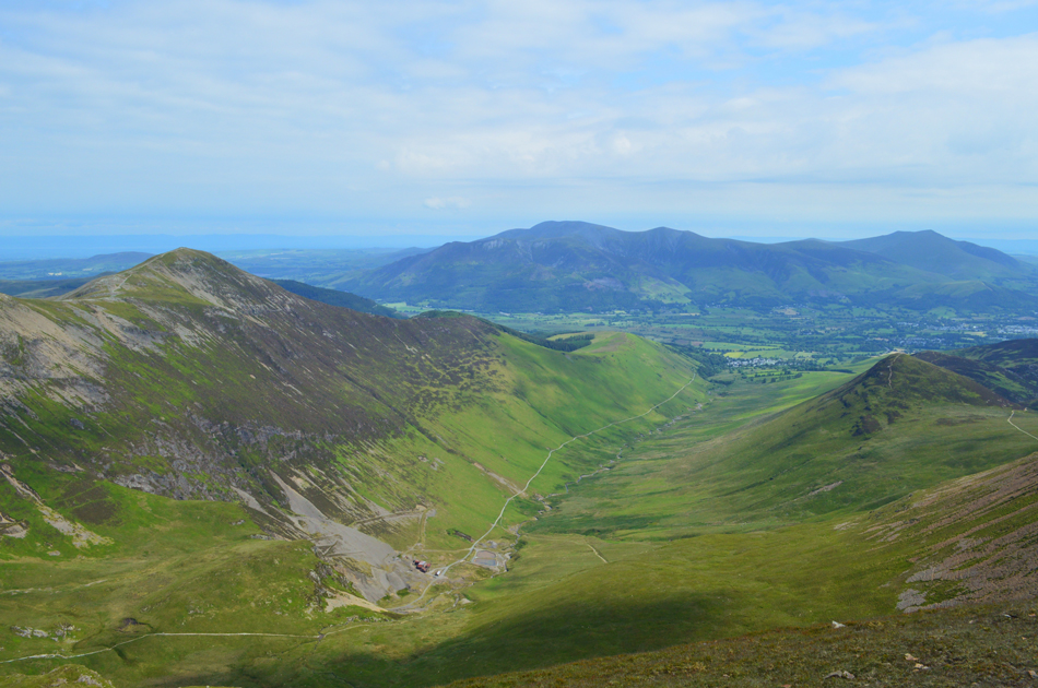
| Grasmoor End comes into view. |
I took this photo prior to reaching Fat Man's Agony which is a grass gully (sorry out of shot far left) with quite a tight squeeze close to the head of the gully.
We ascend left and reach the base of Fat Man's Agony (gully) |
 |
| Looking down on Fat Man's Agony. |
I really could have kicked myself having totally missed out on Fat Man's Agony where instead I 'kid like' ascended the rock tower seen sloping from left to right. With Rod out of sight and earshot I found Rod waiting for me at the top who greeted me with a loud HELLoooooooo... accompanied by a cheeky grin spread across his face "I've just ascended through Fat Man's Agony" he smiled and although I had immensely enjoyed my rocky scramble had I known Fat Man's Agony was just below me I would have followed Rod. |
 |
| From the head of the gully (Fat Man's Agony) |
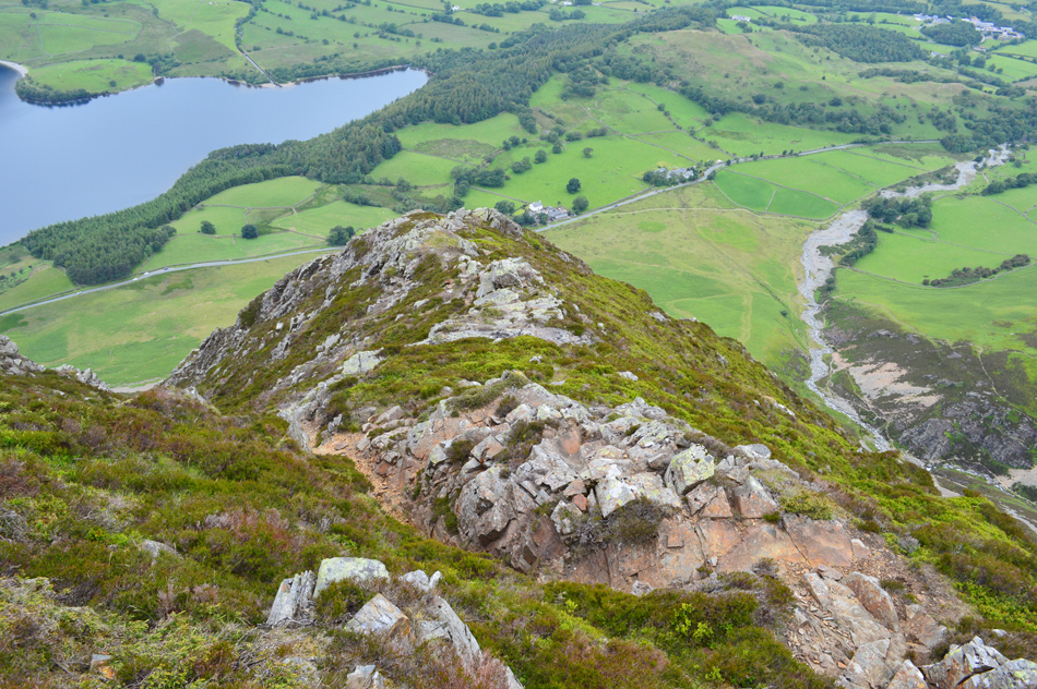
| The Pinnacle comes into view with Grasmoor End seen above the cliffs far right. It is clear why Wainwright wrote that the rocky arete (seen just beyond The Pinnacle) doesn't appear at first until you are actually upon it. |
 |
| Looking down on Mellbreak and Crummock Water from the rocky arete. |
| |
 |
| And looking back on the rocky arete. |
| The Pinnacle can just be seen at the far end of the arete. |
 |
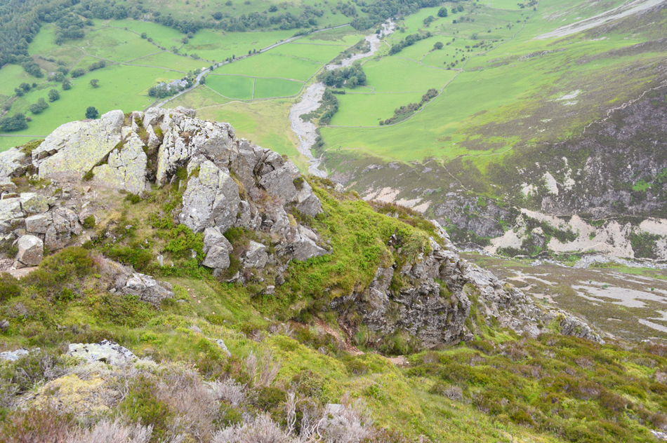
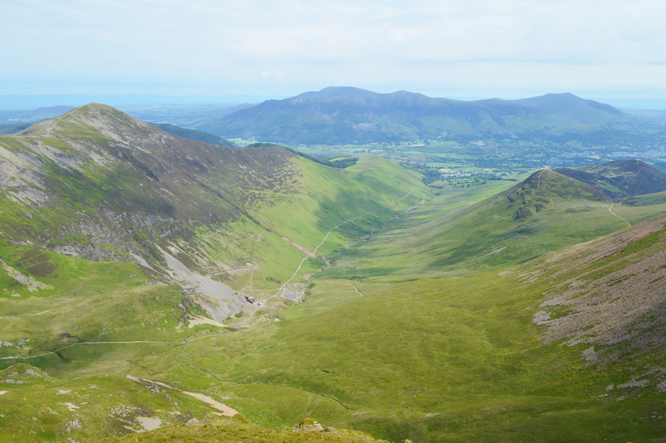
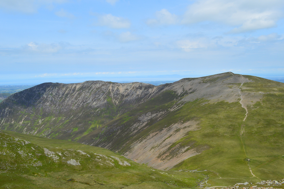
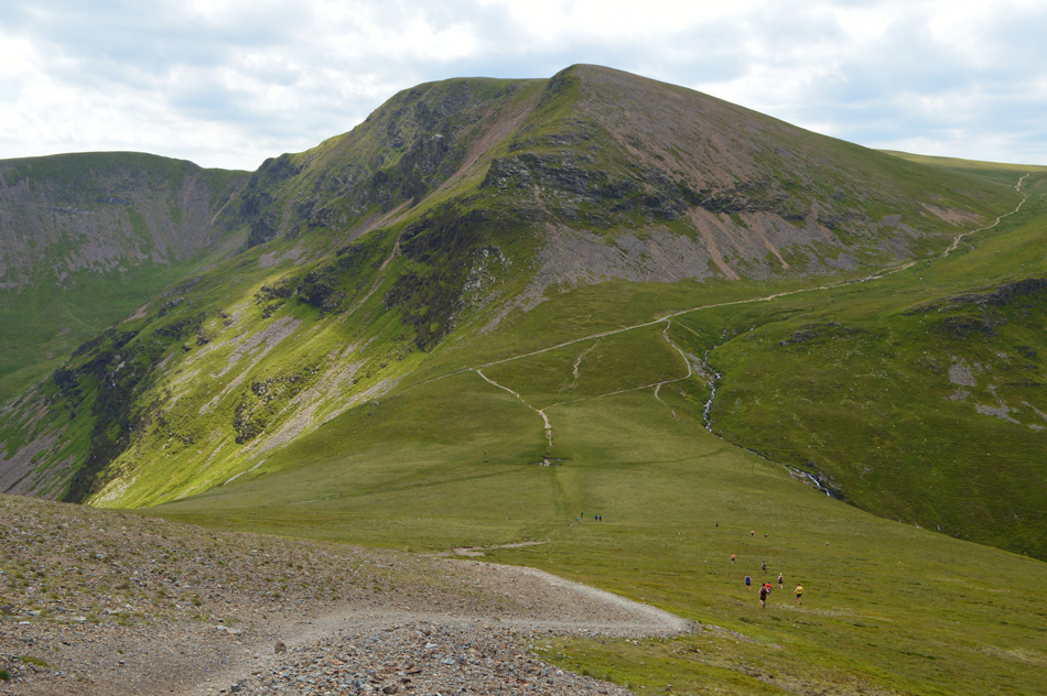
| Distant high ground from Grasmoor End. |
| Having traversed the arete Grasmoor End was now in site which we gained via a steep grassy pull while being eaten alive by midges! The last thing we had expected to see seconds before reaching the cairn was the two guys and their four dogs who were looking down on us as we crested the summit shoulder, feeling a little surprised I can't quite remember what they asked but conversation soon turned to 'which way back was best for them and their dogs ' cheekily advising that this probably wasn't it. |
 |
| Grasmoor summit appears from Grasmoor End. |
| Before heading straight for the summit we descended slightly by following a narrow ridge which came to a end over the rock towers that form Grasmoor End which offered incredible rock scenery matching the likes of The Napes on Great Gable and Chambers Crag, Bowfell but the light by now was so poor capturing the ridges was difficult so they are left in my memory alongside one of the finest ridge ascents in Lakeland. |
 |
| Grasmoor summit. |
We watched the two guys and their dogs disappear back towards the summit and after our excursion along the mini ridge we followed them mostly in silence in awe at our achievements or possibly just out of breath.
On reaching the summit we found a young girl sat down taking in the view over Gasgill while a fell runner was just preparing to leave, we didn't spend too much time at the summit as the light was still low and views were limited so we left and enjoyed the smooth grass underfoot before starting our descent then re-ascent on Eel Crag (Crag Hill) |
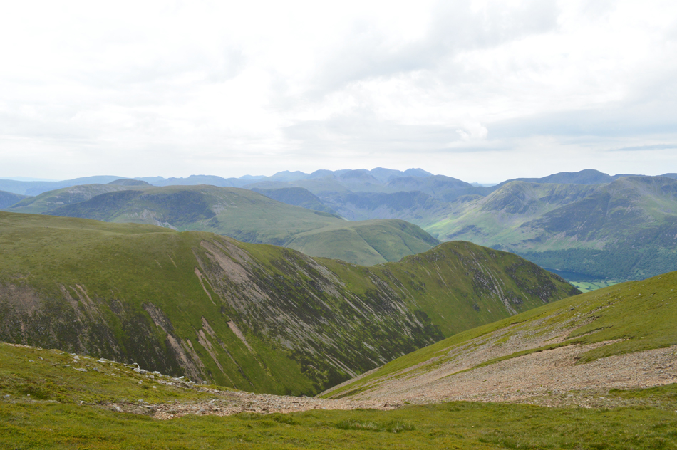 |
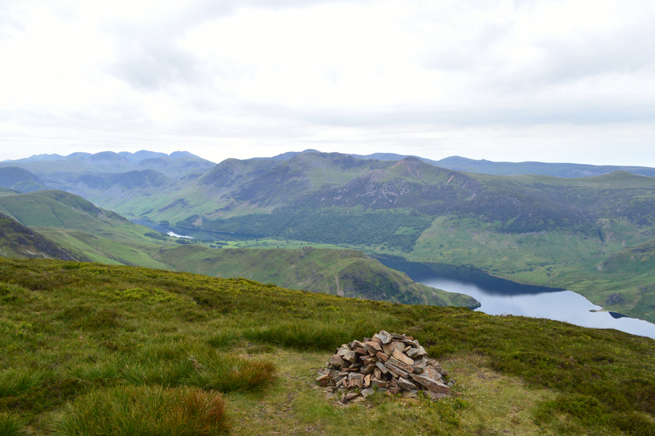
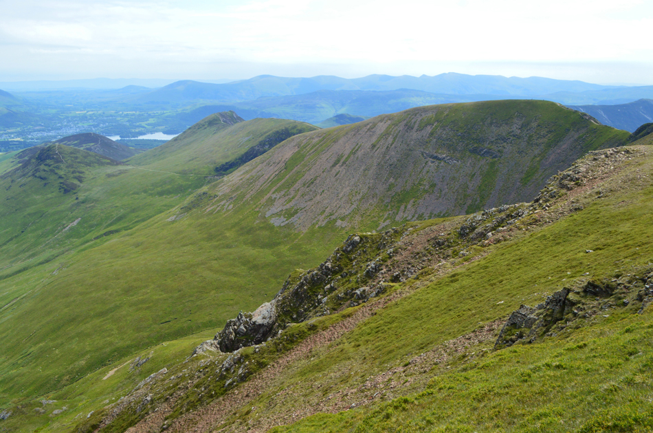
| The view over Whiteless Edge and Whiteless Pike towards High Snockrigg, Robinson, Hindscarth, Fleetwith Pike, Brandreth, Haystacks, Kirk Fell, Pillar and High Stile. |
| While in the disance views extended as far as the Coniston, Great Langdale and Scafell ranges. |
 |
| Descending Grasmoor for Eel Crag (Crag Hill) |
| I think that's the sun about to make an appearance. |
 |
| Wandope seen over Addacomb Hole with Thirdgill Head Man in the distance. |
| By the time we had reached the crossroads linking Grasmoor and Eel Crag the sun was beaming down at a point when just ten minutes earlier while on Grasmoor's summit we were both about to add extra layers. During our descent we spotted quite a few walkers stood on Wandope and Eel Crag summit and what appeared to be two Marshals half the way up the Eel Crag path, it soon became clear that there was a fell race on which we found out had started at the Swinside Inn, Newlands which appeared to take the fell runners from Causey Pike to Eel Crag and returned via Hindscarth and Scope End (our presumption after over hearing a conversation from one of the Marshals as we passed) it wasn't the only fell race we'd encounter today but more on that later. |
 |
| Looking back on Grasmoor from the ascent of Eel Crag (Crag Hill) |
| Despite giving the legs a battering already we were both in fighting spirit for our ascent on Eel Crag and maintained a steady pace only stopping briefly as we passed the Marshals (seen below) by now it was lovely and warm I for one was looking forward to feeling Eel Crag's summit breeze anytime soon. |
 |
| View over the Coledale Valley with Grisedale Pike over on the left and Outerside, Stile End and Barrow on the right. |
| By the time we had reached the summit more fell runners were approaching from the direction of Sail where they checked in with two young Marshals who were sat by the summit trig point, not wanting to disturb them or the fell runners we wandered over to the edge and took in the fantastic views over the Coledale valley. |
 |
| Eel Crag (Crag Fell) summit trig point. |
| Were we were pleased to find the trig point has been repaired after being struck by lightening some years ago. |
 |
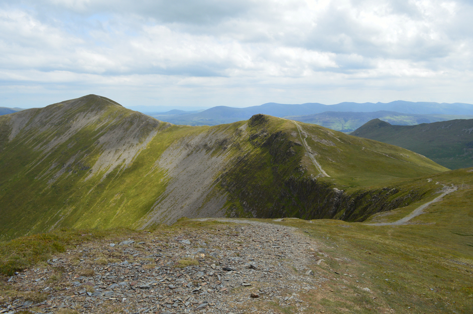
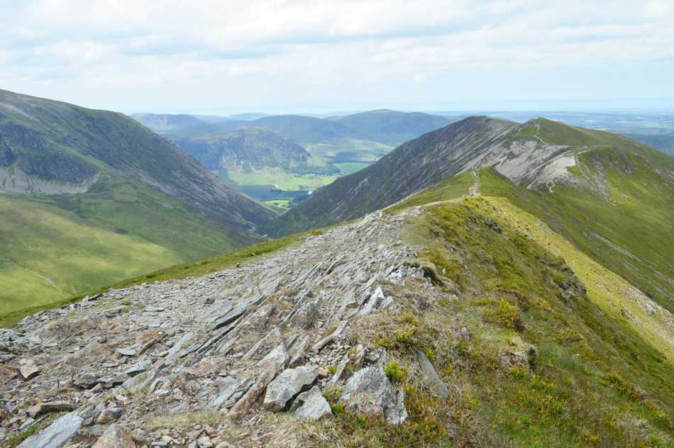
| Whiteside, Gasgale Crags, Hopegill Head and Sand Hill seen beyond Eel Crag. |
I had assumed that we would have been returning via the same path we had ascended by but Rod suggested we descend via Eel Crag which at first took a second to sink in (I initially thought Rod meant descend via scrambling down the rugged and very steep north face) but my panic was soon over when what Rod actually meant was to descend via the rocky zigzags on the west flank of the fell.
A route I think I have only used once by accident some years ago. |
 |
| Coledale. |
| With the bulk of Skiddaw and Blencathra in the distance. |
 |
| The view over Eel Crag's Tower Ridge (seen below) towards Sail, Scar Crags, Outerside Causey Pike and Barrow. |
| |
 |
| While to the north Hobcarton Crag and Grisedale Pike. |
| Seen here above Force Crag Mine. |
 |
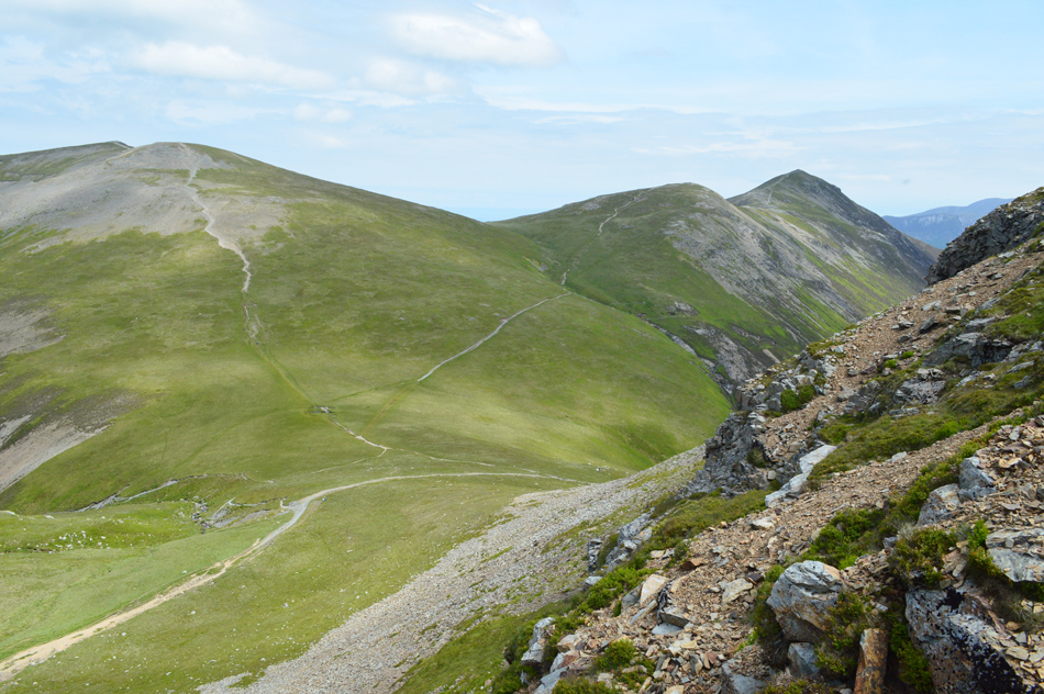
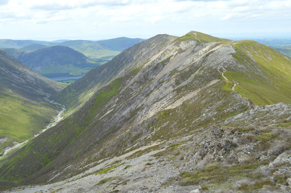
| The view over Coledale Hause towards Sand Hill, Gasgale Crags and Whiteside. |
| It's turning into a beautiful warm Summers day now, not like we've all been waiting for Summer to arrive. |
 |
| From the zizags I took this photo over Coledale Hause looking towards Sand Hill, Hopegill Head, Hobcarton Crag and Grisedale Pike. |
| We flanked west from Eel Crag summit cairn and easily located the zigzag path which descends steadily then steeply encountering erosion underfoot and the odd scramble even so our descent was quick and soon we were heading towards Coledale Hause which is a favourite haunt of mine. |
 |
| Gasgale Crags seen over Gasgale Gill. |
| We were both looking forward to returning to Lanthwaite via the Whiteside ridge and were keeping our fingers crossed hoping that the sun would stay out long enough so we can enjoy it while topping up tans. |
 |
| Looking back over Coledale Hause towards Eel Crag (Crag Hill) |
| Bloody splendid view that. |
 |
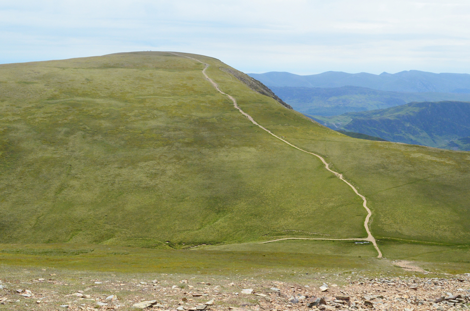
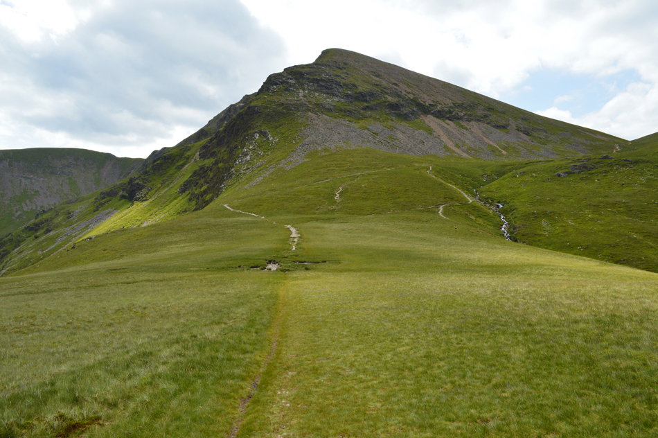
| The same view taken during the ascent of Sand Hill. |
| We both knew that Sand Hill would be todays last big ascent but non of us spoke of it with the exception of a "hey ho lets go" before we got stuck into the ascent which can be tiring at the best of times but we knuckled down only stopping to observe the waves of fell runners seen descending on Coledale Hause from Hopegill Head who were taking part in the Buttermere Horseshoe fell race. |
 |
| Grisedale Pike and Hobcarton Crag seen over the head of the Hobcarton valley. |
| Even if Grisedale Pike and Hobcarton Crag aren't on route I will always make a slight detour to take in this fabulous view over the Hobcarton Valley. Ok it's time for lunch which back on Eel Crag we had agreed to take at the summit of Hopegill Head. |
 |
| Whiteside from Hopegill Head (effectively know as the Whiteside ridge) |
Amid many a fell runner the summit of Hopegill Head was soon reached and we managed to find a spot away from the summit breeze overlooking Hope Gill.
It's now becoming apparent why the car park was so busy this morning as most of its occupants would have been taking part in the Buttermere fell race. |
 |
| Lunch with a view over Ladyside Pike and Swinside (Whinlatter) |
We broke out lunch just a few yards from two Marshals who were checking in the last of the fell runners some of whom were walking hand on hips across the ridge, it was great to see the Marshals give cheery hello's and a 'well done" to each and every competitor even though this was the first leg of the race which takes in the whole Buttermere and Lorton valleys starting from Loweswater before heading onto Whiteside, Hopegill Head, Grasmoor, Whiteless Pike, Newlands Hause, Dale Head, Honister Pass, Haystacks, High Crag, High Stile, Red Pike, Mosedale and finally Mellbreak covering 8,250ft over 22 miles. |
 |
| It looks like the last of the fell runners have passed. |
| As the Marshals asked the last competitor "are you the last" "I think so she laughed!" |
 |
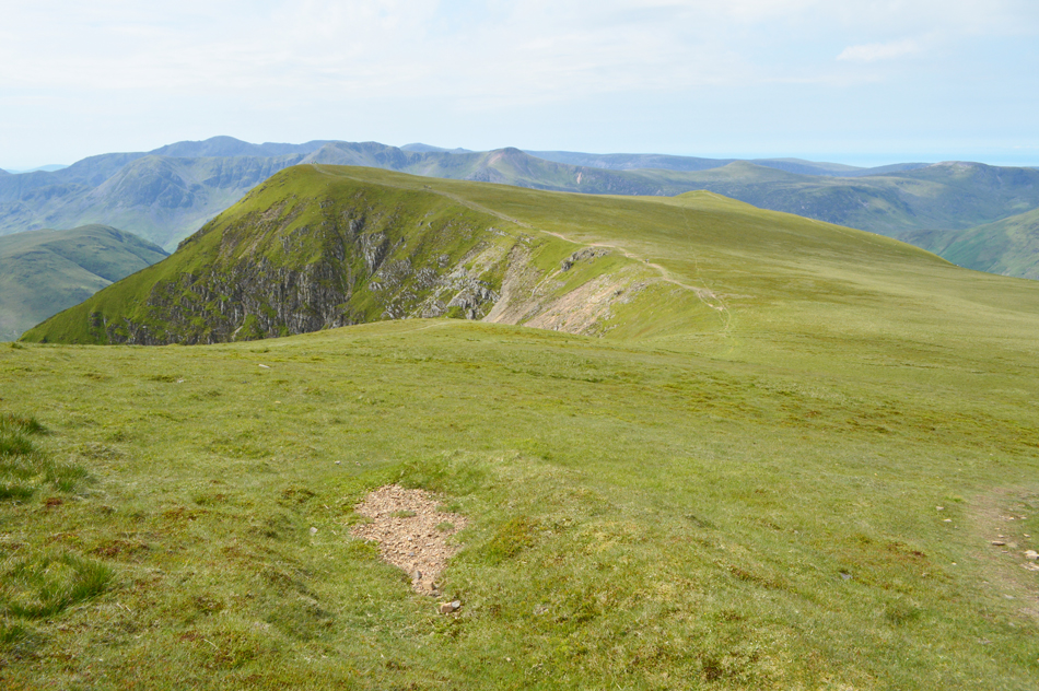
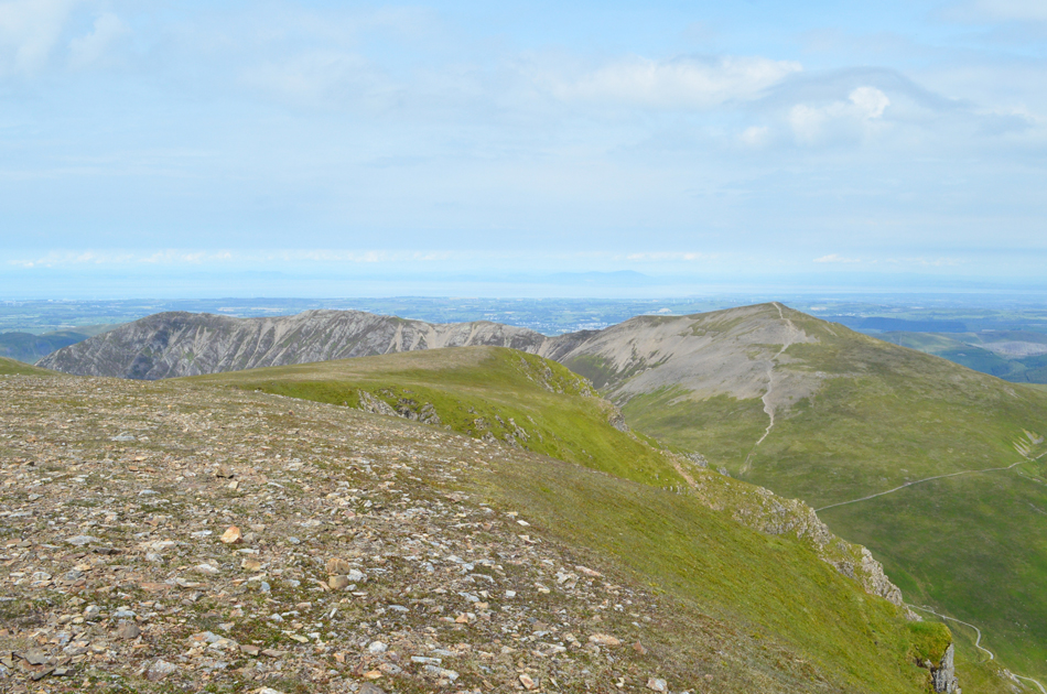
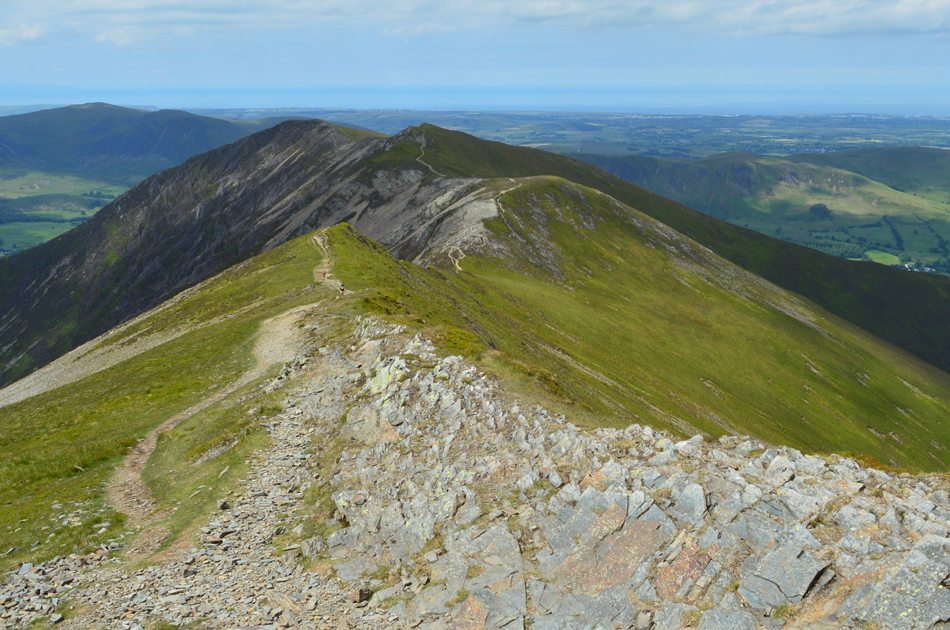
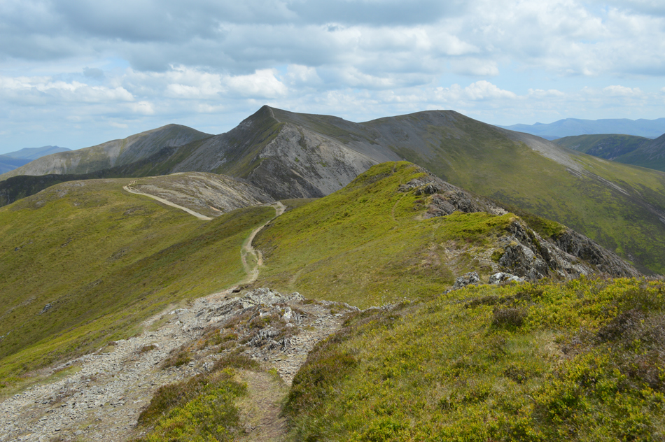
| The view along Gasgale Crags, Whiteside East top and Whiteside. |
| |
 |
| Looking back on Gasgale Crags, Ladyside Pike, Hopegill Head and Sand Hill from Whiteside East Top. |
| |
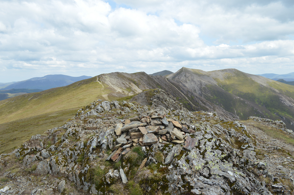 |
| Whiteside summit cairn. |
| We kept to the high ground all the way to Whiteside summit where we stopped to look back along an almost deserted Whiteside ridge where just an hour ago over 150 competitors had crossed, now the ridge had returned to normal with only a warm breeze to keep us company as we prepare to take on the Whiteside's rugged descent. |
 |
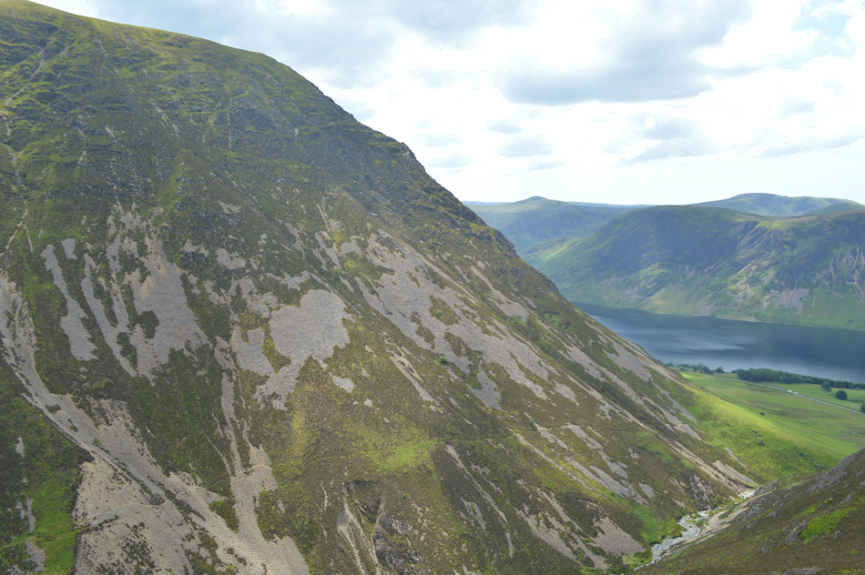
| Grasmoor's Dove Crag and the Dove Crag arete. |
| Seen over on the right. |
 |
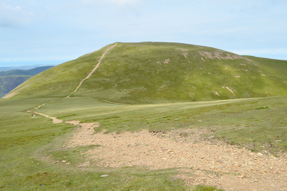
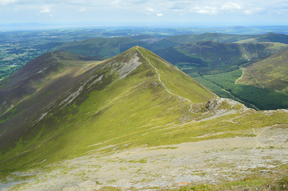
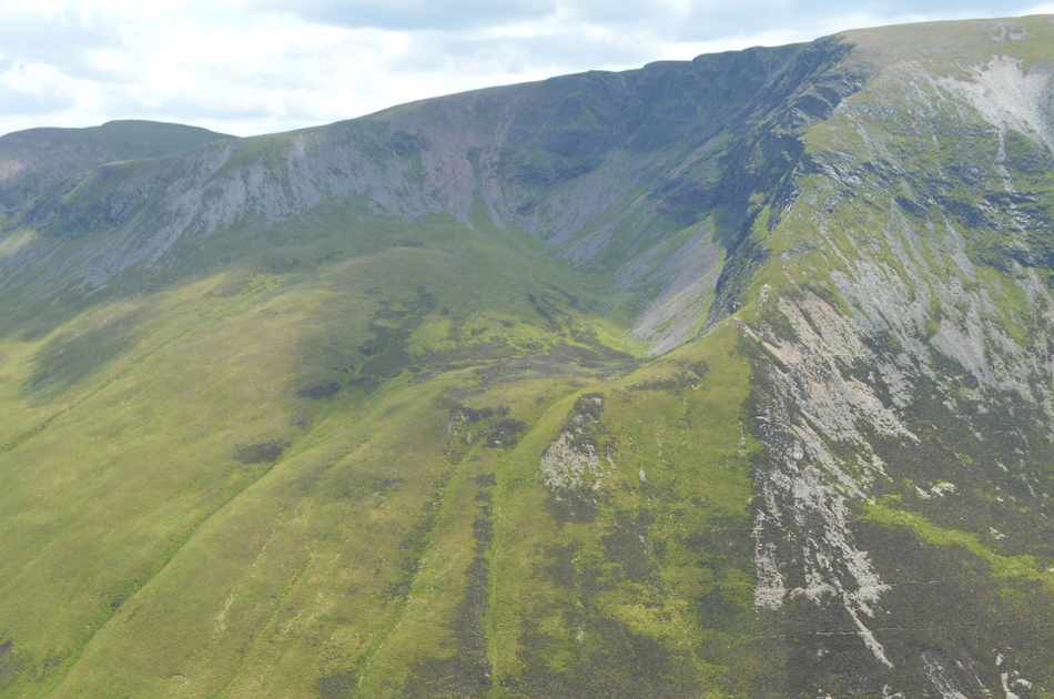
| The profile of Grasmoor's North West Ridge explodes into view. |
| Yep I remember it being that steep! |
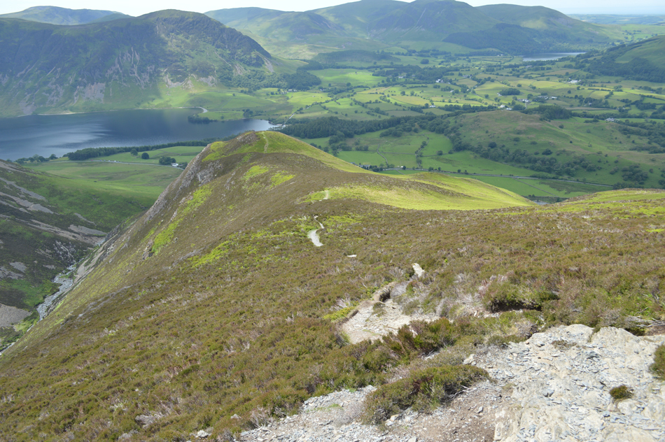 |
| Descending towards Whin Ben. |
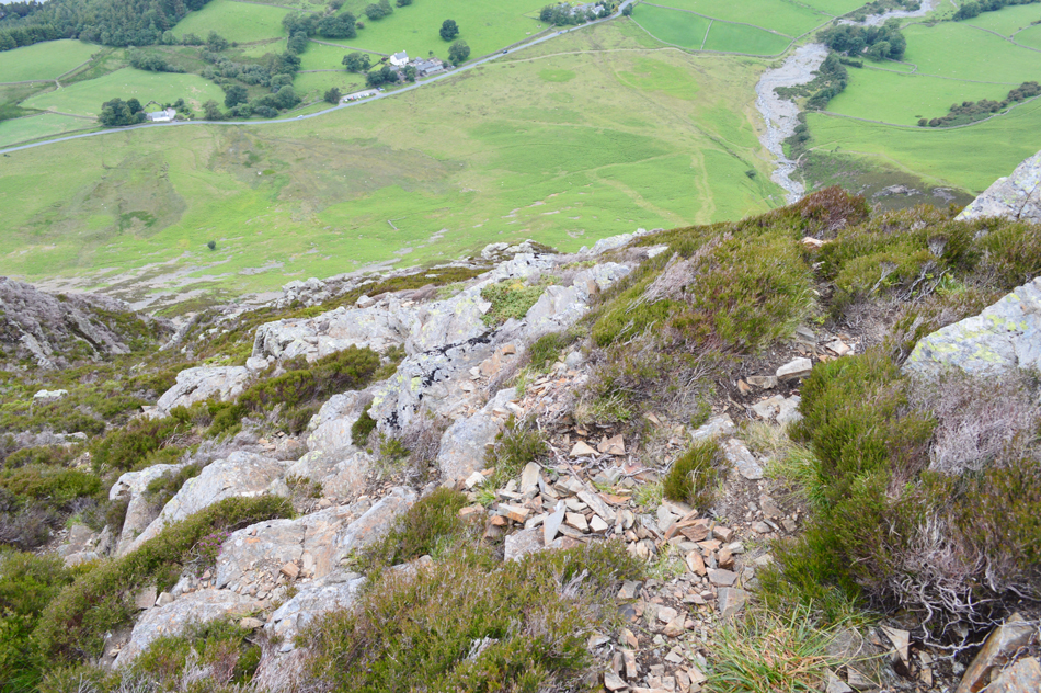
| Care was taken during the descent of Whiteside encountering rock slabs and erosion meaning we couldn't let concentration slip just yet. |
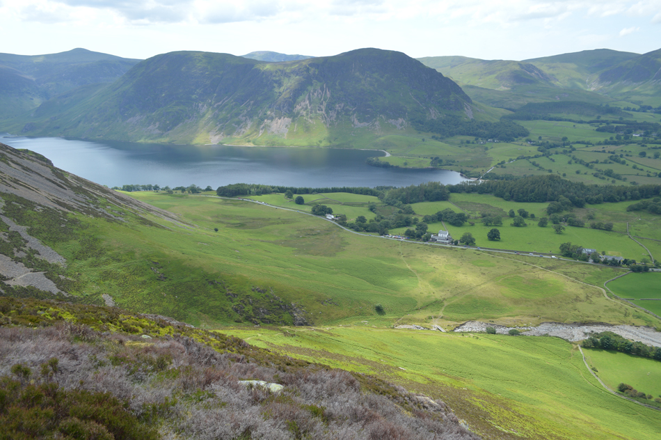 |
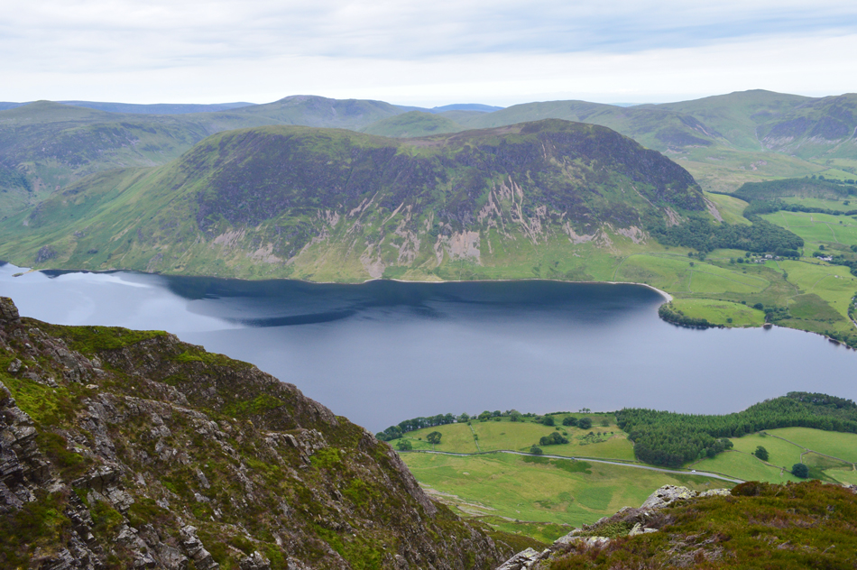
| Mellbreak and Crummock Water seen beyond Lanthwaite Green. |
| Taken during the descent of Whin Ben. |
 |
| Meanwhile Low Fell and Fellbarrow are cast in shadow. |
| |
 |
| Grasmoor North West Ridge taken as we cross the footbridge over Liza Beck. |
| |
 |
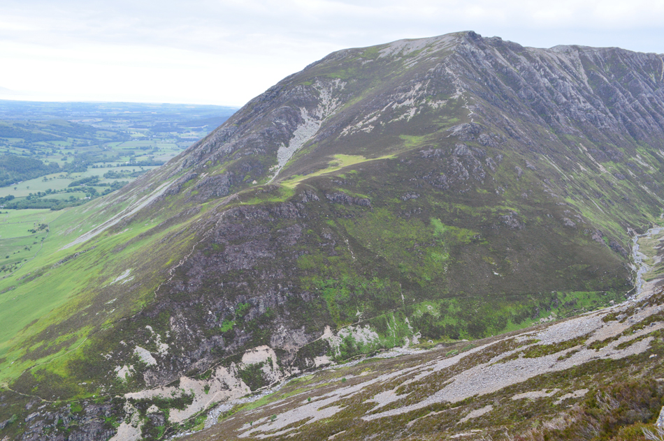
| Grasmoor from Lanthwaite Green. |
We did as we had agreed and took a few moments out to survey this mornings ascent from Whin Ben easily spotting the Grass Rake, the many rock towers where hours earlier we had scrambled followed by The Pinnacle, The Arete and finally steep ascent onto Grasmoor End but the one thought which had never left me all day was how impregnable the ridge still looked while not forgetting the steep scree that had caused me so many frustrations so early into the walk. The closely clipped grass felt good underfoot and with a warm afternoon sun beating down we made our way back to the cars stopping every few moments to look back up the ridge and even though the goal had been completed seeing the ridge as we returned back to our cars still left a gulp in my throat.
|
|
| |
| Back to top |
 |
|