|
Mam Tor |
 |
 |
2nd September 2019 |
 |
|
With time booked off I'm yet again at the mercy of the British Summer at a point when mother nature is preparing us for Autumn, it's kinda unpredictable out there. I spied a lovely morning but this forecast wasn't for the Lake District but the Peak District, a place that I've only driven through so today I plan to change that.
I guess what Cat Bells is to the Lake District Mam Tor is to the Peak District so it seemed the obvious choice along with the fabulous reviews I've read about the Mam Tor ridge being referred to as one of the UK's best walks, well after today I can confirm outside the Lake District this walk ranks right up there at the top so much so I plan to return and explore the Peak District more finding that incredibly, the journey time from home is less than what it would take me to reach Kentmere.
I'm not hooked just yet because the Lakes will always be my second home but I've discovered a beautiful second alternative with the Peak District, what a place and what a walk, I simply can't recommend it enough. |
|
| Ordnance Survey OL1 |
 |
| The Peak District |
| |
| |
|
|
|
| |
|
Overview |
|
|
| Ascent: |
1,540 Feet - 469 Metres |
| Dewey: |
Mam Tor |
| Weather: |
A Bright & Warm Morning With Variable Winds Across The Tops. Highs of 18°C Lows of 12°C |
| Parking: |
Car Park Opposite Castleton Visitor Centre |
| Area: |
Castleton, Hope Valley, Peak District, Derbyshire. |
| Miles: |
6.4 |
| Walking With: |
On My Own |
| Ordnance Survey: |
OL1 |
| Time Taken: |
3 Hours 5 Minutes |
| Route: |
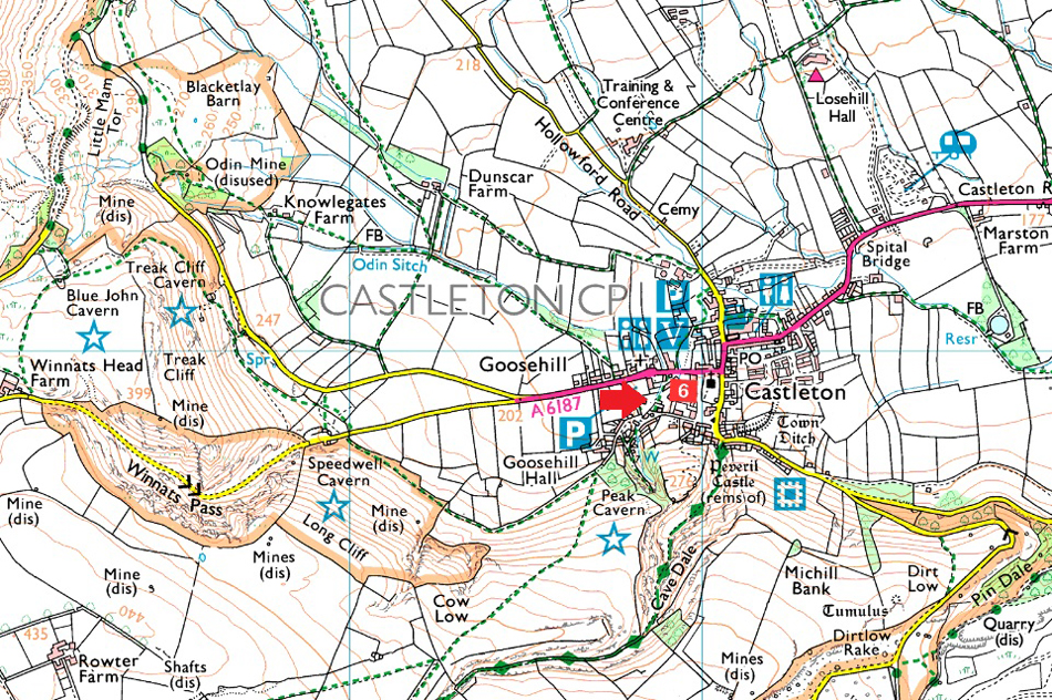
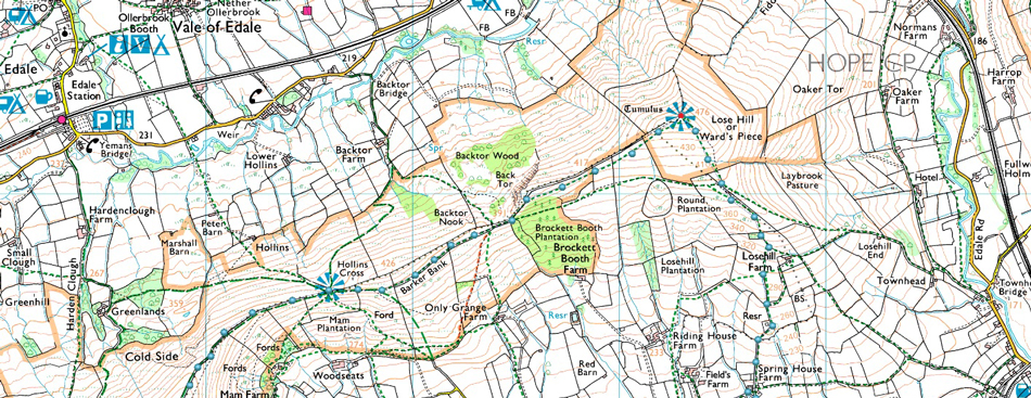
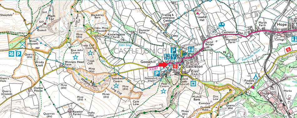
Castleton - Goose Hill - Winnats Pass - Winnats Head Farm - Windy Knoll - Mam Tor South Ridge - Mam Tor - Hollins Cross - Barker Bank - Lose Hill - Losehill Farm - Spring House Farm - Hollowford Road - Castleton |
|
| |
|
Parking Details and Map |
|
|
| Nearest Post Code: |
S33 8WN |
| Grid Reference: |
SK 148 828 |
| Notes: |
A large car park can be found opposite the Castleton Visitor Centre giving immediate access to Castleton and Winnats Pass. Charges apply £5.00 all day. |
|
| |
|
Map and Photo Gallery |
|
|
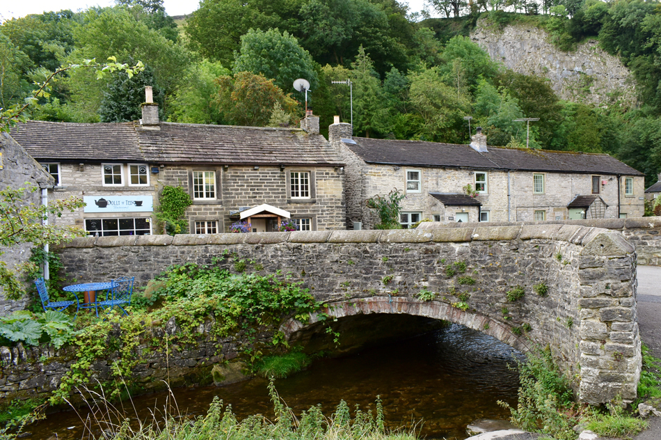 |
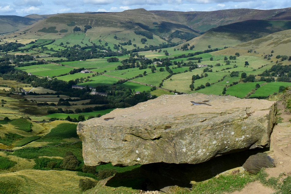
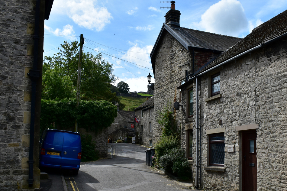
| Castleton Cottages alongside Peakshole Water 09:10am 12°C |
| I would have arrived in Castleton much sooner had I not hit traffic on the M56 which I guess is the only downside to driving to the Peak District from the North but that aside, it is the first day the kids are back at school and I reckon had I chosen to come here on a weekend my journey wouldn't have been affected at all. I chose to park in the large pay and display car park which is more or less opposite Castleton Visitor Centre which charged me £5.00 for all day parking. The car park is conveniently positioned just yards away from this stone bridge and the pleasant back lane cottages from where I head right towards Goose Hill. |
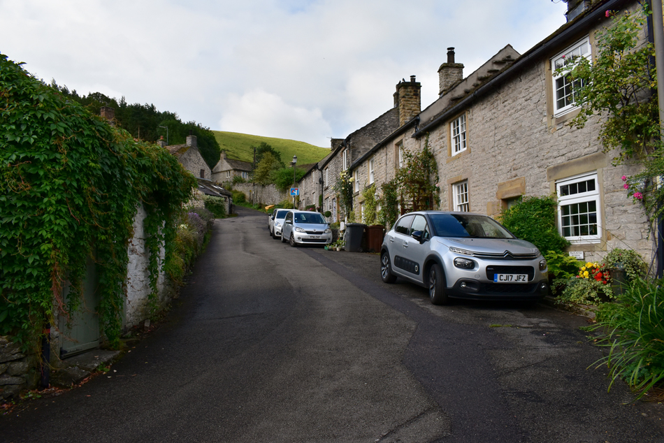 |
| Goose Hill, Castleton. |
| There's a certain, dare I say Autumnal nip in the air so I added an extra layer to take it away but after walking up Goose Hill I was almost ready to take it off again. I'm heading for the jaw dropping Winnats Pass but first I have to climb Goose Hill which will lead me onto open fell below an area known as Long Cliff. |
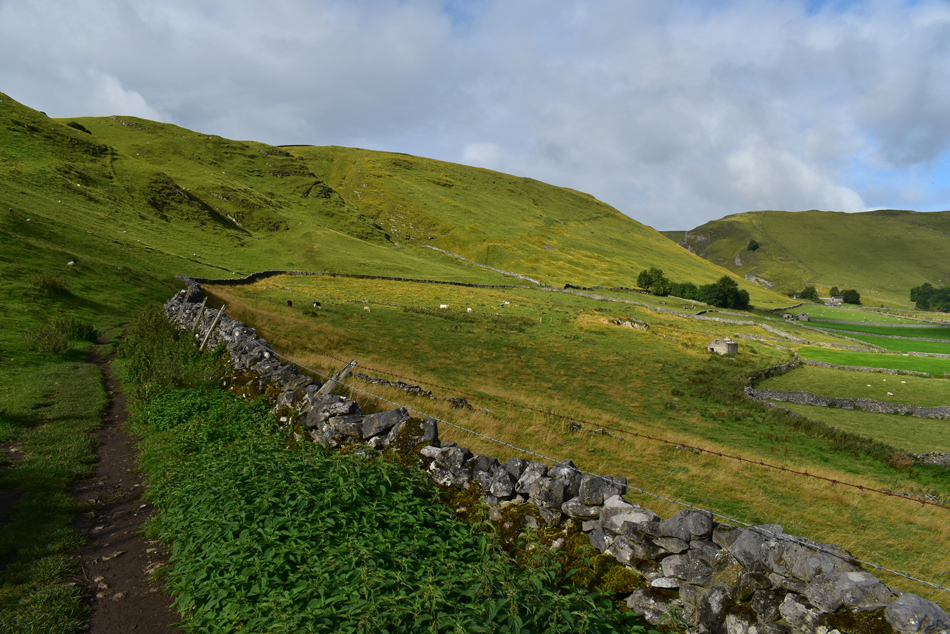 |
| Long Cliff. |
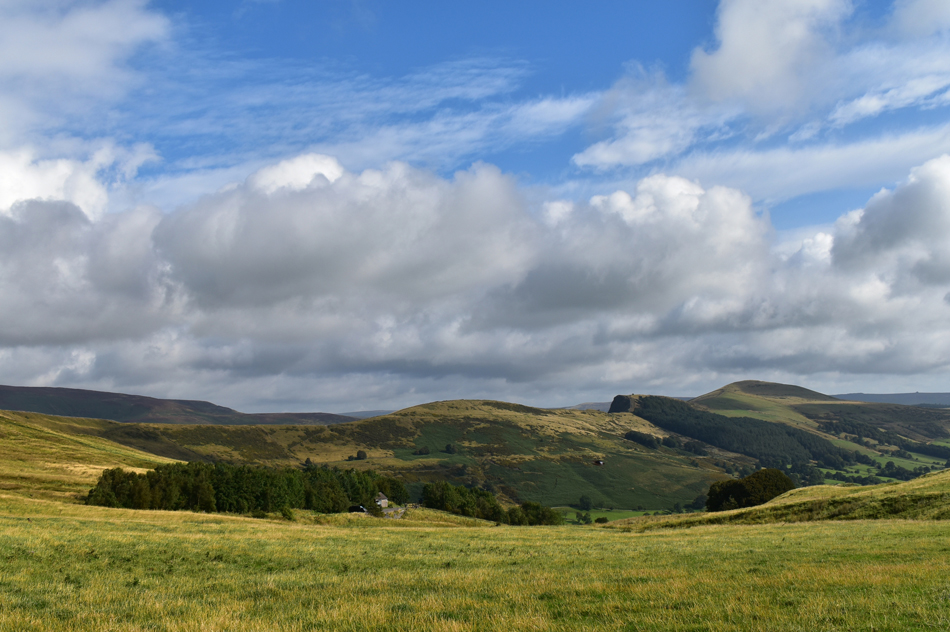
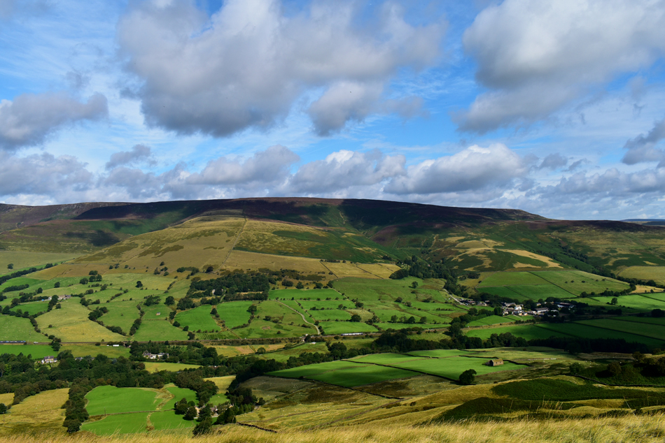
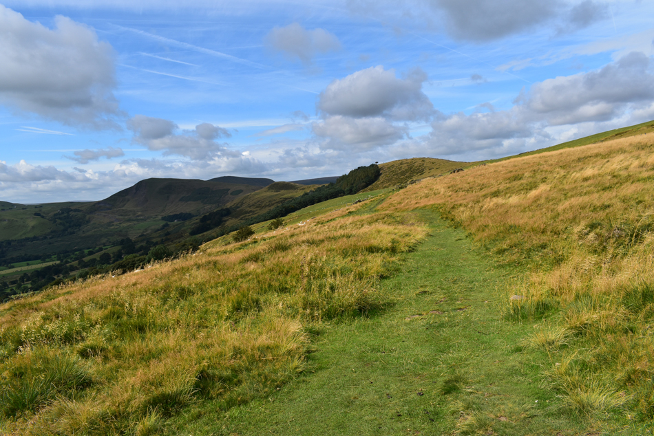
| The rear of Goose Hall is passed soon followed by this view of Long Cliff seen ahead. I'm heading towards the trees seen far right which are situated at the bottom of Winnats Pass, this route simply gives the walker an alternative to the road walk required in order to reach the bottom of the pass and offers lovely views over Castleton, Mam Tor and Lose Hill, in fact, the whole route just 'clicked' into place from here. |
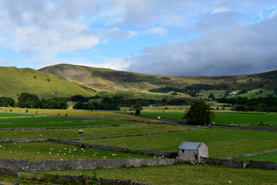 |
| Mam Tor from Long Cliff. |
| I had my doubts concerning the forecast but it looks like the grey clouds are starting to clear leaving blue skies in their wake, fantastic. |
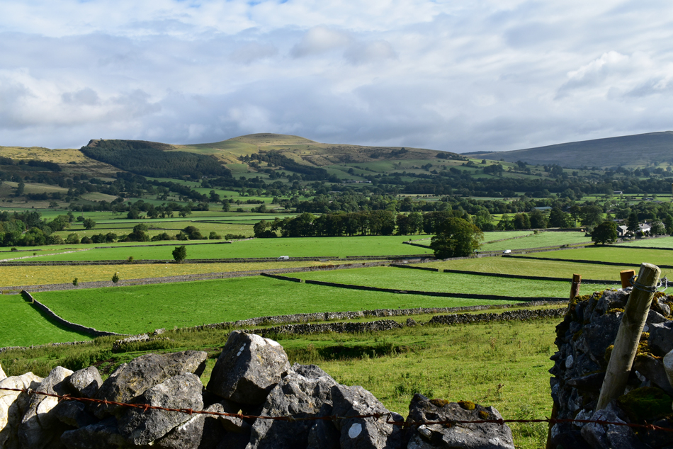 |
| Lose Hill and Back Tor from Long Cliff. |
| I guess this is what I meant when I said my whole route fell into place, that's Lose Hill seen over the Hope Valley in the distance, todays final summit followed by the gentle descent back to Castleton, good stuff. |
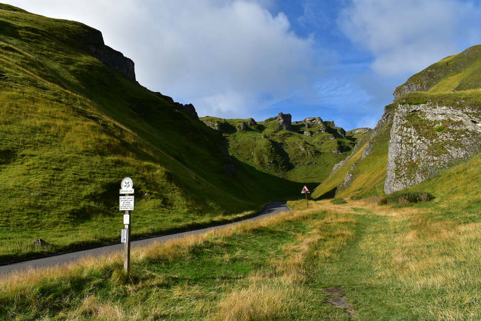 |
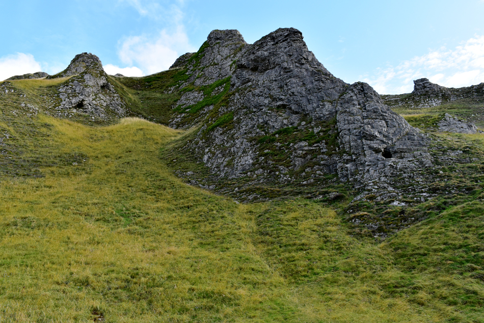
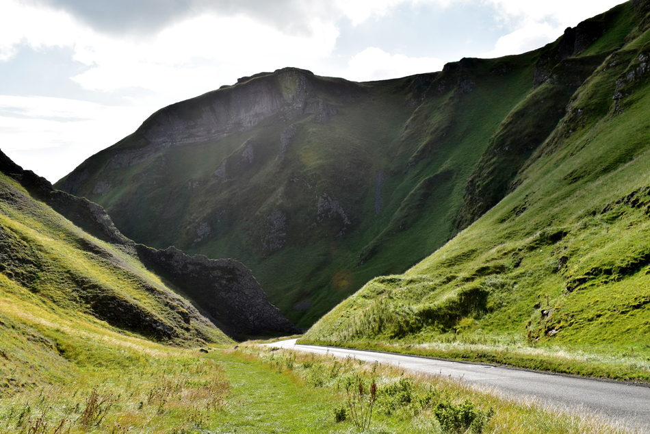
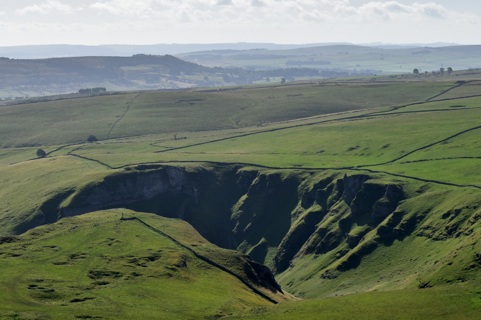
| The steep Limestone cleft that forms Winnats Pass. |
| My route now takes me over Winnats Pass which can be ascended by following this grassy path to the right, the Pass has a 1 / 3 gradient and gets much steeper just below the summit which is where Im heading next. |
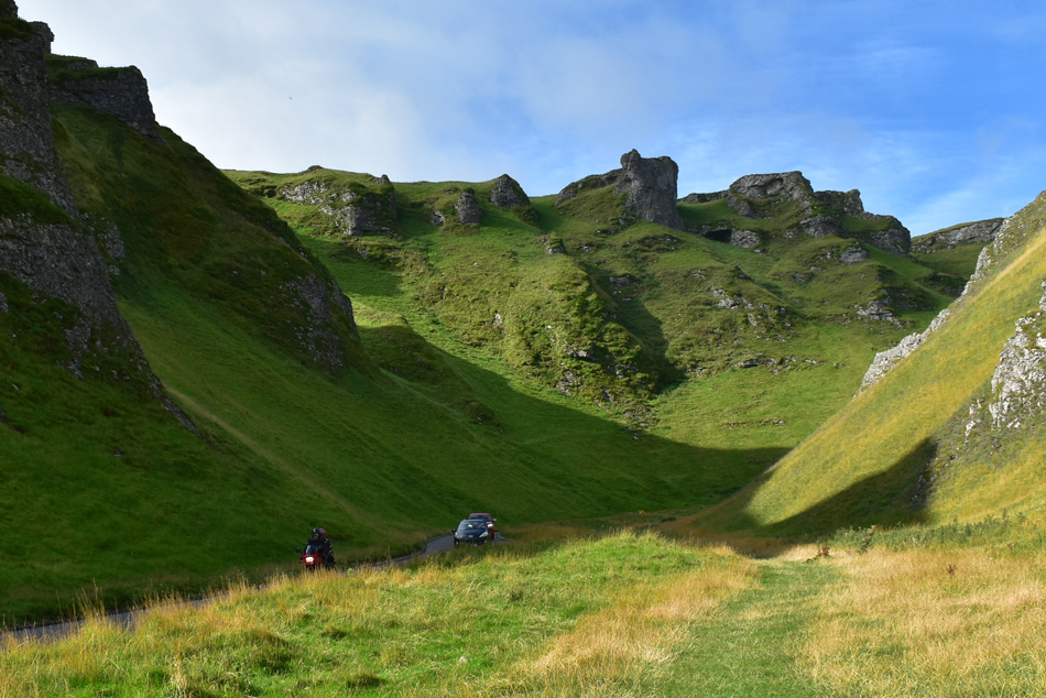 |
| Winnats Pass. |
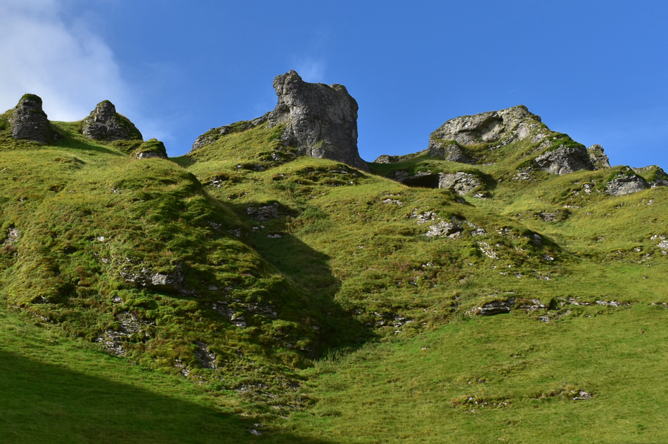
| Formed due to Glacial collapse over 350 million years ago the Peak District was below a tropical sea which is why the Limestone found here is full of fossil sea creatures where by law, is protected meaning nothing is allowed to be taken away. Back in modern times the Limestone has been quarried and the whole area is full of caves, caverns and tunnels. The pass is thought to be haunted by five miners who ambushed, robbed and murdered a young Scottish couple who had eloped to Castleton to start a new life back in 1758. |
 |
| Limestone cliffs, Winnats Pass. |
It is said that after the young couple had been robbed of their £200.000 savings (that's £35,000 in todays money) they were dumped in a mine shaft and their bodies were not found until ten years later. The saddle from one of the horses the couple were travelling on can be seen on display in the Speedwell Cavern Museum while the couple are buried in St Edmund's Churchyard, Castleton.
But the miners didnt get away with it each suffering seperate tragic deaths shortly afterwards who are reputed to haunt the area which now takes me back to the sign I read back at the car park which offered Ghost Walks of the area.
Spooky. |
 |
| Limestone Caves, Winnats Pass. |
| |
 |
| Looking down on Winnats Pass. |
| The ascent of the pass starts gently before heading around a tight right bend where the real climb starts. I've climbed Hard Knott Pass from Jubilee Bridge and although Winnats Pass isn't as steep nor long it's certainly steep enough to force vehicles into using 2nd gear during thier ascent...sod 2nd gear I'm still trying to find 1st! |
 |
| Mam Tor comes into view from the top of Winnats Pass/Winnats Head Farm. |
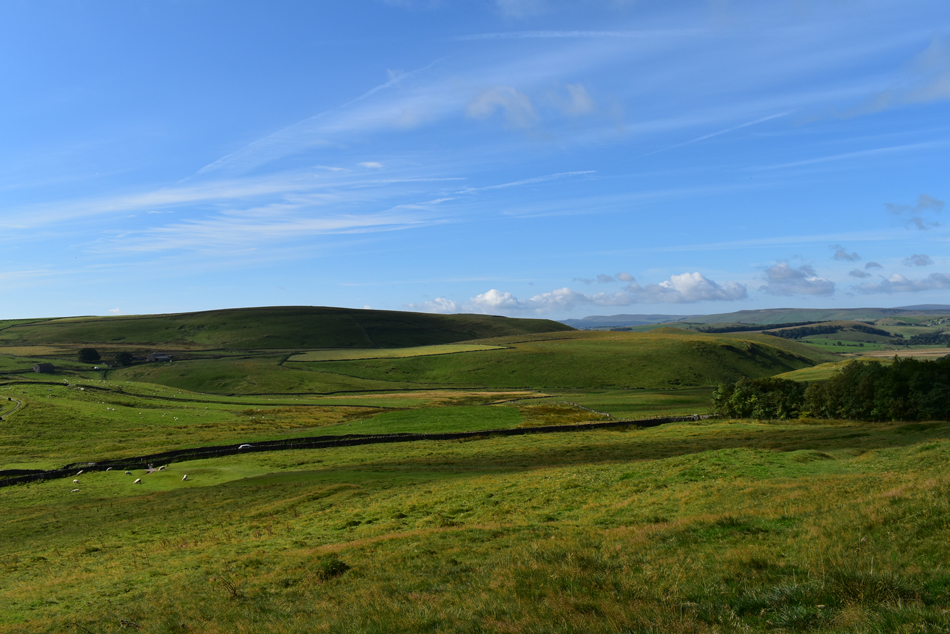
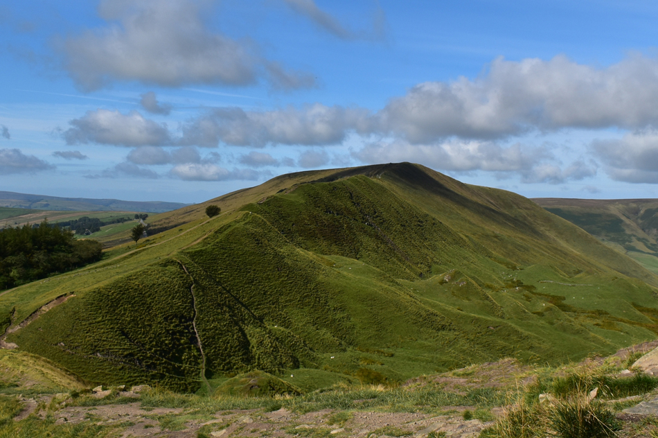
At the top of the pass the path narrows where more nettles had to negotiated in order to avoid being stung again...note how I said again! Soon after the path opens out before Winnats Head Farm is reached where I take a grass footpath around the back of the farm from where I took this photo of Mam Tor's East Face.
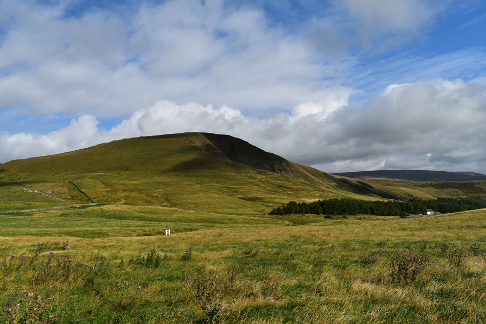
Mam Tor is also known as the 'Shivering Mountain' because its shale and gritstone layers are prone to landslides on the East side, the last of which occurred during 1979 which closed the A625 (Sheffield to Chapel en le Frith road) forcing the road to be eventually abandoned. |
 |
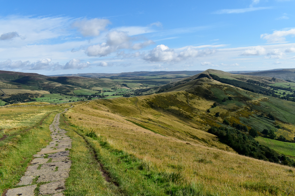
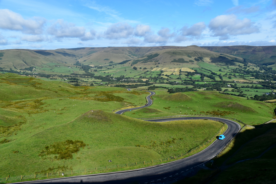
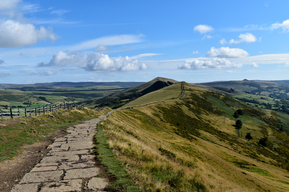
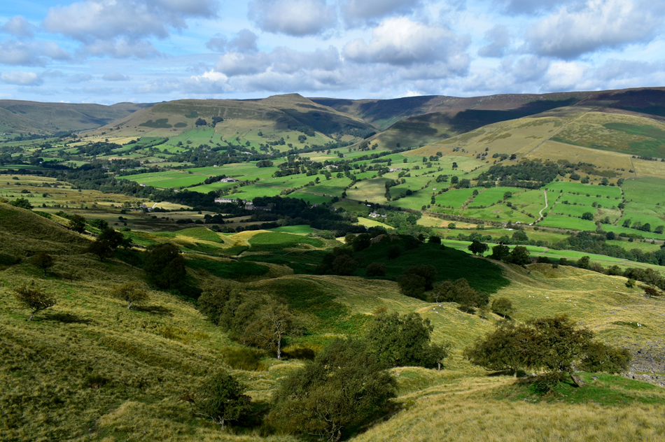
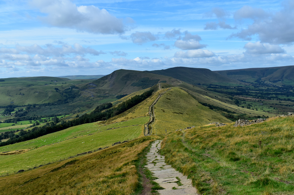
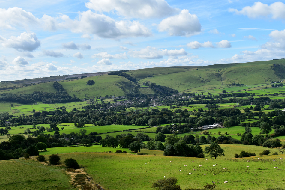
| The view towards Hollins Cross, Back Tor and Lose Hill. |
| Todays fantastic ridge walk. |
 |
| What a beautiful morning! |
| Here looking south westerly towards Middle Hill. |
 |
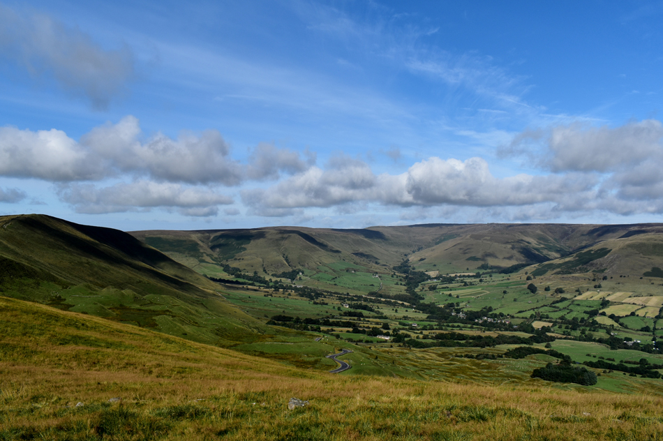
| The Vale of Edale taken during the ascent of Mam Tor. |
| Looking towards Grindslow Knoll (R) Crowden Tower (C) and Edale Head (L) |
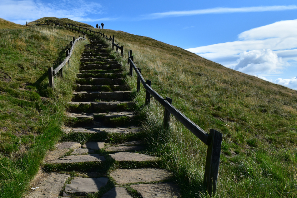 |
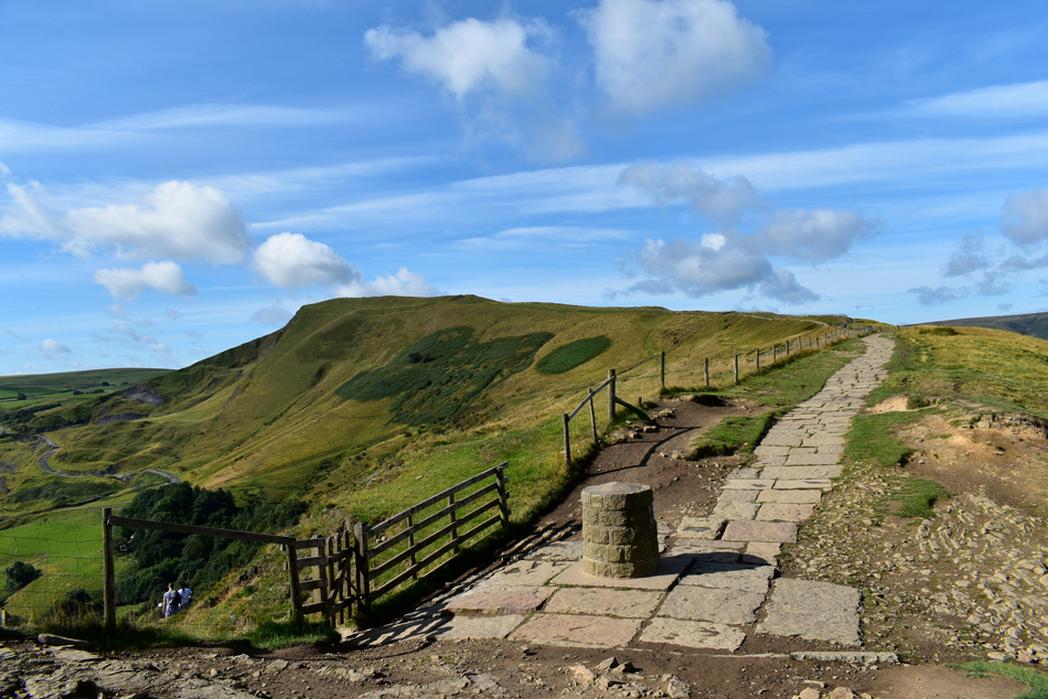
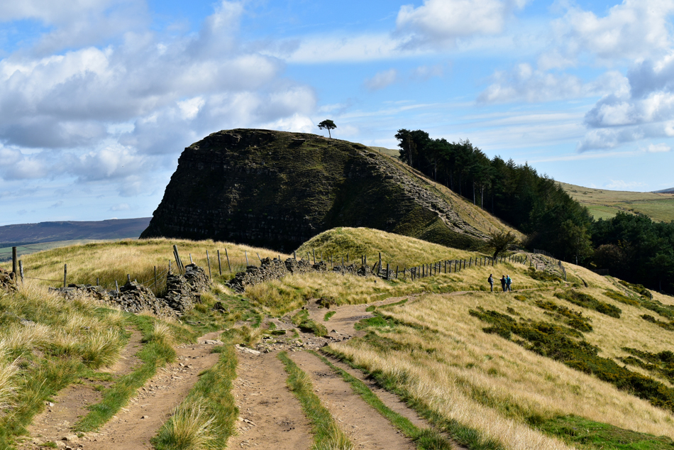
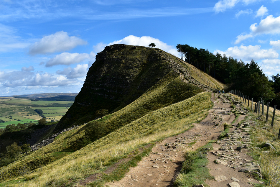
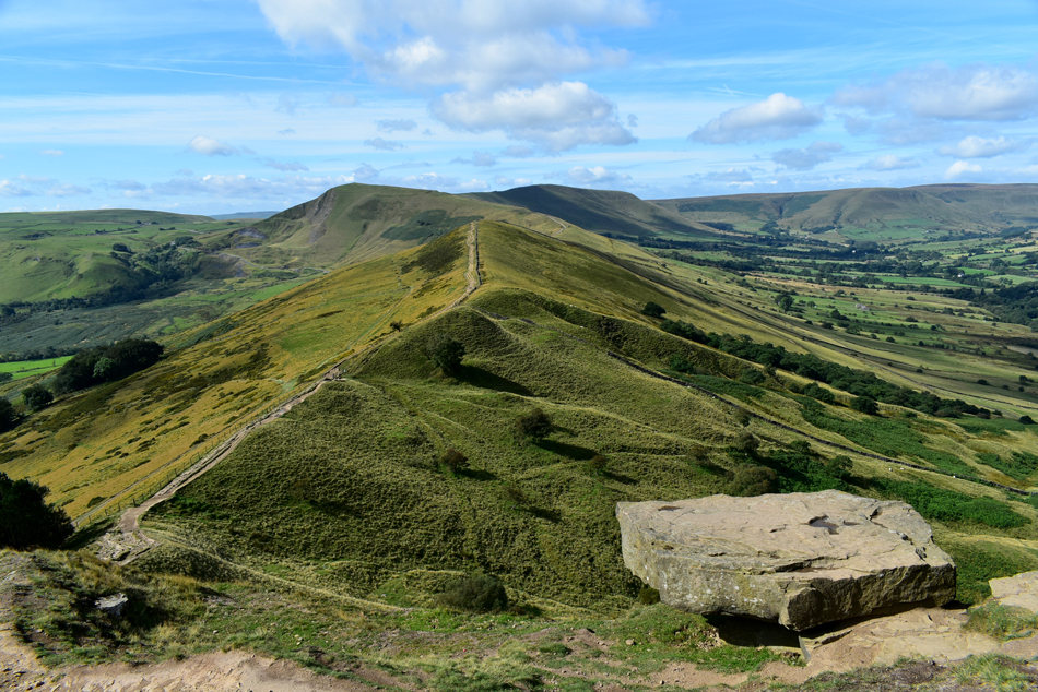
| Mam Tor. |
| Having arrived at the base of the steps all that was left to reach the summit was the steady ascent by means of this lovely stone stairway which in part, continues as far as Back Tor over two miles away. |
 |
| Looking back on Lord's Seat from Mam Tor. |
| |
 |
| A close up of Winnats Pass from Mam Tor. |
| It looks like someone has taken a giant ice cream scoop and scooped all the land away, amazing stuff. |
 |
| Edale Head from Mam Tor. |
| I took these photos while waiting for the people around the summit to clear, I may have a wait... |
 |
| Here looking over the Vale of Edale towards Rowland Cote Moor. |
| Stunning views from the summit. |
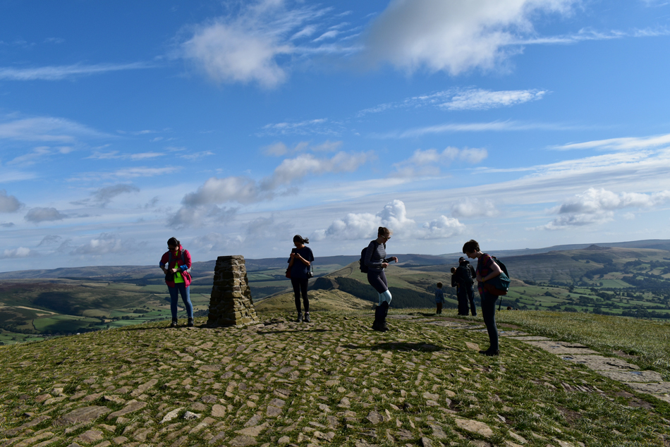 |
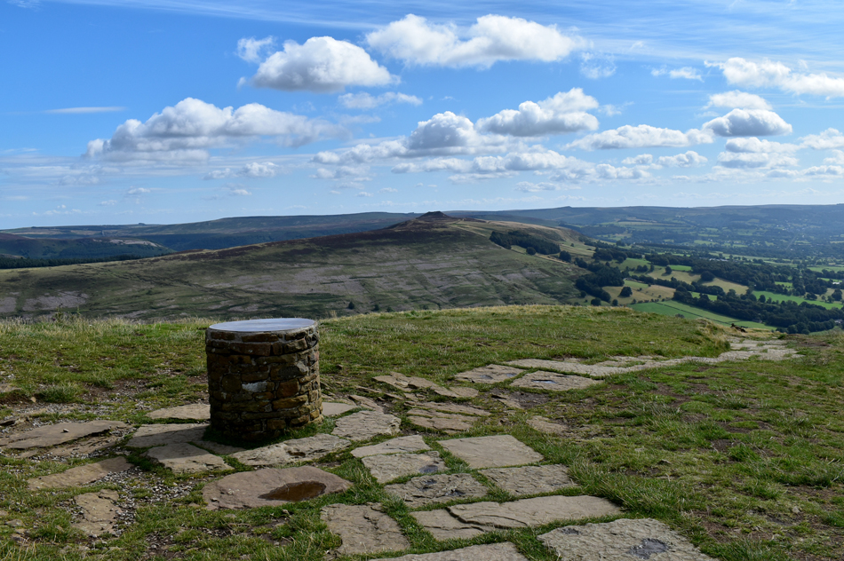
| Mam Tor summit Trig Point. |
| After a few minutes of waiting around it was becoming clear that I wasn't going to get my summit shot so I just took this one anyway. These young girls had just arrived having ascended from the Edale side which would have took them past the the ancient fort, I wondered if any of them stopped to notice. |
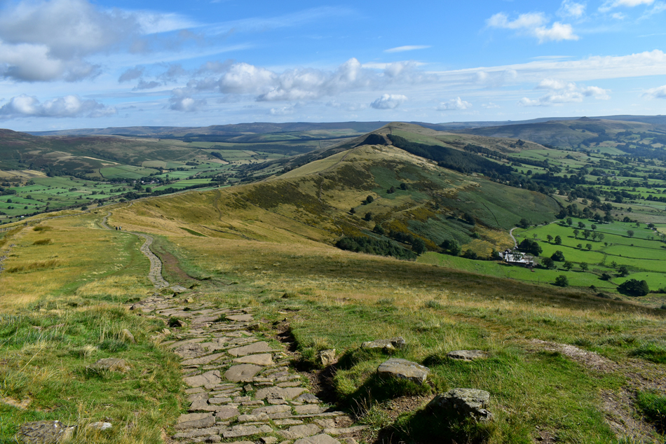 |
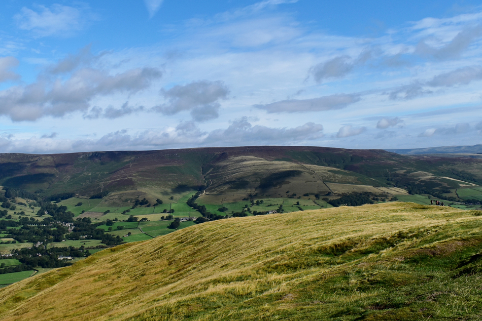
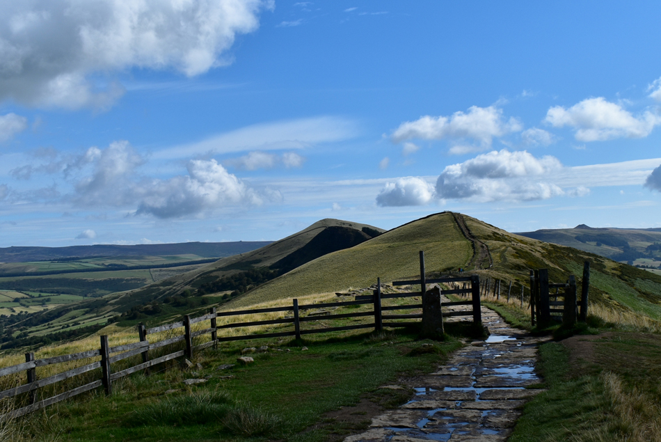
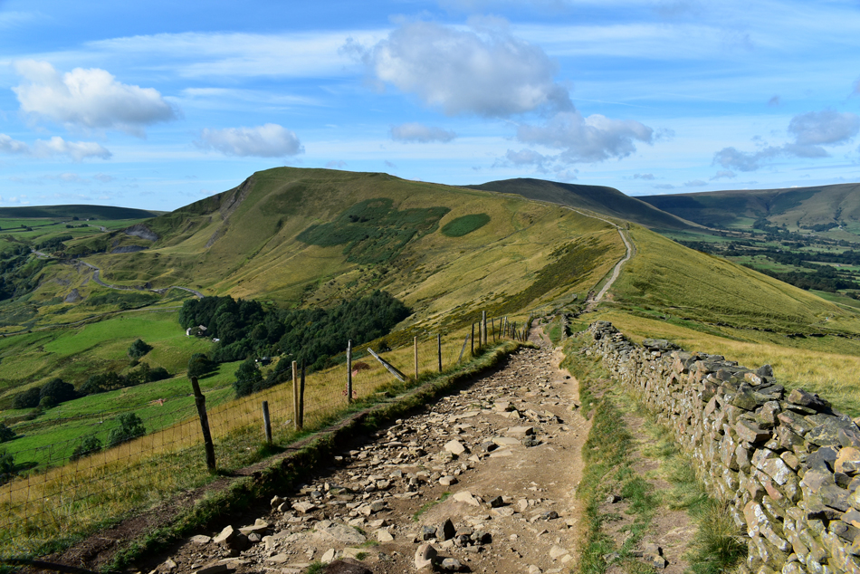
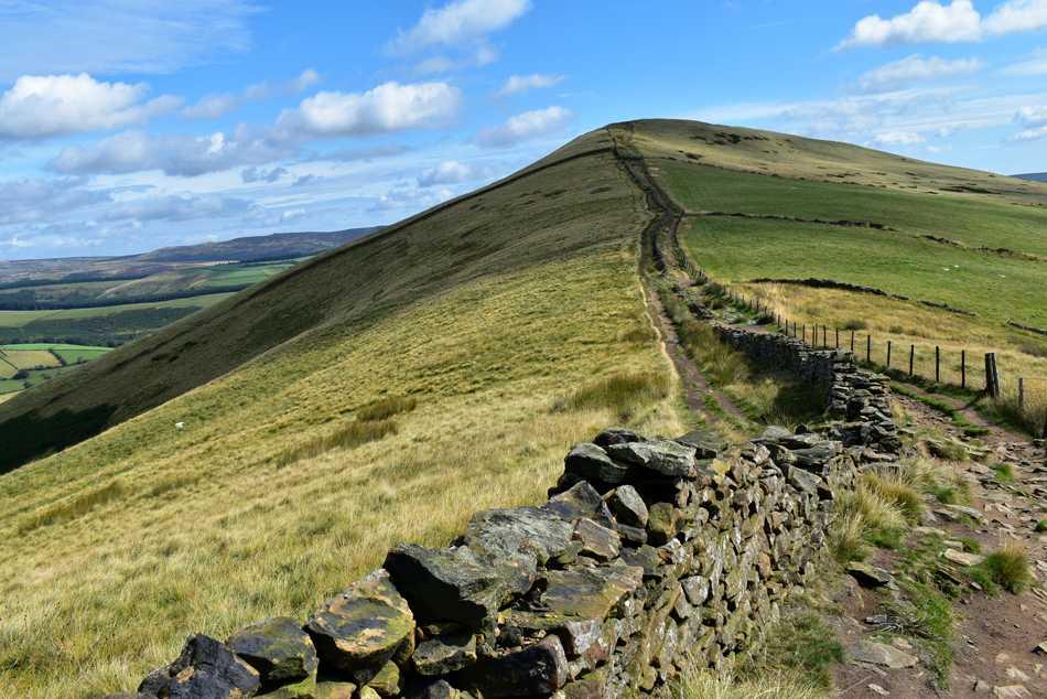
| Looking down on the ridge route towards Hollins Cross, Barket Bank and Lose Hill. |
| It's this ridge which enticed me to be here today, it looks perfect and ideal for all the family. |
 |
| Barker Bank seen beyond Hollins Cross. |
| With Lose Hill in the distance. |
 |
| Approaching Hollins Cross. |
| Just in case you were wondering what the pointed peak over on the right is, that's Win Hill which I only found out after checking the map when I got home. |
 |
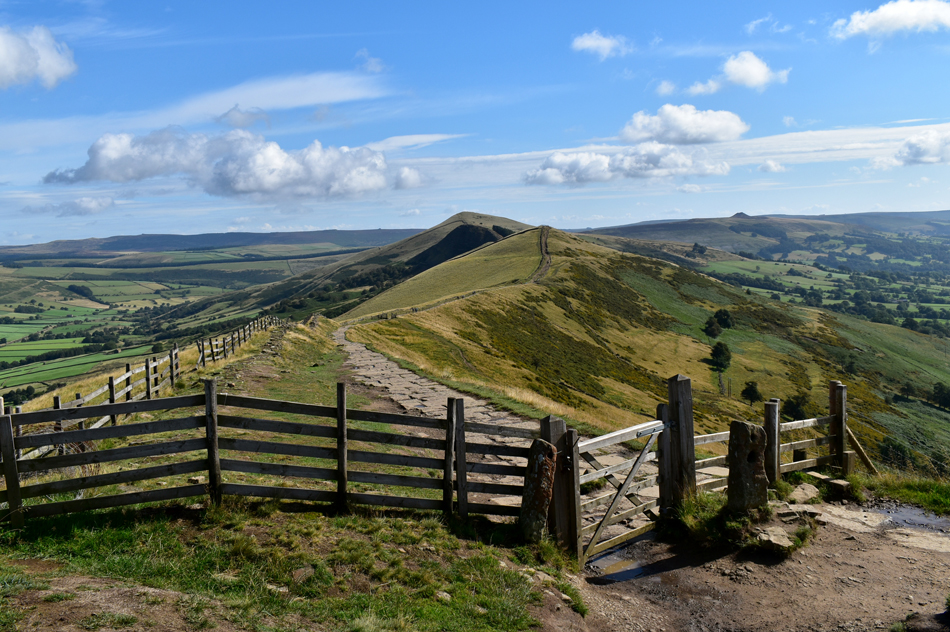
| Barker Bank and Lose Hill are up ahead. |
| While Hollins Cross is just beyond the gate. |
 |
| Looking back on Mam Tor from Hollins Cross. |
| The morning is really starting to heat up now so it's time to lose a layer and enjoy the sunshine whilst it lasts, after all it's due to cloud over within the next couple of hours. |
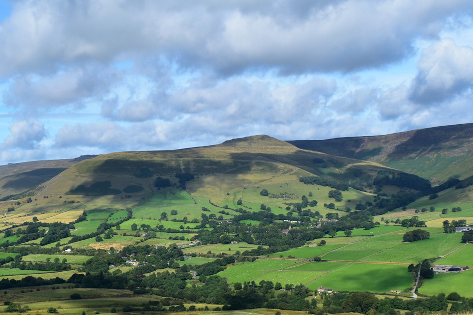 |
| Grindslow Knoll over the Vale of Edale. |
| Which falls short of being classed as a mountain by just 26ft, a fine hill nonetheless. |
 |
| Looking back over Hollins Cross towards Mam Tor from Barker Bank. |
| Evidence of the landslips on Mam Tor East face can now be seen just below the summit on the left. |
 |
| Rowland Cote Moor seen over the Vale of Edale. |
| With the hamlet of Nether Booth seen lower right. I took this right at the point while a passenger train was travelling towards Edale Station, the train can be seen centre while another train approaches from the left. |
 |
| Back Tor comes into view. |
| As I walk along the top of Barker Bank. |
 |
| Back Tor. |
| Just one of the bumps found along the spine of the ridge. |
 |
| Back Tor. |
| Is that a Scots Pine I see? |
 |
| The beautiful Vale of Edale. |
| Taken during the ascent of Back Tor. |
 |
| Looking back on Barker Bank, Mam Tor, Lord's Seat and Edale Head from Back Tor. |
| Back Tor was possibly the steepest ascent found along the ridge but offers fantastic views over the Edale Valley more so on a day like today. |
 |
| Defying gravity. |
| Where's a selfie stick when you need one! |
 |
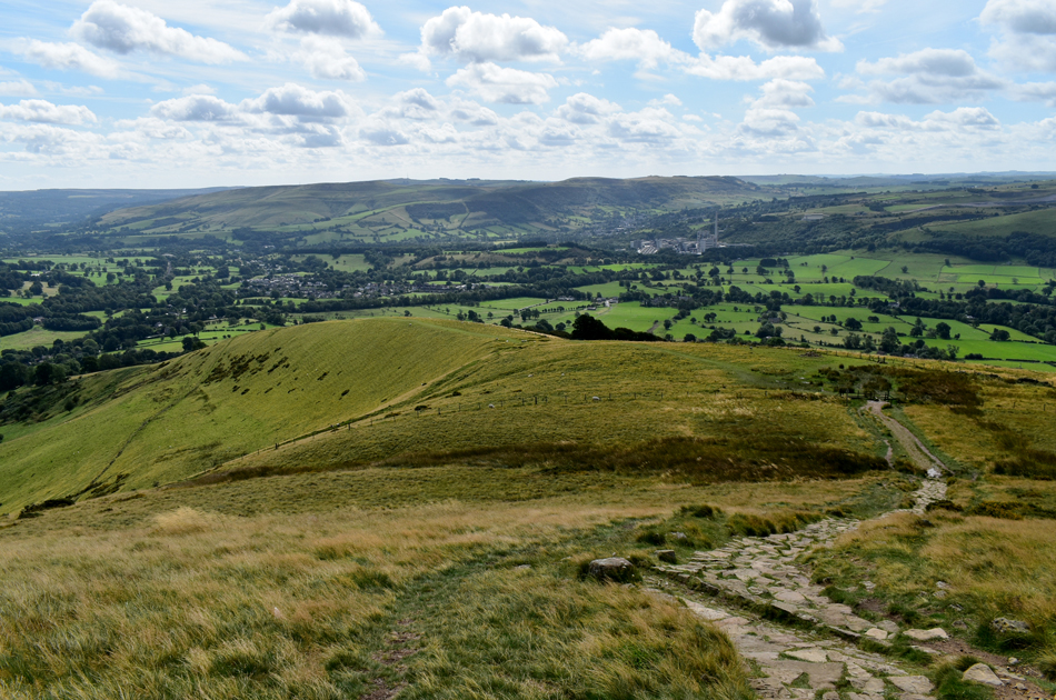
| Ascending Lose Hill. |
| First via the left of the wall before crossing right just below the summit. |
 |
| Looking back on Back Tor, Barker Bank, Mam Tor and Lord's Seat from the ascent of Lose Hill. |
| |
 |
| Win Hill from Lose Hill summit. |
| I wasn't ready for lunch but a well deserved stop was took while on the summit of Lose Hill if only to take in the fantastic views whilst sheltering from the cool summit wind which nipped enough to create goose bumps on my arms. |
 |
| Descending Lose Hill. |
| Instead of following the path towards seen left I head through a gate on the grassy plateau below which will descend me towards (but not past) Losehill Farm from which I'll head for Robinsland Lane not before passing the odd farm or two. |
 |
| Looking back towards Mam Tor. |
| From the lower flanks of Lose Hill. |
 |
| Castleton from the descent of Lose Hill. |
| From Lose Hill I steer right while keeping Losehill Farm to my left. I continue to follow the grassy path which ends abruptly at a concrete lane where I instinctively head right towards Spring House Farm. |
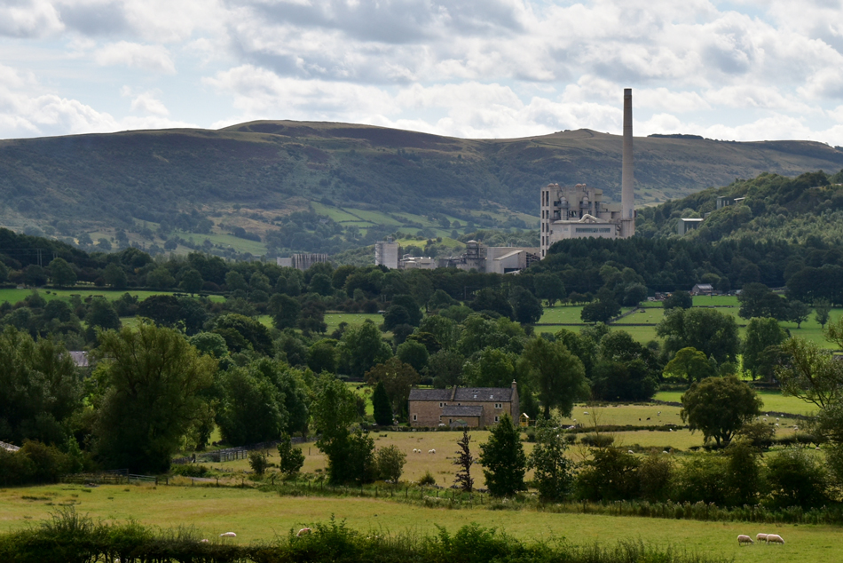 |
| Hope Valley Cement Works. |
| Love it or hate it there has been a cement works in Hope Valley since the early 1930's well before the Peak District National Park was created in 1951. |
 |
| Passing by Spring House Farm. |
| After the farm I turn right again and follow the track towards Hollowford Road, Castleton. |
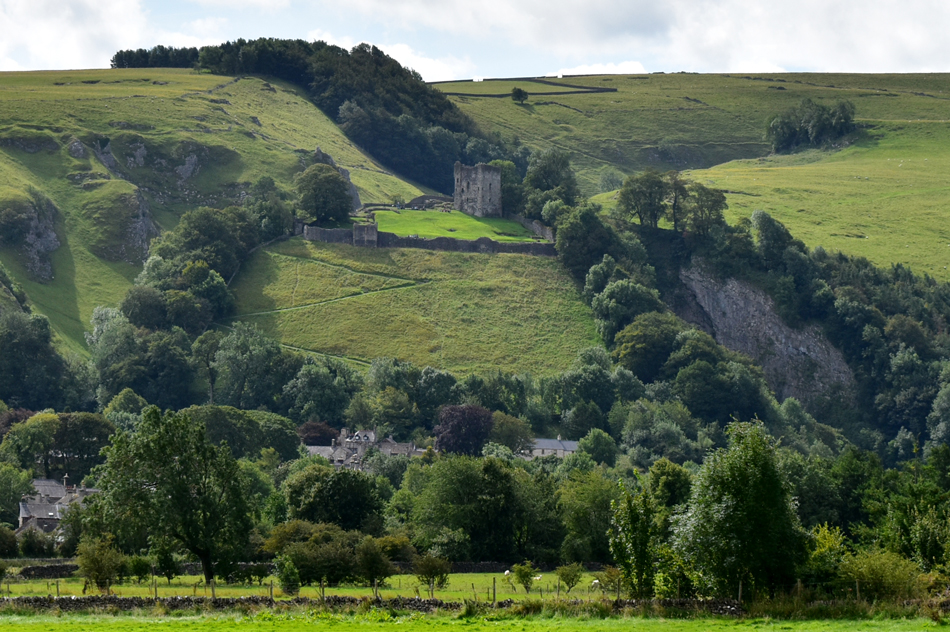 |
| Peverel Castle |
| Built by Henry II in 1176 and is a Grade I listed building. The Castle is cared for by English Heritage and is protected by the National Park Authority which recognises the ruins as an internationally important structure and is perhaps, the finest medieval landmark in the Peak District. |
 |
| Millbridge, Castleton. |
| Having left Robinsland Lane I passed over a stream, then through a gate and followed a gravel path onto Hollowford Lane which lead me back into the village of Castleton, after crossing Millbridge all that is required is to turn right onto the Buxton Road before heading back to the car. |
 |
| Buxton Road, Castleton. |
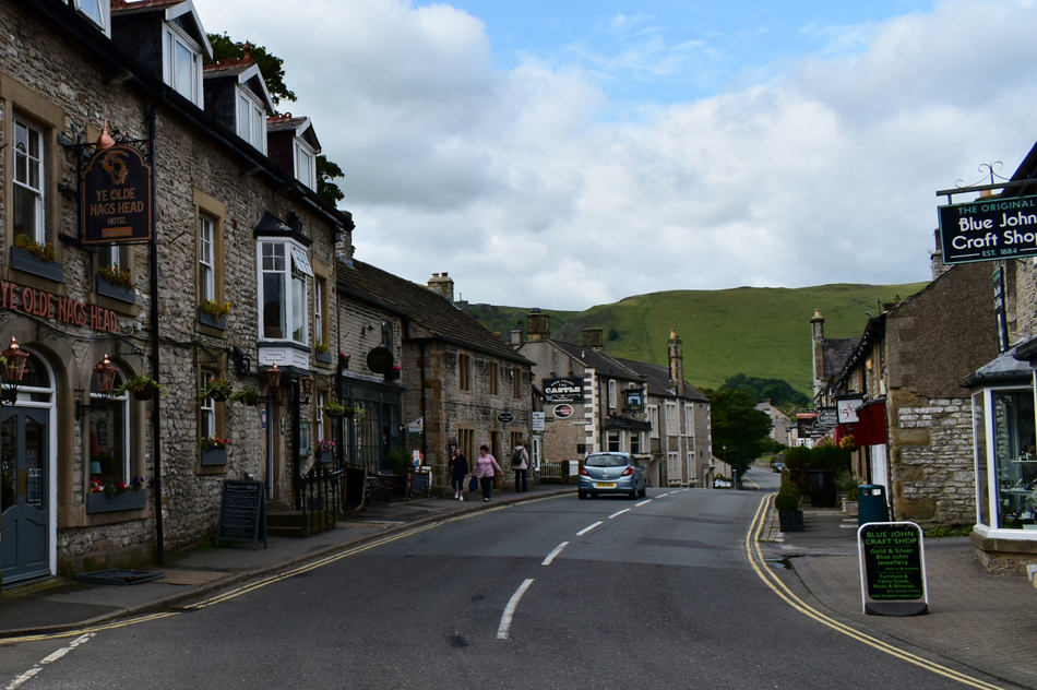
It was still warm by the time I arrived back in Castleton and as predicted it had started to cloud over and I couldn't help but feel thankful that I'd completed the walk under glorious sunshine. Castleton was quite busy but I could see it being busier during the height of Summer where you'd struggle to find a free table outside one of its many coffee shops and restaurants. The car park is situated at the end of the road which I walk back to while swapping footpaths looking through shop windows before passing Castleton Visitor Centre which signalled the end of the walk. There's a few more cars on the car park and before I leave the Peak District I'm going to tuck into lunch whilst going over he highlights of the walk which for me are split between walking up Winnats Pass and one of the best ridge routes I've ever walked. |
|
| |
| Back to top |
 |
|