|
Sheffield Pike and Glenridding Dodd |
 |
 |
16th July 2020 |
 |
|
I woke with the intentions of hiking up Blencathra this evening to catch the sunset but by lunchtime my plan lay in shatters after the forecast changed during the morning so I set about planning on where I could walk today. After checking the forecast and indeed Webcams around the north and south of the district it looked like the cloud was going nowhere but with no plan on where to walk I set off anyway.
Between junctions 33 and 34 of the M6 you do get a glimpse of the Coniston fells over Morecambe Bay which were also below cloud so that ruled out walking in that direction, feeling frustrated I pulled in at Kendal Services and began checking my Met Office Map punching in different locations around the district and the area around Ullswater looked to be the best with sunshine forecast around evening time, Ok I now have an area from where I can set off from but where to walk?
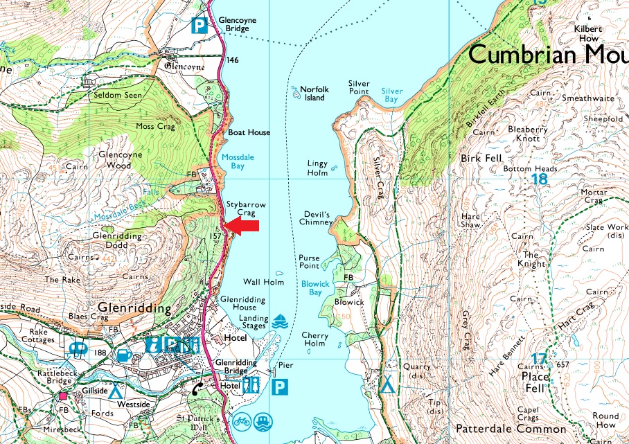
I left the M6 at junction 36 and made for the Kirkstone Pass from which I could see over Hartsop, Patterdale and Ullswater and would you believe it was actually quite sunny down there. Two walks were by now springing to mind one of which was Place Fell from Patterdale but I couldn't find anywhere to park so I continued through to Glenridding by which time I'd already settled on this walk, Sheffield Pike and Glenridding Dodd from Stybarrow Crag. |
|
| Wainwright Guide Book One |
 |
| The Eastern Fells |
| Fashions change. When people climbed hills only for the sake of the views, the heathery summit of Glenridding Dodd must have been more frequented than it is today, for once popular paths of ascent are now overgrown and neglected. It occupies a grand position over looking the upper reach of Ullswater. It is the end, topographically of the eastern shoulder of Stybarrow Dodd. |
 |
|
|
|
| |
|
Overview |
|
|
| Ascent: |
1,826 Feet - 557 Metres |
| Wainwrights: |
2, Sheffield Pike - Glenridding Dodd |
| Visiting: |
Heron Pike |
| Weather: |
Highs of °C Lows of °C |
| Parking: |
Parking Spaces, Stybarrow Crag, Ullswater |
| Area: |
Eastern |
| Miles: |
4 |
| Walking With: |
On My Own |
| Ordnance Survey: |
OL5 |
| Time Taken: |
3 Hours 20 Minutes |
| Route: |
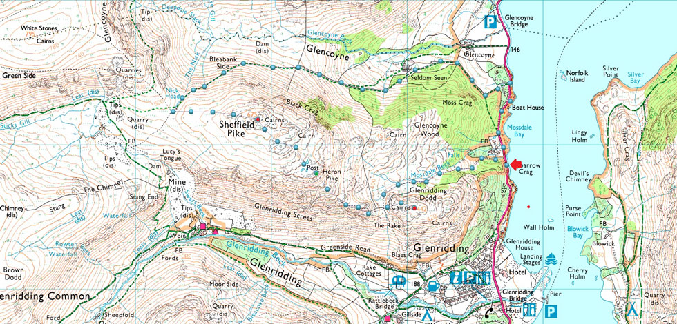
Stybarrow Crag - A592 - Seldom Seen - Glencoyne - Nick Head - Sheffield Pike - Heron Pike - Glenridding Dodd - Mossdale Beck |
|
| |
|
Parking Details and Map |
|
|
| Nearest Post Code: |
CA11 0NG |
| Grid Reference: |
NY 387 117 |
| Notes: |
The parking spaces at Stybarrow Crag are perfectly positioned for walks into and Glenridding, the Helvellyn range or even just a short walk up Glenridding Dodd. If travelling from the north the parking spaces will appear on the right as a long layby right opposite Ullswater or from the south they will appear on left after leaving Glenridding. Despite the popularity of the surrounding fells and villages you would only have trouble parking here if left late into the day during Summer. Parking is free. |
|
| |
|
Map and Photo Gallery |
|
|
 |
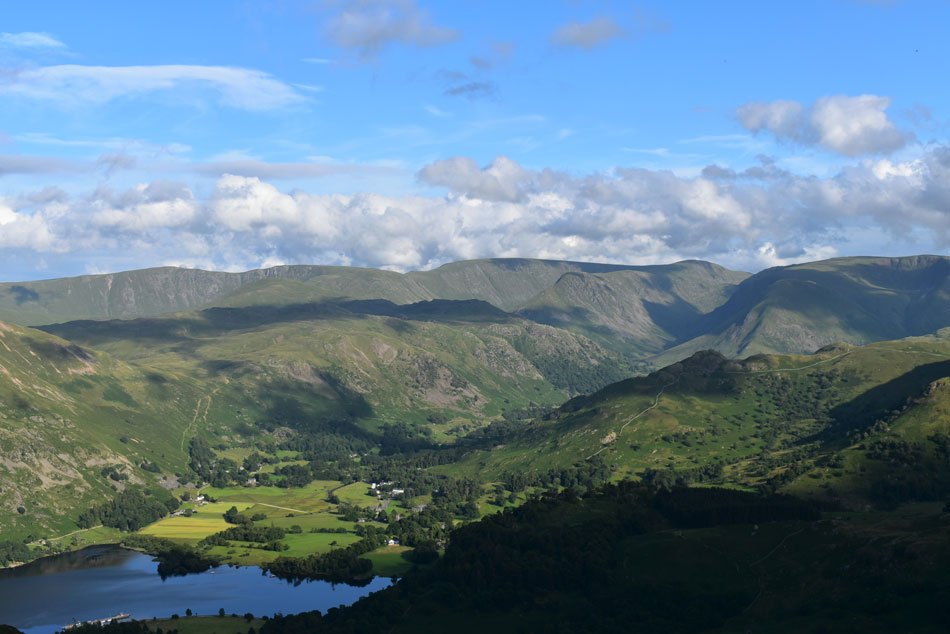
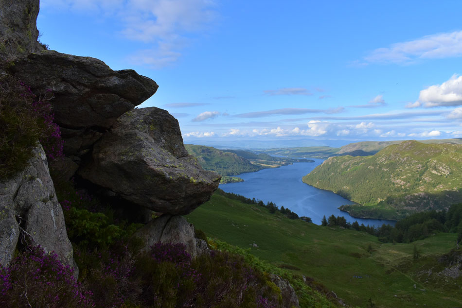
| Place Fell, Angletarn Pikes, Brock Crags and a distant Caudale Moor from Stybarrow Crag 16:45pm 21°C |
| The skies were clearing nicely of the low cloud which by now where only confined to the highest tops along the Helvellyn range. I managed to grab the last parking place at Stybarrow Crag most of which were taken up by Motorhomes or day trippers who were picnicking on the beach just opposite. It's feeling humid so no jacket today which again gets stuffed into my pack should I need it later. Within minutes of arriving I was ready to leave so after locking my car I crossed the road and made for the shore path which will lead me as far as the access road for Seldom Seen and the Glencoyne valley. |
 |
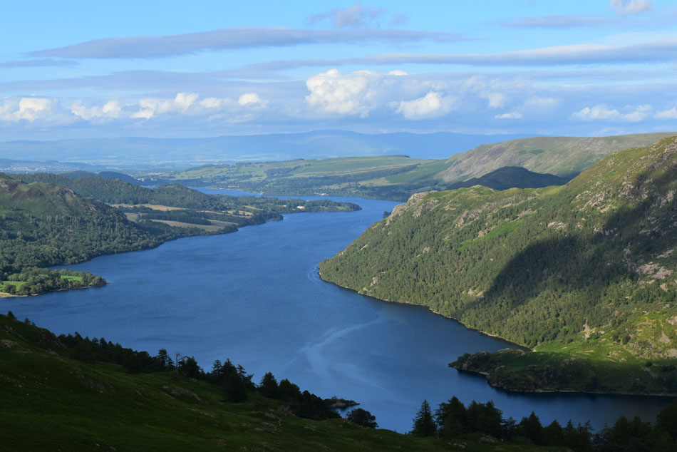
| Gowbarrow Fell, Ullswater and Low Birk Fell from the access track. |
| I found the shore path quite busy with people walking in the opposite direction all the while my head was in overdrive whether I should prolong todays walk into a sunset walk and if I should which other fells should I include and how long would they take me, I concluded that if I was going to wait for the sunset which was a good four hours away I should include an out and back to Hart Side. |
 |
| Passing Seldom Seen cottages. |
| I'd passed a few 'no entry signs' and 'construction traffic only' signs and wondered what it was all about, surely I thought I won't have to turn back but feeling inquisitive and slightly stubborn I continued towards Seldom Seen cottages. |
 |
| New access road appears alongside Glencoyne Beck with Hart Side beyond. |
| The track seen leads back to Glencoyne Farm where construction has begun on a new Hydro-electric scheme for the Glencoyne Valley. |
 |
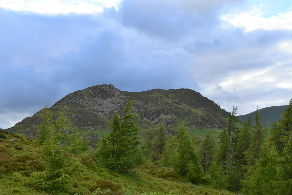
| Sheffield Pike beyond the Glencoyne greenery. |
| The track can be steep in places which I've only ascended a few times previously but for now I seem to have it to myself so with no real plan of where I'm heading next I mull it over in my head, do I or don't I head for Hart Side? |
 |
| Looking back on Glenridding Dodd, Ullswater. Birk Fell, Low Birk Fell, Hallin Fell, Bonscale Pike and Arthur's Pike. |
| What a lovely evening it's turning out to be. |
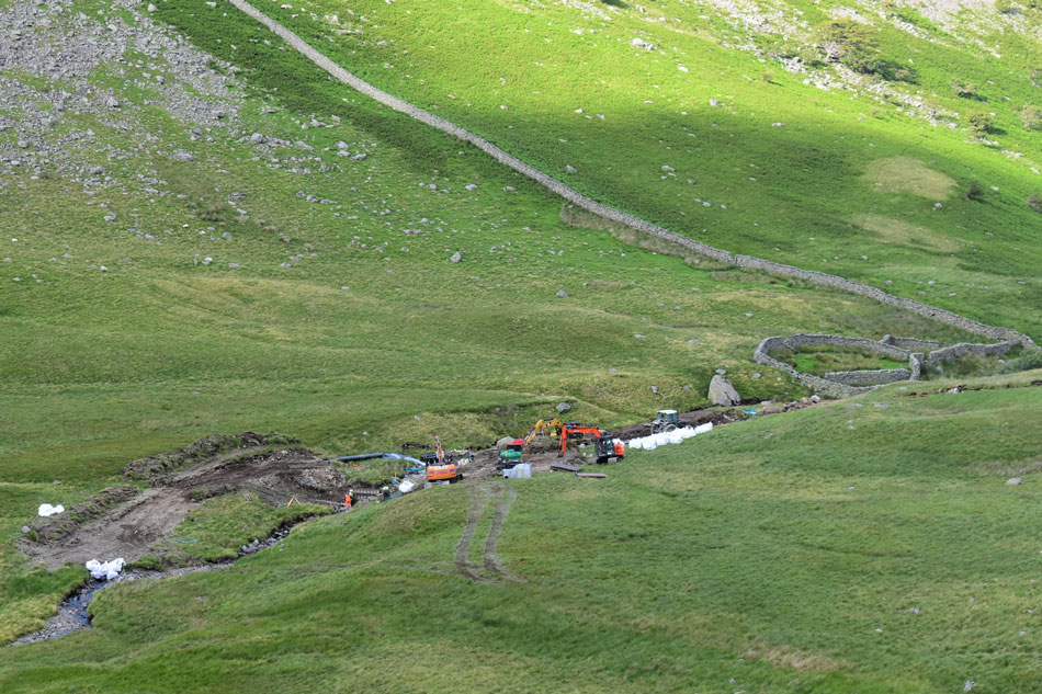 |
| Looking down on the Hydro-Electic Scheme construction alongside Glencoyne Beck. |
| At almost 6pm I was surprised to see the workers still at it. |
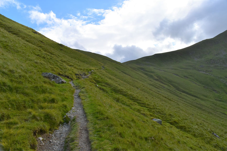 |
| Continuing towards Nick Head. |
| With more height gained I'm met by a slight breeze which helps to keep things cool. |
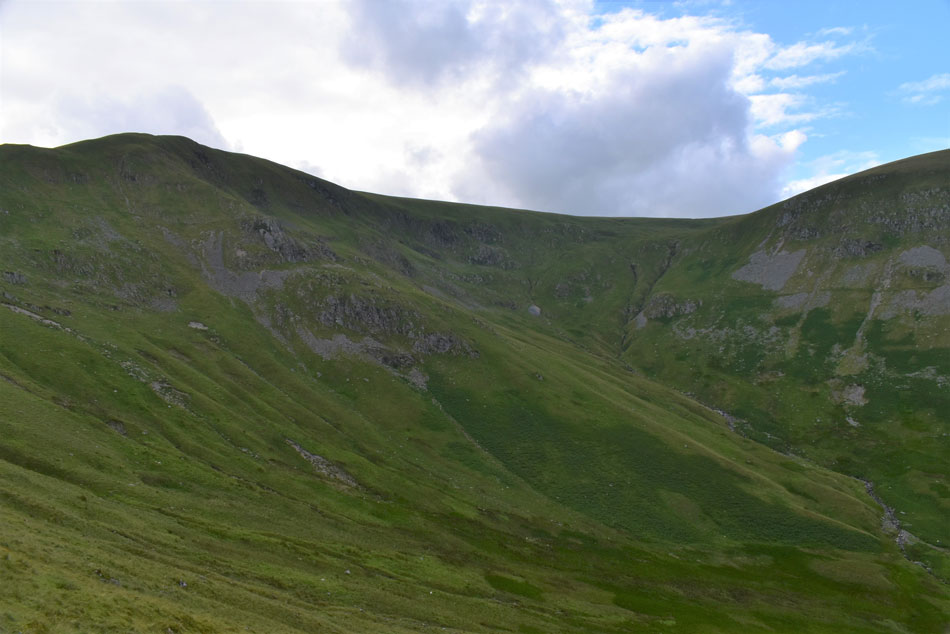 |
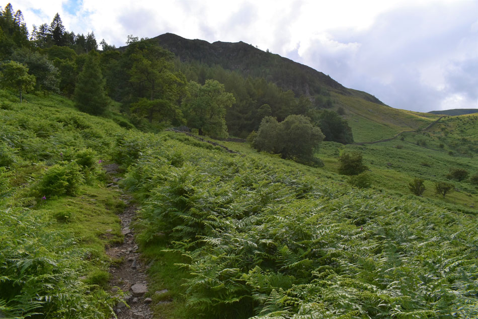
| Views over Glencoyne towards Hart Side. |
| Despite intentionally walking at a snails pace I found myself close to Nick Head from where I had to make the decision do I head for Hart Side or not? I reckoned at a slow pace it would still take me an hour there and back which would take me to 7:15pm then perhaps another hour to reach Glenridding Dodd by which time I'd still have an hour to wait until sunset, unless I'm prepared to wait I think it's best I call off waiting until sunset because (right now) as I look up at clouded skies I might not see it anyway. |
 |
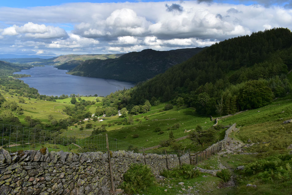
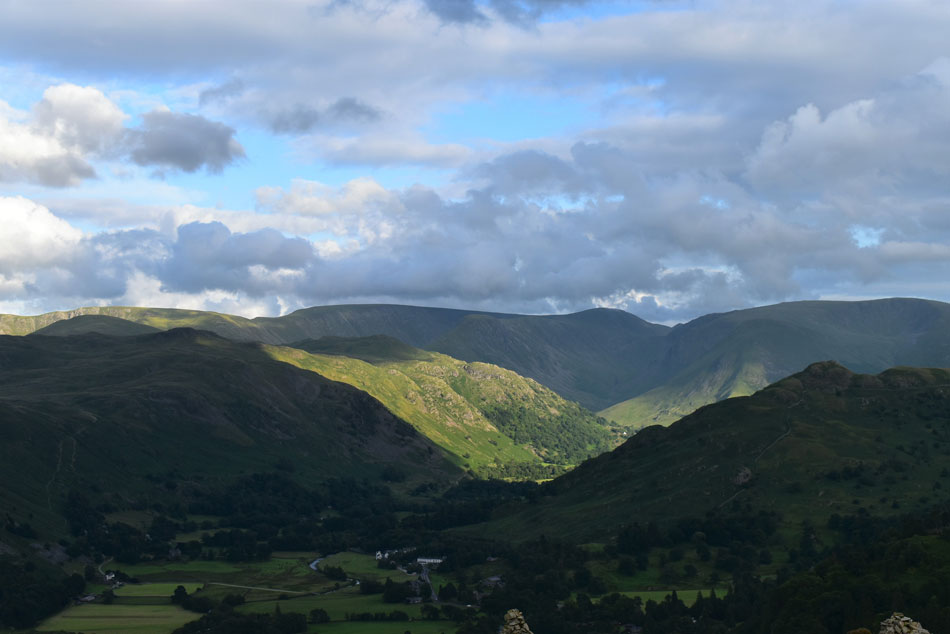
| Extended views over Place Fell, Red Crag, High Raise (Martindale) Rampsgill Head, Angletarn Pikes, Brock Crags, High Street, Gray Crag, Thornthwaite Crag, Hartsop Dodd, Caudale Moor and Arnison Crag. |
| What a view! |
 |
| Views over Birkhouse Moor, Striding Edge, Helvellyn, Catstye Cam, Lower Man and White Side. |
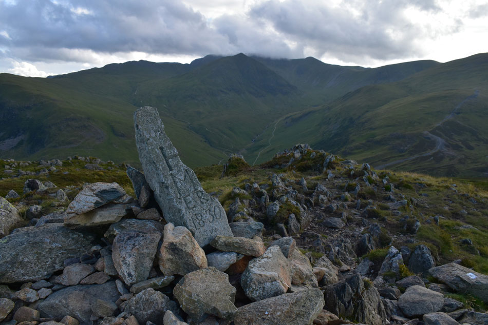
| Before the rock splintered (possibly caused by freeze/thaw effect) The 'H' is for the Howard Estate of Greystoke while on the other side 'M' stood for the Marshall Estate of Patterdale. |
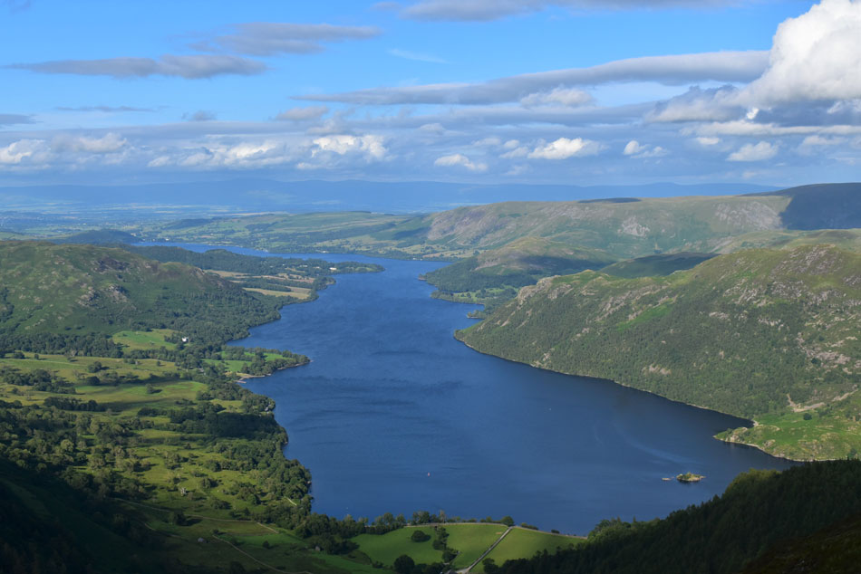 |
| Ullswater close up. |
| I left the summit and took in the view over Ullswater for a few moments. |
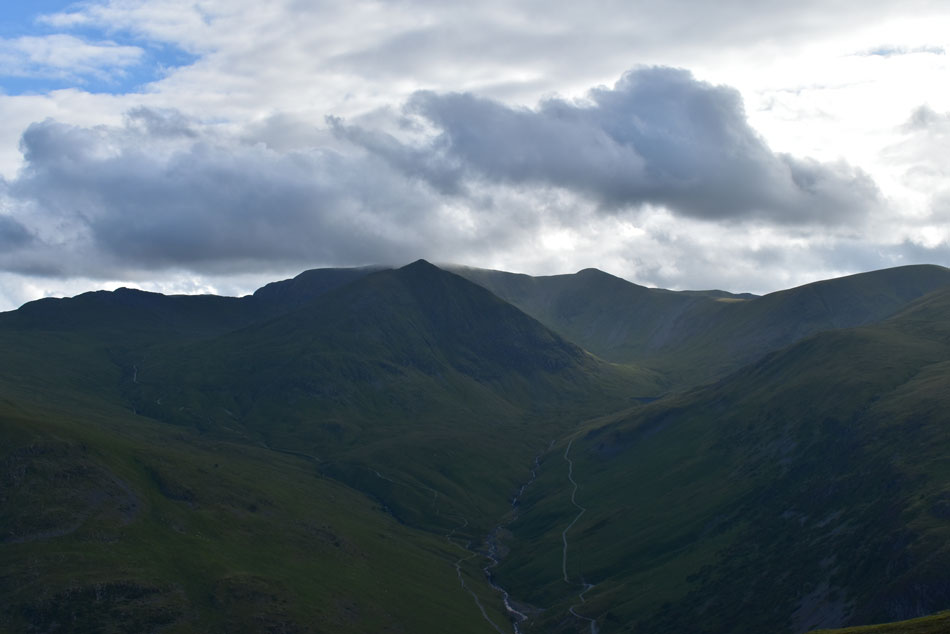 |
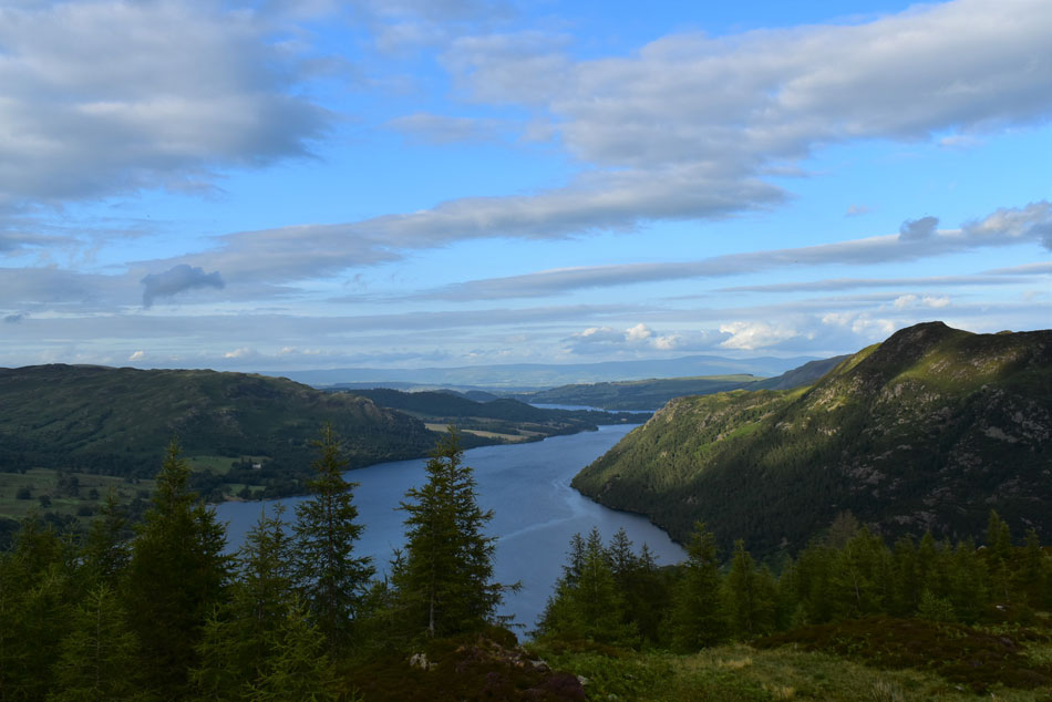
| Dramatic views towards Helvellyn, Catstye Cam,, White Side and Raise from Sheffield Pike. |
| Only the smallest of sun spots being able to break through. |
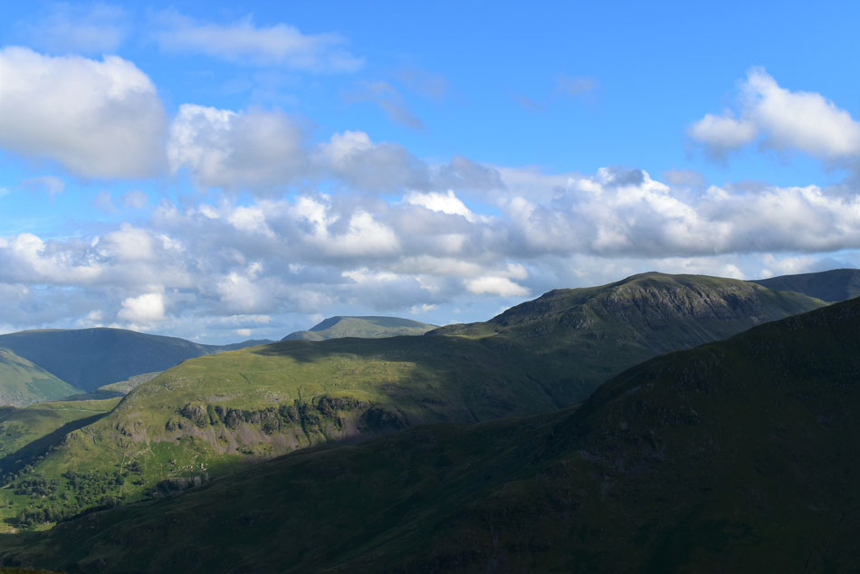 |
| Caudale Moor, Middle Dodd, Red Screes seen beyond Birks and St Sunday Crag. |
| With Birkhouse Moor north ridge seen in the foreground. |
 |
| Red Crag, High Raise (Martindale) Rampsgill Head, Angletarn Pikes, Brock Crags, High Street, Gray Crag, Thornthwaite Crag, Hartsop Dodd, Caudale Moor and Arnison Crag. |
| With Patterdale enjoing the sunshine below. |
 |
| Place Fell, Birk Fell, Hallin Fell, Loadpot Hill, Bonscale Pike and Arthur's Pike. |
| With Silver Point seen extending into Ullswater below. |
 |
| Arnison Crag enjoying the sunshine. |
| |
 |
| Silver Point and Birk Fell on Place Fell. |
| The forecast did say it would be sunny over Ullswater while the fells to the west are all in shade. |
 |
| The Shark and Rhino below Heron Pike. |
| I left Sheffield Pike and dropped Heron Pike's steep east ridge by which point I could pick out the conversations people were having as they walked the Greenside Road down below. I had left the wind confined to the summits and by now it was starting to feel really humid again so up went the sleeves accompanied by long gulps of hydration from my bite valve. |
 |
| Views over the Cottages on Greenside Road as cloud starts to build over Glenridding. |
| |
 |
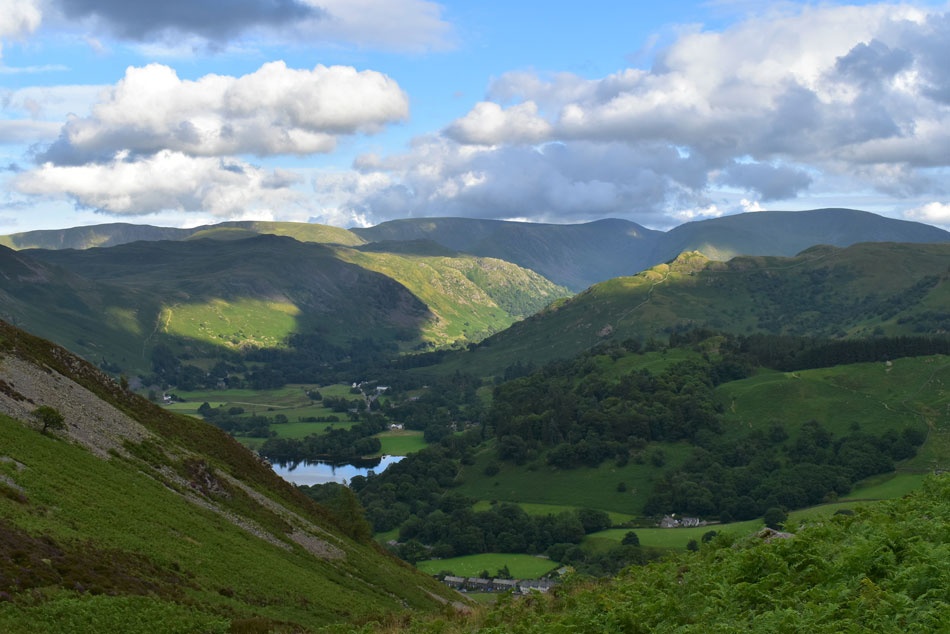
| Gowbarrow Fell, Ullswater and Place Fell from Glenridding Dodd. |
| With the descent of Heron Pike behind me I started the short ascent on Glenridding Dodd before making my way over to the summit, it was still incredibly humid but more cloud was starting to build from the west so to cool down I de-shouldered my pack and tucked into the sandwiches I'd made earlier. |
 |
| The Knight and Place Fell from Glenridding Dodd. |
| While sat eating my sandwiches I started to changing light over Place Fell which kinda got me lost in the moment. |
 |
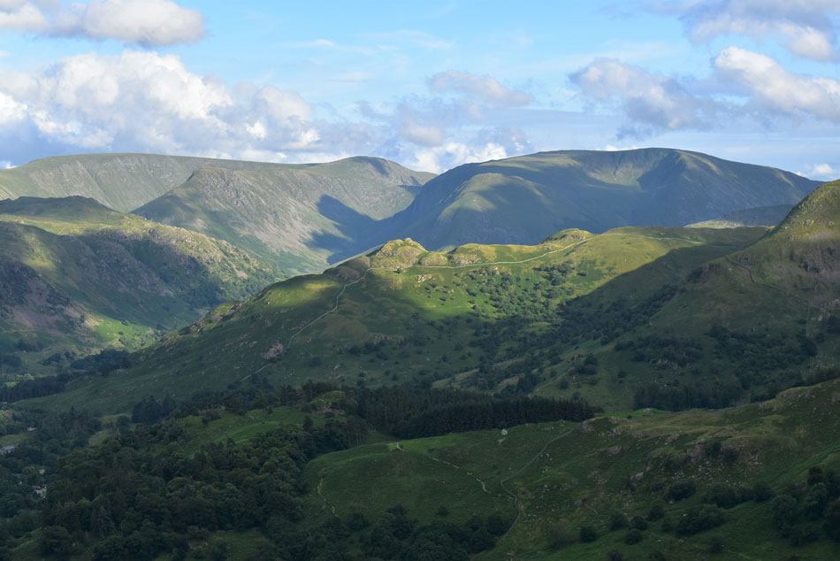
| Looking back towards Heron Pike. |
| The cloud just keeps coming from the west. |
 |
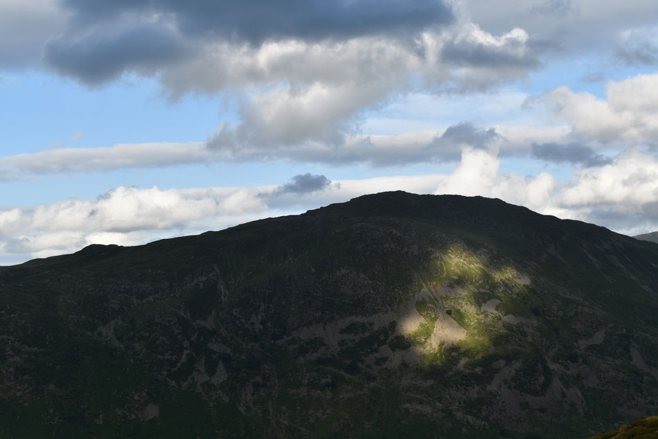
| Brock Crags clings on. |
| While all around is submersed in shade, but it's not to last. |
 |
| Place Fell, Angletarn Pikes, Brock Crags and Arnison Crag. |
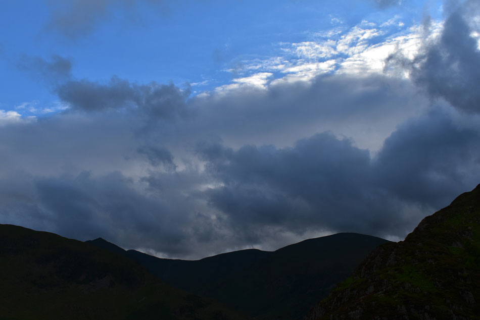
| It's about 8pm now and with the cloud continuing to build I tear myself away and start to make my descent. |
 |
| Catstye Cam, Lower Man, White Side and Raise profiles. |
| |
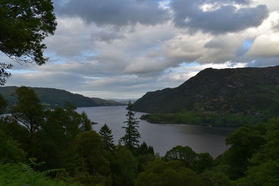 |
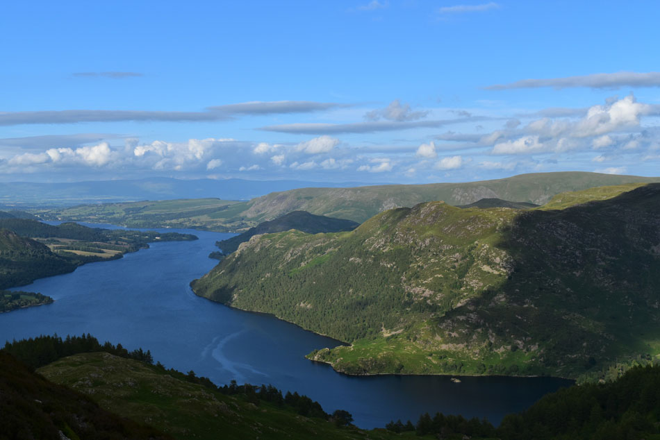
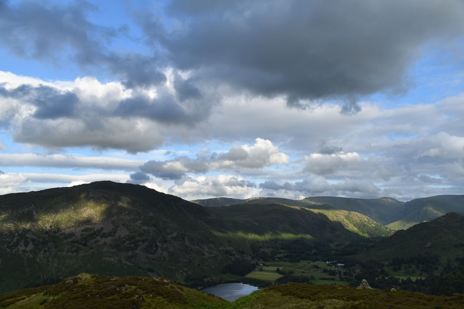
| Ullswater and Place Fell from Mossdale Beck. |
I left Glenridding Dodd under brooding skies and I just couldn't see the sun being able to penetrate through the ever thickening cloud. With the descent of Glenridding Dodd behind me I decided to descend via Mossdale Beck, a route that I hadn't used for sometime my only memory of it being steep. I took in the views over Heron Pike which struck out over the skyline like the Matterhorn before its profile disappeared behind the Ferns. My descent was just as I had remembered, steep and tricky and plagued with tree roots and the odd rock step but every now and again Ullswater would appear through gaps in the trees.
I returned to my car nearly three and half hours later and Stybarrow Crag looked a different place now that all the picnickers had gone it was me and the odd car that passed. I take my time kitting down and then wandered over to the other side of the road to take in the view over Ullswater where in the distance three paddle boarders were still out on the lake. I retraced my drive over Kirkstone Pass where it started to rain lightly but nothing more came of it, I was hoping to get a view of the sun disappearing behind the Langdale Pikes but they were below cloud as were the Coniston fells but the night hadn't finished with just me just yet, by the time I reached junction 34 I was able to be peer back towards the southern fells where by now an incredible sunset was taking place as shafts of light escaped the clouds above a deep orange afterglow, it was a beautiful sight and a dramatic end to the day and in frustration I nearly swore but I kept it back and instead I stole a few more glances before the motorway descended and the sunset was replaced by the car's headlights behind me. |
|
| |
| Back to top |
 |
|