|
Bowfell via The Climbers Traverse |
 |
 |
19th July 2020 |
 |
|
I've always been a big fan of Bow Fell in fact this walk was one of the walks I would dream about once lock down was lifted but due to MRT being as stretched out as they were I put any strenuous walks on hold. It would be incorrect of me to say that MRT are back to normal but things are slowly returning that way and, I can only echo MRT words who advise to enjoy the fells but come prepared especially on unfamiliar routes.
Todays walk is one I've trodden many times, The Bowfell Traverse is perched 1,800ft above the Mickleden valley on Bow Fell's eastern flank and although it's not entirely exposed, there is exposure in places where small rock steps would need to be negotiated and care along the narrowest of paths would be advised at all times.
i couldn't think of a more fitting view, and inspiring walk to finish my week off than Bow Fell via the Climbers Traverse and I guess this walk report won't be my last covering this favourite walk of mine. |
|
| Wainwright Guide Book Four |
 |
| The Southern Fells |
| The best way off the traverse to the summit lies up the fringe of a river of boulders along the south side of Cambridge Crag. |
 |
|
|
|
| |
|
Overview |
|
|
| Ascent: |
2,679 Feet - 818 Metres |
| Wainwrights: |
Bow Fell |
| Visiting: |
The Band |
| Weather: |
Dry Warm & Sunny. Feeling Cool Over The Summits. Light Winds. Highs of 21°C Lows of 8.3°C |
| Parking: |
Car Park, Old Dungeon Ghyll, Great Langdale |
| Area: |
Southern |
| Miles: |
7.4 |
| Walking With: |
On My Own |
| Ordnance Survey: |
OL6 |
| Time Taken: |
4 Hours 20 Minutes |
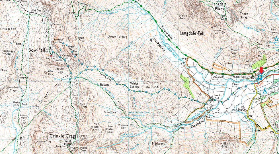
| Route: |
Old Dungeon Ghyll – Stool End Farm – The Band – Bowfell Climbers Traverse – Great Slab – Bowfell – Three Tarns – The Band – Stool End Farm – Old Dundeon Ghyll |
|
| |
|
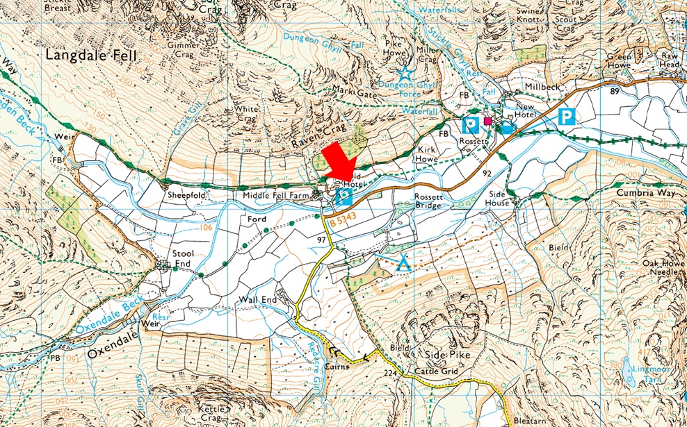
Parking Details and Map |
|
|
| Nearest Post Code: |
LA22 9JY |
| Grid Reference: |
NY 285 206 |
| Notes: |
New Dungeon Ghyll car park is situated next to the B5343 which is the only road into the valley. It is close to the Cumbria Way and an ideal place to ascend to Stickle tarn and the Langdale Pikes. Toilet Facilities can be found around 250 yards away from the car park. Parking Charges apply |
|
| |
|
Map and Photo Gallery |
|
|
 |
| A Great Langdale view taken from just outside Chapel Stile. |
| I couldn't pass this amazing view of the Langdale Pikes, Bow Fell and Crinkle Crags as I was driving through Great Langdale towards ODG. |
 |
| Kettle Crag (L) PikeO'Blisco (R) and Great Knott taken as I head towards Stool End Farm, Great Langdale. |
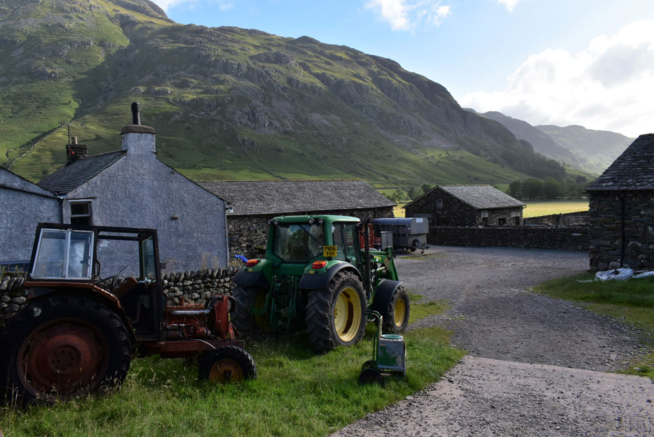
I'm normally at the edge of my seat as when I'm walking in Great Langdale because I usually try and park at Rossett Bridge where parking is limited but seeing as I'm parking at Old Dungeon Ghyll (ODG) I needn't worry which was a good job because by the time I drove past Rossett Bridge not only were all the spaces taken but a long queue of parked cars had formed on the other side of the bridge on the left hand side of the lane and I couldn't help but sigh with disbelief as I continued towards ODG where I found the car park around half full despite it not being 07:30 yet.
I parked easily and started to lace up while feeling pretty chuffed that not only could I wear my shorts today but I didn't have to add my jacket because it was lovely and warm here at valley level. With my boots laced tightly I wondered over to the ticket machine and emptied eight pound coins into it which granted me all day parking, returning to my car I did a quick kit check, locked up and started to make my way towards Stool End Farm. |
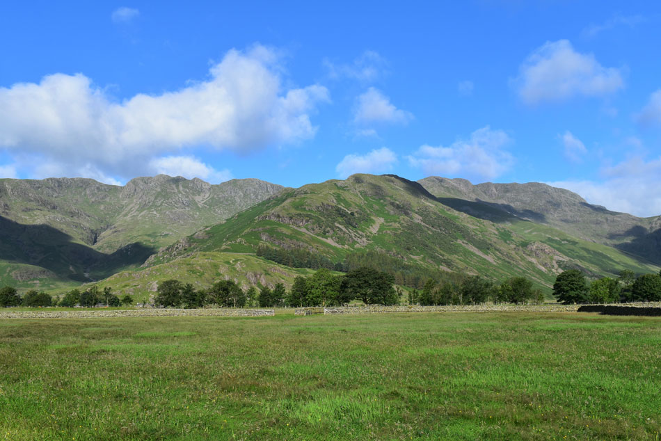 |
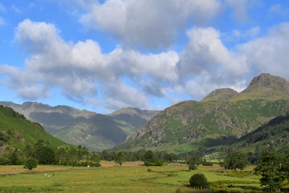
| Crinkle Crags and Shelter Crags (L) The Band (C) Bow Fell and Hanging Knotts (R) |
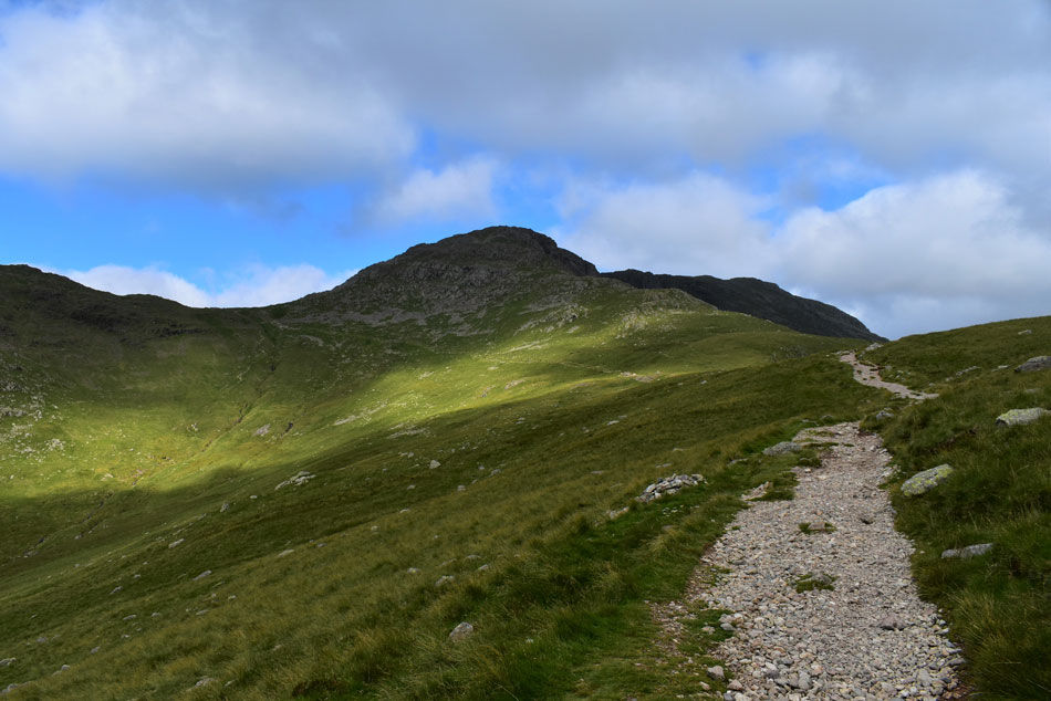
| I'm heading straight up The Band today via a great path which ascends on the Oxendale side of the fell, I say great, what I actually mean is it's the kind of ascent that gets the thighs and calfs burning straight from the off. |
 |
| Views into the Mickleden Valley. |
| With Hanging Knotts seen left, Rossett Pike and Black Crags seen centre and Pike O'Stickle seen right. |
 |
| White Crag and Raven Crag from Stool End Farm. |
| Despite the high number of cars in the valley I was surprised to find not many people around, in fact, the last people I'd seen were back at the car park which makes me wonder where is everyone? it's becoming a recurring theme since lock down was lifted. |
 |
| Crinkle Gill, Crinkle Crags and Shelter Crags from The Band. |
| It isn't long before you are presented with this wonderful view of Crinkle Crags from the start of the ascent on The Band which was great and it gave me an excuse to keep stopping to take photos. |
 |
| The wider view includes Great Knott. |
| Along with the Crinkle Crags Great Knott occupies the head of the Oxendale valley. |
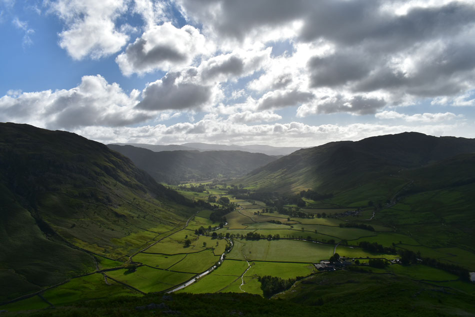 |
| Great Langdale. |
| There wasn't much wind about in Great Langdale today but what wind there was was pushed in cloud cover which created lovely little bursts of light over the valley. Just in case you were wondering that's White Crag and Raven Crag over on the left, the Raw Pike ridge can be seen ahead and Lingmoor Fell is over on the right with Stool End Farm at the foot of the ridge below. |
 |
| Pike O'Stickle with the summit of Harrison Stickle in the distance over on the right. |
| As height is gained not only do the Crinkles domminate the view so does Pike O'Stickle. |
 |
| Crinkle Crags, Crinkle Gill and Great Cove. |
| The morning air is warming up just nicely and with more height gained I'm met with a fresh breeze which helps to cool me down. I hadn't noticed a solo runner/walker who was quickly gaining ground on me so instead of trying to out walk him I stand aside to let him pass, he then thanked me with an 'ey up' |
 |
| The view across the Oxendale Valley. |
| Towards Pike O'Blisco, Browney Gill, Great Knott and Cold Pike with Great Carrs and Swirl How in the distance. |
 |
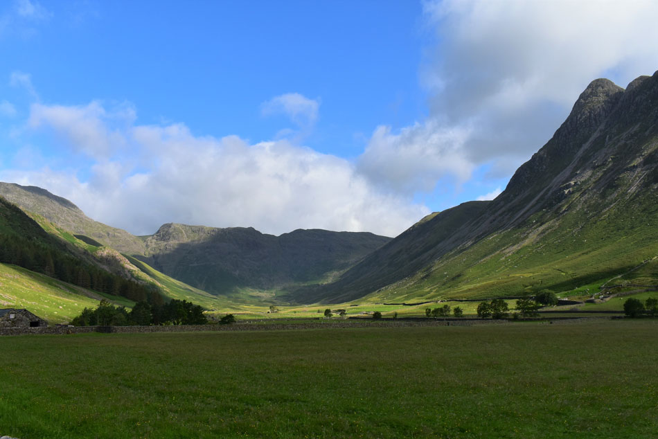
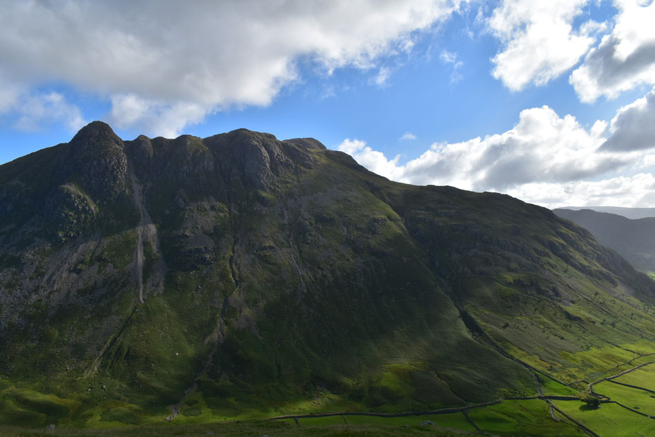
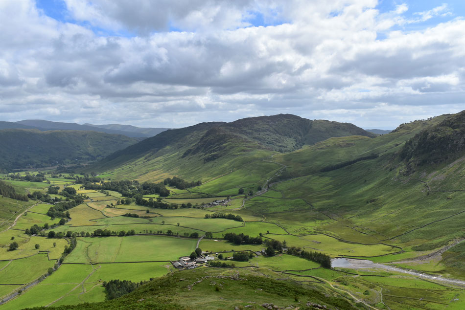
| Bow Fell and Hanging Knotts from The Band. |
Despite having blue skies in the distance overhead it was a different story with a large mass of grey cloud from which sunlight would burst through everynow and again.
I always try to have the camera ready when that happens. |
 |
| Looking towards the Crinkles. |
| With Long Top (Crinkle Crags summit) Gunson Knott and Shelter Crags while Hell Gill descends in the foreground. |
 |
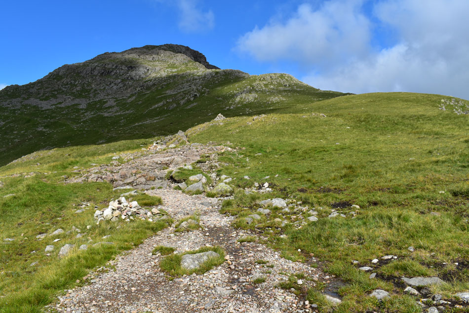
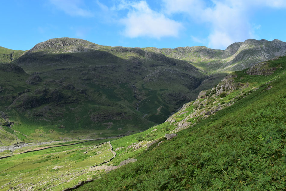
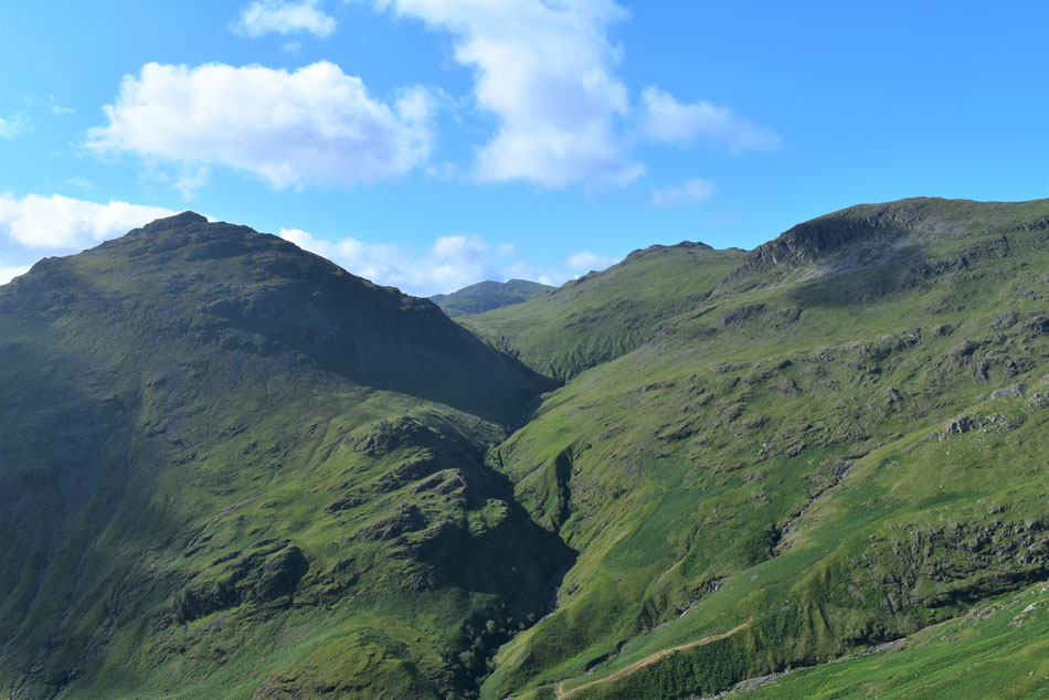
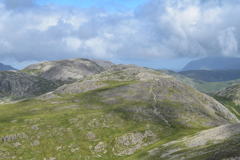
| Approaching the point where I leave the path at the cairn ahead (r) for The Climbers Traverse. |
| I think the cloud is about to make way for some much needed sunshine! |
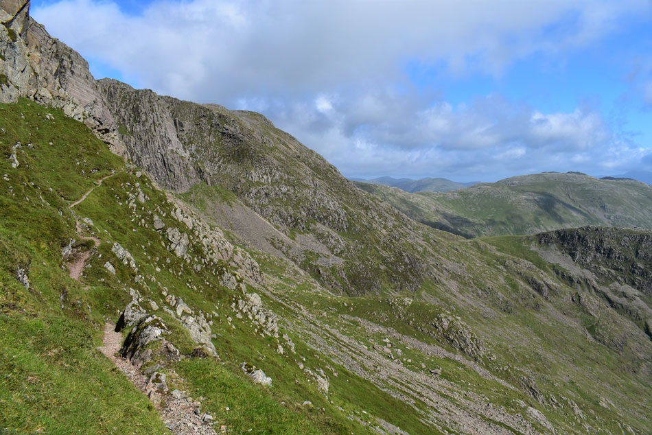 |
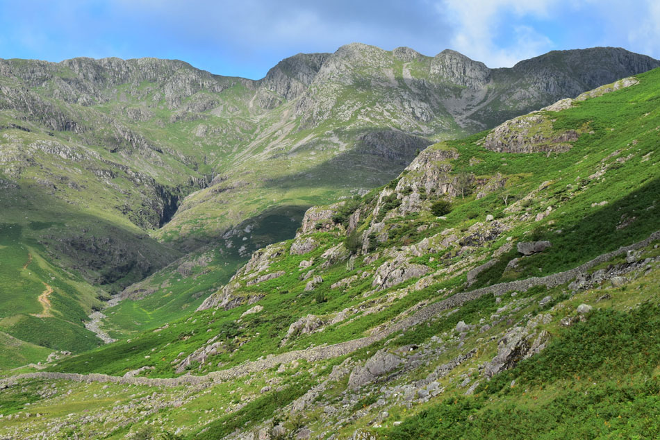
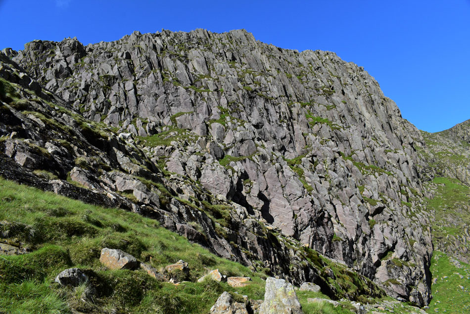
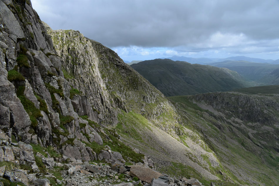
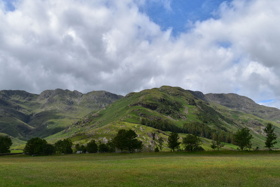
| Bowfell Buttress from The Climbers Traverse. |
I left the main path bound for Three Tarns and joined the start of a grassy trod which started to steepen almost immediately before leaving the comforts of the trod for a rockier approach, the path continues in steepness before arriving at the start of the Traverse from where I stopped to take this photo.
That's Glaramara over on the right with Rossett Pike below...the big question is? do I stop to add a layer because right now the temperature has dropped from the late teens to just 8.3°C helped along by a very fresh breeze. I don't wimp out feeling safe in the knowledge that once I start the climb alongside the Great Slab I'll be complaining I'm too hot. |
 |
| The view over Mickledon towards Rossett Pike, Black Crags, Mart Crag, High Raise, Sergeant's Crag, Eagle Crag, Glaramara, High Crag (Watendlath) the Helvellyn range and finally Skiddaw. |
| I scour for movement and spot no one, not yet anyway. |
 |
| Impressive views of Bowfell Buttress. |
| With Hanging Knotts in the distance.Those with a very keen eye may spot the two walkers on Hanging Knotts summit and those with an even keener eye may spot the four climbers at the base of Bowfell Buttress. |
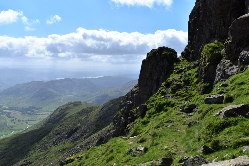 |
| Looking back along The Climbers Traverse. |
| With The Band in the distance. |
 |
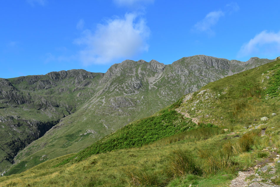
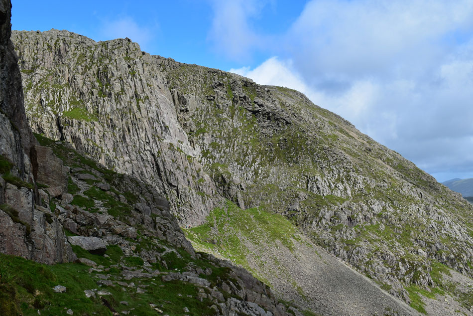
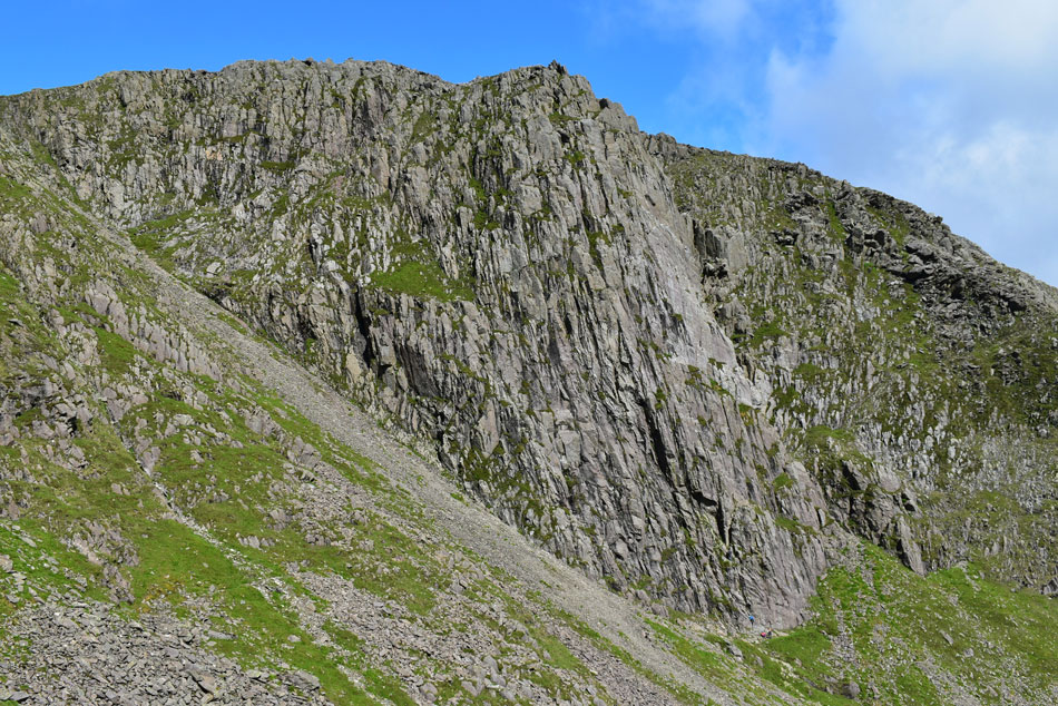
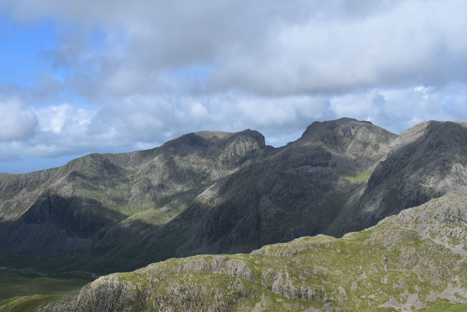
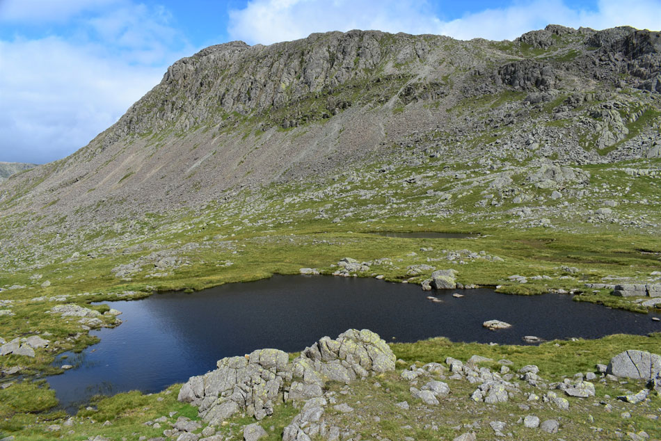
| Cambridge Crag from the Climbers Traverse. |
| The wall of flat rock in the foreground is the base of the Great Slab which I'll be ascending via what Alfred Wainwright described as the 'river of rock' found between the Great Slab and the base of Cambridge Crag. |
 |
| Bowfell Buttress. |
| |
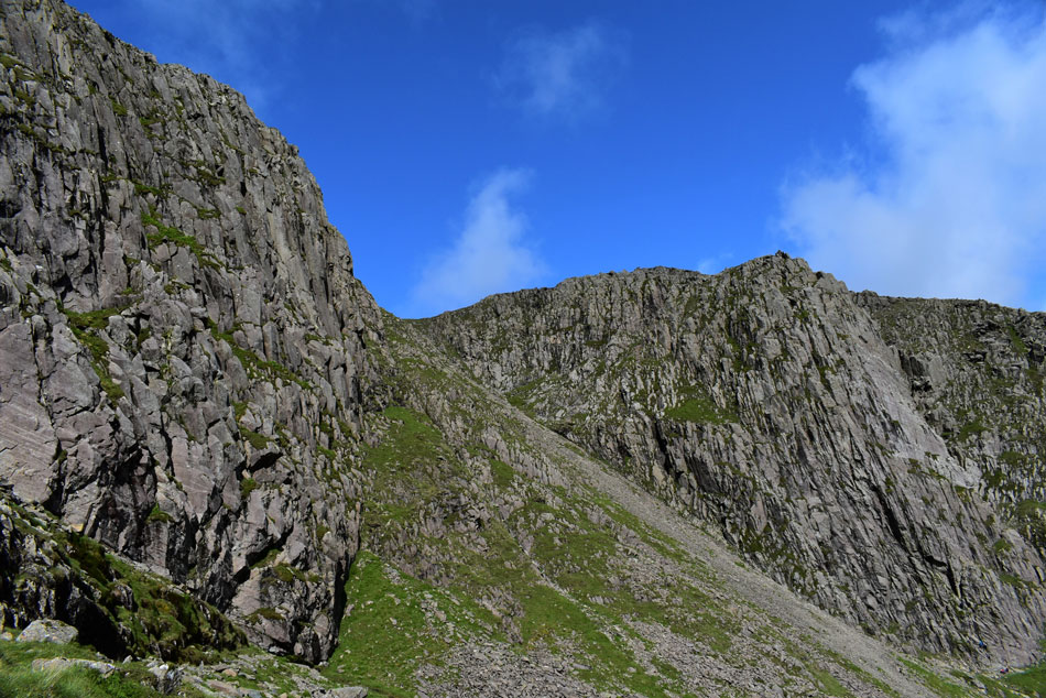 |
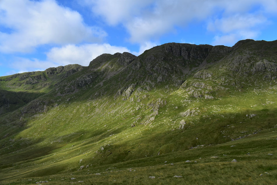
| Cambridge Crag and Bowfell Buttress. |
| Another option to gain Bow Fell would be to ascend the scree seen running through the middle of the photo. |
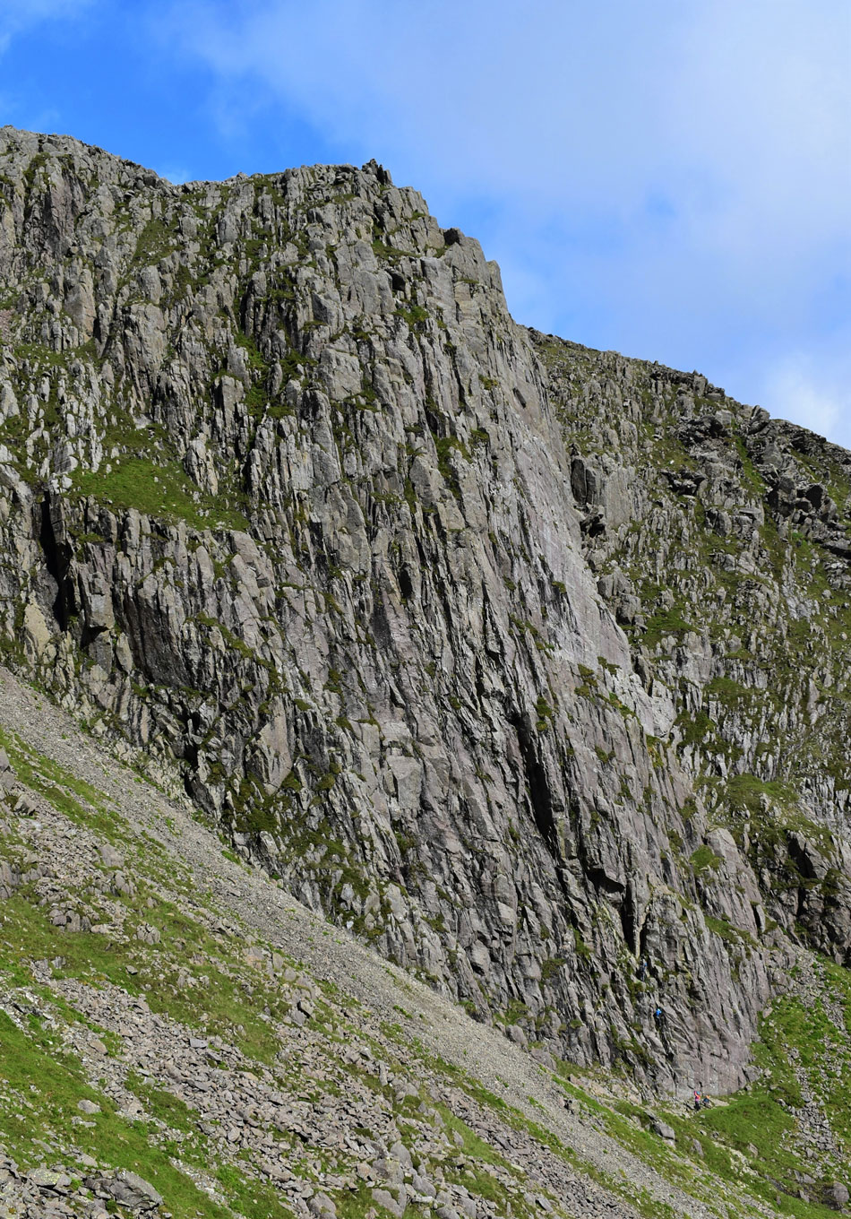 |
| Bowfell Buttress. |
| Climbers seen at the base add scale to Bowfell Buttress. |
 |
| Bowfell Buttress, Hanging Knotts, Rossett Pike and Glaramara. |
| From Wainwrights 'river of rock' |
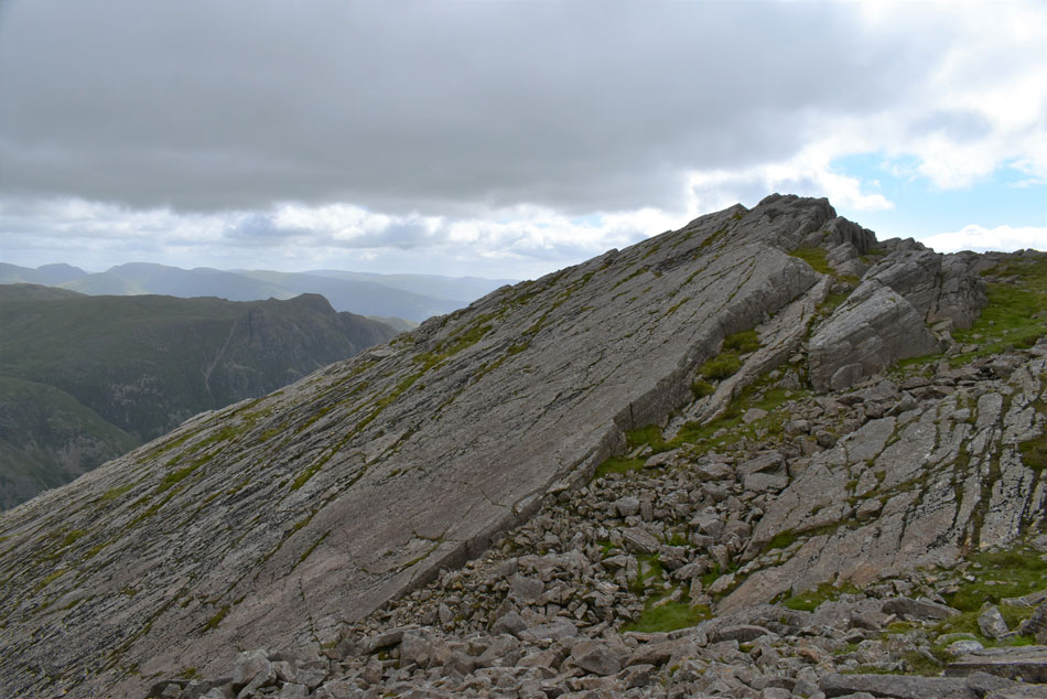 |
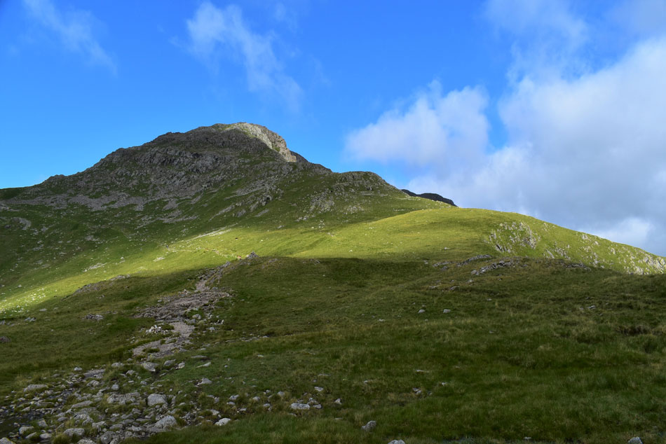
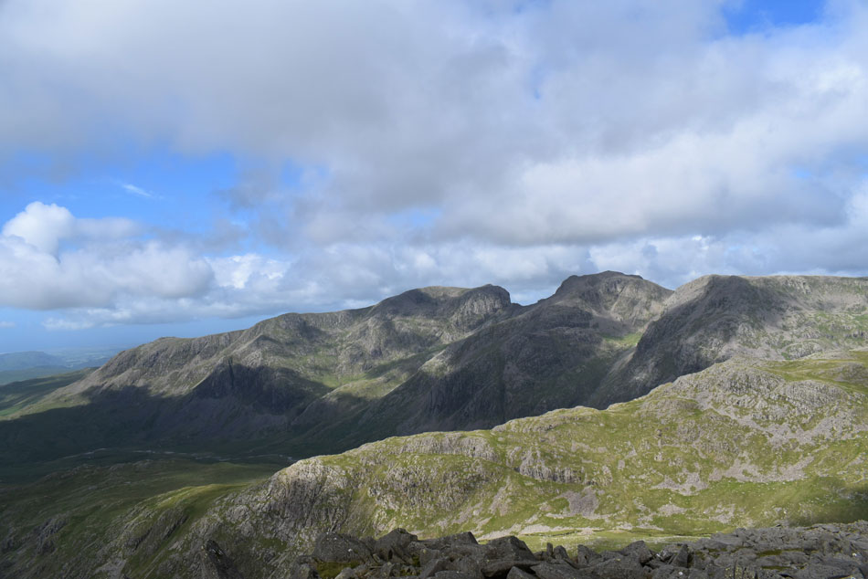
| The Great Slab, Bow Fell. |
| From the top of the gully, it's now time to head for Bow Fell summit which is just a short stroll away. |
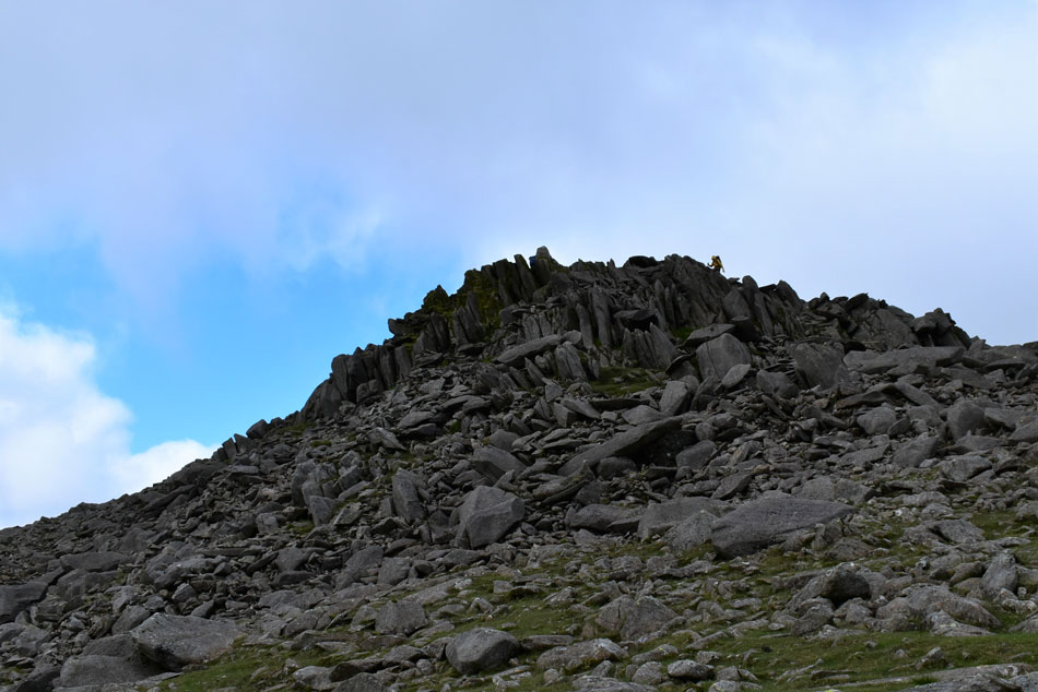 |
| Bow Fell summit. |
| I gained the summit via the boulders as I'm reminded no matter how many times I've summated Bow Fell, I don't think I've ever summated via the boulders the same route twice. |
 |
| From Bow Fell summit. |
| I took in the view over the Yeastyrigg Crags ridge towards Hanging Knotts and Esk Pike (R) Great End (distant R) and III Crag (L) |
 |
| Hanging Knotts, Esk Pike and Great End. |
| Ore Gap can be seen just beyond Shelter Crags with Lower Esk Hause appearing far right below Allen Crags while the bulk of Carl Side and Skiddaw can be seen in the distance over on the right. |
 |
| Upper Eskdale Giants. |
| That's III Crag, Scafell Pike, Mickledore, Broad Stand, Sca Fell and Cam Spout Crag over on the left. Towards the centre of the photo is Pen and below that is Dow Crag where Karl Holding of Karlswalks.co.uk rough camped last night hoping to get some nice sunrise shots in the morning. |
 |
| III Crag, Scafell Pike, Mickledore, Broad Stand, Sca Fell and Cam Spout Crag. |
| Seen over the Yeastyrigg Crags ridge. Ok it's getting pretty chilled up here now it's time I was heading down. |
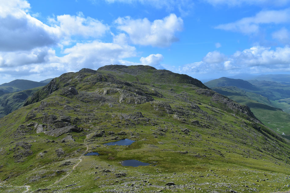 |
| Crinkle Crags seen over Three Tarns. |
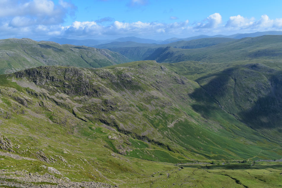
| I left Bow Fell summit and started to make my descent towards Three Tarns which was busy with walkers in ascent most of whom had ascended from ODG. |
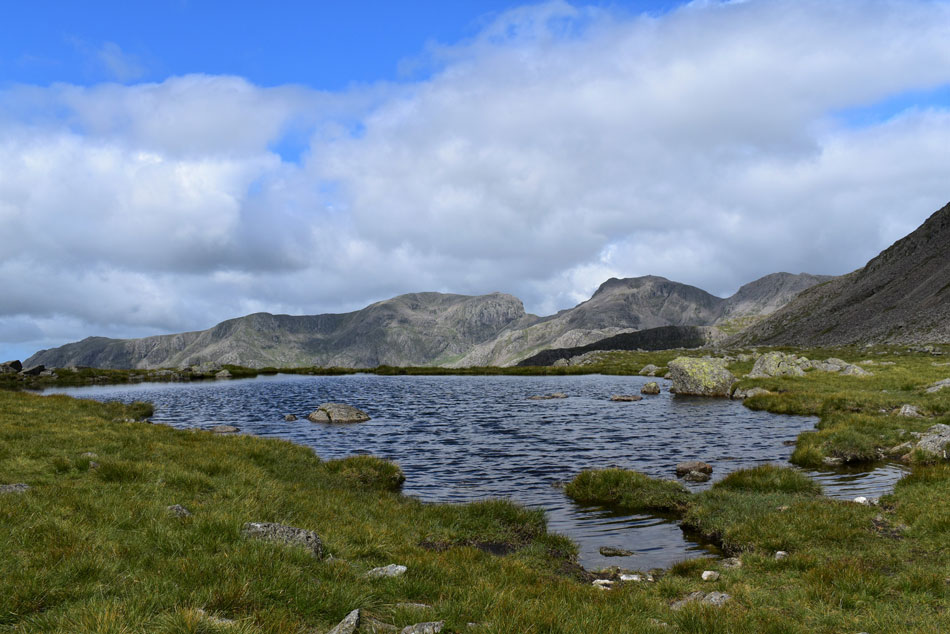 |
| III Crag, the Scafells and Slight Side from Three Tarns. |
| All three tarns were flourishing today especially my favourite the centre tarn from which you get this excellent view of the Scafells from. |
 |
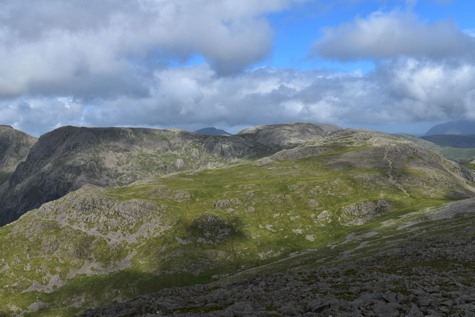
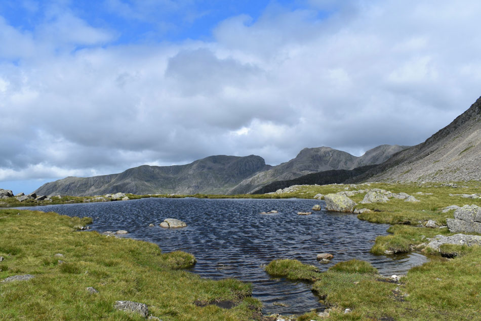
| From the same tarn. |
| I look back on Bow Fell and Bowfell Links. |
 |
| Scafell Pike, Mickledore, Broad Stand and Sca Fell seen over Yeastyrigg Crags. |
| |
 |
| III Crag, the Scafells and Slight Side from Three Tarns. |
| Seeing as I had a spare few minutes I sheltered from the cool wind behind a small out crop of rocks while tucking into an early lunch in the form of a pork pie and while I was eating said pie the sun came out so I trotted back over to Three Tarns and took another photo. |
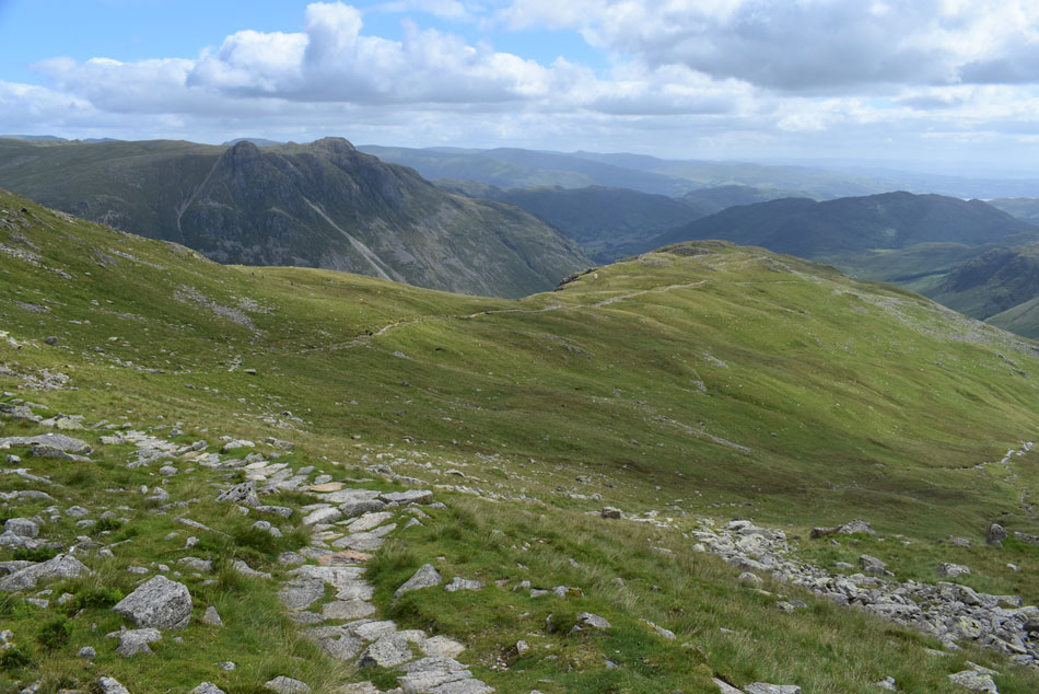 |
| Descending via The Band. |
| |
 |
| Lingmoor Fell and Side Pike. |
| With Stool End Farm in the foreground and Wall End Farm in the centre. |
 |
| Looking back on Crinkle Crags, The Band and Bow Fell from Great Langdale. |
I somehow managed to pick up some speed during my descent back into Great Langdale where more walkers are passed in ascent most of whom were friendly but appeared to be new to fell walking. With the breeze confined to the summits down at valley level the temperature is rising into the twenties and I for one relish this. I'm transfixed on the rock climbers scaling Raven Crag above ODG where I count up to eight on the rock while more look on from the base of the crag.
The scene back at ODG wasn't a pleasant one and neither was my exit from Great Langdale and guess I could go on and on about the scenes of chaos I was presented with but why when all I'm going to remember are the four great hours I spent on Bow Fell. |
|
| |
| Back to top |
 |
|