|
The Deepdale Horseshoe |
 |
 |
1st August 2020 |
 |
|
I wasn't supposed to be walking this weekend due to family commitments which changed at the very last minute. David had wild camped over Thursday and Friday on Kentmere Pike and Rod was planning a trip either on the Langdale Pikes or this walk, the Deepdale Horseshoe so I emailed Rod on Thursday evening asking would he mind I jump on board.
Rod was undecided whether to continue onto Arnison Crag after summiting St Sunday and Birks but I managed to persuade him to drop back into Deepdale via Gavel Pike and Lord's Seat which had been on my 'to do list' for a while and was great to include a never included descent into the walk after a rather mixed day on the fells which at one point saw us take a true Lakeland soaking only to have to remove layers later into the walk because it was too hot.
I've been toying with the idea to use my mobile phone to take pictures when the weather is unsettled because the low light really does have an adverse affect when using my Nikon DSLR, yes I can change the light settings but I don't really want to be worrying about image quality when I'd rather be enjoying the walk so today with rain in the air from the off I switched between my DSLR and mobile phone then once the rain got heavier I packed my DSLR away and ended up using my mobile for picture taking for the majority of the walk. |
|
| Wainwright Guide Book One |
 |
| The Eastern Fells |
Hart Crag
Occupying a strategic position overlooking three valleys. To the north-east, Hart Crag follows usual mountain structure by sending out a long declining ridge, which forms a high barrier between isolated Deepdale and delectable Dovedale. |
 |
|
|
|
| |
|
Overview |
|
|
| Ascent: |
3,267 Feet - 997 Metres |
| Wainwrights: |
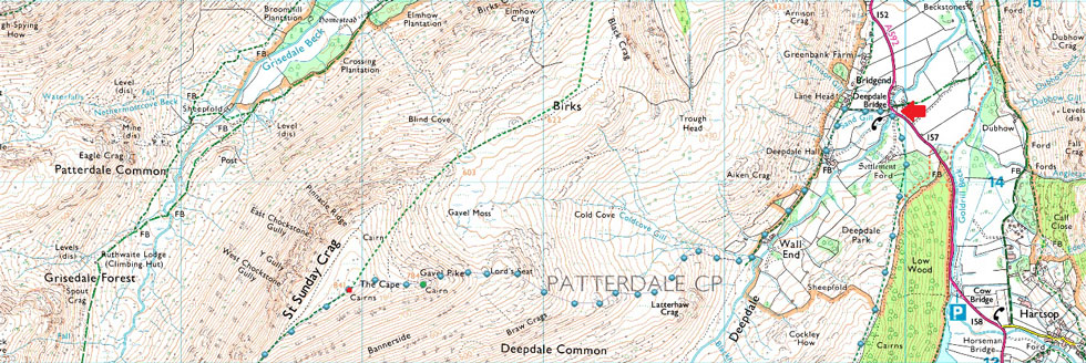
4, Hartsop above Howe - Hart Crag - Fairfield - St Sunday Crag |
| Visiting: |
4, Gale Crag - Cofa Pike - Gavel Pike - Lord's Seat |
| Weather: |
A Wet Start Turning Brighter By Midday. Feeling Fresh Across The Summits. Highs of 16°C Lows of 12.3°C |
| Parking: |
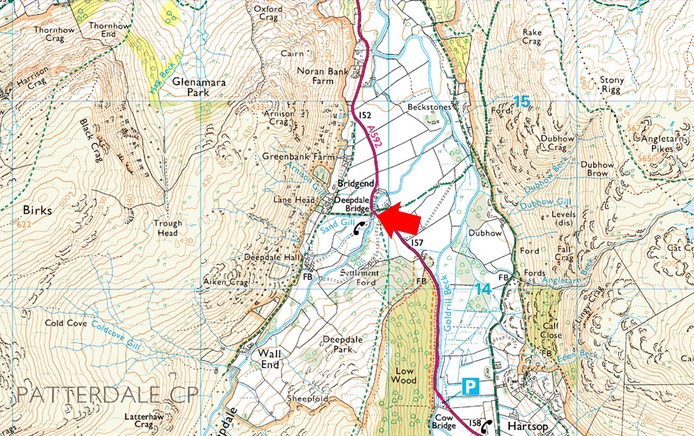
Parking Spaces, Deepdale Bridge |
| Area: |
Eastern |
| Miles: |
7.5 |
| Walking With: |
Rod Hepplewhite |
| Ordnance Survey: |
OL5 |
| Time Taken: |
6 Hours 10 Minutes |
| Route: |
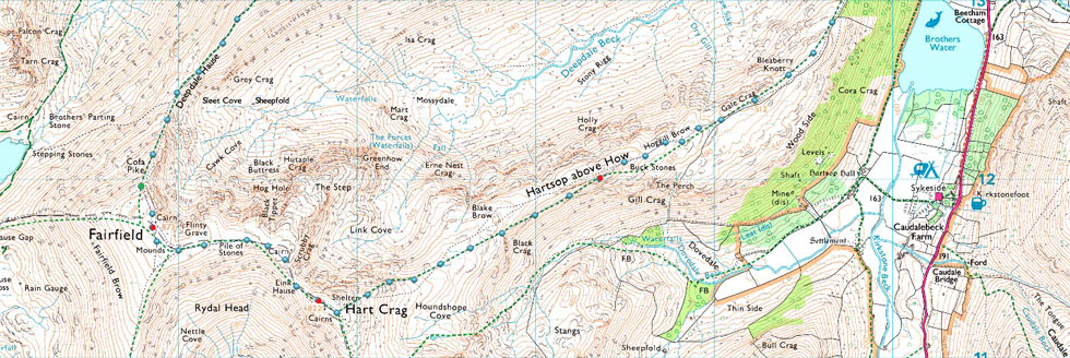
Deepdale Bridge - Gale Crag - Hartsop above Howe - Hart Crag - Link Hause - Fairfield - Cofa Pike - St Sunday Crag - Gavel Pike - Lord's Seat - Deepdale - Deepdale Bridge |
|
| |
|
Parking Details and Map |
|
|
| Nearest Post Code: |
CA11 0NS |
| Grid Reference: |
NY 399 414 |
| Notes: |
There are limited parking spaces at Deepdale Bridge with spaces for around half a dozen well parked cars. Due to the popularity of the fells around the Deepdale Valley parking here can be difficult after mid morning, my advice is to arrive early and you shouldn't have any trouble parking. Parking is free. |
|
| |
|
Map and Photo Gallery |
|
|
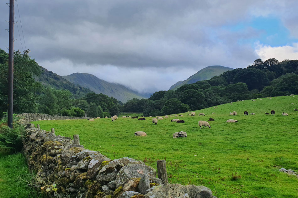 |
| Hartsop Dodd, Middle Dodd and Red Screes from Deepdale Bridge 07:55am 16°C |
The morning hadn't been gifted with the best forecast confirmed by the low cloud which hovered just over the top of Kirkstone Pass as I made my way towards Deepdale Bridge but with that said, chinks of blue sky were appearing from the west which showed promise. We had arranged to meet at 08:15 and I arrived with plenty of time to spare and parked at the parking spaces next to the Deepdale Bridge.
Rod soon followed and parked in front of me before we started to kit up under brooding skies which looked like they could unleash a torrent of rain at any minute. With the cars locked we passed over the style and walked through a field full of sheep towards a second gate bound for the Hartsop above How ridge. |
 |
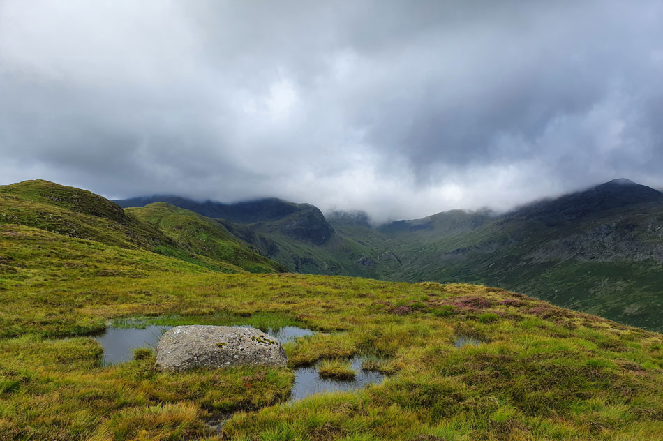
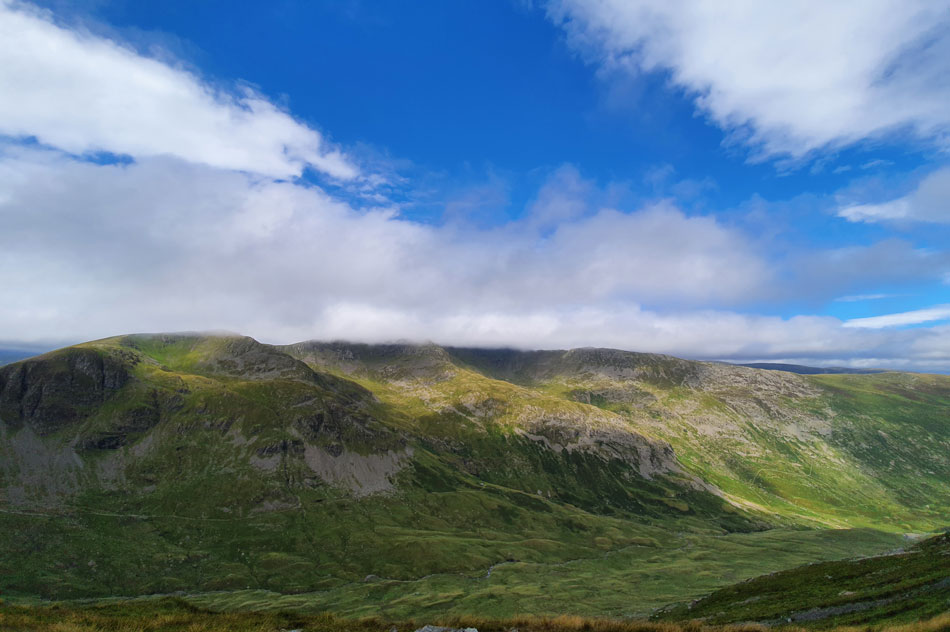
| A distant Deepdale Hause with Hart Crag, Fairfield and St Sunday Crag below cloud. |
| I think this photo kind'a sets the mood of the morning with shafts of light penetrating through the cloud while most, it not all of our surrounding summits are below a heavy mass of cloud. Meanwhile the Hartsop above How ridge seen over on the left is looking a tad gloomy but with atmospherics changing by the minute it won't last. |
 |
| That's better. |
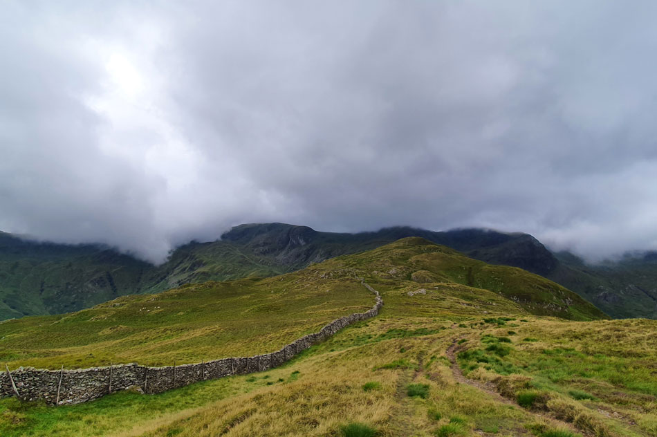
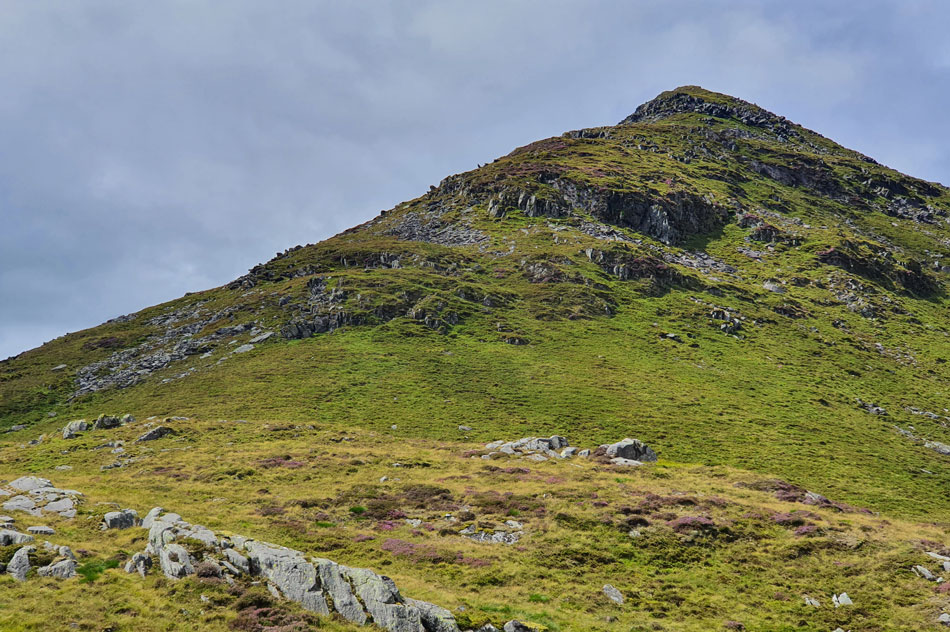
| There's quite a lot of 'up and down' hilly bits to negotiate before the main ridge is crested which was proving to be hot work so off came a layer for now at least. That's Gale Crag (Birkett) on the left with Hartsop above How summit seen further along the ridge. |
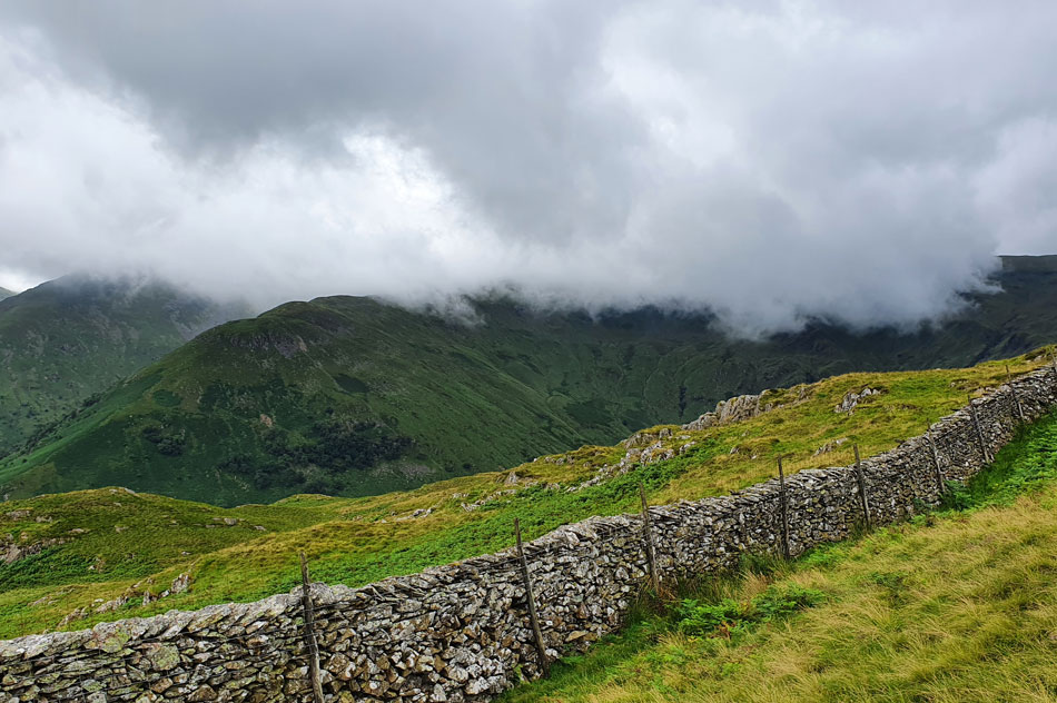 |
| High Hartsop Dodd and Little Hartsop Dodd were there a minute ago. |
| But have succumbed to the slow moving cloud which seems to pushing in from the Scandale, and Rydal valleys. |
 |
| Views over Deepdale towards Angletarn Pikes, Boredale Hause, Place Fell and Arnison Crag. |
| As lock down eased David was able to fulfill his ambition of getting back into wild camping. Place Fell being the location of one of his wild camps just last weekend. |
 |
| Dove Crag (L) Hartsop above How (C foreground) Hart Crag (C) and Fairfield (R) |
| Taken from Gale Crag summit. |
 |
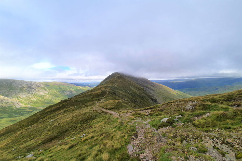
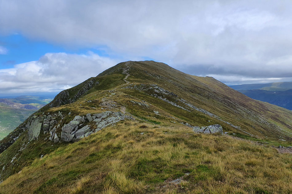
| Ridge route towards Hartsop above How. |
Rod and I were plodding along negotiating the boggy bits and generally taking things easy which meant the two walkers who we had seen behind us started to gain ground and before we knew we were over took before one of the walkers recognised me and asked "are you Paul Sharkey?"
We went on to share our routes and had a short chat before they left for Hartsop above How. I'm sorry if I didn't get your name but if your reading this I'd like to tell you our chance meeting made my day. |
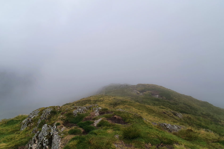 |
| Not a lot to see from Hartsop above How. |
| We watched the two walkers disappear into the lingering cloud along the ridge and sadly that was the last we would see of them and was likely to see, as they we're heading for Dove Crag before returning via High Hartsop Dodd. |
 |
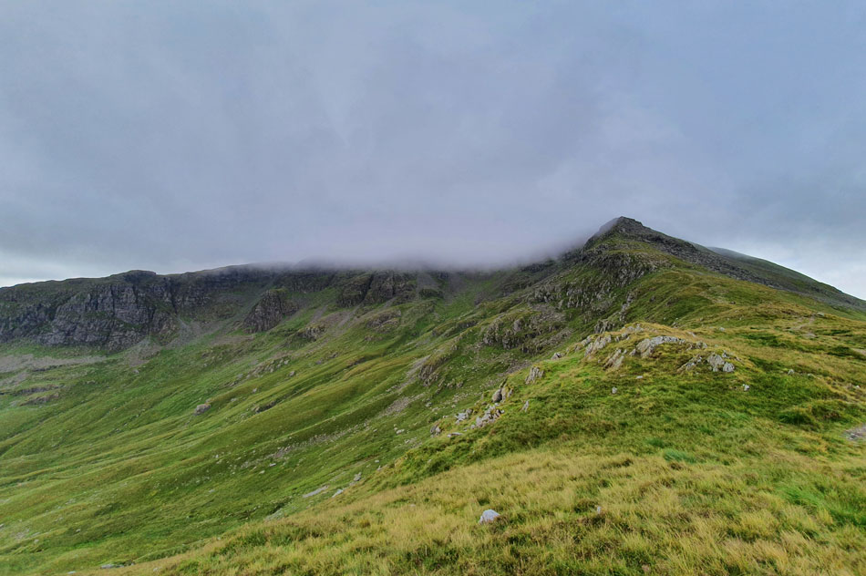
| Looking back on High Hartsop Dodd from the base of Hart Crag. |
| The cloud came and went which if anything only added to the walk but by now that 'rain in the air' started to fall as light, then steadily more consistent, it was time to add the waterproof jacket. |
 |
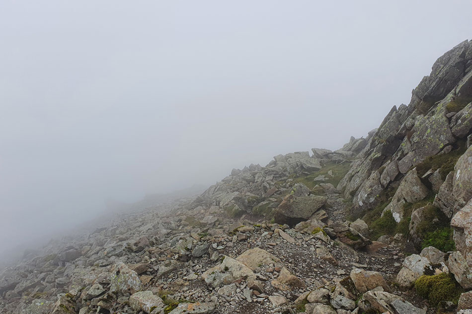
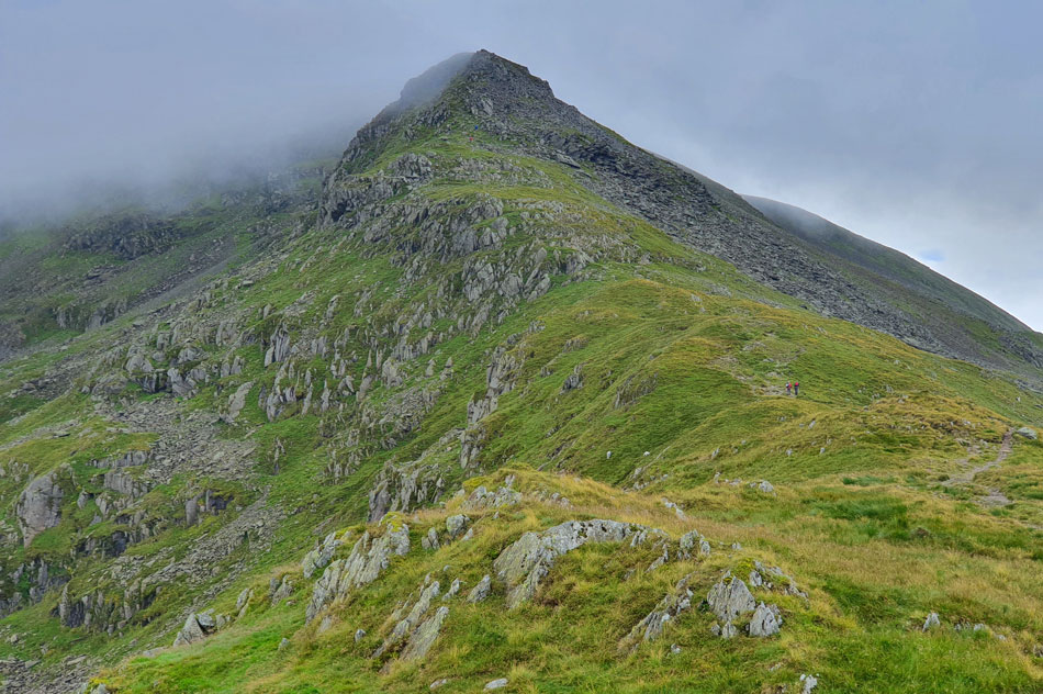
| Ascending Hart Crag. |
| I added a baseball cap, its peak doing a wonderful job of keeping the rain off my face which enabled good vision ahead. The picture of the path and rock steps looks far more dramatic than it actually was were despite taking a soaking during our ascent we were still in good spirits. |
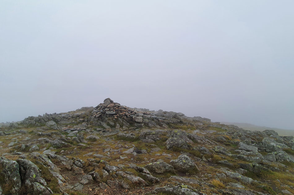 |
| Hart Crag summit. |
| The rain had slackened by the time we reached Hart Crag summit but between here and the crossing of Link Hause it would return only more heavier. We didn't hang around Hart Crag and as soon as we'd taken a couple of photos we left and traced north westerly towards Link Hause. |
 |
| Link Hause. |
| Having taken the slight descent, then another slight ascent onto Link Hause we found ourselves in a cross wind which when combined with rain brought on the effects of windchill on exposed skin - more so our fingers so we stopped to add gloves. |
 |
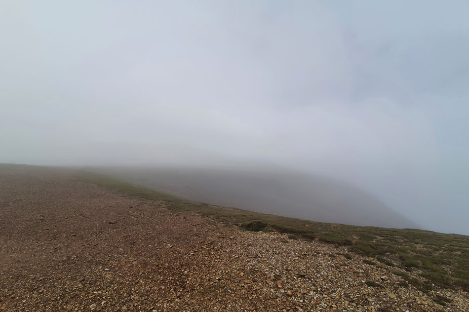
| Fairfield summit. |
More walkers were passed some of whom appeared to have spent the night judging by their laden packs but despite the near zero visibility, the wind and rain, all were in good spirits.
I couldn't but help feel slightly disappointed knowing in just a few hours time clearer weather was on its way while right now Rod and I were struggling to feel the ends of our fingers! |
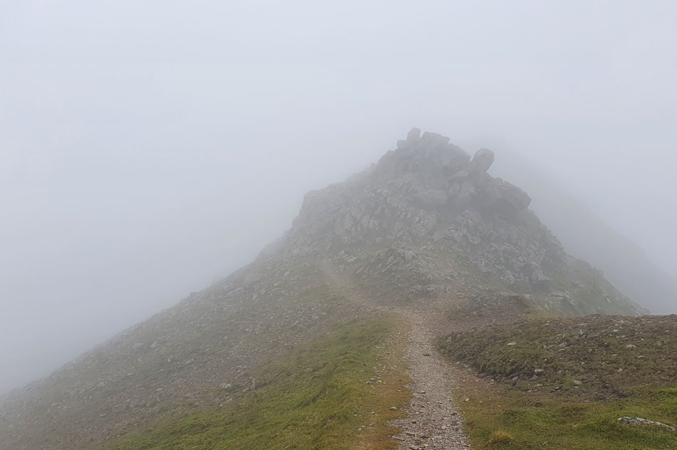 |
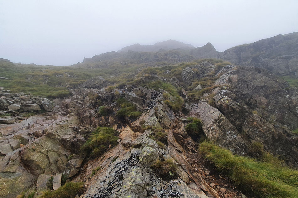
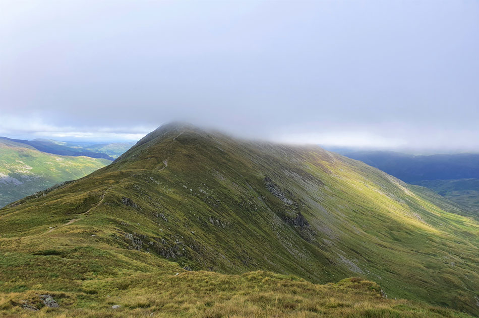
| Cofa Pike appears. |
We left Fairfield summit and tracked northwards carefully following the path which would descend us onto Cofa Pike. In the mist the path was vague but we managed to keep to it and took in the rock descent before picking up the path Cofa Pike bound. I was a little concerned whether we'd encounter wet rock during our descent but oddly, we found the rock dry underfoot. |
 |
| Descending Cofa Pike. |
| It doesn't look it but there is a path to follow which twists its way down while negotiating the odd rock step. |
 |
| A cloud topped St Sunday Crag seen over Deepdale Hause. |
| We carefully made our descent and emerged from the cloud which was still clinging onto Fairfield summit over our shoulders but thankfully the rain had stopped and I was able to remove my gloves. |
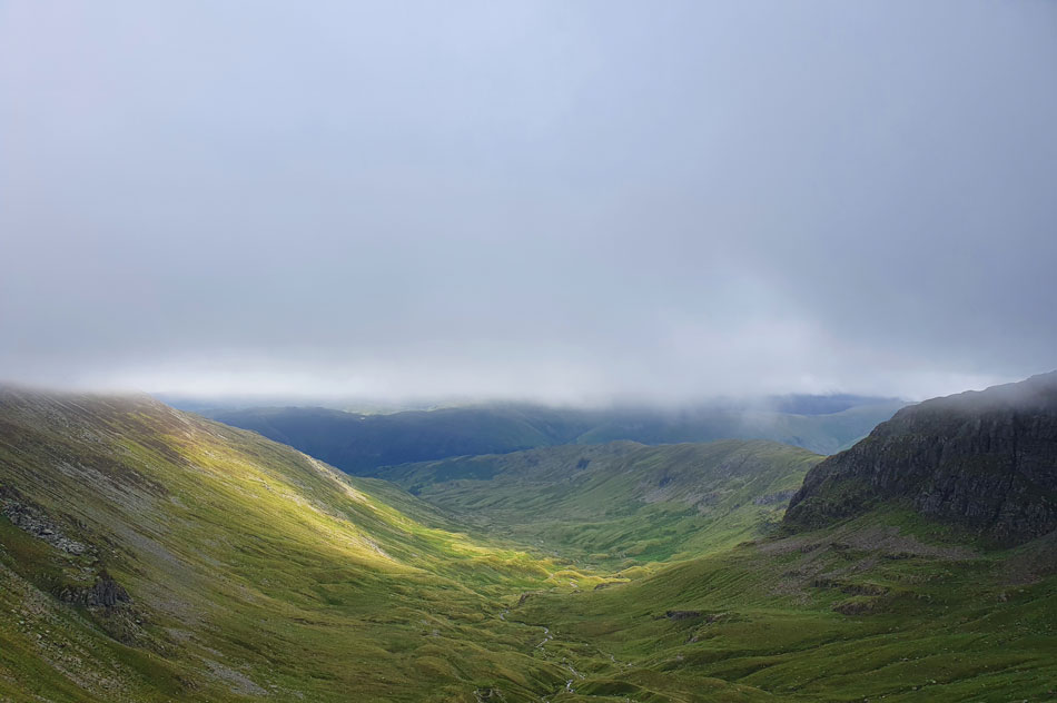 |
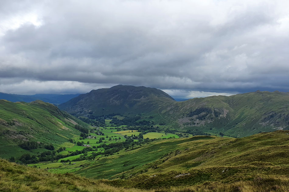
| Deepdale, Greenhow End and Hartsop above How from Deepdale Hause. |
| Despite the low cloud clinging to the summits and above the valleys it was already starting to lift as we took in the views towards Deepdale and then Dollywagon Pike. |
 |
| Dollywagon Pike and Nethermost Pike (below cloud) |
| It's quite difficult to describe the feeling you get while watching cloud lift away from the summits but it certainly feels special. |
 |
| St Sunday Crag seen over Deepdale Hause. |
| |
 |
| The wider view of Fairfield and Cofa Pike. |
| With Cawk Cove seen below. |
 |
| Cofa Pike from Deepdale Hause. |
| |
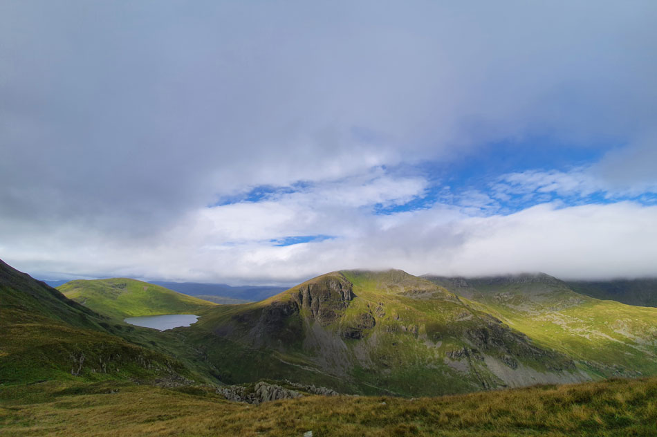 |
| Meanwhile over the Grisedale Valley. |
| Seat Sandal, Grisedale Tarn come into view as the cloud continues to lift although the cloud is still clinging onto Nethermost Pike summit but looking at those blue skies overhead it won't be for long. |
 |
| The view over the Grisedale valley towards Dollywagon Pike, Ruthwaite Cove, Nethermost Pike, Nethermost Cove, Helvellyn and Striding Edge. |
| Anyone on Striding Edge right now are certainly in for a treat. |
 |
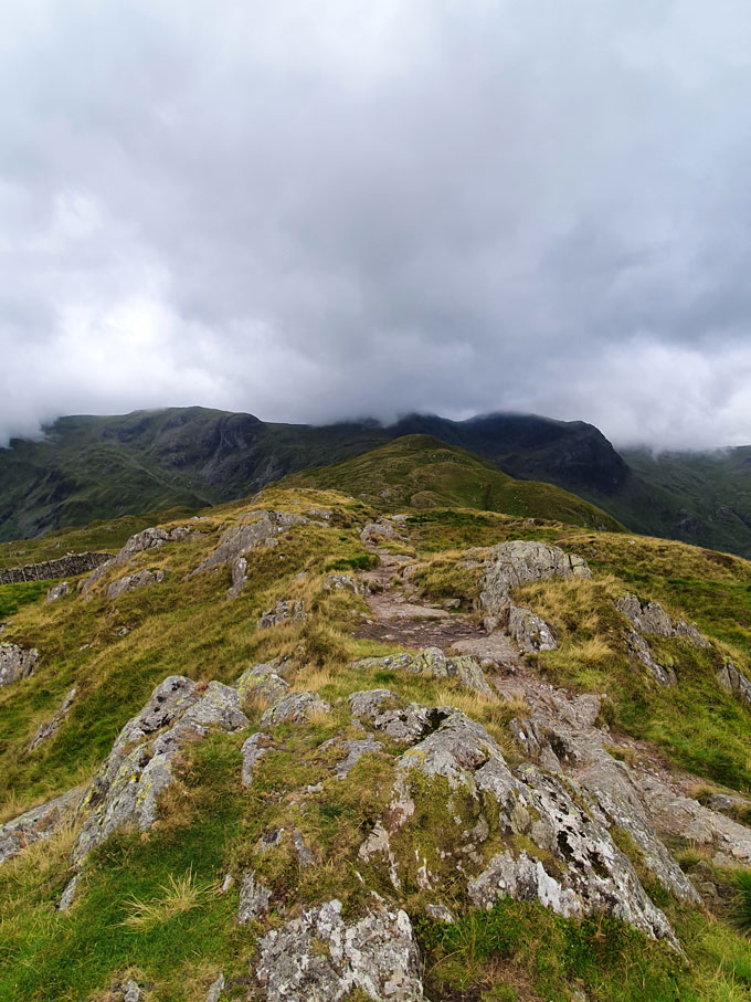
| St Sunday Crag and Gavel Pike seen further to the right. |
| We crossed Deepdale Hause and passed two walkers both heading for Cofa Pike where the cloud continued to peel away. Rod and I couldn't but help be reminded of the last time we ascended St Sunday Crag from Deepdale Hause in brutal wind, spearing spin drift and horizontal hail, today we can share a laugh but back then laughing and joking was the last thing on our minds. |
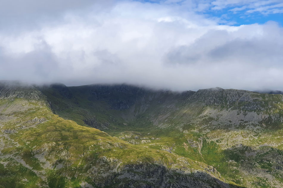 |
| Nethermost Cove close up. |
| With Nethermost Pike east ridge in the foreground and Striding Edge seen right while Helvellyn summit is still lost in cloud. |
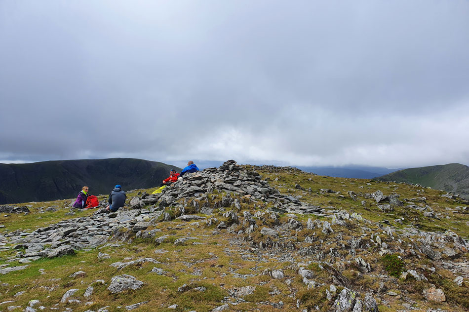 |
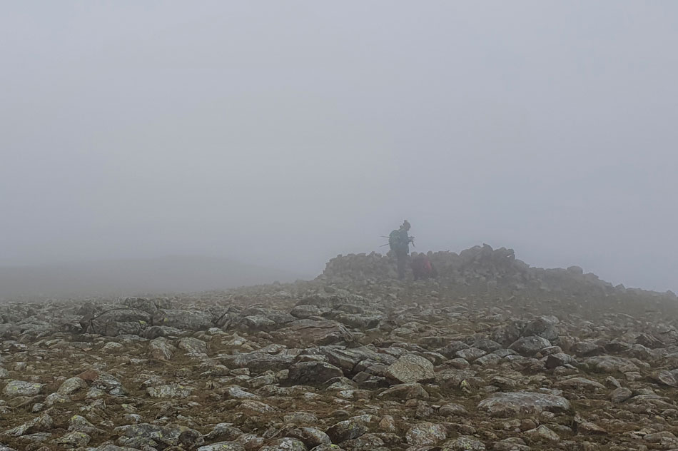
| St Sunday Crag summit. |
| With the summit reached it was time to think about refuelling, this we agreed to do on Gavel Fell which is a good job as all the seats had been taken on St Sunday Crag... |
 |
| Descending towards Gavel Fell. |
| With views of the far eastern fells and Hartop above How seen right. |
 |
| Lunch with a view. |
| The cloud has now completed peeled away revealing Dove Crag, Hart Crag, Gamlin End, The Step, Fairfield and Cofa Pike. |
 |
| Meanwhile towards the north. |
| While we bask in sunshine alongside Birks cloud shadows Place Fell, Boredale Hause and Sheffield Pike although somehow Beda Fell and Gowbarow Fell manage to steel some sunlight. |
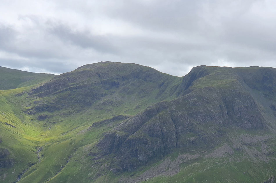 |
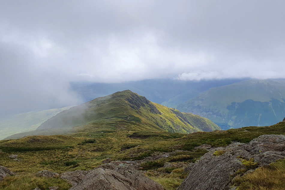
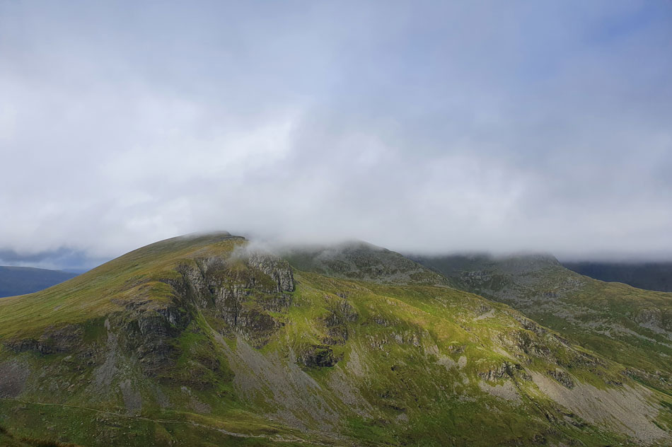
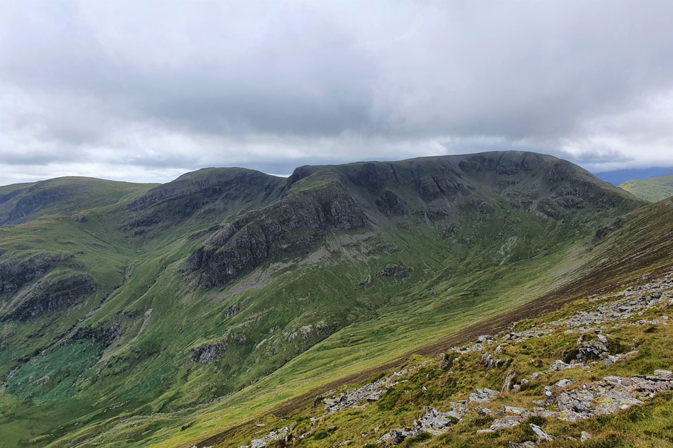
| Hart Crag, Gamlin End, The Step and Fairfield Close up. |
| All the high ground is seen (with the exception of Gamlin End seen foreground) which we covered in the rain and cloud earlier. |
 |
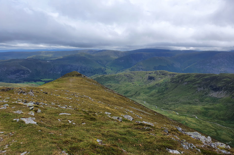
| Looking back at Gavel Pike. |
| And our lunch spot. |
 |
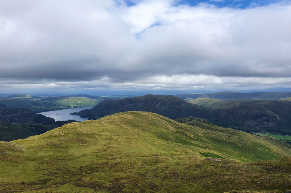
| Views over Wall End Farm, Deepdale towards Angletarn Pikes, Brock Crags and The Knott from Coldcove Gill, Deepdale. |
It was time to de-layer again which we did at the summit cairn on Lord's Seat under a hot aftrenoon sun before continuing our descent back to Deepdale via the flanks of Coldcove Gill. We hadn't seen anyone since leaving St Sunday Crag, that was until I spotted a van being driven towards Wall End Farm which brought me back to reality. Reaching the farm track felt good where I kicked my feet into the backs of my boots before leaving Deepdale via the Clapper Bridge for Lane End where we swung a right and followed the walled track back to Deepdale Bridge.
It was much busier back at Deepdale Bridge with cars extending from the parking spaces onto the grass verges most of whom's occupants are setting off late while taking advantage of the bright afternoon forecast. I'm partial to the Summer sunshine which at times makes me feel like a solar panel but you know what, no amount of sunshine makes you feel grittier than heading onto the high fells when it's lashing it down. |
|
| |
| Back to top |
 |
|