|
A Round of Marchlyn Mawr |
 |
 |
9th August 2020 |
 |
|
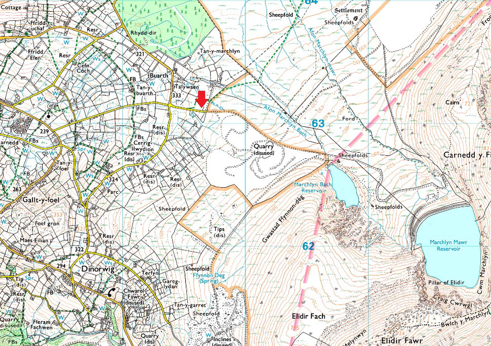
With a week off work today I find myself back in Wales collecting another 3,000'er in Elidir Fawr which I shall be walking today as part of the Marchlyn Mawr Round, and, to mix things up a little I'm also including Foel-goch as an out and back. The Snowdonian Mountains have never been out of the outdoor news recently with unprecedented figures visiting the National Park most of whom choke the lanes in and out of Lamberis from where climbing Snowdon is a popular hot spot so with this in mind I started looking at different locations from where I could start my ascent from.
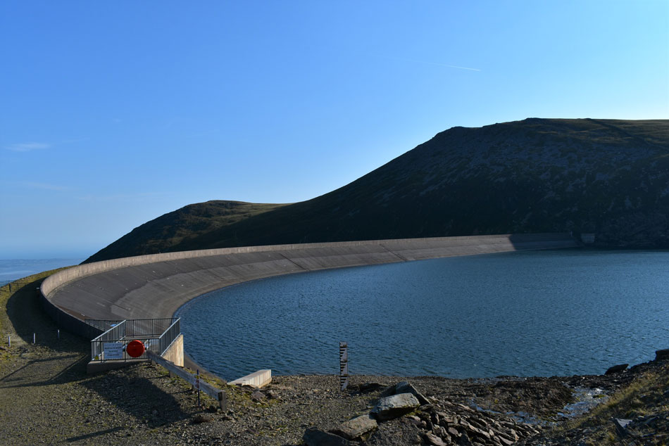
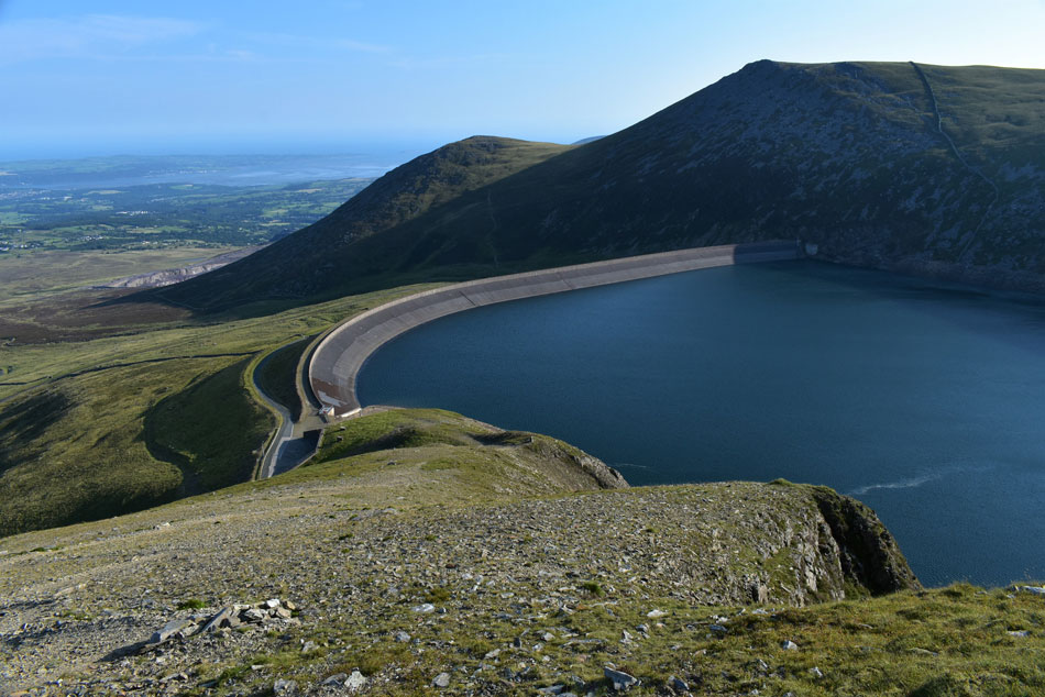
My research took me here on 'A Marchlyn Fawr Round' which is a high level circular walk which circumnavigates Marchlyn Mawr Reservoir, the same reservoir which powers six turbines inside Elidir Fawr known locally as 'Electric Mountain' Built in 1974, deep with Elidir Fawr is a Hydroelectric Power Station set within 9 miles of caverns, each wide enough to allow two lorries to pass and a cavern so big 590ft x 167ft it's adopted the name 'The Concert Hall' all of which lies below the summit of Elidir Fawr which for me was a no brainer. |
|
| Ordnance Survey 17 |
 |
| Snowdon/Conwy Valley |
| |
| |
|
|
|
| |
|
Overview |
|
|
| Ascent: |
2,601 Feet - 794 Metres |
| Summits Over 3,000ft: |
2, Elidir Fawr - Foel-goch |
-
| Visiting: |
Mynydd Peredd - Carnedd y Filiast |
| Weather: |
Hot & Sunny, Breezy Over The Summits. Highs of 24°C Lows of 15°C |
| Parking: |
Roadside Parking, Access Road Marchlyn Mawr Reservoir, Deiniolen |
| Area: |
Snowdonia National Park |
| Miles: |
7 |
| Walking With: |
On My Own |
| Ordnance Survey: |
OL17 |
| Time Taken: |
4 Hours 40 Minutes |
| Route: |
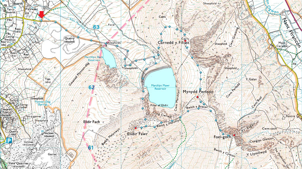
Access Road Marchlyn Mawr Reservoir - Marchlyn Mawr Reservoir - Elidir Fawr North Ridge - Elidir Fawr - Bwlch y Marchlyn - Bwlch y Brecan - Foel-goch - Bwlch 7 Brecan - Mynydd Peredd - Carnedd y Filiast - Marchlyn Mawr Reservoir - Access Road Marchlyn Mawr Reservoir |
-
|
| |
|
Parking Details and Map |
|
|
| Nearest Post Code: |
LL55 3NA |
| Grid Reference: |
SH 596 630 |
| Notes: |
The access road to Dinorwig Power Station also hosts a number of off road parking spaces with room for up to fifteen cars. The locals refer to the parking here as a 'hidden gem' because not that many people know about it and if I'm honest, there's a feeling of guilt dawning down on me as I write this. Please respect the area and the locals, arrive early to avoid disappointment. Parking is free. |
|
| |
|
Map and Photo Gallery |
|
|
 |
| Carnedd y Filiast (right) and Y Fronllwyd (left) from the Power Station access road 07:25am 16°C |
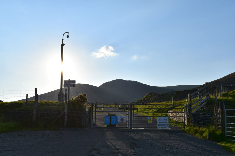
Despite this being the least popular route up Elidir Fawr I didn't want to take any chances not being able to park so I left home at 05:30am and arrived on the outskirts of Deiniolen, North Wales at about 07:10am. I needn't have panicked finding plenty of spaces to park, in fact it was that quiet when I arrived I managed to park at the top of the lane next to this gate at the start of the walk. There's a cool wind which was keeping the heat down which was already climbing towards the late teens and with this in mind I stuffed a light windproof into my pack which felt heavy due to the 3ltrs of hydration I was carrying.
Two more cars arrive who appear to be friends who speak in native Welsh which always fascinates me. I don't rush checking my kit and perform one final sweep of my boot then a pat down before l lock my car and head through the gate seen over on the left. |
 |
| Elidir Fach North Ridge with Marchlyn Bach Reservoir below. |
The access road gains 900ft over 1.8 miles meaning in places it's a bit of a lung buster. The first of two Reservoirs is sighted after passing through a construction site where I was scared out of my wits by an automated warning system which through a speaker in a thick Irish accent warned me that "the authorities had been notified and were on their way" it took a few seconds for me to realise that the voice was recorded so I dismissed it while smirking to myself.
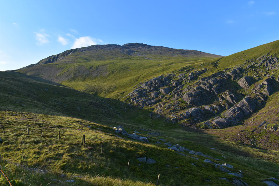
Above Marchlyn Bach Reservoir is Elidir Fach north ridge which is the gentler ascent to gain Elidir Fawr by if approaching from Deiniolen. |
 |
| Elidir Fawr from the access road. |
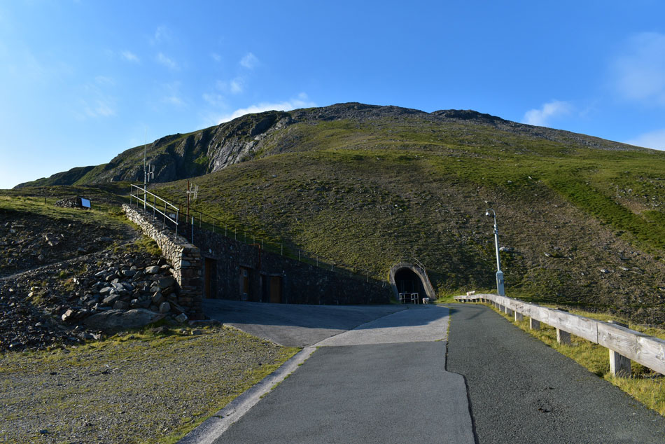
| It didn't take long for the sun to climb above Carnedd y Filiast which meant I was walking into direct sunlight but at least it meant I could see my route, albeit direct onto Elidir Fawr. Those with a keen eye may be able to spot the access tunnel in the far left of the photo below Elidir Fawr's north ridge which is where my ascent begins. |
 |
| Elidir Fawr from the end of the access road. |
| The boy in me told me to continue towards the tunnel entrance but the security camera put me off so I gave it a wave instead. Over to the left is the start of the path which leads onto the north ridge and also doubles as the access path for Marchlyn Mawr Reservoir. |
 |
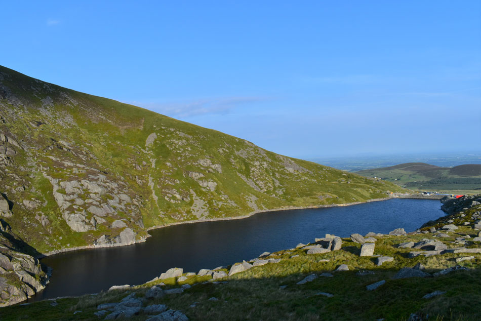
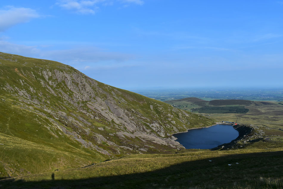
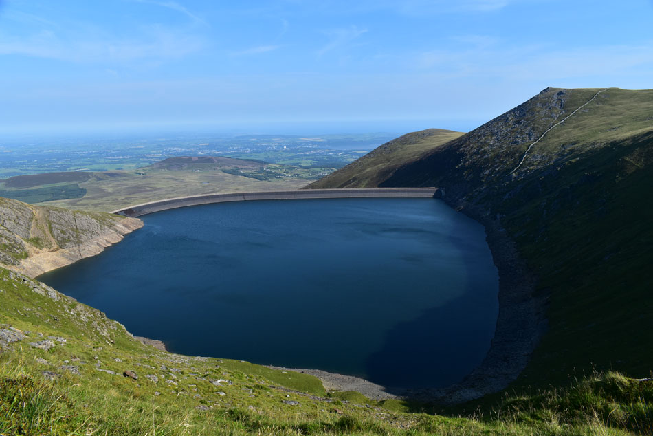
| Marchlyn Mawr Reservoir, Carnedd y Filiast (right) and Y Fronllwyd seen (left) |
| I wasn't expecting that! |
 |
| Elidir Fach seen with Marchlyn Bach Reservoir. |
| Elidir Fach maybe the gentler approach to Elidir Fawr but it would be advised not to wonder too far left. |
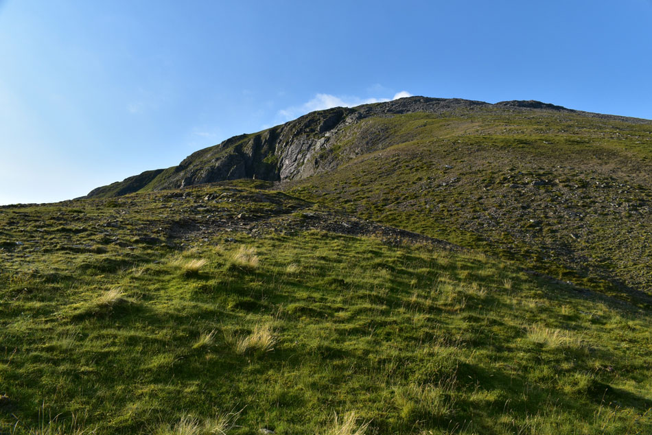 |
| Elidir Fawr North Ridge. |
| It's a steep and direct start with a boulder field to negotiate just below the summit crags. |
 |
| Elidir Fach from Elidir Fawr North Ridge. |
| Who's that bloke who keeps standing in front of all my photos! |
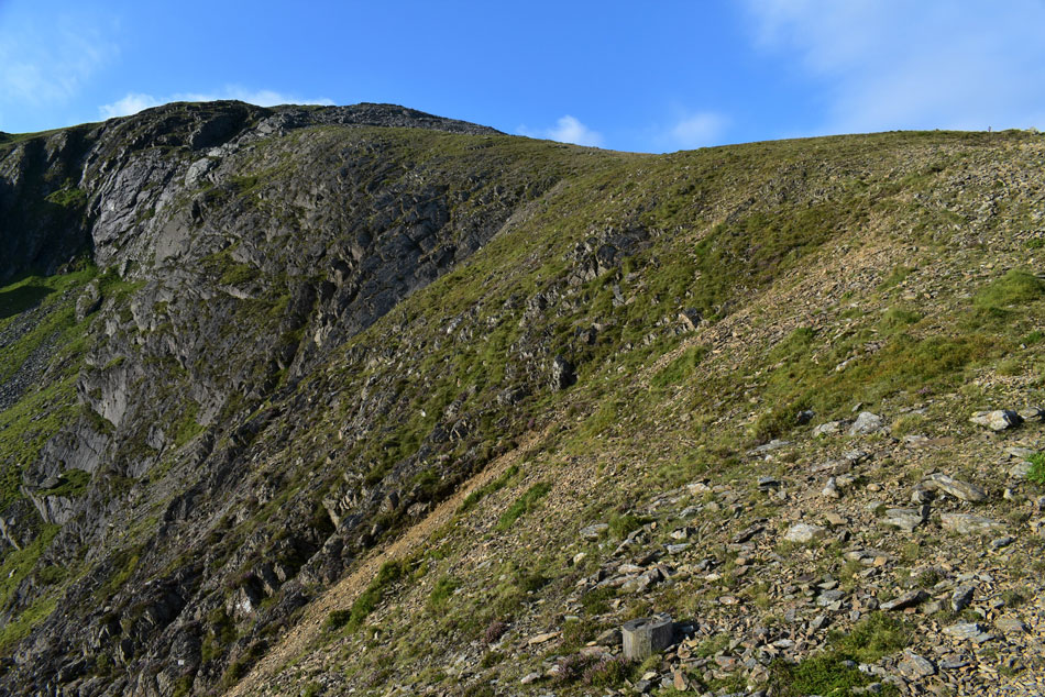 |
| Magnificent, Elidir Fawr North Ridge. |
| I've partaken in hundreds of ascents much like this where usually I would knuckle down and get into the ascent but I can't remember ever enjoying such a steep ascent like I did this one. A stone path has been worn through the lower, grassy half of the ridge before the grass gives way for rock and boulder as the path continues via a series of zigzags. |
 |
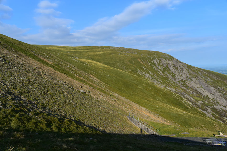
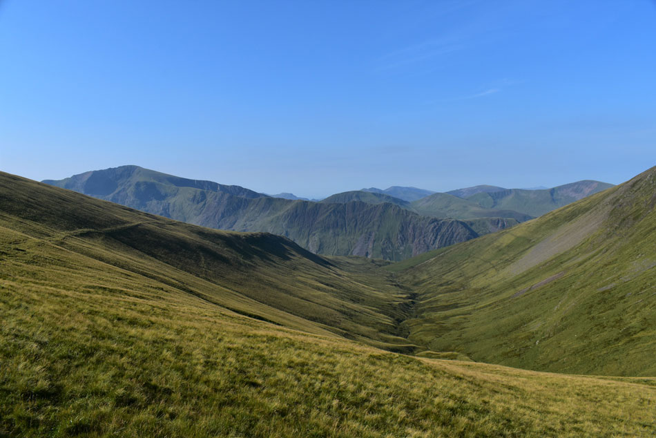
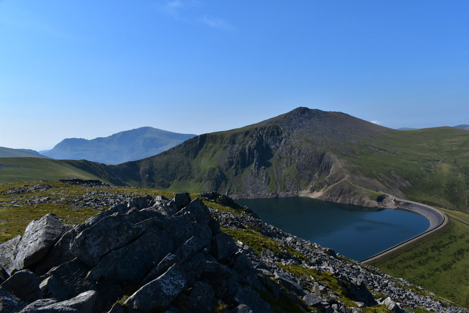
| Looking down Elidir Fawr North Ridge with Marchlyn Mawr Reservoir below, Carnedd y Filiast (right) and Y Fronllwyd (left) |
| The col dividing Carnedd y Filiast and Y Fronllwyd also provides the descent path back to the access road which can be seen as a faint line in the distance. |
 |
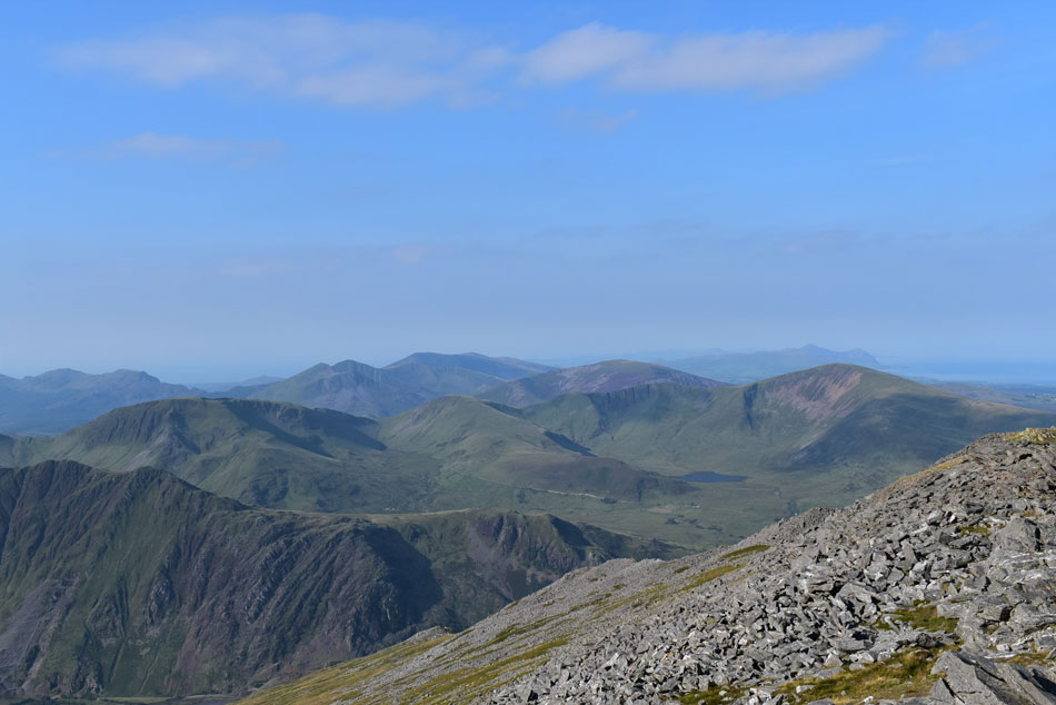
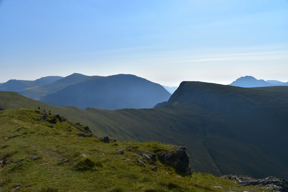
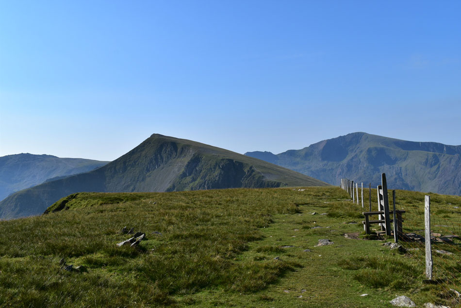
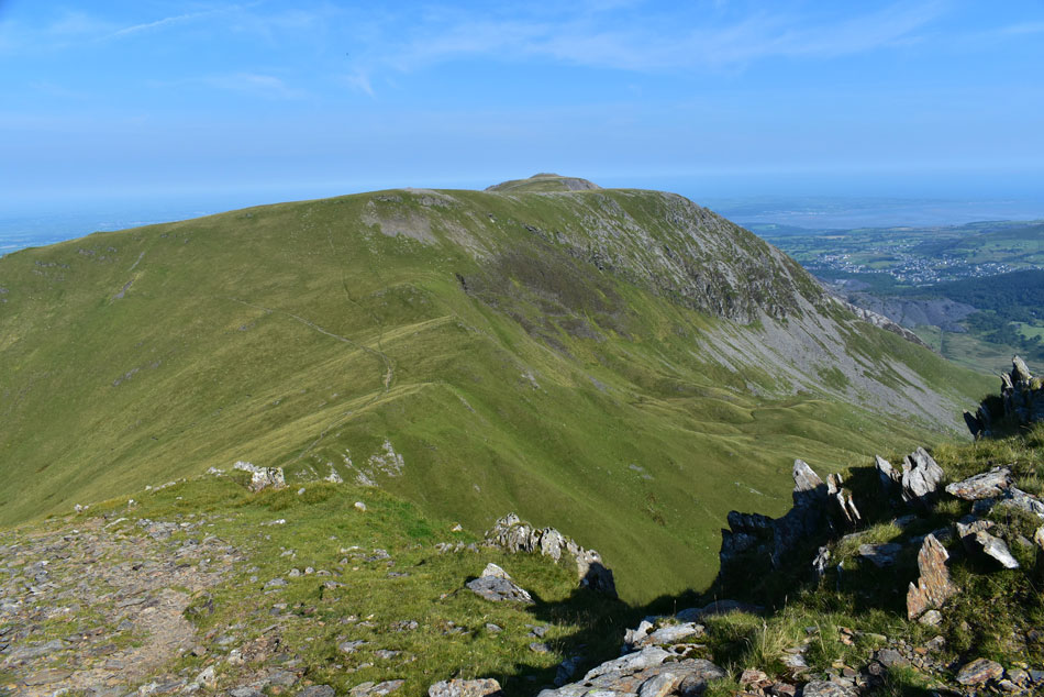
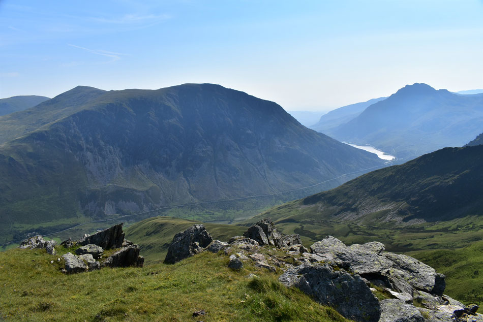
| Mynydd Peredd, Carnedd Dafydd, Pen yr Ole Wen, Foel-goch and Tryfan appear as more height is gained. |
| While in the foreground the narrow ridge (Bwlch y Marchlyn) above Marchlyn Mawr Reservoir links Mynydd Peredd summit seen left but before I reach Mynydd Peredd I'll be heading over to Foel-goch (right) as an out and back via Bwlch y Brecan. |
 |
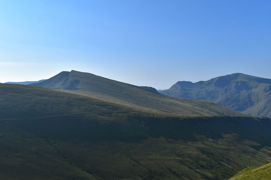
| Carnedd Dafydd, Pen yr Ole Wen, Foel-goch, Tryfan, Glyder Fach, Glyder Fawr and Y Garn. |
Feeling strong I pushed on while taking in the view over the impressive cliffs of Craig Cwrwgl including one impressive rock stack that would have looked more at home on the Isle of Hoy. The path diverts right where a large boulder field requires negotiating at approximately 2,800ft, it is here I stop to plan my way through. The ground is dry and a wind has whipped up but I see it as no concern in fact, it's actually refreshing under the hot sun.
No more than six feet into the boulder field a mishap occurs where after I placed my right foot on what appeared to a stable rock - the rock see-saws and I am jolted backwards which I counteract by placing my left foot on a rock which also shifts, in my ensuing panic I try to use my left walking pole to arrest my fall but it jammed and my stomach drops, I jolt backwards again but somehow I manage to keep upright landing at the edge of the boulder field feeling like I've just won a break dancing competition.
It lasted seconds and after counting myself extremely lucky I collect myself and start again. One day later the result of my mishap is a slightly swollen right knee which I'm treating with ice and Arnica gel. |
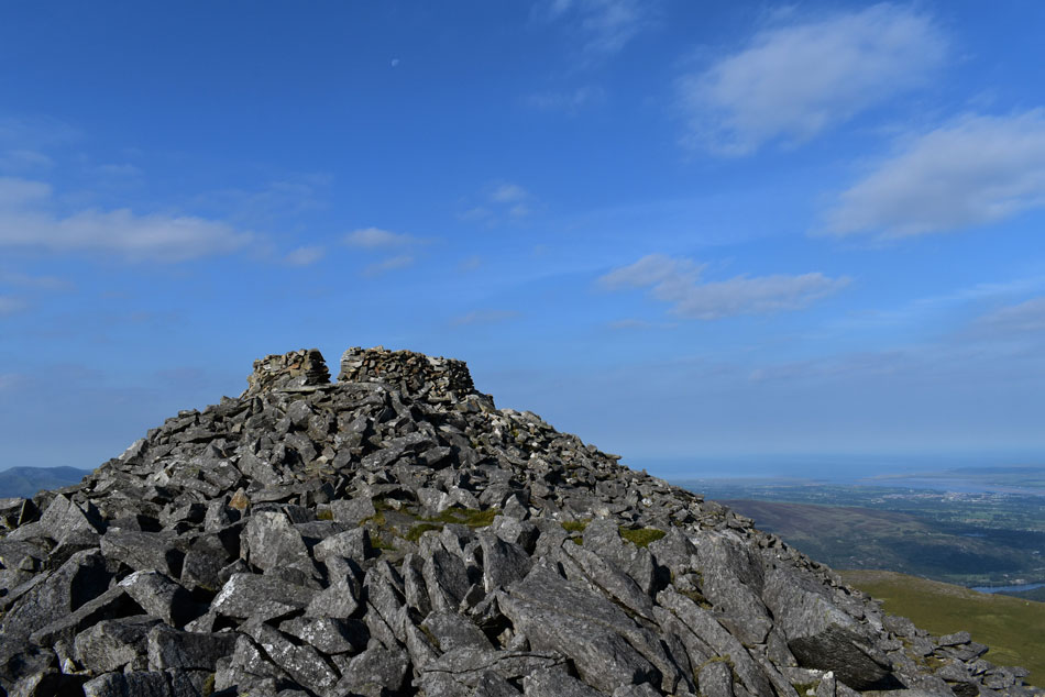 |
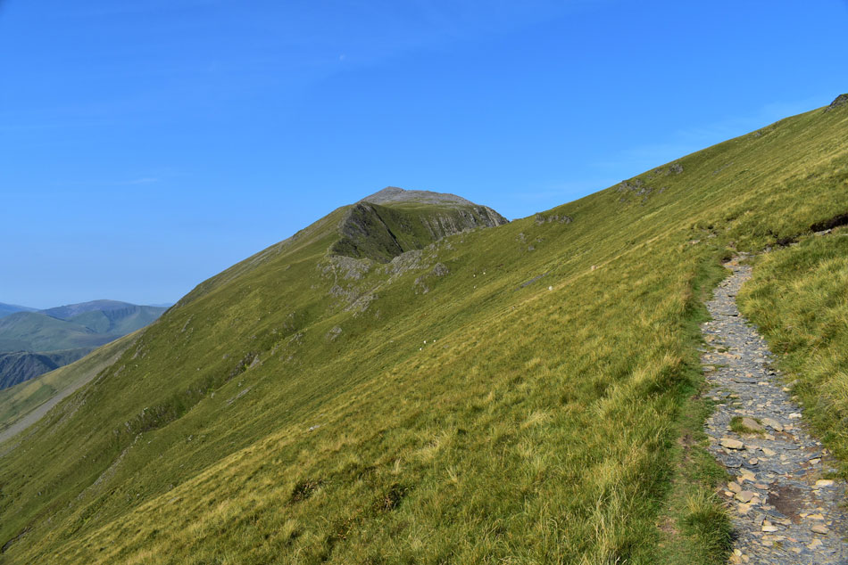
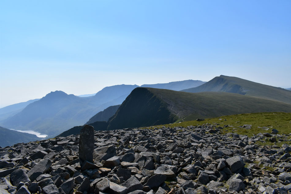
| Elidir Fawr summit. |
| The boulder field continued to divert right before I picked up a faint path which lead me onto the ridge summit bound. My descent path is sighted and instead of boulder hopping all the way to the summit shelter I descend diagonally and pick up the ridge path which I am informed during bad visibility is difficult to locate. |
 |
| Distant views toward Mynydd Mynydd, Drws-y-Coed, Mawr, Moel Eillo, Foel Gron and Foel Goch. |
| While further to the left we have Moel Cynghorion and in the foreground Llechog (Lamberis ridge route towards Snowdon) |
 |
| Snowdon. |
| With Crib Goch seen left. |
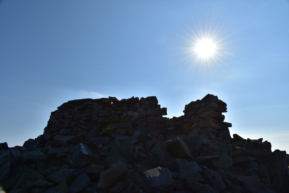 |
| Elidir Fawr summit. |
| Below a cloudless sky. |
 |
| Pen yr Ole Wen, Foel-goch, Tryfan, Glyder Fach and Y Garn. |
| I took in the splendid views which at long distance were hazy but this is a very mountainous region and no amount of haze could spoil my enjoyment. From the summit I began my descent while heading for Bwlch y Marchlyn, the narrow ridge above Marchlyn Mawr Reservoir. During this time I am overtaken by three fell runners one of whom was a teenager followed by the other two who were of a similar age to me who as they passed looked on at the teenager leading the pack while laughing "we were young once you know" I jumped in and laughed too. |
 |
| Descending Elidir Fawr for Bwlch y Marchlyn. |
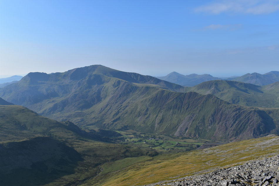
| While ahead my view is dominated by Yr Elen, Carnedd Llewelyn, Carnedd Daffyd, Pen yr Ole Wen, Foel-goch and Tryfan. |
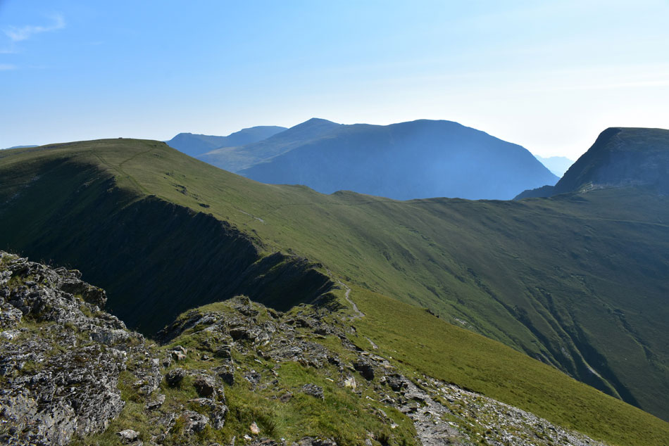 |
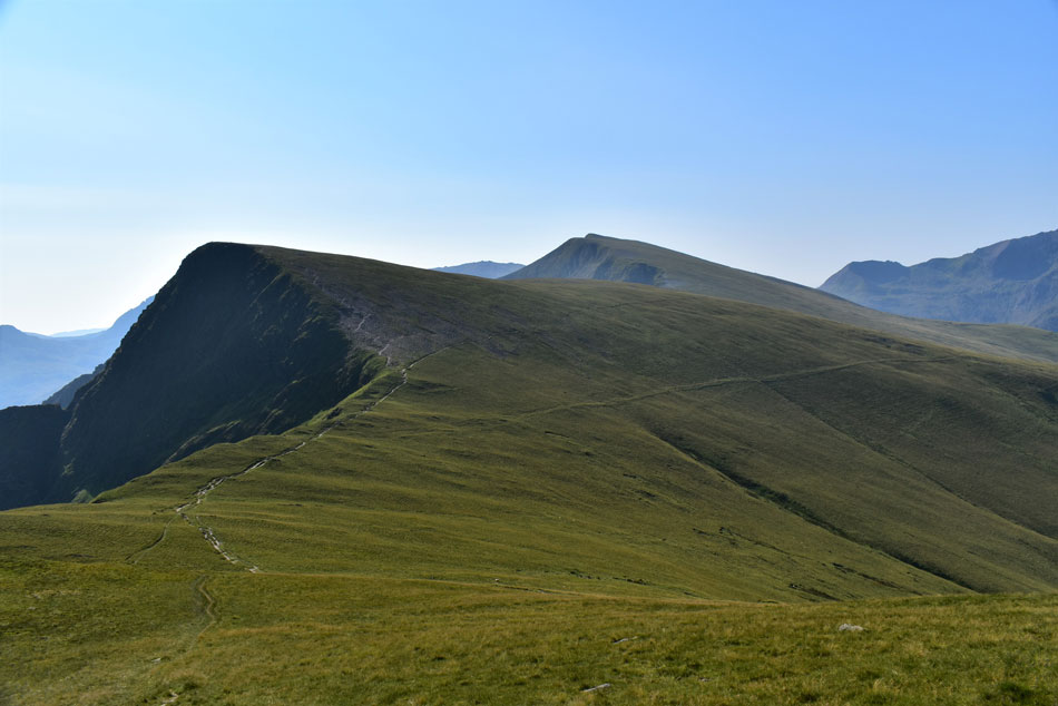
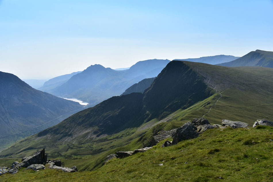
| Bwlch y Marchlyn (centre) Mynydd Peredd seen (left) Bwlch y Brecan (right) and Foel-goch far right. |
| At the end of a grass ridge I descend onto the Bwlch y Marchlyn ridge via a narrow footpath over on the left. I was somewhat surprised watching the fell runners who treat this descent like they were running across a playing field where I treated the several rock steps with a little more haste finding that once I'd reached the base of the ridge the fell runners were already fast approaching Mynydd Peredd summit. |
 |
| Mynydd Peredd from the Bwlch y Marchlyn ridge. |
FRO
| |
 |
| Carnedd Llewelyn, Carnedd Daffyd, Pen yr Ole Wen and Foel-goch from Bwlch y Marchlyn. |
| |
 |
| Peering down on Marchlyn Mawr Reservoir from Bwlch y Marchlyn. |
| With Carnedd y Filiast and Y Fronllwyd in the distance. |
 |
| The mass of Y Garn. |
| With Crib Goch and Snowdon seen right. |
 |
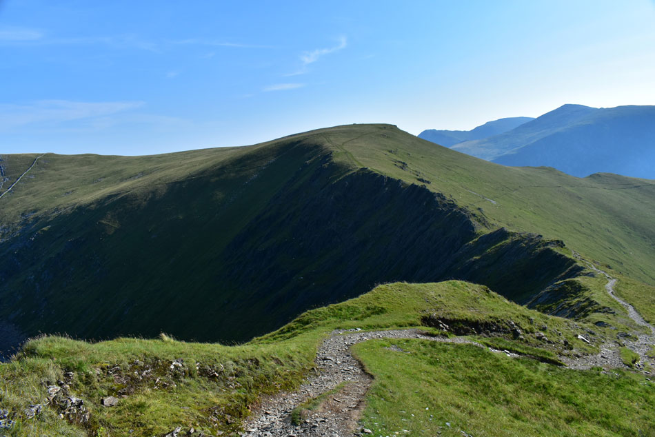
| Looking back towards Elidir Fawr and Bwlch y Marchlyn |
| From Bwlch y Brecan. |
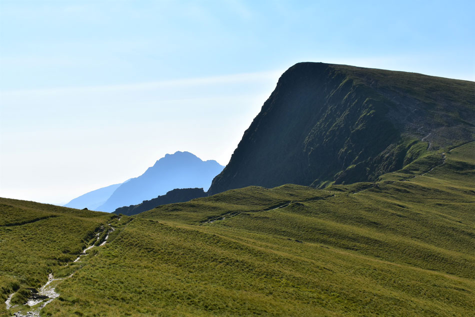 |
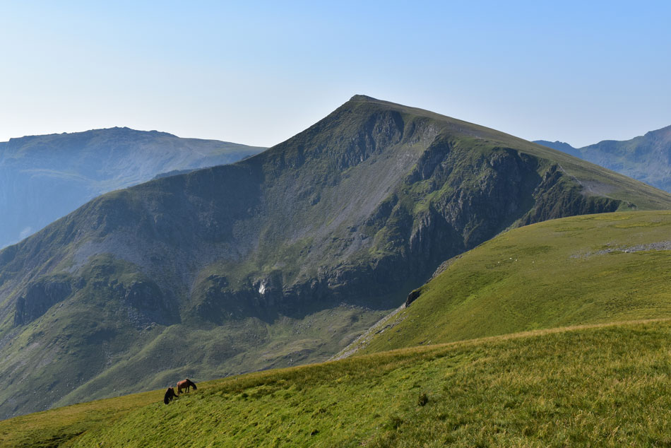
| Foel-goch and Tryfan close up from Bwlch y Brecan. |
| I think now is the time I wished I'd eaten that third Weetabix this morning! |
 |
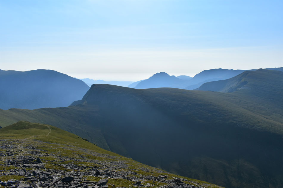
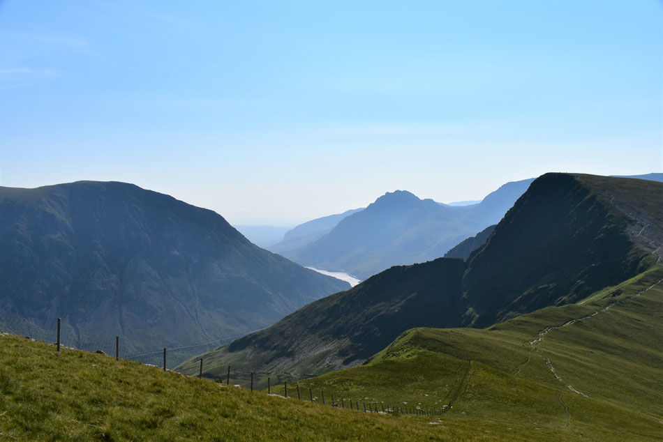
| Snowdon and Cwm Dudodyn from Bwlch y Brecan. |
| |
 |
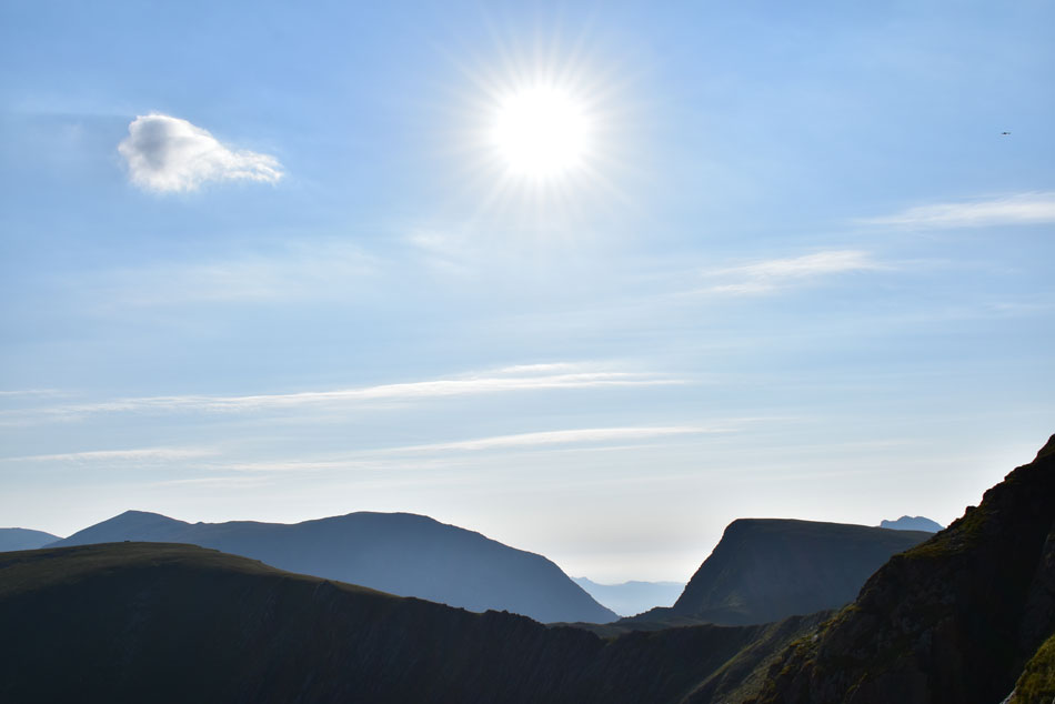
| Glyder Fawr, Y Garn, Crib Goch and Snowdon from Foel-goch summit. |
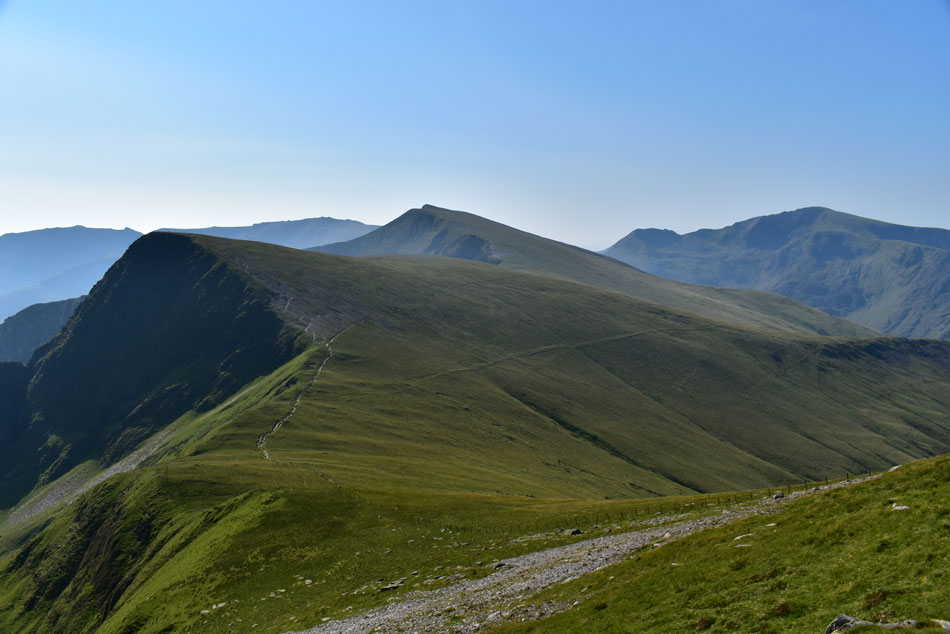
The march up Foel-goch north spur was exactly that, a march which I didn't stop on until Foel-goch summit was reached. The ascent kinda reminded me me of the steep ascent on Castle Crag via the quarries only longer. Three 'shirtless' young fell runners were on my tail and I was determined to reach the summit first, I did while wearing my baselayer I might add! The heat by now was stiffling or at least it felt that way but I controlled this with steady breathing and soon the aches subsided and my lungs returned to their normal size.
Y Garn looked so inviting to the point where I was questioning should I just go, my heart would have let me had I not already summited in January this year but I told myself she was a mountain too far today. With just over 500ft of ascent over grassy ground Y Garn is easily achievable from Foel-goch but sadly, not today. |
 |
| Glyder Fawr and Y Garn from Foel-goch. |
| I had found myself a quiet spot which overlooked the Ogwen valley so I decided to treat myself to a rest, but due to being attacked by a wasp who just didn't like me I high tailed it out of there and followed the ridge line before spotting two fell ponies chomping away at their leisure. Sheep, midges and killer wasp yes but fell ponies so high on the fells was the last thing I thought I'd see today, what an absolute treat. |
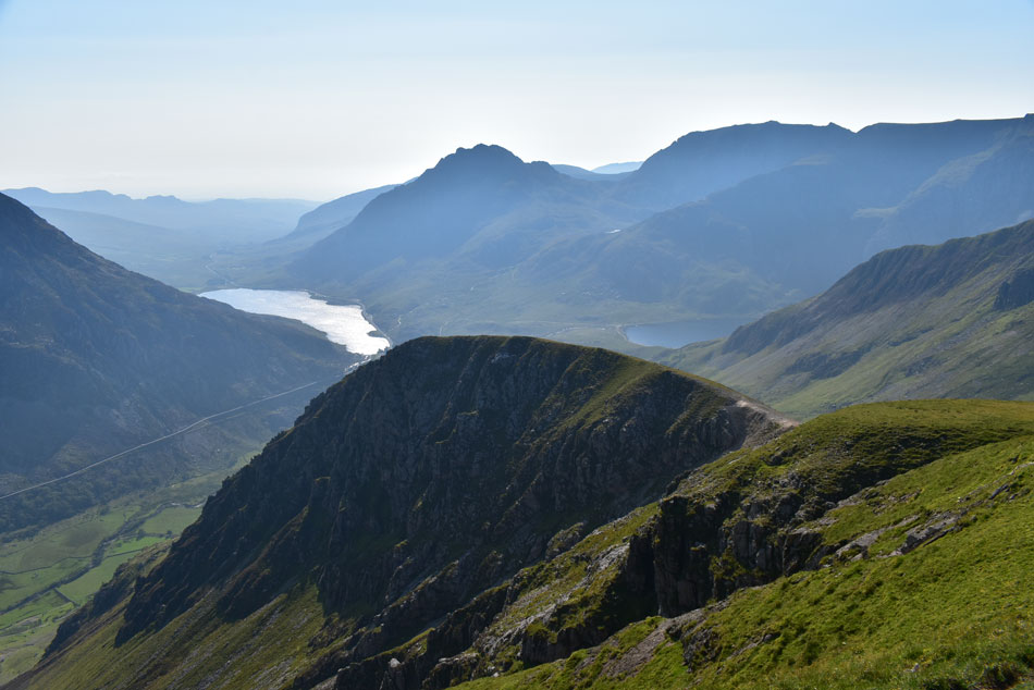 |
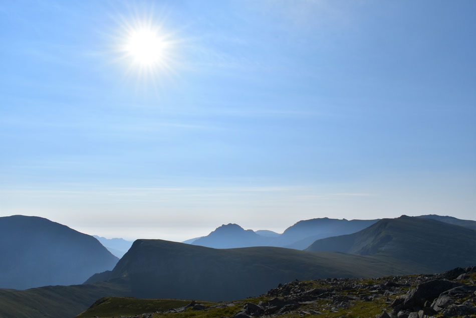
| Y Llymllwd, Tryfan, Glyder Fach, Bristly Ridge, Glyder Fawr, Pinnacle Crag, Llyn Ogwen and Llyn Idwal from Foel-goch. |
I took in the views over Y Llymllwd ridge (foreground) completely mesmerised by the ruggedness of my surroundings while feeling quite content that I was lucky enough to have summited most of the peaks I was looking at but not all I might add.
Mynydd Peredd was calling but first I have to descend Foel-goch via the same steep path I have just ascended by. |
 |
| Mynydd Peredd and Carnedd y Filiast seen over Bwlch y Brecan. |
| I'm heading for the right fork in the footpath which will steeply lead me onto Mynydd Peredd summit. |
 |
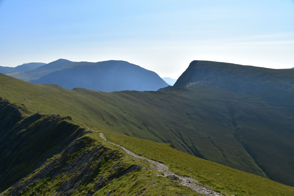
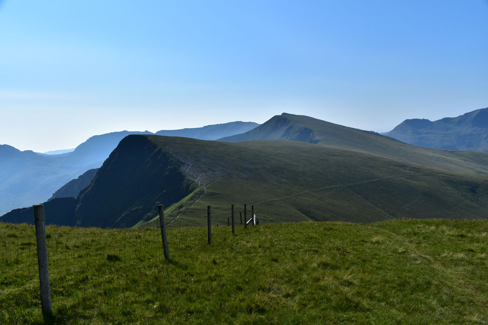
| Foel-goch, Y Garn and Crib Goch seen over Bwlch y Brecan. |
| Where I have another "oh my" moment. |
 |
| ...and another |
| |
 |
| ...and another. |
| |
 |
| Carnedd Daffyd, Pen yr Ole Wen, Llyn Ogwen and Tryfan from Mynydd Peredd. |
| I had underestimated the steepness of my ascent and by the time I reached Mynydd Peredd summit it felt like my lungs were about to explode, perhaps I should have rested for longer back on Foel-goch but all that was forgotten once more as I took in this incredible view of the Ogwen valley just a few metres away from Mynydd Peredd summit. |
 |
| Foel-goch, Yr Esgair, Y Llymllyd, Tryfan, Glyder Fach, Glyder Fawr and Y Garn from Mynydd Peredd. |
| |
 |
| The Glyders, Foel-goch, Y Garn, Crib Goch and Snowdon from Mynydd Peredd. |
| Two fell runners had arrived at Mynydd Peredd summit just a few moments before me so I left them to it while I took in the views. |
 |
| Carnedd y Filiast from Mynydd Peredd summit. |
| After swapping 'hi's' with the fell runners they left leaving me with the summit to myself. By now it's approaching late morning and if I was honest, and if my legs would let me I'd do the whole round again. The last stretch of the walk takes in this wonderful grassy escarpment which links Mynydd Peredd with Carnedd y Filiast, despite not wanting to leave this short section of soft grass has 'walk me' written all over it. |
 |
| Tryfan, The Glyders, Y Garn and Foel-goch from Mynydd Peredd summit. |
| |
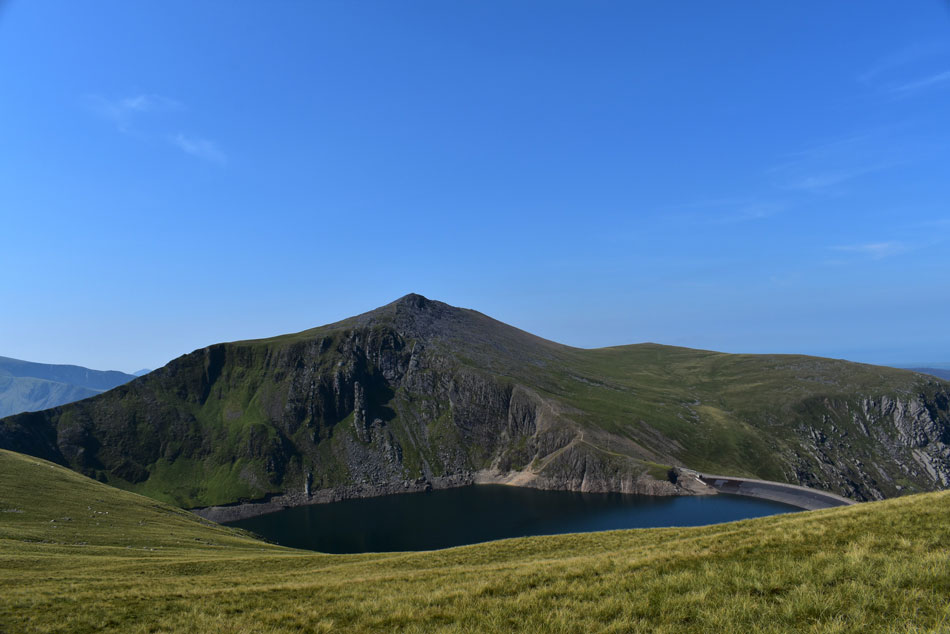 |
| Elidir Fawr and Marchlyn Mawr Reservoir. |
| I pulled myself away from perhaps the best views I'd experienced all day no thanks to the fantastic summit of Mynydd Peredd. It was time to complete the round by visiting todays last summit of Carned y Filiast and while doing so I took this photo of Elidir Fawr which I feel shows the enormity of the mountain including this mornings ascent via the north ridge. |
 |
| Views over Snowdon, Elidir Fawr and Marchlyn Mawr Reservoir from Carnedd y Filiast summit. |
I decided to stop taking photographs on Carnedd y Filiast summit feeling that I didn't think I could better what I'd already seen, I wanted to end the images here rather than back on the access road below if that makes sense. Despite Carnedd y Filiast being the lowest summit today its descent was one of the rockiest but under a scorching midday sun I reached the col which I had viewed from Elidir Fawr's north ridge some four hours earlier. A couple were resting and smiles are exchanged as I pass but all I can think of right now was a re-fuel stop. I pick up the track below and begin my descent towards the access road all the while on the look out for a lunch spot which I found in the form of a solitary boulder just a couple of feet away from the path, with no one heading towards me I'll have the time to eat my early lunch undisturbed.
It's so hot I take out my anemometer which gives a reading of 26.3°C and while sat sheltered on my boulder I experience a zero reading of wind, a quick grope of my hydration bladder reports I have at least a litre and a half left which I gush down to my hearts content. Lunch over I descend back to the road and while doing so pass two women and more 'hi's' are exchanged. I collapse my walking poles and feed them into the side pockets of my pack, take out my sunglasses and base ball cap and begin the mile walk back to my car while passing the odd walker. The sound of rock fall disturbs the silence and I instantly look towards Elidir Fawr's north ridge which had blessed me with a crocked knee but spot nothing, perhaps I thought, it was just the hum of the electric mountain. |
|
| |
| Back to top |
 |
|