|
Walking the Birketts, Pike O'Blisco and Wrynose Fell Circuit |
 |
 |
5th September 2020 |
 |
|
It feels like we're on the cusp of Autumn or at least it does on the Lakeland fells where not one hour is the same. It's been a mixed week of hot sunshine and prolonged downpours and as the nights draw in some areas of the UK have already experienced their first frost. The Lakeland fells are changing too, you can feel it in the air as well as on the ground which after a few days of rain was very boggy today, boggy being the understatement.
I experienced my first 'angels torches' of the season over southern Lakeland this morning, it was one of a few on a day when taking a soaking took on a new meaning. It wasn't meant to rain so prolific according to the experts but what do they know, this is Lakeland losing her greenery, she has every right to change her mind and today her frustration spilled out in the form of rain.
From memory I've only ever been as wet as I was today on two previous occasions, one was when David and I walked the complete Loweswater Fells where we were rained on for ten hours straight and the second was with Rod while doing a tour of the head of Great Langdale when it rained for seven of the eight hours we were on the fell. I wasn't out for no where near those times today but I did manage to fill my walking boots with puddles of water, now that was a first. |
|
| The Complete Lakeland Fells |
 |
| By Bill Birkett |
Blake Rigg
Beneath stands a dark vegetated complex cliff, one from which as a local cragsman I am often called to rescue crag fast sheep and foxhounds. |
|
|
|
| |
|
Overview |
|
|
| Ascent: |
2,165 Feet - 660 Metres |
| Birketts: |
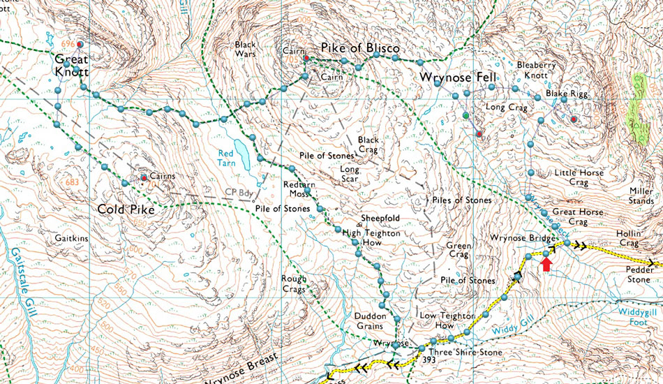
5, Blake Rigg - Long Crag (Wrynose Fell) - Pike O'Blisco - Great Knott - Cold Pike |
| Weather: |
Blustery Heavy Rain Throughout. Highs of 12°C Lows of 7.3°C Max Wind Speed 29.7mph |
| Parking: |
Roadside Parking, Wrynose Bridge, Little Langdale |
| Area - Group: |
Southern - W/BOW |
| Miles: |
5 |
| Walking With: |
On My Own |
| Ordnance Survey: |
OL6 |
| Time Taken: |
3 Hours 50 Minutes |
| Route: |
Wrynose Bridge - Wrynose Beck - Blake Rigg - Long Crag (Wrynose Fell) - Pike O'Blisco - Red Tarn (Langdale) - Great Knott - Cold Pike - Red Tarn (Langdale) - Redtarn Moss - Three Shire Stone - Wrynose Pass - Wrynose Bridge |
|
| |
|
Parking Details and Map |
|
|
| Nearest Post Code: |
LA20 6EQ |
| Grid Reference: |
NY 284 032 |
| Notes: |
Please do not obstruct passing areas with room for just one car parking in what essentially is a 'cutting' just off the pass where there is room to leave one car. Please do not confuse the cutting with the passing area a little further down the pass. Parking is free and very limited! |
|
| |
|
Map and Photo Gallery |
|
|
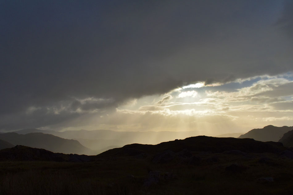 |
| Angels torches over Little Langdale taken from the top of Wrynose Pass 07.45am |
| Todays walk starts at Wrynose Bridge less than half a mile from the top of Wrynose Pass. I wanted to reverse my car into the one available space and seeing that it wouldn't be feasible to perform a three point turn on the narrow road l continued and turned around at the top of the pass instead. |
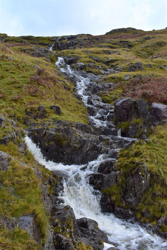 |
| Wrynose Beck with Little Horse Crag ahead. |
By the time I'd parked up close to Wrynose Bridge it had started to rain first lightly soon turning heavy and vertical. I could have waited the shower out in the car but I knew what kind of day I was in for and one shower now wouldn't change getting wet now or later on the grand scheme of things. I used the drivers side of my car as a shelter which shielded me from the winds which were gusting down the pass, I hadn't even locked my car and I was already wet and getting wetter by minute, I add my gaiters for the first time in months and remembered the left one is missing its top press stud but it isn't any hardship.
Despite the sweeping wind and rain I made sure I did a final gear check and pat down before locking my car then headed out towards a roaring Wrynose Beck. My plan was to get a shot of Wrynose Bridge but it was raining so hard I didn't want to get my lens wet on the first photo so for now the camera is left in its bag. Birkett recommends to gain Little Horse Crag/Blake Rigg by ascending a narrow trod to the right of Wrynose Beck but not through want of trying I just couldn't pick this path out, something that I'm usually very good at. Instead I followed a broad footpath to the left which would lead me directly to Pike O'Blisco, I then spotted a cluster of rocks where I could safely cross the beck about 180ft above Wrynose Pass. |
 |
| Little Horse Crag (right) from Wrynose Beck. |
| Wrynose Beck split into a series of feeder streams where my ascent continued to the right, it was here the ascent got steeper and with no path to follow the best plan of action was to ascend directly while making a bearing for Little Horse Crag. Every now and again the sound of a car struggling up the pass would break my ascent and I would find myself looking down to watch the car disappear behind a bend before silence resumed |
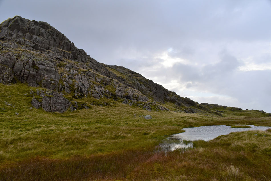 |
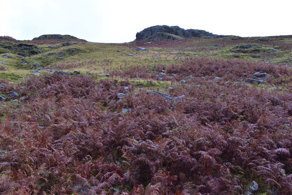
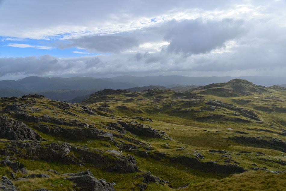
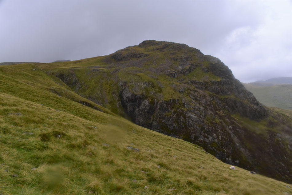
| Blake Rigg. |
| I shouldered Little Horse Crag and up ahead Blake Rigg along with its subsiduary summit appeared. The shoulder of the fell was grassy with just a few boulders to hop over before arriving at this small pool close to Blake Rigg summit. |
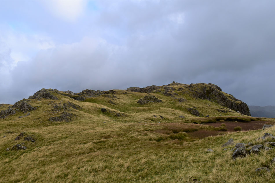 |
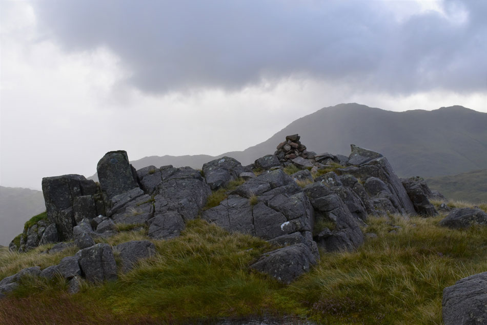
| Blake Rigg subsidiary summit. |
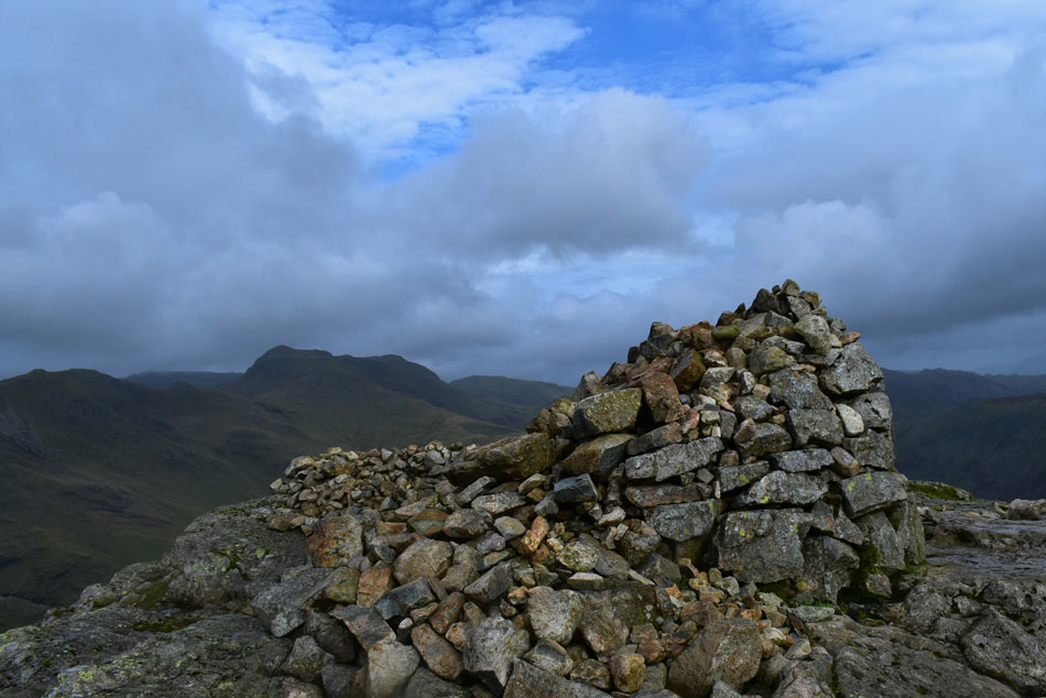
| Before making an ascent on Blake Rigg I took this photo of its subsidiary summit complete with summit cairn. In poor visibility the subsidiary summit could easily be mistaken for the main summit itself. |
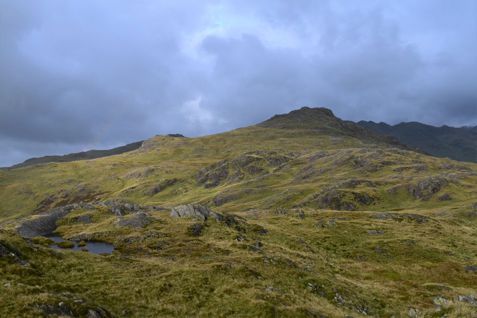 |
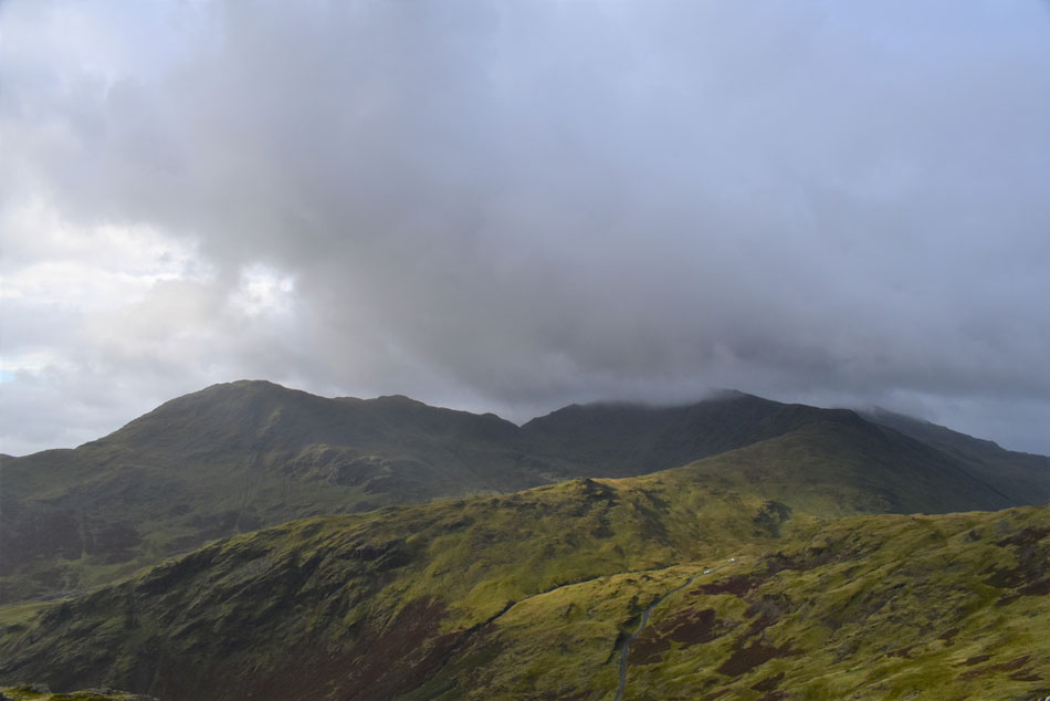
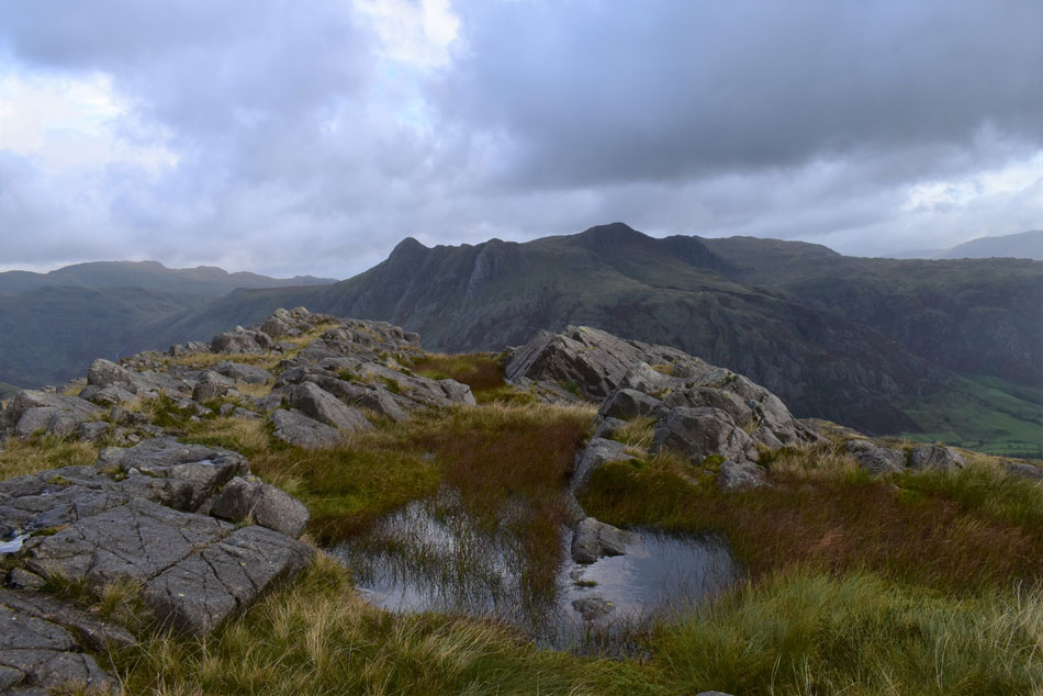
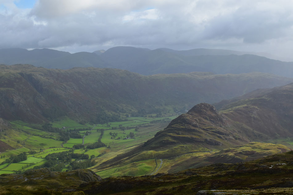
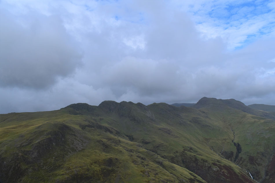
| Long Crag on Wrynose Fell, Pike O'Blisco, Cold Pike and Crinkle Crags from Blake Rigg. |
| The Birkett summit I'm heading for next is Long Crag on Wrynose Fell which can be seen in the centre of the photo while the summit Wrynose Fell appears further right. |
 |
| The Band, Bow Fell, Rossett Pike and the Langdale Pikes from Blake Rigg. |
| |
 |
| Meanwhile to the south. |
| A moment of sunshine over Wet Side Edge reveals Wetherlam, Prison Band and Swirl How while below cars park close to the top of Wrynose Pass. |
 |
| The Band, Bow Fell, Allen Crags, Glaramara, Rossett Pike and the Langdale Pikes from Blake Rigg. |
| I'm feeling quite lucky at the moment because it's stopped raining but judging by those clouds more is on its way. |
 |
| Wrynose Fell summit. |
From the top of Blake Rigg I tried to pick out route from which I could gain Wrynose Fell by and in the end I chose an 'off path' approach. It had started to rain again but in between the sun would come out illuminating the wild grasses which made up for getting wet again at a point when my waterproofs had just dried out.
From Wrynose Fell I head along the south ridge towards Long Crag summit which is in essence, is a short out and back. |
 |
| Pike O'Blisco, Crinkle Crags, Bow Fell, Allen Crags and Rossett Pike from Wrynose Fell. |
| |
 |
| The Langdale Pikes and High Raise from Long Crag on Wrynose Fell. |
| The rain held off and for the the second time this morning the sun made a brief appearance. |
 |
| Wetherlam, Prison Band, Swirl How and Wet Side Edge from Long Crag on Wrynose Fell. |
| The cloud had peeled away from Wetherlam but Swirl How wasn't so lucky but with that aside, the cloud was only adding to the atmospherics of the morning. |
 |
| The Langdale Pikes and High Raise from Long Crag on Wrynose Fell. |
| |
 |
| Prison Band, Wet Side Edge and Swirl How close up. |
| |
 |
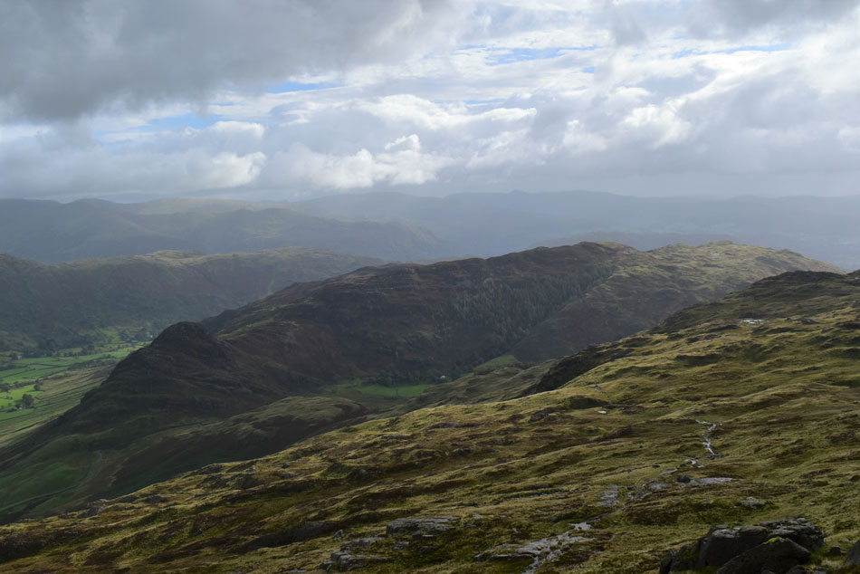
| Wrynose Fell (left) and Blake Rigg (right) from Long Crag on Wrynose Fell. |
| Taken seconds after a rain shower had swept over Blake Rigg which completely missed me, but I shouldn't gloat... |
 |
| Mickleden from Wrynose Fell. |
| From Wrynose Fell summit I descended pathless and picked up the footpath (seen left through lower centre) which links Great Langdale with Pike O'Blisco. |
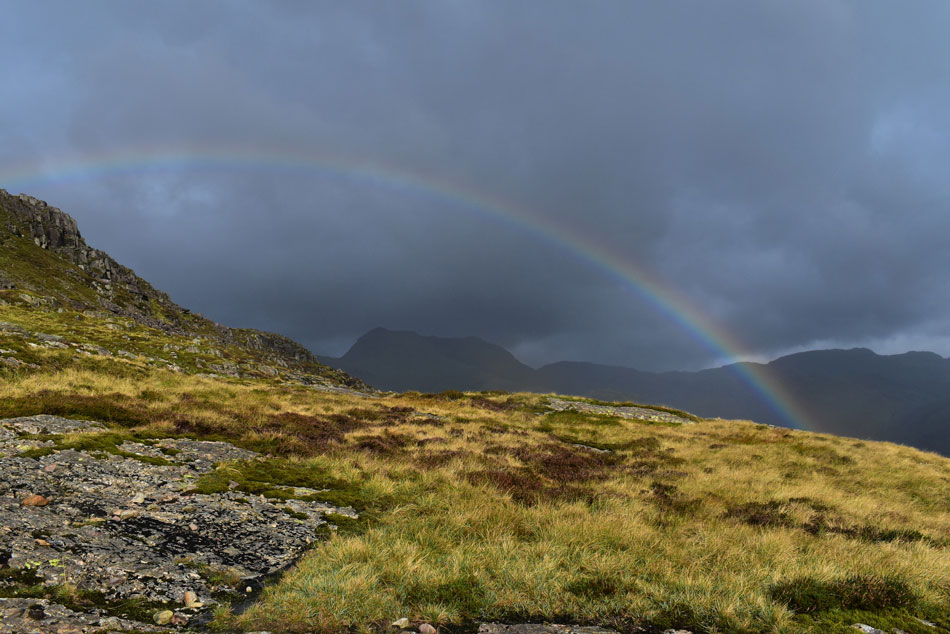 |
| Rainbow over Bowfell. |
| It was great to have firm footings underfoot and for a few brief moments I thought I might even have a spot of warm sunshine to keep me company during my Pike O'Blisco ascent but the weather gods were just teasing me. |
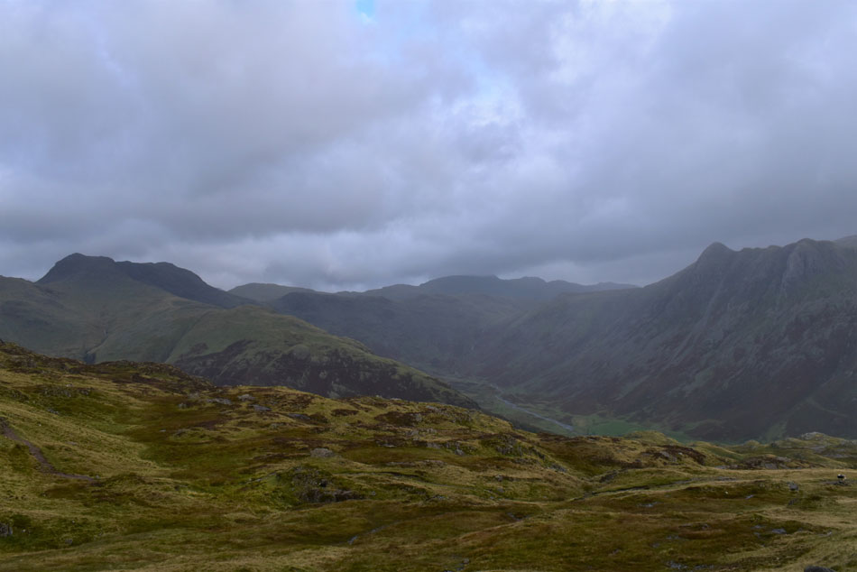
 |
| Moody Great Langdale. |
| |
 |
| Side Pike and Great Langdale. |
| With Kettle Crag seen over to the right. |
 |
| Side Pike and Lingmoor Fell. |
| |
 |
| Side Pike and Great Langdale. |
| With the central and eastern fells just clear of cloud. |
 |
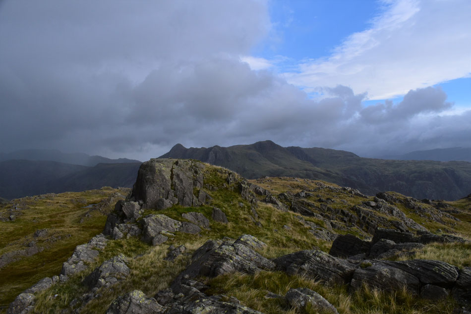
| Crinkle Crags and Bow Fell from Pike O'Blisco summit. |
I was always going to be weary of the wet rock on the three rock steps below Pike O'Blisco summit which was confirmed as I approached the first rock step finding not just wet rock but flowing water over the polished rock. After packing my poles away I cleared the first rock step, then the second and finally the third which was more of a groove than a step. It was whilst I unpacked my poles did it start to rain again, quite squally at first which was accompanied by strong summit gusts.
By the time I reached the summit cairn the gusts were knocking me here, there and everywhere and at one point I pinned myself to the ground using my hands. I made my way over towards the summit shelter and recorded gust of 29.7mph which were increasing and decreasing by the minute. The summit was no place to hang around so I left and headed towards the footpath bound for Red Tarn below. |
 |
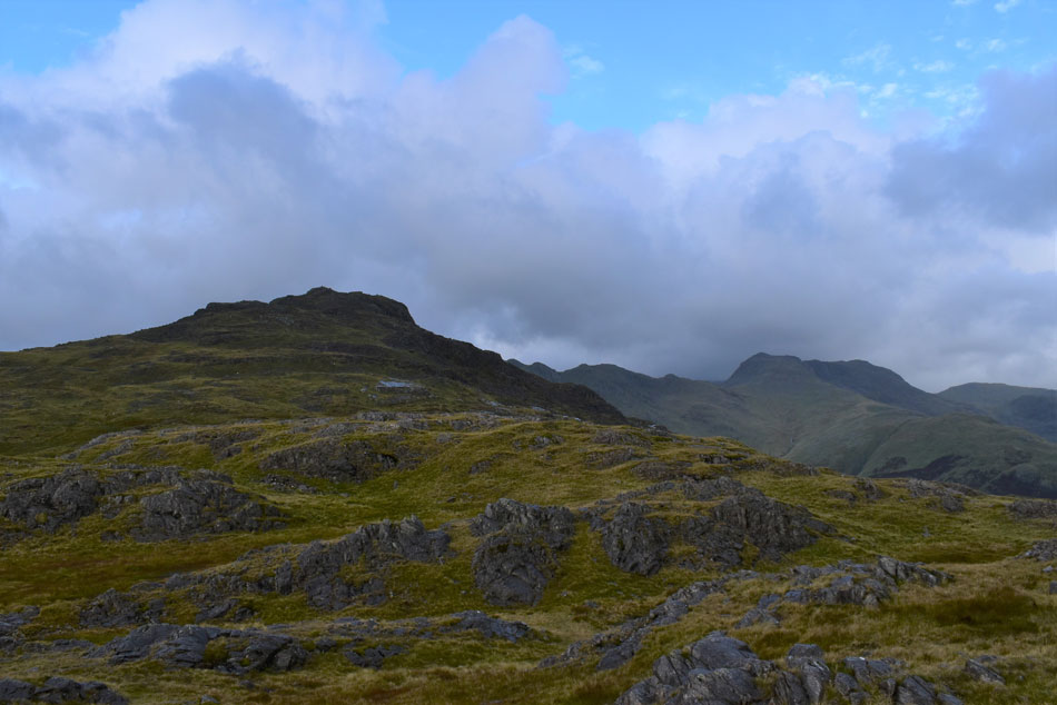
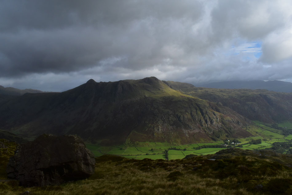
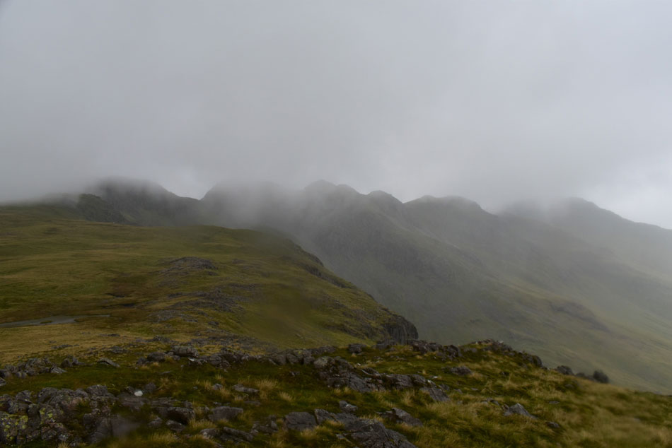
| Great Knott, Crinkle Crags and Bow Fell seen above the Oxendale Valley from Pike O'Blisco. |
| That's Great Knott seen far left which is todays fourth summit, its a favourite fell of mine given the views you get from its summit but I have a feeling todays views are going to be a little less dramatic. |
 |
| Great Knott and Crinkle Crags. |
| I was sheltered from the wind by the fell side but sadly not from the rain which fell heavy and vertical. It was one of those look at your feet type descents while being accompanied by the sound of draining water which was kind'a nice given my waterproofs were doing a wonderful job of keeping me dry, up to now anyway. |
 |
| Great Knott from the top of Browney Gill. |
Three walkers were approaching from Red Tarn who were all wearing shorts, surely I though they must have seen the forecast. They made hard work of the two pools which make up the outflow of Red Tarn and soon they were out of sight as I continued the steady ascent towards Great Knott.
The rain continued to pour down and through my own callas as I walked straight through said pools were my right boot must have leaked in, I paid it no attention. From out of nowhere three walkers appeared up ahead, then two solo walkers who all appeared to be heading for the Crinkles, rather them than me I thought. |
 |
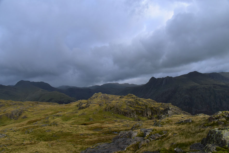
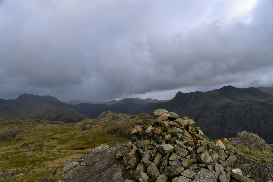
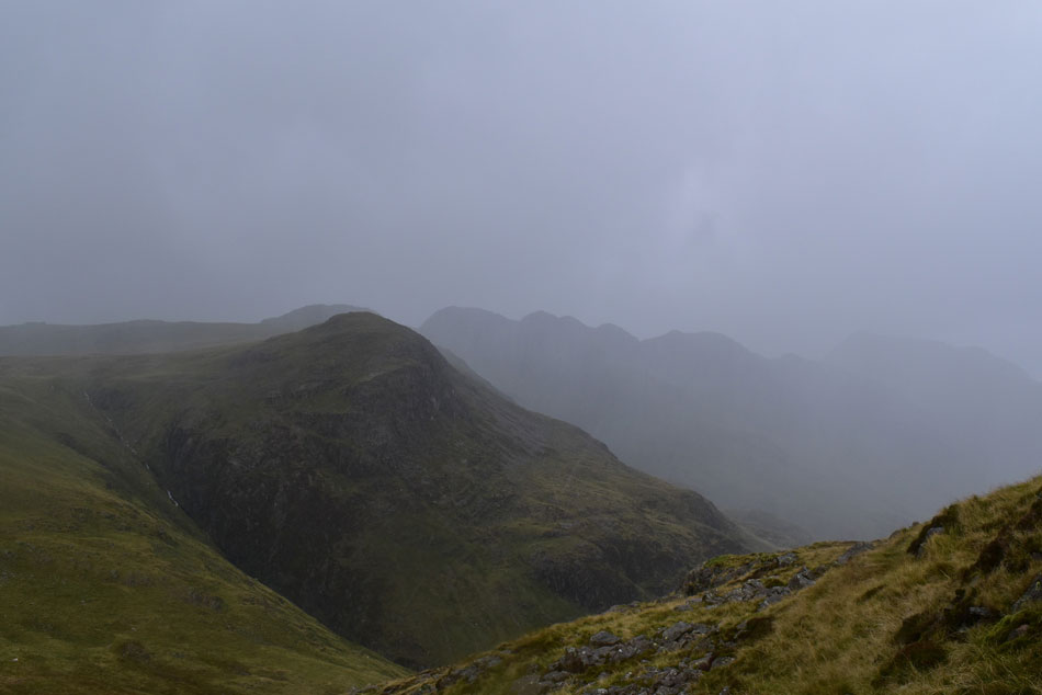
| Crinkle Crags and Bow Fell from Great Knott. |
| From the footpath I made a direct ascent on Great Knott where despite conditions I seemed to be at its summit within minutes. This view is one of my favourite in the whole of Lakeland and todays less than dramatic view was no different. |
 |
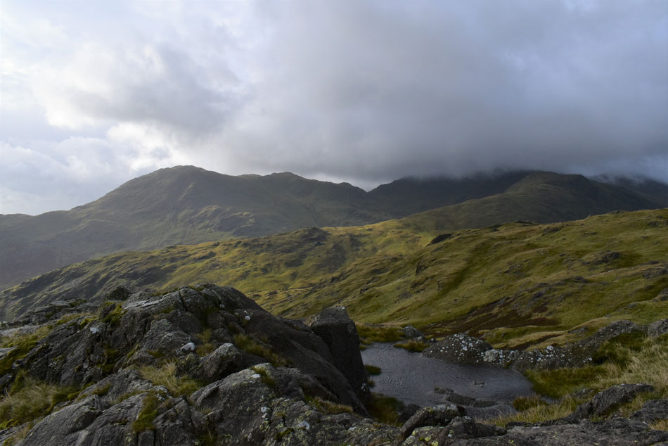
| Cold Pike, todays final summit. |
| It was hammering it down and truth be told I just wanted to get to Cold Pike as quickly as possible. Before descending I choose my line of ascent on Cold Pike picking out pools of water and standing sheep which I would head for as opposed to the grassy trod which looked steeper than my own choice. I crossed the footpath by which time the three lads wearing shorts were a short distant away, all three were silent and soaked. |
 |
| Pike O'Blisco from Cold Pike summit. |
| My line of ascent took me through wet bog and one wet boot soon turned to two. The rain continued and swept across the fell side wave after wave it was relentless sometimes so heavy it took away all thought. For a few minutes cloud had descended and the summit was lost but I kept my line of ascent and linked up with the footpath about 40 yards from the summit, I was drenched and after taking this one photo I turned around and that's when the heavens really opened. |
 |
| Pike O'Blisco from the top of Browney Gill. |
For my descent I used the footpath which by now resembled a river bed, at times the rain was so loud it felt like a stampede, the ground seemed to be vibrating and I could only spare a thought for those attempting the Crinkles that I'd seen earlier. I linked back up with the path and the rain slackened where I passed three more drenched walkers heading for Crinkle Crags, we all spoke of the heavy burst and laughed it off.
The three asked was I heading back to Oxendale and if so to take care because the footbridge over Oxendale Beck had been washed away, I replied that I wasn't but thanks for informing me anyway. Despite the rain we were all in good spirits and even managed a few laughs before bidding each other to 'enjoy the rest of your day' |
 |
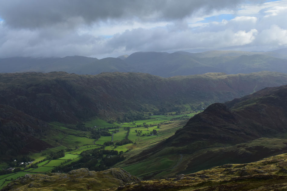
| Great Knott, Crinkle Crags and Bow Fell from Red Tarn. |
Despite the heavy rain continuing the cloud had cleared from the Crinkles and Bow Fell. More walkers had gained the junction from Oxendale all of whom looked as soaked as I was, some downed packs while others continued. By now my feet were not just damp but swimming in water a layer of which I could feel between my socks and the soles of my boots, my body and legs were bordering but thankfully no main leakages. The rain stopped shortly after taking this photo and for the first time since my descent of Pike O'Blisco I could draw back my hood. The sound of drainage echoed around the fell side like someone had just removed a plug from the bath. The footpath at times was largely under running water but I waded through it anyway, my assumption was my feet couldn't get any wetter.
The cloud was still down on Swirl How and Grey Friar and as I descended further cloud lingered over Wrynose Bottom too. The sight of where the Three Shire Stone once stood came into view and I squelched my way towards where despite my wrung feet, the tarmac of the pass felt good underfoot. It started to rain again and the wind I'd experienced this morning on the pass returned and I threw my hood back up and drew in the cords. Passing the parked cars at the top of the pass I wondered of their occupants then began the short descent towards Wrynose Bridge where I spotted my car in the cutting surrounded by water flowing over tarmac. My sequence was too remove everything that was wet, which was basically everything. I removed everything bar my boxer shorts and slipped spare clothing I had kept in my boot that which up until today, I never had the call to use but nothing quite prepared me for the pools of water left in my boots, flipping eck I chuckled, never seen that before. |
|
| |
| Back to top |
 |
|