|
A Round of Marchlyn Mawr |
 |
 |
25th April 2021 |
 |
|
I was meant to be meeting the whole squad including Tim, his son Henry on a tour of the Deepdale Valley before the ascent of Dove Crag but Tim had to cancel last minute followed by our daughter asking would we babysit our grand daughter Penny from Saturday afternoon through to Sunday morning, something that I couldn't leave my wife to do given how boisterous Penny can be and besides, it's been a couple of weeks since we last spent sometime together so I switched walking from Saturday to Sunday.
Ever since I walked a high level circuit of Marchlyn Mawr last August I'd been gripped by its mountain scenery, in fact I was due to return in Winter but Lockdown 3 put a stop to that and I guess it's from then the want to return had never left me. The forecast between Lakeland and Snowdonia was pretty much the same with a bright start before cloud would bubble up come midday so the plan was to start early which meant setting the alarm clock for 4:30am. I'd normally hit the snooze button a few times before getting up but today It was me who beat the alarm rising before it had chance to go off such my eagerness to set foot onto Mountain...I guess I'm still suffering from being away from the hills for so long. |
|
Ordnance Survey 17 |
 |
| Snowdon/Conwy Valley |
|
|
|
|
|
|
Overview |
|
|
| Ascent: |
2,116 Feet - 645 Metres |
| Summits Over 3,000ft: |
Elidir Fawr |
| Visting: |
2, Mynydd Peredd - Carnedd y Filiast |
| Weather: |
A Cool Start With Hazy Sunshine Throughout. Fresh Gust Over The Summits. Highs of 17°C Lows of 9°C |
| Parking: |
Roadside Parking, Access Road Marchlyn Mawr Reservoir, Deiniolen |
| Area: |
Snowdonia National Park |
| Miles: |
6 |
| Walking With: |
On My Own |
| Ordnance Survey: |
OL17 |
| Time Taken: |
3 Hours 45 Minutes |
| Route: |
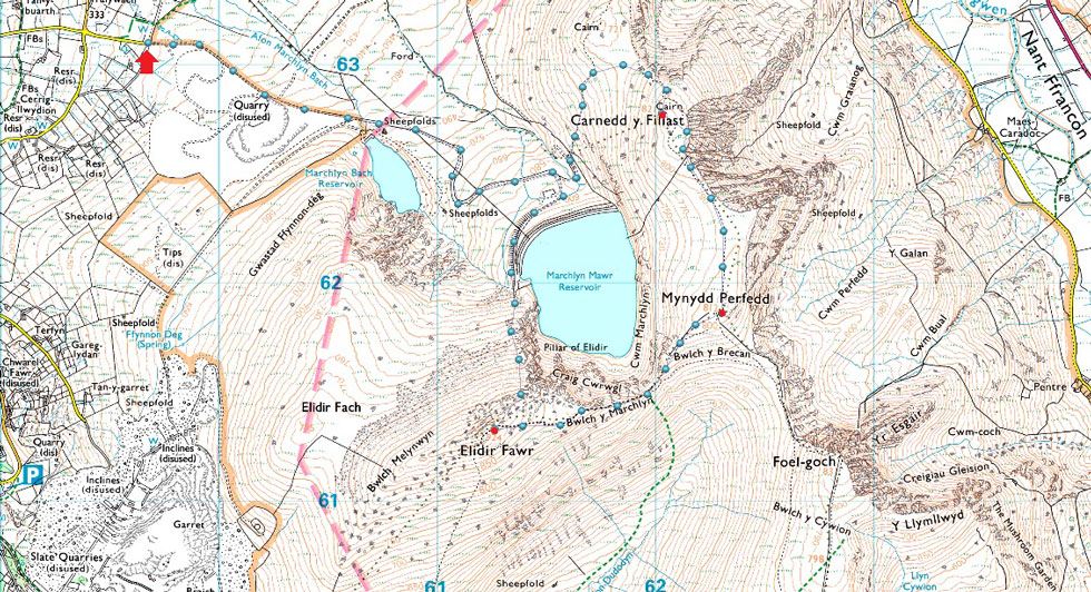
Access Road Marchlyn Mawr Reservoir - Marchlyn Mawr Reservoir - Elidir Fawr North Ridge - Elidir Fawr - Bwlch y Marchlyn - Mynydd Perfedd - Carnedd y Filiast - Marchlyn Mawr Reservoir - Access Road Marchlyn Mawr Reservoir |
|
| |
|
Parking Details and Map |
|
|
| Nearest Post Code: |
LL55 3NA |
| Grid Reference: |
SH 596 630 |
| Notes: |
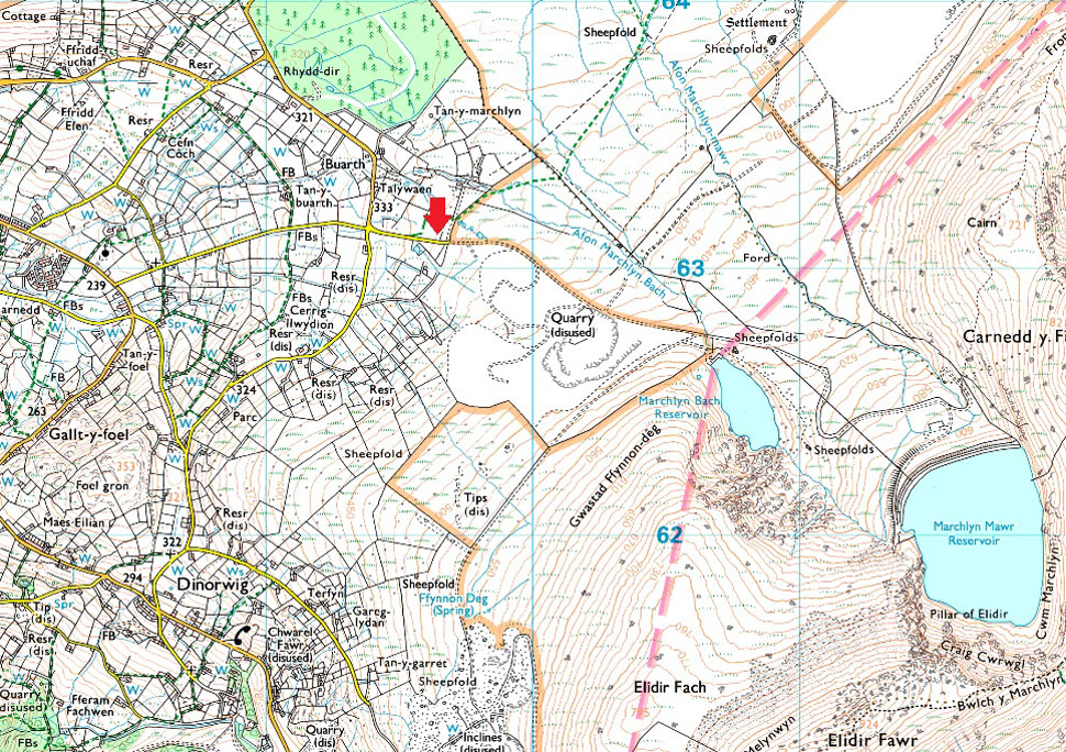
The access road to Dinorwig Power Station also hosts a number of off road parking spaces with room for up to fifteen cars. The locals refer to the parking here as a 'hidden gem' because not that many people know about it and if I'm honest, there's a feeling of guilt dawning down on me as I write this. Please respect the area and the locals, arrive early to avoid disappointment. Parking is free. |
|
| |
|
Map and Photo Gallery |
|
|
 |
| |
| |
 |
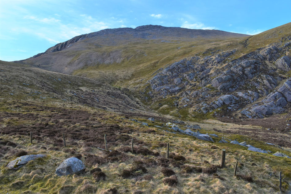
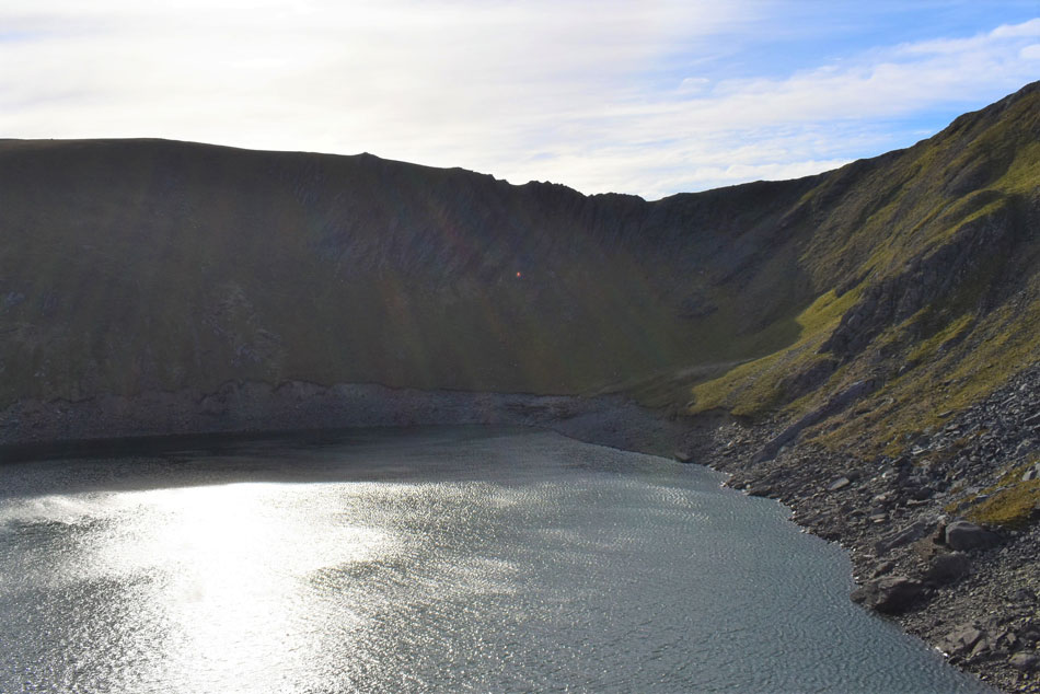
| Marchlyn Bach Reservoir and Elidir Fach North ridge. |
I arrived at the bottom of Marchlyn Fawr Reservoir access road earlier than expected around 7:20am, turned the car around and switched the engine off. I didn't leave the car for another five minutes I just sat there watching the grass sway and listening to the wind. This time last weekend we were able to kit up comfortably in shorts but this morning there's a real nip in the air and I didn't have to leave the car to feel it, I could sense it. Having left the car I went around to the tailgate to kit up and added my jacket before my boots, happen I'm gonna need the hat and gloves too.
Whilst I was lacing up my boots a van pulled up whose owner span it around, opened the side door and started to kit up and by the time I'd laced up my left boot he was off and I couldn't but help notice he'd left with his right sock tucked into his trouser leg, eager I thought. By the time I locked up the chap had a good 200 yards on me and I wondered his route, there really isn't much choice it's either clockwise and anti clockwise but I won't know until further on. Other than the chap it's just me and the electric mountain, oh and the wind and a bloody cold one at that.
I passed through the gate and joined the Marchlyn Fawr access road which rises over 900ft in under 2 miles needless to say despite the tarmac underfoot it's a bit of a lung buster straight from the car. The profiles of Y Fronllwyd and Carnedd y Filiast appear up ahead but due to a mix of haze and poor light the outline of the hills are all I can see for now. New born lambs bleat over the sound of the wind which caused my eyes to water relentlessly - damn and blast I'd left my sunglasses back at the car. Yesterday I'd gashed my left forefinger on a can of tinned pineapples below the knuckle and before I left I thought it would be a good idea to remove the plaster, it wasn't, the cut started to bleed inside my glove - I have plasters in my first aid kit but I'd be dammed if I was going to stop to apply one, I was on a roll and like a stubborn bugger I placed my glove back on and tried to forget about it. |
 |
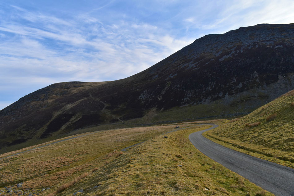
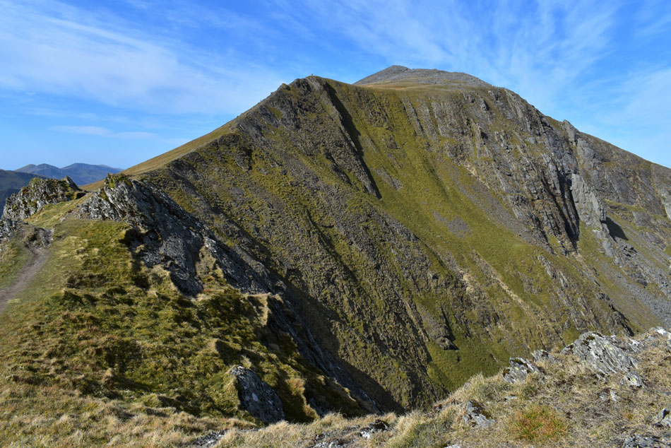
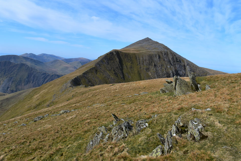
| Elidir Fawr. |
| By now the chap had disappeared around a series of zigzags in the access track but it felt like I was gaining ground on him, it would seem we were both walking at pace. My view of Elidir Fawr had been obscured by Elidir Fach north ridge which once passed Elidir Fawr commands the view. Back in August during my last ascent the area where I'm standing in was part building site due to work on Marchlyn Bach reservoir, with all that gone the area has returned to its natural state...tarmac road n'all. |
 |
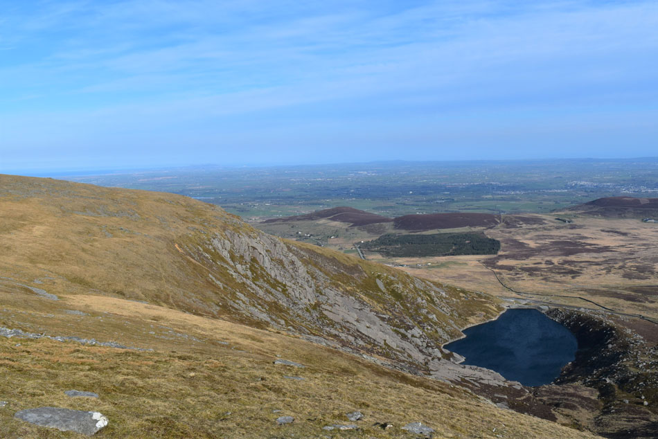
| Looking back on and Y Fronllwyd (left) and Carnedd y Filiast (right) |
| I continue ascending the track until it passes the last curve behind the dam wall seen right which had been sheltering me from the wind but judging off the roar I can hear I'm about to get right back into it. |
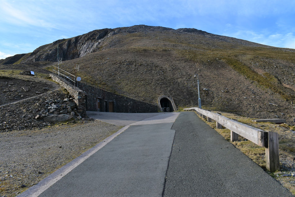 |
| Elidir Fawr. |
| As I rounded the last bend the warm sunshine which had accompanied me for the last twenty minutes was replaced by a fresh wind which roared over the reservoir above me, the wind seemed to bottleneck right where I was standing. The plan was to have a look around, perhaps be boring and read the dozens of no access beyond this point signs and generally get a geographical feel of what goes on inside the Hydroelectric mountain but the wind was still causing tears to stream down my face the best thing I could do right now was keep moving. |
 |
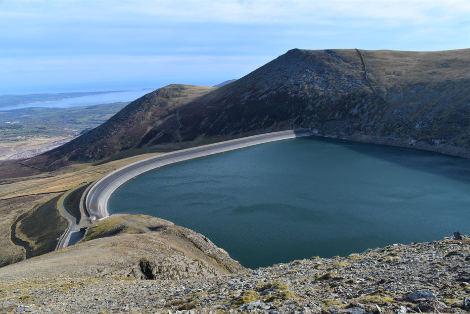
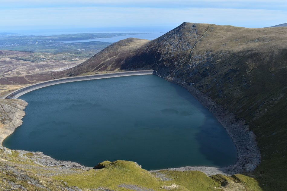
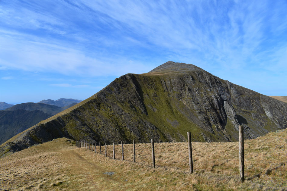
| Elidir Fawr from Marchlyn Mawr Reservoir. |
| From the reservoir a narrow stone track rises steeply up the north ridge with splendid views over the reservoir. |
 |
| Looking across Marchlyn Reservoir. |
| Towards Mynydd Perfedd (left) and Bwlch y Marchlyn ridge (right) |
 |
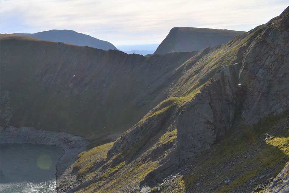
| Outstanding views down Elidir Fawr North ridge. |
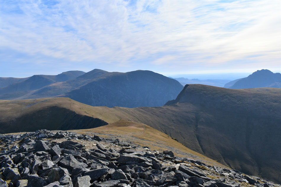
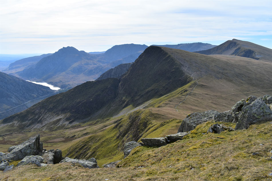
| Looking over Marchlyn Mawr Reservoir towards Y Fronllwyd (left) and Carnedd y Filiast (right) You can just make out the path between both summits which I'll use to descend later, the chap who I had been following is making his ascent on Carnedd y Filiast which means he's walking the round in a clockwise direction, happen I'll bump into him sooner or later. |
 |
| Elidir Fach North Ridge. |
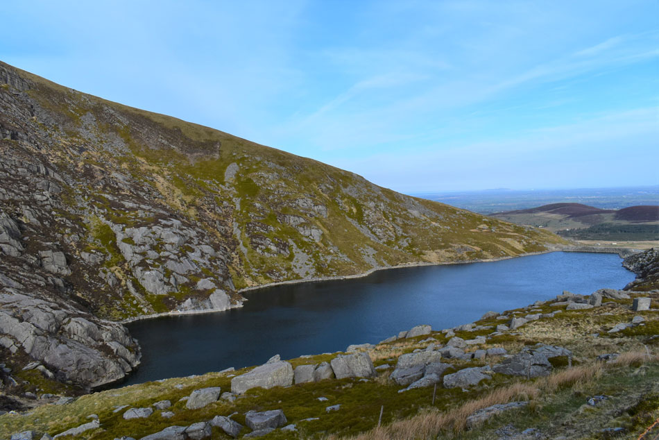
| With Marchlyn Bach Reservoir below and the foothills of Moel Rhiwen, Parc Dryscol and Moelyci in the distance. |
 |
| Rising over the Bwlch y Marchlyn ridge. |
| Pen yr Ole Wen (left) and Foal-goch (right) with the Pillar of Elidir seen foreground (lower right) |
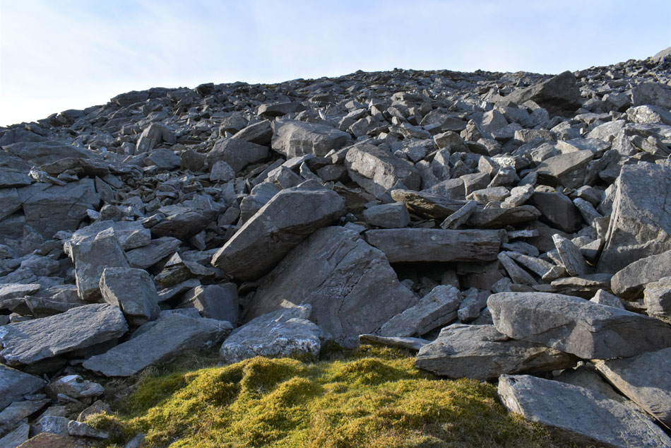 |
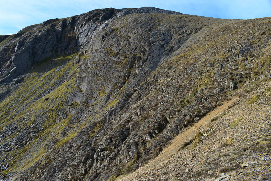
| Time to pull the socks up. |
| The stone path ascended as far as the boulder field where it's left to the walker to find his/her own route up. During my last ascent I took a tumble backwards about 30 yards to the right from where I'm stood resulting in a jarred knee cap. This morning I avoided the stone/grass path far right and instead ascended via as much grass as I could, that was until the grass ran out. Here I continue my ascent heading left over the boulders which worked out well with no mishaps. |
 |
| From the shoulder of Elidir Fawr. |
| Foal-goch, Tryfan the Glyders and Y Garn come into view...surprisingly it's less windier here on the summit shoulder than it was down at the reservoir. |
 |
| Looking down Elidir Fawr North Ridge. |
| With extended views towards Conwy Bay and the Menai Strait. |
 |
| From the summit shoulder... |
| ....Snowdon (centre) and Crib-Goch come into view. |
 |
| Meanwhile towards the East. |
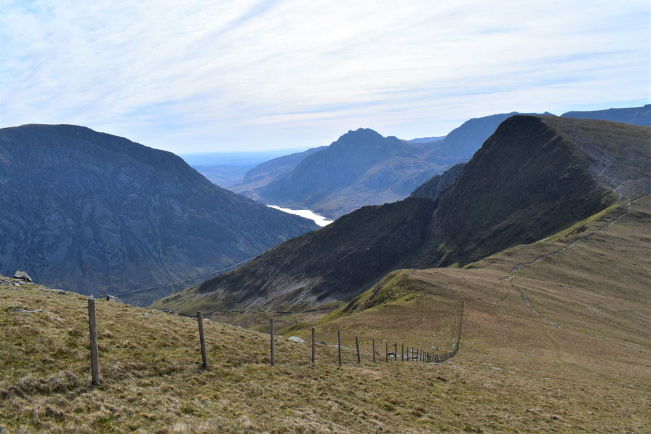
| Eyes are widened as I take in the view first over the Bwlch y Marchlyn and Bwlch y Brecan ridges towards Mynydd Perfedd, Pen yr Ole Wen, Carnedd Dafydd and Carnedd Llewelyn while over on the right stands the mighty Tryfan. |
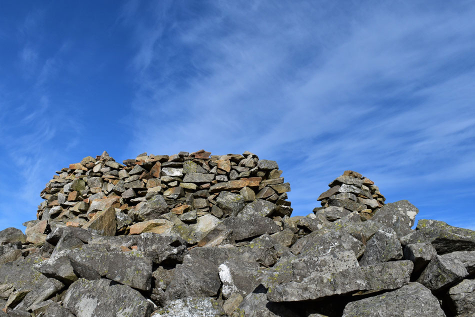 |
| Elidir Fawr summit shelter. |
From the summit shoulder I followed a crest of grass and rock before finally joining with the main summit path before the last push over boulder towards the summit, it was here I passed a young lad on his way down where 'mornings' are shared before arriving at the shelter where I found a couple sat down, it kinda felt like I was walking into their living room but soon we were chatting about our routes and the weather.
After leaving the shelter I took a quick wind speed reading which reached a max speed of 25.7mph - it felt double that back at the wind trapped reservoir I thought. |
 |
| Classic views of Snowdon and Crib-Goch. |
| I left the summit and started to make my way towards Bwlch y Marchlyn (ridge) which can be traversed via its spine or a path cut to the right. |
 |
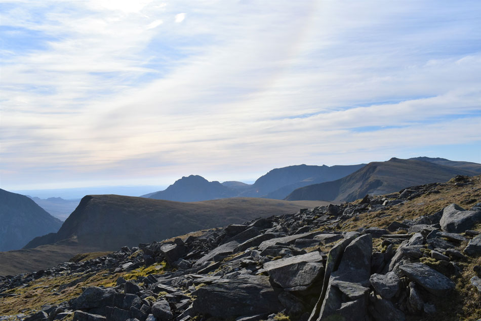
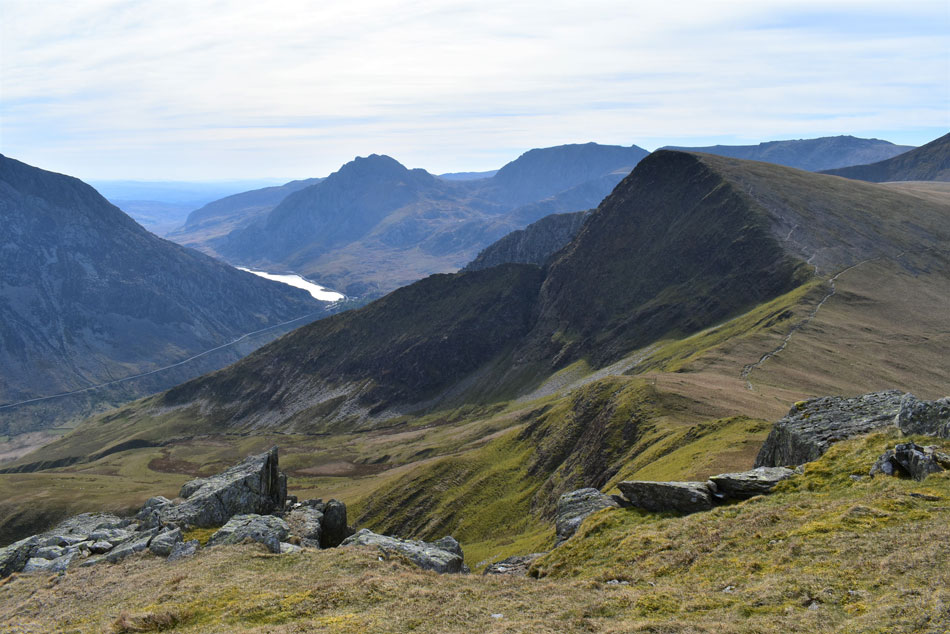
| Craig Cwrwgi (crags) Bwlch y Marchlyn, Mynydd Perfedd, Foal-goch, Pen yr Ole Wen, Carnedd Dafydd and Carnedd Llewelyn in the distance. |
| The spine of the ridge can be accessed further below but I wouldn't recommend it unless you have a head for exposure and certainly not when it's as windy as today. |
 |
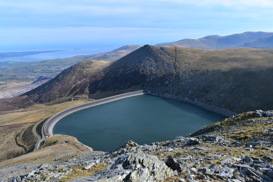
| Taking in the view over Marchlyn Reservoir towards Y Fronllwyd (left) and Carnedd y Filiast (right) |
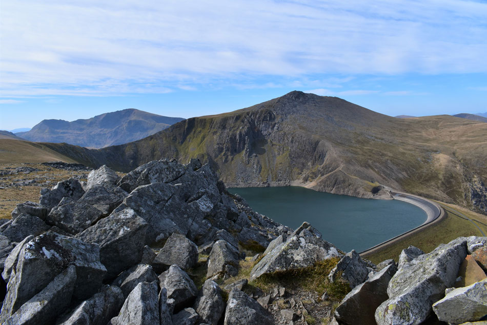
| Constructed between 1975 and 1979 Marchlyn Mawr is a high level reservoir used as a water source to provide Dinorwig Hydroelectric Power Station a mile and a quarter below via a tunnel 34ft in width. |
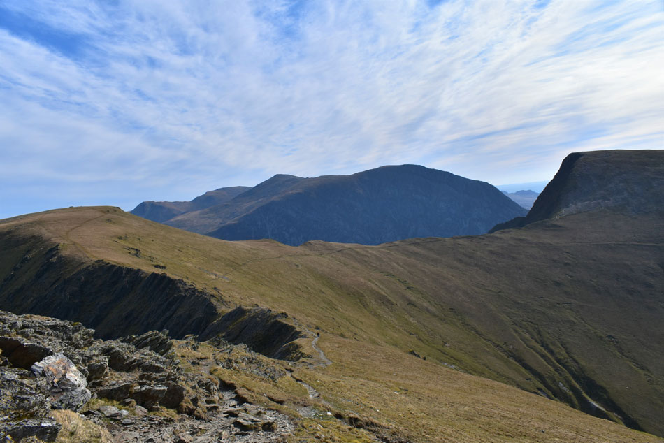 |
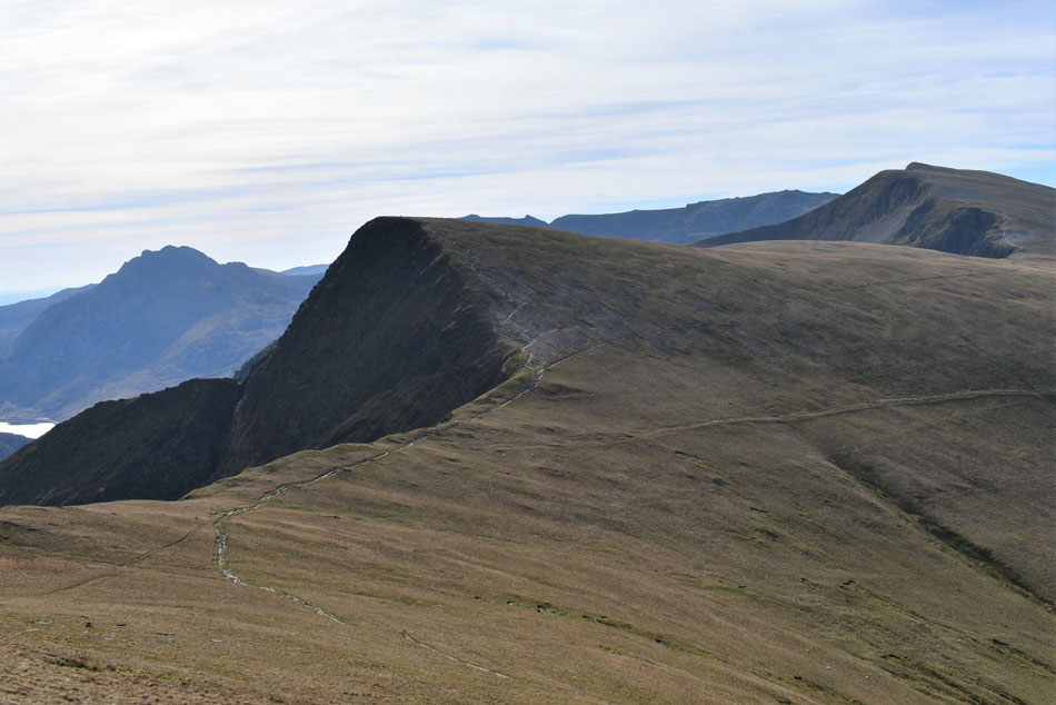
| Mynydd Perfedd, Bwlch y Marchlyn (ridge) Bwlch y Brecan (ridge) Foal-goch, Pen yr Ole Wen, Carnedd Dafydd and Carnedd Llewelyn. |
| The path descends steeply sometimes having to negotiate the odd rock step until it levels above Craig Cwrwgi (crags) it is here I pass the walker who left just before me back at the cars. This time we have time for a chat as he explains it's his first time walking the Marchlyn Mawr round and he was looking for a view of Elidir Fawr from some 'spiky rocks' on Mynydd Perfedd which he'd seen on the photo sharing website Flicker which he wanted to replicate but couldn't find, he went on to say how impressed he was with the round adding that only two days earlier he had rough camped on Pen yr Ole Wen and was shocked at how busy it was when he arrived back at the car park at Idwal Cottage early that morning "you're the first person I've seen all morning" he said to which I replied "I passed one on his way down and I've just seen the two I met at the summit starting their descent so you should have the summit to yourself" We smiled and went our separate ways. |
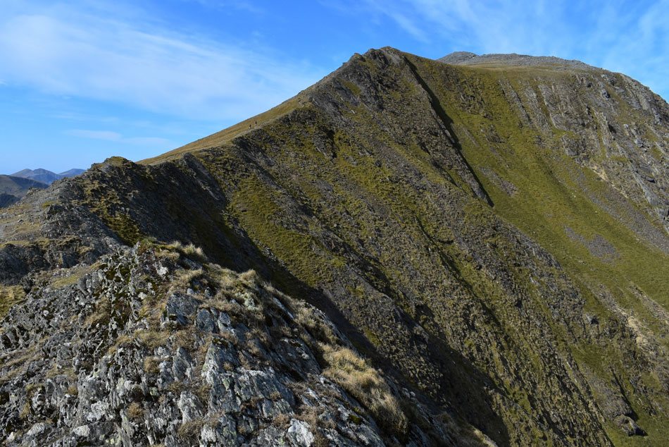 |
| Looking back on Elidir Fawr from Craig Bwlch y Marchlyn. |
| I left the path and climbed up onto the rocky spine to take in this impressive view of Elidir Fawr. Two walkers appear up ahead to add scale. |
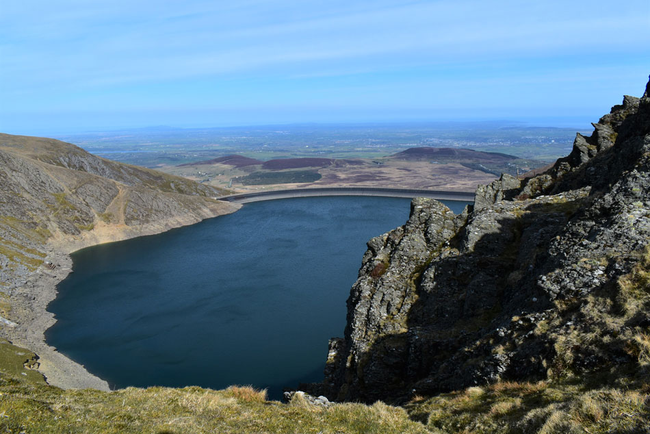 |
| Marchlyn Mawr Reservoir from Bwlch y Marchlyn. |
| |
 |
| Elidir Fawr from Craig Bwlch y Marchlyn. |
| More walkers seem to be appearing from Dudodyn valley (Nant Peris) |
 |
| Craig Bwlch y Marchlyn and Elidir Fawr from the ascent of Mynydd Perfedd. |
| After the steep bouldersome ascent of Elidir Fawr it was nice to have smooth grass underfoot. Elidir Fawr really is taking shape now, what a view! |
 |
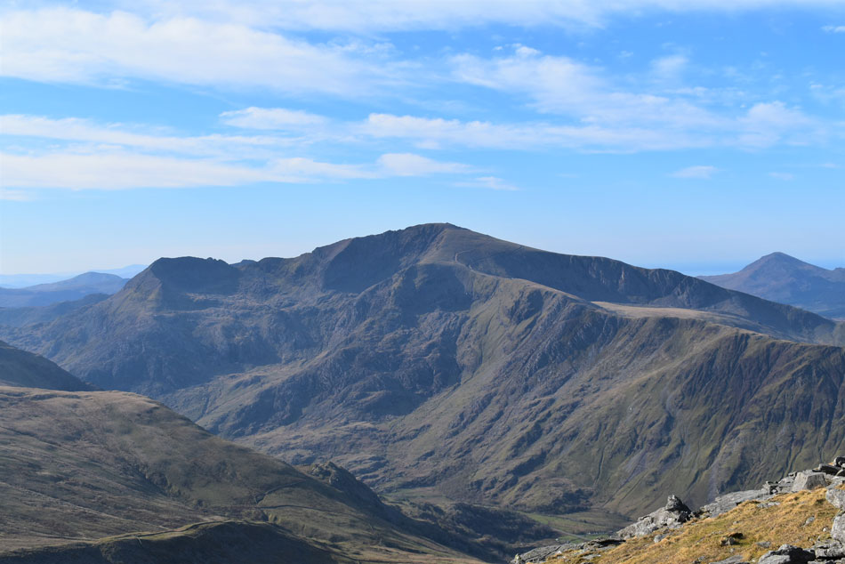
| Y Garn, Glyder Fawr and Snowdon. |
| Seen over Dudodyn valley. |
 |
| Tantalising views over Y Esgair (ridge) Foal-goch, the Glyders, Tryfan and Llyn Ogwen (lake) |
| During my last visit it was this view which impressed me the most taken during the ascent of Mynydd Perfedd, today I descended slightly to join the path between Foal-goch and Mynydd Perfedd so I could take in the same view. |
 |
| Elidir Fawr from Mynydd Perfedd. |
| I wonder if these were the spiky rocks the chap had been looking for which I happend to stumble across as I made my way back towards the path. |
 |
| More classic views of Foal-goch, Pen yr Ole Wen, Tryfan and the Glyders. |
| |
 |
| Foal-goch, Pen yr Ole Wen, Tryfan and the Glyders from Mynydd Perfedd. |
| Instead of heading for Mynydd Perfedd summit I skirted around the east side to take in these incredible views. The plan was to sit and have an early lunch here but as appealing as that sounded it was far too windy. |
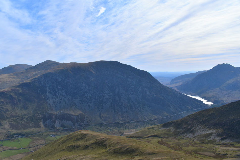 |
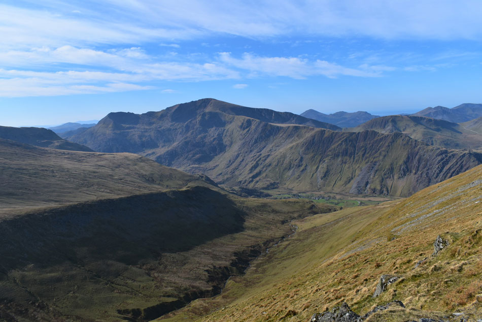
| Pen yr Ole Wen, Carnedd Dafydd, Carnedd Llewelyn, Llyn Ogwen and Tryfan. |
| Parking in the Ogwen and Llanberis valleys has become a real problem with cars choking the narrow lanes in and out of the valleys so the National Park came up with a park and ride scheme and those who park illegally will be given on the spot fines which appears to be working as I couldn't see any illegal parking at Idwal Cottage below. |
 |
| Foal-goch, Pen yr Ole Wen, Tryfan, the Glyders and Y Garn. |
| What a place. |
 |
| Tryfan, Foal-goch The Glyders and Y Garn. |
| Time for one last photo before I head for Mynydd Perfedd summit. |
 |
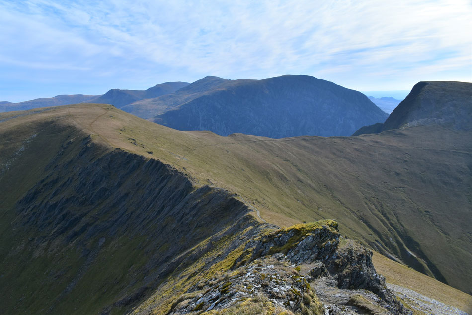
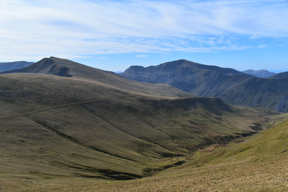
| Looking towards Carnedd y Filiast from Mynydd Perfedd. |
| I retraced my route and summited Mynydd Perfedd before being beckoned by the grassy ridge linking Mynydd Perfedd with Carnedd y Filiast, it was while I was crossing the ridge did I pass a solo woman and over the wind a hi was shared. |
 |
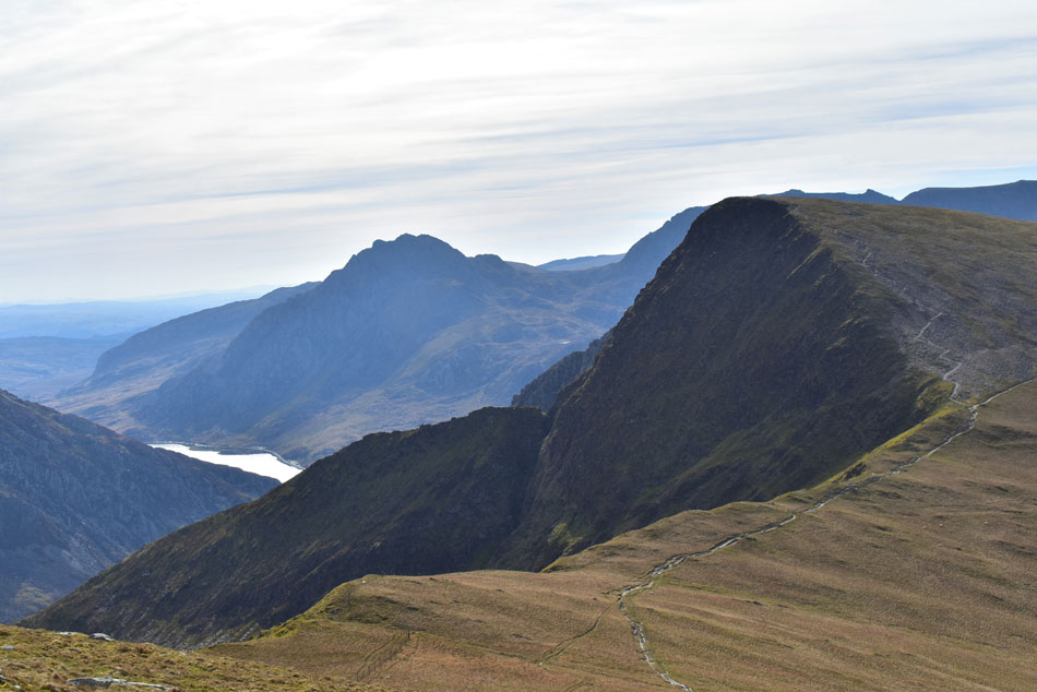
| Crib Goch, Snowdon, Elidir Fawr and Marchlyn Mawr from Carnedd y Filiast summit. |
Two walkers were sharing the summit shelter and were just getting ready to leave as I scrambled over rock towards the summit cairn, as I did I took one look over my shoulder and waved the two guys off who smiled and waved back. I had the summit to myself from where I could take in the grandeur of the Marchlyn Round while being buffeted by wind and rays of sunshine. From the summit I had panoramic views of the North Wales coastline from Conwy Bay to Caernarfon Bay not forgetting the Menai Strait which glistened below.
I hadn't noticed that I was still wearing my hat and gloves which I took off at the summit and soon remembered why I'd kept them on, it was still pretty breezy on top but before putting my gloves back on I took a look at my finger which had stopped bleeding but looked a right mess with dried blood under and around the nail so I did what anyone would do and stuck it in my mouth to clean it up after which the summit breeze got a hold of the cut which made me wince with pain, I couldn't believe how one cut could cause me so much discomfort.
Heading north I scrambled over boulder and located the footpath westwards which I hadn't remembered being as eroded as it was. From the summit shoulder I could see pairs and groups heading towards the grassy col below whose conversations I could hear over the a wind which had dropped all of a sudden. With a solo walker ascending towards me I de-shouldered my pack and took out one of two mini pork pies to enjoy my descent by. From the grassy col I took in the view of Braich Ty Du (Pen yr Ole Wen north west ridge) which seemed to extend the entirety of the Ogwen valley before turning boot and continued my descent back to the access road where I spotted mountain bikers and more walkers one of which was the guy I'd been speaking to back on Bwlch y Marchlyn ridge earlier. By the time I arrived at the access road the midday sun was beating down and those walking towards me were probably stumbled to why I was wearing a soft shell and long trousers oposed to thier shorts and T shirts and why the handle of his left walking pole was covered in blood. |
|
| |
| Back to top |
 |
|