|
The Buttermere Horseshoe |
 |
 |
5th May 2021 |
 |
|
Picking up where I left off after six months away was never going to be an easy task. After completing the Eskdale Horseshoe last October the country went into lock-down and exercise had to be done locally from home, fitness was bound to suffer. Although it didn't feel it at the time gaining a maximum of just 1,300ft per walk my fitness started to falter with Winter not helping due to limited daylight hours not only did I suffer physically so did my mental health, a subject that I've already touched on.
A couple of weeks ago I rode to the top of Winter Hill which made me realise how unfit I'd become. Since Christmas I have focused more on my diet and cut my alcohol intake, gasping for air and feeling my calfs burning during that bike ride made my efforts seem futile. Five walks in after lock-down my fell fitness is beginning to return which I noticed during the ascent of Elidir Fawr last weekend.
My take on this is even though you may have calfs the size of dinner plates without confidence in your ability to achieve your goals your engine may fail, training the brain is equally as important as training the muscle. I'm not there yet but I aim to be and soon. Having the Lake District fells as your gym brings back that confidence, brings back everything that I have solely missed these last few months and today I was going to consume everything that I love about walking the Lake District fells. |
|
| Wainwright Guide Book Seven |
 |
| The Western Fells |
Hay Stacks
With its thick covering of heather it is dark and sombre even when the sun sparkles the waters of its many tarns, gloomy and mysterious even under a blue sky: There are fierce crags and rough screes and outcrops that will be grittier still when the authors ashes are scattered here. |
 |
|
|
|
|
| |
|
Overview |
|
|
| Ascent: |
6,047 Feet - 1,844 Metres |
| Wainwrights: |
8, Red Pike (Buttermere) - High Stile - High Crag - Hay Stacks - Fleetwith Pike - Dale Head - Hindscarth - Robinson |
| Visiting: |
Chapel Crags - Seat - Black Star - High Snockrigg |
| Weather: |
Predominently Sunny, Max Wind Gust 27mph Thawing Snow Underfoot. Highs of 12°C Lows of 2°C Freezing Across The Summits. |
| Parking: |
Newlands Pass (Buttermere) |
| Area: |
Western |
| Miles: |
14 |
| Walking With: |
On My Own |
| Ordnance Survey: |
OL4 |
| Time Taken: |
9 Hours |
| Route: |
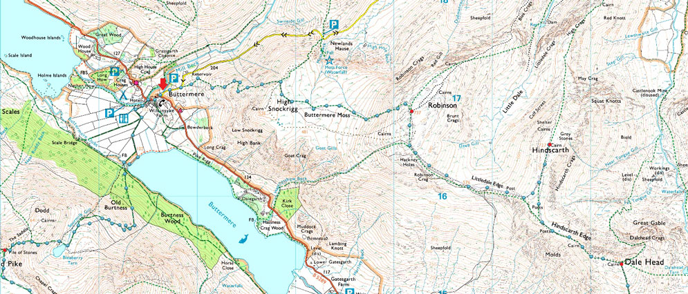
Newlands Pass - Buttermere - Old Burtness - Bleaberry Tarn - The Saddle - Red Pike (Buttermere) Top of Chapel Crags - High Stile - High Crag - Gamlin End - Seat - Top of Scarth Gap Pass - Hay Stacks - Innominate Tarn - Black Beck Tarn - Dubs Hut - Fleetwith Pike - Black Star - Honister Mine - Yewcrag Quarries - Dale Head - Hindscarth Edge - Hindscarth - Littledale Edge - Robinson - Buttermere Moss - High Snockrigg - Newlands Pass |
|
| |
|
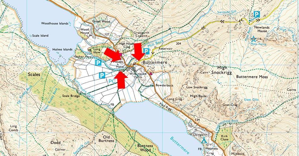
Parking Details and Map |
|
|
| Nearest Post Code: |
CA13 9XA |
| Grid Reference: |
NY 176 317 |
| Notes: |
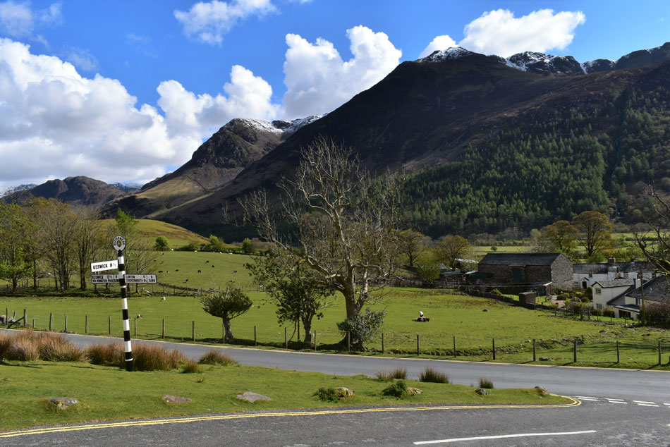
Buttermere is a fairly small village and due to this finding a place to park can be difficult especially during the Summer months. There is free off road parking at the end of the Newlands Pass (right arrow) where there is room for around a dozen cars but being a popular area these spaces fill up quickly, parking here is free. The Fish Inn and The Bridge Hotel also have small car parks which are for patrons only. During busier months Syke Farm Campsite allows parking for non patrons but charges apply. |
|
| |
|
Map and Photo Gallery |
|
|
  |
| |
| |
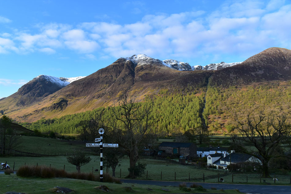 |
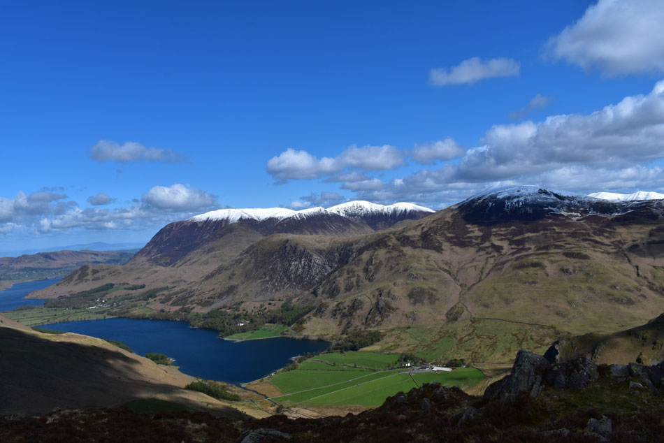
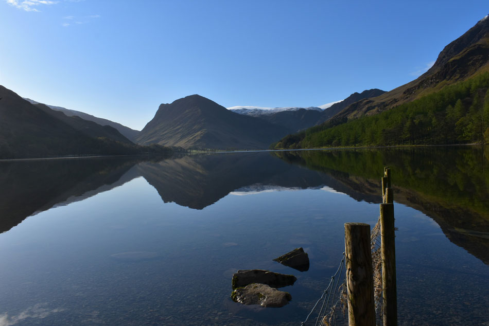
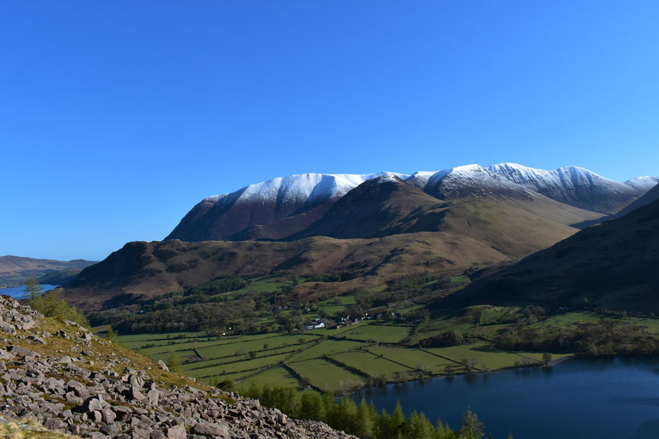
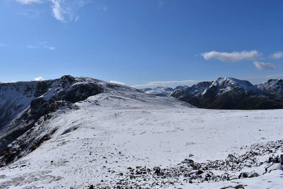
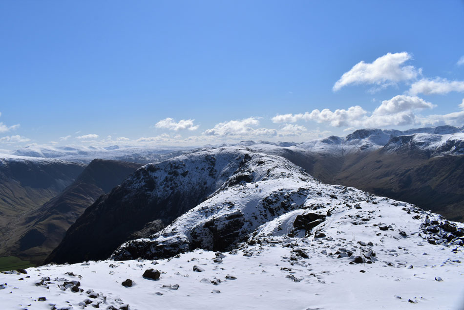
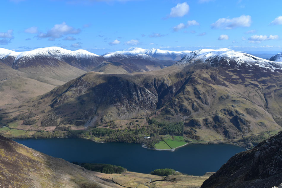
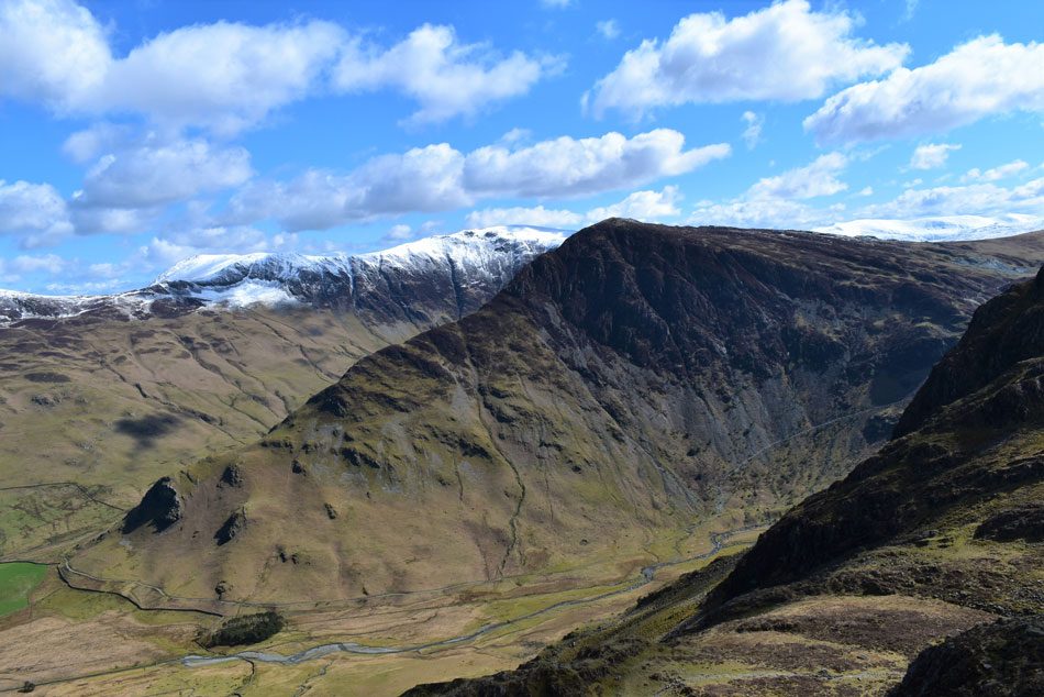
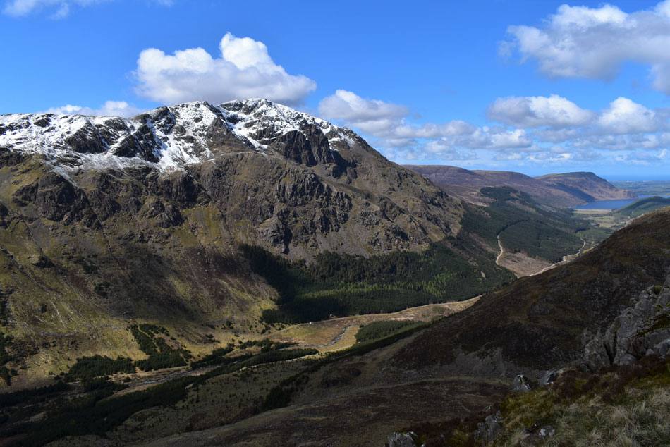
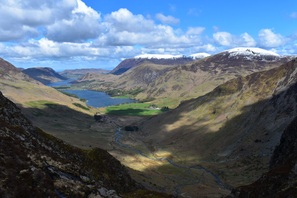
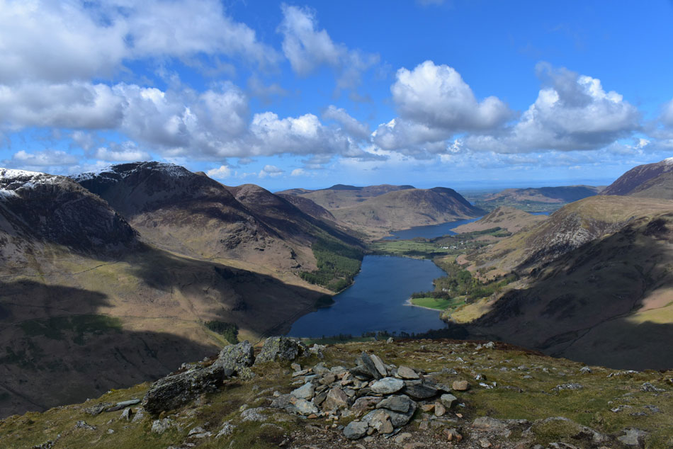
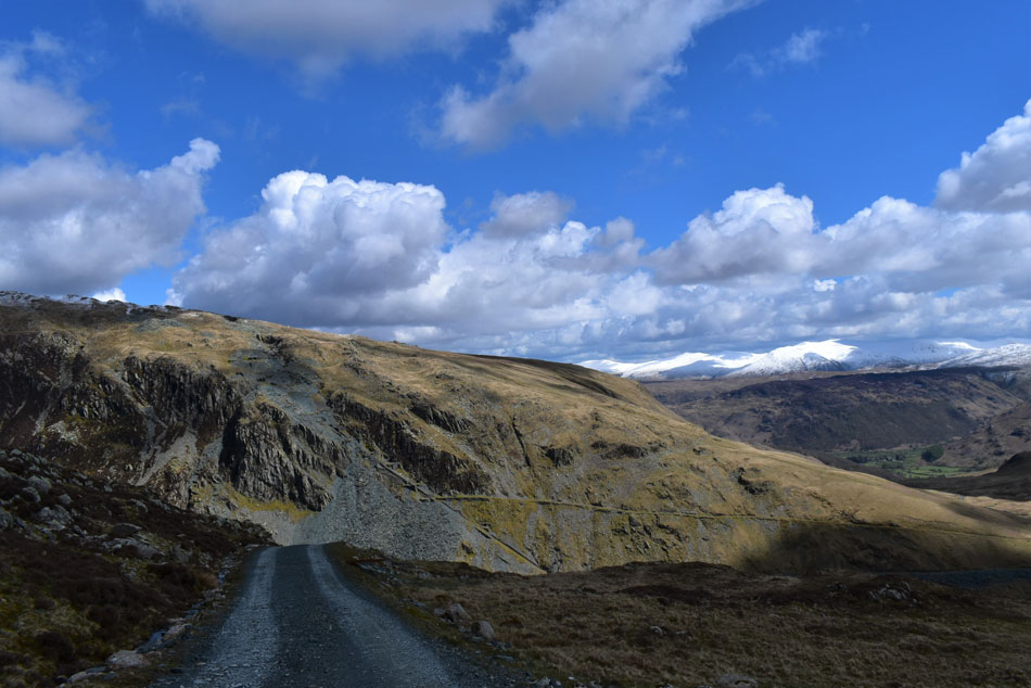
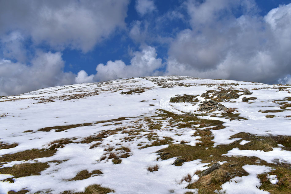
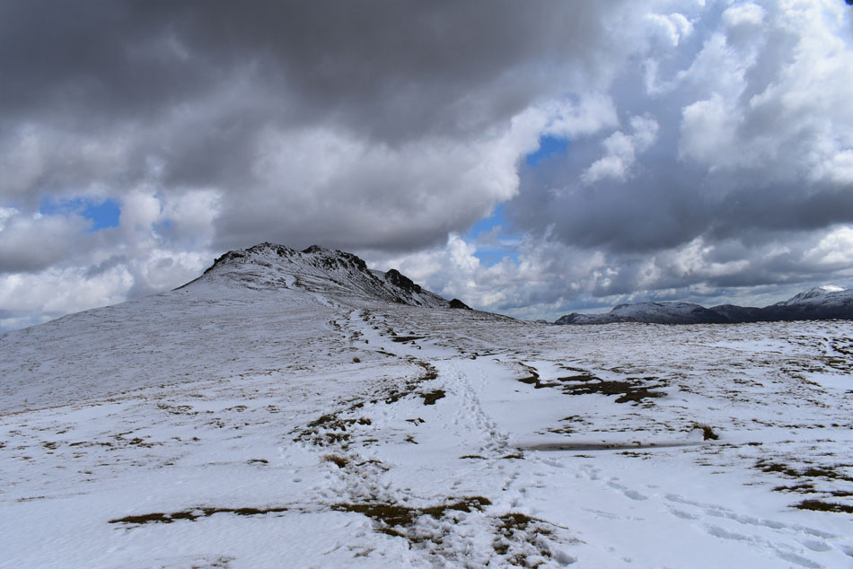
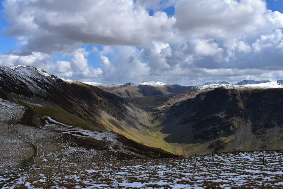
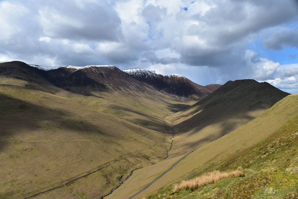
| High Crag, High Stile and Red Pike (Buttermere) from the bottom of Newlands Pass 7:15am 2°C |
I arrived a little later than planned after getting stuck behind a bin lorry on the outskirts of Braithwaite, no biggie. Encountering sporadic sheets of ice across the top of the Newlands Pass I eased the car down towards the Buttermere side until I was confident enough to pick up speed where ice was replaced by flowing water. I was able to park easily at the parking spaces and couldn't wait to kit up feeling like a kid in a sweet shop I needed to be careful I didn't forget anything. I'm only carrying the essentials to lighten my pack packing one layer of waterproofs, a first aid kit 3ltrs of hydration and three 500ml bottles of Lucozade Sport one of which I gulp down before leaving, a pointless effort because within the hour I'll be peeing it out but in my head it primed the system, a pack of Fruit Pastels are tucked into my waist strap pocket for sugar boost.
Locking the car I took in the view over the High Stile ridge while butterflies performed somersaults in my stomach. This walk will test me and exceeds the Eskdale Horseshoe in terms of total ascent - the mileage being similar only today, I have a fresh coating of snow across the tops, I had every right to feel nervous but a good nervous at that. |
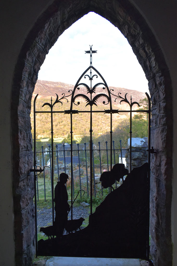 |
| The Shepherds Gate, St James Church, Buttermere. |
| I can't pass through Buttermere without visiting St James Church where I took this image of the iconic Shepherds Gate. It feels kinda like a ritual to me now. |
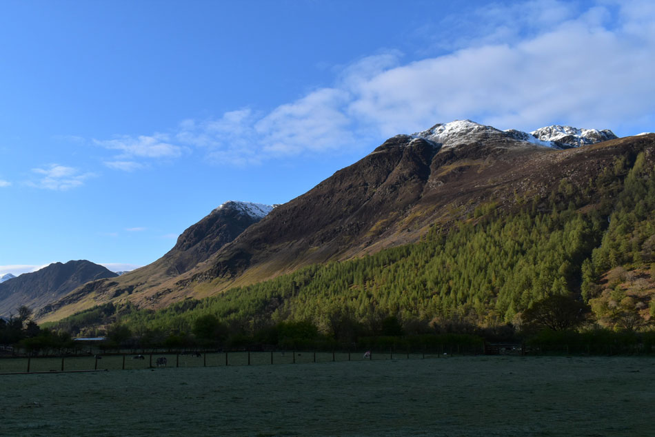 |
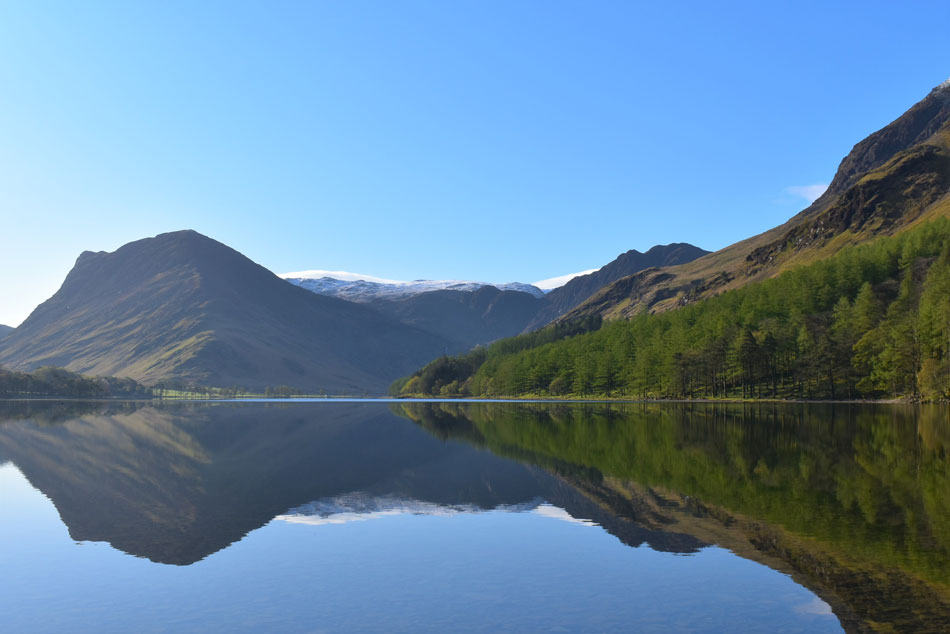
| Hay Stacks comes into view. |
| As I made my way towards Buttermere (Lake) The snow from valley level doesn't look like it's going to be a problem at all. |
 |
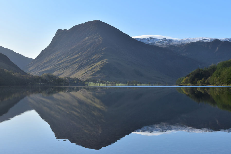
| Hay Stacks, High Crag and High Stile reflections. |
| It's views like this which scramble the job in hand! |
 |
| Fleetwith Pike, Grey Knotts and Hay Stacks from Buttermere. |
| |
 |
| Fleetwith Pike, Grey Knotts and Hay Stacks from Buttermere. |
| |
 |
| Fleetwith Pike and Grey Knotts reflections. |
| Earlier I had noticed a chap also walking towards the lake who by now was taking selfies and photos, we're only a couple of feet apart at this point and it looks like he doesn't want to be disturbed so I stay silent. I am taken back by the calmness and tranquility at the waters edge, there wasn't a murmur and was peacefully silent here this morning. The chap disappears towards the footbridge while I hang around for a few minutes more. |
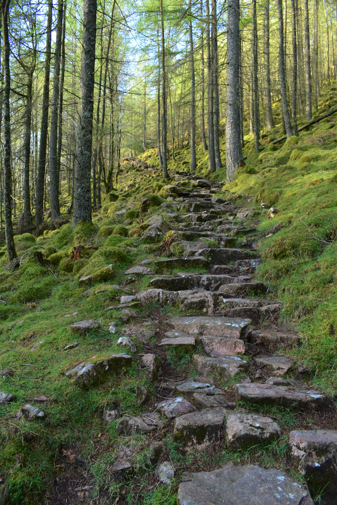 |
| The stone staircase, Old Burtness Wood. |
| I caught a quick view of the chap before he disappeared up ahead, blimey I thought this guy has just left me standing although I was making sure I didn't tire myself out too quickly by charging up the steep footpath...funny how you would never use the words 'steep' and 'charging' together here. |
 |
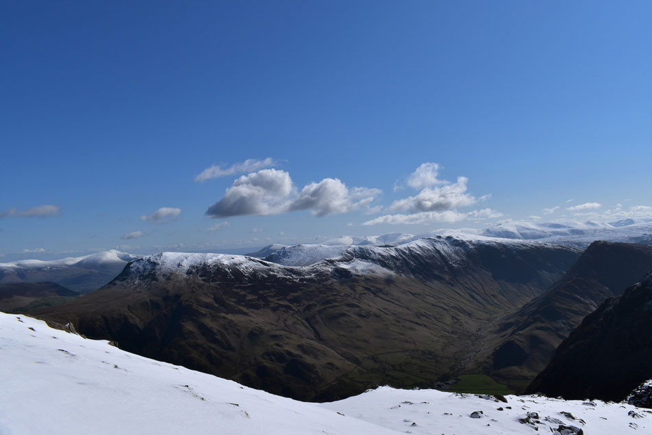
| Views over Buttermere. |
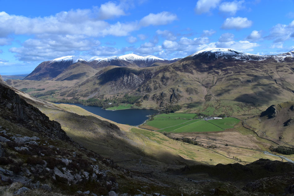
| Towards Rannerdale Knotts, Whiteless Pike, Wandope, Grasmoor, Eel Crag (Crag Hill) Sail and Scar Crags while further left a glimpse of Crummock Water and Low Fell appears. |
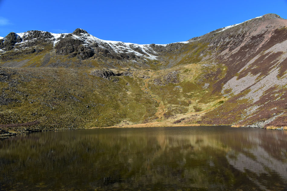 |
| Chapel Crags and Red Pike (Buttermere) from Bleaberry Tarn. |
| The temperature dipped and by the time I had reached Bleaberry Tarn it was time to add the gloves although I reckon my ears could cope without a hat for now. I'd seen glimpses of the chap I'd seen back at Buttermere who by now is climbing the path above the tarn towards Red Pike summit. |
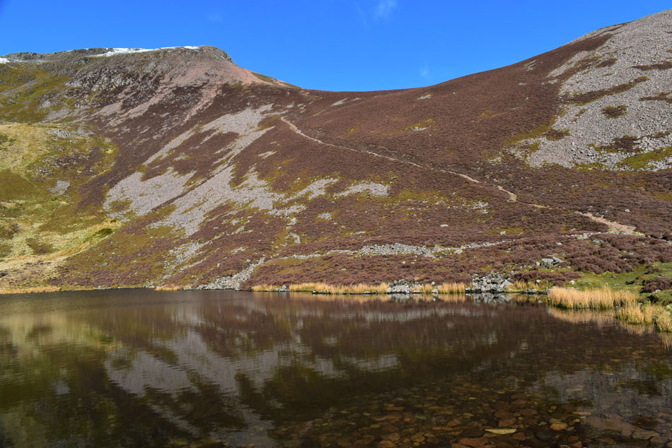 |
| Red Pike (Buttermere) from Bleaberry Tarn. |
| I'm currently reminded of the day David, Rod and I sat eating our lunch while seeking shelter behind the wall back in February 2019, It had been a cold blustery day but within the lee of the broken wall all was well. |
 |
| High Stile (left) and Chapel Crags (right) |
| What a day for views! |
 |
| Looking down on Bleaberry Tarn. |
| And across to High Stile while Dale Head appears in the far distance. |
 |
| From above the Saddle. |
| Rannerdale Knotts, Grasmoor, Whiteless Pike, Wandope, Sail, Scar Crags, Causey Pike, Skiddaw, Ard Crags and Knott Rigg fill the view not forgetting Dodd in the foreground and Crummock Water over on the left. |
 |
| High Stile, Pillar and the Scafells from Red Pike (Buttermere) summit shelter. |
| The path below the summit was as eroded as I'd remembered but I still enjoyed its ascent nonetheless especially the little rock gully which had snow drifts deep enough to swallow the bottom half of my walking pole. I was met by an almost blinding light as the sun reflected off the fresh snow which probably added to the suntan I currently have burned across my face one day later. The chap was nowhere to be seen but judging off his footprints he too was heading for High Stile. |
 |
| A host of North, North Western and Western hills and mountains from Red Pike (Buttermere) summit. |
| I'm not taking too much notice of the Dale Head to Robinson ridge as I want to enjoy and concentrate on the High Stile ridge for now ... out of sight out of mind way of thinking. |
 |
| High Stile, the Gables, the Scafells, Scoat Fell and Pillar. |
| I left Red Pike feeling pleased that for now I had gained the ridge and that (some) of the days hard work was behind me. Finding the snow had compacted underfoot meant there was no punching through instead I was able to almost glide over with a reassuring crunch but conditions underfoot won't always be as good as I'm finding here as I'll later find out. |
 |
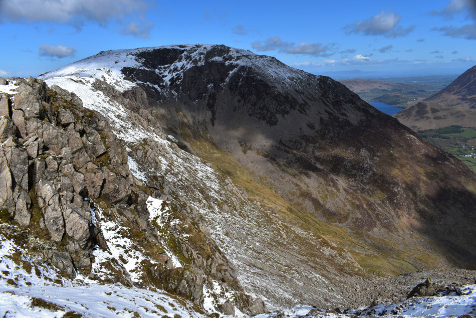
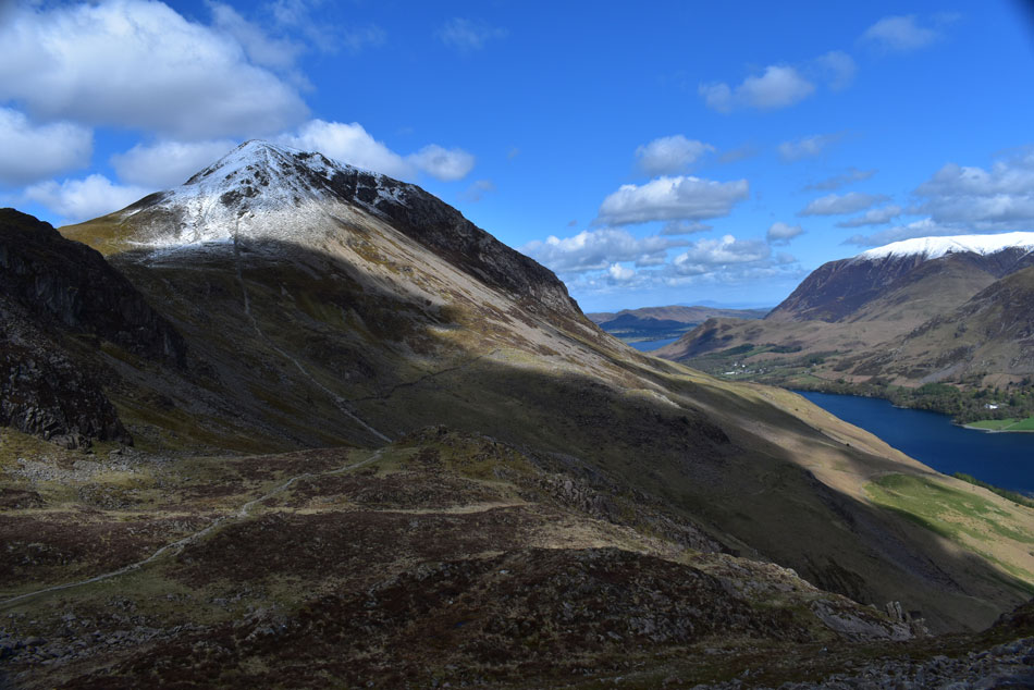
| Looking back on Red Pike (Buttermere) and Great Borne. |
| It wasn't all blue skies as a huge mass of dark cloud formed overhead threatening the sunlight but thankfully nothing more came of it. |
 |
| From High Stile. |
| I peer down on Bleaberry Tarn, Red Pike, Mellbreak the Loweswater Fells, Crummock Water, Grasmoor and Rannerdale Knotts. |
 |
| Heading towards High Stile summit. |
| If you squint you can probably make out a figure stood on the summit cairn which is the chap I'd been following. By the time I arrived he was still stood on the cairn having just taken more selfies and stayed there as I politely brought conversation "cracking day for it" yeah he replied "where you heading" I asked inquisitively? Keswick he replied...again I got the feeling I was intruding from his one word answers so I ended the conversation there. |
 |
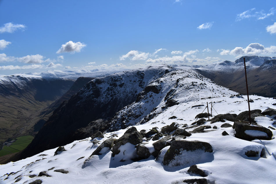
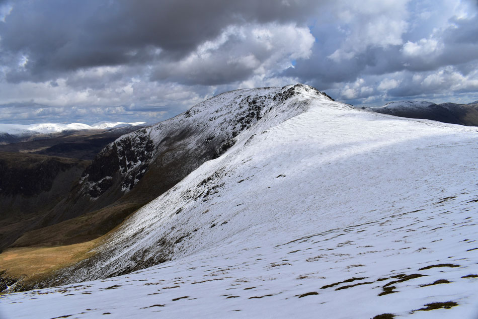
| High Crag from High Stile (The High Stile ridge) |
I left the summit where again I was blinded by the sun reflecting off the snow so off came the pack so I could add a pair of sunglasses. The snow started to gather in depth as I descended from High Stile at times letting go beneath my weight sending me everywhere but in a straight line, anyone following must have thought they were following a drunk not a guy trying to find the best line of descent.
By now my laces had balled up with snow and my trouser ankles were wet through but I'm wearing my Salomon Winter boots which are keeping my feet nice and toastie. |
 |
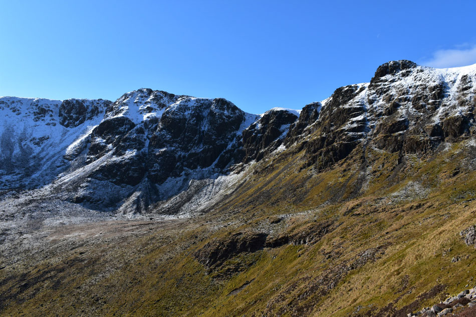
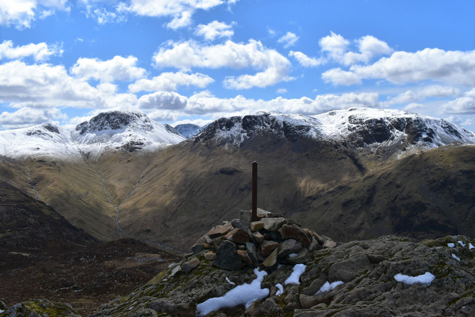
| Summits five, six, seven and eight. |
| Fleetwith Pike, Dale Head (far right) Hindscarth and Robinson. |
 |
| High Crag seen over Burtness Comb and White Cove. |
| I was confident that I had spotted a foxes track in the snow which lead more of less over the hidden footpath below which I used to navigate myself across the ridge along with the broken fence line which I used during my last visit here while walking the Ennerdale Horseshoe in almost zero visibility, today however, I have the luxury of splendid views in every direction. |
 |
| Like this view... |
| ...over the Ennerdale valley towards Kirk fell, Great End, III Crag, Broad Crag, Scafell Pike, Mickledore and Sca Fell. The peak in the foreground is that of Looking Stead (Pillar) |
 |
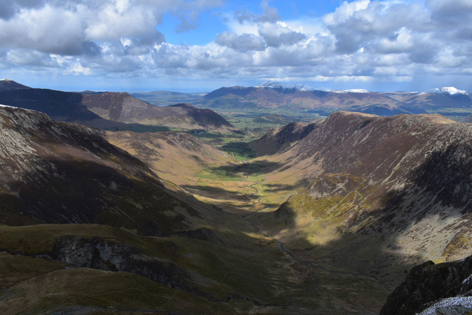
| Looking east over Buttermere. |
| Robinson, Buttermere Moss and High Snockrigg. Later after summiting Robinson I'll descend over Buttermere Moss then onto High Snockrigg (left) from where I'll descend back to Newlands Pass via its west ridge, it's a route I've never taken before and I'm looking forward to it. |
 |
| From the top of White Cove looking back on Burtness Comb and High Stile. |
| A quick push on High Crag should see me reach the summit in a few minutes time from here. |
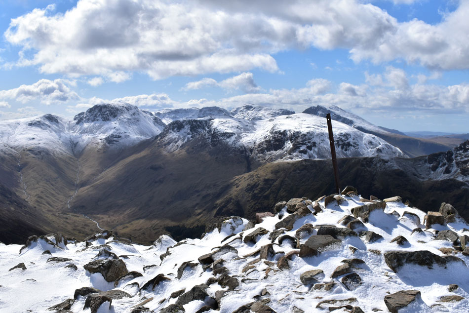 |
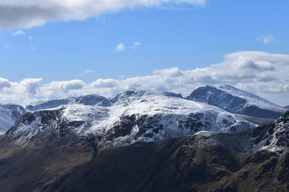
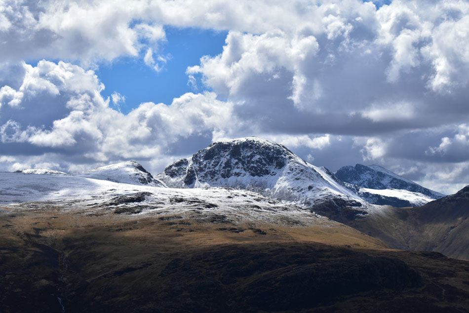
| Green Gable, Windy Gap, Great Gable, III Crag, Broad Crag, Scafell Pike, Sca Fell, Kirk Fell and Looking Stead from High Crag summit. |
| Deep drifts saw me approach indirectly just to avoid sinking into the snow which by now was less compact, five minutes my arse I thought. With the thawing snow in mind I begin the task of descending Gamlin End. |
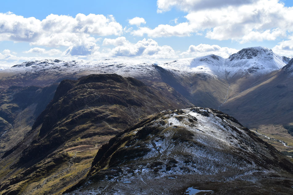 |
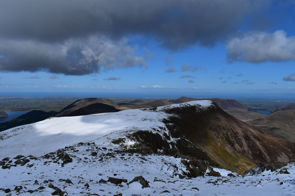
| Brandreath, Green Gable, Great Gable, Hay Stacks and Seat from Gamlin End. |
From the summit I pushed forward to the top of Gamlin End while struggling to locate the path which was buried beneath a foot of snow but experience told me I was practically on top of it. The descent started well with the snow compact for the first 50-80ft of descent before this gave way for thawing snow which was extremely slippery underfoot. By now I had reached the stone staircase but it was only the tops of the stone which were visible and surrounded by thaw which I deemed a no go. I continued the steep descent using the path at the side before guiding myself back onto the stone staircase to see if what little I had descended helped with the stone path, it hadn't. It wasn't a case of if I was going to fall on my arse here it was when and how far I'd tumble. Spotting a grass clearing towards my right I carefully picked my way towards it all the while being watched by a fellow who was stood on Seat summit below, great I've got a crowd I sarcastically thought.
Having made my way across to the grassy area I picked my way down relying on my walking poles and by side stepping the best part of the descent until the ground levelled where I composed myself as I was about to pass the chap who by now was walking towards me "judging by your descent it's pretty hellish up there" he smiled, aye I replied "stick to the left and you shouldn't have any problem, the snow compacts the higher you go" I wouldn't have thought twice about ascending Gamlin End I thought to myself, but to descend it in thawing snow was tough both mentally and physically. Feeling composed I turned my back on Gamlin End and passed over Seat while looking forward to sumitting Hay Stacks. |
 |
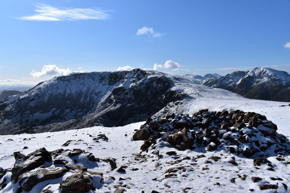
| Hindscarth, Dale Head and Fleetwith Pike from Seat. |
| Summits, five, six and seven. |
 |
| Fabulous views over the Buttermere valley. |
| Towards Robinson, High Snockrigg, Whiteless Pike, Wandope, Grasmoor, Eel Crag (Crag Hill) Sail, Knott Rigg and finally Ard Crags. |
 |
| Looking back through gritted teeth. |
| Over Scarth Gap towards Gamlin End on High Crag. |
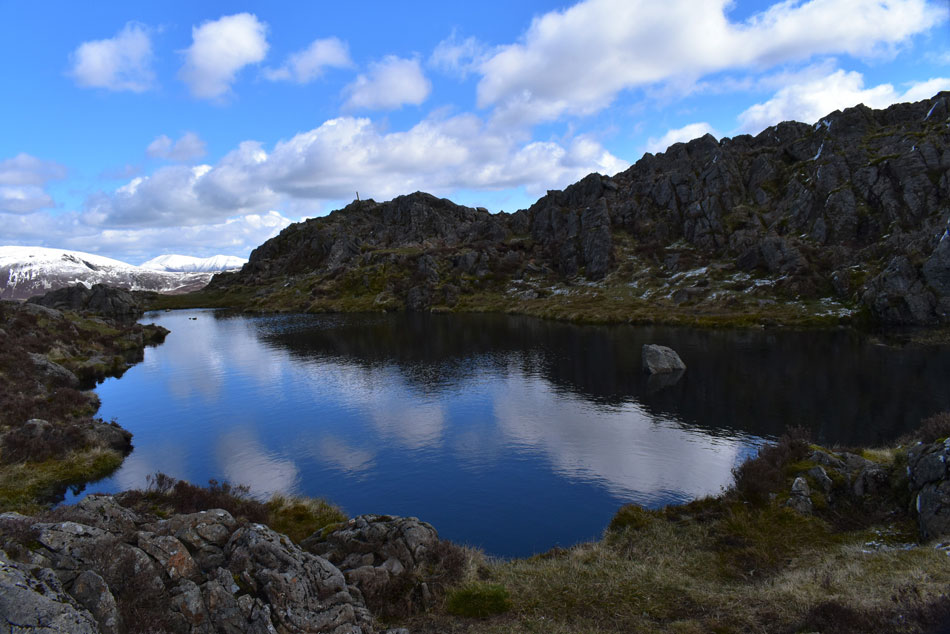 |
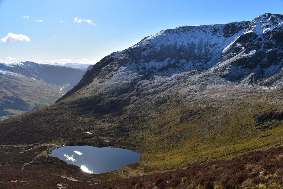
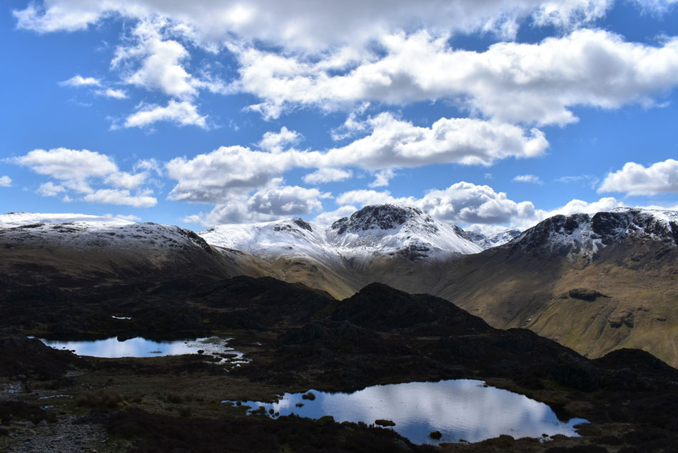
| The un-named Tarn besides Hay Stacks summit. |
| After crossing Scarth Gap I weaved my way up onto Hay Stacks enjoying the little rock steps along the way. By now it was fast approaching lunchtime and not wanting to summit both Fleetwith Pike and Dale Head on a full stomach I kept up my energy levels by feeding myself Fruit Pastels three at a time washed down with plenty of hydration. |
 |
| A long distance view though the Ennerdale valley. |
| With Pillar commanding the view. |
 |
| Green Gable, Windy Gap, Great Gable and Kirk Fell from Hay Stacks South summit. |
| While it had been bright all around the summit of Hay Stacks seemed to be below patchy cloud which I hadn't noticed until I was stood at the summit, I really hoped the cloud would clear. |
 |
| Mind you. |
| The cloud did leave the summit looking very astompheric as I made my way towards Innominate Tarm. |
 |
| And as if by magic. |
| The sun came back out upon reaching Innominate Tarn here as I take in the view towards the Gables and Kirk Fell. |
 |
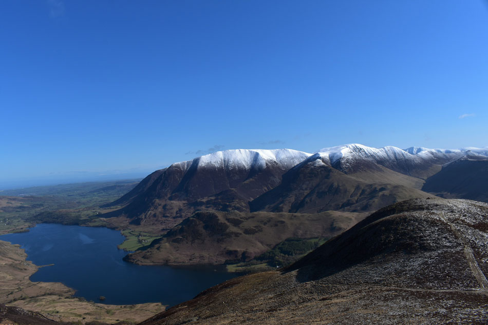
| Extended views along the Buttermere valley towards Crummock Water and a distant Low Fell. |
| I left Innominate Tarn and dropped towards Black Beck Tarn where my mind was focused on gaining Fleetwith Pike and Dale Head thereafter. It was while crossing Black Beck did I pass a trio, then a couple of walkers all heading for Hay Stacks. |
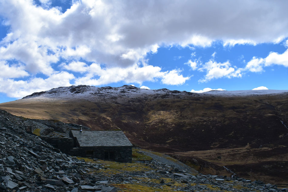 |
| Grey Knotts from Dubs Hut. |
| I descended further and waded through a swollen Warnscale Beck before climbing towards Dubs Hut via a slate zigzag path that I had never used before which I had spotted minutes earlier, it was during that short ascent did I feel a slight burn in my calfs, I remedy this by popping more Fruit Pastels into my mouth followed by a long gulp of water but Fruit Pastels weren't gonna keep me going, I needed a proper lunch stop to restore my energy levels, stubbornly I told myself one salad sandwich after summiting Fleetwith Pike. |
 |
| Lovely light over the Gables. |
| Taken from the ascent of Fleetwith Pike. |
 |
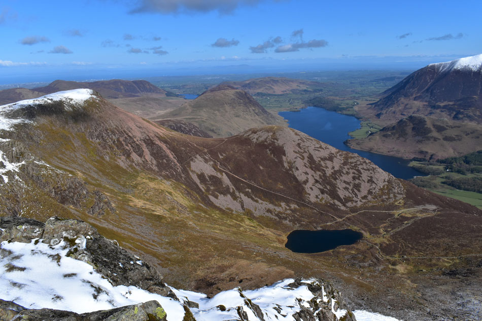
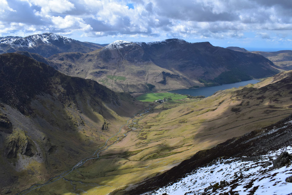
| The High Stile Ridge, Mellbreak, the Loweswater fells, Buttermere, Rannerdale Knotts and Crummock Water from Fleetwith Pike. |
| I ascended the diagonal path up the western flank of Fleetwith Pike in serenity, I was caught in a sun trap and with no wind instead of thinking about todays goals I let nature overtake my thoughts, if I could take one memory from todays walk it was how peaceful the ascent felt. |
 |
| Taking in the view. |
| The plan was to rest but the wind had returned and chilled the sweat which had formed over exposed skin so I left the summit, dropped down a little and found a sheltered spot in the sunshine. It was here I de-layered my pack and tucked into half my lunch then popped down a ibuprofen tablet for the muscular pain my body might encounter. |
 |
| Hindscarth and Robinson from Fleetwith Pike. |
| Two walkers were stood at the summit of Black Star who waved as I passed below. Here I look over towards Hindscarth and Robinson while wishing the weather doesn't deteriorate before I reach their summits. |
 |
| Light fantastic. |
| Over Green and Great Gable. |
 |
| Descending the Honister Mine Track towards Honister Slate Mine. |
| While being passed by six wheeled drive monster truck carrying huge boulders too and from the quarry. What a job this guy has. |
 |
| My first proper view of Dale Head from the Mine Track. |
| I make a mental note of where the snowline starts. |
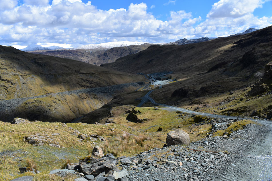 |
| Descending towards Honister Hause/Slate mine. |
| I would be lying if I told you the ascent of Dale Head hadn't been on my mind for the past hour or so after all it's a 'deal breaker' of the route without which there is no Buttermere Horseshoe. |
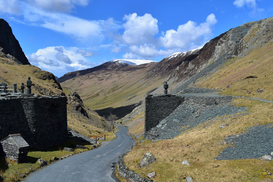 |
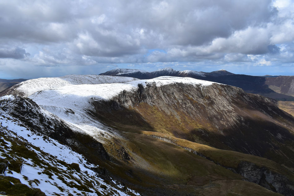
| Hindscarth and Hindscarth Edge from Honister Hause. |
| The slate mine was as busy as I'd expected with cars coming and going while tourists ate ice creams or supped on tea and coffee at the outside tables. A loud whistle broke the silence as my eyes are diverted to the direction it came from where I spot a large group harnessed up for a traverse of the Via Ferrata the youngest of which looked nervous and no older than ten years of age. Their excited voices faded into the distance as I crossed the top of the pass under blazing sunshine before starting the ascent on Dale Head. |
 |
| Ascent on Dale Head from Honister Hause. |
| The start of the ascent is the steepest covering 1,220ft (373m) over a mile in total. A mile is nothing I just kept telling myself but that didn't stop the aches and pains from creeping in! |
 |
| Reaching the snowline. |
| I may have stopped two or three times before reaching the snow line each time to gulp down as much liquid as I could, I generally had a thirst on. A couple approach from the summit and we stop for a quick chat, I asked what condition the snow was in and the woman replied "it's deep" is it compact I asked "no it's thawing, it's slippery and slushy" I smiled a thank you but was secretly cursing the conditions that lay ahead. |
 |
| Newlands from Dale Head summit. |
I continued my push towards the summit as my walking pole tips, boots and trouser bottoms balled up with heavy slushy snow each footprint produced a slopping sound as if I was walking through a couple of inches of water, I practically was. After two false summits the summit cairn appeared and what a site it was my pace quickened as I raced towards it. The sight of the cairn brought me so much joy and instantly I regained my mojo. Despite my wheezing breath, my aching limbs I had reached Dale Head. Hindscarth and Robinson were there for the taking. |
 |
| Hindscarth and Robinson from Dale Head summit. |
| It appears the skies are starting to fill with dark clouds which wasn't forecast until later - I joke please drop firm snow! |
 |
| Commanding views over Honistor Pass towards Pillar and the High Stile Ridge and Buttermere. |
| Red Pike feels like a distant memory as I focus on Hindscarth and Robinson. |
 |
| From Hindscarth Edge. |
| I look back on Dale Head. |
 |
| Dale Head |
| Damn and blast I'd only forgotton to take a photo of Dale Head summit cairn - too late to do anything about it now. |
 |
| Light snow showers pass over the High Stile ridge seen here from Hindscarth summit. |
| I slipped and slopped my way up onto Dale Head summit where no matter how many times I have visited I am always left shocked at how far the summit cairn is from the ridge, a proper out and back. The good news was there's a diagonal path which descends towards Littledale Edge which is where I'm heading next. |
 |
| Robinson with Little Dale below |
| With Scar Crags and Causey Pike silhouetted in the distance. |
 |
| Looking back along Littledale Edge. |
| Towards Dale Head, Honister Hause, Glaramara, Grey Knotts and Fleetwith Pike. |
 |
| Pillar, the High Stile ridge and Great Borne from Robinson summit. |
I was all geared up to gain the final summit when I passed an elderly gent on Littledale Edge who I can't remember was from either Whitehaven or Workington. He carried a small portable radio out of which 'swing and big band' music played. We stopped to chat after he noticed the camera clip fastened to the strap of my pack remarking that he had never seen one before so I told him where he could buy one "Ebay for a cheap unpatented version or Peak Design (patented) for the real deal like this one. He then asked me of my route which I explained "I started on Red Pike this morning and now I'm here, his jaw generally dropped followed by "my my you'll sleep tonight"
He went onto explain he was in his 70's and was on his seventh tour of the Wainwrights "are you doing the Wainwrights" he asked "fourth tour and counting" I replied. I'm originally from Keswick he said, but I've walked all over including the Himalaya, besides walking the Lakeland fells I'm also a volunteer on the La'al Ratty railway. It was only while I was ascending Robinson did it occur to me how long this guy has been walking the Lakeland fells, and still climbing the likes of Robinson and Hindscarth well into his 70's which left me feeling like a drop in the ocean while making that ascent. |
 |
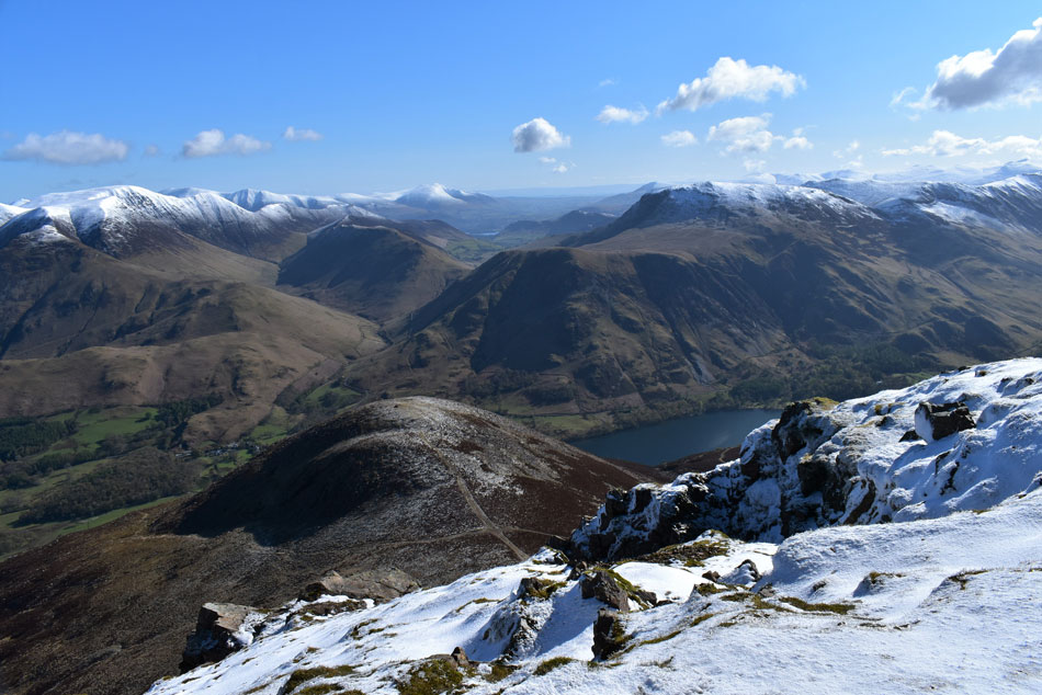
| Bearing down on Buttermere Moss and High Snockrigg (top left) from Robinson. |
Feeling rejuvenated I attempted (and failed) in locating the path between Robinson and Buttermere Moss - turns out it was 50 yards or so off to my right so I made my way over and joined it half way down. The sun was back out but it was still breezy making it feel colder than it actually was, out of the wind it felt like the middle of Summer as sweat dried across my forehead.
I continued down the path before spotting a couple and their dog who seemed to magically appear on the path right in the centre of Buttermere Moss. WHAT! where did they come from is there a vortex or something down there you don't just appear in the middle of a moss without being seen first especially from this height but appear they did and friendly they were too...I didn't get around to asking where the vortex was - happen I might stumble across it myself. |
 |
| Looking back on Robinson from Buttermere Moss. |
| There was no point navigating around the boggy bits with the state my socks, trousers and boots were in which had gave up being waterproof somewhere along Hindscarth Edge. |
 |
| Descending High Snockrigg with views of Rannerdale Knotts, Crummock Water, Mellbreak, Hen Comb and Low Fell. |
| Locating the path down High Snockrigg westerly ridge was easily gained which wasn't without its steepness which the views more than made up for. Down below I can see the windscreen of my car glistening in the afternoon sunshine when my stomach received another wallop of butterflies. |
 |
| Outstanding views over Mill/Rigg Beck(s) featuring Whiteless Breast, Whiteless Pike, Wandope, Sail, Scar Crags, Ard Crags and Knott Rigg. |
| With the Newlands Pass below. |
 |
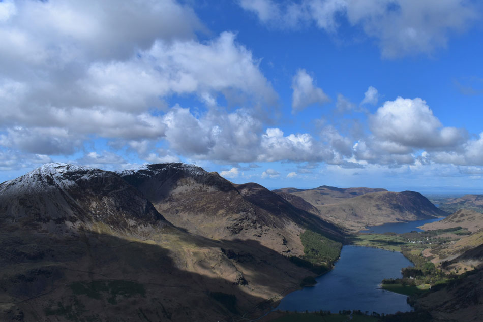
| Hay Stacks, High Crag and High Stile from Buttermere. |
Gone were the blustery summits, my descent was blessed in afternoon sunshine where If I hadn't have been closer to my car layers would have been removed. The closer I got to the pass the more realisation started to kick in as the sound of cars and motorbikes broke the silence but with that said it still took a few minutes adjusting until I entered back into the real world.
A creaking gate gained access back onto the pass where I kicked my heels into the backs of my boots. Within minutes I will be back at car squeezing the last bottle of Lucozade Sport into submission as I re-tap my energy levels. It's a two hour drive home but before I leave I took this one last photo of three of the summits that had gained me so much pleasure today. This isn't a round for the faint hearted, it's a tough day both physically and mentally but it comes with the odd surprise such as I had while gaining Fleetwith Pike when everything around me just fell into place. |
|
| |
| Back to top |
 |
|