|
Helvellyn via Nethermost Pike East Ridge |
 |
 |
4th June 2021 |
 |
|
Fully recovered I planned to take advantage of the great weather and end my walking week with something a bit special, trouble was I didn't know what that special walk was going to be. During an exchange of emails last week between Rod and myself I hinted I fancied to climb Helvellyn possibly via Nethermost Pike east ridge, a route that I descended back in October 2012 later exploring Ruthwaite Cove and Nethermost Cove with David and Rod in May 2015. Rod replied insisting I must walk Nethermost Pike east ridge, a route that Rod climbed back in April this year where he was met with low cloud half way up the ridge.
The route itself is quite arduous but easy to locate from the footbridge which crosses Nethermostcove Beck. Eagle Crag dominates over 1,000ft of steep ascent accompanied by the sound of Nethermostcove Beck as it cascades to the Grisedale Valley below. It is not until Nethermost Cove is reached does the east ridge appear where a further 160ft of steep ascent is required until the east ridge is reached 'proper' The walker has the choice to head directly along the lower spine of the ridge or outflank it by heading left for a less strenuous ascent before the real climbing begins, I mixed it up a little and explored both.
At the base of the buttress the walker can head left and take in Hard Tarn or climb directly using a well trodden steep path which weaves steeply between the rock before the final rock arete which leads directly onto Nethermost Pike summit plateau. If like me you wanted to take in the view over Hard Tarn be prepared for an exposed grass/ledge route which leads directly back to the main path. If your the type of person who enjoys the likes of Striding Edge or Sharp Edge but you haven't climbed Nethermost Pike east ridge yet I can fully recommend it and I can guarantee you will not be disappointed. If you much prefer to view the east ridge from the comforts of your armchair then please carry on reading. |
|
| Wainwright Guide Book One |
 |
| The Eastern Fells |
Nethermost Pike East Ridge
On this side a narrow rocky ridge bounded by forbidden crags falls steeply between twin hollows, deeply recessed, in a wild and lonely setting, here is solitude, for here few men walk. Here too, is a gem of a tarn. |
 |
|
|
|
|
| |
|
Overview |
|
|
| Ascent: |
3,227 Feet - 984 Metres |
| Wainwrights: |
3, Nethermost Pike - Helvellyn - Catstye Cam |
| Weather: |
Hot, Dry & Sunny. Feeling Fresh Across The Summits. Highs of 23°C Lows of 12°C |
| Parking: |
Patterdale Football Club |
| Area: |
Eastern |
| Miles: |
8 |
| Walking With: |
On My Own |
| Ordnance Survey: |
OL5 |
| Time Taken: |
5 Hours 20 Minutes |
| Route: |
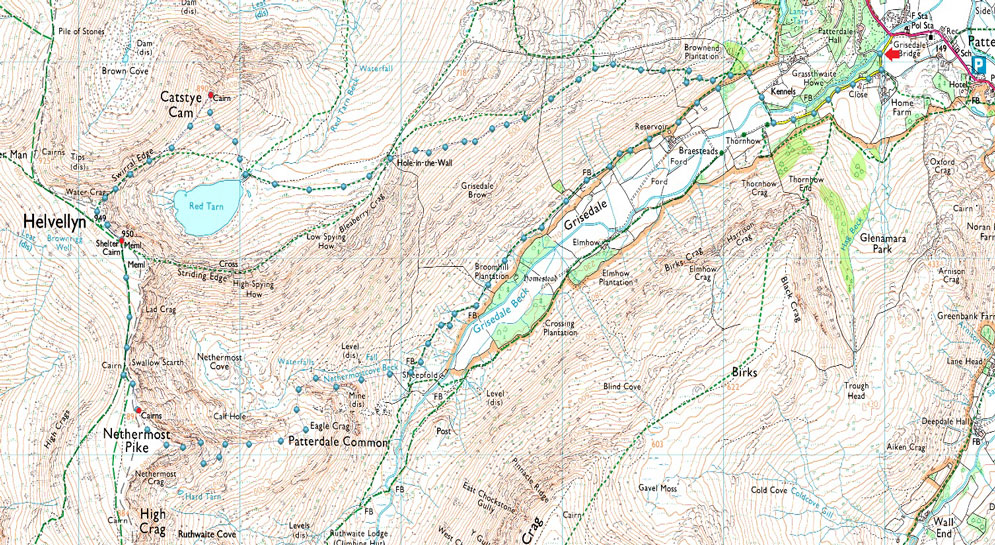
Grisedale Lane - Grisedale - Nethermostcove Beck - Nethermost Pike East Ridge - Nethermost Pike - Helvellyn - Swirral Edge - Catstye Cam - Red Tarn (Helvellyn) - Hole-in-the-Wall - Grisedale - Grisedale Lane |
|
| |
|
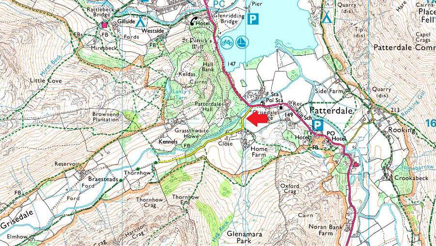
Parking Details and Map |
|
|
| Nearest Post Code: |
CA11 0NW |
| Grid Reference: |
NY 389 160 |
| Notes: |
Home to Patterdale Football and Cricket clubs this car park is large enough to accommodate up to twenty cars although at the time of writing this surface work was being carried out which limited spaces, a donation of £3.00 is required to park. The donation box is located to the left of the entrance gate. UPDATE All day parking charges have risen to £5.00 as of 04/06/21 |
|
| |
|
Map and Photo Gallery |
|
|
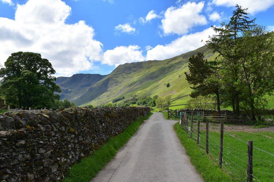 |
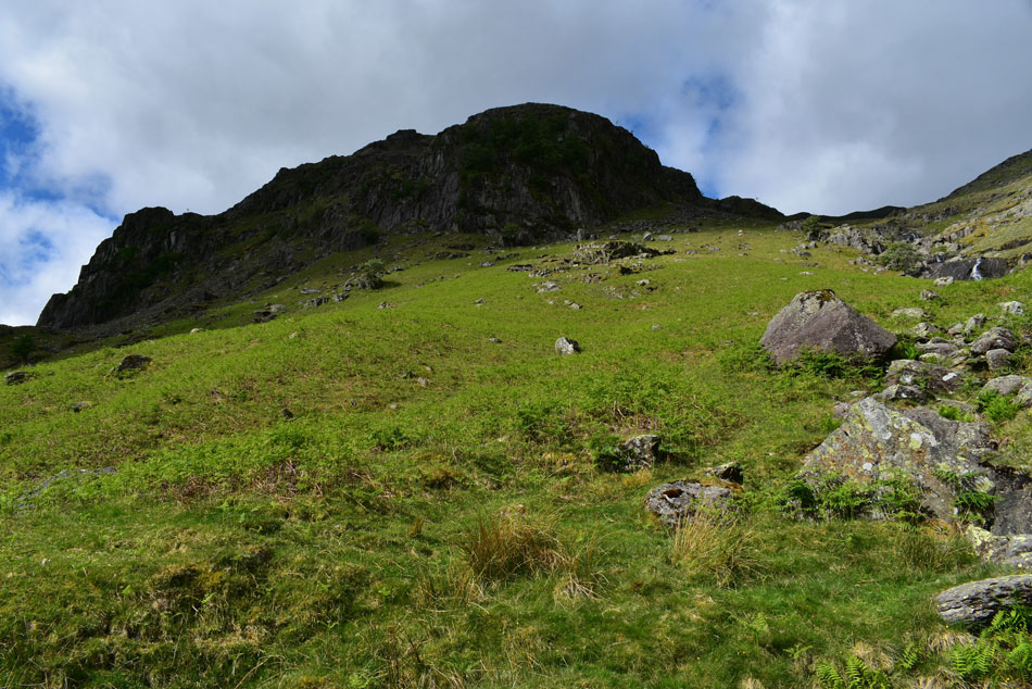
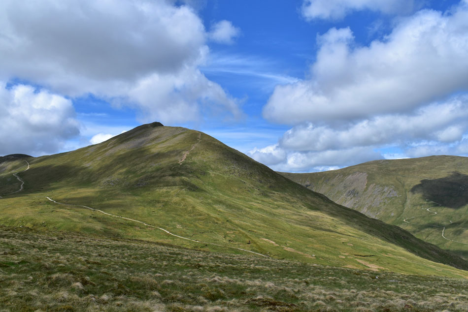
| Nethermost Pike and Nethermost Pike East Ridge from Grisedale Lane, Grisedale 08:15am 13°C |
Patterdale was starting to come alive as I drove through - its car parks were mostly full but there was still a few off street parking spaces left which I drove past in favour of parking at the home of Patterdale Football and Cricket Club where I managed to park easily. An honesty box is located next to the entrance which has been replaced by a parking attendant who made sure everyone paid there £5.00 before leaving.
I left more or less at the same time as a family but quickly overtook them such my eagerness to get underway. The lane rises from the village and soon views of Nethermost Pike and Dollywagon Pike dominate the head of the Grisedale Valley. It's nowhere near as hot as the beginning of the week with temperatures in the low teens for now and best of all, the haze has lifted. I couldn't have asked for a better start to the day. |
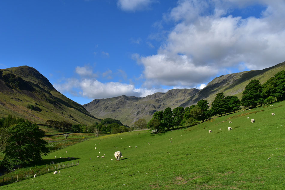 |
| Views widen as I cross the valley. |
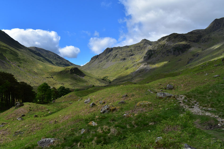
| That's Dollywagon Pike and Ruthwaite Cove over on the left with Nethermost Pike, Nethermost Cove and Nethermost Pike east ridge seen right. As mentioned there's a heck of a climb to reach the east ridge 'proper' which I know will be worth the effort but for now it's a gentle 1.6 mile stroll through the valley until Nethermostbeck is reached. |
 |
| Here's a close up of Dollywagon Pike and Nethermost Pike. |
| The tree in the foreground is hiding Eagle Crag which dominates the intial ascent alongside Nethermostcove Beck. |
 |
| Dollywagon Pike and Nethermost Pike from Braesteads. |
| The ridge below Dollywagon Pike is known as The Tongue which along with Nethermost Pike east ridge forms a classic glacial 'U shape' cove. |
 |
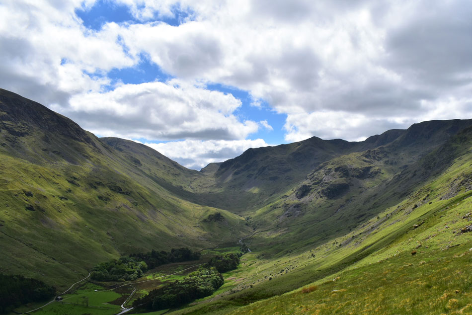
| St Sunday Crag. |
| Appears with Grisedale Hause seen over on the right. |
 |
| In this photo... |
| ...Fairfield now appears to the left of Grisedale Hause. |
 |
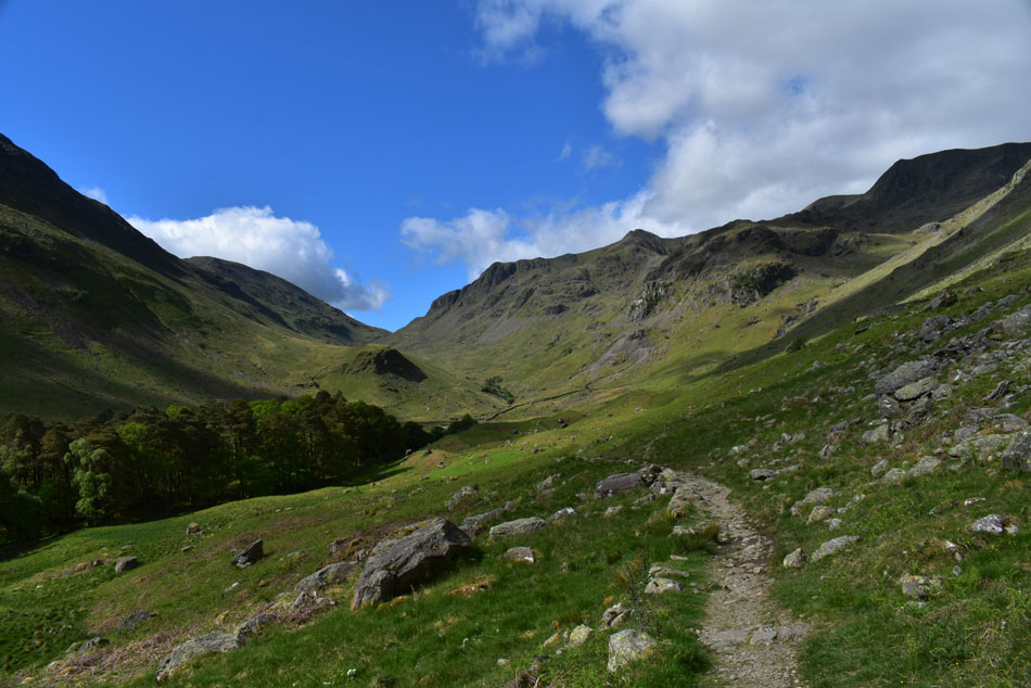
| Fantastic Grisedale. |
| What a day to be out on the hill, conditions couldn't be more perfect. |
 |
| Fairfield and Grisedale Hause dominate the view for now. |
| The wall in the foreground is the same wall which forms Hole-in-the-Wall another 1,500ft above the Grisedale valley. |
 |
| Where Eagles dare. |
| My route alongside Eagle Crag appears vague due to the young Bracken which shouldn't cause any trouble as it's only boot height for now, mind you if I'd have left this walk a few weeks longer Id be forced to wade through waist high Bracken which wouldn't be pleasant at all given how steep the ground is. |
 |
| Looking back through the Grisedale Valley. |
| Towards Place Fell. |
 |
| Gulp. |
| After crossing the Footbridge over Grisedale Beck I pick up the start of the footpath which will eventually flank Eagle Crag to my left. Nethermostcove Beck is just out of shot on the right. |
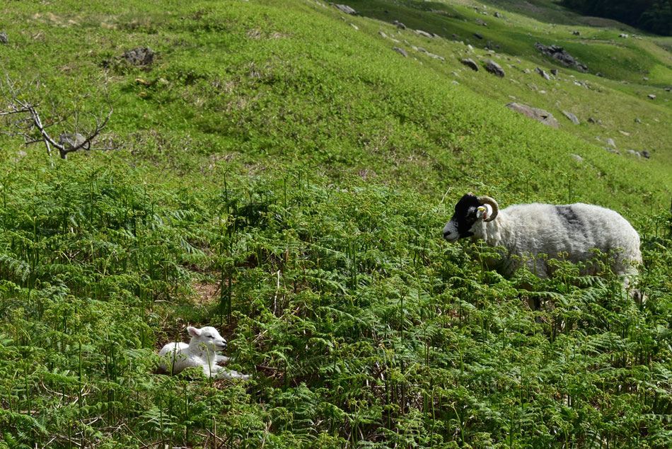 |
| Cute. |
| After a steep short pull I arrive at a break in a stone wall where a wooden fence links the wall back together, up against the fence a group of boulders can be used to help pass over the fence - I commit by throwing my walking poles over first, pass the fence easily before spotting this lamb and its mother enjoying the sunshine. |
 |
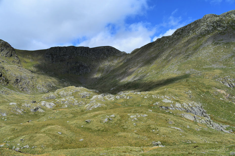
| My first view of Nethermost Cove appears with Nethermostcove Beck seen to the right. |
| After the initial 500ft of ascent Nethermost Cove appears and after resting for a few moments I needed to make my mind up on which part of the Cove do I aim for? All routes are direct its just which one suited me most, by heading left I could have gained the Cove via a steep grassy rake or continue ahead and aim for the flat looking ground between the tree and Nethermost Pike east ridge summit seen left, I go for the latter. |
 |
| Almost there. |
| As Helvellyn and Striding Edge appear over on the right. |
 |
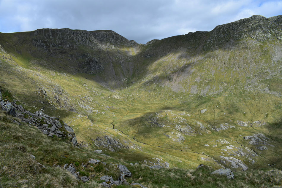
| Helvellyn, Lad Crag and Striding Edge from Nethermost Cove. |
| Protected from the elements 900ft above me I can hear the voices of walkers as they traverse Striding Edge, it's purely surreal you really have to stand here just to take it all in. What a place and what a walk choice. |
 |
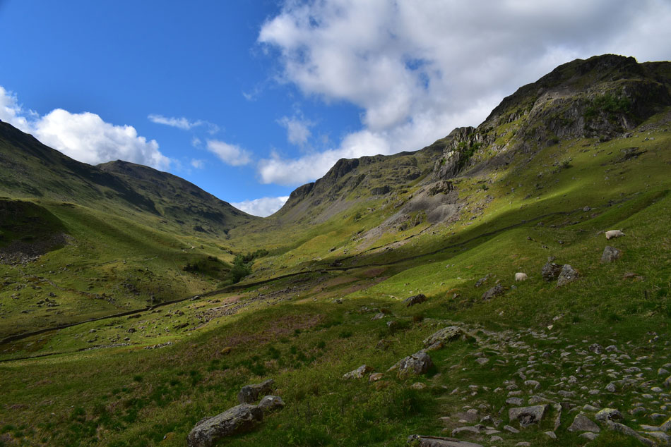
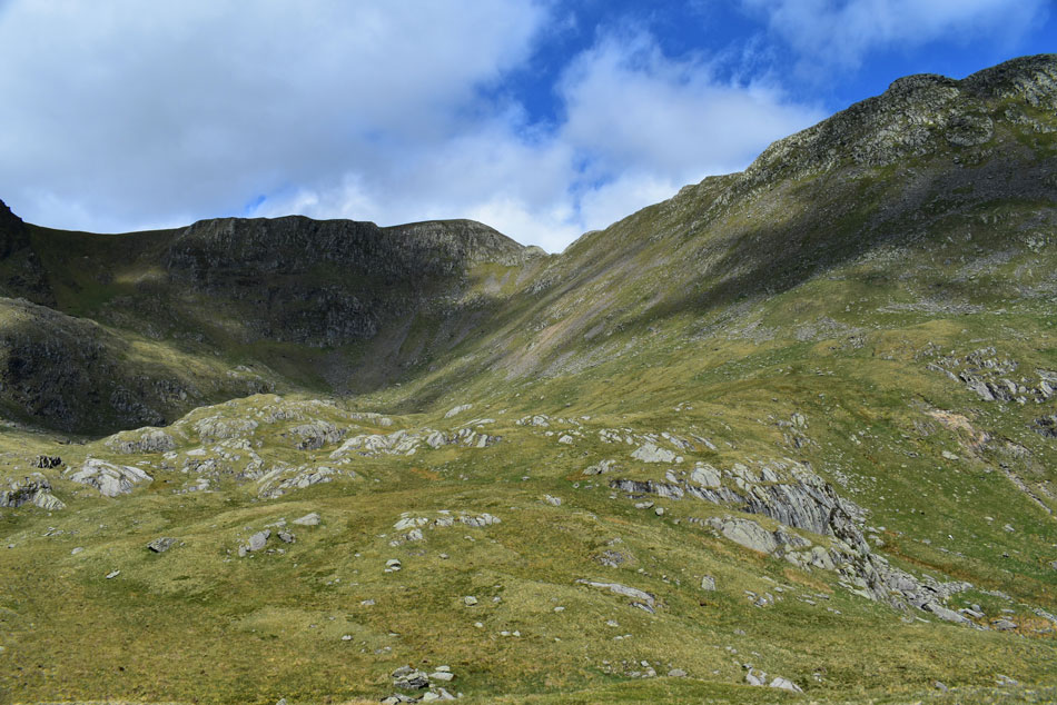
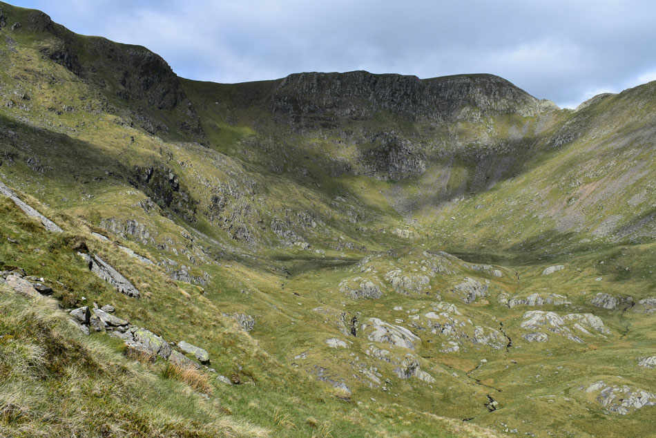
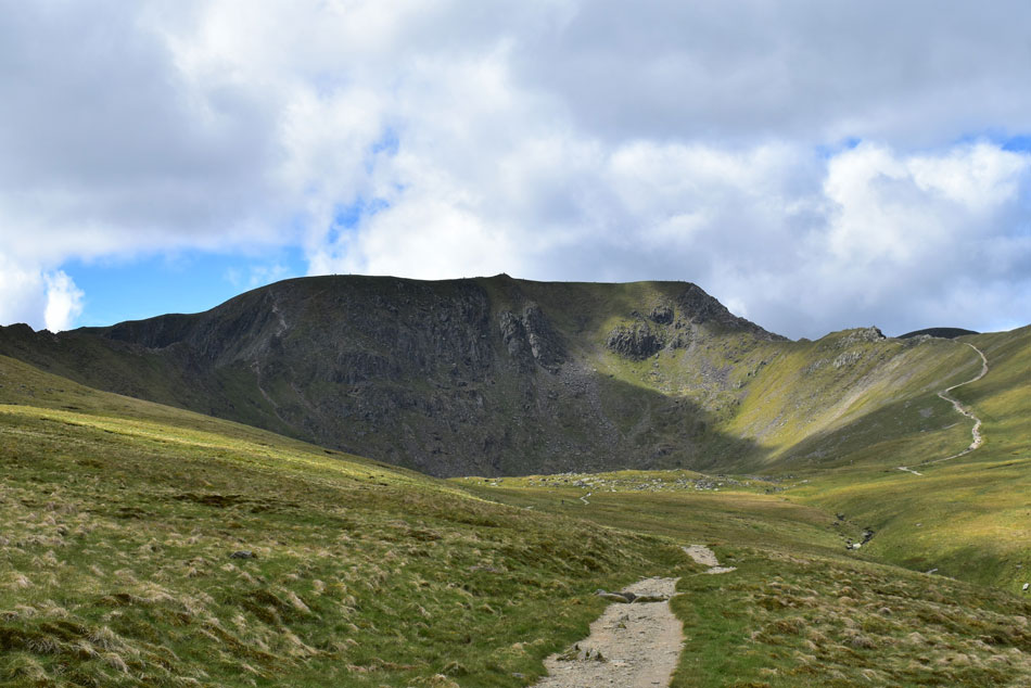
| Nethermost Pike East Ridge from Nethermost Cove. |
| I still have to climb out of Nethermost Cove until the ridge is reached 'proper' but for now, and while I get my breath back I continue to take it all in. |
 |
| Lad Crag, Helvellyn and Striding Edge form Nethermost Cove. |
| Gaining ground on Nethermost Pike east ridge I couldn't but help stop to take in the views. |
 |
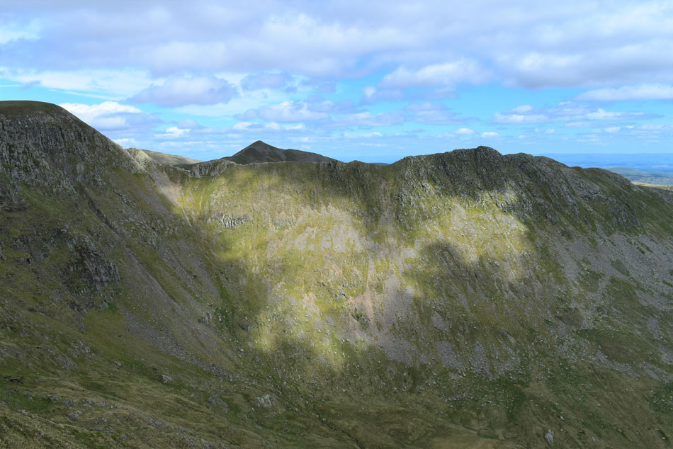
| Nethermost Pike East Ridge peak (seen far left) Lad Crag and Helvellyn. |
| It's hard to imagine that I'm looking at 450 million year old process that started life under the sea. Around 28,000 years ago the Lake District was still under ice but it is possible that these summits would have protruded the ice known as a Nunatak (a rocky island which protrudes above the ice) |
 |
| Helvellyn and Striding Edge above Nethermost Cove. |
| |
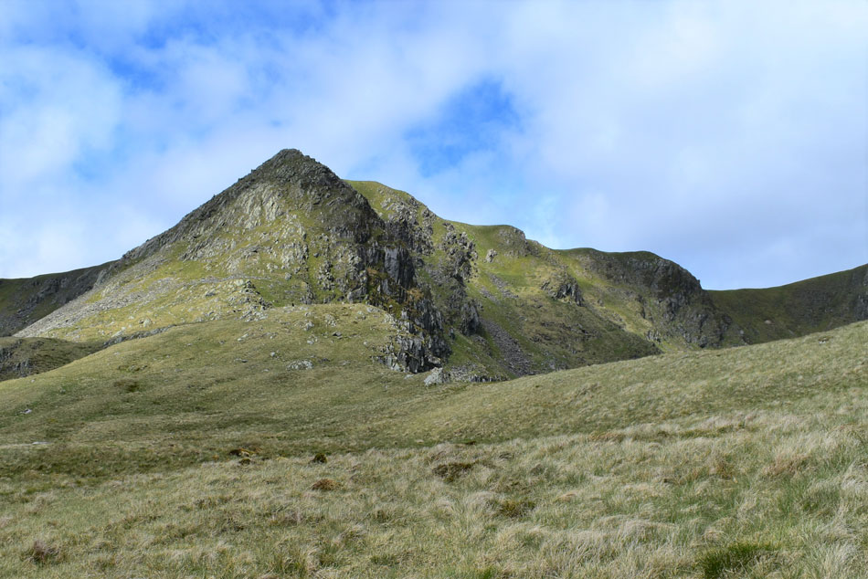 |
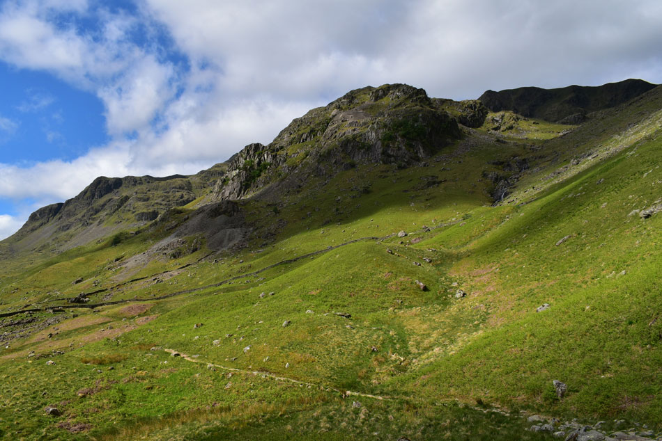
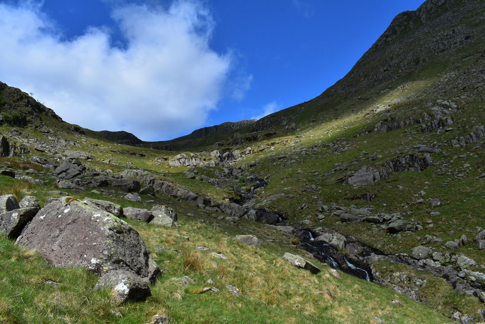
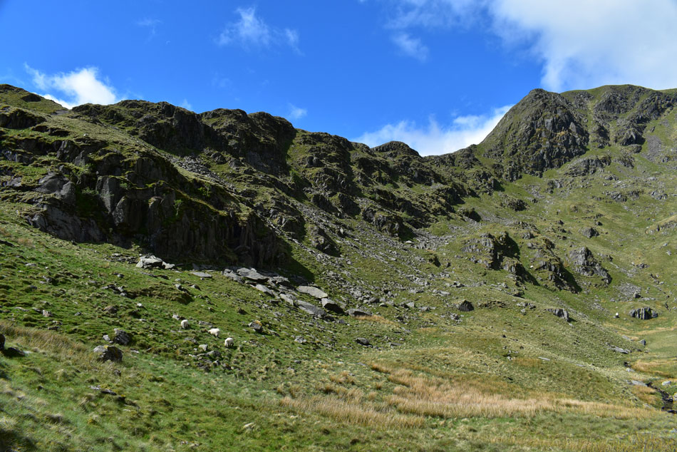
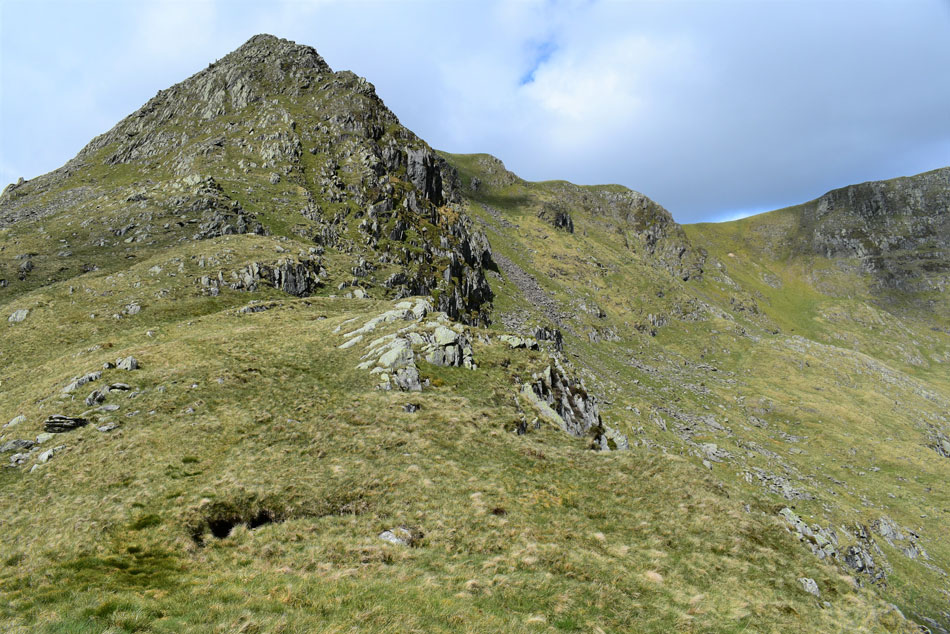
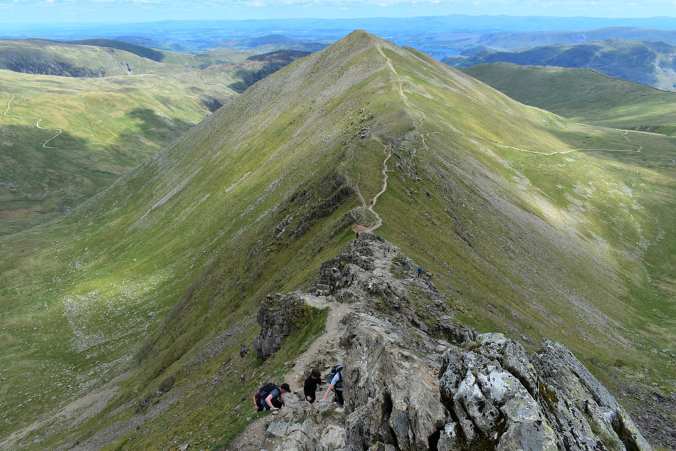
| The rock butress that forms the peak of Nethermost Pike East Ridge. |
| I crested the ridge 'proper' and found that I still had ground to gain in the form of grassy undulations which formed at the end of the ridge which can be outflanked by heading left as I did before rejoining the ridge afterwards. |
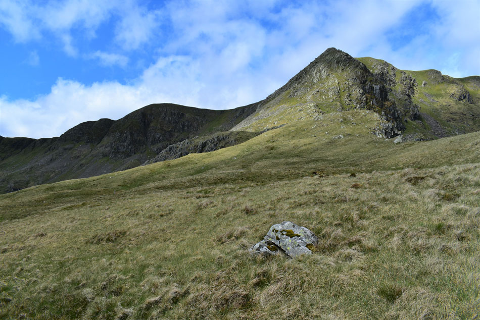 |
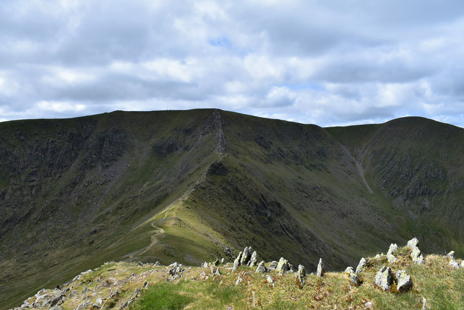
| Nethermost Pike East Ridge seen with Black Crag over Ruthwaite Cove on the left. |
| My plan of attack is to head over to the area above Hard Tarn which I will do by heading towards the buttress then climb left through the patch of scree. |
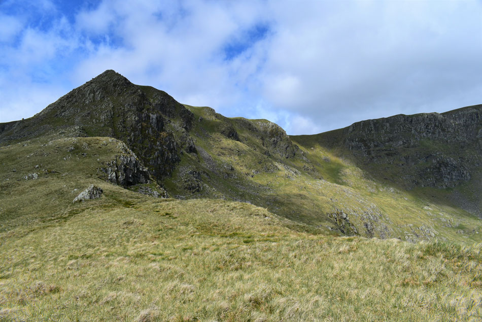 |
| Nethermost Pike East Ridge above Nethermost Cove. |
| It maybe bright and sunny but boy had the temperature dropped which has forced me to de-shoulder and add my soft shell jacket. |
 |
| Helvellyn and Striding Edge over Nethermost Cove. |
| Eventually Nethermostcove Beck will flow into Grisedale Beck, then through Patterdale via Grisedale Bridge and eventually into Ullswater. Should you ever be sat looking down on Grisedale Beck eating your ice cream on Grisedale Bridge spare a thought where the water your looking at started its life. |
 |
| Nethermost Pike East Ridge. |
| The ground begins to steepen again as I head towards the large boulder seen over on the far left. |
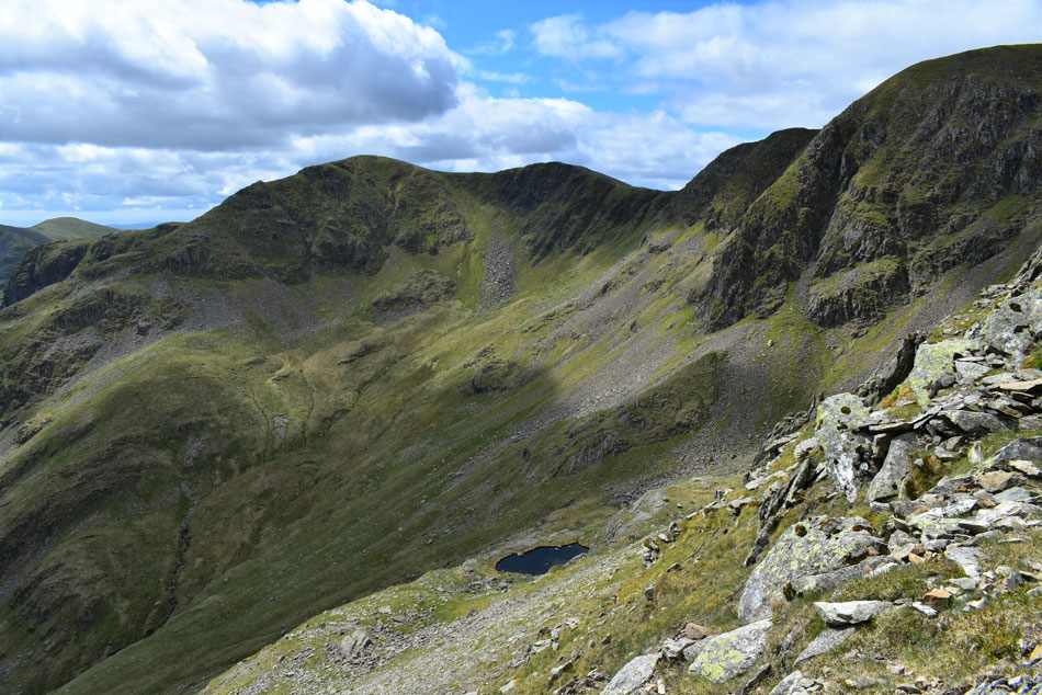 |
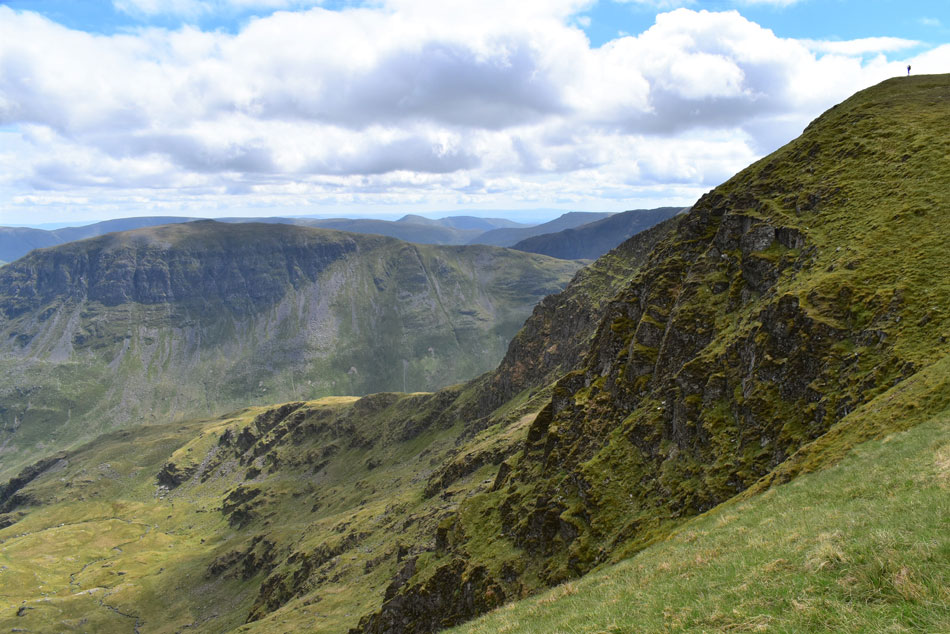
| Dollywagon Pike, The Tongue, Black Crag and Hard Tarn over Ruthwaite Cove. |
| I'd actually gained more height than first thought which worked out well as Hard Tarn came into view. At one point I was so close I could see the bottom of the Tarn and the large familiar slab of rock where many a tent has been pitched. Hard in name and certainly hard in nature, what a place. |
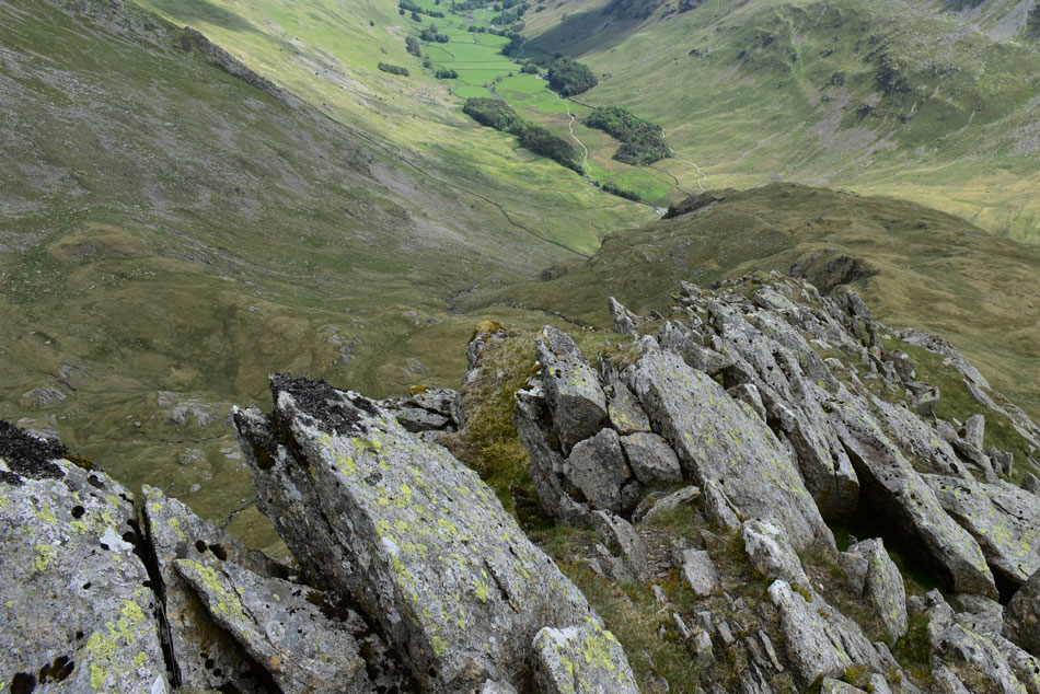 |
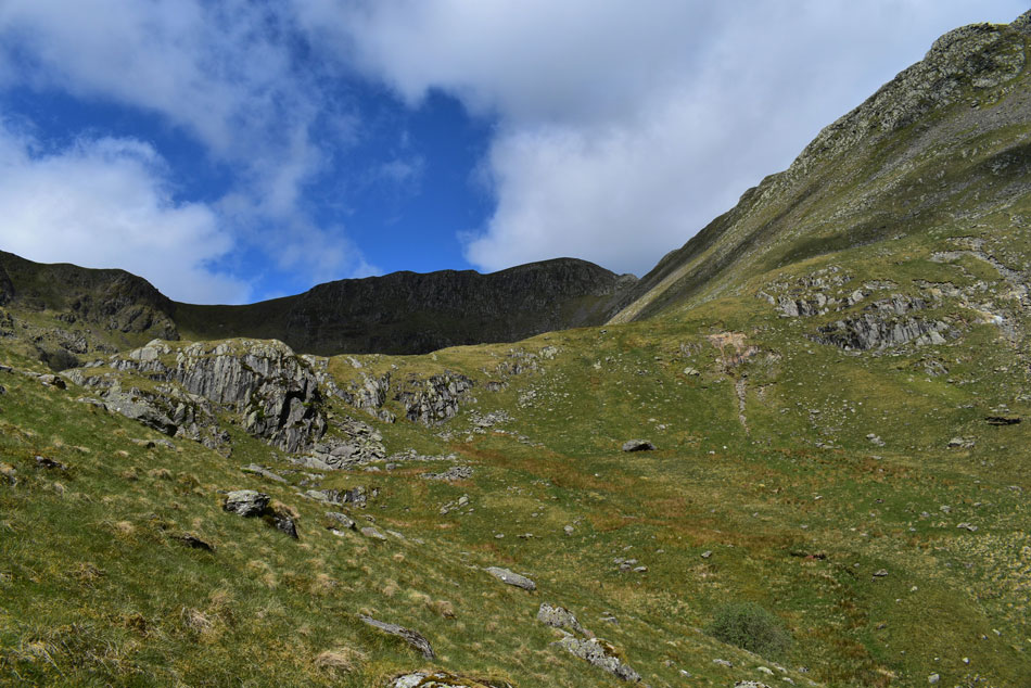
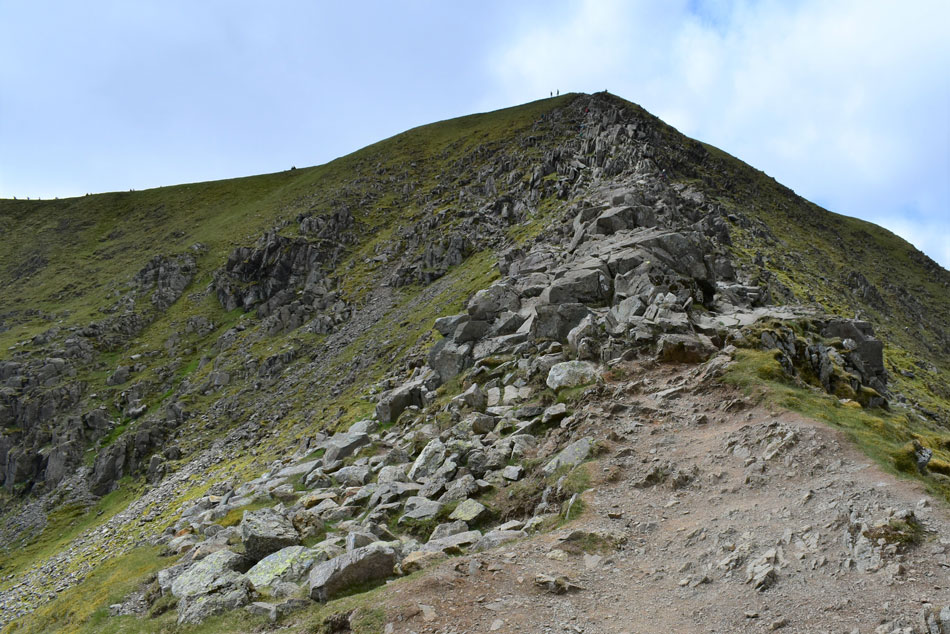
| The Grisedale valley from the rock arete atop Nethermost Pike East ridge. |
| I linked back up with the main path below the rock arete by means of an exposed grassy terrace from which I began climbing the final spine of the ridge which forms a rock arete close to its summit, the arete is narrow and in places it is advised that four points of contact are required to traverse it safely. |
 |
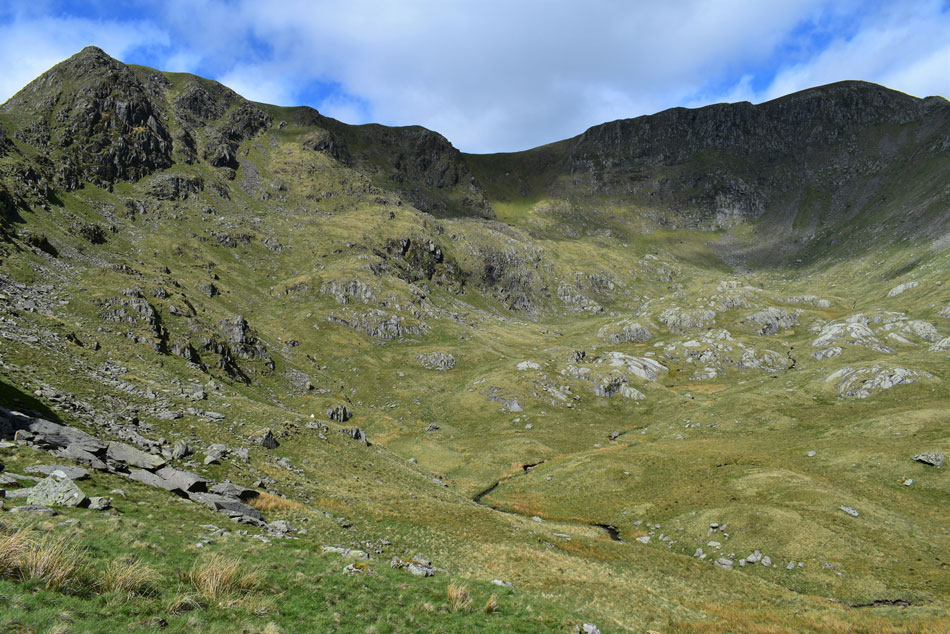
| Helvellyn, Catstye Cam and Striding Edge seen over Nethermost Cove. |
| Taken from the summit of Nethermost Pike east ridge. |
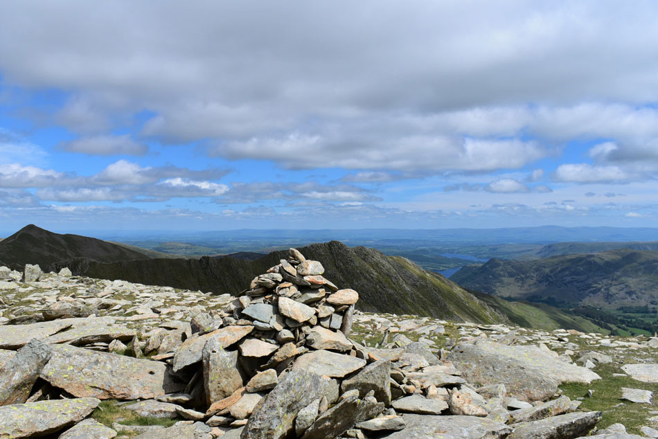 |
| Helvellyn, Catstye Cam and Striding Edge from Nethermost Pike summit. |
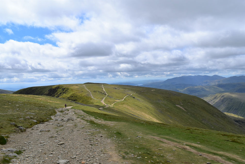
| A short grassy col links the east ridge to the summit plateau where adjustments were made to clothing before I walked towards the summit where two walkers had just left in the direction on Black Crag. For a few moments I took in the view then added a pair of sunglasses as the wind was quite strong and left for the final plod up Helvellyn. |
 |
| Helvellyn from Nethermost Pike. |
| With Catstye Cam seen far right. |
 |
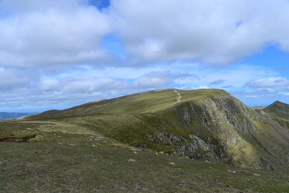
| From the top of Nethermost Cove. |
| Time to look back on ground covered, no wonder everything hurts. |
 |
| Looking back on Nethermost Pike. |
| |
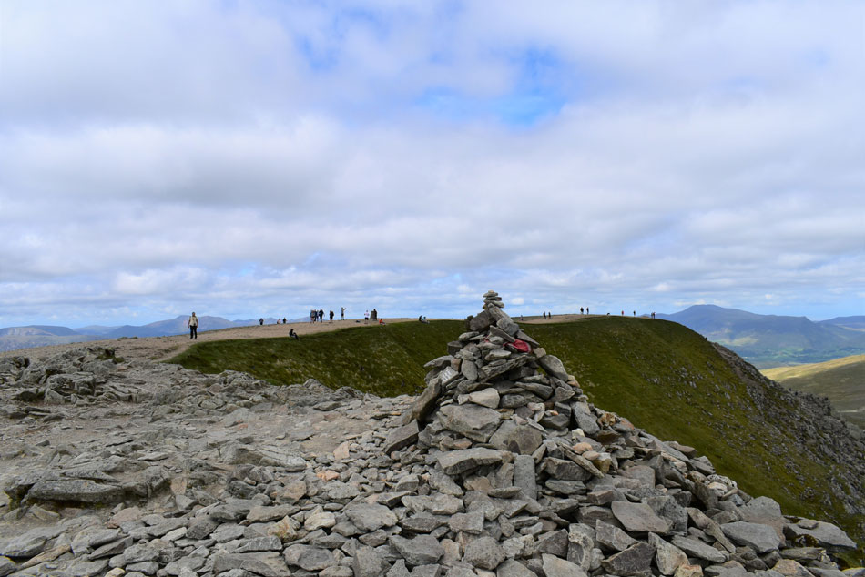 |
| Hevellyn. |
| The vast majoirty of people on Helvellyn had ascended from either Striding Edge or from the Thrilmere side leaving the summit shelter and summit looking as busy as I'd seen it in a while. |
 |
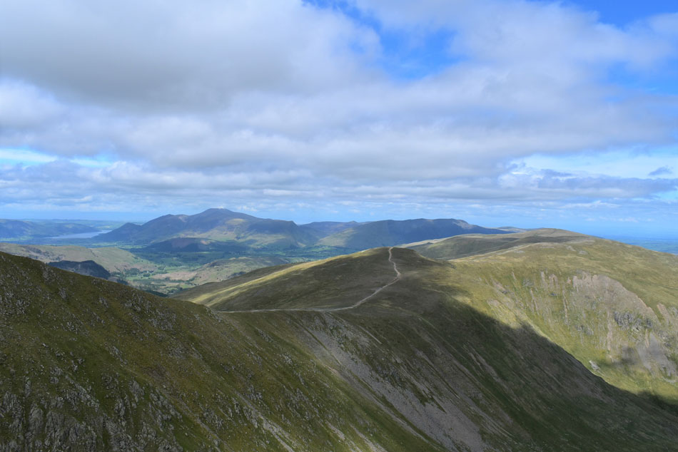
| Views over Brown Cove towards Helvellyn Lower Man. |
| With a distant Bassenthwaite Lake seen in the beyond. |
 |
| White Side, Raise and Stybarrow Dodd seen over Brown Cove. |
| With the Skiddaw and Blencathra group beyond. |
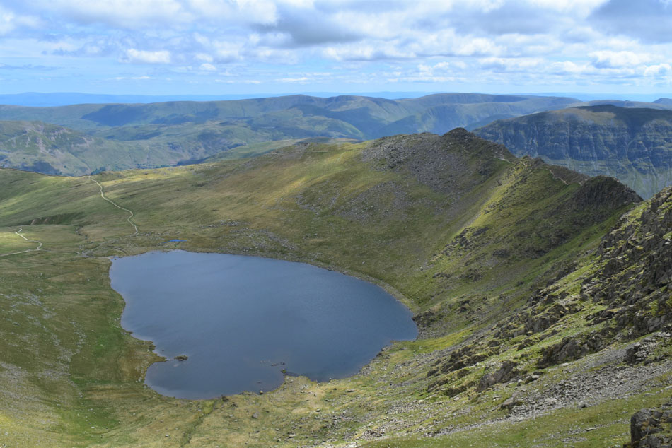 |
| Before I make my descent via Swirral Edge. |
| I take in the view over Red Tarn and Striding Edge. |
 |
| Catstye Cam from Swirral Edge. |
Having made my way towards the top of Swirral Edge I was just about to start my descent when I decided to take the previous photo and within what only felt like seconds I was joined by two groups of three and more on their way from the direction of the trig point. By now I was holding the groups up some of whom looked down worryingly.
One of which was a young girl and her boyfriend who caught my eye "have you been down before I asked" the girl nervously laughed and replied "first time" I looked at them both and replied "feel free to follow me, don't be afraid to switch which side you're descending by and definitely don't be embarrassed to use your bum" They both followed and once the worst was over the couple confidently found their way down to the col below. |
 |
| Looking back on Swirral Edge. |
| Ok, time to refuel. |
 |
| Lunch with a view. |
| I crossed the col and began my ascent on todays final summit, Catsye Cam. The breeze had picked up by now and it was a tad uncomfortable to sit in but I managed to find a sheltered spot just below the summit where after a few minutes the sun came out. |
 |
| Looking back on Helvellyn with Striding Edge seen left and Swirral Edge seen right. |
| |
 |
| Catstye Cam. |
| Is viewed as I make my way towards Hole-in-the-Wall. |
 |
| Birks, Place Fell, Boredale Hause, Angletarn Pikes, Brock Crags, Rest Dodd, Wether Hill, Rampsgill Head, High Raise, and High Street. |
| Hole-in-the-Wall was busy with folk sat on the wooden sty who I had to ask would they mind they move so I could get over which was quickly followed by an apology. I was back in the heat of the afternoon so off came the soft shell and on stayed the sunglasses. |
 |
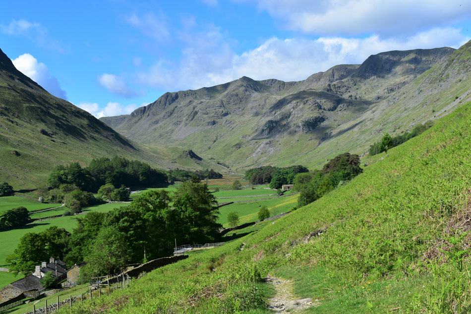
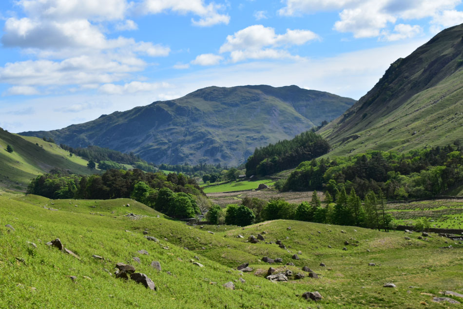
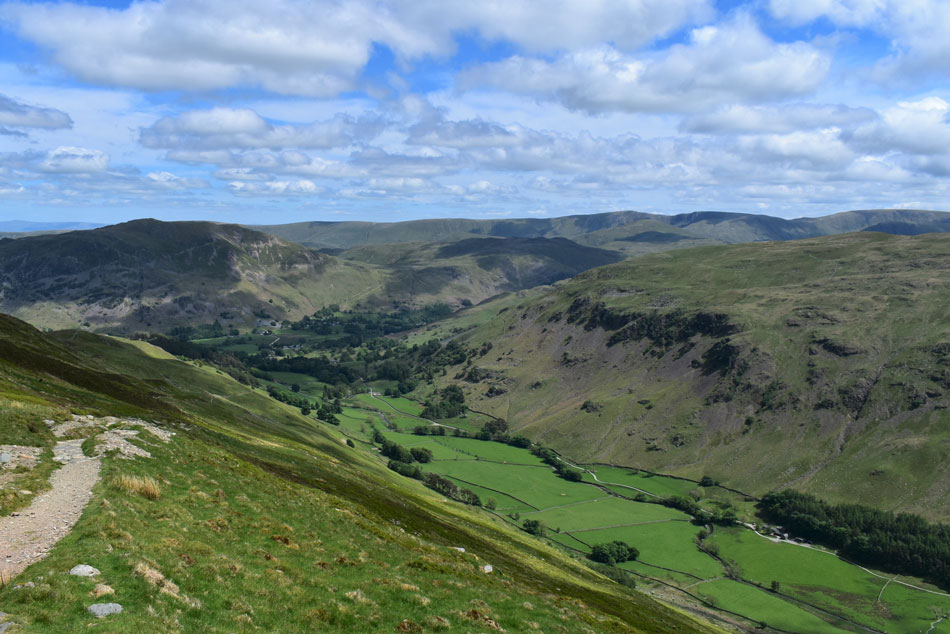
| The Grisedale Valley. |
| With St Sunday Crag seen left, Fairfield and Grisedale Hause, Dollywagon Pike and Nethermost Pike. |
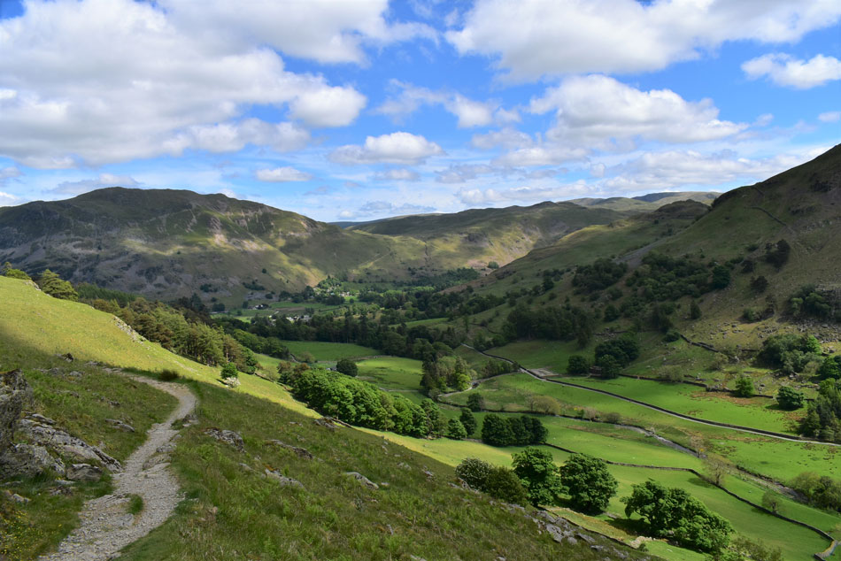 |
| Place Fell, Boredale Hause, Angletarn Pikes and Grisedale. |
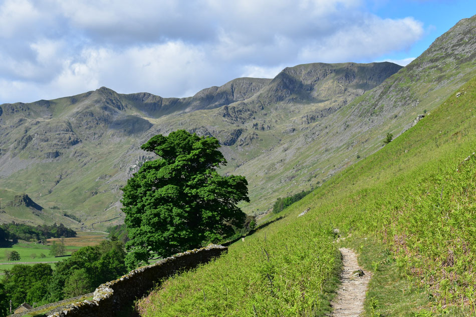
I seemed to make good progress with my descent and before I knew it I was crossing the valley towards Grisedale Lane. Families walked through the fields where Hi's are exchanged. It feels like a proper Summers day as I walk down the lane towards the car park accompanied by Grisedale Beck which fell steeply to my left as sunlight streaks through the canopy of trees leaving hot pockets of air to pass through. The car park still isn't full, perhaps not that many people know about it as it isn't sign posted that well, and long may it continue given these crazy busy times.
I finish off a bottle of Lucozade and dropped all the car windows to let the heat escape then whacked the air conditioning to almost full blast in an effort to cool my car down. At the back of my car I sat down on my little tripod chair and eased my boots off which were still covered in dust from Fleetwith Pike mine track and I reckon If I looked a little closer I'd probably find mud from Caw Fell too. |
|
| |
| Back to top |
 |
|