|
Red Pike Direct |
 |
 |
2nd July 2021 |
 |
|
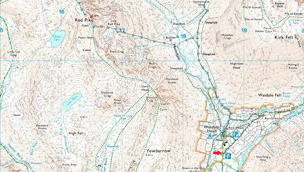
During the week I returned to my lock down walks 'to do' list and hovered over one of Lakelands classic horseshoes The Mosedale Horseshoe and to make things interesting why not gain Pillar via the High Level Traverse. I had already planned to visit the Y Boulder in the Mosedale valley after descending Red Pike via Dorehead Screes before my attention turned to a direct ascent on Red Pike via a stone wall which ran from the Mosedale valley to a ridge/buttress approximately 300 ft below Red Pike summit.
I then set upon researching the route scouring books and the internet and yielded nothing. After that I emailed David first asking was it a route he had ever attempted his reply was no but after showing him a screen shot of my suggested route David replied "it looks really steep but it they can build a wall up there then I'd say it's do-able" The wall was a huge clue which started its origins below Mosedale Crags on Kirk Fell west flank before crossing the valley basin then rose 2,100 ft towards Red Pike summit.
I still had doubts about the last 300 ft so I found alternative plan B routes of ascent just in case I was left looking at un-climbable buttresses of rock. All I needed now was for the conditions to be perfect. |
|
| Wainwright Guide Book Seven |
 |
| The Western Fells |
| There are several Mosedales and the best known of them, and the best, is the one branching from Wasdale Head. The circuit of the ridges around this side-valley is a succession of exciting situations and fine vantage points in rugged surroundings |
 |
|
|
|
|
|
| |
|
Overview |
|
|
| Ascent: |
3,796 Feet - 1,157 Metres |
| Wainwrights: |
4, Red Pike (Wasdale) - Steeple - Scoat Fell - Pillar |
| Visiting: |
2, Low Red Pike - Looking Stead |
| Weather: |
A Warm Sunny Day With Varied Cloud And Light Winds Across The Summits. Highs of 20°C Lows of 15°C |
| Parking: |
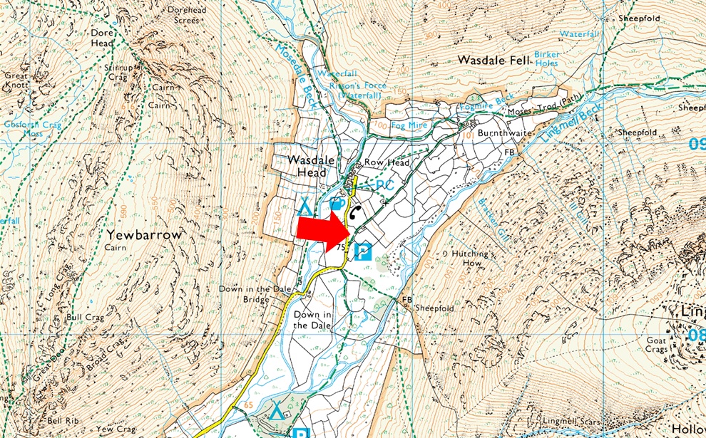
Car Park, Wasdale Head |
| Area: |
Western |
| Miles: |
8.5 |
| Walking With: |
On My Own |
| Ordnance Survey: |
OL4 |
| Time Taken: |
6 Hours 15 Minutes |
| Route: |
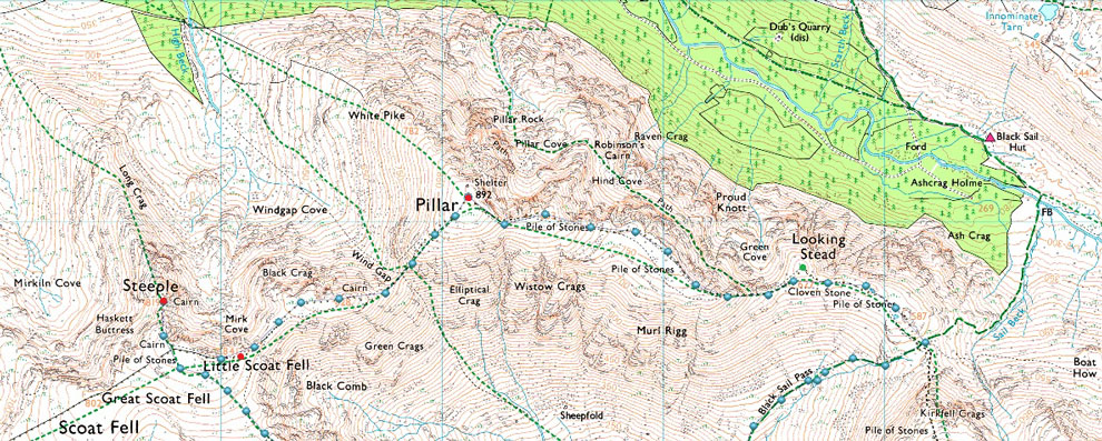
Wasdale Head - Mosedale - Mosedale Beck - Y Boulder - Low Red Pike - Red Pike - Steeple - Scoat Fell - Black Crag - Wind Gap - Pillar - Looking Stead - Top of Black Sail Pass - Gatherstone Beck - Mosedale - Wasdale Head |
|
| |
|
Parking Details and Map |
|
|
| Nearest Post Code: |
CA20 1EX |
| Grid Reference: |
NY 186 708 |
| Notes: |
Probably one of the more popular car parks in Lakeland due to its proximity to Scafell Pike meaning that the car park at Wasdale Head is very popular all year around and is large enough to accommodate around forty cars and mini buses. Despite its popularity you may only struggle to park here during mid Summer or late into the afternoon. |
|
| |
|
Map and Photo Gallery |
|
|
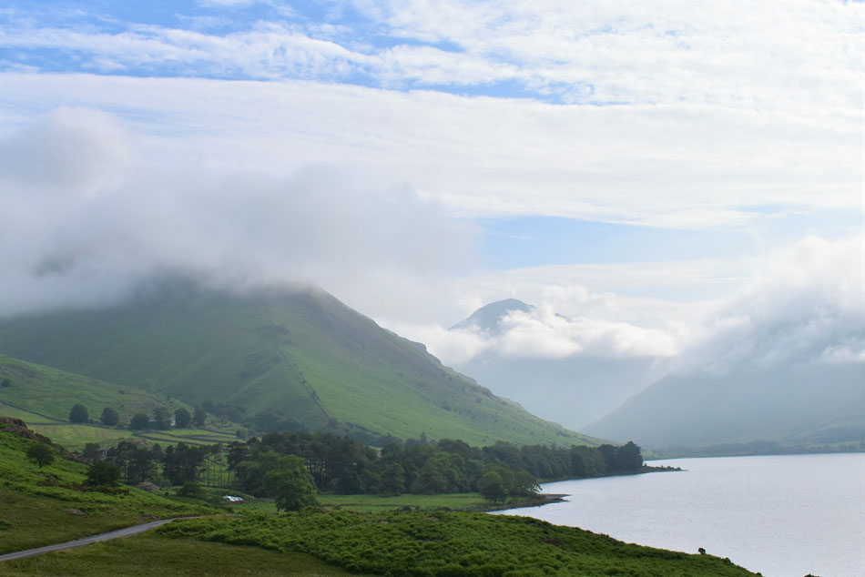 |
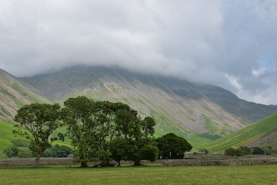
| Yewbarrow and Great Gable misted in valley cloud from the shores of Wast Water. |
| To be honest the thought of achieving a direct ascent on Red Pike went out of the window the moment I saw the lingering valley cloud and after so much research into the route I switched to my plan B walk of the Mosedale Horseshoe via Black Sail Pass. |
 |
| Pillar from Wasdale Head 08:30am 15°C |
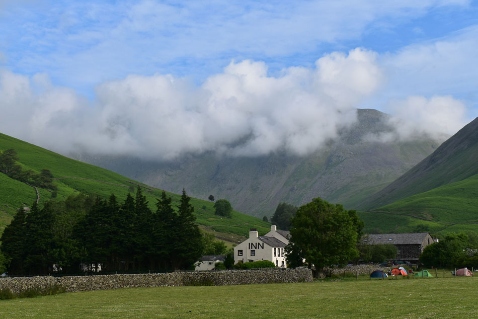
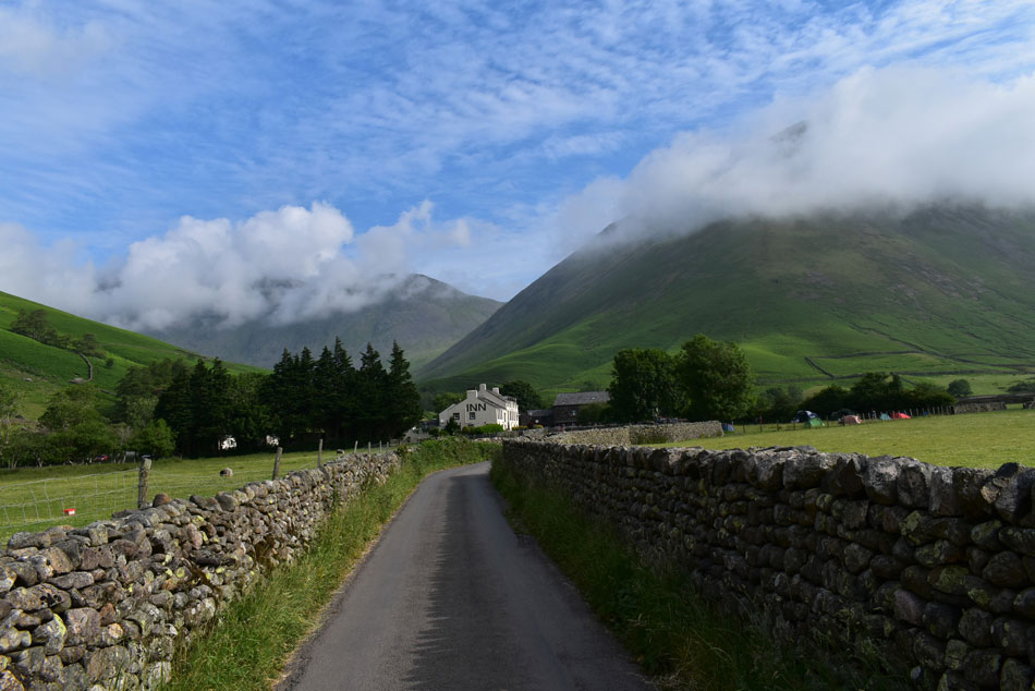
| Before returning to my car back at Wast Water I watched the cloud most of which was lifting only to be replaced by more cloud but the potential was there, I may be climbing Red Pike direct after all I thought. Soon after I arrived at Wasdale Head and parked easily facing Lingmell, the car park was quiet with another couple kitting up right opposite me, other than that and a few parked cars it was just us. After planning to set off around 09:00am I resisited a hasty kit up making sure laces were fastened tightly and gear was present and correct. The tempreature is in the mid teens already and with the humidity climbing I fold my jacket neatly into my pack before finishing off a 1ltr bottle of Summer fruits.
More cars started to arrive and what was once a deserted car park started to get busy, annoyingly one of the cars parked side on taking up two spaces, i just didnt get it and felt the need to leave but I resist and instead had a wander over to the edge of the field and started to take a few photos of the atmospheric cloud all the while feeling delighted, yet slightly puzzled why there was blue sky and sunshine overhead when what was forecast was cloud and more cloud. |
 |
| Kirk Fell from Wasdale Head. |
| For once I don't mind being on the receiving end of a wrong forecast although I must admit I'd have been pretty annoyed if I decided against the walk going off what the forecast had said. |
 |
| Great Gable and St Olaf's Church hidden in the coppice of trees in the foreground. |
| Time for one last photo before I lock the car and head out. |
 |
| Heading for Mosedale with views of Pillar and Kirk Fell. |
| |
 |
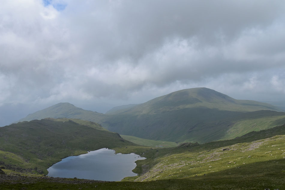
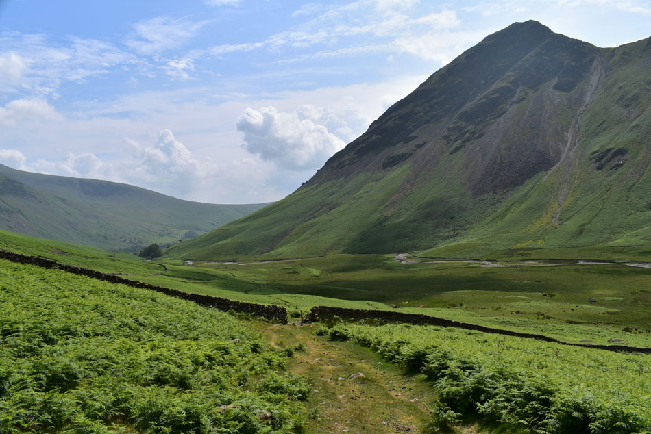
| Red Pike (Wasdale) and Pillar from the Mosedale Valley. |
| From the car park I passed The Inn and joined the footpath alongside Mosedale Beck where I sighted a family heading straight up the nose of Kirk Fell. By now the temperature was starting to climb and despite the lingering cloud I make a mental commitment on Red Pike from Mosedale. The cloud appears to be rising which was great news - the not so good news was it was replaced by more cloud but it's the blue sky above which is a good sign the cloud will eventually lift. |
 |
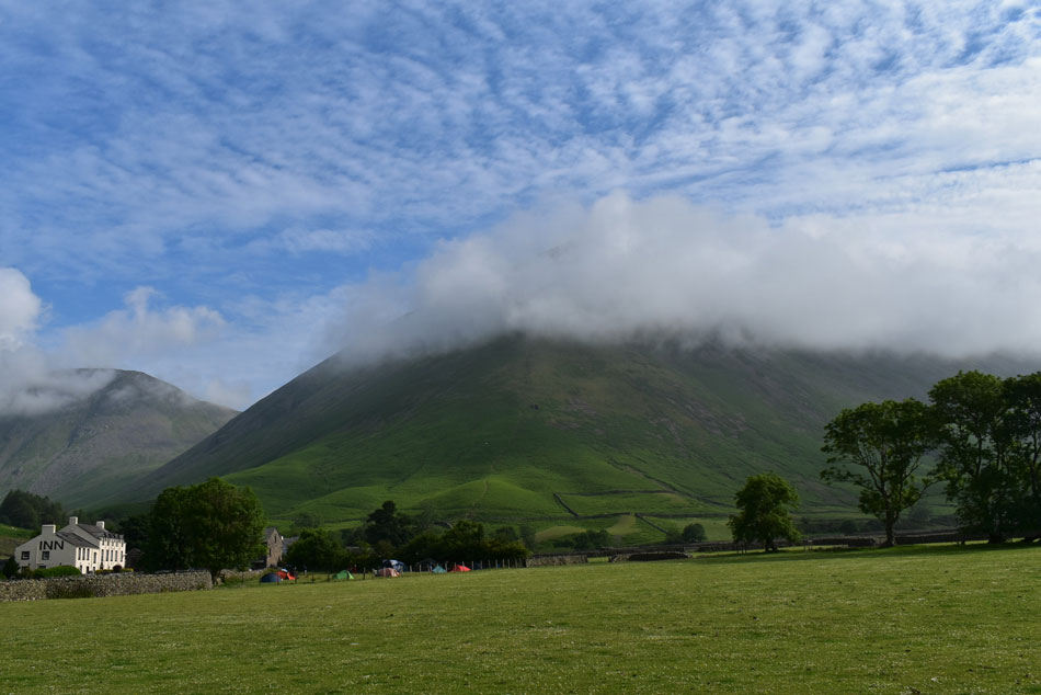
| Red Pike (Wasdale) |
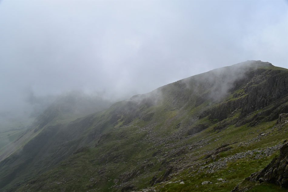
| The cloud base stagnated between 1,400 ft and 1,500 ft meaning I couldn't see the full route and more importantly the final 300 ft of ridge line that I plan to ascend onto the summit by but mentally I knew it was there, if the cloud does lift, well, that's an added bonus. |
 |
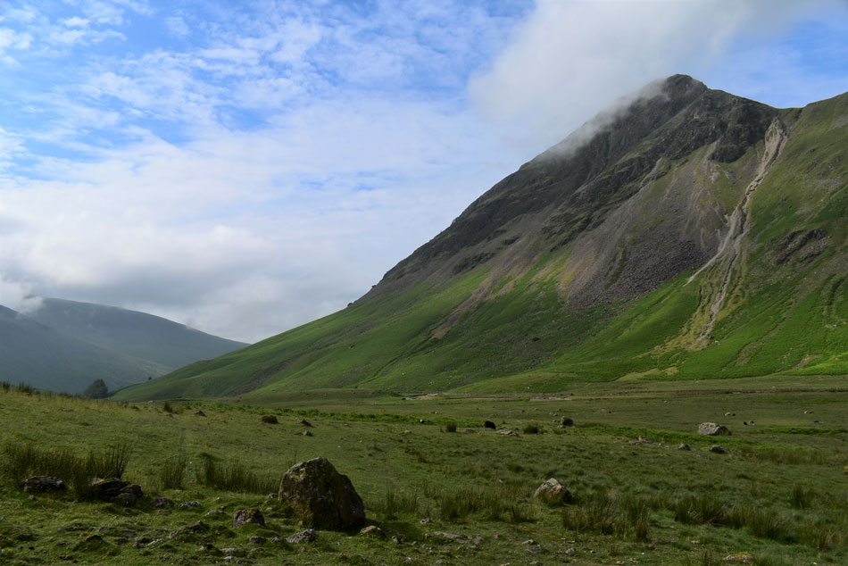
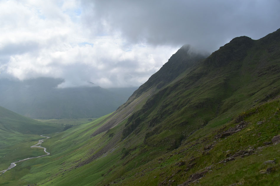
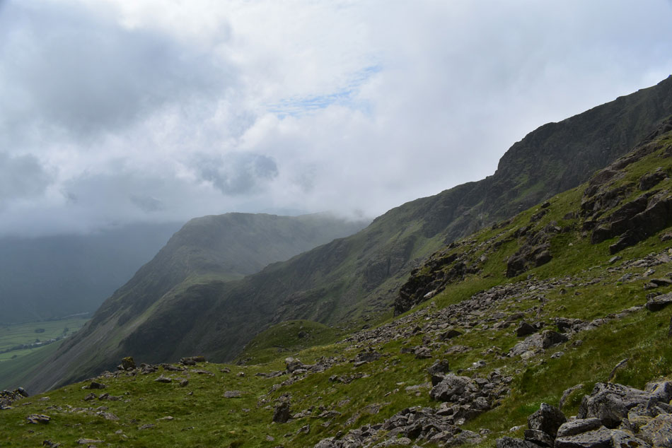
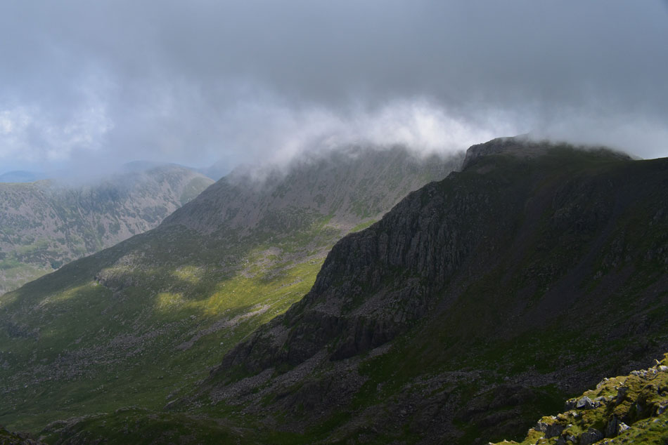
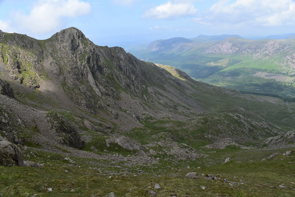
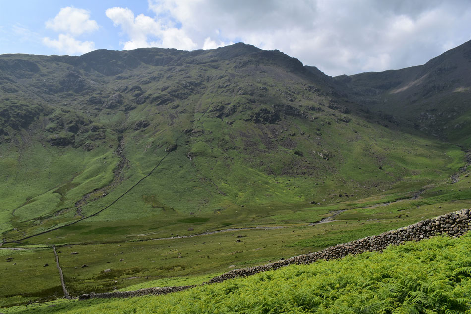
| Bull Crags (left) and Red Pike (right) |
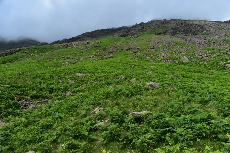
| The stone wall which I will ascend by comes into view just above the large boulder on the right, it's from here I realise I won't be ascending over grass but bracken for the initial 600 ft or so. |
 |
| Passing Yewbarrow's Stirrup Crag. |
| With Dore Head and Dorehead Screes seen further right. Before I head for the stone wall I plan to make a visit to the Y Boulder situated not far from the start of the climb. |
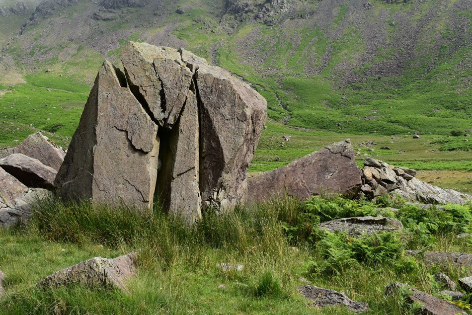 |
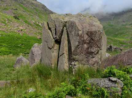
| The Y Boulder, Mosedale. |
| i left the main path and made a pathless traverse across the valley basin passing a herd of curious cows nearby. The ground was becoming increasingly boggier and by the time I had to cross Mosedale Beck my boots were already wet with bog water.
Thirty five minutes after leaving the car I was standing next to the Y Boulder in blazing sunshine while exploring the boulder and my surroundings just as the Abraham Brothers did back in the day. I'm not sure what forces caused the Y Boulder to split the way it has but those same forces left a magnificent boulder where many have come to train their climbing skills before going on to greater things. |
 |
| Y Boulder, Mosedale |
|
|
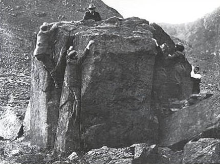 |
| Bouldering on the Y Boulder by the Abraham Brothers. |
|
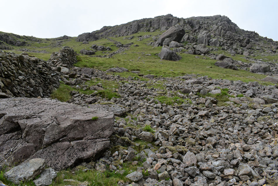
 |
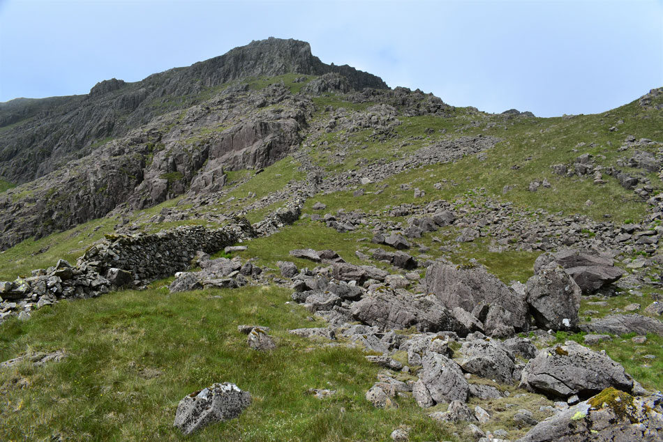
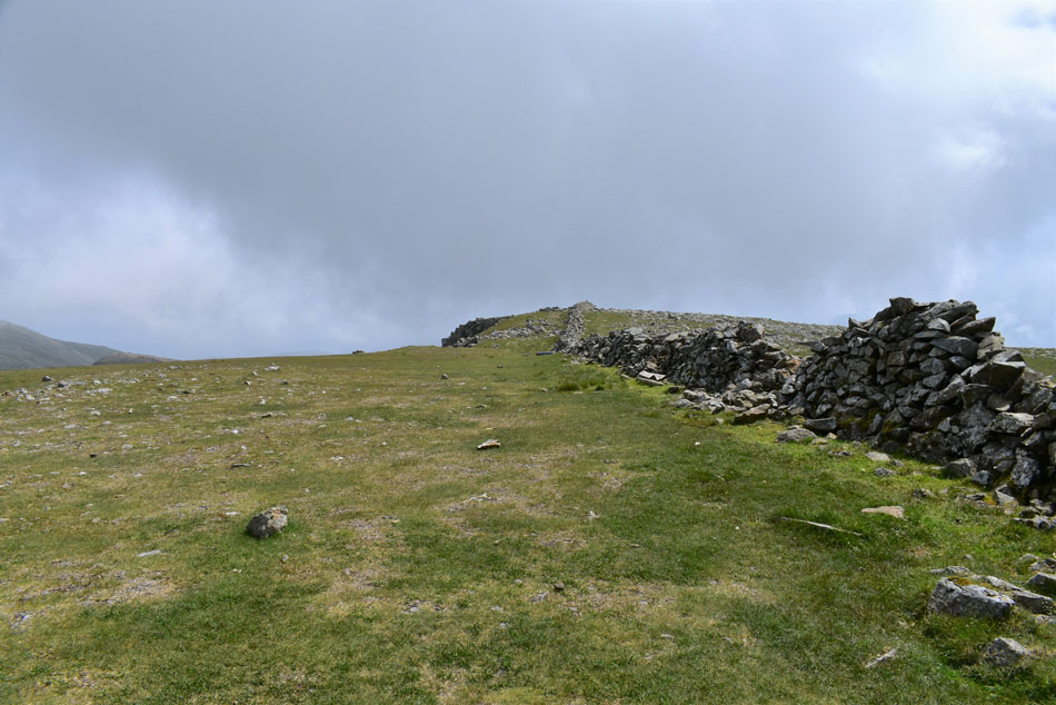
| The start of my ascent. |
| I didn't see any point in heading for the base of the wall in any case my ascent is pathless so it doesn't really matter if I start here or at the foot of the wall. The bracken looks a lot more menacing than it actually is. If you look centre left you can see the wall which I plan to link up with in the middle of the craggy outcrops up ahead. |
 |
| The view over Yewbarrow's Stirrup Crag |
| The wall appears closer as the angle of the incline steadily steepens. |
 |
| "By eck" |
| Cloud is still lingering above but for now I have wall to wall sunshine. If you measure the height of the wall against the bracken you can see that it's only ankle to knee high deep and not as dense as it appears. |
 |
| Looking down over the first false summit into Mosedale. |
| When stopping to get my breath back was becoming more and more frequent! |
 |
| Cloud appears to be building. |
| Which worked to my advantage in helping me to cool down. |
 |
| Crunching the numbers. |
| If you add another 800ft onto the ascent of Pen from Great Moss you come somewhere near the direct ascent on Red Pike which is equally, if not the steeper ascent. |
 |
| Approaching Low Red Pike. |
| Cresting one false summit I continued to follow the wall now less the bracken as the gradient continues to steepen as I nearthe base of Low Red Pike, it finally feels like I'm making progress now. |
 |
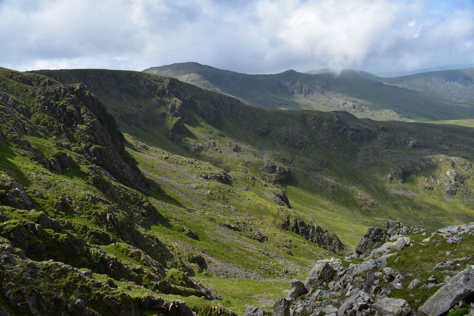
| Looking down from the second false summit. |
| With Mosedale and a cloud topped Kirk Fell beyond. |
 |
| The view South. |
| Towards Black Crag, Dore Head, Stirrup Crag and Yewbarrow. |
 |
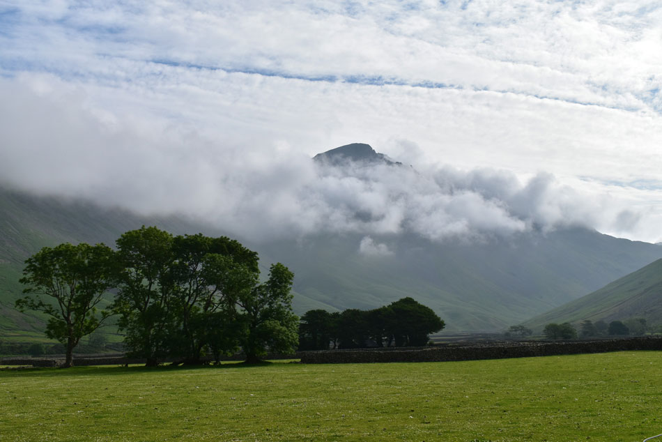
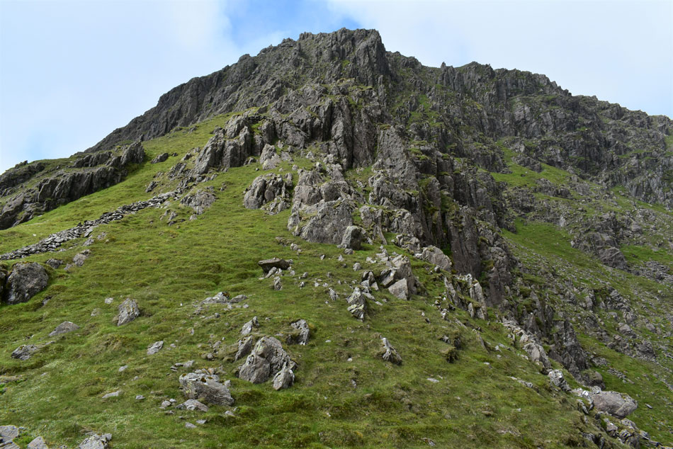
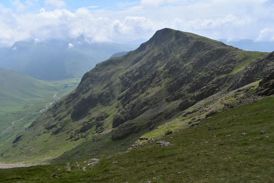
| Red Pike summit comes into view. |
| Well, not exactly as the summit lies about 60 yards across the cove towards the right. The good news is the cloud has lifted revealing the ridge I am about to ascend. |
 |
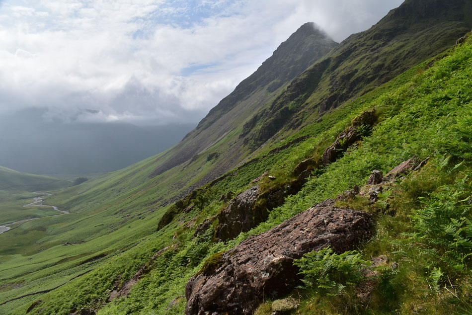
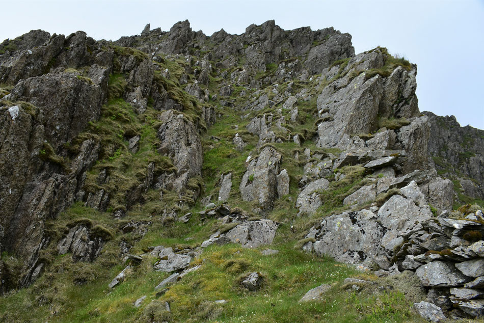
| Final assault on Red Pike. |
| I leave the stone wall to take in the view of the outline of the ridge which on paper looks a lot more precarious than it does in person. From here I continue my ascent towards the left via the steep grassy incline then continue to the base of the buttress/ridge up ahead. |
 |
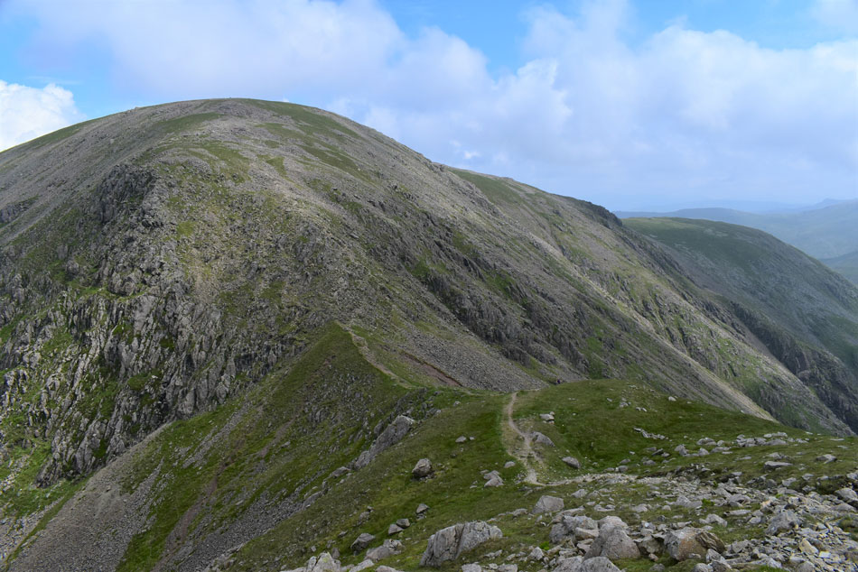
| Almost there. |
| A steep grassy rake ascends the final part of the ascent onto the summit. |
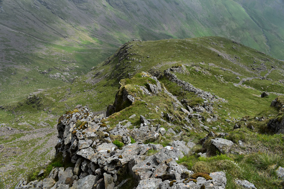 |
| Looking down on the ridge. |
| With Low Red Pike and my companion for the duration of ascent (the wall) below. It's now apparent why on the 1:25,000 scale map does the ridge appear as a 'knife like' arete. |
 |
| Yewbarrow, Stirrup Crag, Dore Head and Red Pike South summit as I near the top of the rake. |
| |
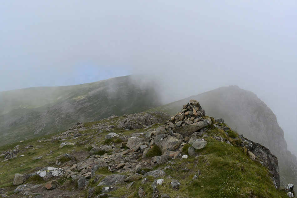 |
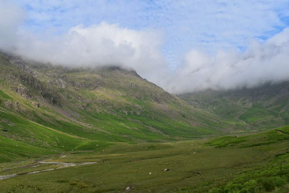
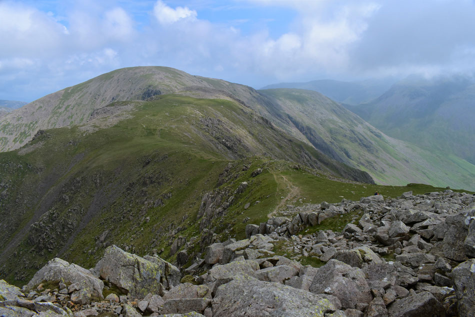
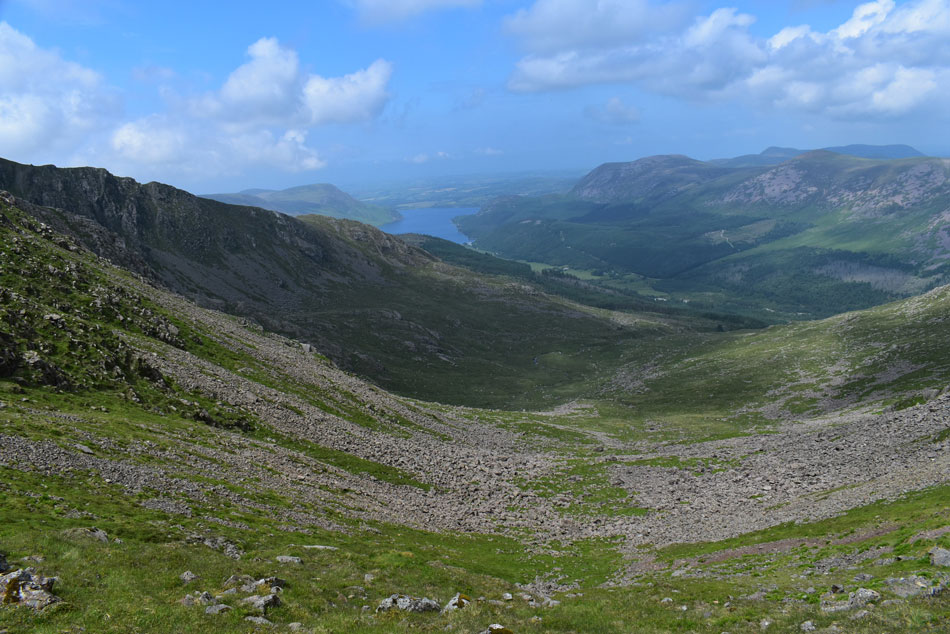
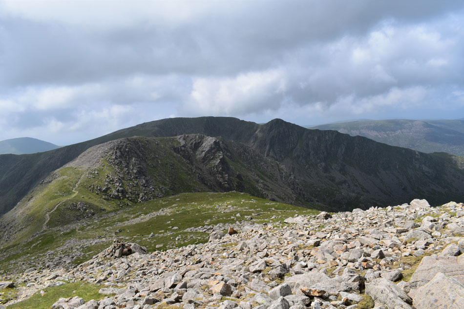
| A distant Scoat Fell from Red Pike (Wasdale) summit. |
| With the grass rake behind me I was lead directly onto the summit plateau right at the same time as the cloud lowered and the summit was consumed by cloud. The temperature had plummeted too but not enough for me to add my jacket as I prepare my legs and lungs for the ascent on Scoat Fell. |
 |
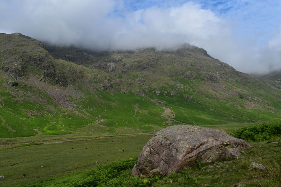
| My rewards for the direct ascent were plentiful. |
| Having descended Red Pike I picked a direct line for Steeple on the other side of the ridge while being treated to this wonderful cloud display which curled up over the head of Black Comb. |
 |
| Seatallan, Haycock and Scoat Tarn. |
| It's quite hazy but at least the sun is trying to poke through. |
 |
| Wowzers. |
| Looking back on Red Pike, the third peak along the ridge being the actual summit. |
 |
| Steeple from Scoat Fell. |
| My legs and lungs where starting to feel normal again and I actually enjoyed the yomp up onto Scoat Fell where I bumped into a chap who had just summited Steeple having ascended from Ennerdale remarking that I was the first person he'd seen since leaving his car "likewise" I returned. He wandered off to find a place to eat lunch as I made my way towards Steeple where I was passed by a woman who was making her way back to Scoat Fell and in passing we remarked what a fine day it was to be out on the fells. |
 |
| Brilliant light show. |
| As I descend Scoat Fell for Steeple. |
 |
| Fell runner heading for Black Crag (Pillar) |
| And as if by magic the cloud thickened and I lost the sunshine leaving this dramatic view over Mirk Cove. |
 |
| Mirk Cove, Black Crag, Windgap Cove and Pillar from Steeple. |
| The reason for including Steeple into todays route is I missed both Steeple and Scoat Fell out during my last outing here at the beginning of June due to feeling unwell after giving myself a dose of sun stroke. Seeing as both summits were on route what better reason to include them into todays walk. |
 |
| Looking West over Mirkiln Cove towards Haycock, Great Cove, Little Gowder Crag and Caw Fell. |
| I left Steeple and made my back to Scoat Fell, not before stopping to take this photo the same time as the sun came back out. |
 |
| Heading back to Scoat Fell. |
| The chap who I was speaking to earlier is sitting beyond the wall enjoying his lunch and as I pass hands are raised as if to say hello again. |
 |
| Black Crag (Pillar) and Pillar from the descent of Scoat Fell. |
Lunchtime had come and gone and I started to catch up with the woman I had seen on Steeple earlier and just when it looked I was about to pass her she would have a second wind and sprint on.
I think I must have left my second wind along with my lungs just below Red Pike summit. |
 |
| Steeple seen over Mirk Cove. |
| With Great Borne and Red Pike (Buttermere) seen beyond the Ennerdale valley below. |
 |
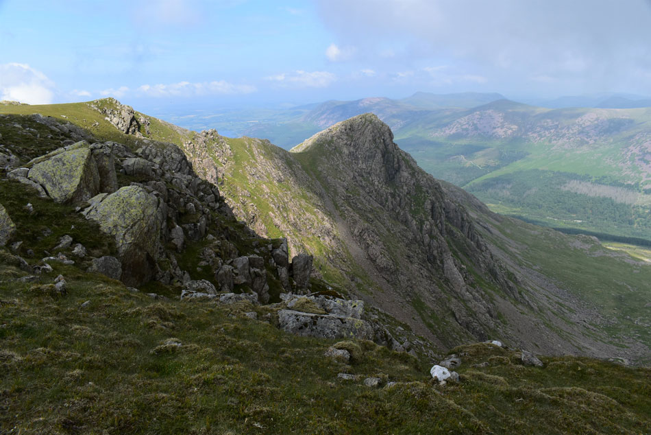
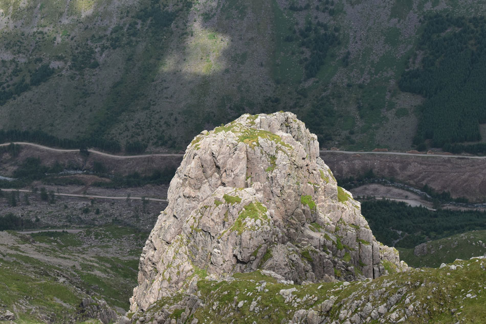
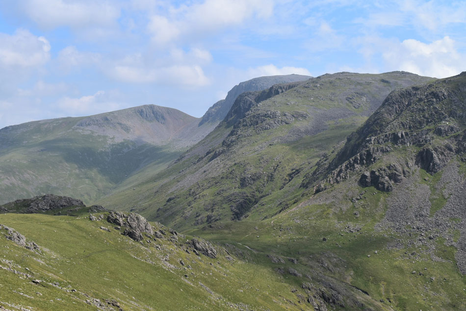
| Red Pike (Wasdale) from Black Crag (Pillar) |
| Aye, it's as steep as it looks. |
 |
| Pillar seen over Wind Gap. |
| Pillar is now cloud free by which time I wasn't just hungry my body needed an energy top up. I'm sure I have enough left in from breakfast to make it onto Pillar's summit. |
 |
| Long Crag (Steeple) and Ennerdale from Windgap Cove. |
| Okay time to get those legs moving again. |
 |
| Wind Cap, Black Crag, Scoat Fell and Steeple from Pillar. |
| The woman disappeared over Pillar's shoulder as I continued my ascent only stopping to take this photograph. Pillar's summit is just minutes away now. |
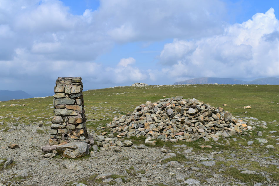 |
| Pillar summit. |
| The woman had made her way over to the shelter seen up ahead by the time I'd reached the summit where all I could think about was putting food in me and restoring lost energy. |
 |
| Lunch with a view. |
| I waved at the woman as I passed before making my way towards a viewing point which overlooked Pillar Rock and Pisgah seen in the foreground. Sheltered, I ate lunch overlooking the Ennerdale valley before spotting movement in the form of an orange climbers helmet who would appear at the top of The Notch then disappear. I waited and waited for the climbers to appear who I could hear but decided to move on before they peaked on top of Pillar Rock summit. |
 |
| Descending Pillar. |
| With hazy views of Kirk Fell, Great Gable, Green Gable and Brandreth. |
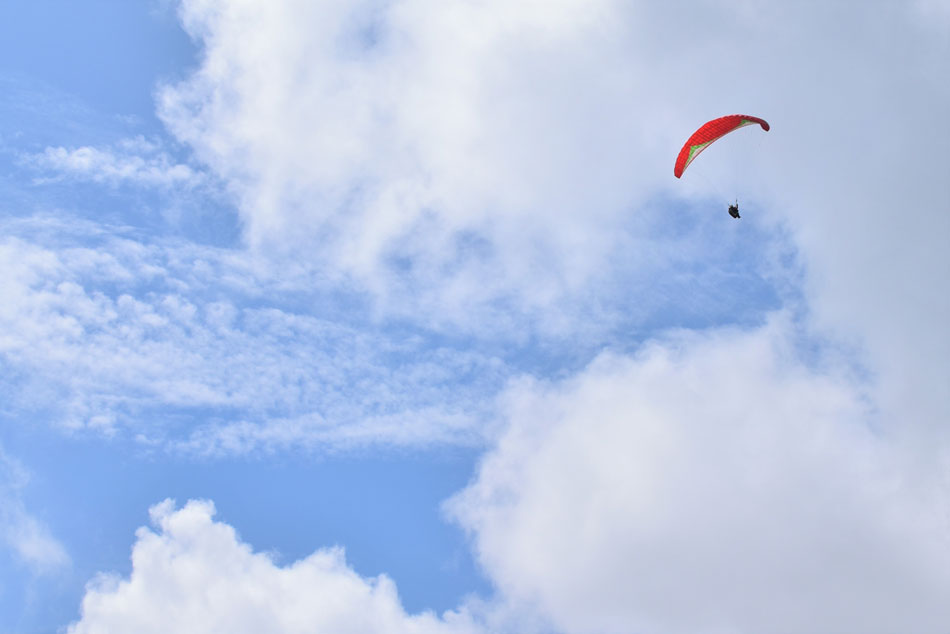 |
| Paraglider over Pillar. |
| I've seen Paragliders all over Lakeland but this is the first time over Pillar, a second glider could be seen circling over the top of Black Sail Pass too. |
 |
| Views over the top of Black Sail Pass towards Kirk Fell, Great Gable and Green Gable. |
| From here Kirk Fell looks like it's almost split into two by Baysour Slack which divides the north summit (left) from the main summit seen (right) Those with a keen eye might be able to spot a small tarn below the outcrop of rock seen lower left which I'll be heading to after summiting Looking Stead. |
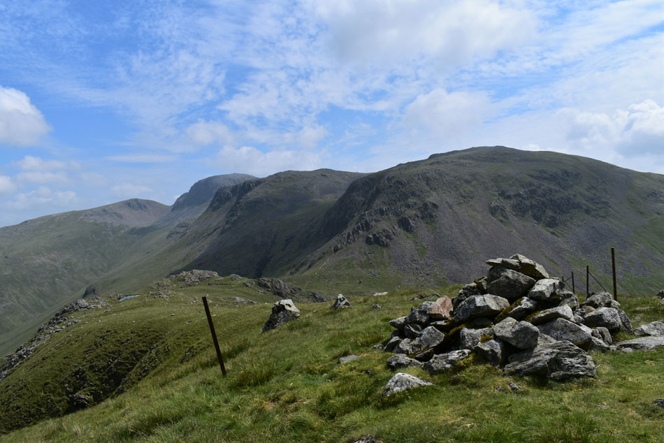 |
| Kirk Fell, Great Gable, Windy Gap and Green Gable from Looking Stead summit. |
| Descending Pillar seemed to take no time at all and before I knew it I was stood on todays final summit of Looking Stead under a scorching afternoon sun. My final two destinations before I descend back into Mosedale are the two tarns found along the ridge. |
 |
| Kirk Fell, Great Gable Windy Gap and Green Gable. |
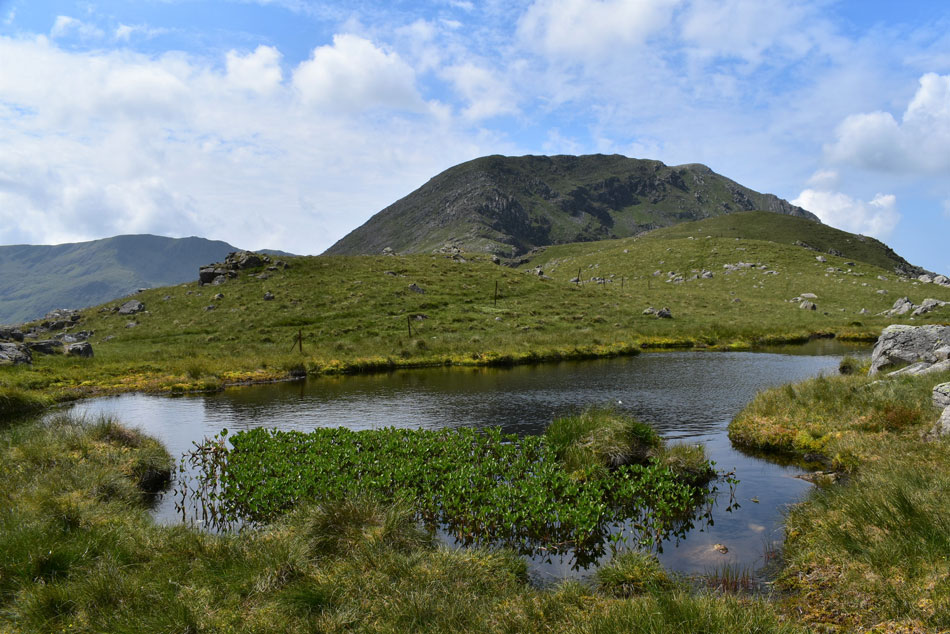
| This is the first tarn I came across after descending Looking Stead. Both tarns are nameless and are just off the beaten track. |
 |
| What a view. |
| |
 |
| Looking in't other direction towards Gamlin End, High Crag and a distant Red Pike (Buttermere) |
| |
 |
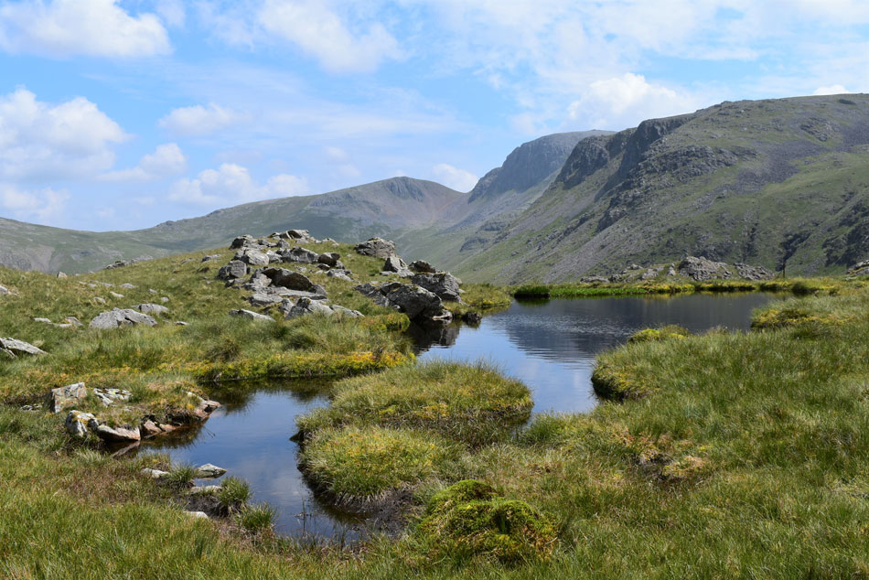
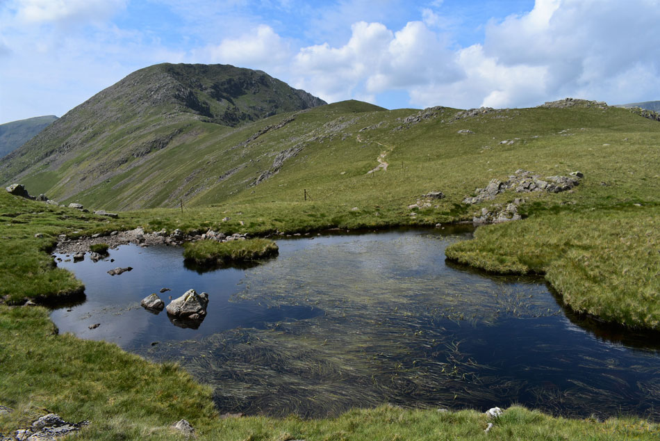
| Pillar and Red Pike (Wasdale) from the nameless tarn. |
| |
 |
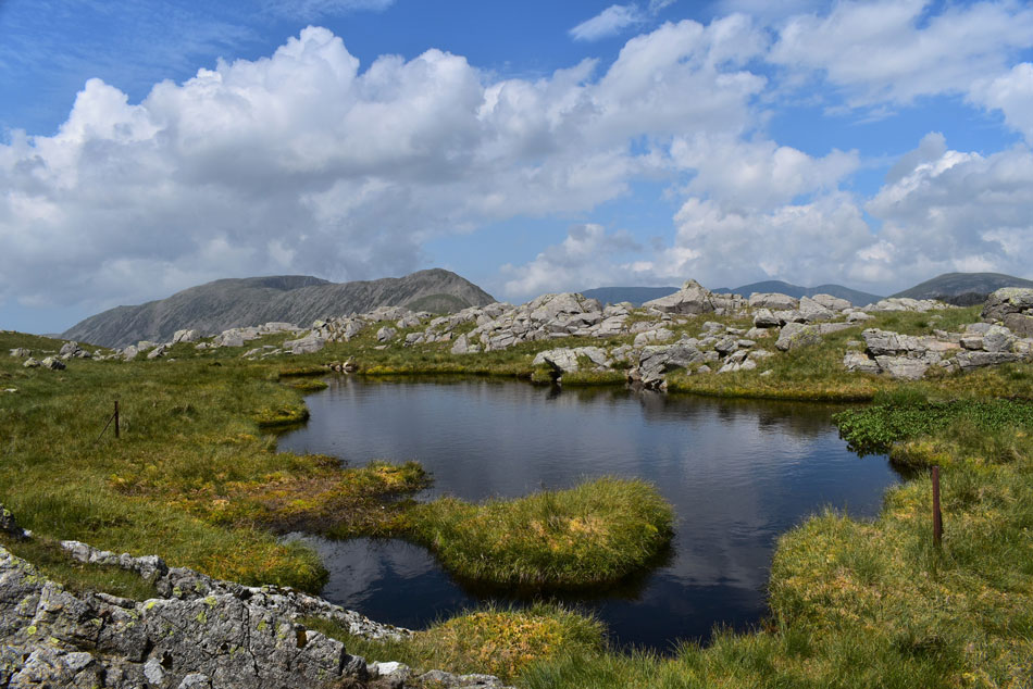
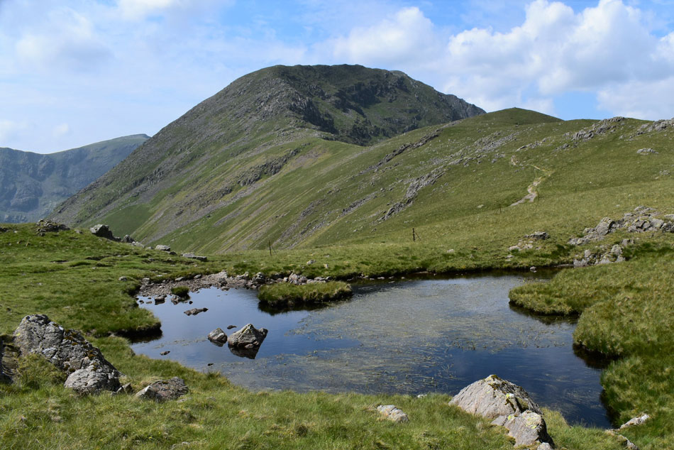
| Pillar from the second nameless tarn found close to the top of Black Sail Pass. |
| If for some obscure reason my ashes can't be scattered over the Straights of Riggindale then I would want them scattered here. This tarn doesn't have a name but deserves the name Black Sail Tarn due to its proximity to the top of Black Sail Pass. |
 |
| One last photo... |
| ...before it's time to leave. |
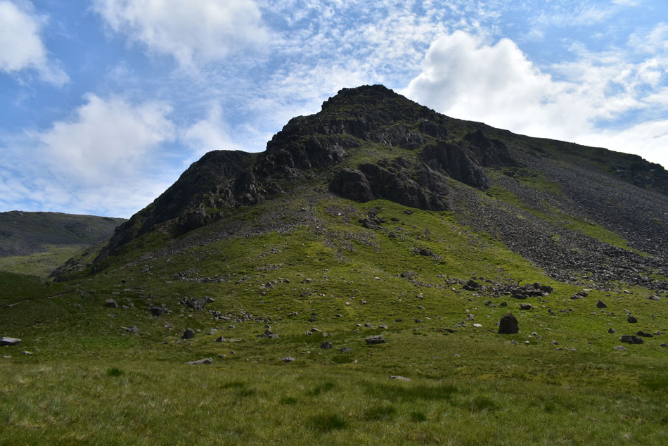 |
| Kirk Fell Crags from the top of Black Sail Pass. |
| I descended towards the top of Black Sail Pass and in doing so passed a family who were sat on the grass enjoying the sunshine, I was too far away to chat but got a wave from one of the family members which I returned. |
 |
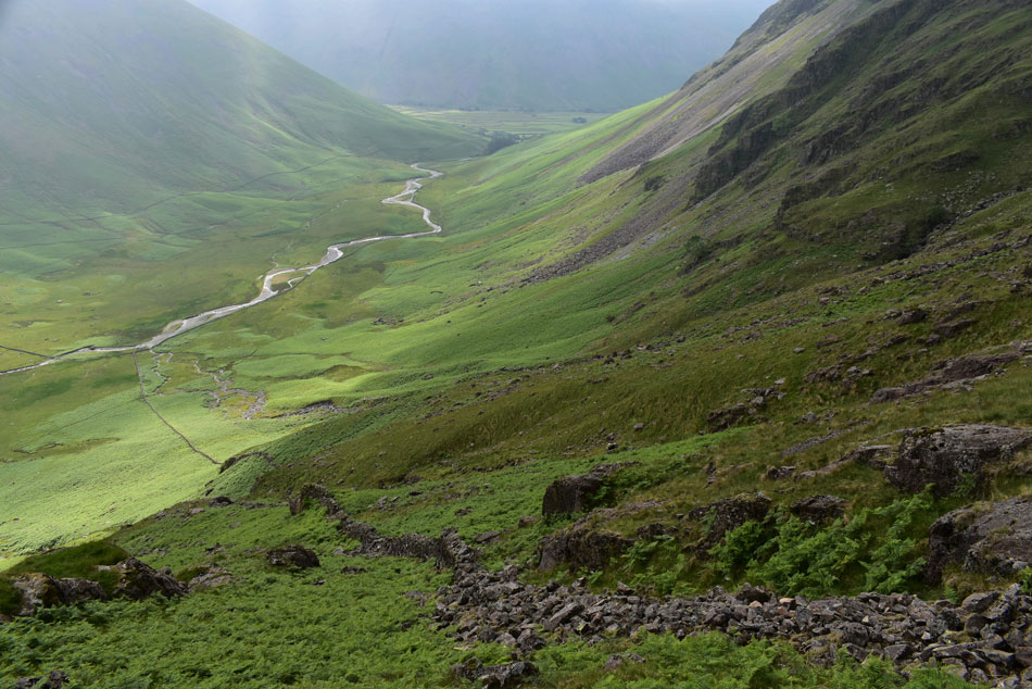
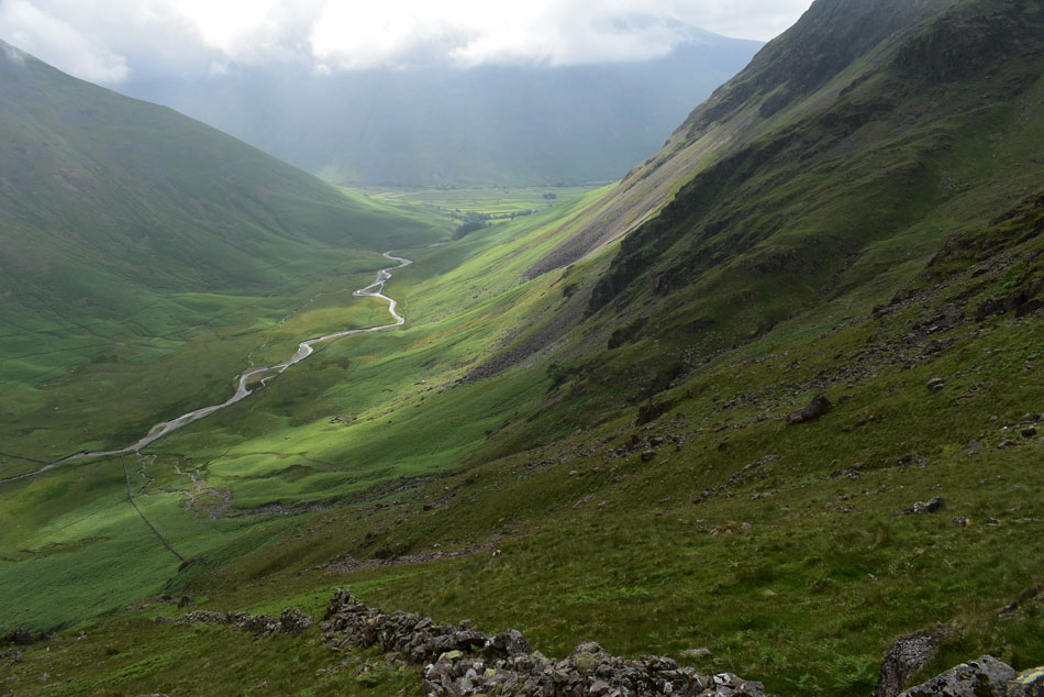
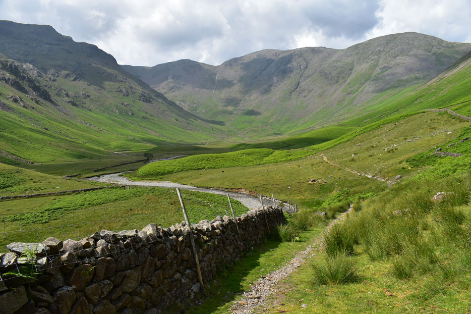
| Dorehead, Stirrup Crag and Yewbarrow from Mosedale. |
| I joined the rugged footpath alongside Gatherstone Beck and began the descent into Mosedale stopping at the last crossing to dip my head under a waterfall where surprisingly the water was tepid. After generous scoop fulls I continued my descent before arriving at what felt like an old acquaintance... |
 |
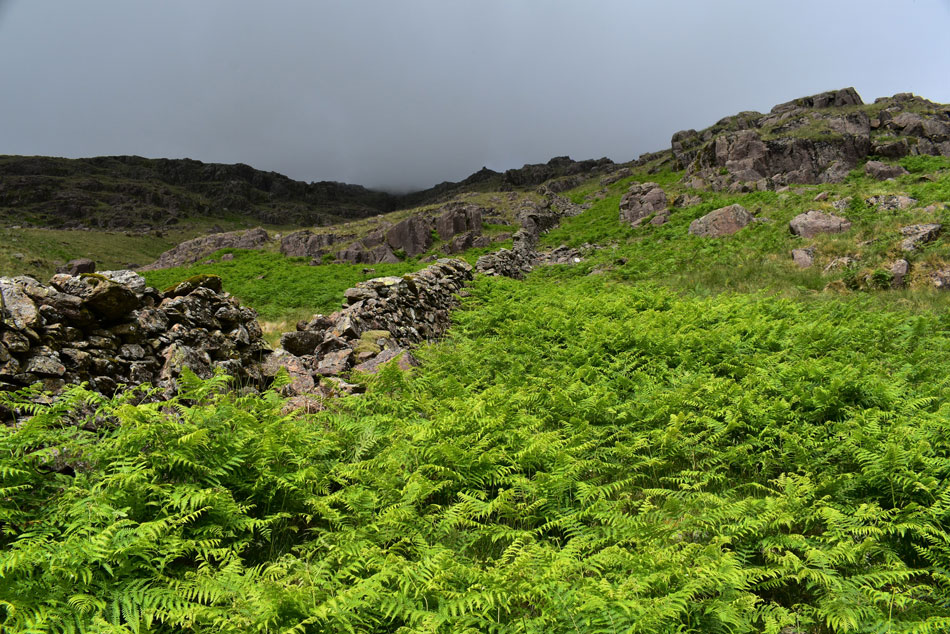
| ...the stone wall. |
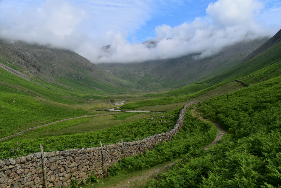
| My route can be seen clearly by following the stone wall which looks like it flattens below Low Red Pike (trust me it doesn't!) before rising towards the summit buttress. Just beyond Mosedale Beck in the lower half of the photo you might just be able to make out Y Boulder. |
 |
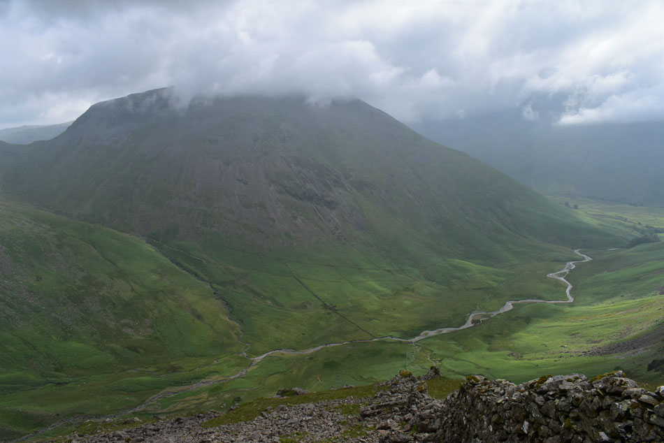
| Red Pike (Wasdale) Black Crag, Wind Gap and Pillar from Mosedale. |
| |
 |
| Cloud has gathered over Great Gable once again. |
| Under a hot afternoon sun I took in the last half mile while looking across the valley transfixed at the stone wall and wondered of the men who toiled in all weathers on one of Lakelands steepest inclines to build it. I came away thinking that this is no ordinary boundary wall which at times felt like my enemy and others, my guide.
The direct ascent on Red Pike from Mosedale isn't a route to be taken lightly, it's possibly the steepest continuous ascent I've endured to date but there comes a lot of satisfaction when trodding somewhere you haven't been before like the incredible views of Stirrup Crag or the rocky buttresses that you just don't get to see from Red Pike's grassy plateau, it's a route that spurs you onto greater things like Steeple, Scoat and Pillar and finally the two unmanned tarns between Looking Stead and the top of Black Sail Pass. I enjoyed this walk from beginning to end and it will come to a time when I'm too frail to climb these giants but at least I can say "I've been up there" and who knows, I may even have a longer view of these mountains than I ever intended. |
|
| |
| Back to top |
 |
|