High Street & Mardale Ill Bell East Ridge

14th August 2021

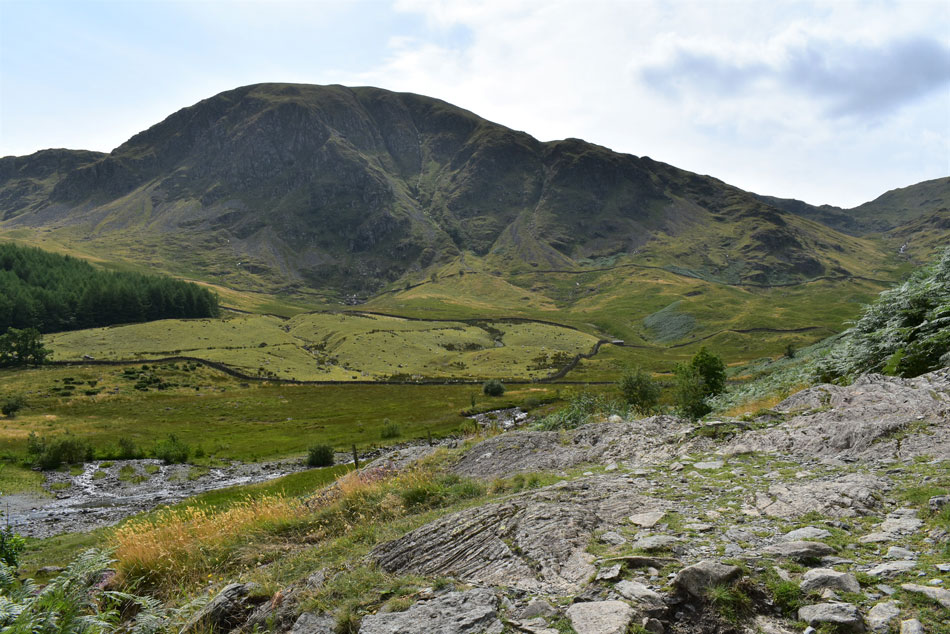
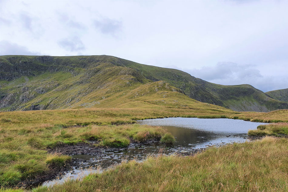
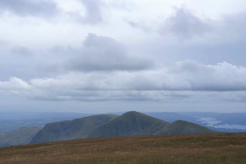
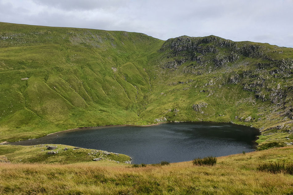
Between working this morning I was also planning on where to walk which was kinda difficult right now given how busy Lakeland is. My heart wanted to walk Dow Crag and Coniston Old Man but my head told me I'd really struggle to park at Fell Foot so late into the afternoon, happen my head was right this time.

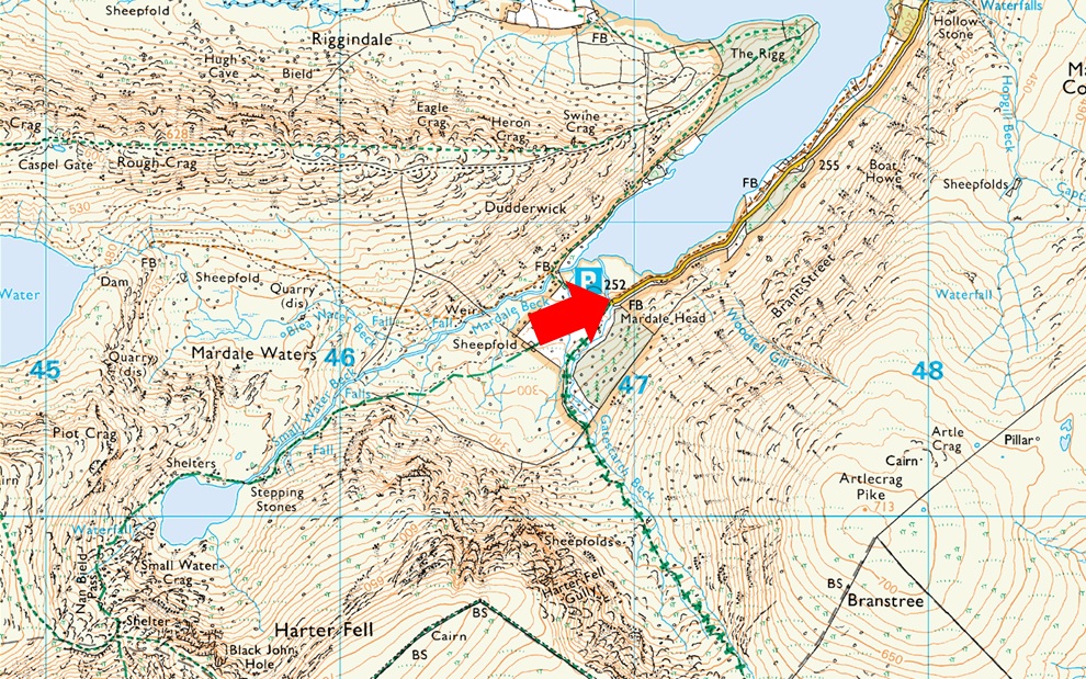
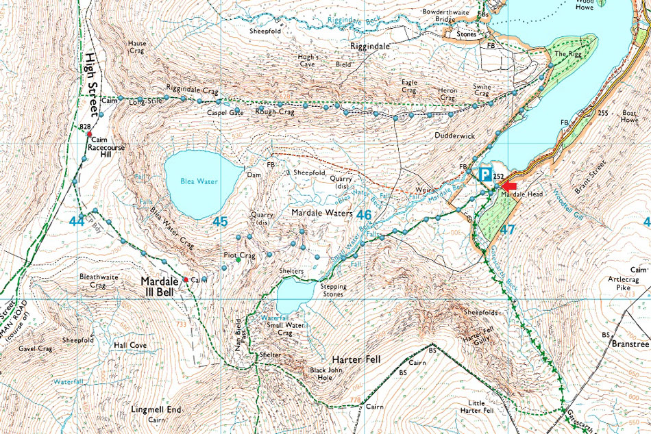
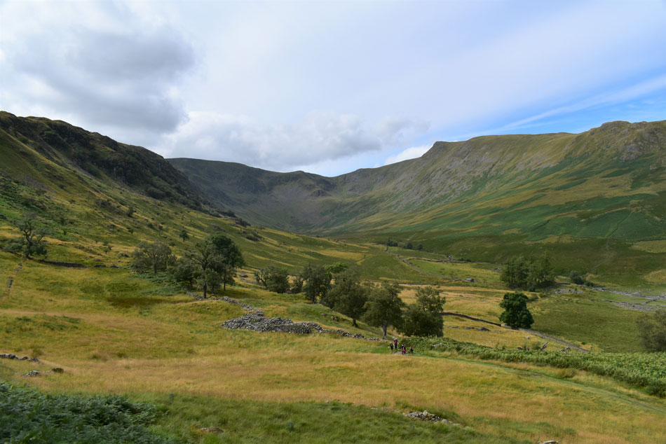
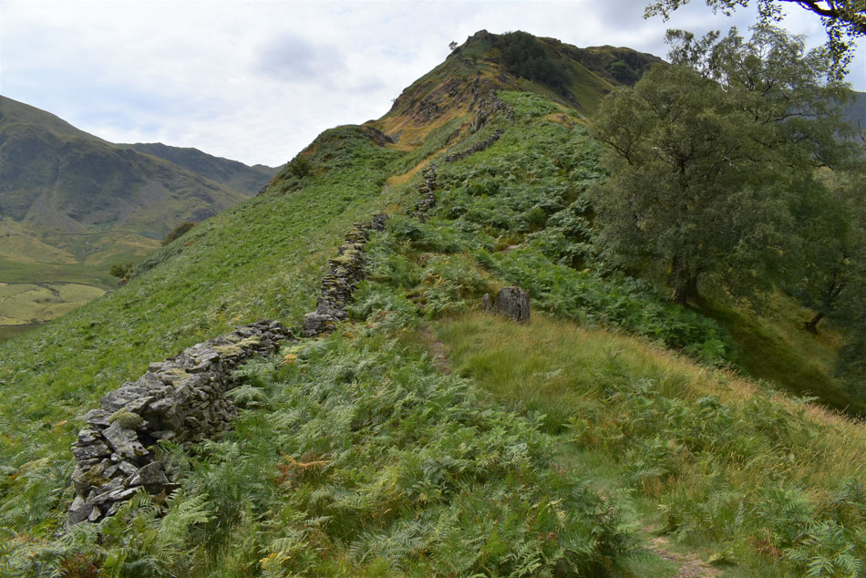
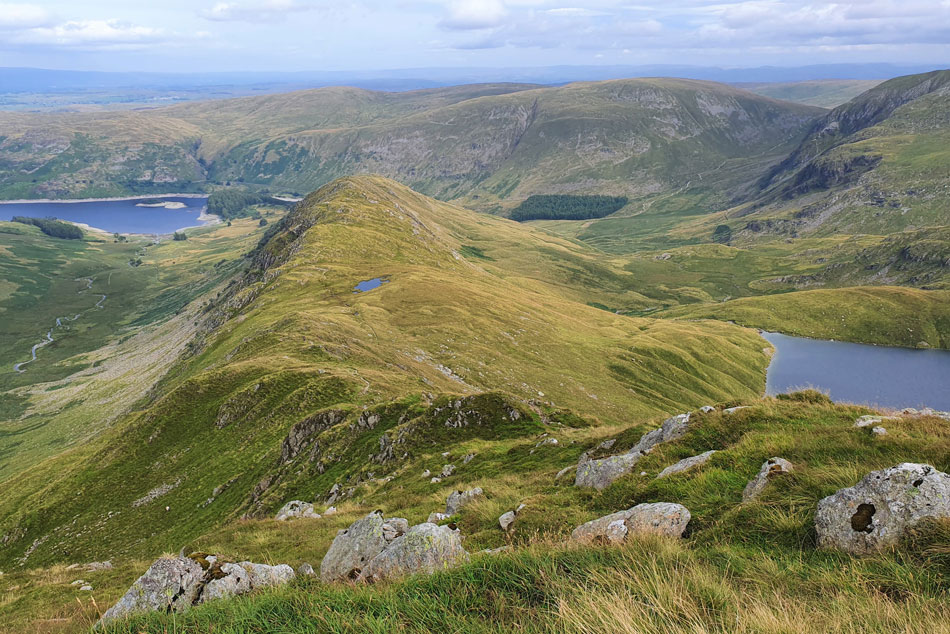
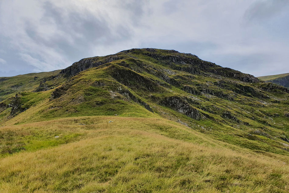
Instead I came up with a plan A, plan B and a plan C walk all within a five mile vicinity. Plan A was to park up at Burnbanks on the eastern fringe of Haweswater Reservoir and walk High and Low Kop, plan B was to walk Selside Pike and Branstree returning via Bransree impressive north ridge and plan C, the walk I thought the least possible was to walk High Street from Mardale Head and because I thought parking at Mardale would be impossible I didn't even bother to come up with a route to return to Mardale by.

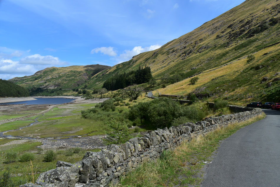
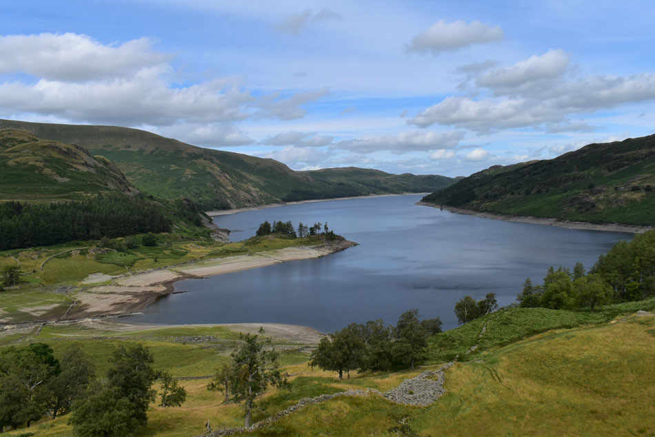
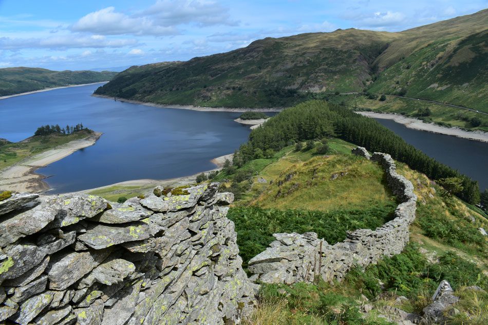
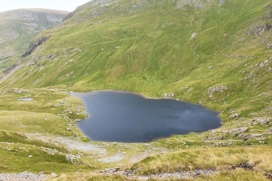
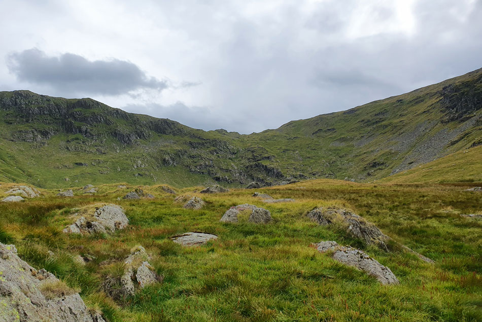
You could imagine my surprise when not only did I spot free parking at Burnbanks but I also found spaces at the lay by close to the Mardale side of The Old Corpse Road which I quickly manoeuvered into, that was until two or three cars passed me from the direction of Mardale Head, if three cars have just left there I was bound to find at least one parking place so I jumped back into the car and drove down to Mardale Head while not quite believing my luck, yes there was over parking but there was also one parking space left on the car park which had my name all over it.

 
Wainwright Guide Book Two
The Far Eastern Fells

Of the many excellent climbs available from Mardale Head the direct ascent of Mardale III Bell ranks high, the walk being favoured by striking views of two of the finest tarns in Lakeland, each set amongst crags in wild and romantic surroundings.


Overview
Ascent: 2,159 Feet - 659 Metres
Wainwrights: 2, High Street - Mardale Ill Bell
Visting: Piot Crag
Weather: A Warm Bright Start Turning Cloudy Late Afternoon, Windy Across The Summits. Highs of 18°C Lows of 16°C
Parking: Car Park, Mardale Head
Area: Far Eastern
Miles: 5.7
Walking With: On My Own
Ordnance Survey: OL5
Time Taken: 3 Hours 20 Minutes
Route: Mardale Head - The Rigg - Rough Crag - High Street - Mardale Ill Bell - Piot Crag - Mardale Ill Bell East Ridge - Small Water Beck - Mardale Head
 

Parking Details and Map
Nearest Post Code: CA10 2RP
Grid Reference: NY 469 310
Notes: Probably one of the most scenic car parks in Lakeland found at the head of the Mardale Valley offering easy access onto the High Street fells plus many more. The car park during Summer can fill up quickly but with most car parks in Lakeland if you time your arrival early enough your always guaranteed a parking place. Parking is free.


Map and Photo Gallery


Looking back on Brown Howe and the Naddle hills from Mardale Head 13:45pm 18°C
Admittedly Mardale Head was very busy but in the same breath I was passing cars who were leaving as I made my way towards the car park having already spotted a couple of parking spaces as I drove towards Burnbanks then two more close to the Mardale end of the Old Corpse Road. Having settled on walking Selside Pike and Branstree I thought I'd 'just see' if there was any spaces left at Mardale Head where upon arrival one car was reversing out of a space, great timing or what - the butterflies in my stomach performed a full rendition of the River Dance in that one split second. I was still wearing my work trousers and shirt but quickly changed into my walking shorts and base layer using the car door as cover.

Despite how busy Mardale Head is there's not many folk around the car park most I suspect are either on the fell or making their way down. Across a very low Haweswater Reservoir the Rough Crag ridge and High Street await although for now I still haven't made my mind up where to walk once I'd reached its summit, the main thing is I'm parked up which was far beyond todays expectations. The sun beams down on Mardale but if the forecasters are correct it's not to last, still I soak up the warmth of the afternoon sunshine as I pass through the deer gate and make my way towards the footbridge over Mardale Beck.


Views over a very low Haweswater Reservoir towards The Rigg.
So low in fact that patchworks of grass are growing where water once flowed.

Pausing to look back on Hater Fell (Mardale)
With Adam Seat seen far left and the top of Nan Bield Pass seen right.

Views opening out into Riggindale.
With High Street coming into view over on the left, Short Stile seen centre and the unmistakable Kidsty Pike with Kidsty Howes far right.

Ascent on Swine Crag.
I wadded through thigh high bracken between The Rigg and the base of Swine Crag finding the bracken is already starting to turn brown as it retreats for Autumn.

Views over Haweswater and Speaking Crag.
As I start the ascent on Swine Crag.

Classic view of The Rigg and Haweswater Reservoir from Swine Crag.
This view of The Rigg and Haweswater is up there in my all time views of Lakeland which I stumbled across some years ago now. I have the grid reference written down somewhere but the easiest way of finding it is to look out for the drop in the wall during the ascent of Swine Crag, a narrow tree found alongside the path is also a good reminder.

Heron Crag from the top of Swine Crag.
With High Street and Kidsty Pike in the distance.

Views over Mardale Waters towards Harter Fell (Mardale) Small Water, the top of Nan Bield Pass and Mardale III Bell.
With Mardale III Bell east ridge seen left and Mardale III Bell north ridge seen right...I think I've just found my route of descent, or at least I think I have but I can't make up my mind, east or north ridge?

High Street from Rough Crag summit.
Although it was warm at valley level a cool wind blew as more height was gained causing a notable drop in temperature not helped by the forecasted build up of cloud which caused a loss in light. I decided from Rough Crag that I would pack my main camera away and complete the rest of the walk using my mobile phone to take pictures given how well it copes in low light conditions.

Long Stile (High Street) and Short Stile from Caspel Gate.
From Rough Crag I took the indirect descent towards the unnamed tarn at Caspel Gate which was looking rather sorry for itself in its semi-muddied dry state, still, a fabulous view all the same.

Harter Fell and Mardale III Bell seen over Blea Water.
With Mardale III Bell north and east ridges seen below. Having already descended the north ridge on numerous occasions today I have decided to descend by the east ridge.

Looking back on the Caspel Gate and the Rough Crag ridge from the ascent of Long Stile.
With Selside Pike, High Howes and Branstree enjoying a brief spell of sunshine in the distance.

High Street summit trig point appears.
The breeze turned gustier once the summit plateau was reached and with it the sky darkened. I was still wearing a single base layer but right now the hat, gloves and Soft Shell jacket I had packed wouldn't have gone a miss but instead all I do is roll my sleeves down. I make my way towards the summit which I pat with my right hand before drawing my left hand back over the concrete scratching my wedding ring in the process.

It's just a triangular column I know but to me it's the place I lost it weeks after my mums death back in 2012 and ever since the already tight bond I had with High Street it continues to grow tighter.


Yoke, III Bell and Froswick affectionately known as the III Bell ridge.
Seen after leaving High Street as I made my way towards Mardale III Bell.

Harter Fell (Mardale) and Mardale III Bell.
With the north ridge descending steeply towards the left.

High Street and Kidsty Pike from Mardale III Bell.
I was gaining on a couple who were also making their way to Mardale III Bell summit who seemed to disappear when I arrived, perhaps they too are descending via one of the ridges but I spotted no one.

Views over Blea Water towards Caspel Gate, Long Stile, Kidsty Pike and High Raise (Martindale)
Instead of steering left for the north ridge I steer right encountering steep rough ground underfoot where a stumble looked imminent but I managed to keep upright as the ground levelled and Piot Crag summit came into view.

Fantastic views of Small Water from Piot Crag.
Spot the two wild swimmers about to enter the water!

The band of ridge linking Nan Bield Pass with Harter Fell (Mardale)
The grassy hollow at the head of the ridge is known as Black John Hole.

Blea Water, High Street and Kidsty Pike from the descent of the Mardale III Bell east ridge.
From the Small Water side of Piot Crag I traversed ahead passing the old quarry then headed across the grassy summit plateau until I reached the head of a craggy buttress popular with rock climbers. I then traverse left finding a steep grassy rake which was strewn with boulder at its base. Once the boulder had been negotiated I pass below the imposing buttress of Piot Crag then follow the true line of the ridge.

Piot Crag from Mardale III Bell East ridge,
Where I found having a good eye for the lay of the land was a good advantage.

Small Water appears again.
With Small Water Crag seen above.

Looking back on Piot Crag from Mardale III Bell East ridge.
The east ridge descends all the way down to Mardale Waters which would have made for a very boggy end to the walk so instead I leave the ridge and descended steeply towards Small Water Beck.

Looking towards the top of Nan Bield Pass.
A young family where picnicking alongside Small Water Beck and looked surprised to find me descending in zig zags while carefully negotiating a mix of grass ledges and rock, also watching were a number of walkers descending from Small Water so I made sure it looked like I knew what I was doing, truth was it was so steep I could have slipped on my arse at any time, thankfully I didn't.

I crossed Small Water Beck and joined a steady stream of walkers who were all descending back to Mardale Head some of whom I managed to over take. After passing through the Deer fence below the crags and gullies of Harter Fell most of the steepness was behind me as the ground levelled and Mardale Head edged closer.


Back to top