Kinder Scout & Kinder Downfall from Edale

20th August 2021

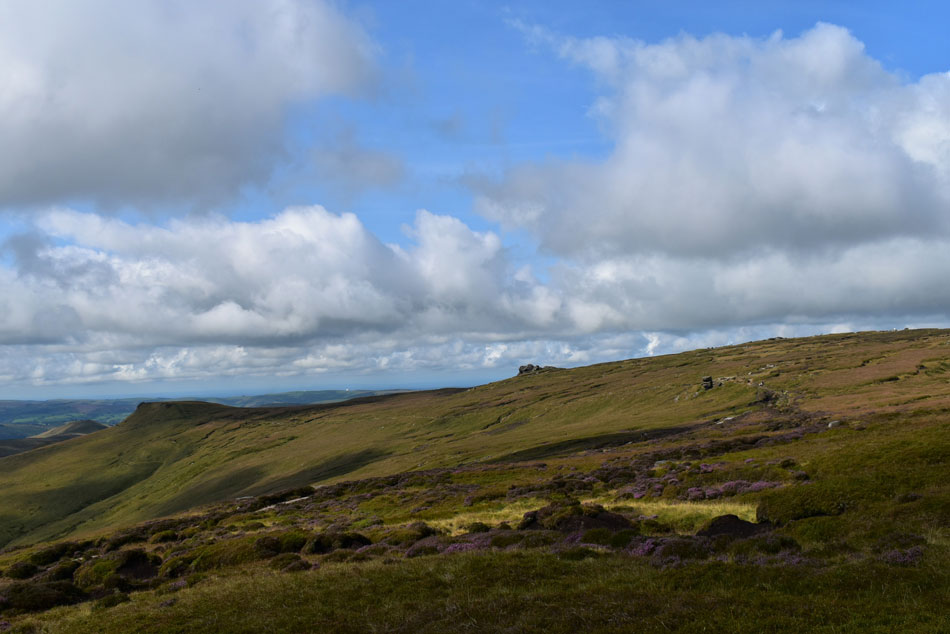
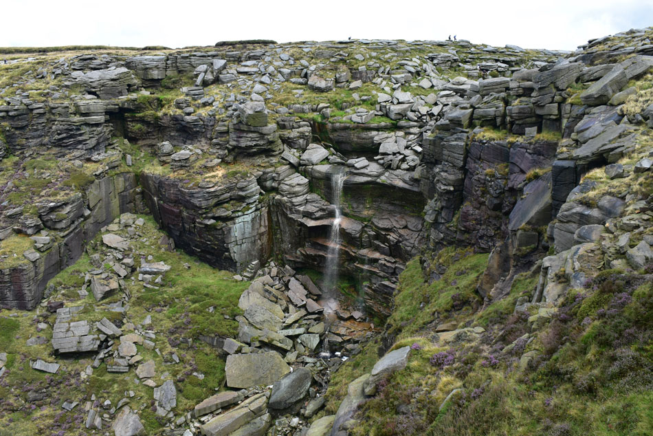
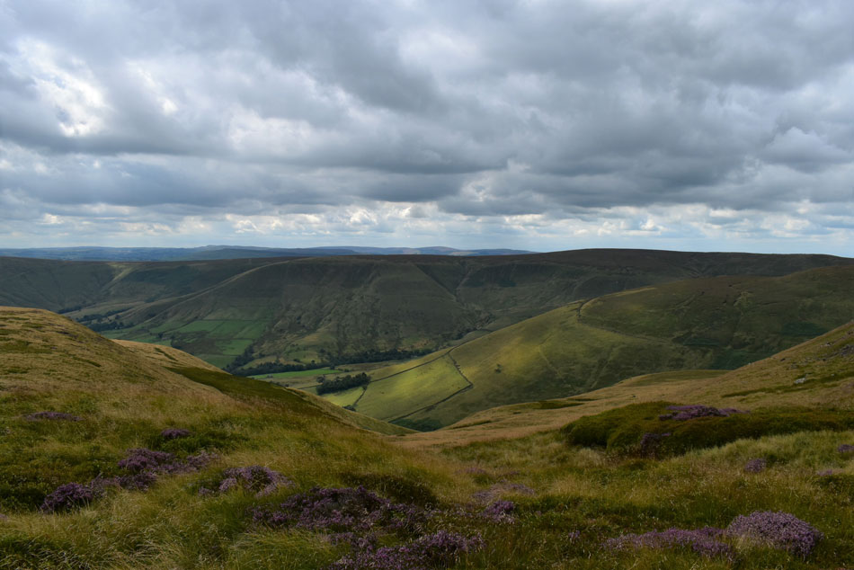
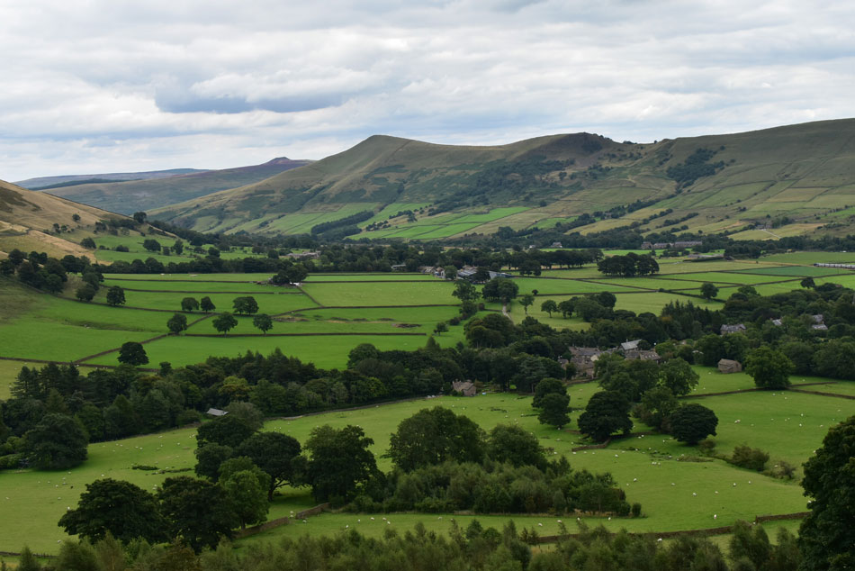
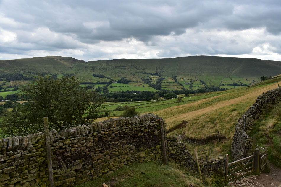
With a long weekend planned I had my heart set on a tour of the Coledale Horseshoe where if conditions permitted I would have also included an ascent of Eel Crag via Tower Ridge but not only did conditions not allow they worsened to the point I had to re-think the whole walk, a walk that certainly deserved a blue sky day.

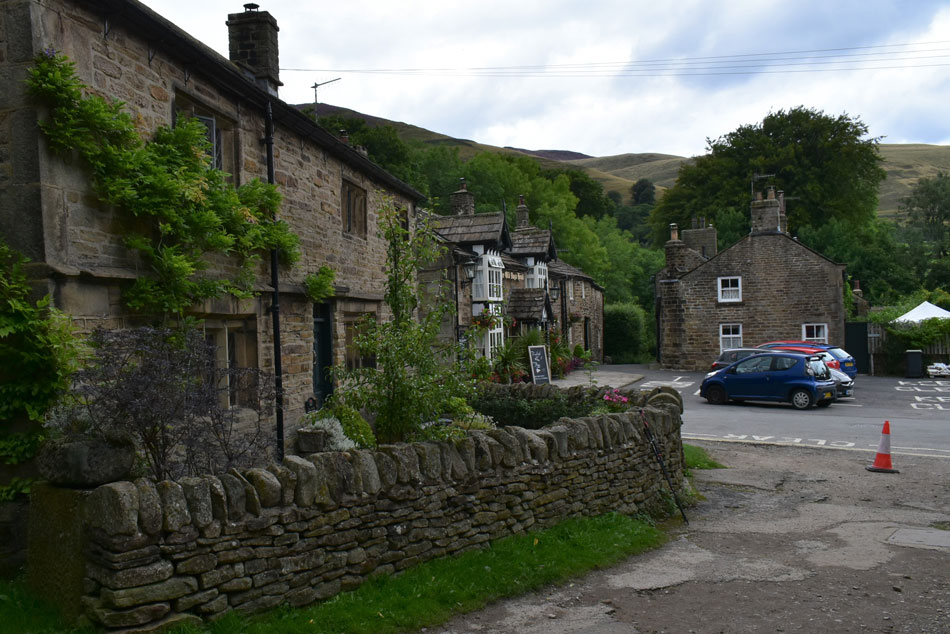
Most of the UK has at some point been affected by low cloud this week with rain arriving by Saturday but there was a glimmer of hope when I checked the forecast for the Peak District National Park where sunshine during the morning and 80% cloud free summits had been forecast, it was Thursday morning and I had one day to come up with a route.

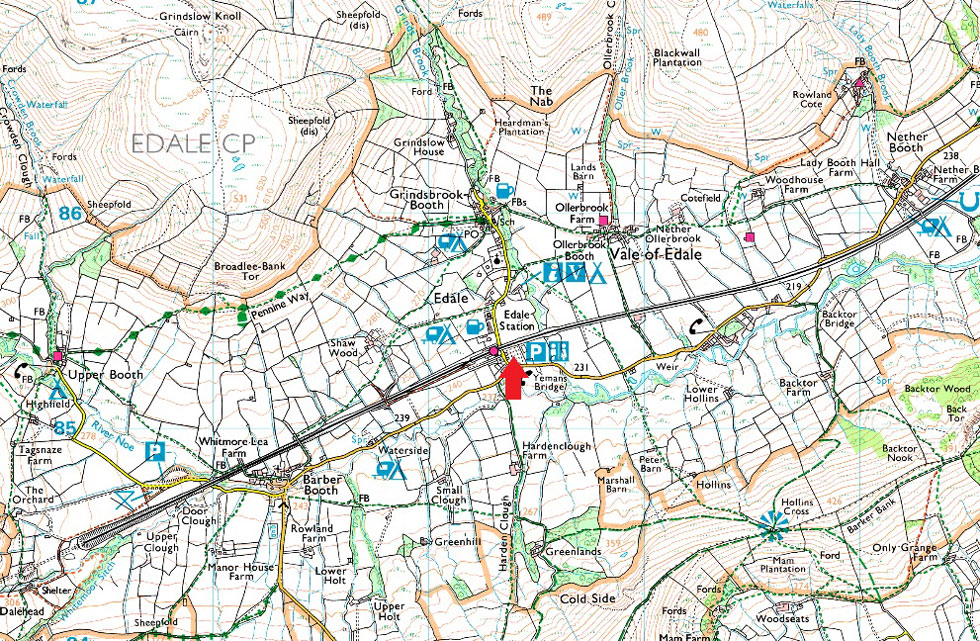
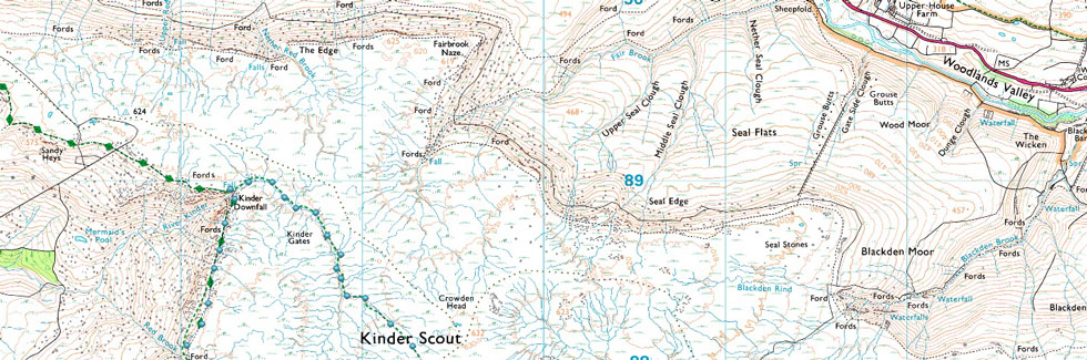
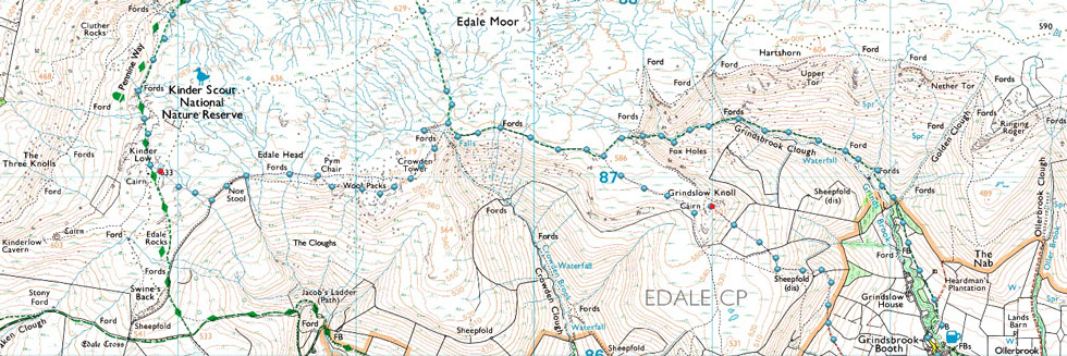
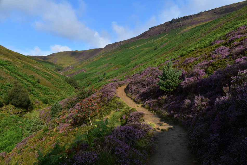
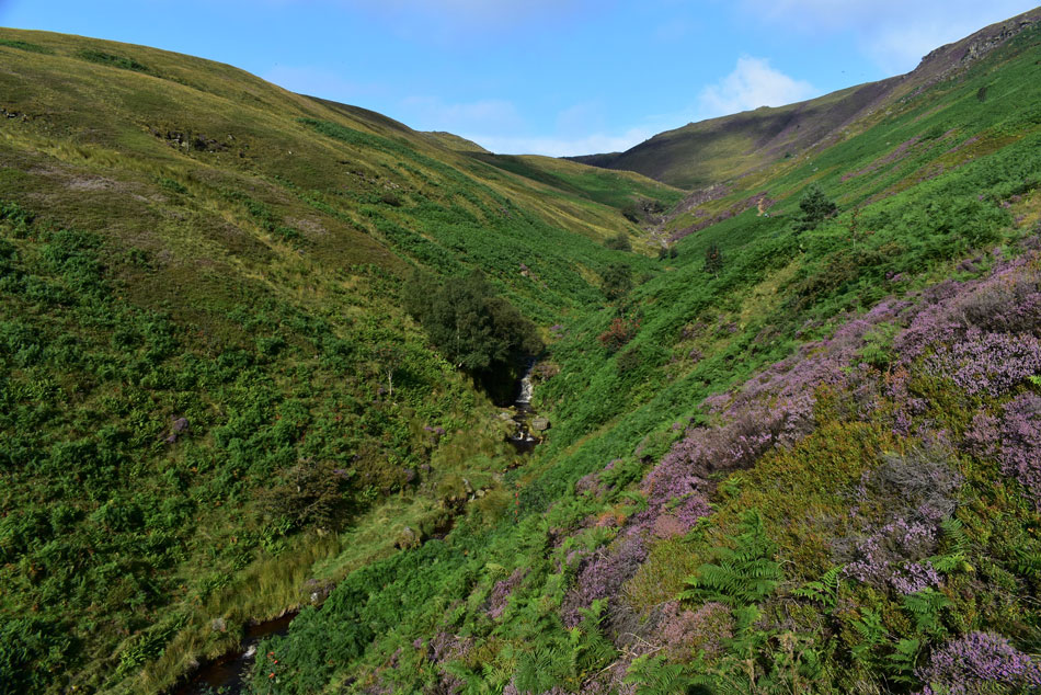
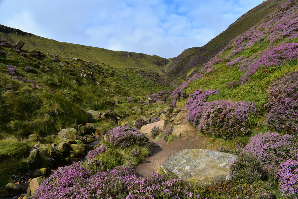
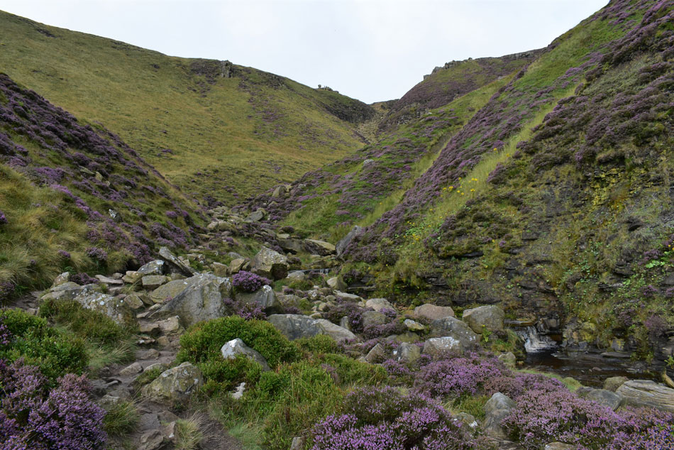
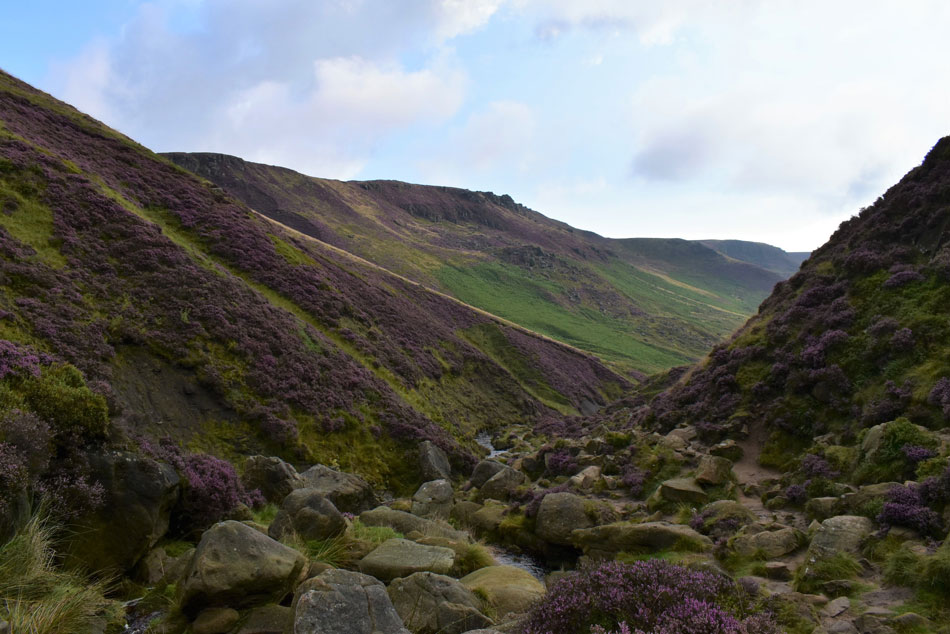
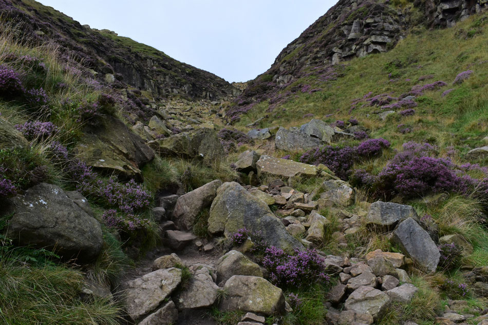
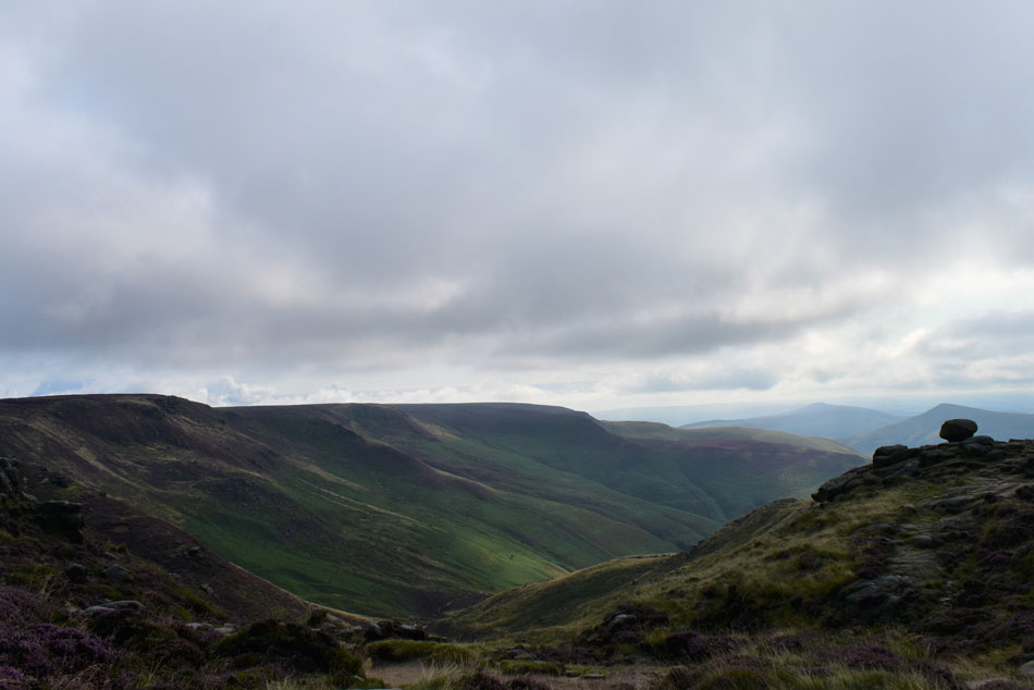
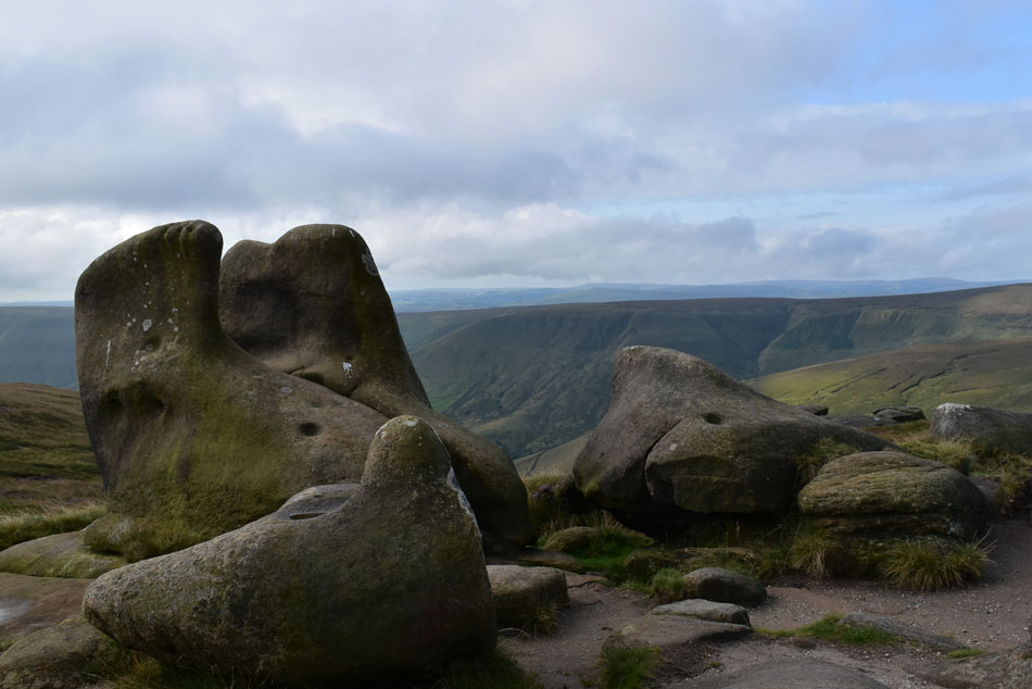
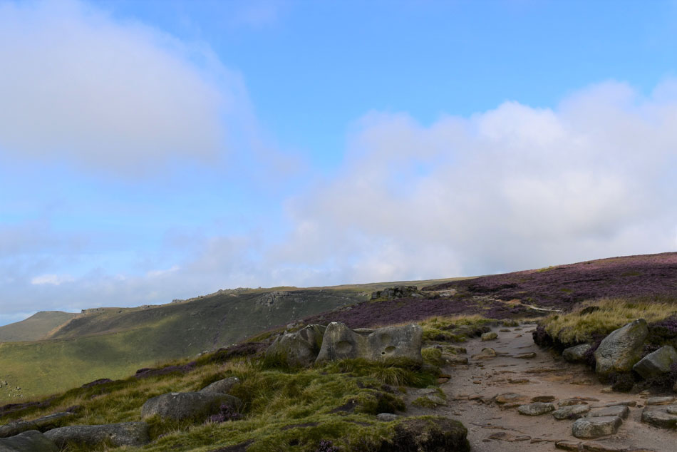
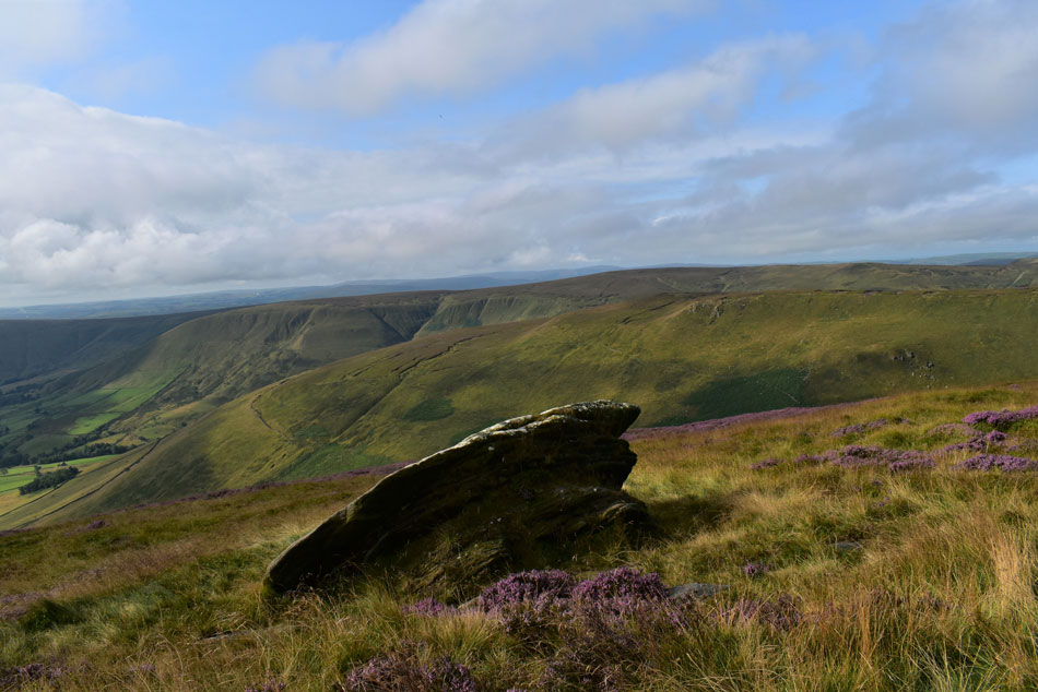
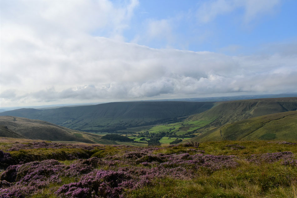
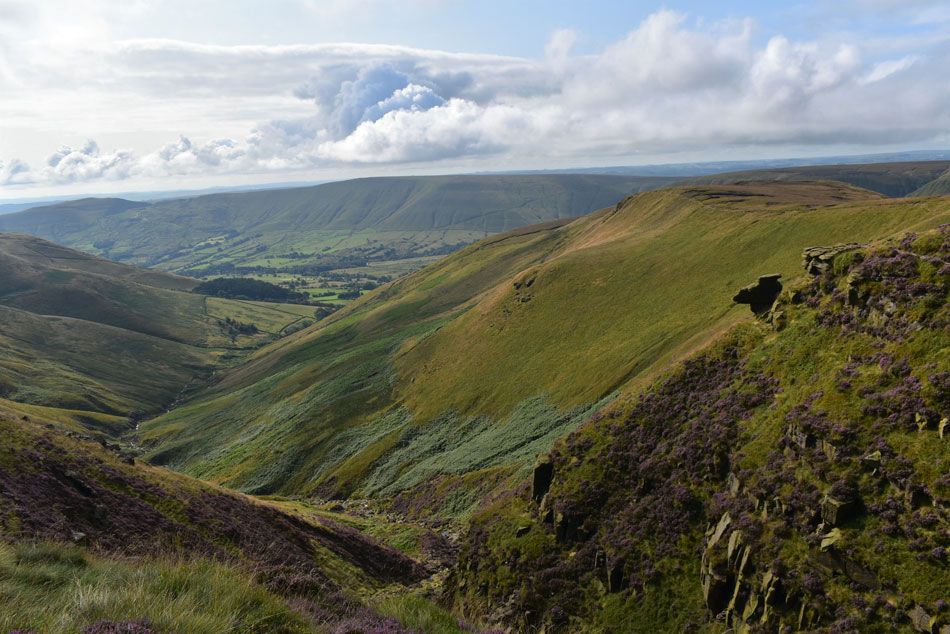
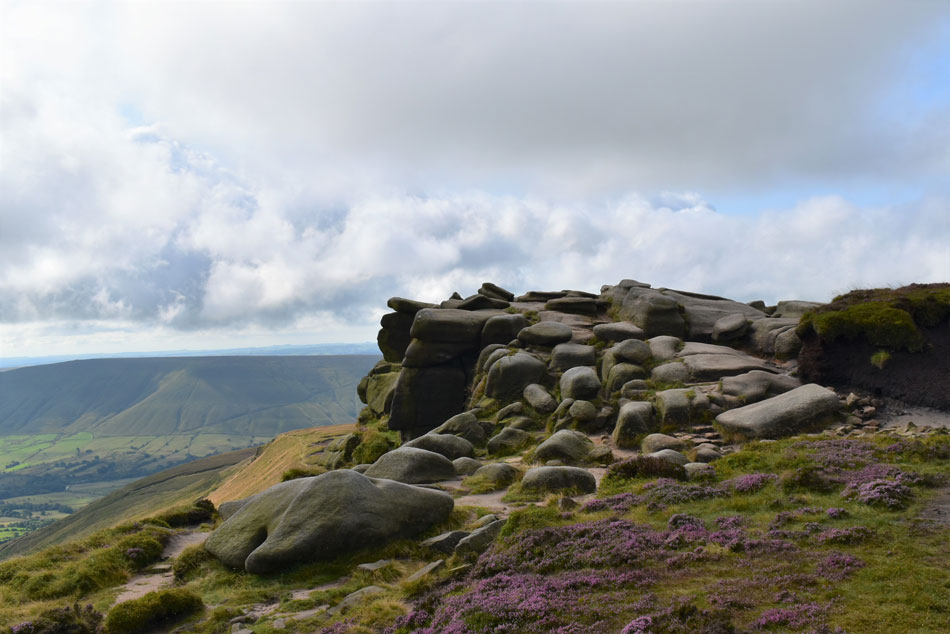
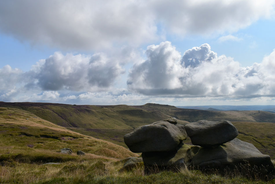
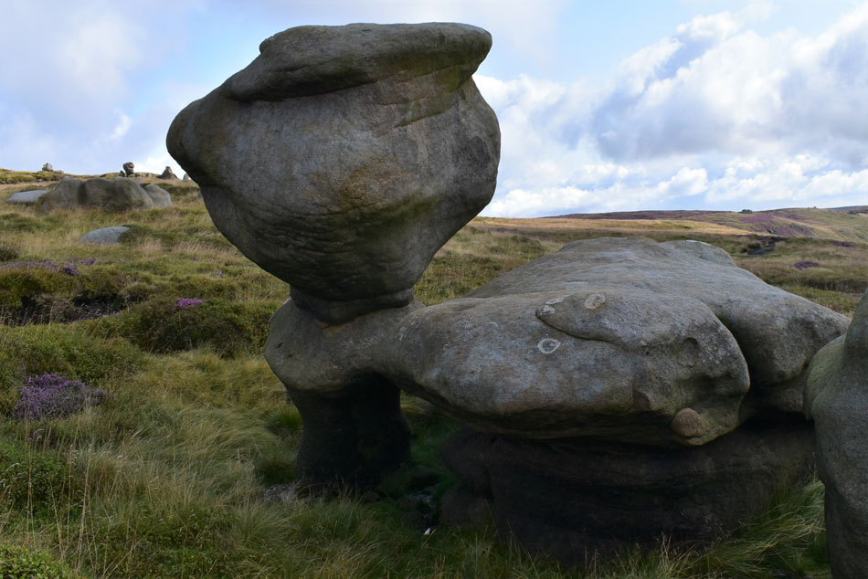
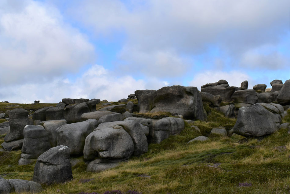
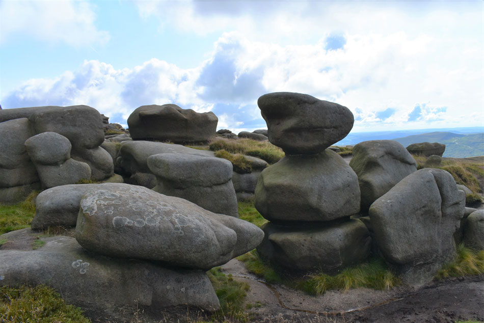
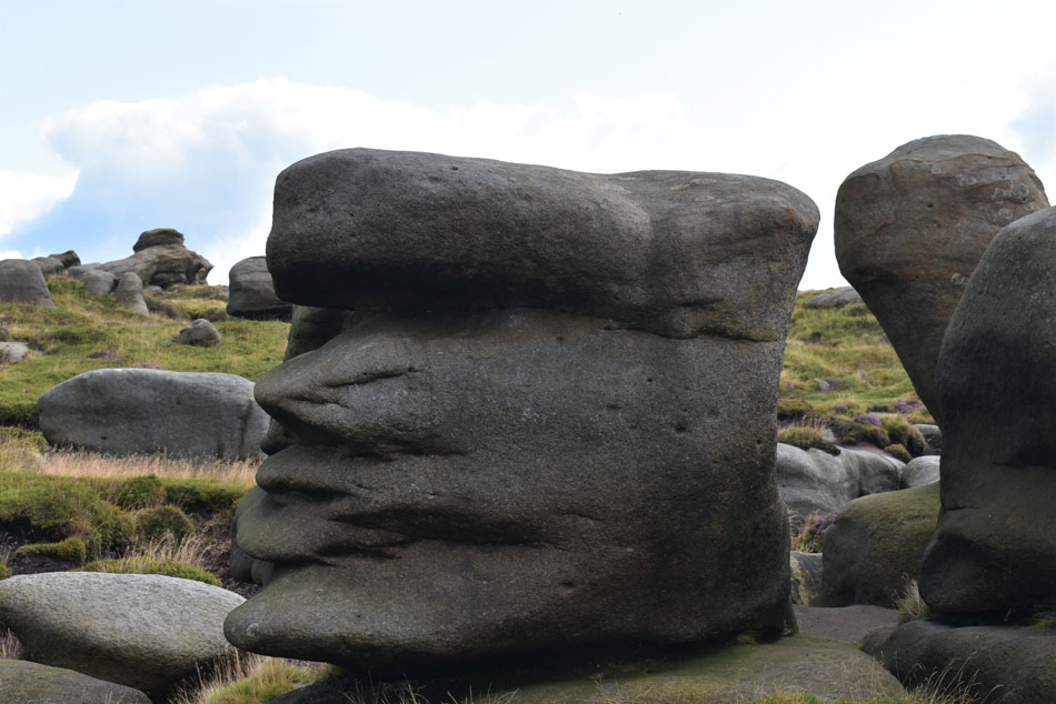
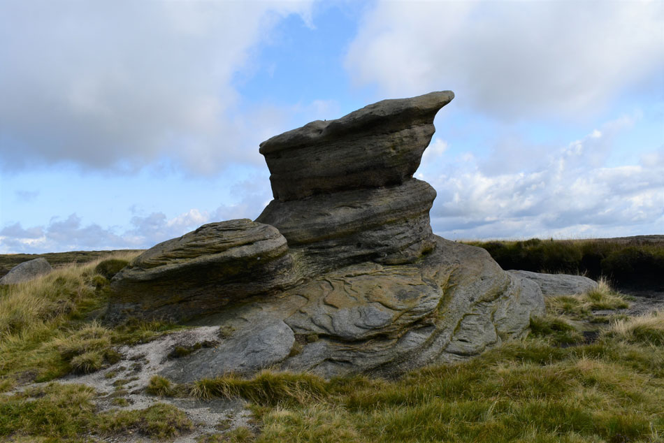
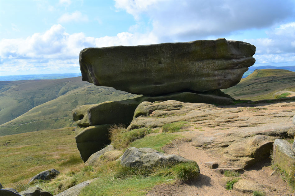
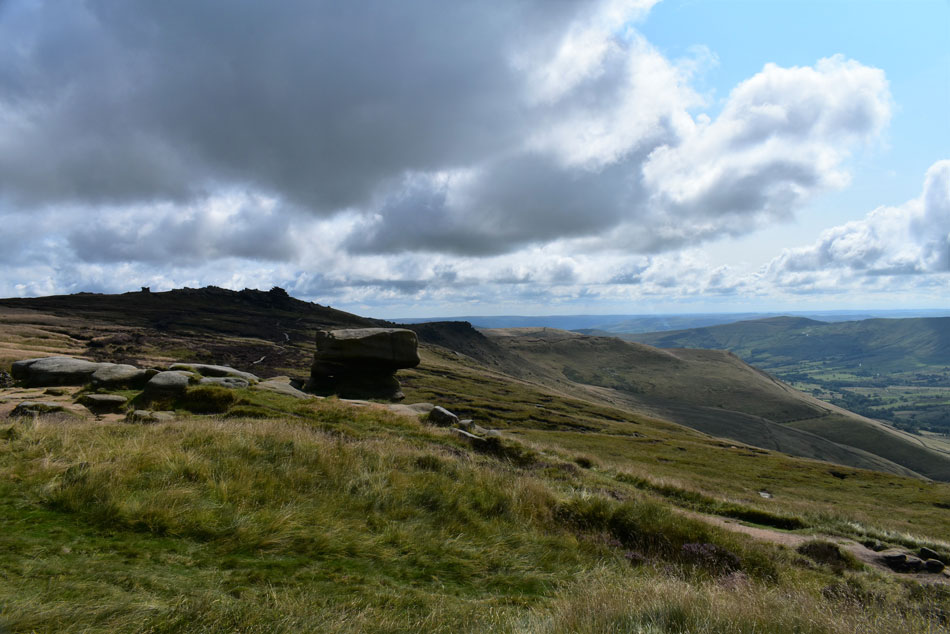
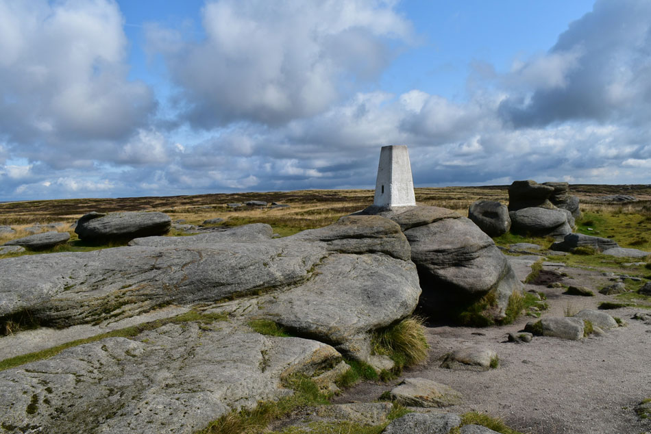
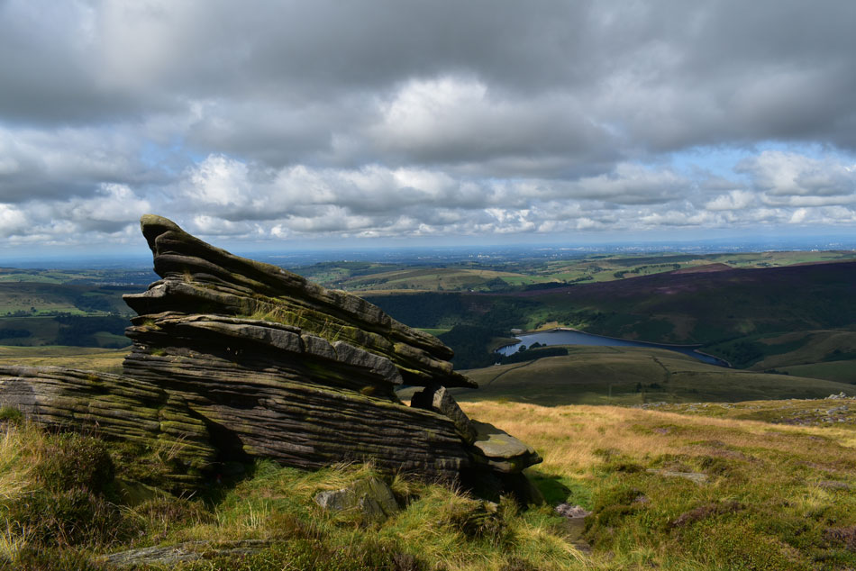
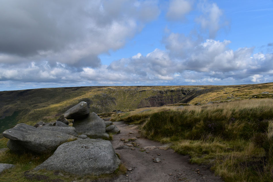
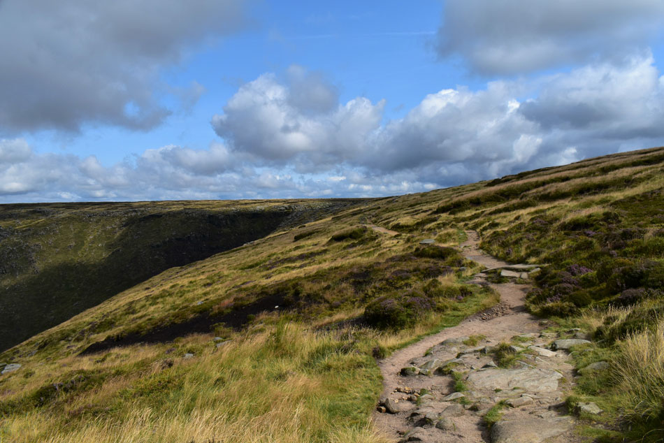
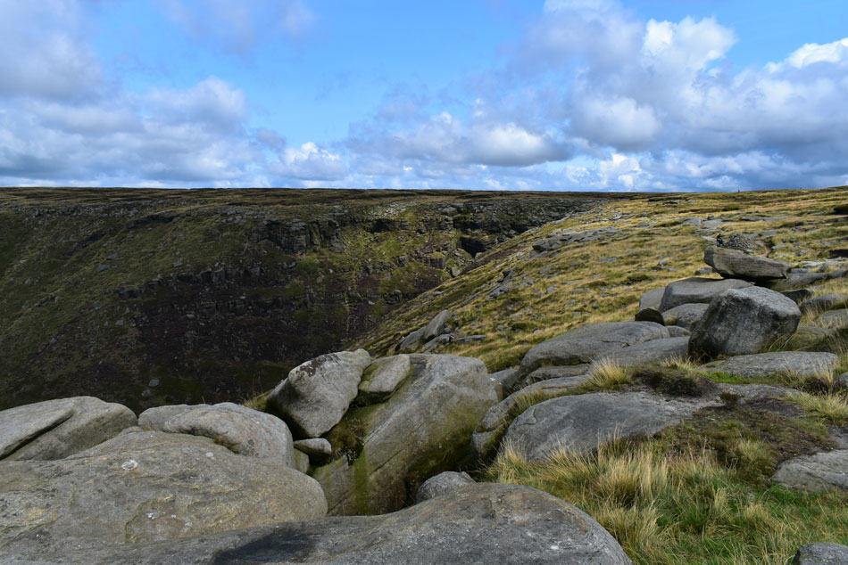
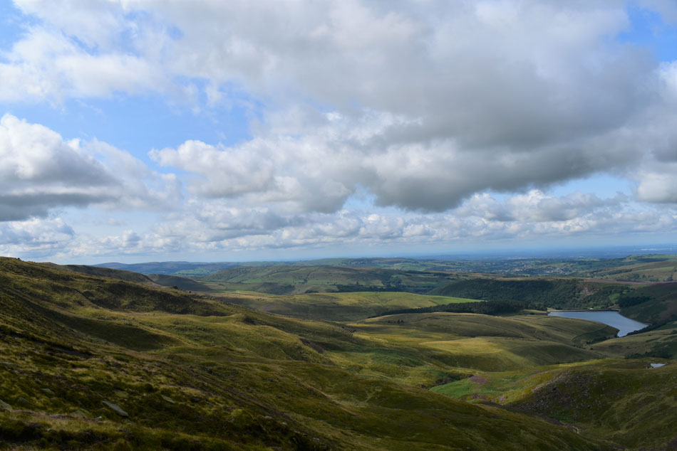
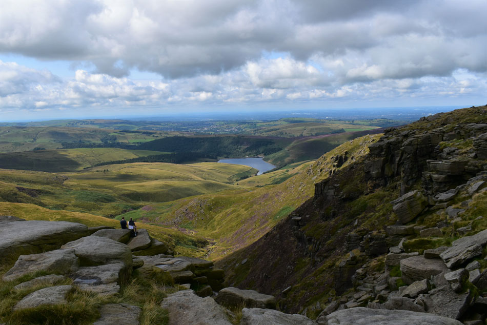
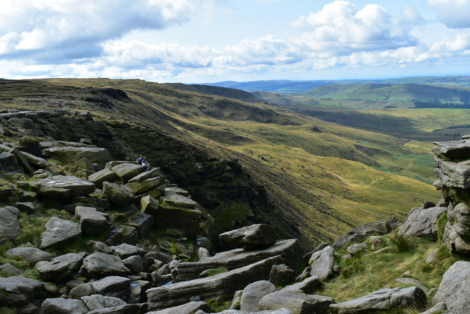
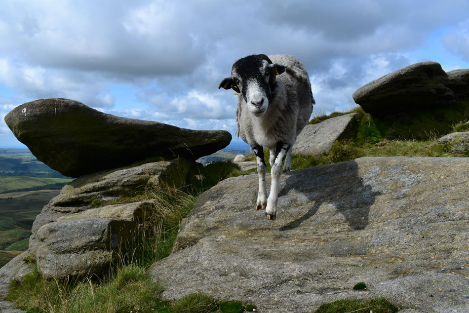
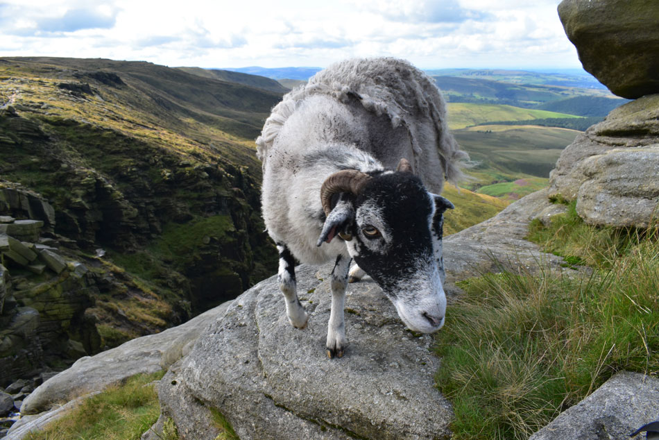
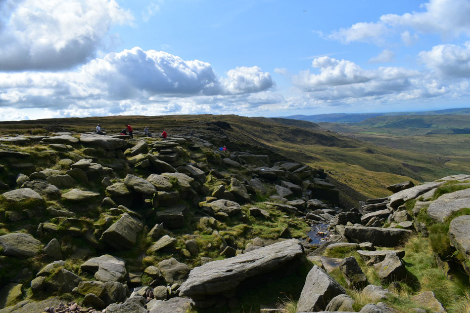
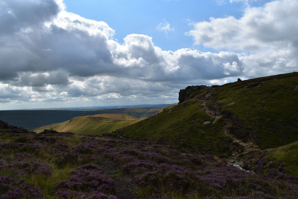
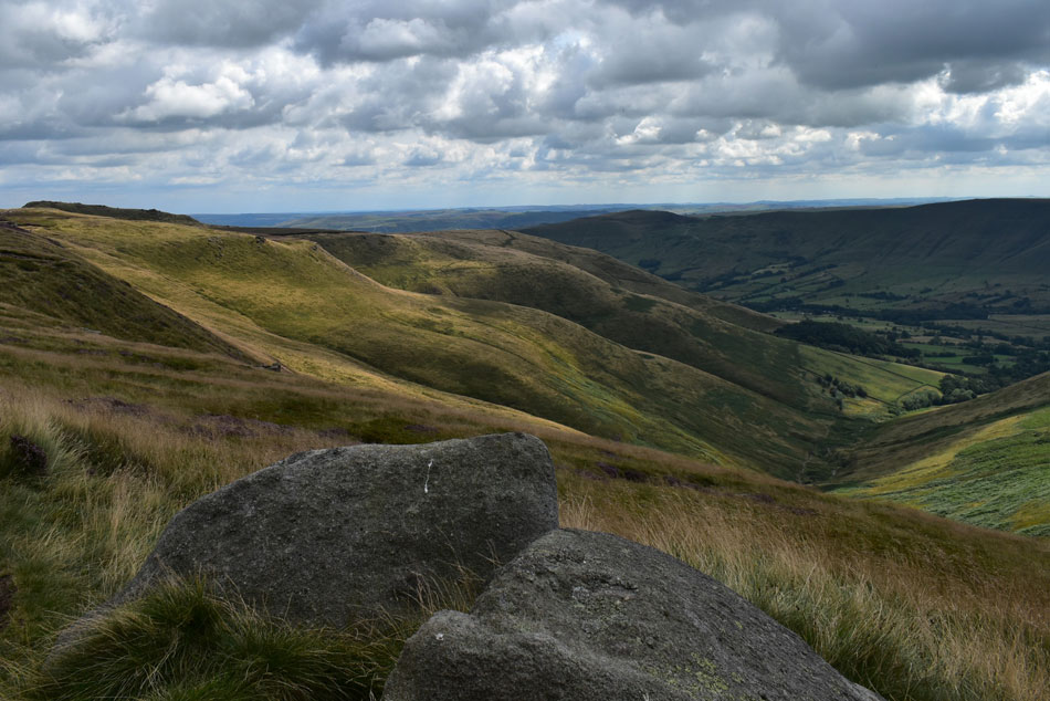
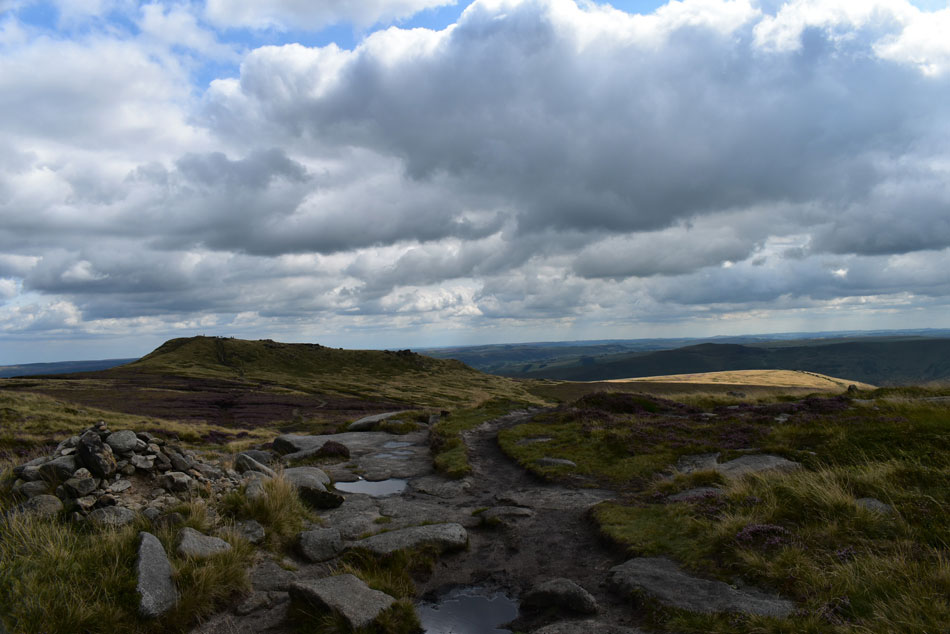
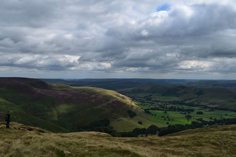
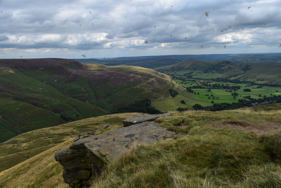
Walking in the Peak District is still new to me and I kinda felt thankful that I have the software which allows me to plan a walk anywhere in the UK. That night as I went through my options I kept referring back to the highest summit in the district, it had to be Kinder Scout.


Ordnance Survey OL1
The Peak District


Overview
Ascent: 1,893 Feet - 578 Metres
Summits: Kinder Scout
Visiting: Grindslow Knoll
Weather: A Bright Starter Then Intermittant Sunshine. Mild With Light Winds Across The Summits. Highs of 22°C Lows of 14°C
Parking: Edale Car Park
Area: The Peak District
Miles: 11
Walking With: On My Own
Ordnance Survey: OL1
Time Taken: 5 Hours 10 Minutes
Route: Edale - Grinds Brook - Heardman's Plantation - Grindsbrook Clough - Crowden Brook - Crowden Tower - Wool Packs - Pym Chair - Noe Stool - Kinder Low - Pennine Way - Kinder Downfall - Kinder Gates - Kinder Scout - Crowden Brook - Grindslow Knoll - Grindbrook Booth - Edale
 

Parking Details and Map Edale Car Park
Nearest Post Code: S33 7ZP
Grid Reference: SK 124 853
Notes: Large Pay & Display Car Park at the junction of Edale Road - Mary's Lane 1hr £1.60 1-2hrs £2.50 2-4 hrs £4.00 over 4hrs (max 10 hrs) £6.00


Map and Photo Gallery


The Church of the Holy and Undivided Trinity, Edale 08:30am 14°C

Just 50 miles after leaving home I arrived at Edale car park encountering light traffic around Manchester Airport which now seemed a distant memory as I parked easily on the car park. Behind me a mother and her young daughter are kitting up and so too is a young lad who's military pack looked so heavy I wondered how he was going to shoulder it but shoulder it he did before passing me a hi...he had to be armed forces I thought. By the ticket machines one fellow listens to the news on BBC Radio 4 - I know this because I had only just switched it off my myself. There's no feeling of hustle & bustle which I soak up as I went over to buy my ticket and after gifting the ticket machine with six pound coins for the day I returned to my car and laced up, watched on by the chap who was still listening to the news.

Despite the mild temperature I left the car park wearing my new Alpkit soft shell jacket which after only a few minutes of wearing I started to regret although being the stubborn bugger that I am it'll be a mile or so until I take it off. I joined Mary's Lane and passed under the railway bridge and stopped to take a look back, it was at that moment did I hear the sound of the points changing followed by the signal change mounted on an old fashioned white post, wow chances of that I thought. Continuing up the Lane I then passed the Rambler Inn who's tables and chairs would be later filled with guests, The local milkman passes and stops just a few yards ahead to deliver milk to a nearby cottage, a scene which is repeated as I walk up the lane towards the Old Nags Head pub.


The Old Nags Head from Edale Primary School.
The sound of a train arrving at Edale Station disturbs the silence as I continue through the village following the milk man on his rounds who had stopped opposite a gate marked 'Pennine Way' the same gate I'll be returning by later.

Approaching the sign posted 'Grinds Brook'
Seen at the gate over on the right.

Wooden footbridge over Grinds Brook.
.After turning right at the sign I picked up a woodland trail then crossed Grinds Brook which I'll follow the course of as I ascend Grindsbrook Clough.

Hartshorn seen with Nether Tor (right) and Upper Tor (left)
After crossing Grinds Brook I turned left onto the footpath not quite believing how pleasant the morning was turning out, after all when I left home it was grey and miserable.

Wooden bench, Heardsman Plantation.
Very inviting indeed!

Mam Tor and Rushup Edge from Grindsbrook Clough.
With the woodland behind me I stopped after crossing a second wooden footpridge where I decided to take my jacket off and packed it under my packs lid should I need it later.

Nether Tor and Hartshorn from Grindsbrook Clough.
Lined with heather and accompanied by the sound of Grinds Brook as it cascades below Grindsbrook Clough, on a day like today it's the type of place you can only dream of, what a place.

Views into Grinds Brook from Grindsbrook Clough.
 

After a sweeping left curve Grindsbrook Clough begins to close in.
As the steep bouldersome acsent onto Edale Moor appears ahead.

Time to cross Grinds Brook.
As I edge closer.

Looking back down Grindsbrook Clough.
With Hartshorn seen over on the left.

Ascending the head of Grindsbrook Clough.

Prior to crossing Grinds Brook earlier I had caught up with two girls who as I passed said "we'll let you pass you're much quicker than us" or words to that affect, it may have been true, I smiled and replied thank you as sweat ran down my forehead. The path underfoot became more rugged after crossing Grinds Brook and I too found myself slowing down.

Hands on hips I stopped at the base of the boulders where a narrow but clear path ascended all the way onto the summit plateau. I'm not sure why but the ascent reminded me of the ascent of Raise Beck or maybe I was just comparing the two to try and keep my mind off how steep it was.


Looking back on Hartshorn from the top of Grindsbrook Clough.
I split the ascent into following the footpath and the river bed whichever I found easiest at the time. At the head of the boulders two families who I'd seen earlier were resting on nearby rocks as I gathered myself trying to look unaffected by the steep ascent but probably failing miserably.

Weathered sandstone rock.
It is said that the forces of wind over thousands of years has blasted the sandstone rocks into how we see them today, this one reminded me of giant tooth!

Crowden Tower, Edale Head and Swine's Back.
Following the stone slabs from the top of Grindsbrook Clough I then picked up the path bound for Crowden Tower (seen centre left) My initial plan was to cross Edale Moor and head towards Kinder Downfall then return to Low Kinder and descend via Grindslow Knoll, but given that it's due to cloud over around lunchtime I thought it best to take in the sites of Kinder Scout with blue skies overhead rather than the other way around.

Views over Crowden Clough.
Towards Brown Knoll (right) and Colburn (left)

And down into the Edale valley.
With Mam Tor (left) Rushup Edge (centre) and Colburn (right)

Crowden Clough.
Time to descend before crossing Crowden Brook followed by a short ascent onto Crowden Tower.

Crowden Tower.
During the descent over Crowden Brook I passed who I thought was the military guy who had just ascended Crowden Clough and another friendly nod was exchanged. The path rose again directly onto Crowden Tower which I explored while taking in the jaw dropping views of the Edale valley below.

Looking back on Grindslow Knoll from Wool Packs.
Leaving the main path I dropped off the ridge to explore Wool Packs next.

Mother nature at her best, Wool Packs.
Found on Kinder Scout’s southern flank are a scattered group of rocks known as the Woolpacks, on account of them apparently being shaped like the old fashioned method of wool packing.

Wool Packs.
 

Wool Packs.
Amazing stuff.

Who else thinks this looks like a giant head...
... ahh just me then.

Pym Chair.
I left Wool Packs and rejoined the main footpath where deep peat bog had to be navigated. Pym Chair stood out on the skyline just a few yards off the beaten path which was where I went to explore next.

The view along the south Kinder Ridge towards Noe Stool and Swine's Back.
Low Kinder whose summit trig point can just about be seen far right is close now but before I reach it...

...I visit Noe Stool next.
With Swine's Back (top of Jacob's Ladder path ) seen right.

Pym Chair and Crowden Tower from Noe Stool.
Spotting a short cut from the main path I took in the gentle ascent towards Kinder Low.

Kinder Low (633m) summit trig point.
Although not the main summit Kinder Low is considered the visitors favourite as opposed to Kinder Scout (636m) summit being a mere mound of grass amongst boggy and featureless terrain.

Distant views of Manchester and Kinder Reservoir.
As I head north towards Kinder Downfall along the Pennine Way.

Approaching Kinder Downfall.
It's less than 1.5 miles from Kinder Low to Kinder Downfall which can seem longer due to the rocky terrain underfoot, the views are spectacular though.

A close up of Kinder Reservoir and Laygatehead Moor.
With the city of Manchester in the distance.

Almost there.
 

Kinder Downfall.
What a place.

Kinder Downfall.
The Peak Districts highest waterfall with a 30m fall. During the Summer the waterfall can resemble just a mere trickle yet if the conditions are right in Winter the waterfall can be blown back onto the plateau which can be seen for miles around.

The view back towards Kinder Reservoir.
The tarn over on the right is named the Mermaid Pool which legend has it is inhabited by a mermaid who will grant immortality to whoever sees her on Easter Eve. It may not be Easter Eve but I can definitely see someone swimming down there.

Kinder Reservoir from Kinder Downfall.
Time for a well earned lunch although I'll take my chances on firmer ground than these two.

Looking back in Kinder Downfall from my lunch spot.
I'm about to have a very friendly visitor.

Hey up!
 

Just curious.
 

I sniff lunch!
 

Pleaseeee!
I have never had the pleasure of having a sheep lick the back of my hand the way this one did or one who let me stroke its head. What an absolute treat...but you're still not having any of my sandwich!

Sadly it's time to leave Kinder Downfall.
Just as a group of Rangers showed up who advised the two guys eating lunch too close to the edge to come back a little.

Heading over Edale Moor (Kinder Scout)
I left Kinder Downfall and followed a well marked path alongside the River Kinder which narrowed over peat bog.

The River Kinder.
At Kinder Gates.

Kinder Scout / Edale Moor.

I continued to follow the path which at times became so vague I found myself surrounded by featureless moorland. Three walkers who had set off a few minutes after me were initially following me but veered right towards Low Kinder and at first I wondered if was I off path. After checking my GPS I did find myself off path but thankfully only by yards. With no feature to aim for I took a bearing southwards and soon spotted two people walking towards me.

They looked pleased to see me, their white long haired labrador was virtually black and only a smile was shared as we passed. After dropping down a steep bank of peat I located the path again before spotting a family of five over to my left "you on path they shouted" "sort of I replied" they wandered over, thanked me and continued across the moor. Soon the silhouette of Crowden Tower appeared as little dots of walkers crossed the main path oblivious to those on the open moorland.

I told myself that despite the moorland crossing lasting just 1.5 miles it was the first time I had to navigate in a while, Edale Moor certainly isn't a place for the less experienced or during bad weather.


Back at Crowden Brook / Crowden Tower.
Time to re-join the footpath above Crowden Brook.

Retracing my steps.
As I head back towards Grindslow Knoll.

Grindslow Knoll.
The forecasted cloud had well and truly arrived yet it was still mild enough to wear my short sleeved base layer. With Edale Moor behind me I stamped my boots free from peat, left the main path at the sandstone rock I described as a tooth earlier and followed the slabbed path to the summit of Grindslow Knoll.

The sun at times would still poke through.
Seen here over the Edale valley.

A distant Loose Hill from Grindslow Knoll.
Grindslow Knoll was looking incredibly busy during my approach and incredibly all had left by the time I reached the summit with the exception of the chap stood standing on the left who I had last seen leaving Kinder Downfall as I approached. Incredibly we had arrived at Grindslow Knoll summit at exactly the same time but by different routes.

It's flying ant weekend.
One minute they weren't there the next I'm being attacked! Buzz off!!

Views of the Vale of Edale.
Towards a distant Loose Hill, Back Tor and Barker's Bank.

Mam Tor and Rushup Edge.

With the summit of Grindslow Knoll behind I began the descent back to Edale passing a father and his two daughters during the process, they stopped as a solo woman walker passed but not to chat, more to stare as I later found despite wearing the best gear she was ascending barefoot!

Tidying her hair as she approached it was only after she had passed with a 'hi' did I realise she was walking barefoot by which time I was too gobsmaked to say owt!


Loose Hill and Back Tor.
Seen over the Vale of Edale.

Mam Tor and Rushup Edge.
Seen as I join the Pennine Way less than half a mile out of Edale.

Edale.

The barefoot woman was still on my mind as my feet longed for the clipped grass of the Pennine Way, they soon got their wish. Walking the last few yards of the Pennine Way into Edale was my reality check, my photo doesn't show how busy the village was as I waited patiently until I had a clear shot of the Old Nags Head before joining the Mary's Lane back to the car park.

The quiet scenes of village life were just a memory now as tourists flooded the narrow lanes while traffic waited patiently to pass. I passed the church once more and its adjoining graveyard then the Rambler bar whose tables were packed with folk people watching or chatting. Dogs barked and for the second time I heard the points change on the railway track as I passed under the railway bridge. By now I'd left the crowds behind before entering the car park via its side entrance. The train sped through this time without stopping and that's where my day above the Edale valley ended, what a day.


Back to top