|
Crinkle Crags via Hell Gill |
 |
 |
20th September 2021 |
 |
|
It's been hit and miss regarding the weather as of late but If I'd have known how well the forecast would have turned out when I booked this day off four weeks ago I'd have put a line on the lottery too.
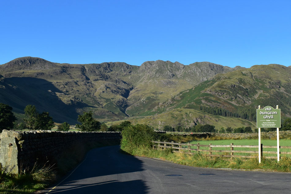
I had an encyclopedia of walks to choose from which included Snowdonia and The Peak District but in the end Lakeland won. I built the walk around visiting Little Stand then set about my options of which there were many. The last time I climbed alongside Hell Gill I was troubled by a chap who didn't know the way and decided to follow me from ODG all the way to Three Tarns, now I'm far from being an anti socialist but that ascent was very trying and I don't mean due to the steepness of the gradient.
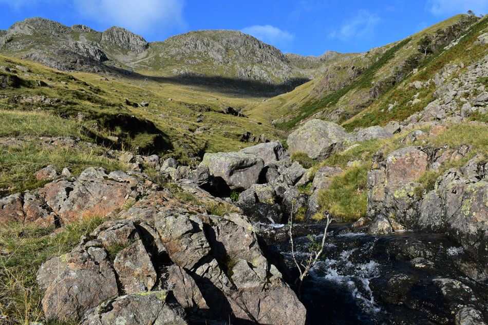
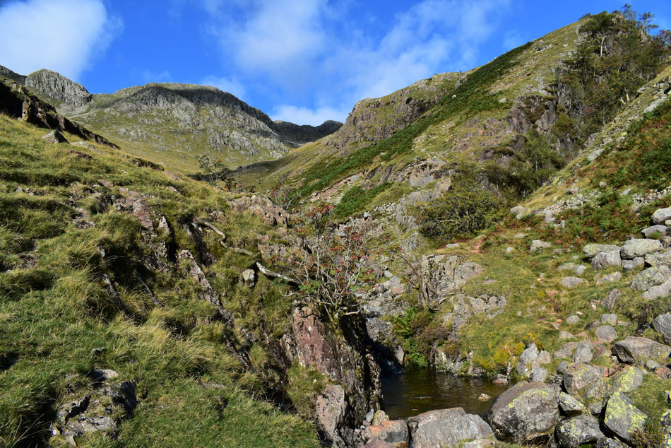
Wainwright describes the ascent of Hell Gill as an alternative to that of the Band but I feel it's much more than that, it's a rugged wild place with rock scenery and waterfalls that would equal any walk above Seathwaite yet the walker is gripped by the solitude of the place all the while 300ft above your head walkers make their pilgrimage to Three Tarns while in the expanse below Shelter Crags the walker ascends unseen towards the same goal. |
|
| Wainwright Guide Book Four |
 |
| The Southern Fells |
Hell Gill
For walkers who have already trodden the Band several times it makes a pleasant change and gives striking views of the huge Hell Gill ravine. |
 |
|
|
|
|
| |
|
Overview |
|
|
| Ascent: |
3,016 Feet - 919 Metres |
| Wainwrights: |
2, Crinkle Crags |
| Weather: |
A Bright Cool Start Remaining Sunny Throughout With Intermittant Cloud Across The Summits. Highs of 19°C Lows of 9°C |
| Visiting: |
Shelter Crags - Stonesty Pike - Little Stand - Great Knott |
| Parking: |
Parking Spaces, Rossett Bridge Great Langdale |
| Area: |
Southern |
| Miles: |
11 |
| Walking With: |
On My Own |
| Ordnance Survey: |
OL6 |
| Time Taken: |
6 Hours |
| Route: |
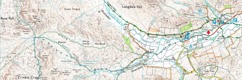
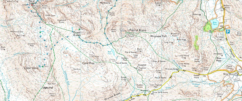
Rossett Bridge - Stool End Farm - Oxendale Beck - Hell Gill - Buscoe Sike - Three Tarns - Shelter Crags - Crinkle Crags - Stonesty Pike - Little Stand - Great Knott - Red Tarn (Langdale) - Brown Howe - Oxendale - Oxendale Beck - Stool End Farm - Rossett Bridge |
|
| |
|
Parking Details and Map |
|
|
| Nearest Post Code: |
LA2 29JX |
| Grid Reference: |
NY 291 606 |
| Notes: |
A popular place to park your car is Rossett Bridge, Great Langdale found between New Dungeon Ghyll and Old Dungeon Ghyll on the left hand side here you will find roadside parking for up to six cars. My advice is to arrive early due to the popularity of the area. Parking is free. |
|
| |
|
Map and Photo Gallery |
|
|
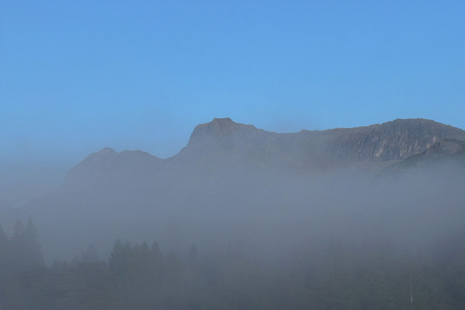 |
| The Langdale Pikes poking out above the valley mist 08:12am |
| Taken between Chapel Stile and Millbeck while on route to ODG |
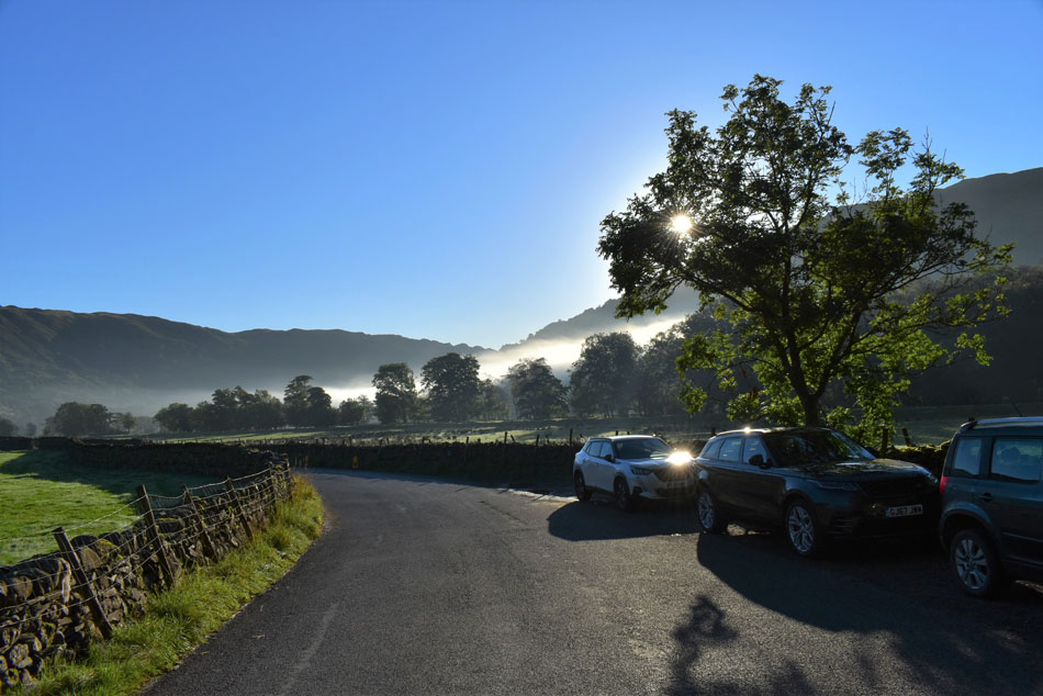 |
| Parking spaces, Rossett Bridge, Great Langdale 08:30am 9°C |
Not only was I treated to a parking space at Rossett Bridge the mist had started to clear leaving pockets just here and there hovering above the tree tops. It felt like Christmas had come early. I arrived the same time as the chap who owned the black Land Rover parked in front of me who was just about to leave and smiled 'morning' as I got out of my car before making off in the direction of ODG. It's a beautiful bright morning with just a slight nip to the air so I add my Alpkit soft shell just to take the bite away.
Despite the miles ahead of me I wasn't in any huge rush to leave so once laces are tied I had a wander to the opposite side of the road to see if I could spot anyone ascending Stickle Gill but unusually, spot no one. I returned to my car and took a long gulp of Summer Fruits clearing half a litre in the process before placing the bottle back in my boot, after one final pat down and sweep of the boot I locked the car and crossed Rossett Bridge towards Stool End Farm. |
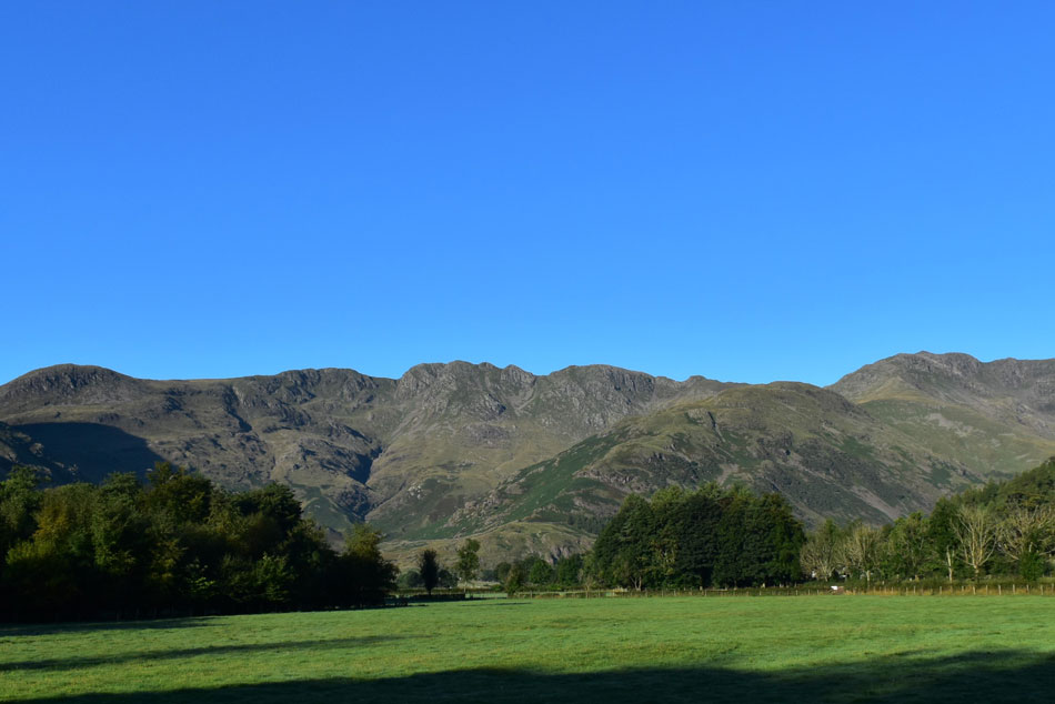 |
| Views of Great Knott, Crinkle Crags, The Band and Bow Fell. |
| Taken shortly before arriving at ODG. |
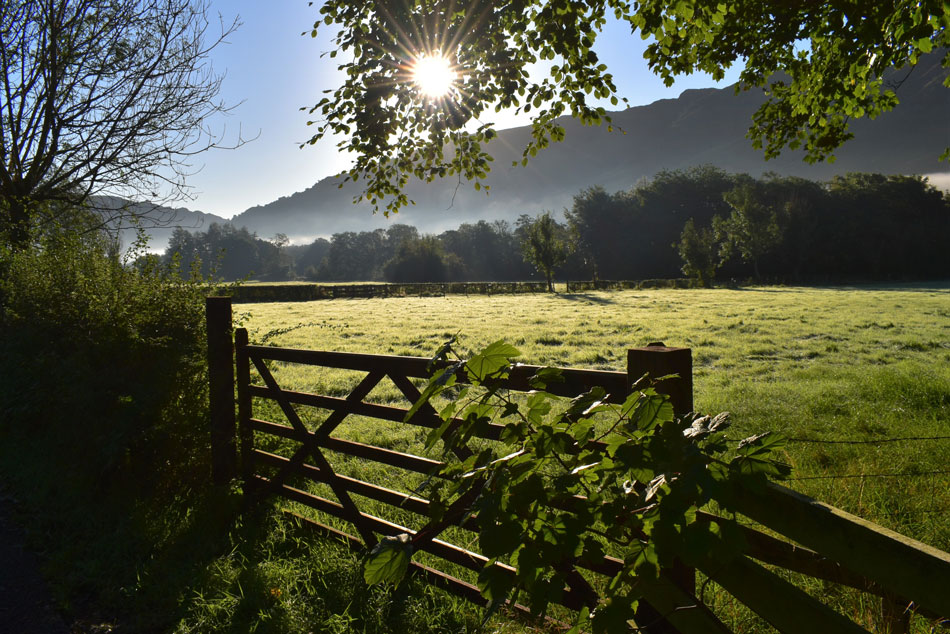 |
| What a fantastic morning. |
| Here looking back across the dew covered fields towards Rossett Bridge and the northern spur of Lingmoor Fell. |
 |
| Great Knott, Crinkle Crags and The Band from ODG |
| Forgive me if I'm a little trigger happy with the camera this morning. |
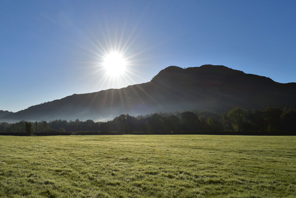 |
| Sunrise above Side Pike. |
| |
 |
| Views into the Mickleden valley. |
| With Hanging Knotts seen far left, Rossett Pike centre and the unmistakable Pike O'Stickle seen right. |
 |
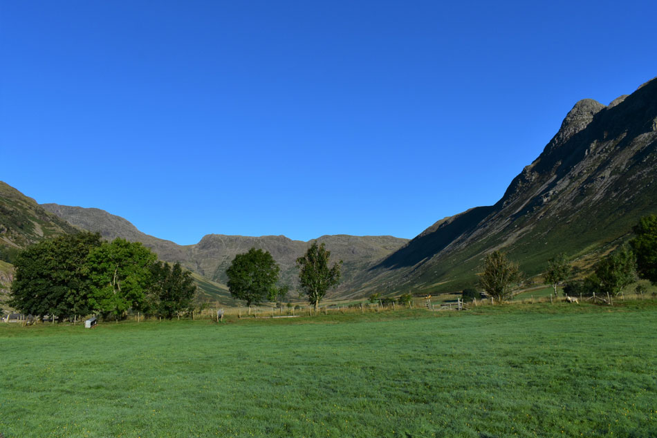
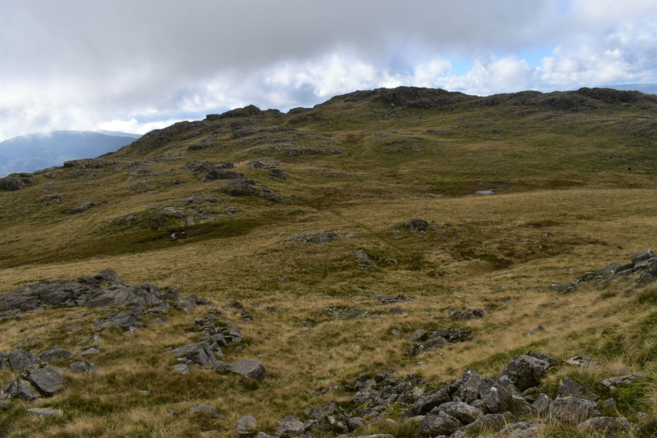
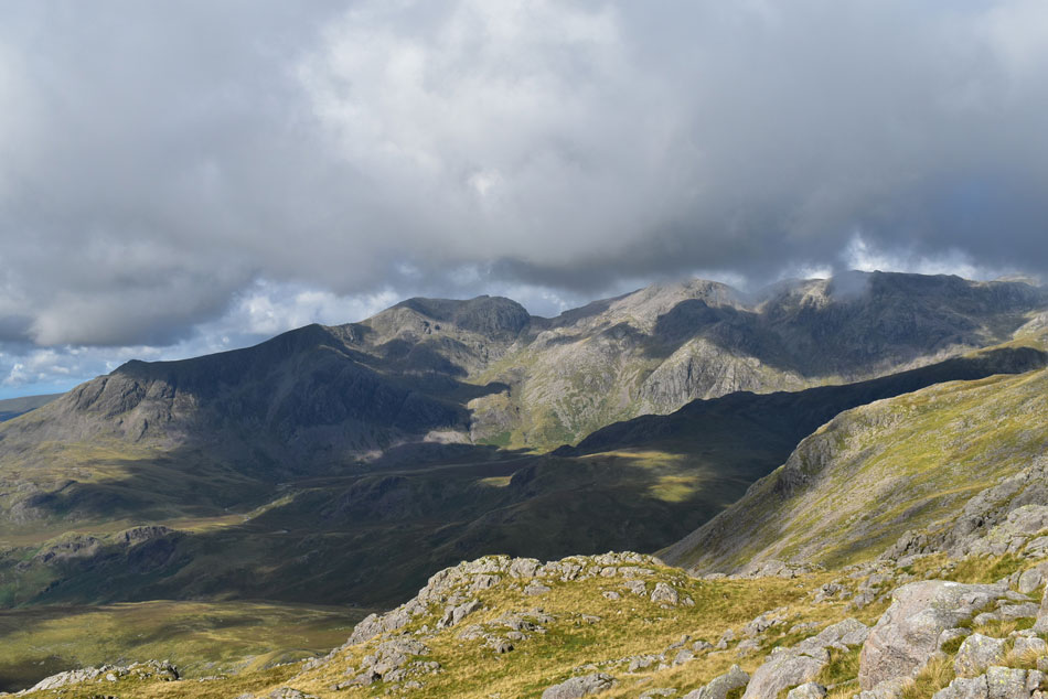
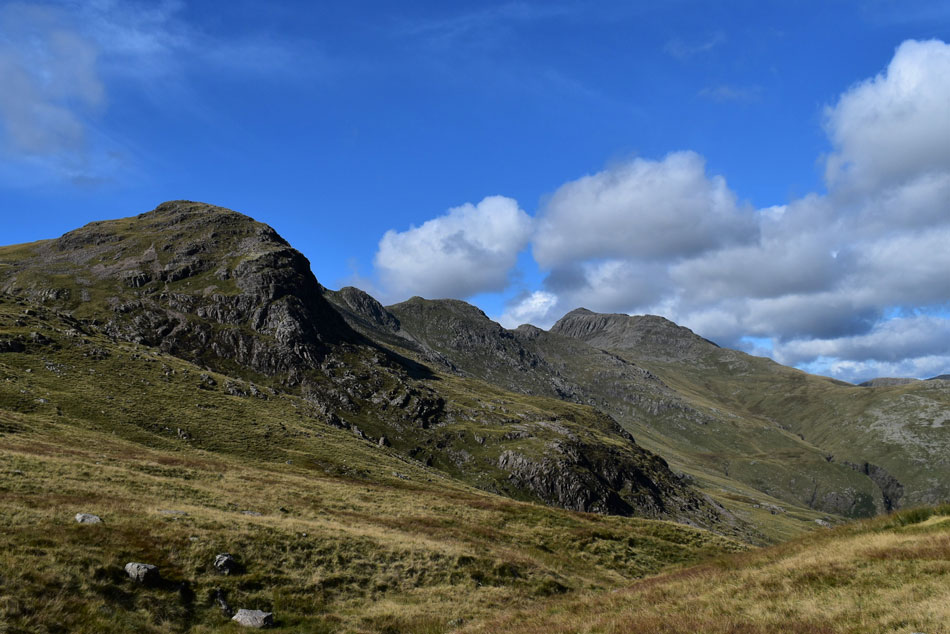
| Great Knott and Crinkle Crags. |
| Viewed again this time from Stool End Farm. |
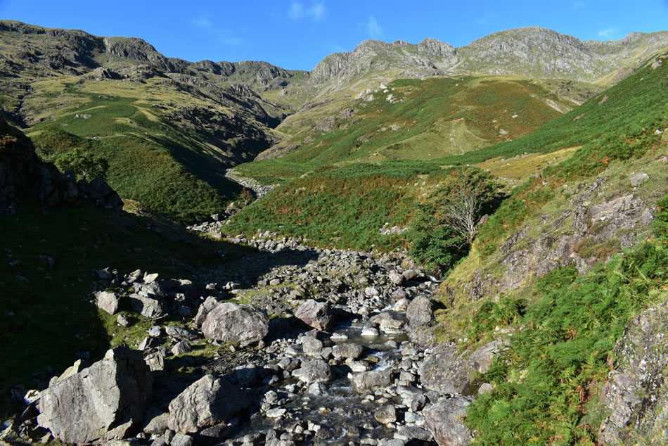 |
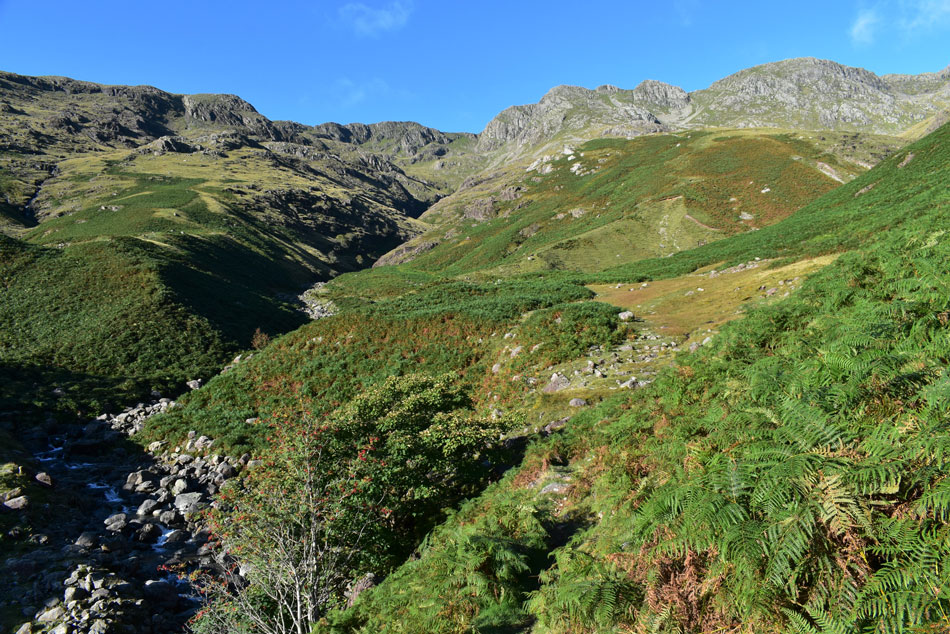
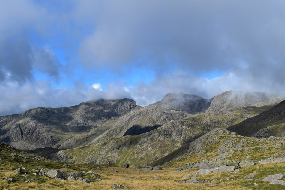
| Crinkle Gill, Crinkle Crags, Gunson Knott and Shelter Crags from Oxendale Beck. |
| Still not quite believing how fine the morning was turning out I passed through Stool End Farm then ascended the track into the Oxendale valley where I was treated to magnificent views of the Crinkles and Crinkle Gill seen centre. |
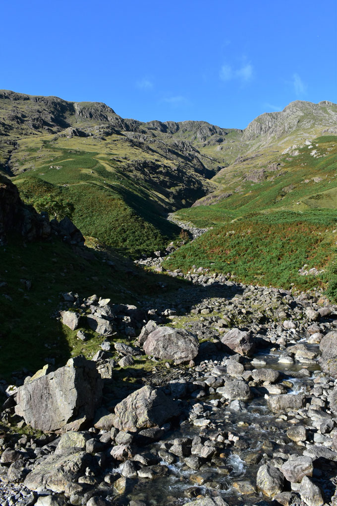 |
| Staring into the throat of Crinkle Gill. |
| Which is actually navigable with extreme caution if you don't mind getting wet and the odd wet scramble. |
 |
| Following the path above Oxendale Beck. |
| Which steers through the clearing up ahead towards a footbridge over Whorneyside Force. |
 |
| Crossing Whorneyside Force. |
| Where you are presented with two choices either to ascend the fell side or walk alongside Whorneyside Force until Whorneyside waterfall is reached. |
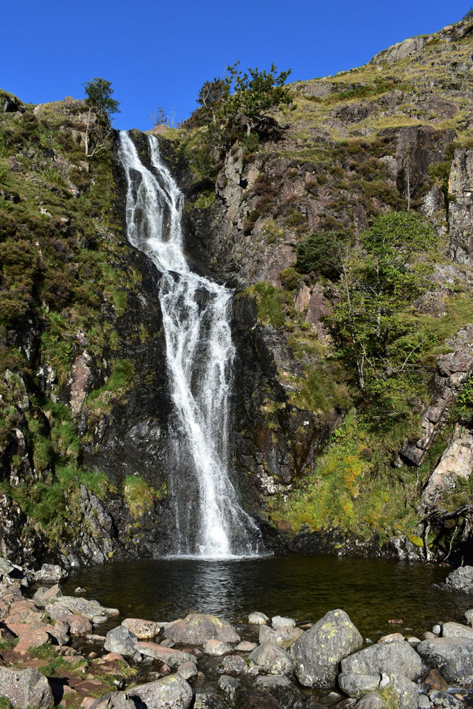 |
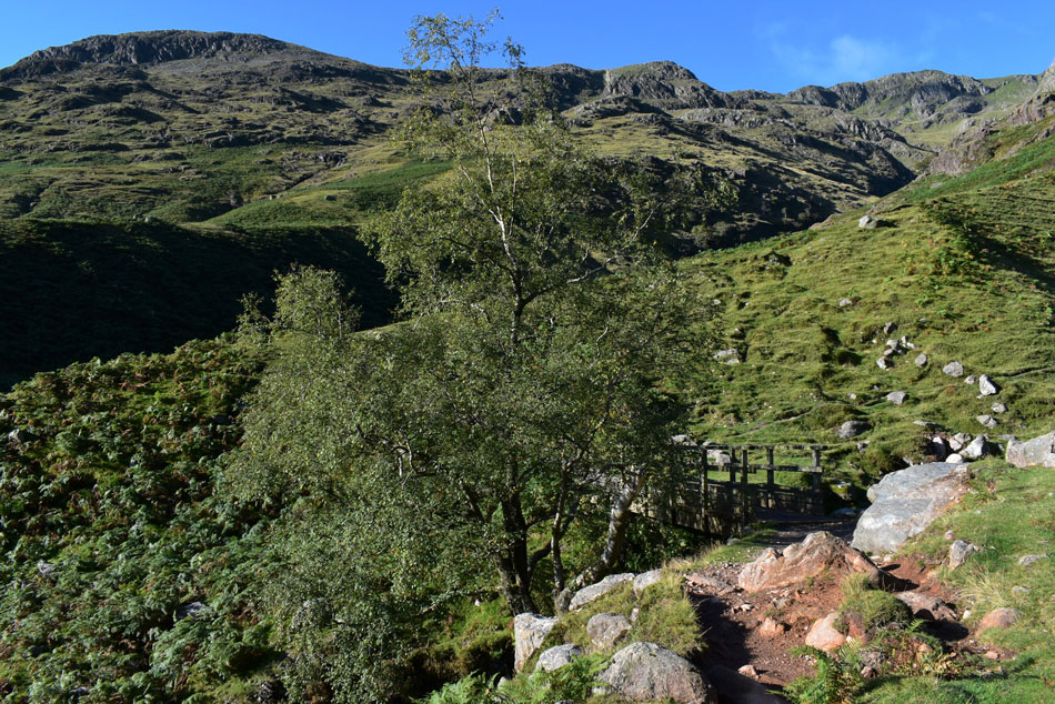
| Whorneyside Force (waterfall) |
Today I opted to walk alongside Whorneyside Force until the waterfalls came into view which were the first of many highlights on todays walk.
I re-join the path by ascending steeply to the left of the falls all the while being treated to the sound of cascading water. |
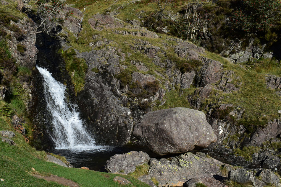 |
| The perched boulder... |
| ...found at the top of Whorneyside Force. |
 |
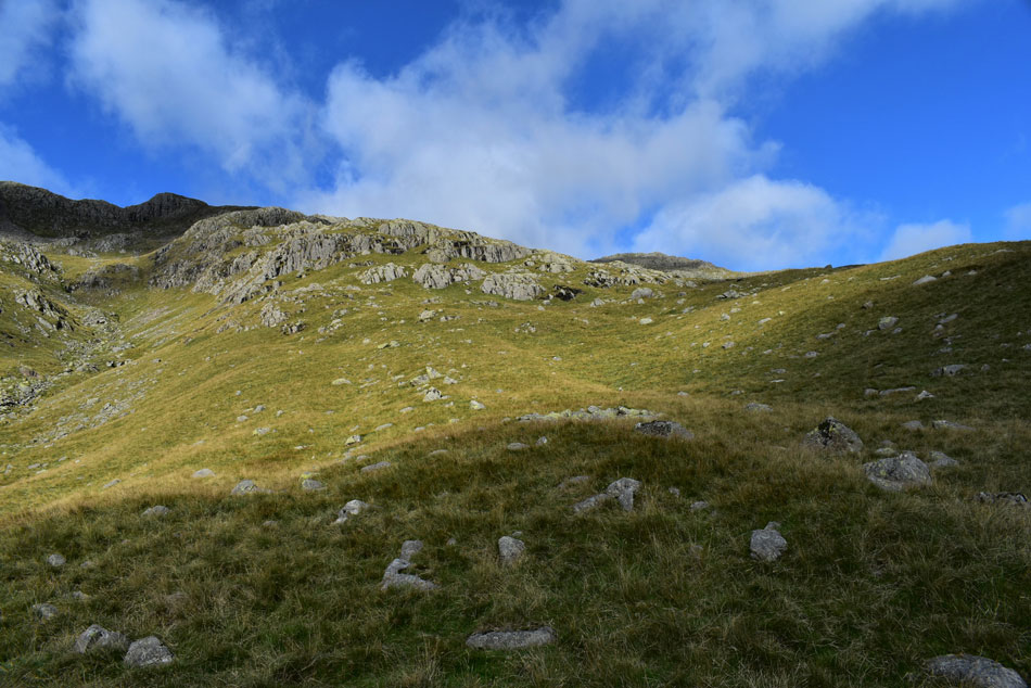
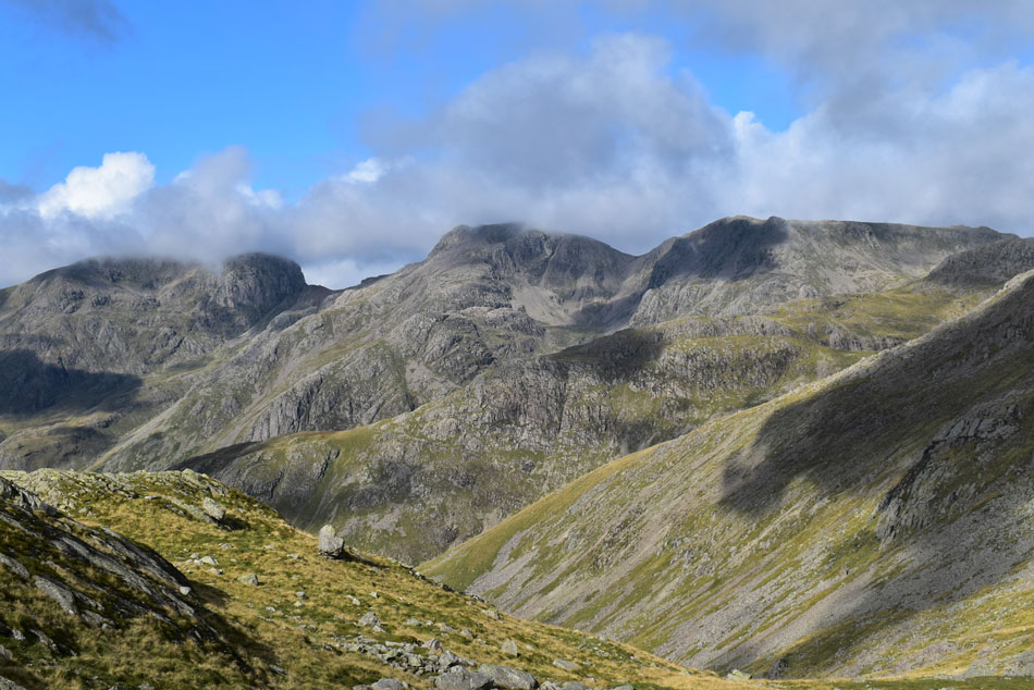
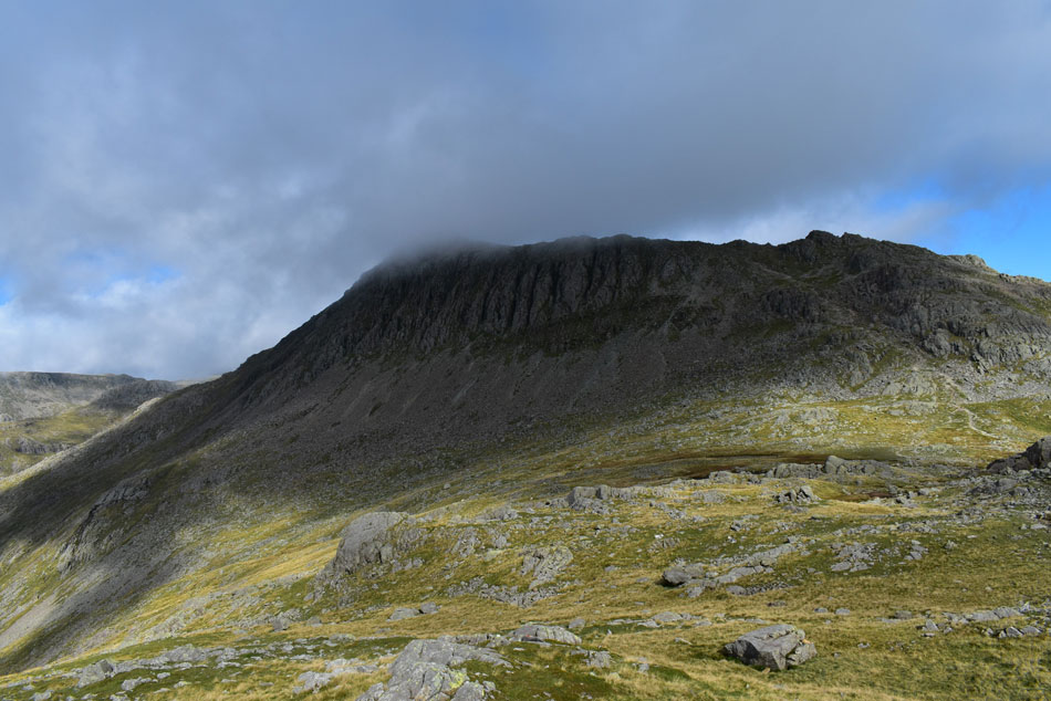
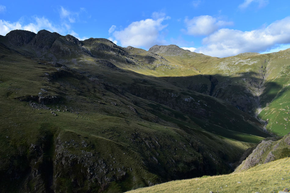
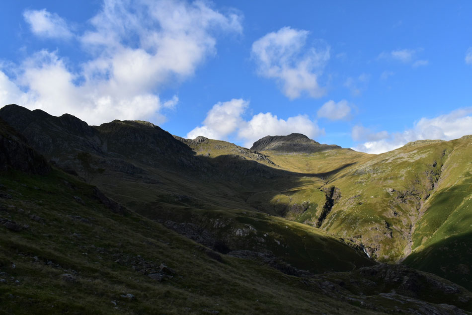
| Gunson Knott and Shelter Crags. |
| Will domineer my ascent until Three Tarns are reached. |
 |
| Gunson Knott and Shelter Crags up ahead. |
| With Dry Gill appearing right. |
 |
| Flippin fantastic stuff. |
| I cross a feeder stream in the centre of the photo before steering right while continuing to follow what is now Buscoe Sike. |
 |
| Gunson Knott and Shelter Crags. |
| I'm heading for the lower section of the ridge seen over on the right and while I'm at it I really need to lose a layer so off comes the jacket which gets tucked below the lid of my pack. |
 |
| Once reached... |
| ...I leave the path and make a pathless ascent towards the base of the crags then continue to steer right which In principle allows me to maintain a constant altitude. |
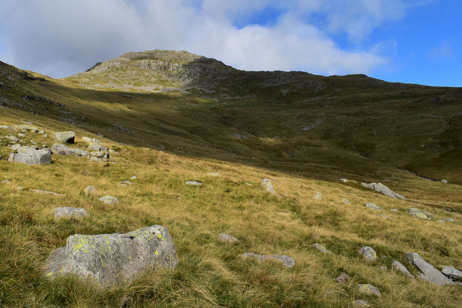 |
| Bow Fell and Three Tarns appear. |
| Despite a total lack of path the going underfoot wasn't as difficult as it looks, in fact I seem to be gaining ground on walkers using the Three Tarns path from Stool End Farm / The Band. |
 |
| Sca Fell and Scafell Pike from Three Tarns. |
| For the first time I started to bump into people at the cross roads that is Three Tarns firstly by a chap who had just come from the direction of Crinkle Crags then by two couples who had descended Bow Fell. We all stopped to admire the cloud dramatics over the Scafells. |
 |
| Bow Fell from Three Tarns. |
| You can't help but fall for the light at this time of year. |
 |
| Oh eck... |
| ...I think I spoke to soon. |
 |
| Oh well... |
| ...I'll just use the camera to zoom in on Sca Fell, Mickledoor, Rough Crag and Scafell Pike. |
 |
| Whoop whoop. |
| I didn't have to wait long until the sunshine returned. |
 |
| Slight Side, Cam Spout Crag, Sca Fell, Mickledoor, Rough Crag and Scafell Pike from Three Tarns. |
Three Tarns were all visible but the centre tarn has to be my favourite given its magnificent views. By now that 'morning nip' had turned into a bit of a chill so off came my pack and on went my jacket.
I hadn't realised that by adding my jacket I'd now covered up the Buff which I'd double twisted over my right wrist to form a sweatband which I conveniently used to wipe my forehead...just stick with me on this... |
 |
| Cam Spout Crag, Sca Fell, Mickledoor, Scafell Pike and Broad Crag. |
| With the Yeastyrigg Crags ridge seen foreground. |
 |
| The view was so good. |
| I took another photo! |
 |
| Leaving Three Tarns. |
| With views of Bow Fell. |
 |
| Bow Fell and a distant Great End. |
It was around here as I went to wipe my forehead did I realise my Buff was missing from my wrist, without thinking too much into it it dawned on me that when I added my jacket I must have taken it off and now it was lying on the ground back at Three Tarns. It was too far to head back for a fifteen quid Buff so feeling gutted, I continued over Shelter Crags thinking how the hell am I going to wipe my forehead now...
It would transpire that I might not need too. |
 |
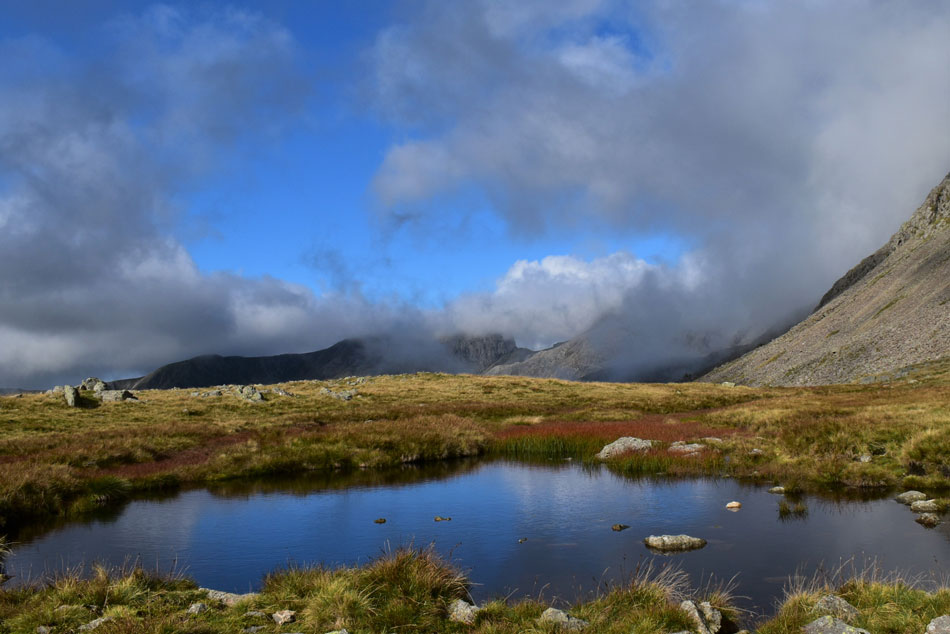
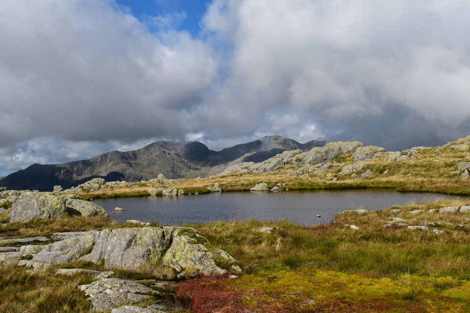
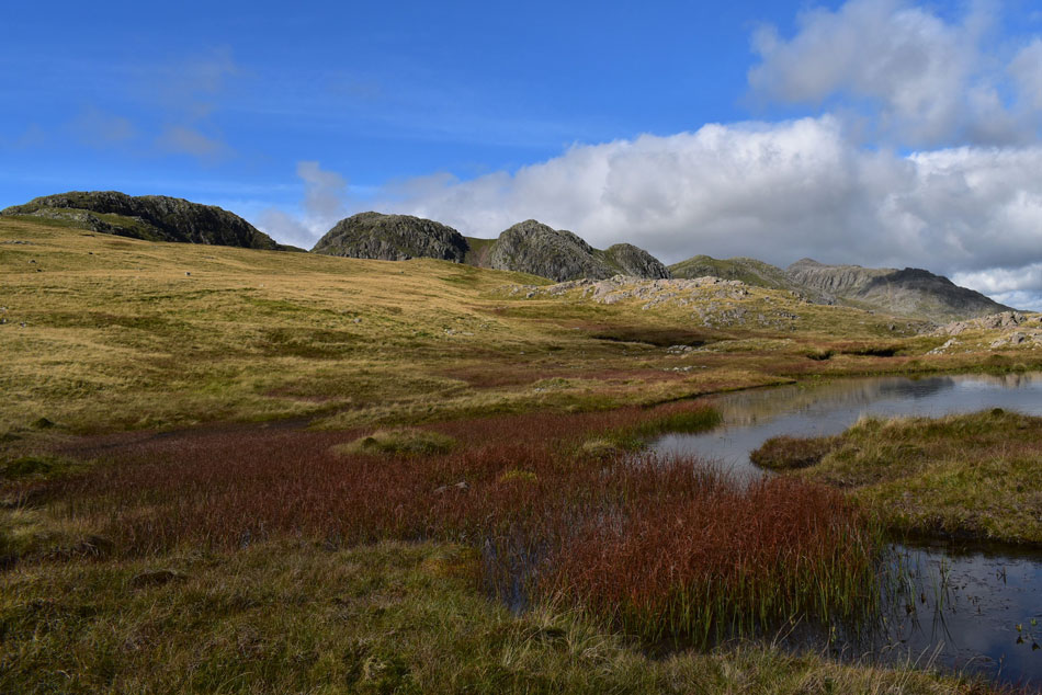
| From the unnamed Tarn on Shelter Crags. |
| Looking out towards the Langdale Pikes. |
 |
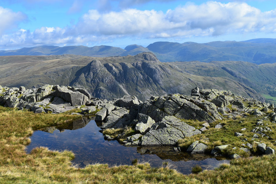
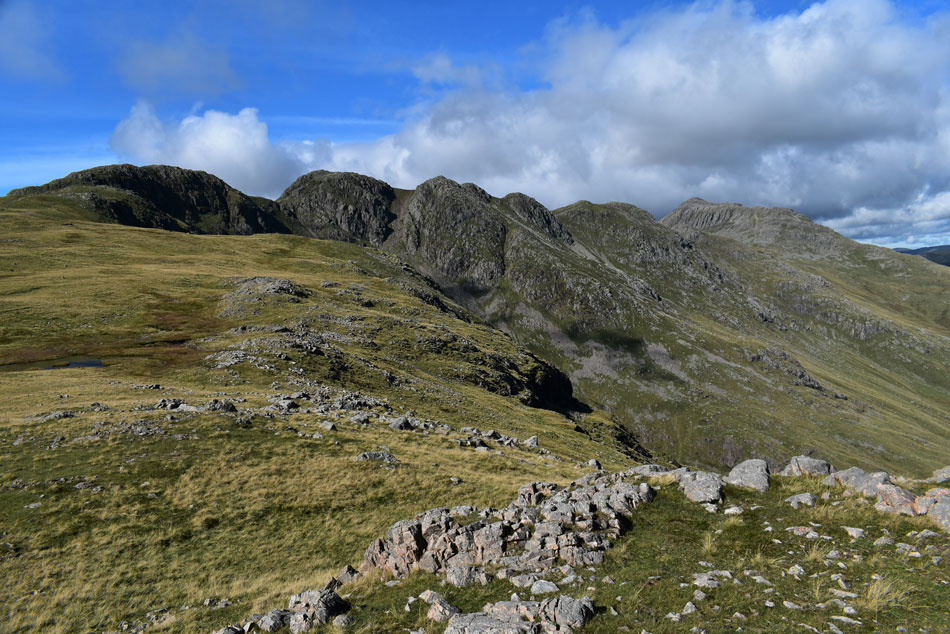
| Between the 3rd and 4th Crinkles (travelling north to south) |
| I look back on Bow Fell (right) Esk Pike (centre upper) and Great End (left) with Pike de Bield appearing above the Yeastyrigg Crags ridge (centre left). |
 |
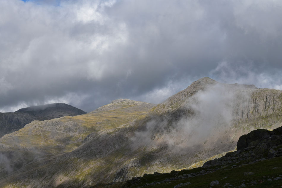
| More cloud arrives. |
| Adding more dramatics as I take in the endless views towards the Scafells. |
 |
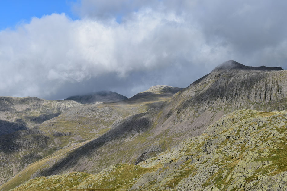
| Bow Fell, Esk Pike, Great End and Pike de Bield. |
| The same cloud is starting to drift over towards Bow Fell and the Crinkles. |
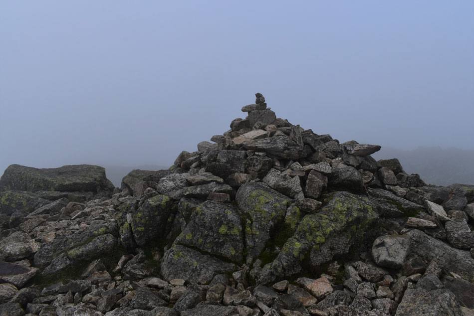 |
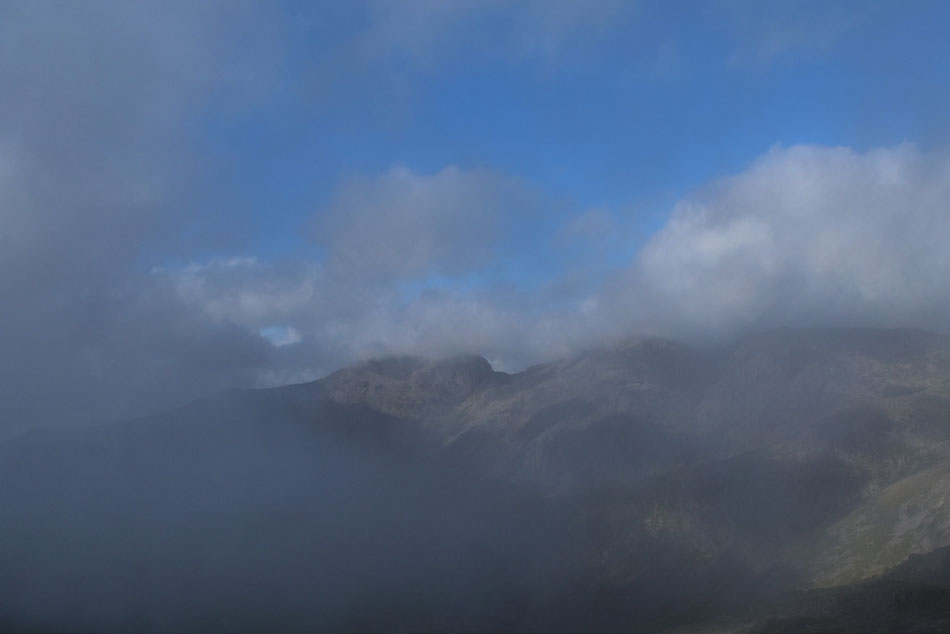
| Crinkle Crags summit. |
Within minutes of taking the last photo I was enveloped in thick cloud that eerily clung to the summit. One minute I was enjoying the sun soaked views while wiping sweat from my forehead the next I was in almost zero visibility while thinking about adding my hat and gloves, this is how quick the weather changes in Lakeland.
Between Crinkles three and four I passed two walkers before beginning my ascent on Crinkle four (Crinkle two if travelling south to north) Where I found the rock to be wet and greasy, funny how conditions change quickly too not encountering rock so slippery previously. Clambering over rock I crested the summit and made my way over to the summit cairn which was eerily quiet. I gave the cairn a tap with my right walking pole then another with my right hand, doubled back right and followed the cairns towards the alternative Bad Step path. |
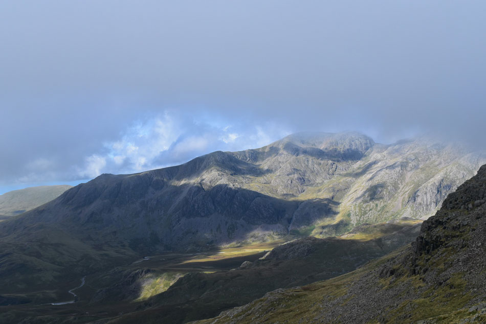 |
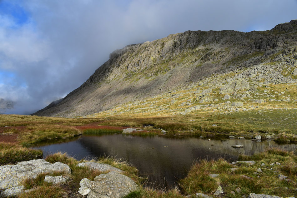
| Scafell Pike, Mickledoor, Sca Fell, Cam Spout Crag and Slight Side above Great Moss. |
| Within minutes of leaving the summit behind I was standing at the top of the alternative path to the Bad Step just as the cloud started to clear from the summit revealing Sca Lathing and High Gait Crags below. |
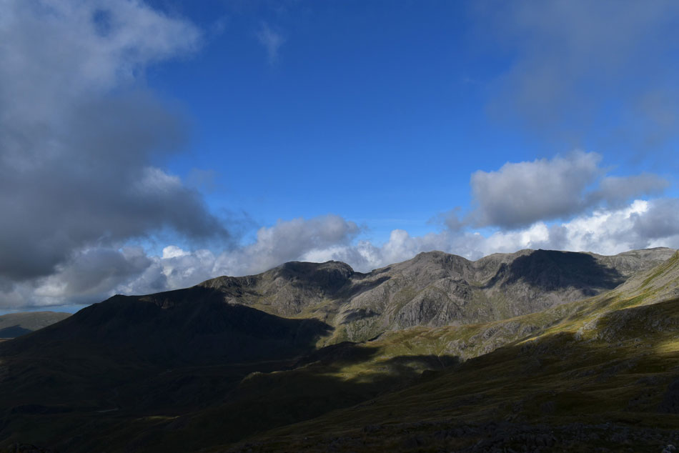 |
| And as if by magic. |
| Someone turned the lights back on. |
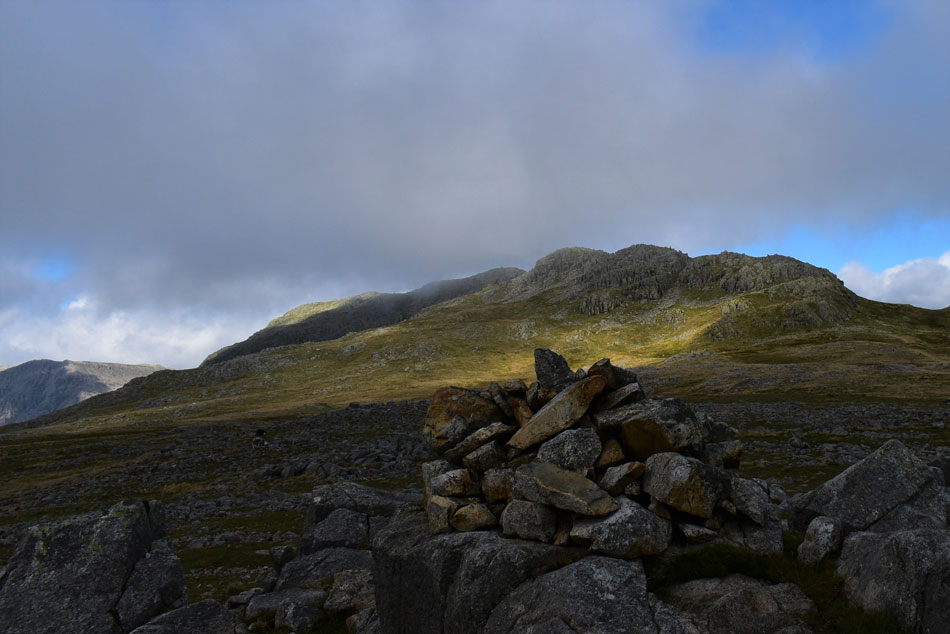 |
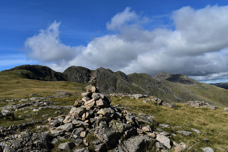
| Crinkle Crags from Stonesty Pike summit. |
I started my descent and was soon passed by a young lad probably no older than 21 ascending the alternative path who gave off a 'how do' in a strong Lancashire accent 'morning' I replied. Descending Crinkle five was a trio made up of two young girls and a young lad, all by-passed the Bad Step and made their ascent by the alternative path where another 'morning' was shared.
Despite my surrounding summits being cloud free Crinkle Crags was still holding onto a little cloud which left the fell side looking between one shade of dark brown to another. I had remembered using a second alternative path which by-passes a direct descent/ascent of the 5th or 1st Crinkle where by leaving the path at grid reference NY 251 044 the walker can descend easily via a series of grassy banks onto the Stonesty Pike plateau.
It was during this descent did I spot who appeared to be an elderly chap having just left Stonesty Pike summit. In the low light the summit cairn was barely visible but the chap made a great reference point for me to aim for, shame I couldn't thank him for it. |
 |
| From Stonesty Pike. |
| I continued to follow the ridge southwards towards Little Stand. |
 |
| Slight Side, Sca Fell, Cam Spout Crag, Mickledoor, Scafell Pike and Broad Stand from Little Stand. |
| I couldn't believe my luck by the time I had reached Little Stand the sun had come back out and fell side came alive. It was time to celebrate with lunch. |
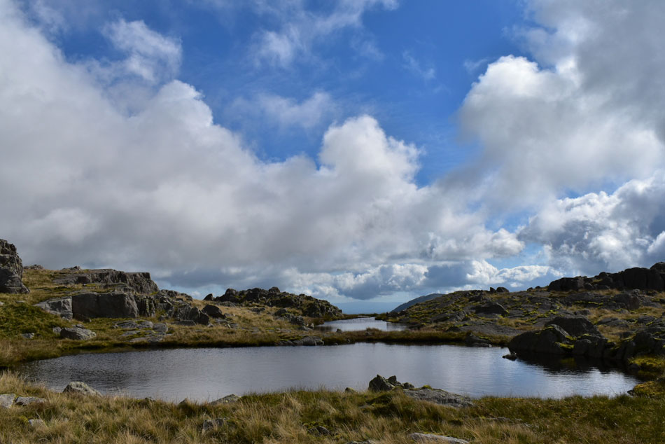 |
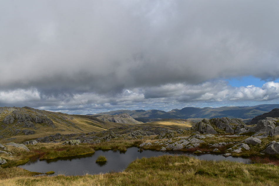
| The two unnamed Tarns. |
| Found on Little Stand summit. |
 |
| Lunch with a view. |
| Here looking back on Stonesty Pike towards Crinkle Crags, Scafell Pike, Broad Crag and III Crag seen far left. |
 |
| While in t'other direction. |
| Here looking towards Slight Side, Cam Spout Crag, Sca Fell, Mickledoor, Scafell Pike, Broad Crag and III Crag with Throstlehow Crag, Sca Lathing, High and Low Gait Crags, Pen and the Yeastyrigg Crags ridge seen in the foreground. |
 |
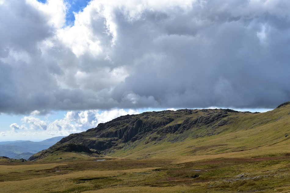
| Leaving Little Stand. |
| My plan was to visit todays final summit of Great Knott seen centre left via Stonesty Pike before having a change of plan where I would traverse the head of Gaitscale Gill seen to the right of the crags far left which although direct, was quite tricky underfoot. |
 |
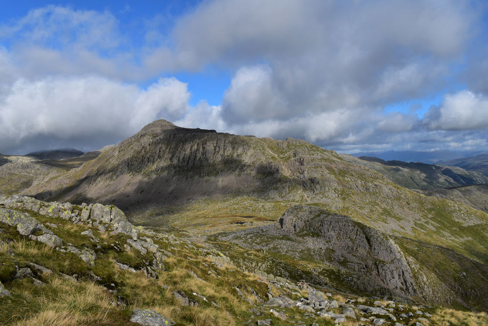
| Lovely light over Great Knott. |
| I maintained a constant height which was to no avail having reached a ravine which formed Gaitscale Gill part of which was made up of steep rock and grassy ledges. Negotiating the ravine was a no-no so in the end I did what I hate having to do, I lost height before steadily making it back up again. |
 |
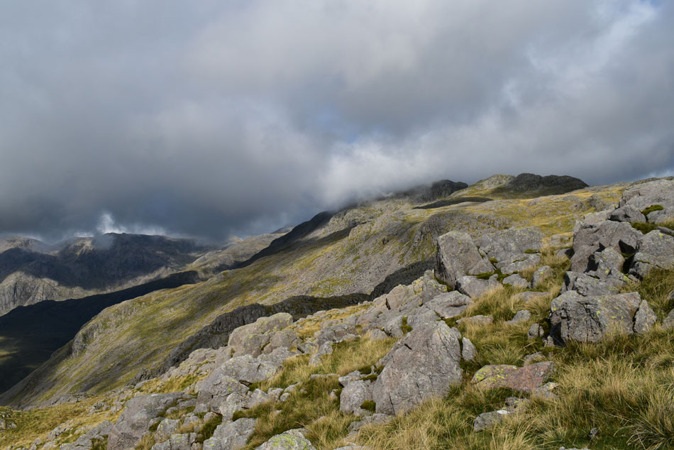
| Crinkle Crags and Bow Fell. |
| Taken from the unnamed Tarns below Great Knott. |
 |
| Crinkle Crags and Bow Fell. |
| |
 |
| Crinkle Crags and Bow Fell. |
| From todays final summit, Great Knott. |
 |
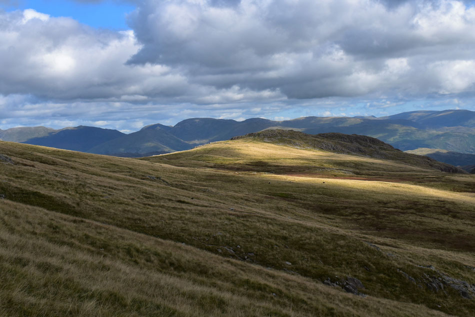
| Looking back towards Little Stand from Great Knott. |
| The start of my earlier traverse can be seen far right. |
 |
| Pike O'Stickle, Harrison Stickle and Pike O'Blisco. |
| Seen as I begin my descent towards Red Tarn (Langdale) |
 |
| Great Knott, Crinkle Crags and Bow Fell from the top of Browney Gill. |
My feet were starting to ache a little but I took the descent in good stead under a hot afternoon sun while looking forward to de-layering once Red Tarn was reached. Walkers had congregated at the crossroads so I found a spot off the beaten track and removed my jacket where I instantly spotted my Buff still wrapped around my wrist.
It would seem I hadn't removed it after all and there was me mourning its loss, what an absolute goofball! |
 |
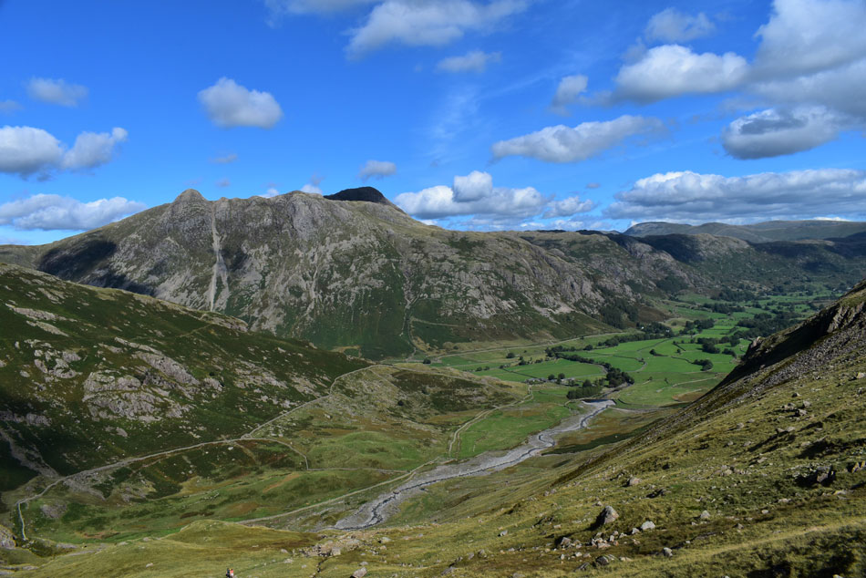
| Crinkle Crags, Bow Fell, Hell Gill, Dry Gill and Browney Gill. |
| Adding a pair of sunglasses I left Red Tarn and started my descent into Oxendale feeling quite pleased with myself that my Buff hadn't been lost and just brushed aside how stupid I'd been (author still shaking head at time of writing) |
 |
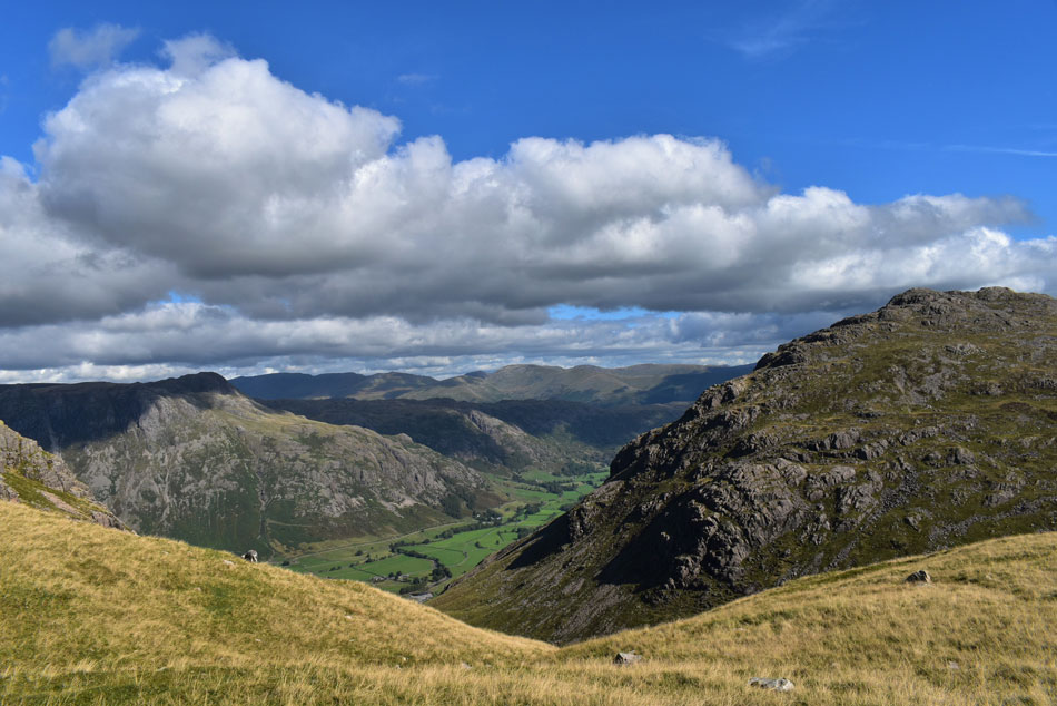
| Great Langdale Views over the Oxendale valley. |
| Descent slowed slightly partly due to tiring legs and partly due to the steepness of descent. |
 |
| Crinkle Crags, Bow Fell, Hell Gill and Dry Gill. |
| Hell Gill can be seen centre right with Whorneyside Force waterfall below also to the right. |
 |
| Crinkle Crags from Oxendale. |
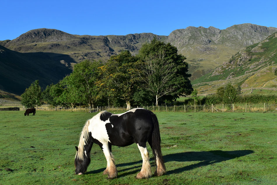
With temperatures topping 20°C it was time to enjoy the afternoon sunshine while kicking my feet into the backs of my boots. Lakeland is still experiencing unprecedented high figures of visitors but on this quiet Monday afternoon as I made my way through Great Langdale I only passed two people at Stool End Farm where I spotted the Farmer and hand tending to a flock of penned sheep.
With Stool End Farm behind me the sound of climbers on Raven Crag relaying orders broke the silence of the valley followed by the odd passing car or the distant bark of a dog from a nearby campsite. |
|
| |
| Back to top |
 |
|