|
Harter Fell & Hard Knott from Jubilee Bridge |
 |
 |
21st November 2021 |
 |
|
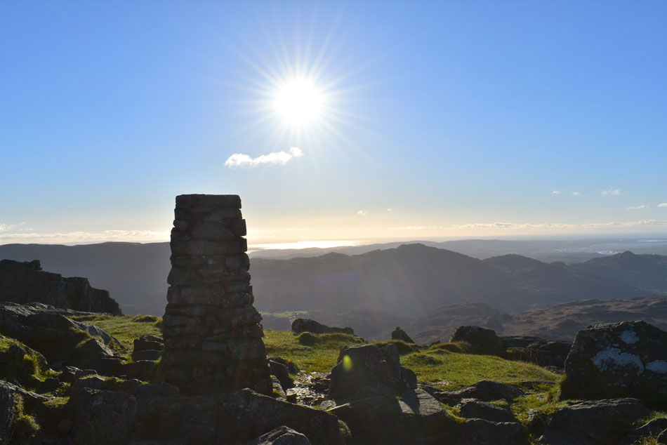
Another poignant walk which originates from a couple of days before my father passed away when David and I had arranged to meet at Jubilee Bridge. The forecast that day was very similar to todays which reminds me, I forgot to ask David where he ended up walking but that's for another day.
We had the kind of forecast which commanded a deserving walk, we had the whole of Lakeland to choose from but settled on returning to the walk we cancelled which for me, kind'a puts a little closure on recent events. I originally chose this walk because of its wildness, its views and because it was the right time of year to experience Lakeland at her best right at the edge of Winter.
I'm not sure about anyone else but due to travel restrictions last year most of us missed out on those Autumn days when we missed the transition between Autumn and Winter when the tips of your fingers go numb and that all to familiar snurch starts. Today we were back to embrace, and to witness that transition when it suddenly dawns on you that you should have added that extra layer after all. |
|
| Wainwright Guide Book Four |
 |
| The Southern Fells |
Harter Fell Not many fells can be described as beautiful, but the word fits with Harter Fell, especially so when viewed from Eskdale. |
 |
|
|
|
|
| |
|
Overview |
|
|
| Ascent: |
2,533 Feet - 772 Metres |
| Wainwrights: |
2, Harter Fell (Eskdale) - Hardknott |
| Weather: |
Bright & Sunny, Medium Winds Where Exposed. Highs of 7°C Lows of 2°C Freezing Level Above The Summits. |
| Parking: |
Parking Spaces, Jubilee Bridge |
| Area: |
Southern |
| Miles: |
6 |
| Walking With: |
David Hall & Rod Hepplewhite |
| Ordnance Survey: |
OL6 |
| Time Taken: |
5 Hours |
| Route: |
Jubilee Bridge - Harter Fell - Hardknott Pass - Ravencrag Tarn - Hard Knott - Border End - Hardknott Fort - Jubilee Bridge |
|
| |
|
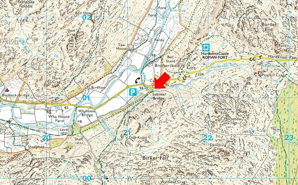
Parking Details and Map |
|
|
| Nearest Post code: |
CA19 1TH |
| Grid Reference: |
NY 212 801 |
| Notes: |
There is room for around eight well parked cars at Jubilee Bridge with further off road spaces found between Jubilee Bridge and Whahouse Bridge. The parking spaces are perfectly positioned to get into upper and lower Eskdale whether you aim for a walk up Harter Fell, Bowfell or the Scafells these spaces during summer are at a premium and my advice is to arrive early should you want to secure a parking place. Look out for the cattle grid at the bottom of Hardknott Pass (Jubilee Bridge itself cannot be seen from the road) parking can be found on the left if approaching from the top of the Hardknott Pass or just after the cattle grid on the right if approaching from Eskdale. Parking is free. |
|
| |
|
Map and Photo Gallery |
|
|
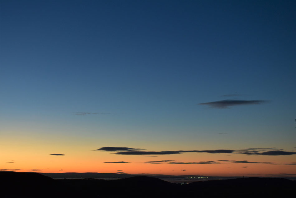 |
| Dawn from Gawthwaite 07:09am |
| The glow of a fiery dawn caught my rear view mirror as I climbed through the village of Gawthwaite and just like last weekend I visited the same lay-by to snap a few photos here looking towards Cartmell and Flookburgh. |
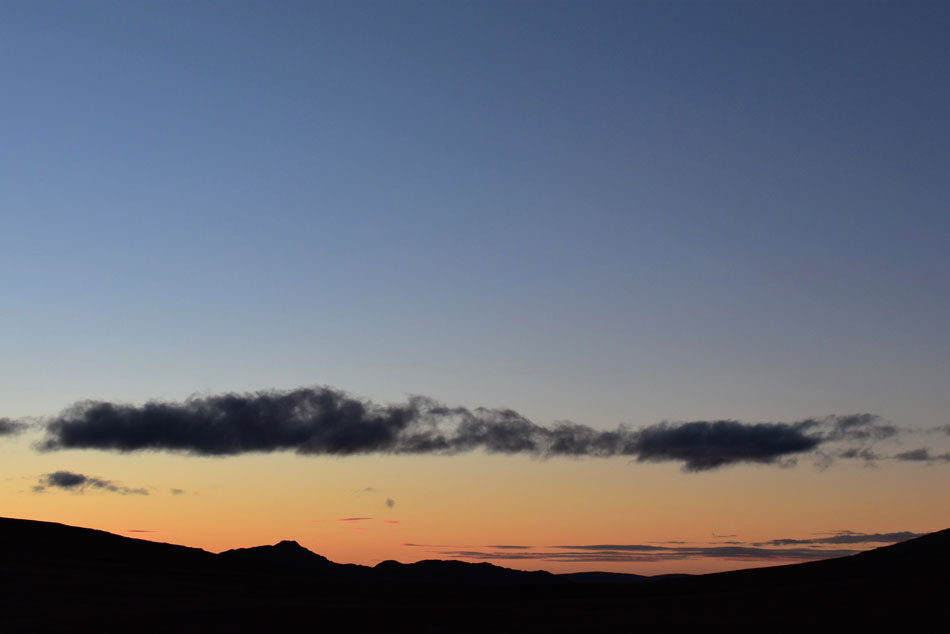 |
| Stickle Pike silhouettes from Birker Fell Road. |
| I'd normally drive over both Wrynose and Hardknott passes but this morning I fancied a change, I'm glad I did, having the sun rising in my rear view mirror nearly caught me off guard a few times while driving over the Birker Fell Road. |
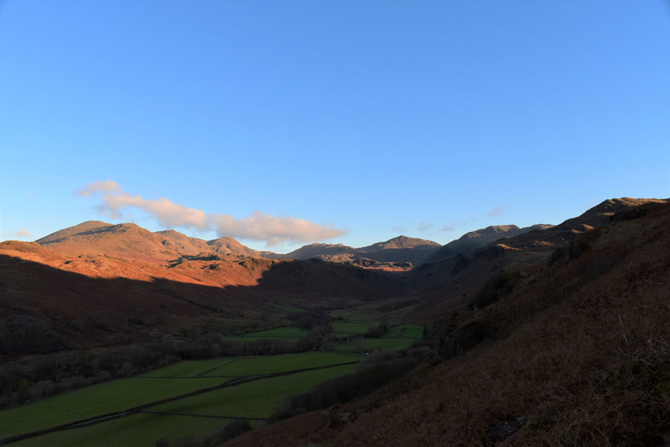 |
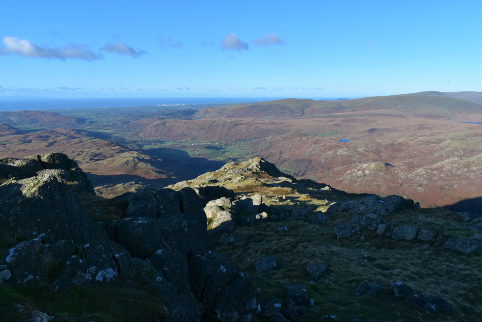
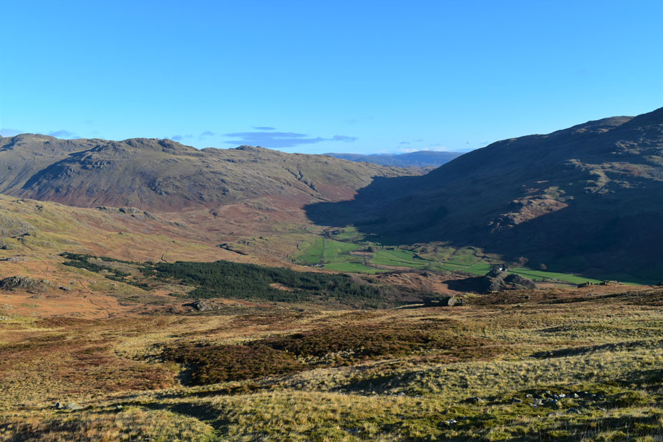
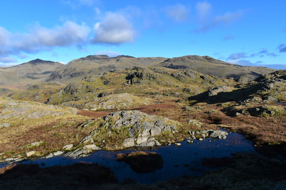
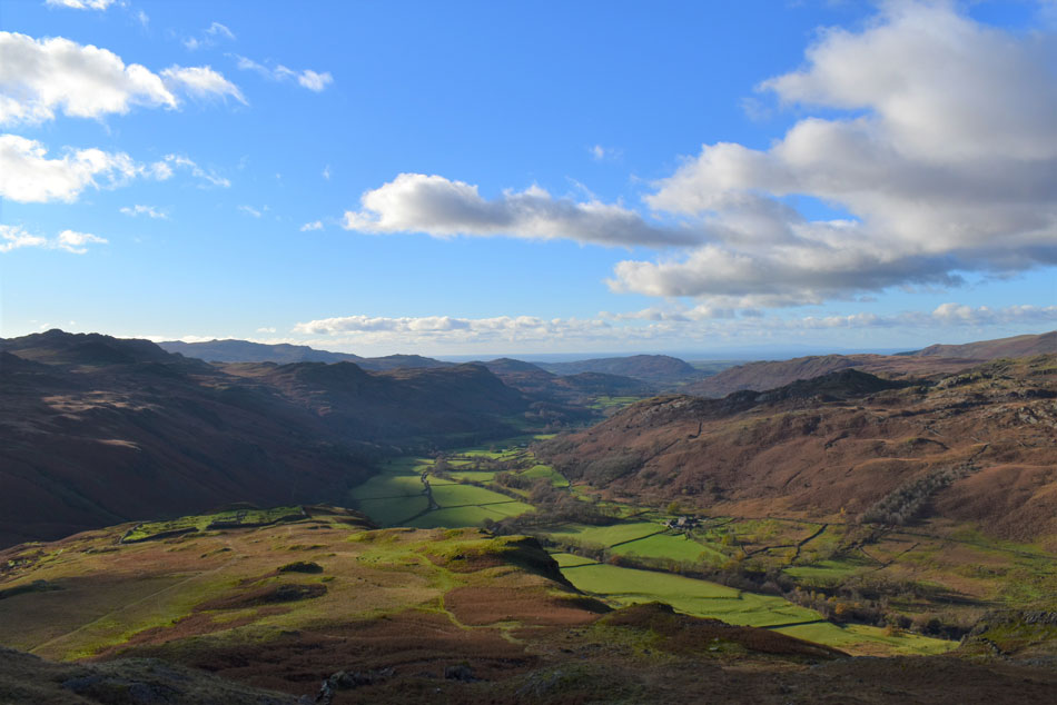
| Looking back into Upper Eskdale with views towards Slight Side, Sca Fell, Scafell Pike, III Crag, Esk Pike and Bow Fell 8:45am 2°C |
We had arranged to meet at 08:15am and by the time I'd turned off the Birker Fell Road I caught David's car in my rear view mirror. We stopped for a few minutes and gazed at the sunlight as it slowly eased its way over Bow Fell summit.
We got back into our cars and continued towards Jubilee Bridge and within minutes of arriving we spotted Rod's car easing down the zigzags on Hardknott Pass. David and Rod both asked how I was and my reply was kept minimal which the guys understood without a word being spoke. There was little to no wind here at valley level but that didn't stop the morning frost nipping at the fingers so while Rod and I added gloves David thought he'd wait a while longer until the penguins made an appearance. |
 |
| Morning light over ... |
| ... Slight Side, Sca Fell, Scafell Pike and III Crag. |
 |
| Our last view over Eskdale towards IIIgill Head and Whin Rigg. |
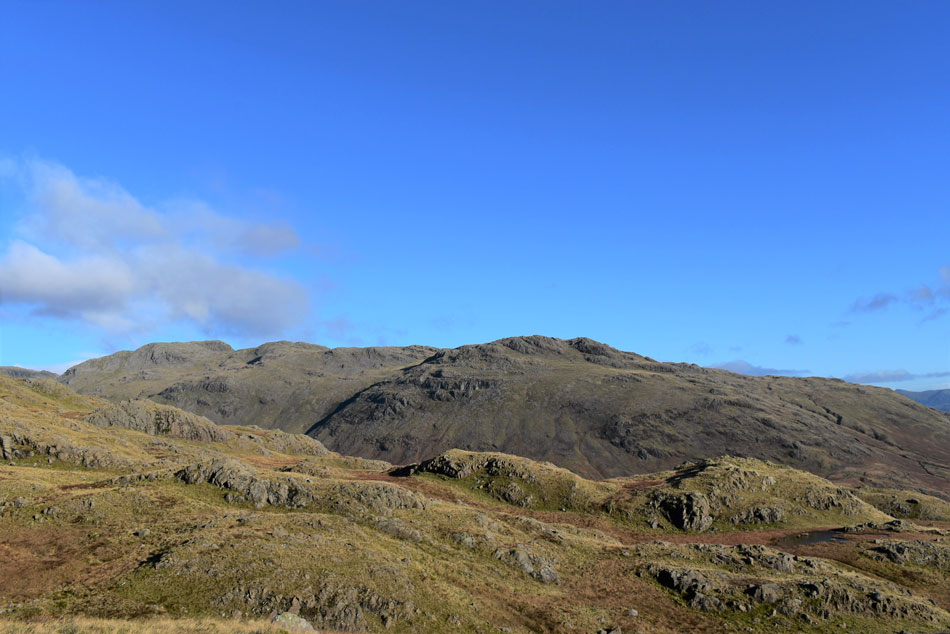
| As we turn south and begin the steady climb towards Harter Fell summit. |
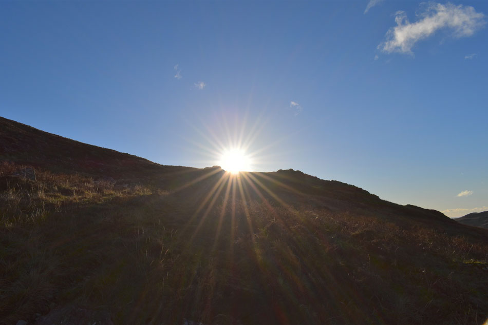 |
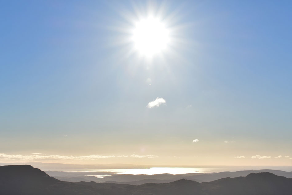
| Blinding light. |
| What little wind there was left behind as we started to climb into a blinding sun almost directly above the footpath causing us to ascend with eyes looking down at our boots only looking up to make sure we were still on the footpath. |
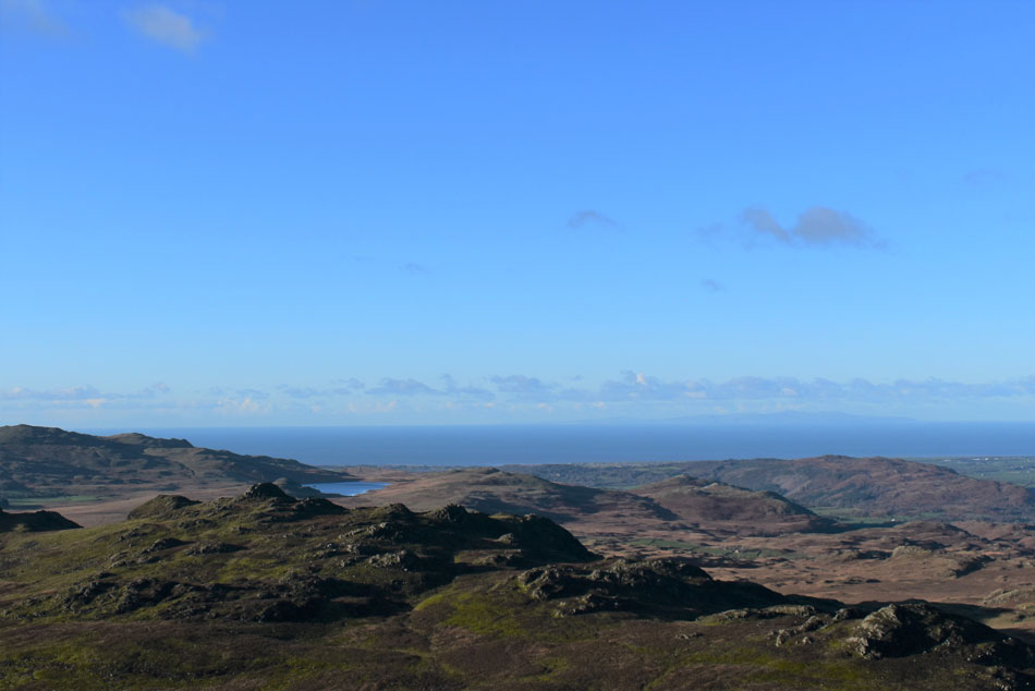 |
| Looking beyond Kepple Crag towards a distant Devoke Water with Muncaster Fell seen right. |
| While over to the left of Devoke Water White Pike and Yoadcastle came into view. |
 |
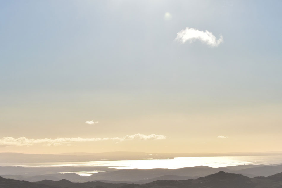
| Golden Morecambe Bay |
| Glowing as the sun rises directly above. |
 |
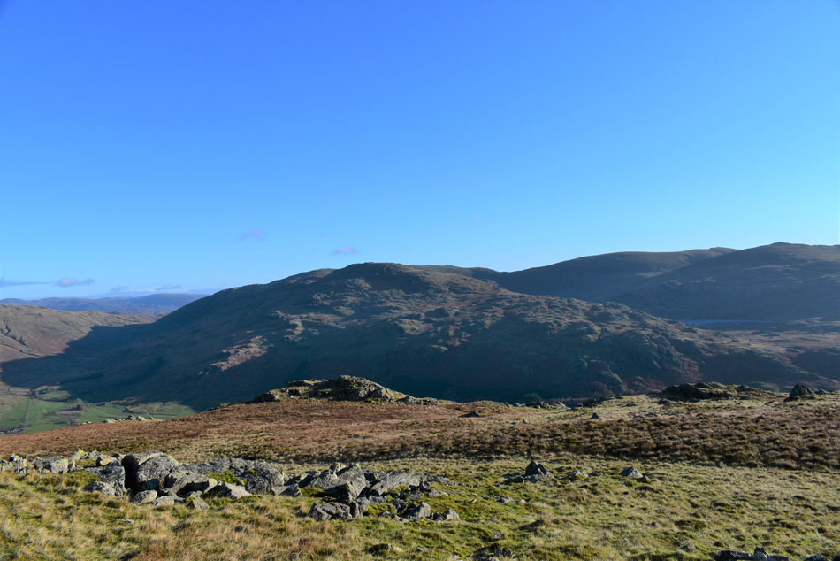
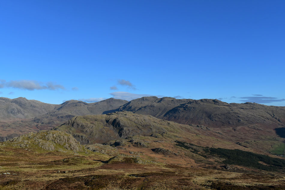
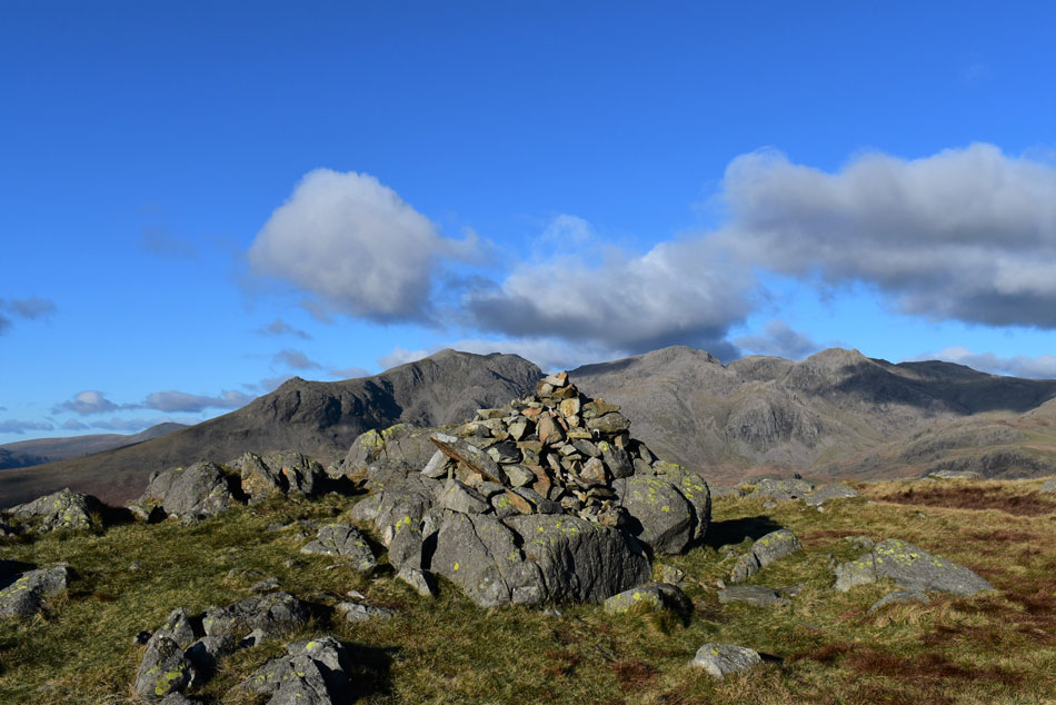
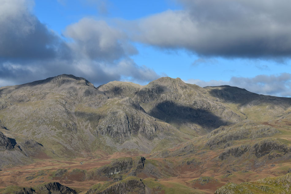
| Stickle Pike, Caw and White Pike from Harter Fell. |
| We turned abruptly and with it our eyes stopped streaming and we could finally look up again. Beyond us lay bastions of rock which could have easily been mistaken for the summit but for those in the know the summit lay just beyond. I let David and Rod take off as I gazed over Morecambe Bay, Heysham Power Station clearly visible. |
 |
| Views down Harter Fell West Ridge |
| Towards Wallhead Crag. |
 |
| A long distant view ... |
| ... over Burnmoor Tarn and IIIgill Head towards Yewbarrow, Haycock, Seatallan, Scoat Fell Red Pike (Wasdale) Pillar and Slight Side. |
 |
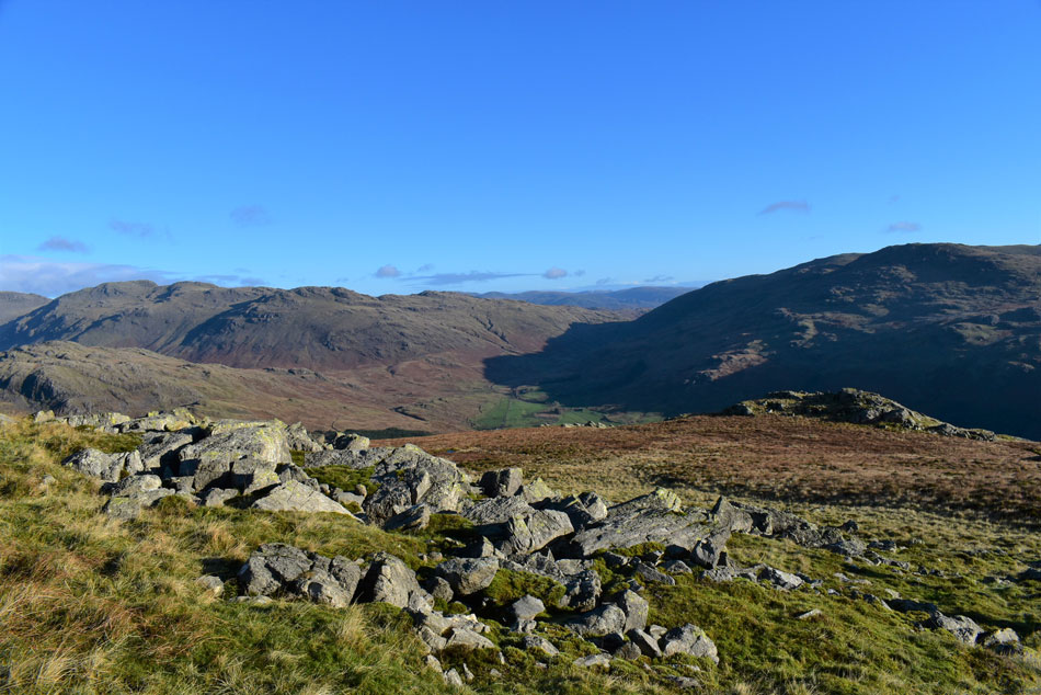
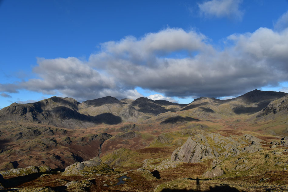
| Descending Harter Fell with views of Grey Friar, Dow Crag, Brim Fell, Coniston Old Man and Seathwaite Tarn. |
| The good news was we were back in the sunshine the not so bad news was we were directly in the winds firing line which saw me and Rod nearly add a pair of proper winter gloves. It was here David finally saw those penguins so on went the hat. |
 |
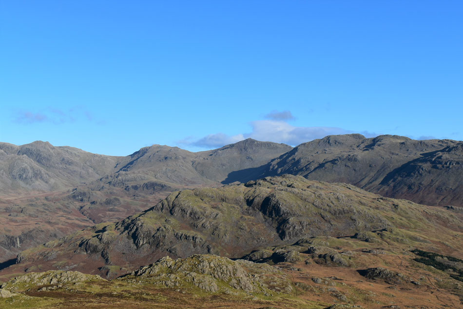
| It might have been a tad nippy. |
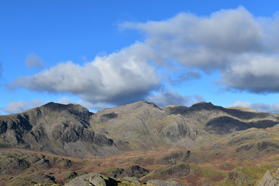
| But boy did the views make up for it. Here we have Little Stand, Cold Pike and Crinkle Crags seen left, Wrynose Bottom seen centre and Grey Friar over on the right. |
 |
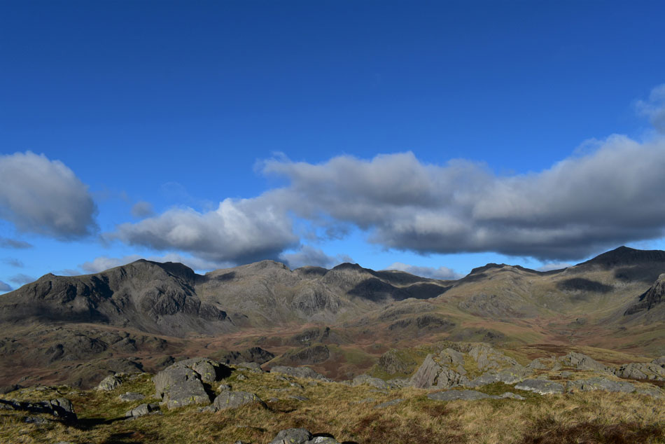
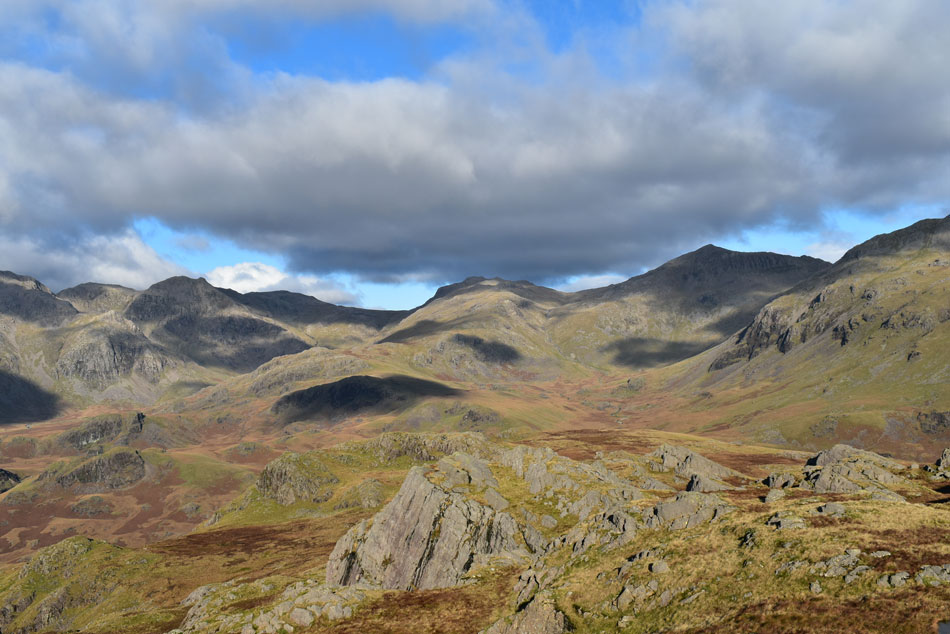
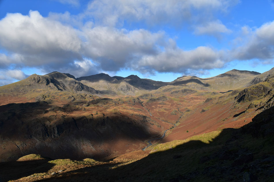
| Soon. |
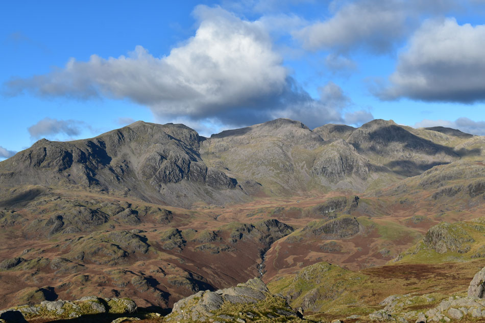
| Border End, Hard knott, III Crag, Esk Hause, Esk Pike, Bow Fell and Crinkle Crags enlightened our view. |
 |
| It's that time of year when the low sun |
| Makes us all look like aliens. |
 |
| Another view of Wrynose Bottom from our descent. |
| |
 |
| More eye watering views of Border End, Hard knott, III Crag, Esk Hause, Esk Pike, Bow Fell, Crinkle Crags and Little Stand. |
| While in the foreground over on the left is Demming Crag with Horsehow Crags beyond. |
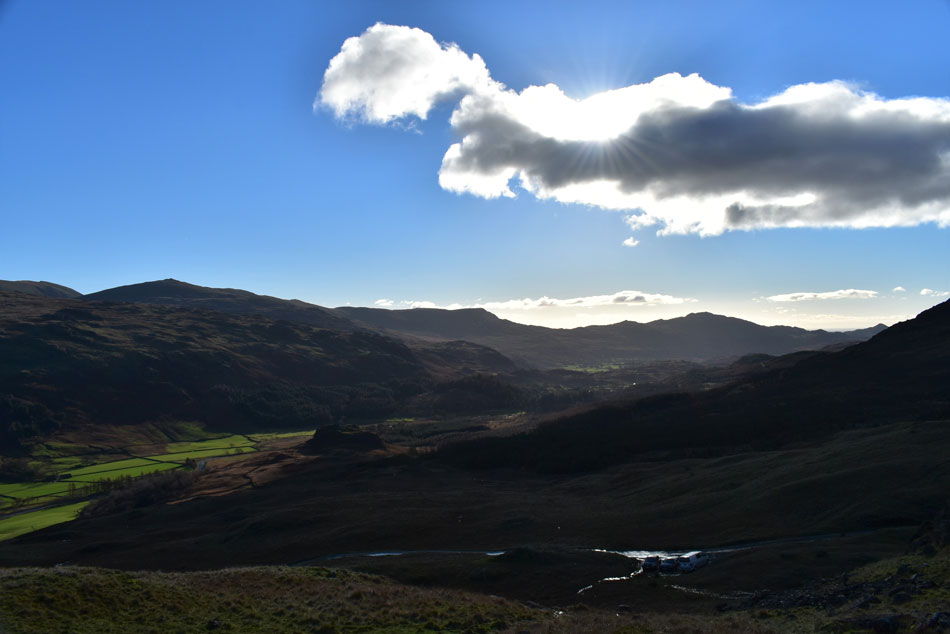 |
| The view over the top of Hardknott Pass. |
| Having not seen a soul we squelched all the way down to the top of Hardknott Pass when a passing car brought us back into a temporary reality before beginning the short but steep haul to Border End's eastern shoulder where we planned to visit Ravencrag Tarn. |
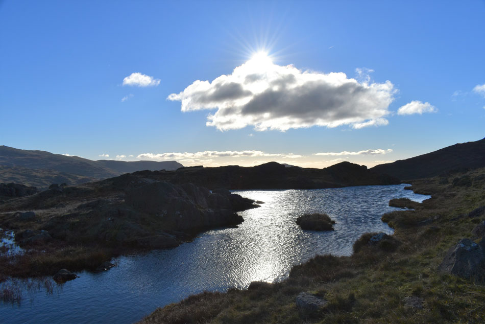 |
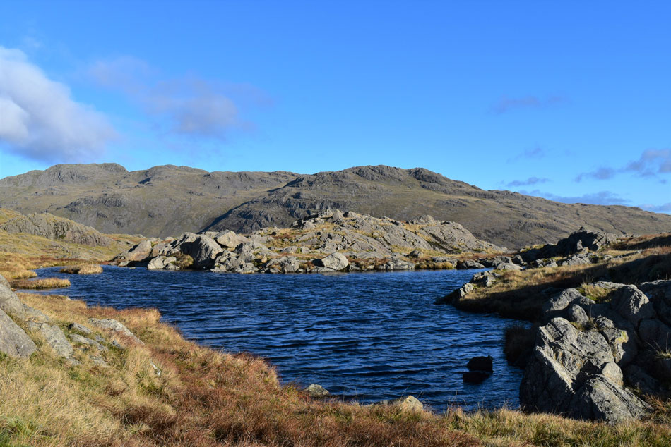
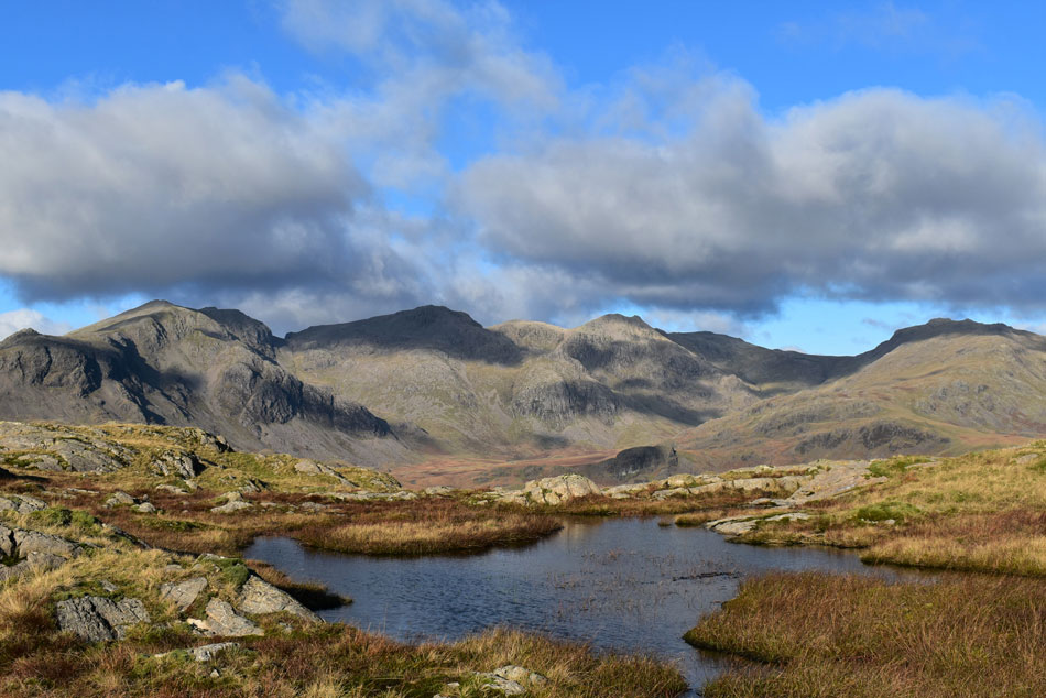
| Ravencrag Tarn. |
| Two steep pulls saw us arrive at the elusive Ravencrag Tarn and while David and Rod waited at one side of the Tarn. |
 |
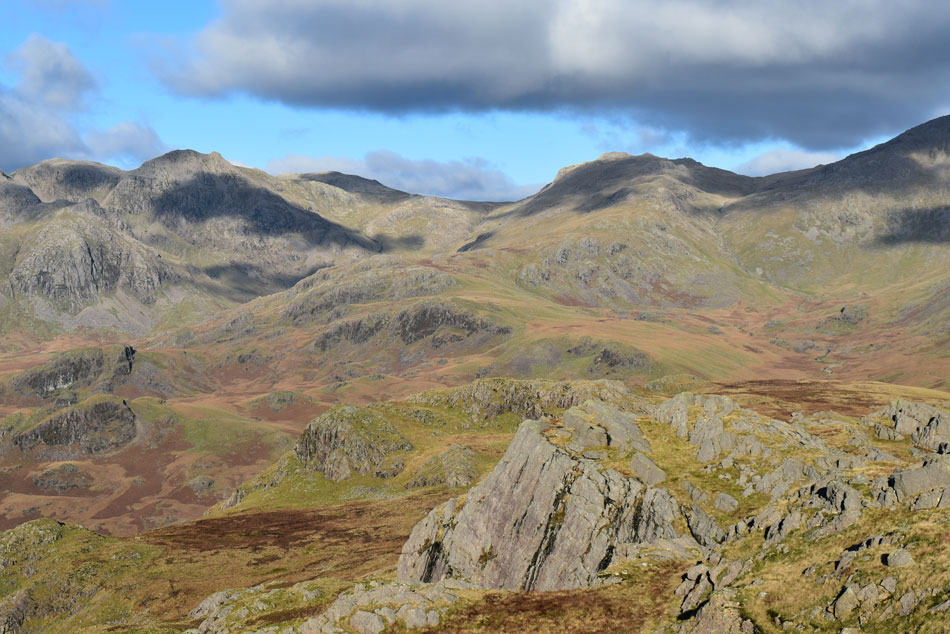
| Crinkle Crags and Little Stand from Ravencrag Tarn. |
| I made a quick visit to the other side. |
 |
| Crinkle Crags and Little Stand. |
| |
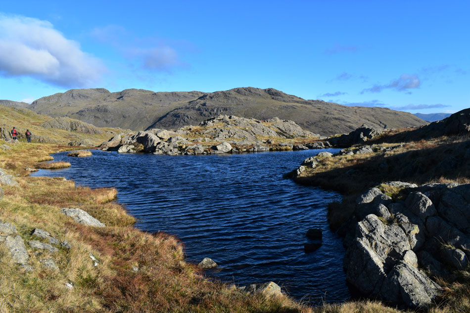 |
| Crinkle Crags and Little Stand from Ravencrag Tarn. |
| While I took photos David and Rod eyed up some good wild camping spots at the other side of the Tarn, the area below the Tarn even after rain was relatively dry, can you imagine waking up to this. |
 |
| Heading towards Hard Knott summit. |
| Instead of summiting Border End we dropped off the shoulder and walked north towards Hard Knott summit. The plan was to double back after summiting Hard Knott. |
 |
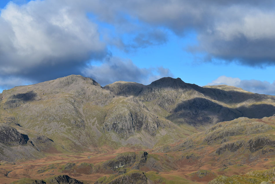
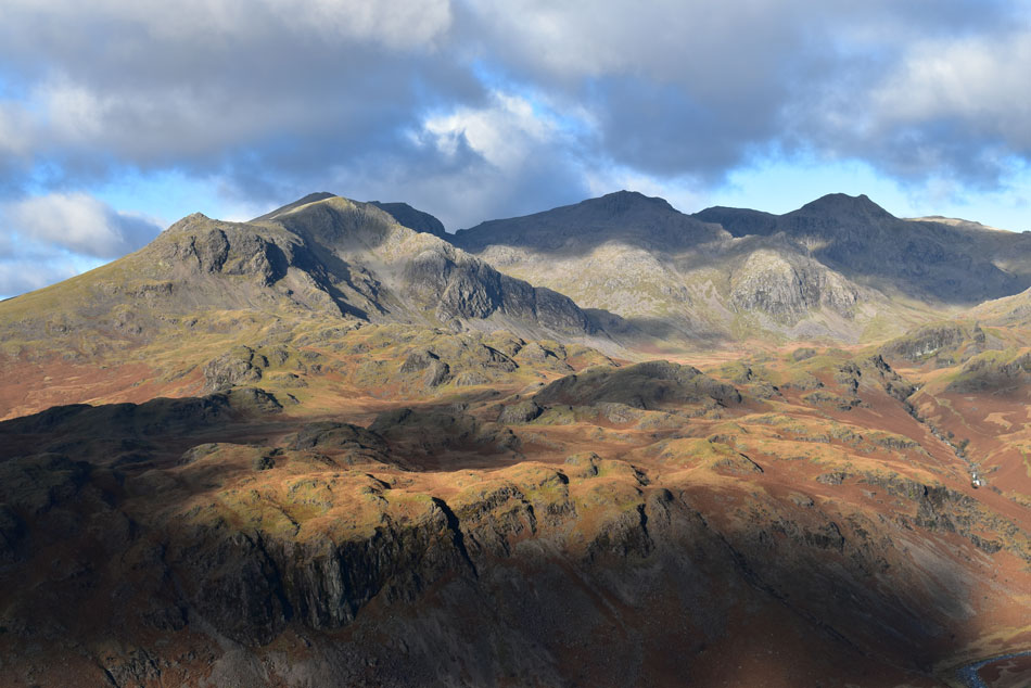
| Slight Side, Sca Fell, Scafell Pike, Pen, Broad Crag, III Crag abd Great End from Hard Knott summit. |
| We took in the undulations, swerved the mosses as best we could and seemed to arrive at Hard Knott within no time and were greeted to what I consider to be one of the best, and most iconic of Lakeland views. |
 |
| It stops here. |
| This is England's highest ground. |
 |
| We take in the view ... |
| ... towards Low Gait Crags, High Gait Crags, Pike de Bield, Esk Pike, Ore Gap and finally Bow Fell. |
 |
| Epic encounters. |
| We stride from the summit and while being licked by a fierce windchill stand in silence looking towards the Sca Fell, Broad Crag, Scafell Pike and Great End. |
 |
| We stand back... |
| ...and do it all again. |
 |
| Cloud begins to gather. |
| But it only adds to the dramatics. |
 |
| One last view from Hard Knott summit. |
| Before we turn heel and double back to Border End. |
 |
| I did say we were leaving. |
| But how can you turn your back on that view. |
 |
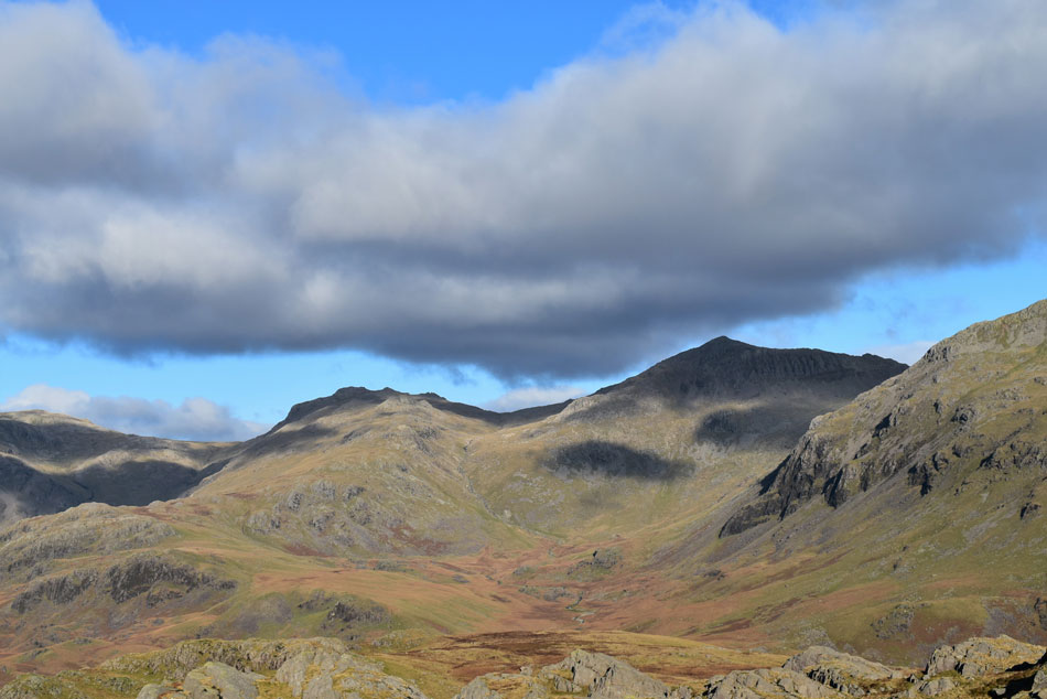
| Slight Side, Sca Fell, Mickledore, Scafell Pike, Broad Crag, III Crag, Great End, Esk Hause, Esk Pike and Bow Fell from Border End. |
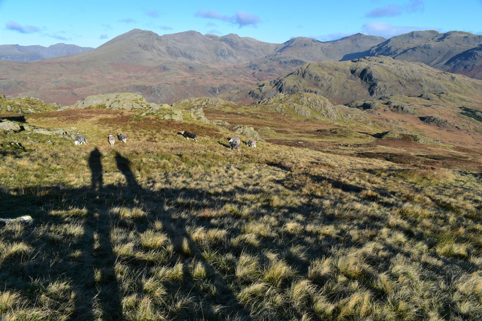
We descended from Hard Knott leaving the windchill behind into a hollow on the west side of the summit crags and instantly the warm sun began to tinge exposed skin.
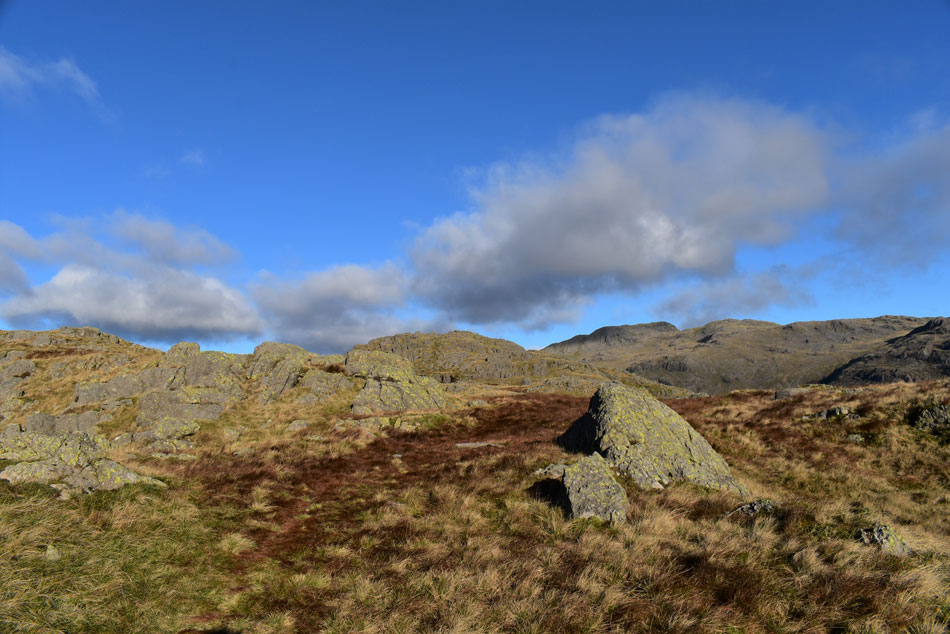
The area between Hard Knott and Border End was quite busy with walkers coming and going while dodging the boggy ground as best they could. After negotiating the undulated wet ground we spotted a short but steep grass rake and decided that that was the point we'd ascend Border End by...a huge summit cairn silhouetted by the sun just above the rake kinda did give the summit away. |
 |
| Pen, Rough Crag (Scafell Pike) Mickledore, Broad Crag, III Crag, Great End, Esk Hause, Pike de Bield, Esk Pike, Ore Gap and Bow Fell. |
| |
 |
| Slight Side, Sca Fell, Mickledore, Scafell Pike, Broad Crag, Pen, III Crag, Great End, Esk Hause and Esk Pike. |
| We were certainly spoilt for views! |
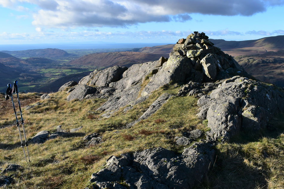 |
| Border End summit. |
| We left the bogs behind and climbed the steep grass rake which left just a few yards before the summit cairn was reached, from Border End the views over Great Moss and the Scafells just get better and better. |
 |
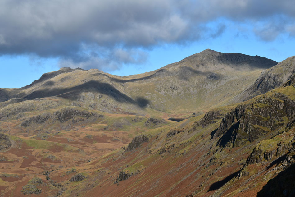
| Hard Knott, Bow Fell, Crinkle Crags and Little Stand from Border End. |
| I'm sure after prolonged dry weather finding a good spot to wild camp on Border End wouldn't be too difficult but if you did that at this time of year I'm sure you'd end up floating away. |
 |
| Slight Side, Sca Fell, Mickledore, Scafell Pike, Pen, Broad Crag, III Crag, Great End, Esk Hause, Esk Pike and Bow Fell. |
| I was trusted to lead the descent from Border End opting to descend via a steep grass rake via the north west flank which avoids the steep crags on the south flank. Rod and David started the descent while I brought up the rear while taking the odd photo or three. |
 |
| Slight Side, Sca Fell, Mickledore, Scafell Pike, Pen and Broad Crag. |
| While in the foreground High Scarth Crag can be seen towards the right and Silverybield Crag seen over on the left. |
 |
| Another close up of Esk Pike and Bow Fell. |
| With Low Gait Crags, High Gait Crags and Pike de Bield. The area below the main mass of Bow Fell is named Green Hole with Yeastycrag Gill seen over on the left. |
 |
| Hardknott Fort comes into view. |
| We approach by the path seen over on the right. |
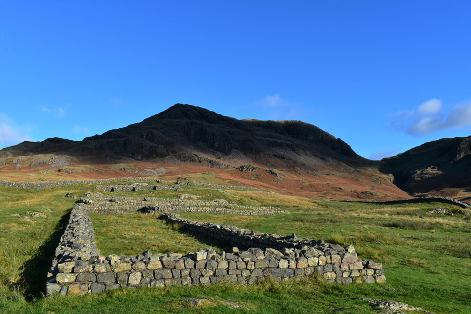 |
| Border End from Hardknott Roman Fort. |
With the windchill confined to the summits we descended into warm sunshine and for the last half mile I decided to remove my gloves and treat my hands to the midday sun. There was no point stopping for lunch but we did stop at various stages as we passed through the Fort while casting our minds back to the time when this area was ruled by garrisons of Roman Soldiers.
Letting our minds drift back to reality we descended back to Jubilee Bridge only being passed by an old Land Rover trying to find the lowest ratio to hit the steepness of the pass with. Arriving back at the cars we kit down behind our cars while observing a trio of badly parked cars, heads shook and kit down continues. I'm suddenly overcome by a feeling of sadness, I'm about to drive home to a place that was once occupied by someone I cherished, someone I deeply miss. |
|
| |
| Back to top |
 |
|