|
St Sunday Crag via Grisedale |
 |
 |
19th December 2021 |
 |
|
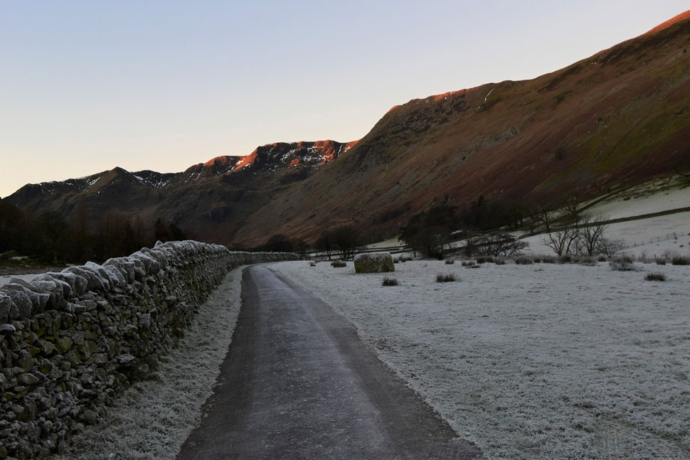
A ridge of high pressure affecting Cumbria has caused some very scenic views with cloud inversions above the towns and villages spanning through the week and into the weekend bringing with it unseasonable mild temperatures at height while frost affected anything below 300m
Since last weekend I've had a hankering for St Sunday Crag, trouble was the cloud inversions where to be found further south leaving me with a real conundrum...do I chase the inversion or go with the heart?
The last time I climbed St Sunday Crag was December 2019 with Rod Hepplewhite on a day when really we should have been at home watching crap TV with our feet up...to say the forecast was horrendous would be an understatement but my ever lasting memory of that day was how alive it left me feeling.
You'll be pleased to know the todays forecast was perfect with a frost on the ground at valley level while across the summits temperatures rose into double figures causing folk including myself who'd set off in full Winter gear to strip back to bare skin, unseasonal, yes, memorable, definitely. |
|
| Wainwright Guide Book Two |
 |
| The Eastern Fells |
| Every walker who aspires to high places and looks up at the remote summit of St Sunday Crag will experience an urge to go forth and climb up to it, for its challenge is very strong. Its rewards are equally generous, and altogether this is a noble fell. Saint Sunday must surely look down on memorial with profound gratification. |
 |
|
|
|
|
| |
|
Overview |
|
|
| Ascent: |
2,704 Feet - 825 Metres |
| Wainwrights: |
3, St Sunday Crag - Birks - Arnison Crag |
| Weather: |
Some Local Mist Otherwise Bright & Sunny Throughout, Little To No Wind Across The Summits. Highs of 11°C Lows of -2°C |
| Parking: |
Roadside Parking, Patterdale School |
| Area: |
Eastern |
| Miles: |
8.4 |
| Walking With: |
On My Own |
| Ordnance Survey: |
OL5 |
| Time Taken: |
5 Hours |
| Route: |
Patterdale - Grisedale Lane - Grisedale - Ruthwaite Lodge - Grisedale Tarn - Deepdale Hause - St Sunday Crag - Birks - Trough Head - Arnison Crag - Patterdale |
|
| |
|
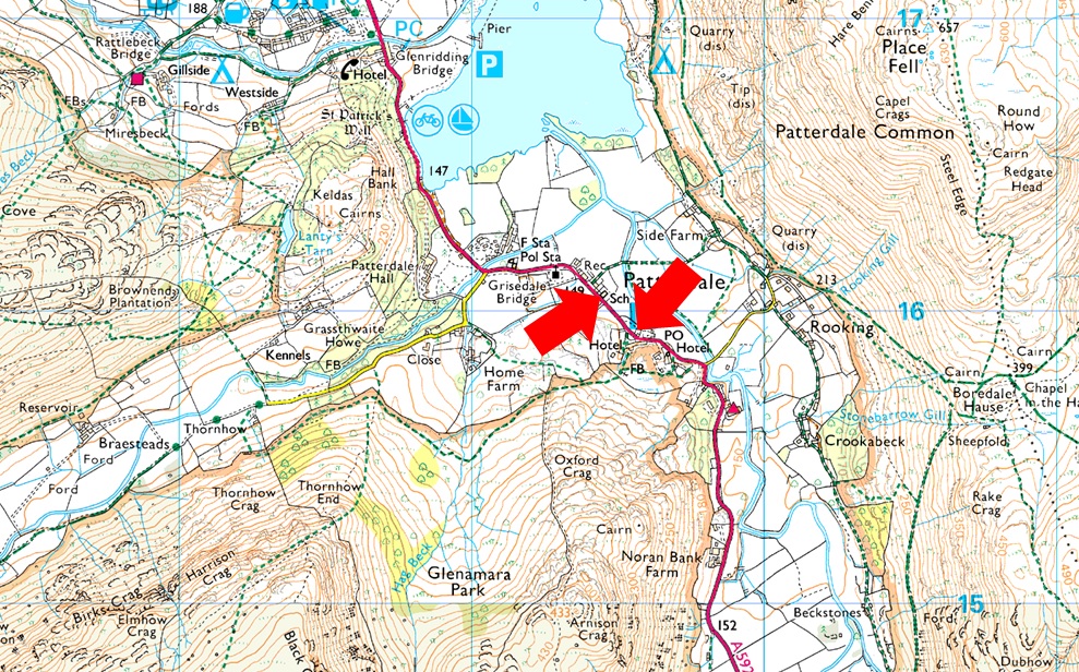
Parking Details and Map |
|
|
| Nearest Post Code: |
CA11 0NW |
| Grid Reference: |
White Lion Hotel - NY 395 315 - Patterdale Primary School NY 394 516 |
| Notes: |
Patterdale alongside Glenriddging acts as a hub for the eastern and far eastern fells yet unlike Glenridding Patterdale doesn't have a centralised car park. With this said parking in Patterdale, especially during the height of Summer can be a problem with only two main sites to leave your car. The first is very popular with fell walkers which is just opposite the White Lion Hotel, here you will find a short layby with room for up to five parked cars. Parking is free. The second place to park is found just outside Patterdale Primary School where you can park on the kerb right outside the School, here you will find spaces for around three to four well parked cars. Parking is free. |
|
| |
|
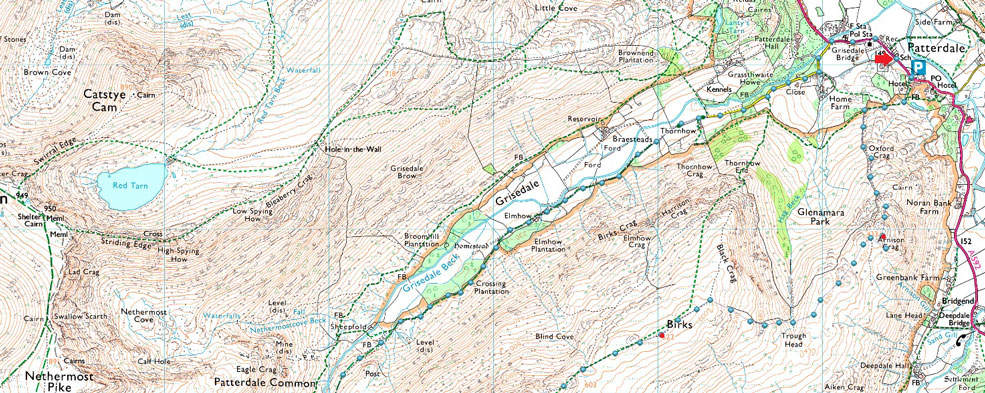
Map and Photo Gallery |
|
|
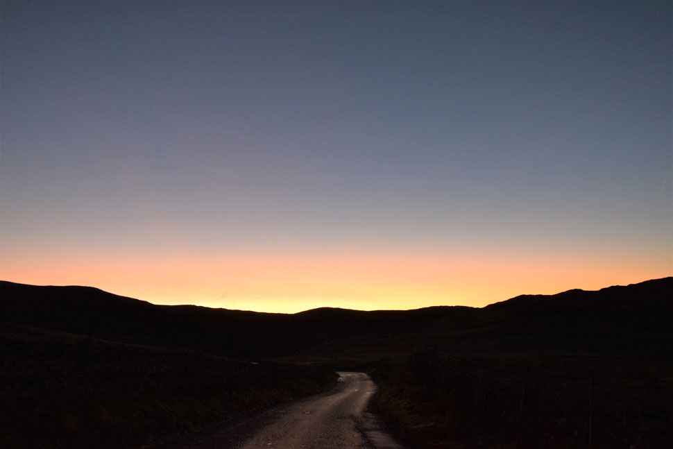 |
| Garburn Pass sunrise. |
| As I drove along the A591 towards Ings a fiery afterglow was illuminating my rear view mirror trouble was my view was obscured until I climbed higher along the Kirkstone Pass where I pulled into a lay by to take this photo. If you look left that's heading towards Yoke while right is towards Sallows. |
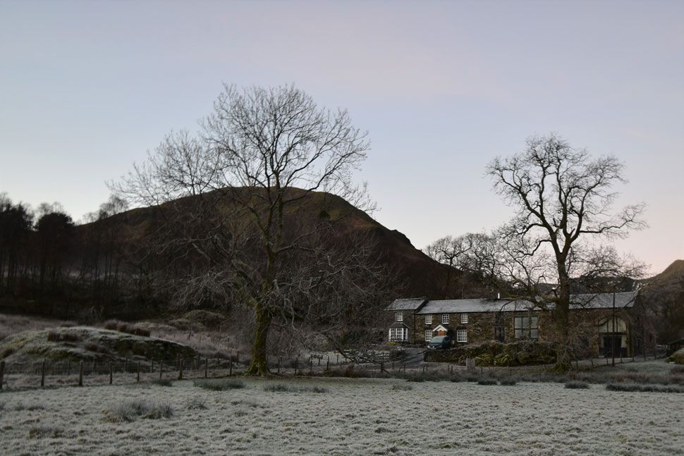 |
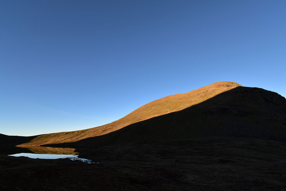
| Thornhow End (Birks) from Deer How cottage, Patterdale 8:20am -3°C |
| i managed to park outside Patterdale School where I dropped a handful of gold and silver change into the honesty box. Although it was the same temperature as I'd experienced on Kirkstone Pass it felt much cooler here in Patterdale as my fingers chilled whilst lacing up my boots. Another car pulls up but I'm unable to see its occupants because my tailgate obscures the view.
I still hadn't confirmed my plan of attack whether I should head straight up Birks or a meander through the Grisedale valley...I think there was only going to be one winner there. The guy in the other car quickly kits up and locks his car whilst I was doing a final sweep over. I was just about to leave when I decided to take this photo so I crossed the road and in doing so realised that my right boot lace could be a bit tighter so off came the gloves and more chilled fingers.
I left the car feeling like a seven year old after my mum had just tucked me up into bed. Everything was tight and restrained even my shoelaces. My pack creaked under its extra load and no amount of re-shuffling seemed to stop it, I just had to live with it like I had these last few weeks.
Patterdale was just starting to wake up as I headed towards the entrance for Grisedale Lane. A young couple walking their dog glanced a 'morning' while beyond the boat masts and rigging I caught a view of mist lying feet above the surface of Ullswater. I knew this view was special but I needed to be underway and reluctantly turned my back on it, turned left and followed the lane. |
 |
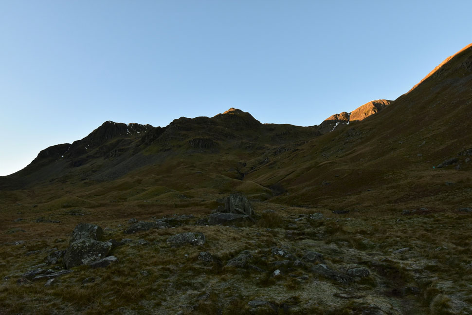
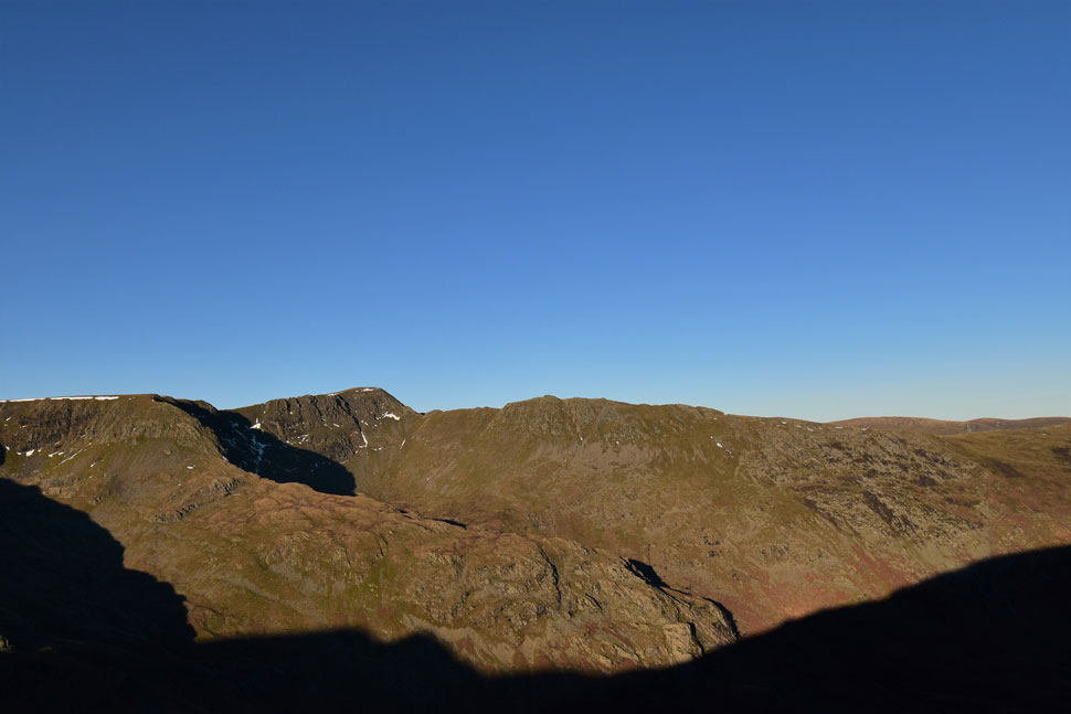
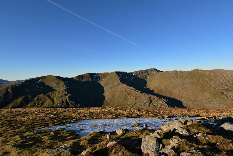
| Dollywagon Pike, Ruthwaite Cove, Nethermost Pike, Nethermost Cove and Grisedale Brow from Grisedale. |
| With Patterdale behind me I climbed steadily while finding my feet taking care not to slip on the ice underfoot. I've walked in much lower temperatures than -3°C but somehow the stillness of the morning made it feel like double that. Clouds of breath escape as I take in the view reminding myself that the last time I was here it was during the Summer when I had set off in temperatures four times that of this morning.
Stunning views though. |
 |
| On route to Elmhow, Grisedale. |
| The release lever on the gate had frozen which took three good yanks to free it which left me thinking that I must be the first person through the valley this morning. |
 |
| Sun lit Nethermost Cove. |
| While Nethermost Pike summit lies towards the right the top of Nethermost Pike east ridge can be seen as the pointy bit over on the left. |
 |
| Ruthwaite Cove with Dollywagon Pike over on the left and High Crag lit up in sunshine on the right. |
| I'd meandered for long enough now it was time to step down a gear and begin the climb towards Ruthwaite Lodge which is hidden in the middle of the photo. |
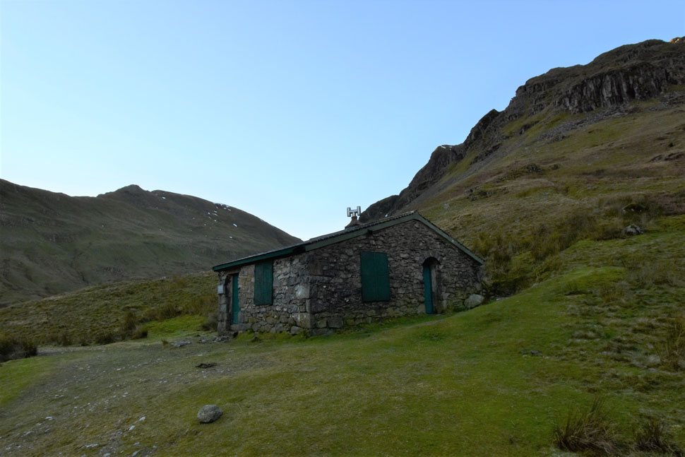 |
| Ruthwaite Lodge. |
| A Plaque on the wall reads RUTHWAITE LODGE Restored By The Maintenance Team Of Outward Bound Ullswater And Dedicated 26-3-93 To The Memory Of Richard Read And Mike Evans Tutors From O.B.U Killed on Mount Cook New Zealand 31-1-88 |
 |
| Black Crag, Ruthwaite Cove and the top of Nethermost Pike East Ridge. |
| The light edges slowly into the Grisedale valley. |
 |
| The view back through the Grisedale valley. |
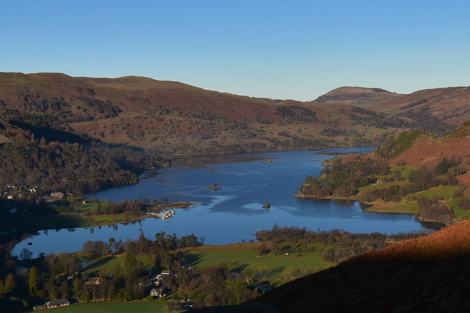
| Towards a rather epic inversion forming over Ullswater with Place Fell beyond. |
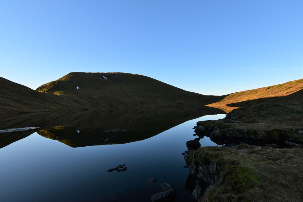 |
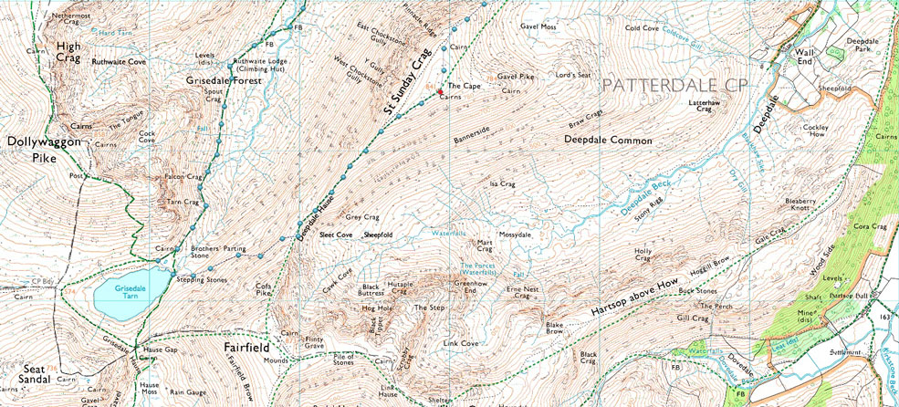
| Seat Sandal and Grisedale Tarn. |
| I left Ruthwaite Lodge and continued in ascent only stopping to look back on a tiny square of inversion forming over the southern tip of Ullswater. It was during one of these stops did I spot a fell runner at the footbridge below Ruthwaite Lodge. Within twenty minutes I heard his and his Jack Russell trotting up behind me so I pulled to one side to let them pass "ok" he asked? "good mate" I replied. I watched him and his Jack Russel tackle the next steep section before continuing on towards the Tarn.
I think it was the first time I'd even seen Grisedale Tarn looking so calm so much so I spent much longer here than I had planned. |
 |
| Dollywagon yikes. |
| Sunlight still hadn't penetrated the valley but it was ever so slowly edging its way down the fell side leaving spectacular light shows across the fell reflecting here into Grisedale Tarn. |
 |
| Heading for Deepdale Hause from Grisedale Tarn. |
| Still in shade and really looking forward to the glimmers of sunlight I could see on the eastern flanks of St Sunday Crag I begin the ascent towards Deepdale Hause. |
 |
| Looking across the Grisedale valley... |
| ...towards Dollwagon Pike, The Tongue, Ruthwaite Cove, Black Crag, Nethermost Cove, Nethermost Pike East ridge, Nethermost Pike, Helvellyn and Striding Edge. |
 |
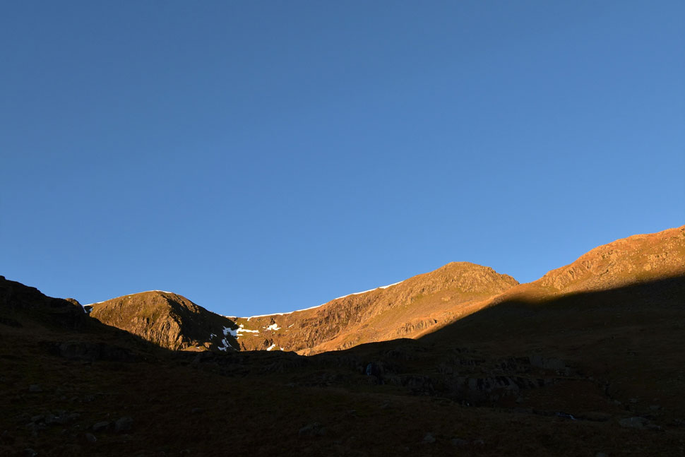
| Cofa Pike and St Sunday Crag from Deepdale Hause. |
| I ascended into blinding sunlight and interrupted a chap who had stopped for a bite to eat sharing our thoughts on the morning both agreeing how amazing it was. The chap went on to ask me about my camera clip as had to stop to remove his DSLR from his pack when he went to take photo's.
He went on to say that he was walking the Deepdale Horseshoe in an anti clockwise direction adding how good the views were over Ullswater this morning so I replied remarking about the little square patch of inversion I'd caught a glimpse of while feeling suitably jealous, |
 |
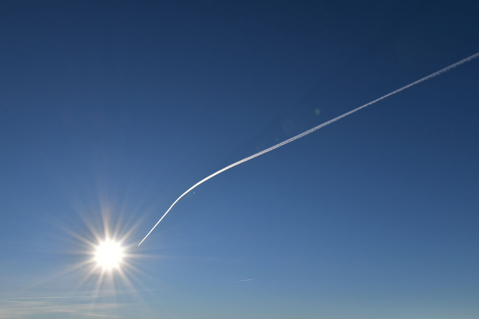
| Strange yellow object spotted above Fairfield. |
| When you drive to work in the dark, drive home in the dark and in between all that its raining all the time so once you do get a glimpse of sunlight you feel like sharing it with the world...or at least I do. |
 |
| A little further up the path towards St Sunday Crag. |
| The view widens to include Seat Sandal and Grisedale Tarn. |
 |
| And with more height gained... |
| ...Dollywagon Pike comes into view with distant views of Bow Fell, the Gable and the Scafells. |
 |
| Across the Grisedale valley. |
| The dominance of Nethermost Pike East Ridge, Nethermost Cove, Nethermost Pike, Helvellyn and Striding Edge. |
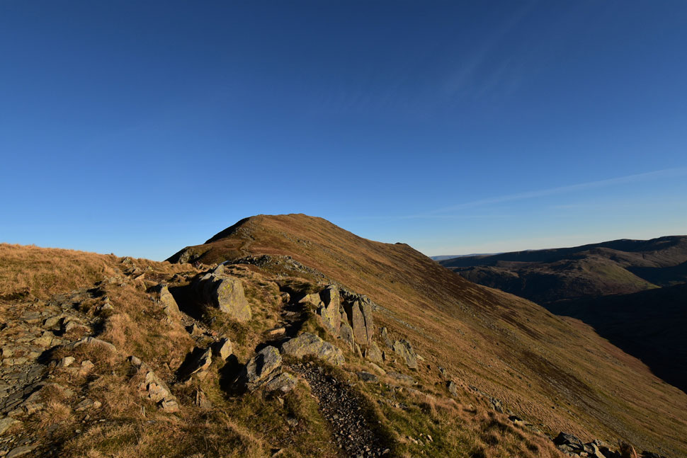 |
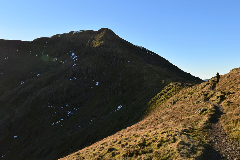
| St Sunday Crag lies up ahead. |
| With the summit now in view I was wondering why anyone heading in the opposite direction had stripped off their jackets and were walking in rolled up sleeves or shorts even. |
 |
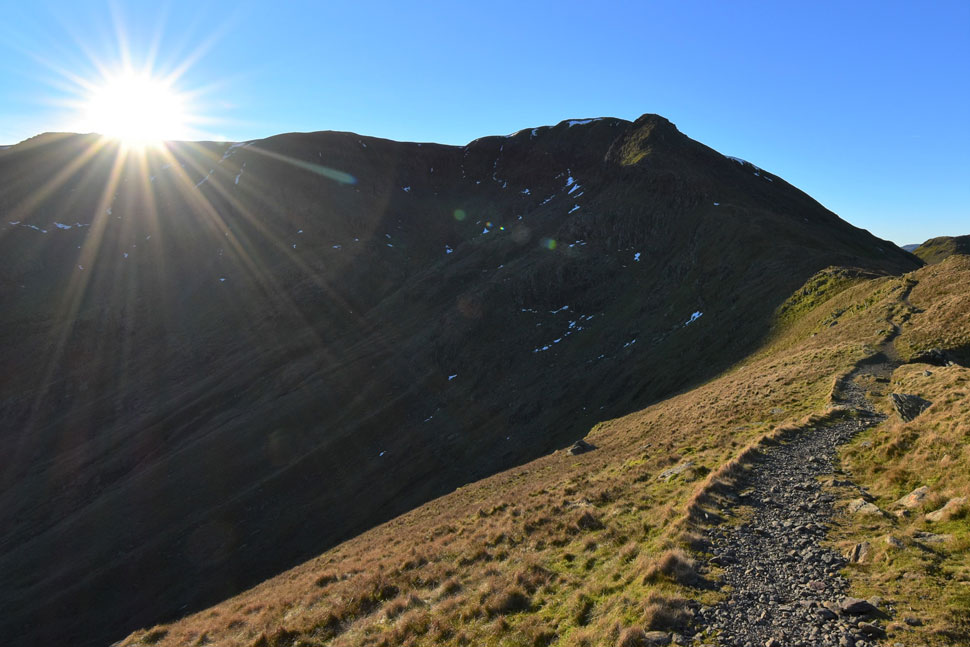
| Time to delayer. |
| Mesmerised by the clearest of views I hadn't really taken it in that the ground wasn't as frozen like it was in the valley below. The temperature had risen to the point when I no longer could see my own breath as thin beads of sweat formed over my forehead. |
 |
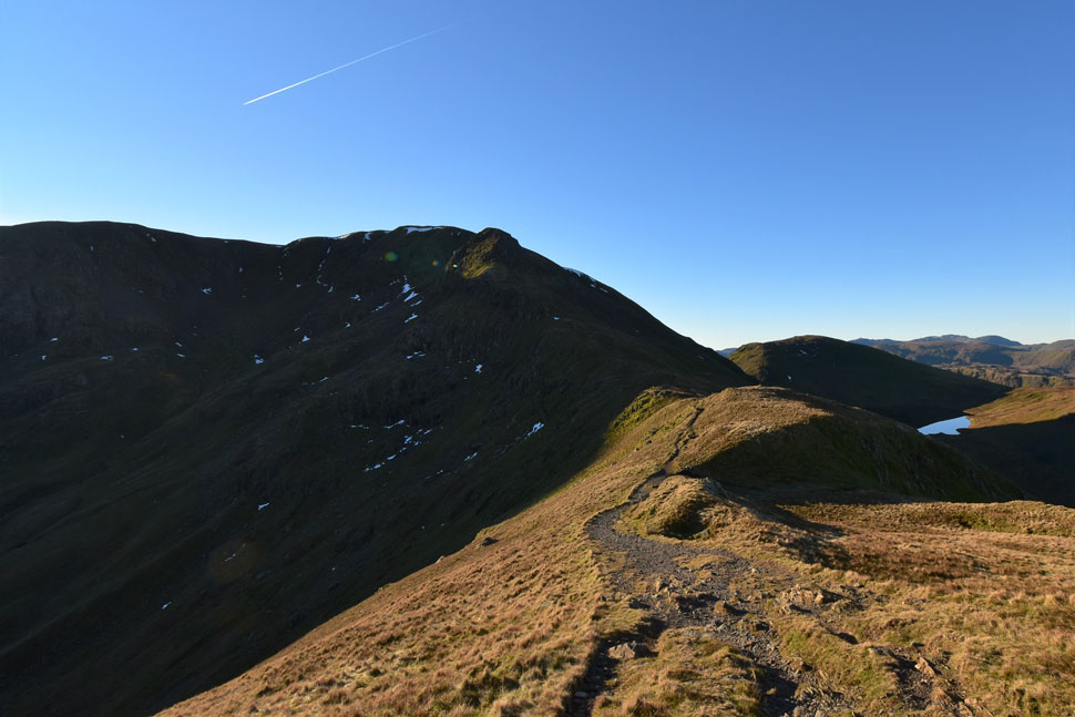
| That view again. |
| |
 |
| The skies were so clear. |
| |
 |
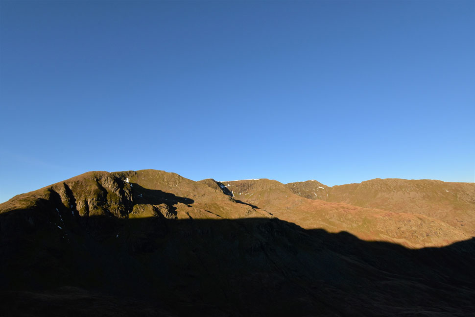
| Dollywagon Pike, Ruthwaite Cove, Nethermost Pike East Ridge, Nethermost Cove, Nethermost Pike, Helvellyn, Striding Edge and Catsty Cam |
| The first snow of the season is already starting to disappear but you can bet it won't be the last. |
 |
| Red Screes, Dove Crag, Hart Crag and Fairfield. |
| With distant views of the inversion domineering south and central Lakeland. |
 |
| Almost there. |
| |
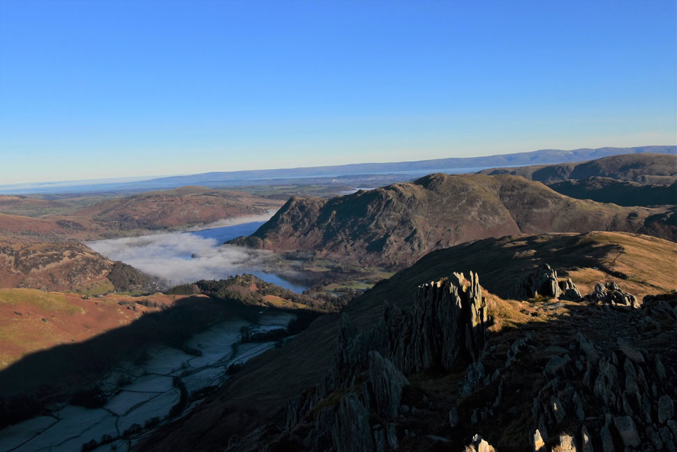 |
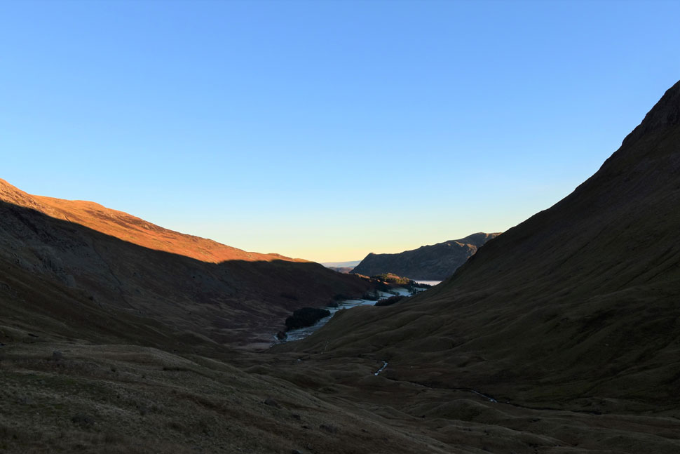
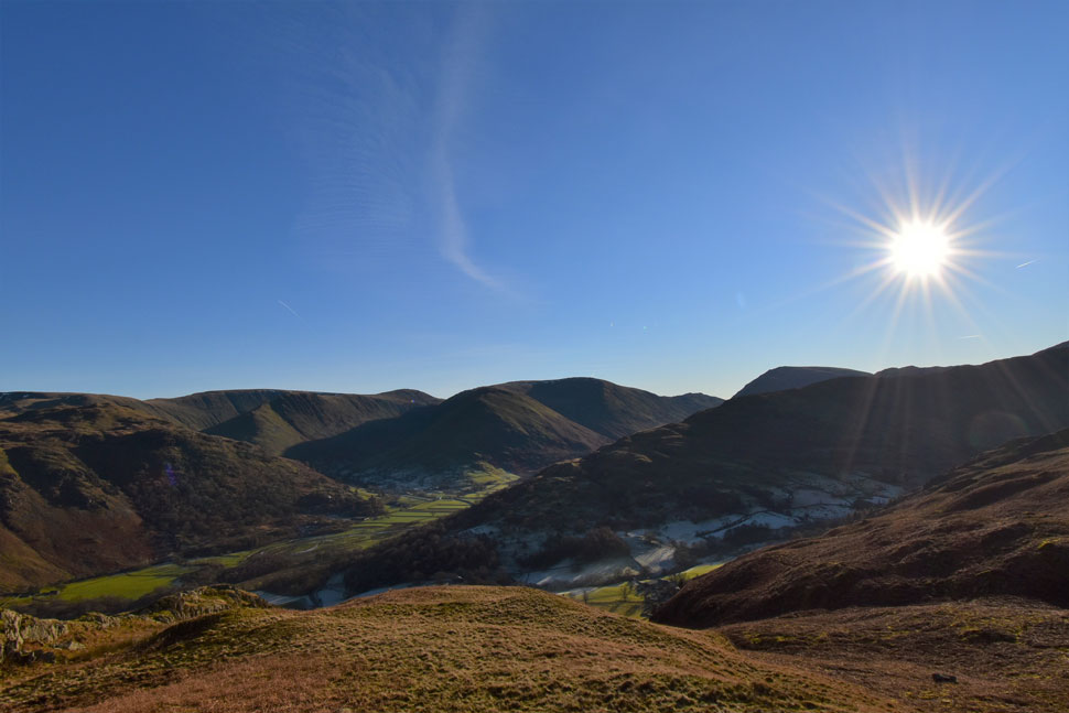
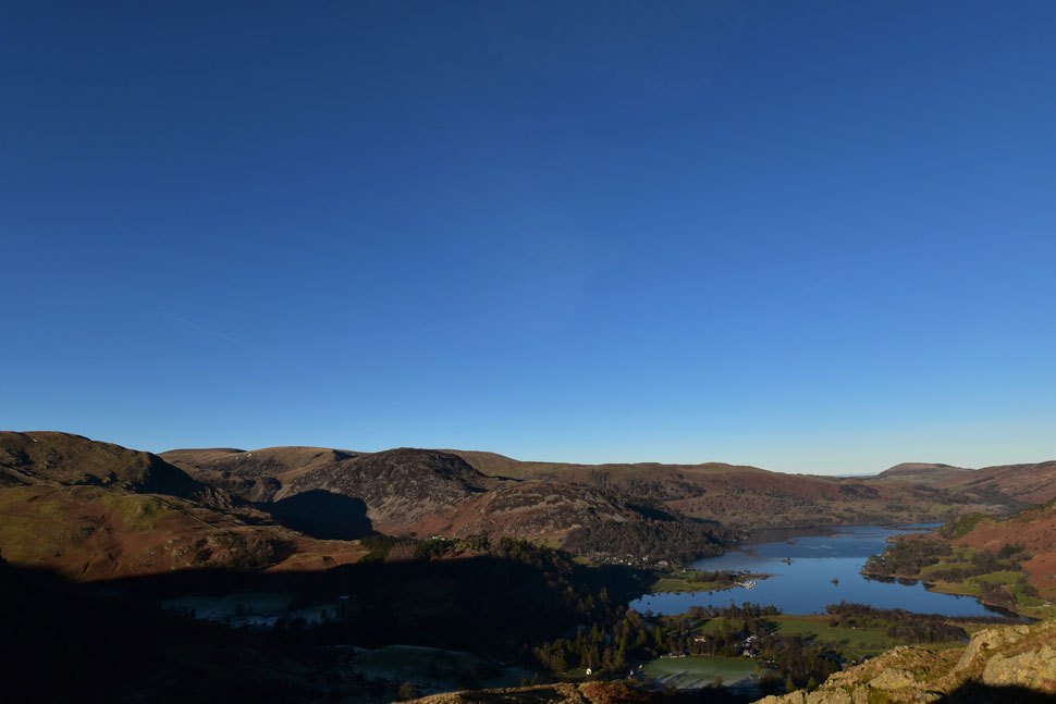
| Birks, Place Fell, Glenridding Dodd, Gowbarrow Fell and Ullswater from St Sunday Crag. |
| The initial plan was to descend to Gavel Pike then descend further onto Birks but I somehow managed to catch a glimpse of a slowly retreating inversion over Ullswater so I changed my mind and instead made a direct descent while taking in this stunning view as the inversion began to peel away. |
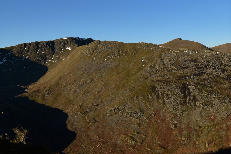 |
| During the descent Striding Edge domineers the view. |
| Seen here with Helvellyn and Catstye Cam over to on the right. |
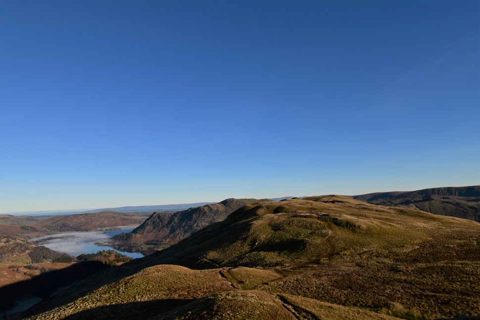 |
| Continuing my descent. |
| I realise that the inversion over Ullswater is beginning to peel away. |
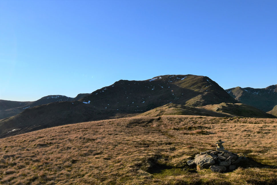 |
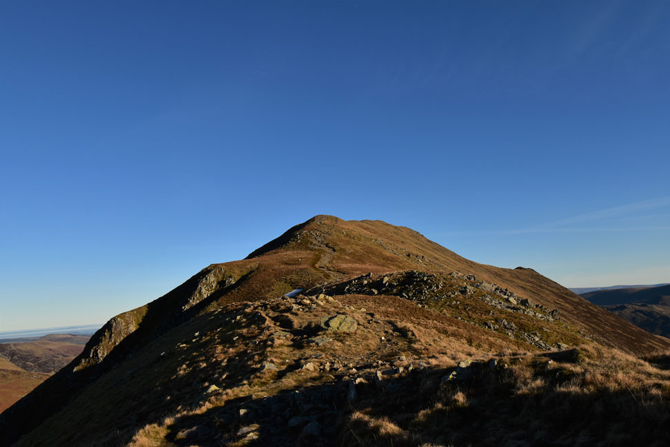
| Hart Crag, Dove Crag, Gavel Pike and St Sunday Crag from Birks. |
| It had just gone midday by the time I'd reached Birks summit which moments earlier had been occupied by a family who had just left. Despite there only being a good three hours of daylight left I was surprised at how many people passed me as they made their ascent on St Sunday Crag which appeared even busier than Striding Edge today. |
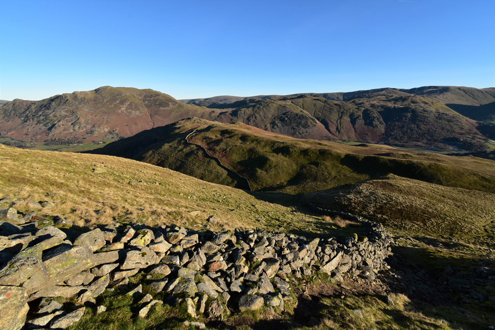 |
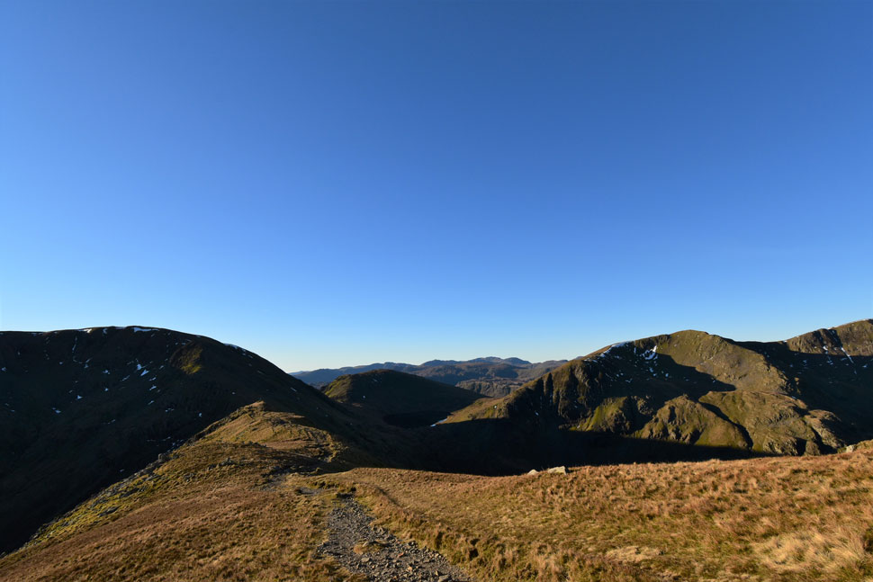
| Descending Birks for Trough Head with Arnison Crag (left) |
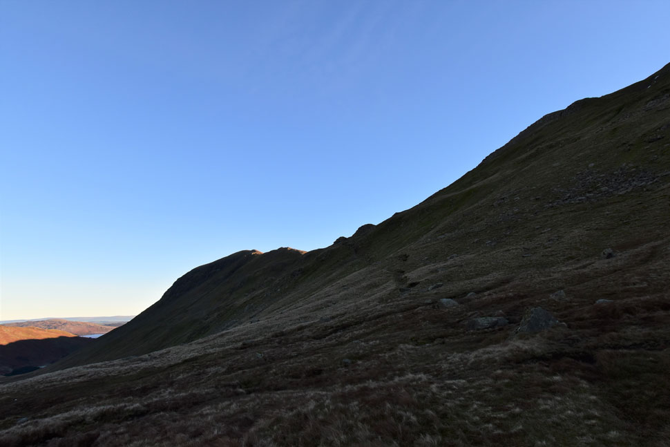
| With Birks summit behind me I followed the grassy plateau until I arrived at the familiar large boulder which marks the way to head right for Trough Head. This descent has a gentle start but quickly steepens over three false summits. The stone wall acts as a guide before veering right where Trough Head is crossed.
The later the day went on the clearer the views seemed to be. |
 |
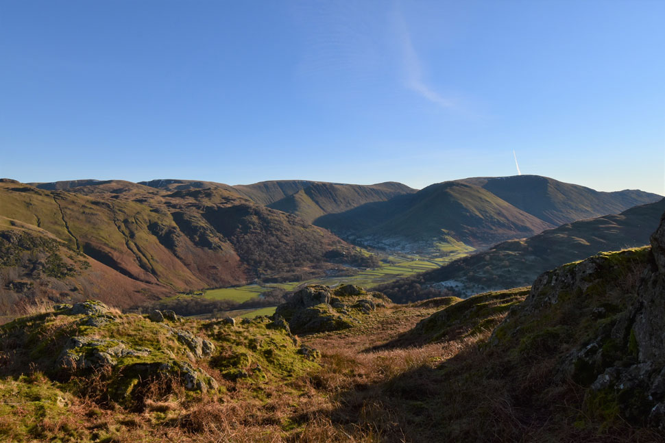
| From the southern spur of Arnison Crag. |
| I take in the view over Deepdale towards the Hartsop above How ridge, Red Screes, Caudale Moor, Hartsop Dodd, Thornthwaite Crag, High Street, Gray Crag and finally Brock Crags. |
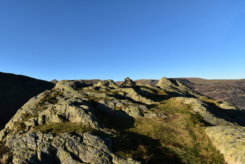 |
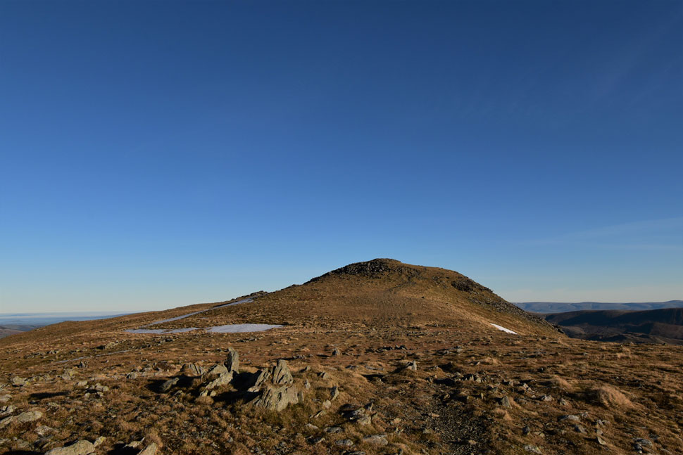
| Arnison Crag summit. |
| Two walkers had just left the summit and besides the female fell runner who passed me earlier who had also just left I had Arnison Crag summit to myself as I took in the view over Patterdale, Glenridding and Ullswater whilst perching my backside against a convenient rock. I'd made good time and could afford a few minutes more before I began my descent. |
 |
| Glorious! |
| |
 |
| Glenridding Dodd, Heron Pike, Sheffield Pike, Greenside, Stybarrow Dodd, Hart Side and Little Mell Fell from the descent of Arnison Crag. |
| Already I could feel the temperature begin to fall the closer I descended towards valley level. |
 |
| Ullswater close up. |
| |
 |
| Place Fell is seen as I pass through the frozen grounds of the Patterdale Hotel. |
| I descended by the familiar stone wall where sparse tree cover left the frost covered ground in cold shade. It had been a few hours since I last saw my breath but I could see it again and soon the chill nipped at the ends of my gloveless fingers. It was incredible to think that the temperature on St Sunday Crag was a staggering 13°C while at valley level it was hovering around freezing level.
Just the odd car passes as I made my way towards the school where I changed my mind and decided to treat myself to the flask of hot Vimto I had in the boot, a decision I didn't feel I'd have to make with my mid-layers sleeves pulled high whilst stood on St Sunday Crag's summit just a few hours earlier. |
|
| |
| Back to top |
 |
|