|
Crummock Water, Scale Force & Mellbreak |
 |
 |
15th January 2022 |
 |
|
One week ago we were stood at the back of our cars in Patterdale when the conversation turned to are we all free next week and if so where shall we walk? Given that last week we should have walked Mellbreak it was pretty unanimous when we all piped 'Mellbreak'
It's been a dry, cloudy week topped off with a cloud inversion on Thursday with quite a lot of sunshine only for the cloud to return by weekend but all was not lost as spells of sunshine had been forecast through the morning so we planned the walk around the forecast meaning we'd take to Crummock Water first before paying a visit to Scale Force then return over Mellbreak via Scale Knott.
Due to the steepness of the terrain most walkers would ascend Mellbreak via its north ridge then descend via the smooth grassy south ridge. None of us had actually descended Mellbreak via the north ridge before but we knew to expect a gnarly descent where extra care had to be taken descending the many rock steps before the final steep screen run at the base of the ridge.
It's fair to say descending the north ridge was an experience which we tackled in our stride so why would two lots of complete strangers patronise, then advise us how to descend the hill? The last thing I want to do is harp on about how many years fell walking experience there is between the three of us so why do a small minority asume it's your first time on the hill, |
|
| Wainwright Guide Book Seven |
 |
| The WesternFells |
Mellbreak
There is of course a natural infinity between mountains and lakes; they have developed side by side in the making of the earth. Often there is a special ossociation between a particular mountain and a particular lake, so that, in calling the calling the one to mind the other comes inevtiably to mind also: they belong together. |
 |
|
|
|
|
| |
|
Overview |
|
|
| Ascent: |
1,992 Feet - 607 Metres |
| Wainwrights: |
Mellbreak |
| Visiting: |
2, Mellbreak North Top - Scale Knott |
| Weather: |
A Little Sun To Start, A Little Sun At The End, Overcast In The Middle. Highs of 6°C Lows of 0°C |
| Parking: |
Parking Spaces, Phone Box, Loweswater |
| Area: |
Western |
| Miles: |
6.1 |
| Walking With: |
David Hall & Rod Hepplewhite |
| Ordnance Survey: |
OL5 |
| Time Taken: |
5 Hours |
| Route: |
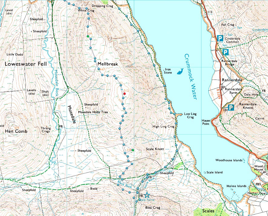
Loweswater - High Park - Crummock Water - Low Ling Crag - Scale Beck - Scale Force - Scale Knott - Mellbreak South Top (Summit) - Mellbreak North Top - White Crag - Kirkgate Farm - Loweswater |
|
| |
|
Parking Details and Map |
|
|
| Nearest Post Code: |
CA13 0RU |
| Grid Reference: |
NY 143 021 |
| Notes: |
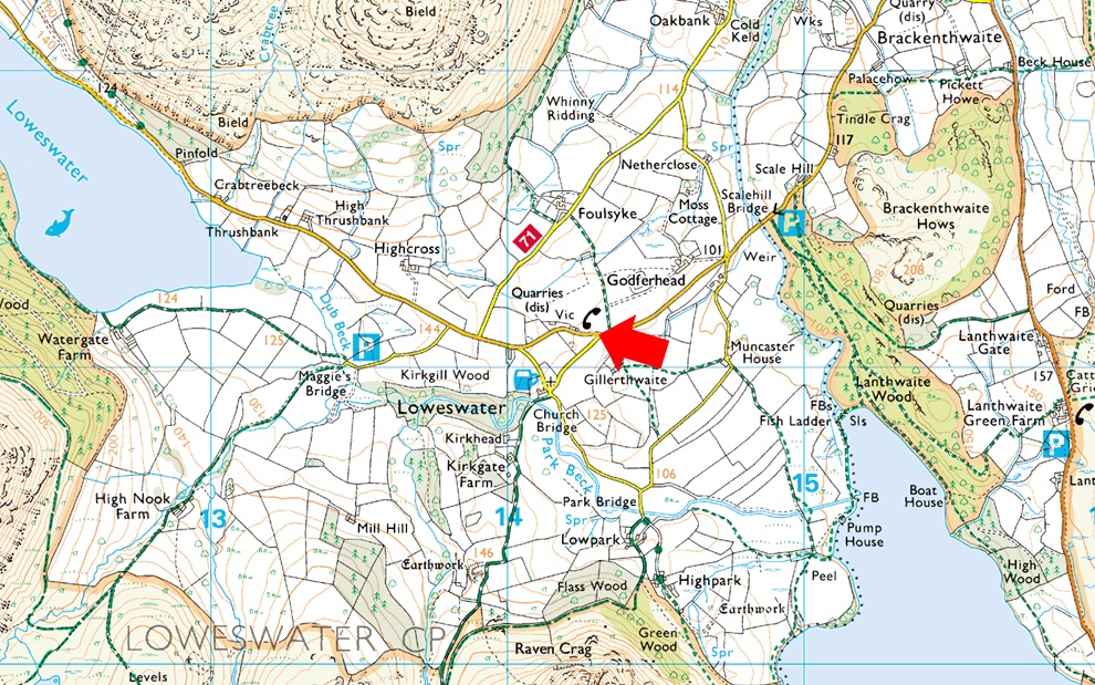
Despite the popularity of the Loweswater Fells parking can be difficult due to limited spaces. The Red Phone Box in the centre of the village is what the Wasdale Inn is to Wasdale Head and here you will find parking spaces for around five well parked cars. The Phone Box now had a defibrillator inside as are most rural phone boxes. My advice as with many other premium parking spaces is to arrive early and you shouldn't have any trouble parking. The parking spaces provide access to of course the whole of the Loweswater fells or just walks around Loweswater with the Kirkstile Inn close by for food and drink. Parking is free. |
|
| |
|
Map and Photo Gallery |
|
|
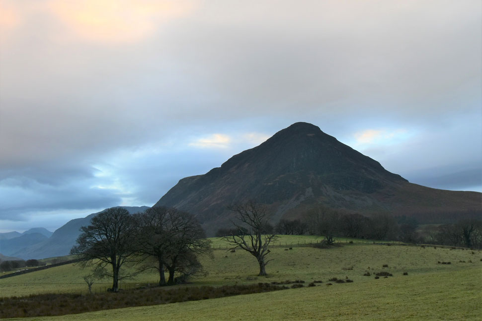 |
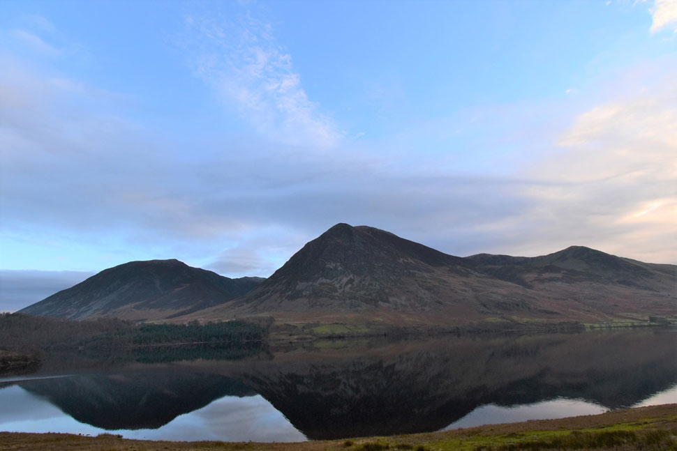
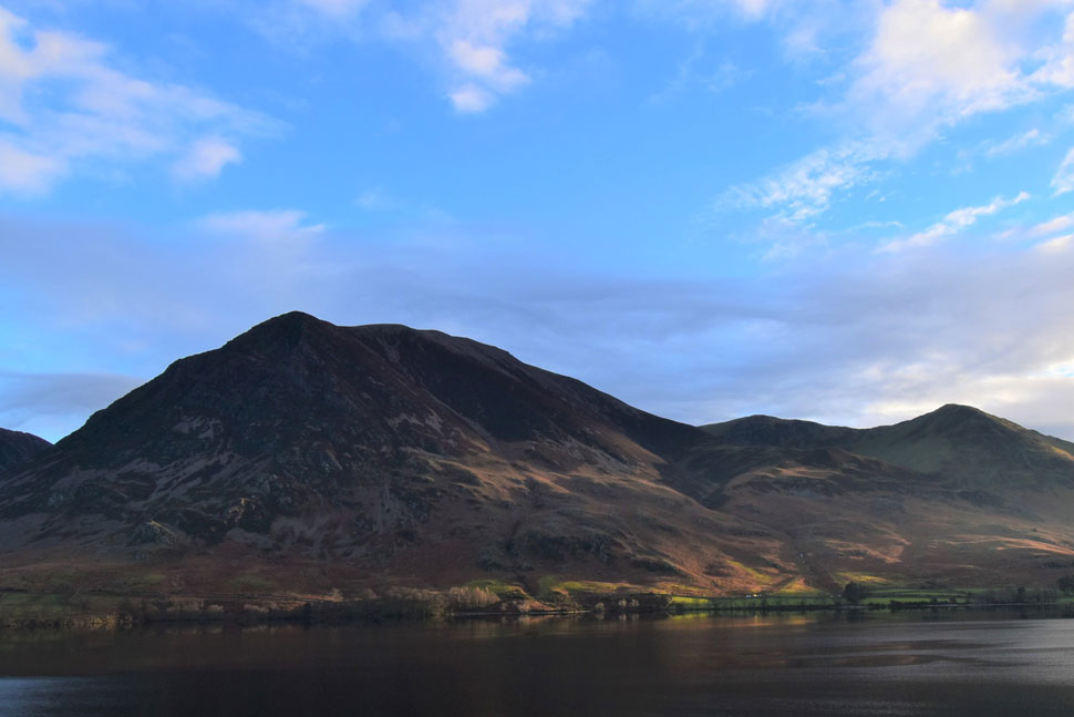
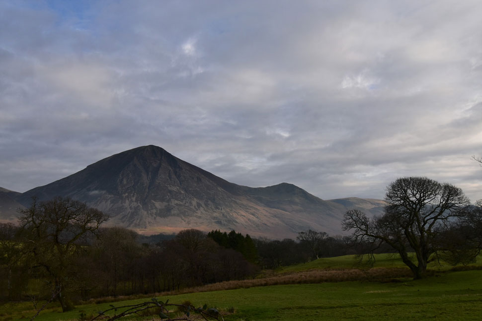
| Mellbreak from Loweswater 09:10am 0°C |
We'd arranged to meet at the slightly later time of 08:45am for a 09:00am start to allow any lingering cloud to lift and the forecasted sunny spells to push through, as you can see the fells are completely cloud free but it was just too gloomy for any sunshine. With limited parking at the red phone box just outside Loweswater it was debatable whether we'd manage to park at all but within the nick of time Rod and I grabbed the last two spaces even if it meant I'd be blocking David in.
It's a mild morning with only light winds forecast across the tops so for the first time in weeks we throw on soft shells instead of waterproof jackets. It was a little later than 09:00am by the time we'd left when it was decided that we'd head for Crummock Water first to let the brightness develop. |
 |
| Grasmoor and Whiteless Pike dominate the view. |
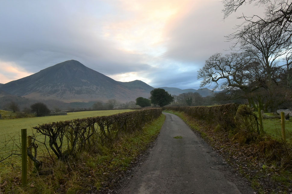
| From the red phone box we strode out towards Kirkstile Inn then turned left towards Park Bridge. You can't see it but Park Beck is just out of shot over on the left. |
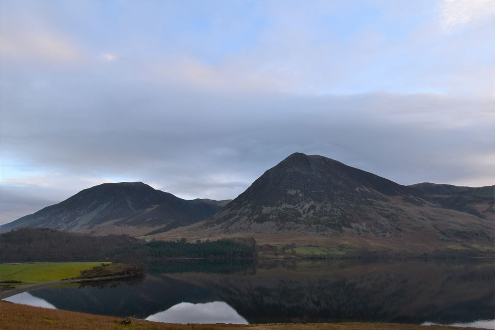 |
| Whin Ben, Whiteside and Grasmoor as seen from Crummock Water. |
| After passing through Low Park we soon arrived on the banks of Crummock Water. The light was still very low but we could see breaks in the cloud forming above our heads. Perhaps we're going to see some sunshine after all. |
 |
| Whiteside, Grasmoor, Wandope and Whiteless Pike. |
| |
 |
| Grasmoor, Wandope, Whiteless Pike and Rannerdale Knotts. |
| Todays walk was by no means a 5 hr walk but we stopped so much we made it in to one. |
 |
| Rannerdale Knotts silhouette. |
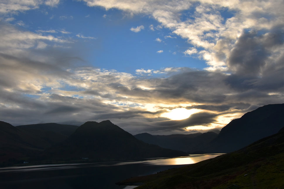
| The distant cloud was quite mesmerising as it cloaked Fleetwith Pike, Grey Knotts, Brandreth and the Gables made more dramatic as the sun poked through leaving Crummock Water's surface with a golden after glow. |
 |
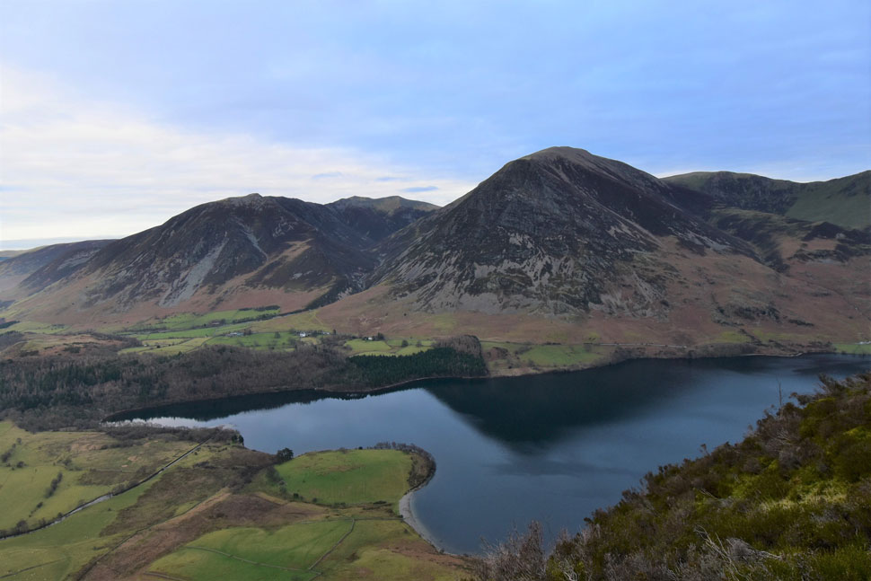
| Whiteside and Grasmoor from Crummock Water. |
| The sunshine was still teasing us illuminating Grasmoor for just a few minutes before more cloud arrived. |
 |
| Grasmoor, Wandope, Whiteless Edge and Whiteless Pike. |
| What a difference a bit of sunshine makes. |
 |
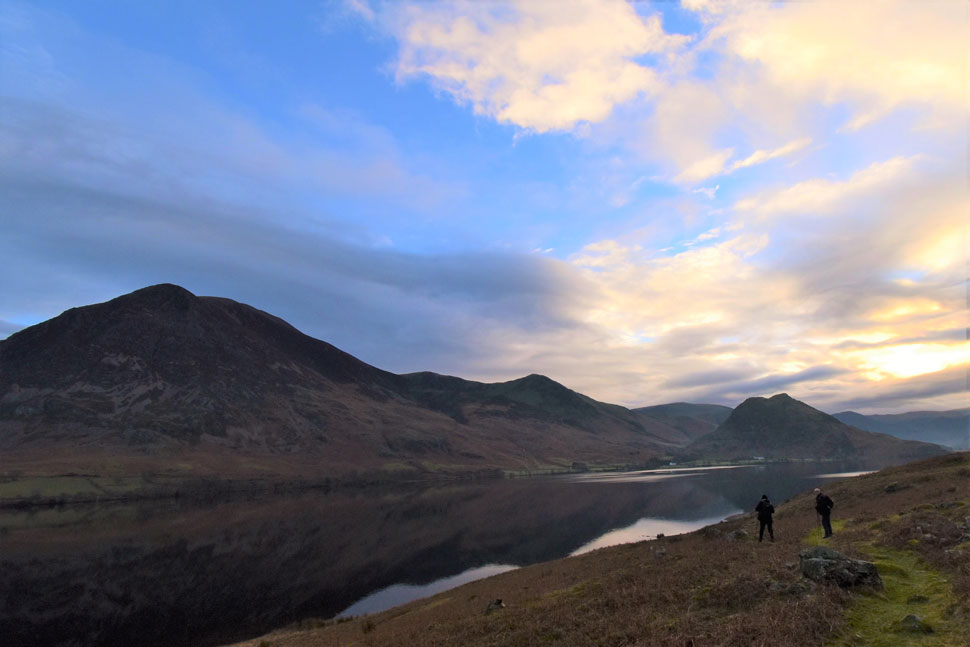
| Low Ling Crag, Grasmoor, Wandope, Whiteless Edge, Whiteless Pike and Rannerdale Knotts. |
| We stopped to chat about nothing much close to Low Ling Crag and before we knew it half an hour had gone by during which time more cloud had arrived. |
 |
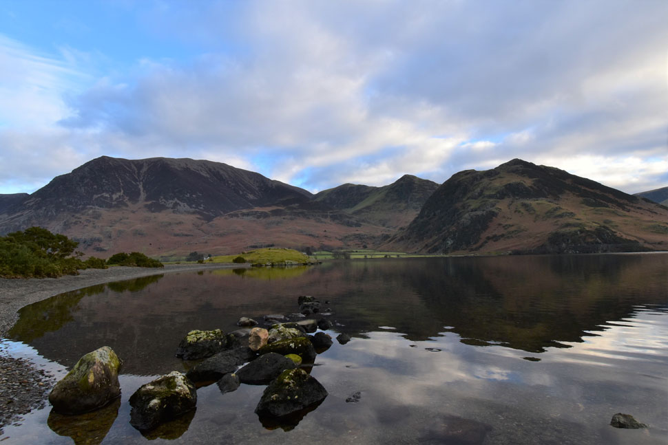
| Scale Force. |
| From Low Ling Crag we turned west and followed the banks of Scale Beck before arriving at Scale Force which, after recent rain was in glorious spate. |
 |
| Gale Fell, Great Borne and Floutern Cop. |
| Instead of retracing our steps by Scale Beck we pushed into the valley for a short distance after spotting an area of highcground which meant we wouldn't have to descend, then reascend as much before picking up the path for Scale Knott. |
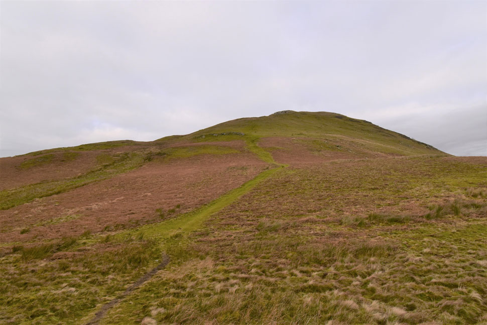 |
| Mellbreak South Top seen shortly after leaving Scale Knott. |
| Despite its steepness this is the family way up Mellbreak. |
 |
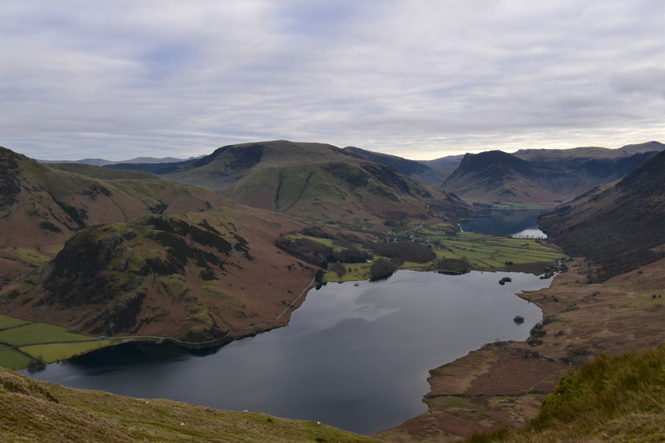
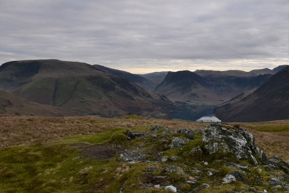
| Scale Knott, Crummock Water, Buttermere, High Snockrigg, Robinson, Dale Head, Fleetwith Pike, Grey Knotts and High Stile. |
| The stunning view made for a good excuse to stop to get our breaths back. |
 |
Scale Knott, Crummock Water, Buttermere, High Snockrigg, Robinson, Dale Head, Fleetwith Pike from Mellbreak South Top.
|
The difference in height between the south top (summit) and north top is a tad short of 10ft (3mtrs) making it pretty difficult by eye to determine which summits looks the highest!
|
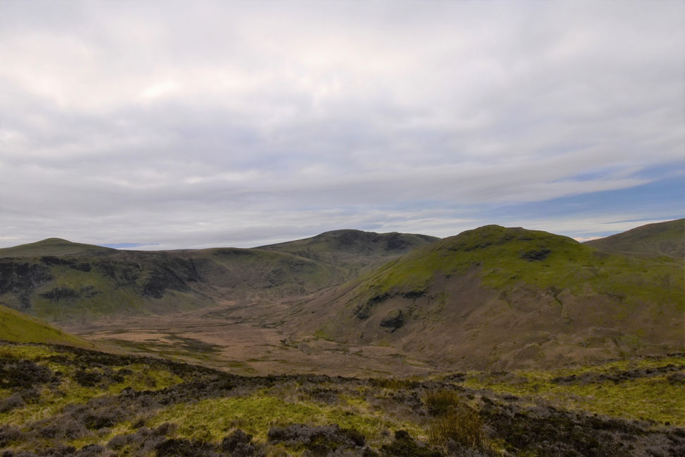 |
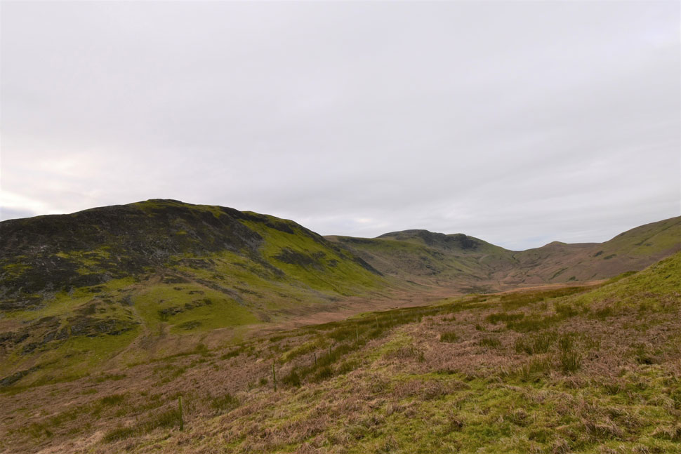
| Starling Dodd, Great Borne, and Hen Comb. |
| With the Mosedale valley dividing Mellbreak from Hen Comb. |
 |
| Lunch with a view. |
| We crested the north summit and took in the views for a few moments before beginning the descent via the north ridge. We followed the narrow path flanked heavily by heather before the path began to twist steeply through where at some points hands on rock was the safest descent. |
 |
| Views over Crummock Water towards Whiteside, Hopegill Head, Grasmoor and Wandope. |
| Taken close to the third premonitory. |
 |
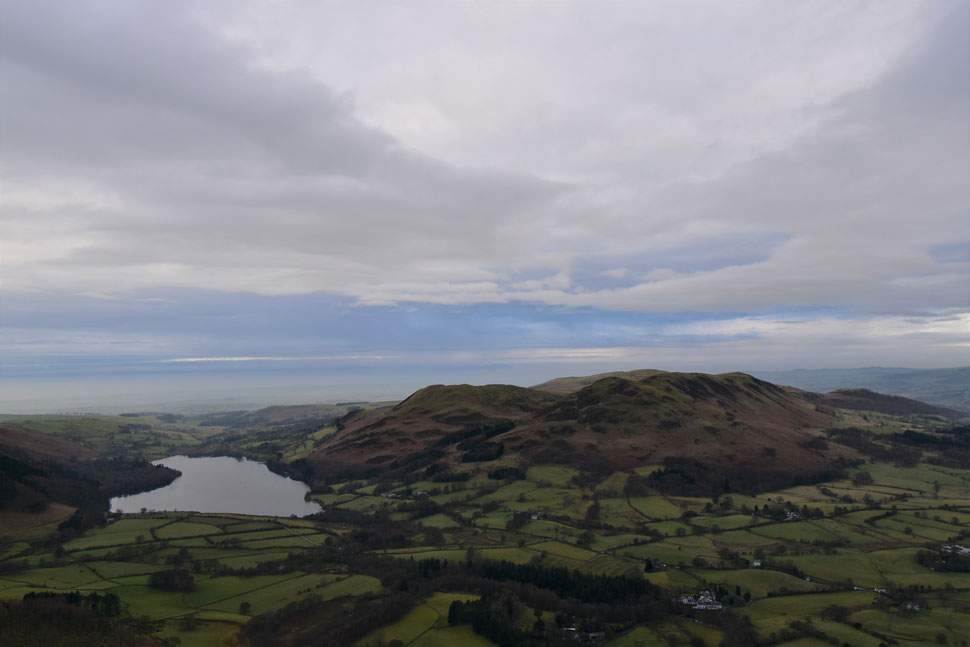
| Grasmoor and Whiteless Pike from Loweswater. |
With the narrow rock steps safely negotiated we arrived at the top of the scree run where we were passed by a group in ascent. One of the group immediately took up conversation almost teacher to student like leaving all three of us a little silent and stunned. I wont go into the ins and outs but we were yet again at the wrong end of someone who knew more anyone, was extremely patronising and clearly a liar. Oh well you meet all sorts I guess.
Boots soon touched grass as we made our way between the break in the trees and the gate thereafter. We arrived at the gate to find a farmer talking to a couple we'd seen on the north summit earlier who must have descended into Mosedale from the saddle of the summit. The farmers dog barked friendly as we passed through the gate as a light mist hung over Lorton Vale which we'd spotted from the summit earlier. The afternoon felt almost Spring like as we passed the Kirkstile Inn where two families occupied tables confirming although the temperature was only 6°C it felt mild enough to eat and drink outside. We soon reached our cars where our chatting and sometimes laughter was the only sound that split the silence of the valley. |
|
| |
| Back to top |
 |
|