|
Raise from Glenridding |
 |
 |
11th February 2022 |
 |
|
Frustrations continue as the best of the weather is forecast through the week only for the wet weather to return by weekend. Spying Friday's forecast at the beginning of the week I booked leave and prayed the forecast wouldn't change, it didn't.
With the exception of 2021 when I look back through my walking diary by now I would have already climbed the heights of Blencathra, Bow Fell, Helvellyn and travelled down to Snowdonia to climb Y Garn yet due to appalling forecast I've only managed to scale Branstree and Melbreak while the rest of my walks have either been low level or local.
Due to this years slow start no doubt my fell fitness has faltered slightly so with what appeared to be the perfect weather window I aimed high. It's been nearly 4 years since I last linked these fells together, the main attraction of the route being the ridge linking Raise and White Side, a flat high level slice of heaven that I have missed and was heavily looking forward to returning to. |
|
| Wainwright Guide Book One |
 |
| The Eastern Fells |
| Raise deserves a special cheer. It is the only summit in the Helvellyn range adorned with a crown of rough rocks. |
 |
|
|
|
|
| |
|
Overview |
|
|
| Ascent: |
3,256 Feet - 994 Metres |
| Wainwrights: |
5, Glenridding Dodd - Sheffield Pike - Hart Side - Raise - White Side |
| Visiting: |
2, Heron Pike - White Stones |
| Weather: |
A Bright Start Turning Cloudy By Late Morning. Summit Cloud & Gust Across The Summits Highs of 7°C Lows of -3°C Feels Like -8°C |
| Parking: |
Pay & Display Car Park, Glenridding |
| Area: |
Eastern |
| Miles: |
10 |
| Walking With: |
On My Own |
| Ordnance Survey: |
OL5 |
| Time Taken: |
5 Hours |
| Route: |
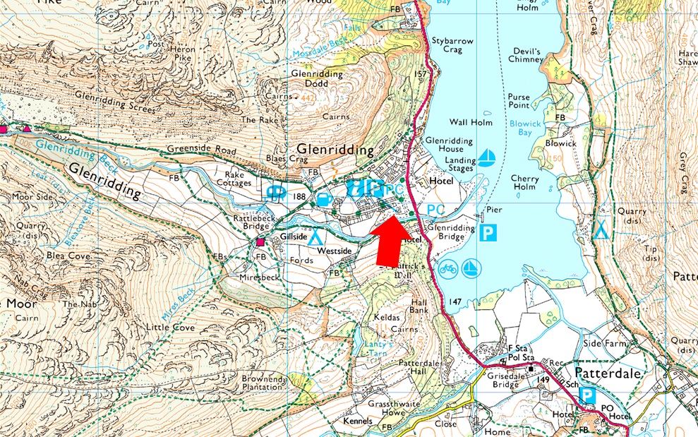
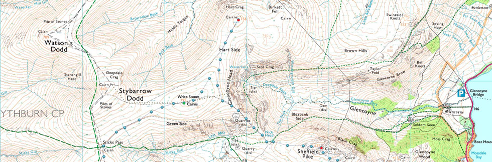
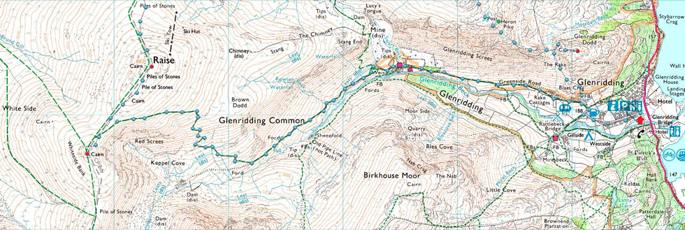
Glenridding - Greenside Road - Glenridding Dodd - Heron Pike - Sheffield Pike - Nick Head - Glencoyne Head - Hart Side - White Stones - Top of Sticks Pass - Raise - White Side - Keppel Cove Zigzags - Glenridding Beck - Greenside Road - Glenridding |
|
| |
|
Parking Details and Map |
|
|
| Nearest Post Code: |
CA11 0PD |
| Grid Reference: |
NY 385 716 |
| Notes: |
A large Pay and Display can be found in the centre of Glenridding alongside Glenridding Beck. The car park hosts an Information Centre and Toilets with local shops, bars, hotels and not to forget some of Lakelands most popular fells close by. The car park is Pay and Display and charges apply. |
|
| |
|
Map and Photo Gallery |
|
|
  |
| |
| |
 |
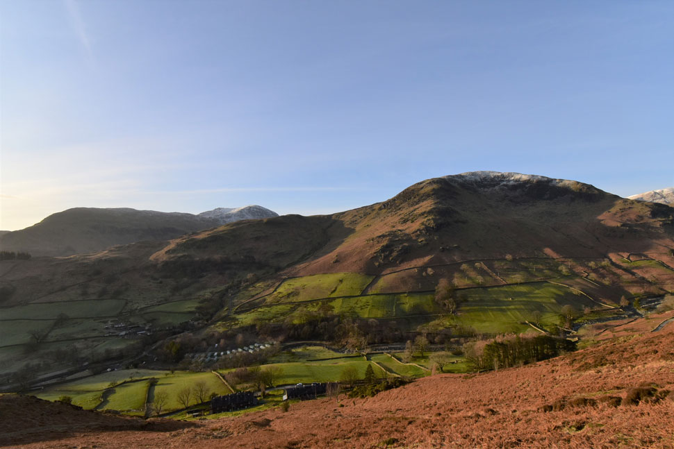
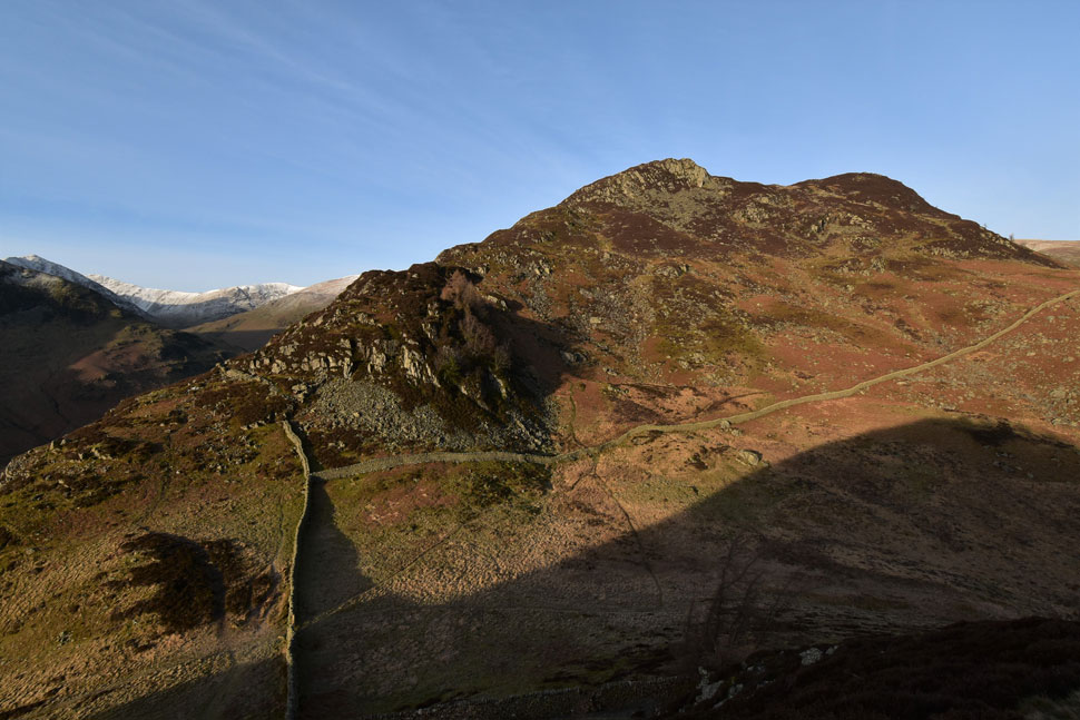
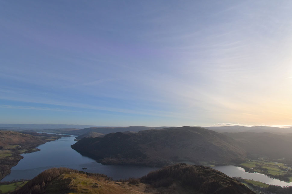
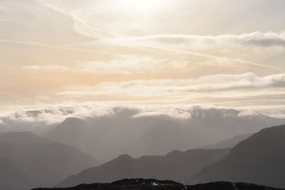
| Birkhouse Moor, Birkhouse Moor North Ridge and Raise from the ascent of Glenridding Dodd 08:40 am -3°C |
| The forecast had changed slightly with bright sunshine forecast until late morning making way for high cloud and sunny spells for the rest of the day. I timed my arrival for 08:30am and arrived ten minutes early. It was a bright, frosty windless morning as I deposited £7.00 into the parking meter which would give me a 5 hour window give or take. A dusting of snow had fallen on frozen ground overnight so for the first time in my fell walking career I pack a brand new pair of Grivel micro-spikes although looking at the tops they might have to wait a while longer untill their debut.
The morning sun takes the nip out the air as I complete my kit up, I then lock the car before heading up Greenside Road passing workmen carrying out repairs to a nearby cottage and a local lady defrosting her car. Inconsiderate parking in Glenridding has got to the point where cones are laid outside all the residential housing which extend towards the rear of the Travellers Rest where one or two parking spaces used to be located, I say used too because aside half a dozen cones the whole area is littered with red 'Private Parking' signs which is probably why I left the camera in its bag. Greenside Road steepens after a right turn where views unfolded over to Birkhouse Moor and Mire Beck before I pass through a gate and begin the short but steep ascent on Glenridding Dodd. |
 |
| Views over Gillside towards Birks, St Sunday Crag and Birkhouse Moor. |
| It might be -3° but under a cloudless sky and with the morning sun on my back it feels more like 30°! so down come the zips and off comes the hat and buff I'd wrapped around my neck. |
 |
| Catstye Cam Helvellyn Lower Man, White Side and Heron Pike from Glenridding Dodd. |
| The frozen ground was a pleasure to ascend and soon I'd reached the col where I was thankful of the shade. Continuing on I picked up the zigzagged path while hoping the experts had got the forecast wrong where it would stay so bright and clear for the rest of the day. |
 |
| Gowbarrow Fell and Ullswater from Glenridding Dodd summit. |
| Minutes later I shouldered the summit poles in a held position while taking in the glorious views. Part of me wanted to explore this fantastic little summit but if I'm to enjoy the best of the conditions I need to keep moving. |
 |
| Time for a couple of photos before I leave. |
| Here looking towards Birkhouse Moor, Birks, St Sunday Crag Fairfield, Hart Crag and even a glimpse of Dollywagon Pike seen beyond Birkhouse Moor north ridge. |
 |
| Here's Gowbarrow Fell and Ullswater again... |
| ...seen with Birk Fell on Place Fell over on the right. |
 |
| A similar view. |
| Taken from the ascent of Heron Pike. |
 |
| The Shark and the Rhino / Heron Pike. |
| With Glencoyne below. |
 |
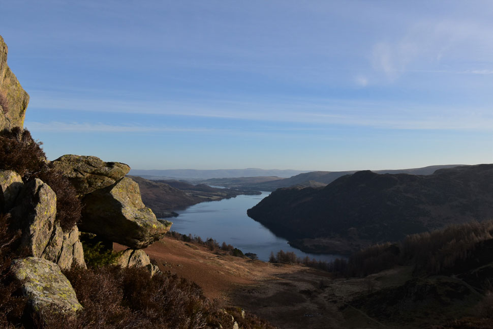
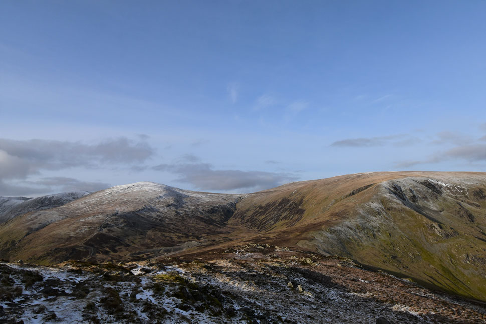
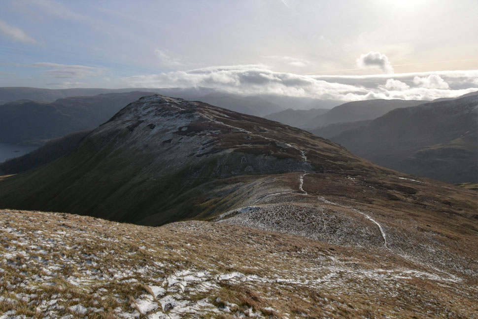
| Views over the Glenridding valley towards Helvellyn, Catstye Cam, Helvellyn Lower Man, White Side and Raise. |
| On the face of it Raise dominates the valley with Brown Dodd seen over on the left and Stang at the lower end of the east ridge. |
 |
| Birks, St Sunday Crag, Fairfield, Hart Crag seen beyond Birkhouse Moor North ridge. |
| Although an exceptional view it wasn't St Sunday Crag I was looking at but the cloud in the distance which seems to have materialised in no time. |
 |
| Place Fell, Hallin Fell, Gowbarrow Fell, Wether Hill, Bonscale Pike and Arthur's Pike from Heron Pike. |
| Instead of heading directly to Sheffield Pike I paid a visit to Heron Pike summit to take in the views. |
 |
| Wide angle shot of the Southern Ullswater and Place Fell from Heron Pike. |
| With Glenridding Dodd seen right. |
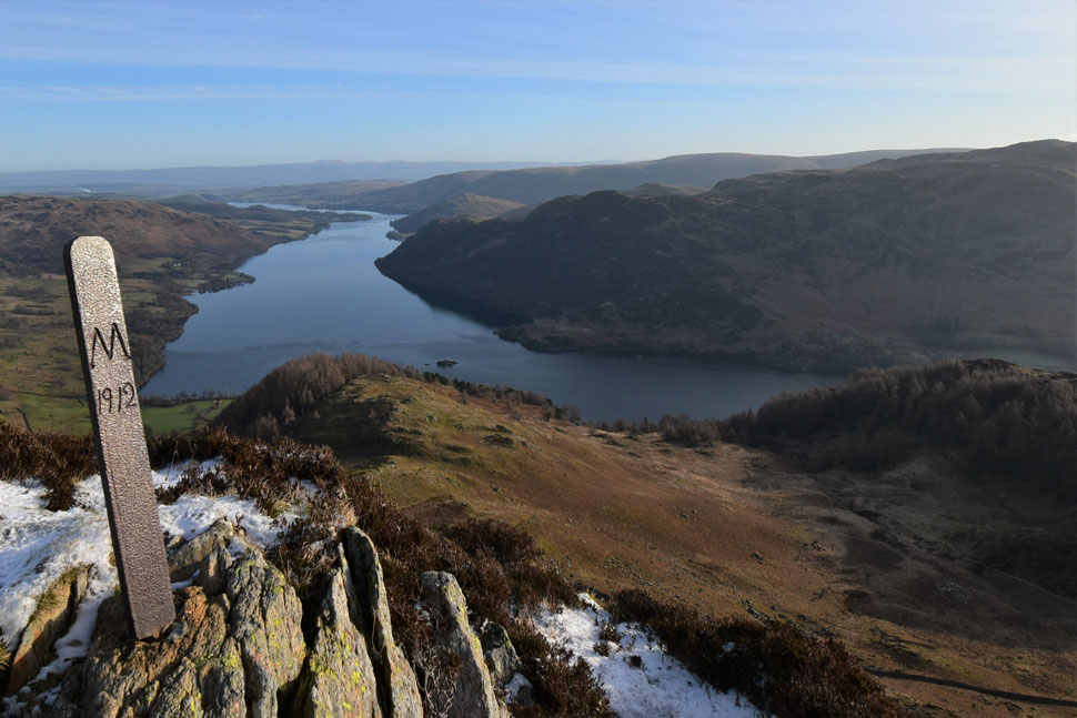 |
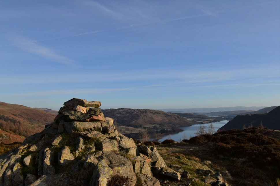
| Ullswater seen from Heron Pike summit boundary marker. |
| Just in case you were wondering 'M' stands for Marshall estate, Patterdale. |
 |
| Looking back towards Hartsop Dodd, Rest Dodd, The Knott, and High Street. |
| In less than one hour the cloud I'd seen earlier had settled on the far eastern fells. You can just imagine the view from The Knott summit, incredible. In the time it had taken me to visit Heron Pike summit the trio I'd seen back on Glenridding Dodd had almost caught up with me, you can just see them in the foreground. |
 |
| Striding Edge, Helvellyn, Catstye Cam, Helvellyn Lower Man, White Side, Raise and the top of Sticks Pass from Sheffield Pike summit. |
| With Sheffield Pike summit reached I took in the views for a few moments before being joined by the trio after conversation was stuck up I was asked "are you from Wigan?" "I am" I replied before being asked my name which the guys quickly linked to the website ...as it turns out not only was the trio from Wigan we lived within a mile of each other, shared friends and attended the same schools as myself and my wife.
Then came the "do you know such a body" we ended up having a good natter about home, friends and fell walking before sharing our routes. The guys were heading for Sticks Pass before ascending Raise while my route would see me visiting Hart Side and possibly Stybarrow Dodd first. Talk about a small world.
We bid each other to enjoy the rest of our walks before the guys left while I stood transfixed watching the cloud envelope the far eastern fells. |
 |
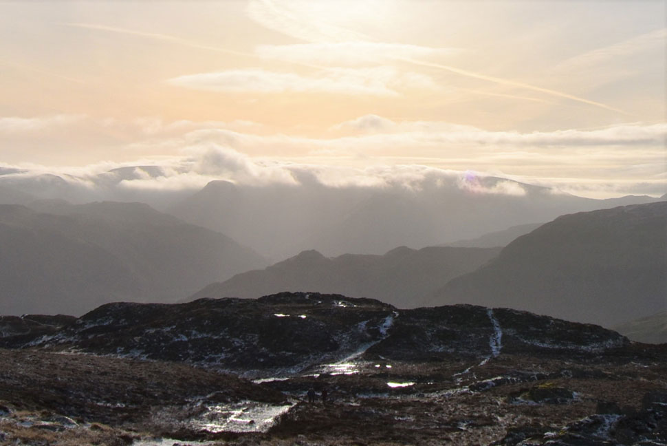
| Waves of cloud... |
| gently lapping at the shores of the far eastern fells. |
 |
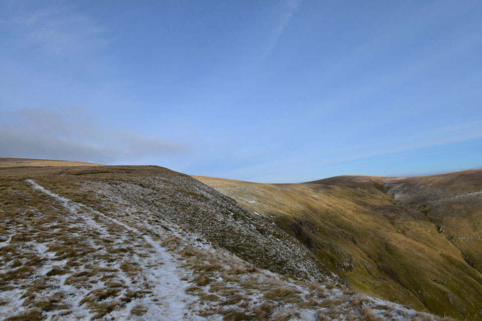
| White Side, Raise, the top of Sticks Pass, White Stones, Nick Head and Glencoyne Head. |
| I left Sheffield Pike summit behind and began my descent over frozen ground towards Nick Head from where I'll begin the steady ascent onto Glencoyne Head and Hart Side thereafter. |
 |
| White Stones, Glencoyne Head, Hart Side and the Glencoyne valley. |
| While the lads descended out of view I continued towards Nick Head while taking in the view of the Glencoyne valley. |
 |
| Cloud settling over Helvellyn and Little Man with Raise seen right. |
| Only an hour earlier it had been completely clear and if I'm honest no cloud had been forecast until later this afternoon so for now I'm gonna have to keep my eye on it. |
 |
| Looking down on Nick Head and Sheffield Pike. |
| From a steady assault of Glencoyne Head. |
 |
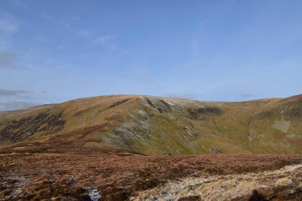
| Hart Side and Glencoyne Head comes into view. |
| There were many reasons for choosing todays route one of them being walking the ridge linking Raise with White Side the second one is walking over the top of Glencoyne Head seen here with a dusting of fresh snow. |
 |
| Rewards for the hard work. |
| Is this easy walk to Hart Side summit. |
 |
| Hart Side summit. |
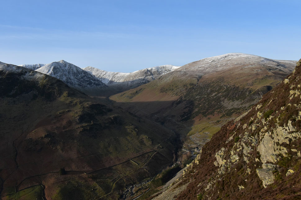
| What started with a layer of cloud over the far eastern fells has extended towards the Fairfield and Helvellyn group. You don't mind losing your extended view when it's as dramatic as this. |
 |
| White Stones (L) and Stybarrow Dodd (R) |
| Up until ten minutes ago the plan was to strike right and continue up onto Stybarrow Dodd then return to the top of Sicks Pass before an ascent on Raise but it looks like I'm playing catch up with the cloud so instead I change plans and take in White Stones instead. |
 |
| Looking back on Hart Side. |
| Using the last of the brightness before it disappears behind thick cloud. |
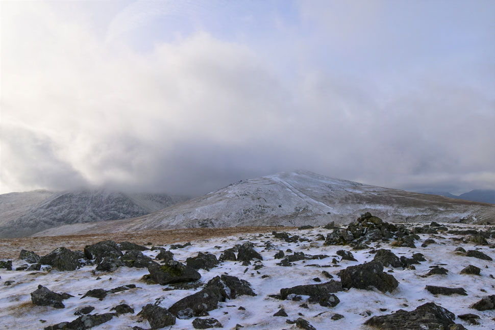 |
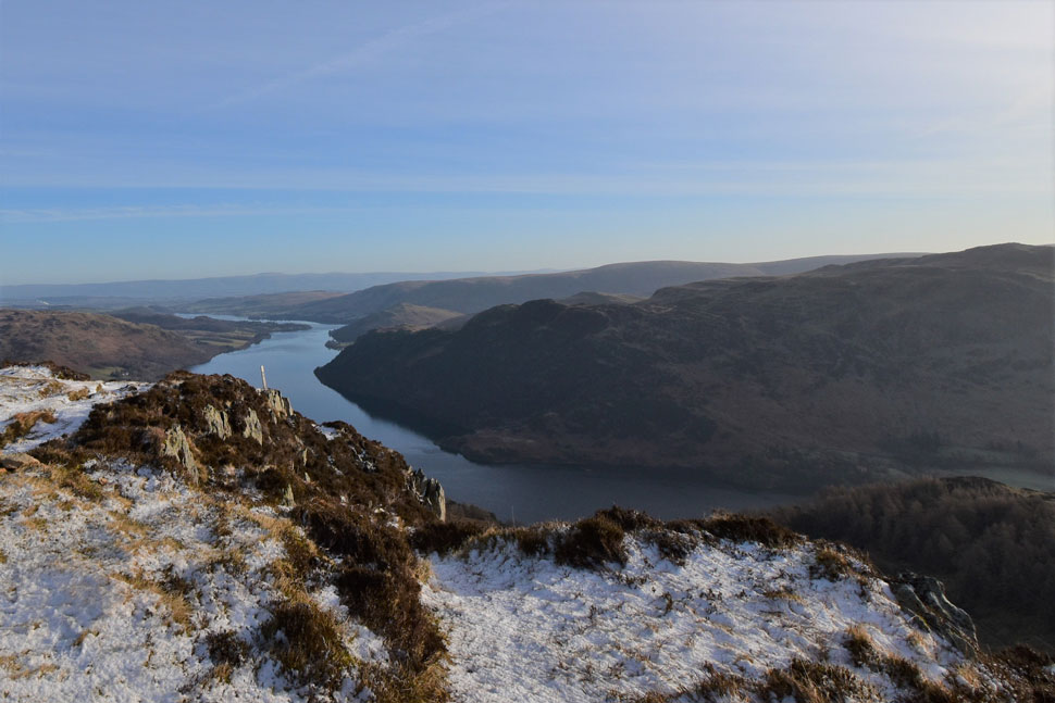
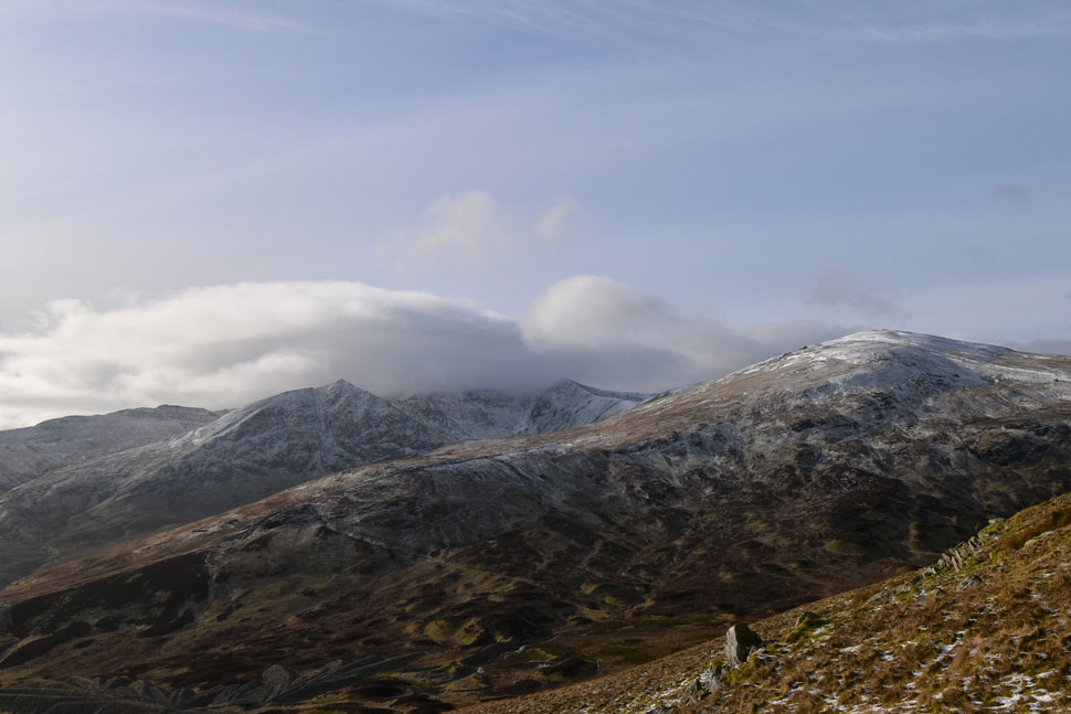
| Raise from White Stones with Catstye Cam summit below cloud over on the left. |
| The windchill is starting to drop now freezing my chin, nose and even my ears despite wearing a hat which I change for a thicker one, then raise my buff to below eye level. Snug as a bug now. |
 |
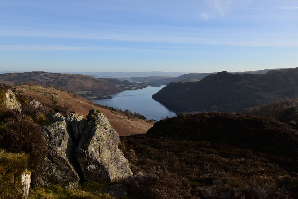
| Looking back on White Stones with Ullswater in the distance. |
| I'd still only seen the three Wiganer's up until now that was until I'm passed by a chap who as it turned out was my walking my route only in reverse, in tow was a Patterdale Terrier which carried a squeaky ball in her mouth. All my ears had been used too was wind so hearing a dog squeeze its squeaky ball was kind'a funny if not surreal given the location. |
 |
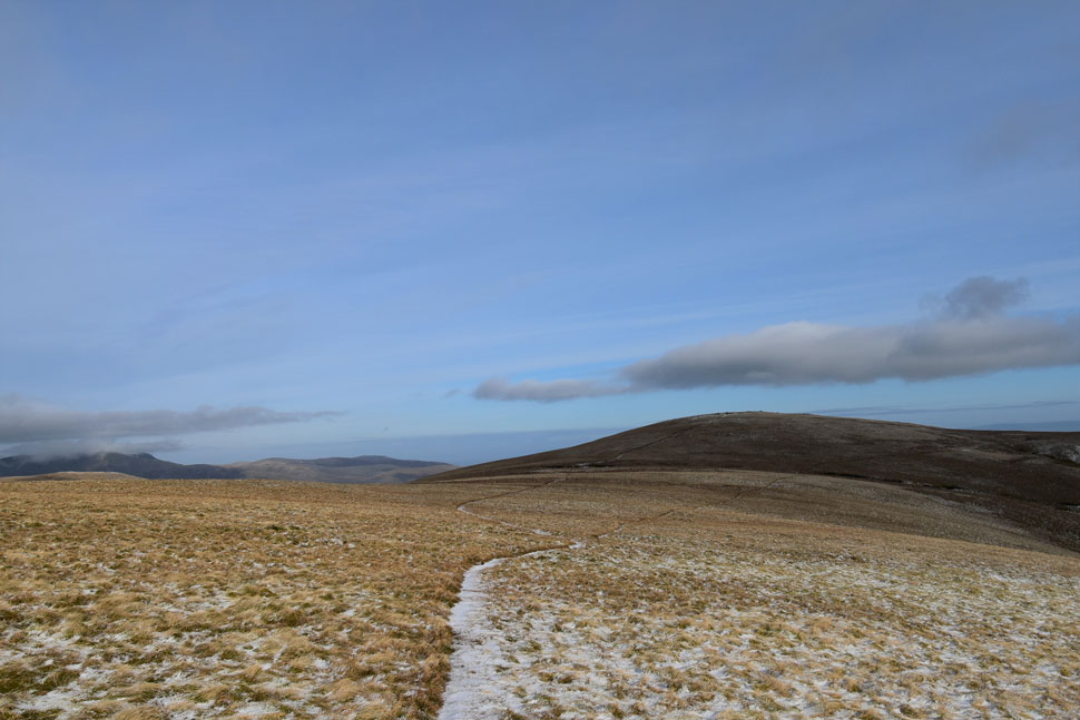
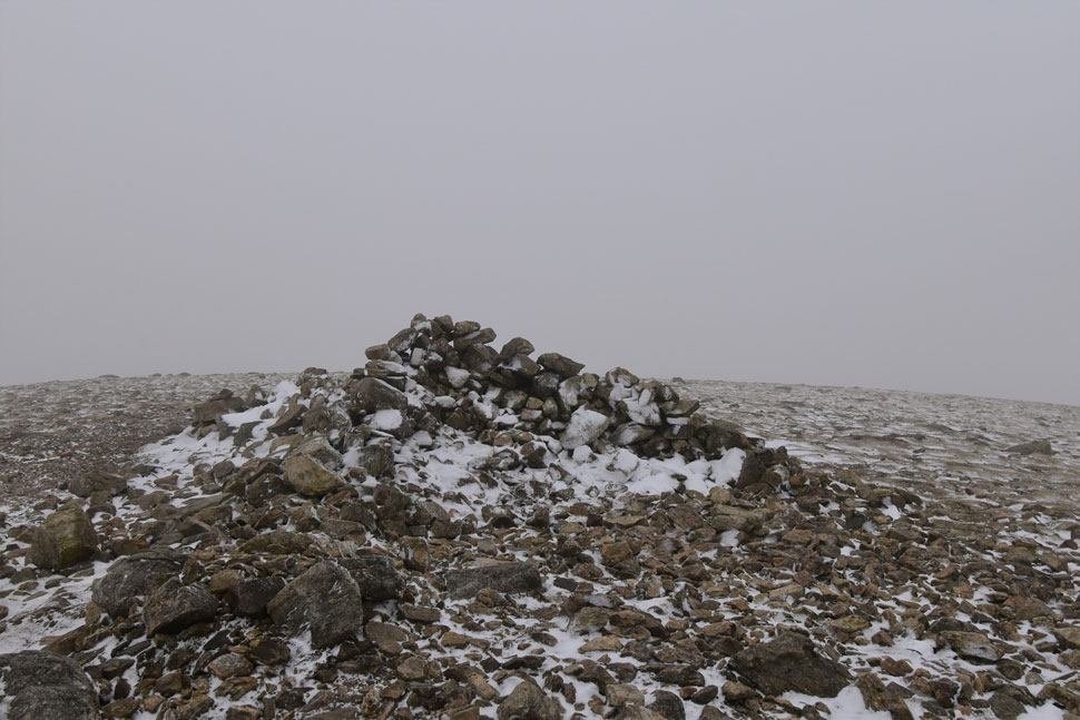
| Into the snow line. |
| As I took in the view over the top of Sticks Pass towards Stybarrow Dodd and Watson's Dodd. |
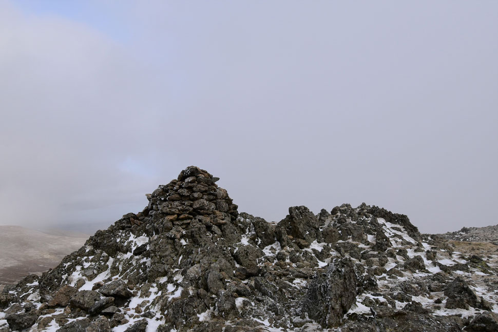 |
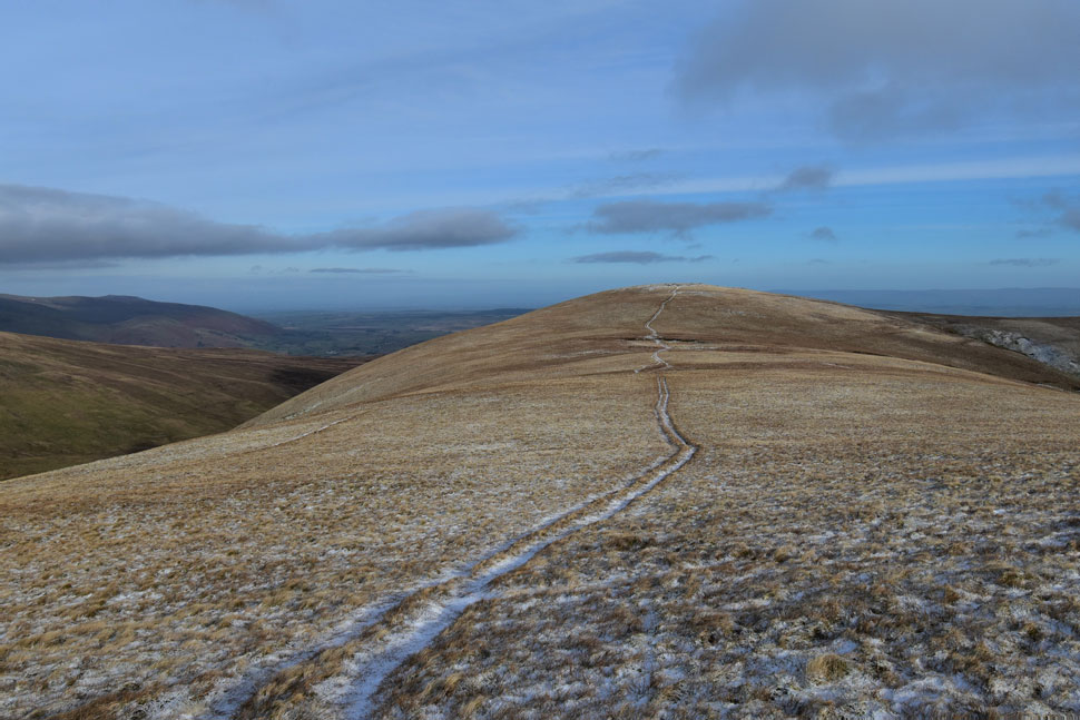
| Raise summit. |
| I arrived at the same time as a young lad who'd approached from the direction of White Side and over the wind a 'morning' was shared. |
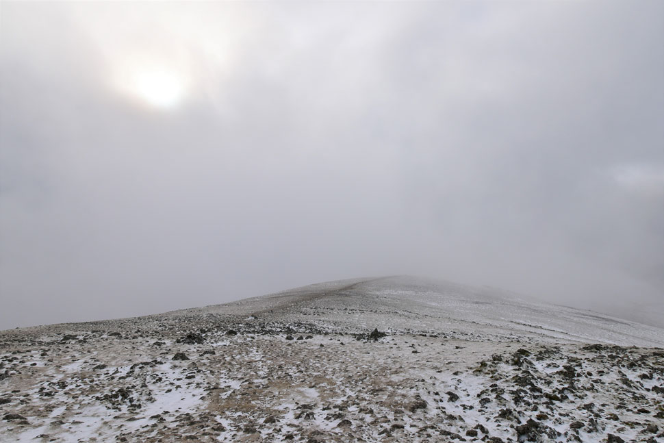 |
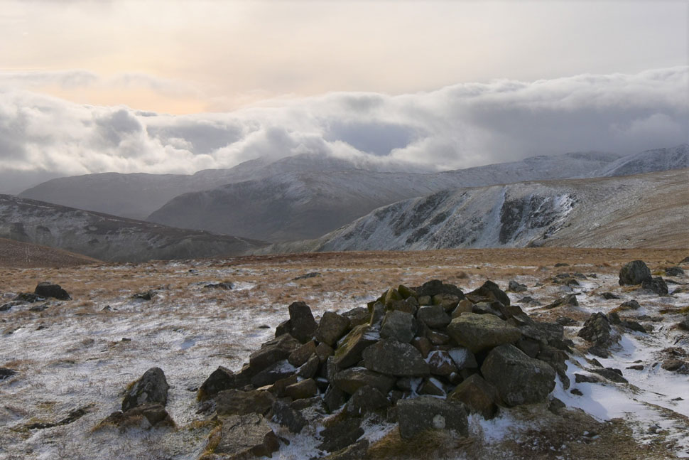
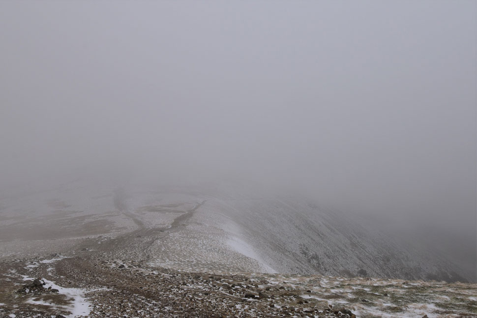
| Raise frozen summit plateau. |
| The cloud for now was just above the summit and other than the biting windchill was quite dramatic. |
 |
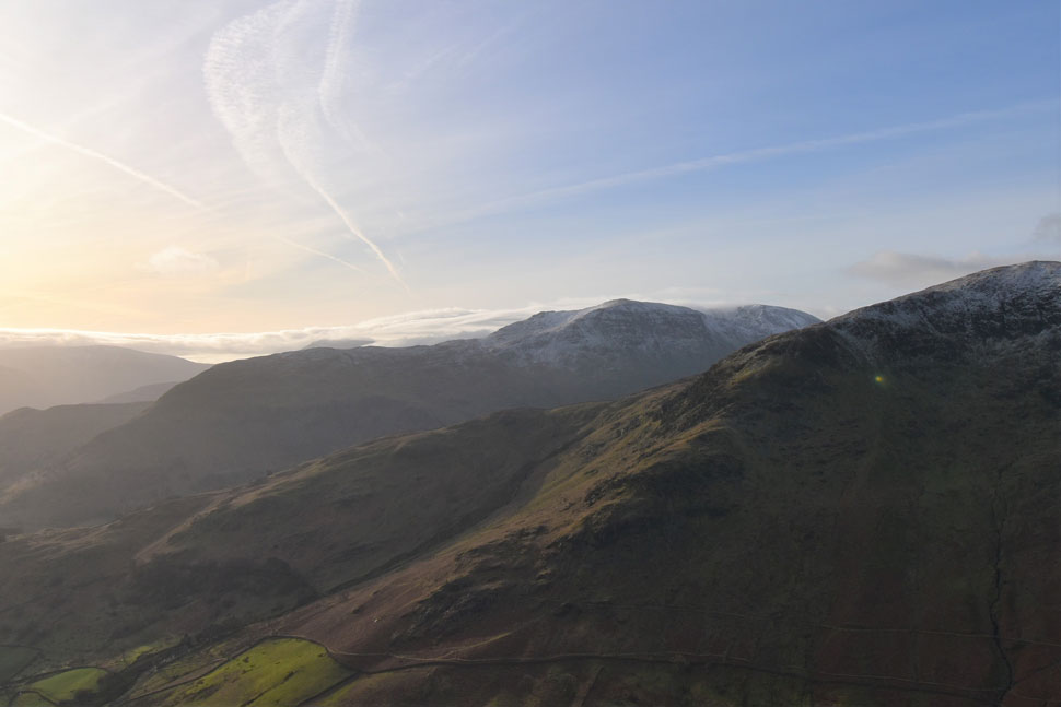
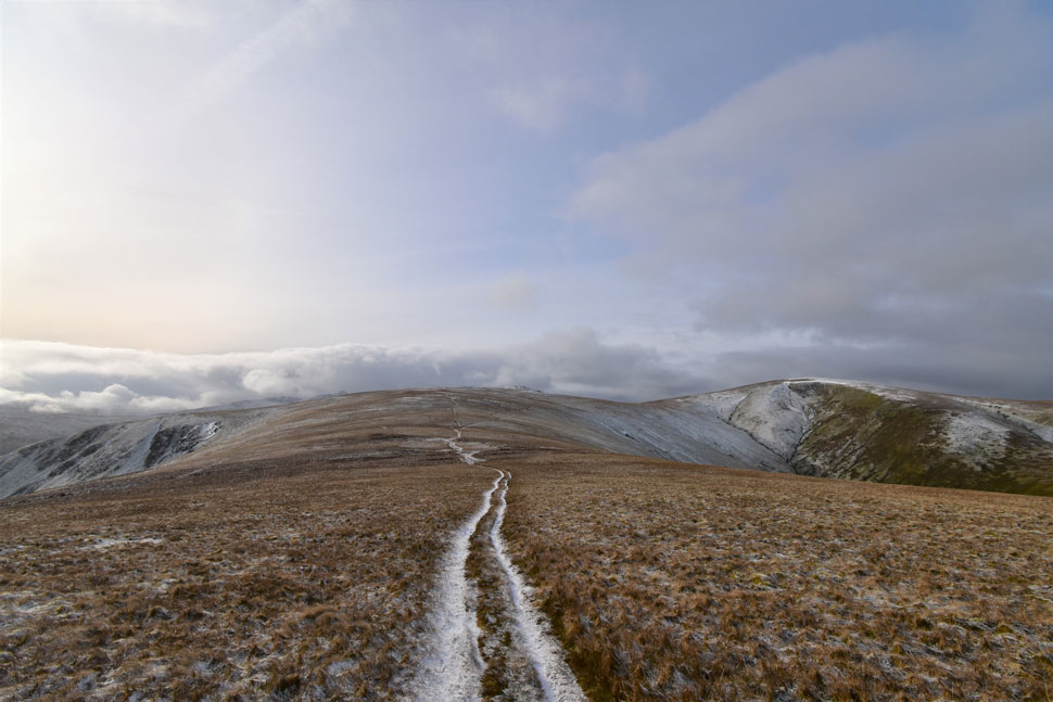
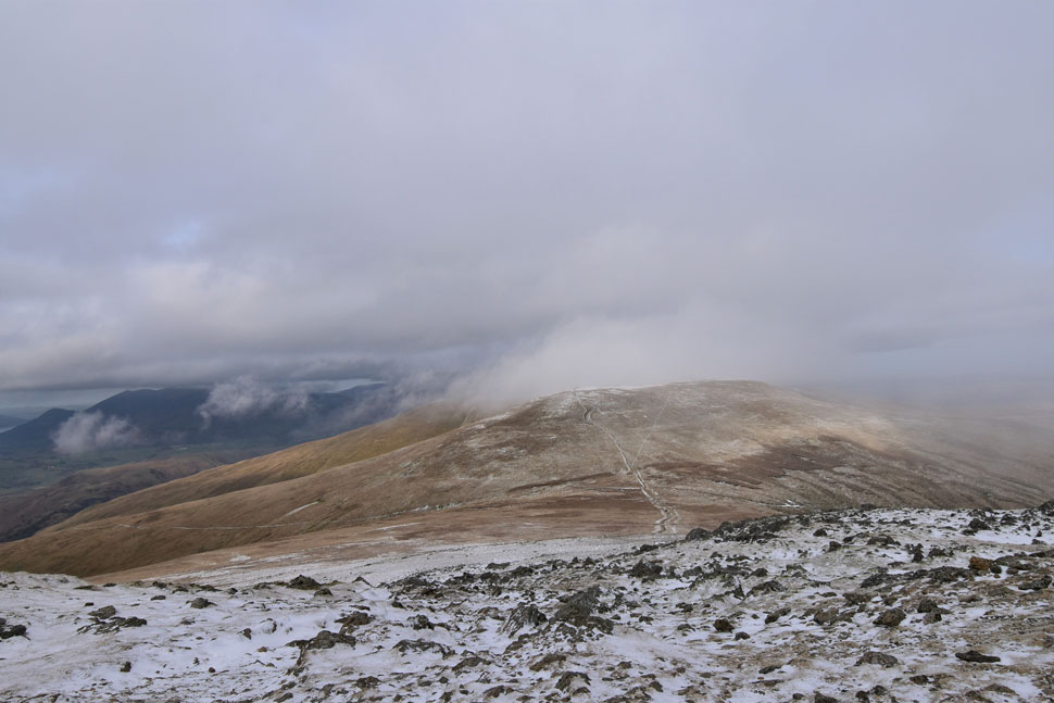
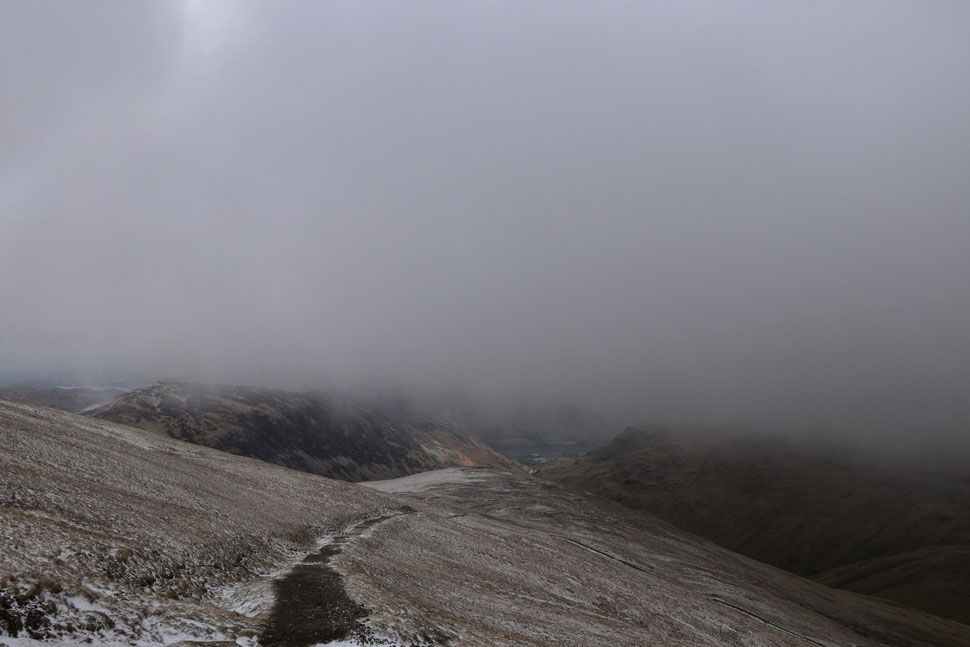
| White Side appears. |
| Only minutes earlier the cloud had dropped to near zero visibility but due to a strengthening wind didn't last long. If you look left you might be able to spot the cairn marking the path for the Keppel Cove zigzags. |
 |
| White Side summit shelter. |
| After a rather quick ascent I arrived at White Side summit from where I took a reading using my anemometer which recorded a -6.3°C windchill with a maximum wind speed of 27.4 mph although I must admit it felt much chillier than that. |
 |
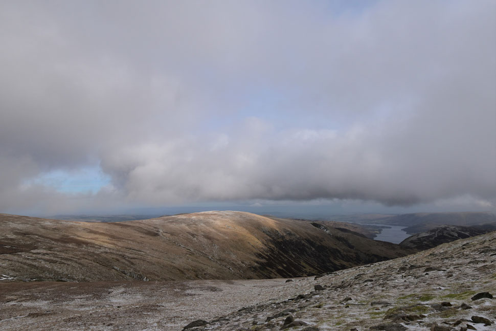
| Heading back down to the ridge. |
| With Kepple Cove seen over on the right. |
 |
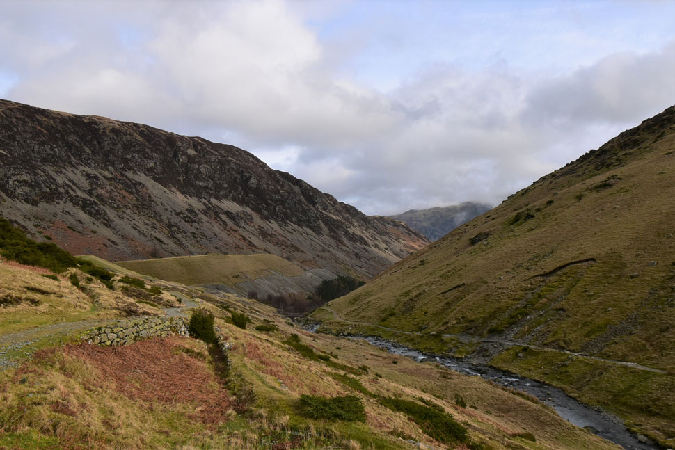
| Descending into Kepple Cove. |
| With Sheffield Pike on the left and Birkhouse Moor on the right. |
 |
| Snippets of sunshine came and went. |
| As I walk back through the valley towards Greenside Road. |
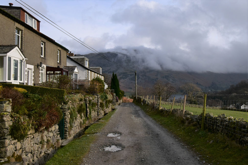 |
| Place Fell from the miners cottages, Greenside Road. |
| With White Side lost in the cloud I joined the top of the zigzags while being transported back to the last time I was here in November 2017 with Tim Oxburgh during which time with laden packs we ran the entire length of the zigzags, back then my knees could cope with the extra stress, not so much now. I pass a mountain biker slowly winding his way through the zigzags his rewards would be plentiful once he reached the ridge but for now he looked exhausted. Continuing down the track views opened up into the cracks and gullies of Catstye Cam only for the cloud to cover them up again.
At times the cloud lurked low enough to obscure entire mass of Brown Cove and I wondered was there any takers on Swirral Edge, there had to be. At the bottom of the zigzags the path levelled as the temperature rose to the point where I had to remove my hat and gloves. I passed through what was YHA Helvellyn where I couldn't resist a look up at the white water cascading down Swarth Beck.
I left the cottages and joined the tarmac of Greenside Road proper. Walkers occupied tables both in and outside of the Travellers Rest while further down the road the workers I'd seen this morning were packing away tools into the back of a van. My nostrils were treated to the smell of wood smoke coming from the chimney of a nearby cottage as I reached the end of the road with only minutes to spare before my parking ticket ran out of time. Despite the car being less than half full Glenridding was still busy with footfall as I reached the car, unlocked my boot and began to kit down not forgetting to grab a hot flask of Vimto which I sipped while staring at the cloud cover over Place Fell which I later learned extended over the top of Kirkstone pass and back down the other side. |
|
| |
| Back to top |
 |
|