|
Blencathra via Hall's Fell Ridge & Sharp Edge |
 |
 |
27th March 2022 |
 |
|
I couldn't make yesterdays epic Central ridge walk with David and Rod who very kindly agreed to shelve the walk until the three of us can do it together, that's team mates for yer.
It's been four years since I last traversed Sharp Edge and eight years since I last linked the Hall's Fell ridge with Sharp Edge and if I'm completely honest after four years away it had started to creep up on me whether I still had the legs to do it. This isn't a sign of weakness, I've seen it happen to the most fell hardened among us, I've witnessed it first hand and I didn't want it to creep up on me too.
With the continuing run of good weather there was no better time than the present to attack Sharp Edge and for inspiration I started looking through my archives for a route that would add a little spark which was when I spotted a route very similar to this were one can take all that Blencathra has to offer. |
|
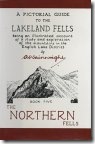
| Wainwright Guide Book Five |
 e e |
| The Northern Fells |
| Sharp Edge is a rising crest of naked rock, of sensational and spectacular appearance, a breaking wave carved in stone. |
 |
|
|
|
|
| |
|
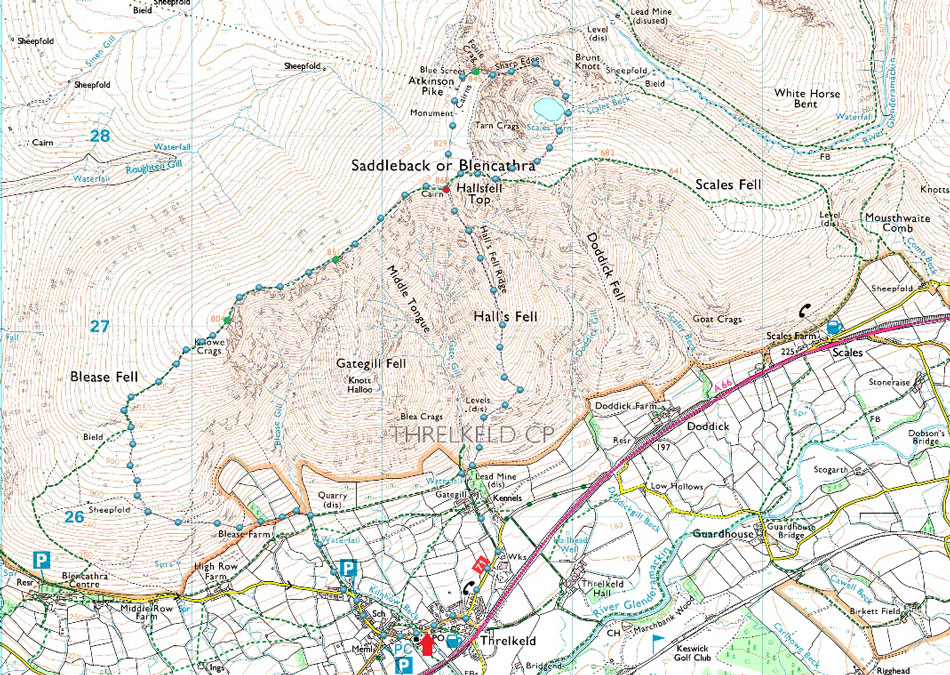
Overview |
|
|
| Ascent: |
3,200 Feet - 976 Metres |
| Wainwrights: |
Blencathra |
| Visiting: |
3, Atkinson Pike (Foule Crag) - Gategill Fell Top - Knowe Crags |
| Weather: |
Bright & Sunny AM Clouding Over PM With Light Winds Across The Summits. Highs of 17°C Lows of 12°C |
| Parking: |
Roadside Parking, Threlkeld Village |
| Area: |
Northern |
| Miles: |
6 |
| Walking With: |
On My Own |
| Ordnance Survey: |
OL4 |
| Time Taken: |
4 Hours 10 Minutes |
| Route: |
Threlkeld - Gategill Farm - Hall's Fell Ridge - Blencathra - Scales Tarn - Sharp Edge - Foule Crag - Blencathra - Gategill Fell Top - Knowe Crags - Blease Fell - Blease Farm - Threlkeld
|
|
| |
|
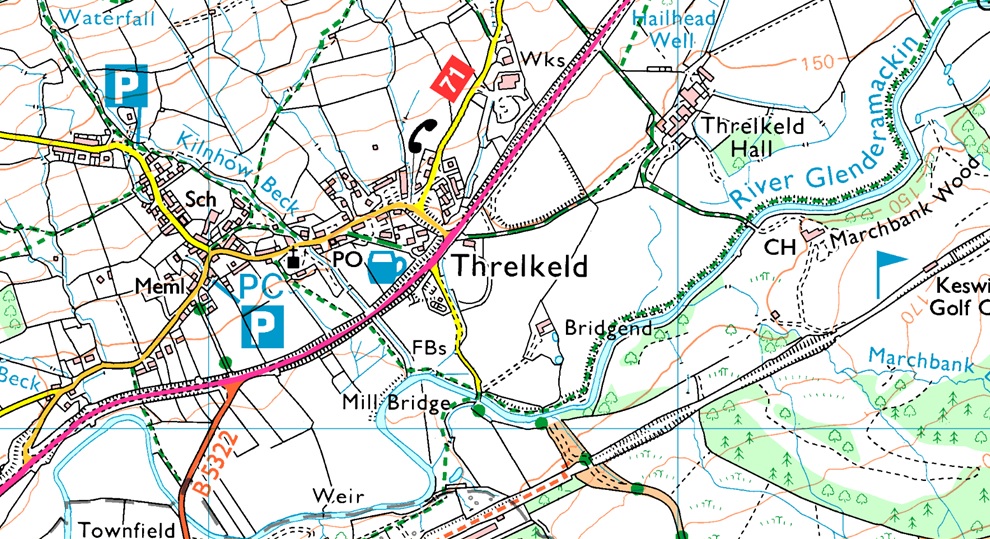
Parking Details and Map |
|
|
| Nearest Post Code: |
CA12 4RY |
| Grid Reference: |
NY 321 825 |
| Notes: |
There is room to park in the lovely village of Threlkeld but it's advisable to remember that Threlkeld is quite a small village and parking is premium even for its residents so care must be taken when parking. The ideal place to park is next to the the church where you will find room for up to half a dozen cars, My advice is to arrive early to secure a place to leave your car due to how the alternative routes you can ascend Blencathra by, the most popular being The Hall's Fell Ridge where most would start from Threlkeld. |
|
| |
|
Map and Photo Gallery |
|
|
 |
| |
| |
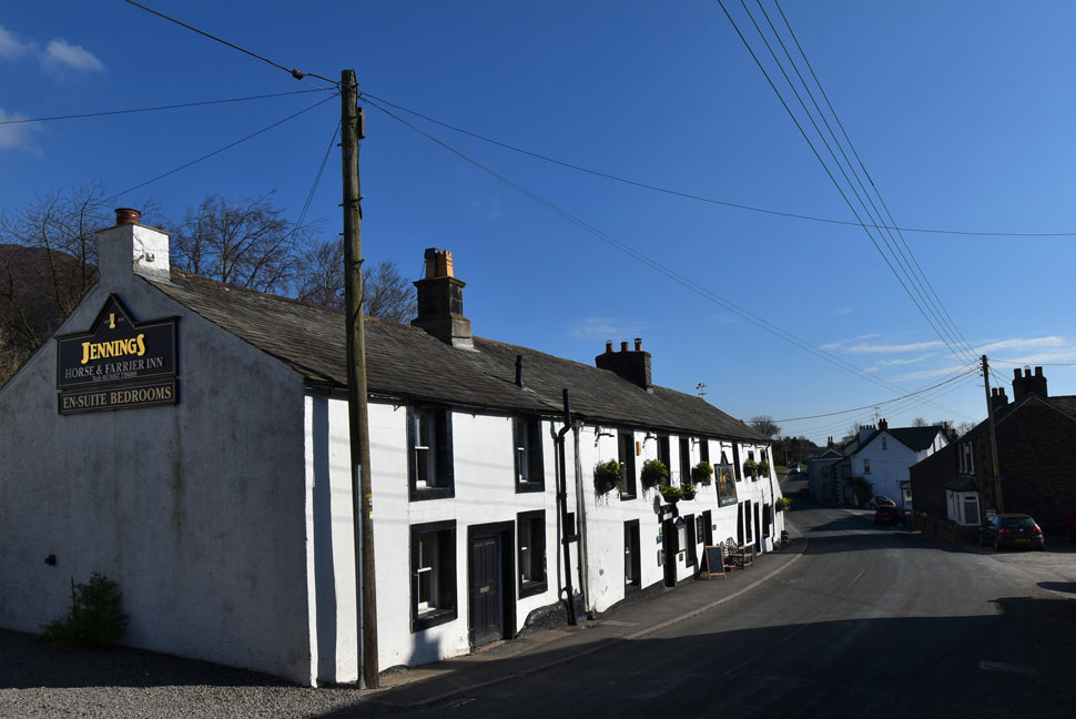 |
| The Horse & Farrier Inn, Threlkeld 09:00am 12°C |
| I had originally planned to use the car park on the A66 adjacent to the Threlkeld junction but I thought I'd try my luck and check out if there were any spaces left outside Threlkeld Church where as luck would have it there was actually room for two cars which was pretty lucky given my later arrival time. For the first time this year I'm wearing shorts and a long sleeve base layer while my lightweight Alpkit jacket gets rolled neatly into my pack which I'd de-wintered during the week, funny, it's still as heavy though.
The odd car passes and so too does a cyclist who I shared a 'morning' with. Given todays route I've opted to use my DSLR camera rather than faff with my mobile phone which takes the clearest of photos which is exactly the reason why I don't want to drop it whilst traversing Sharp Edge, can you imagine making that call to the insurers! After one final sweep of the boot I shouldered my pack which left a thud against my back due to the 3.5ltrs of hydration I'm carrying which by the looks of the forecast I'm going to need every drop of. |
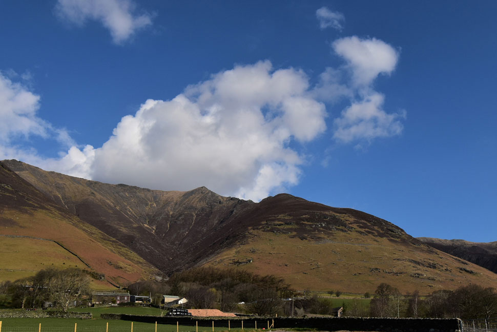 |
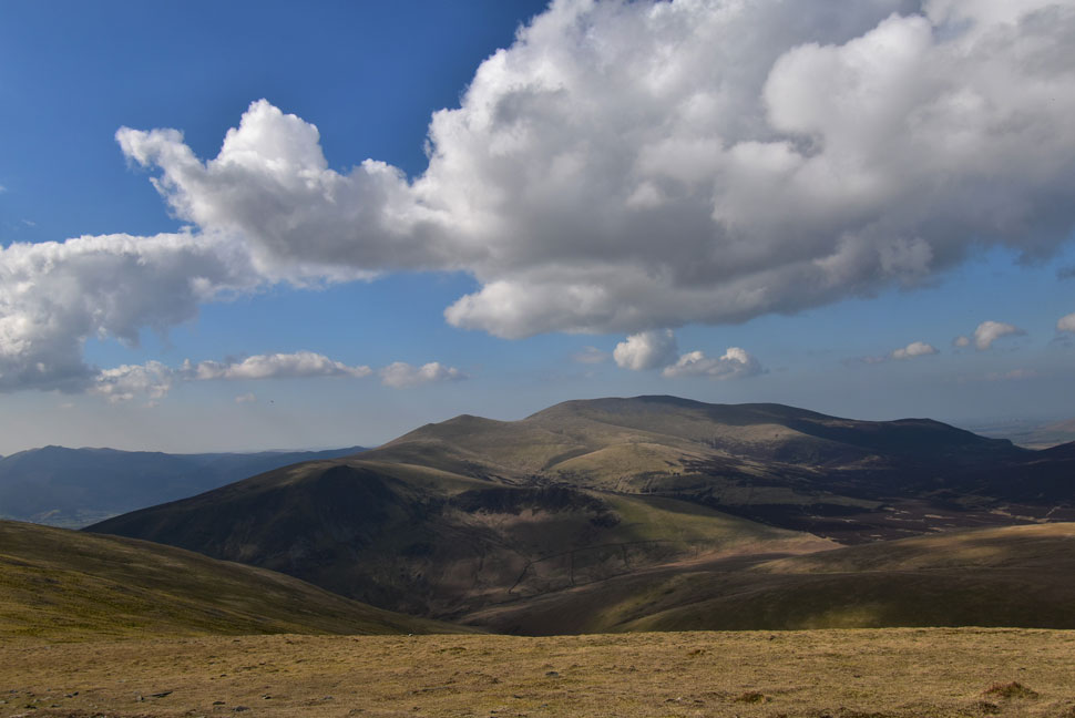
| Hall's Fell Top (Blencathra summit) and the Hall's Fell Ridge. |
With Threlkeld now behind me I joined Fell Side road and soaked up the morning sunshine which according to the forecasters should last until around 2pm before high level cloud is due to arrive which is plenty of time for todays route.
Shortly I turn left and follow the track towards Gategill Farm seen in the foreground. |
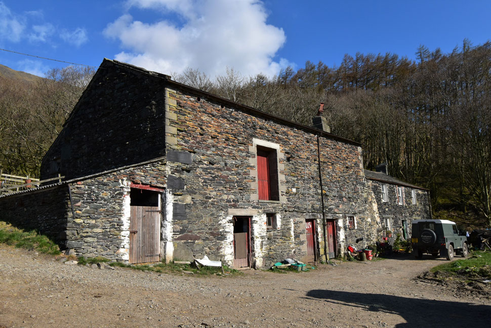 |
| Gategill Farm. |
| I continued up the track passing the kennels to my right before heading through Gategill Farm which looks as traditional today as the day it was built. |
 |
| Hall's Fell Top seen above Gate Gill. |
The guy in the photo just appeared from nowhere wearing jeans and wellington boots and headed into the gill. Whoever he was he seemed to know where he was going.
I join the path behind the tree preparing for the steep pull that awaits me. |
 |
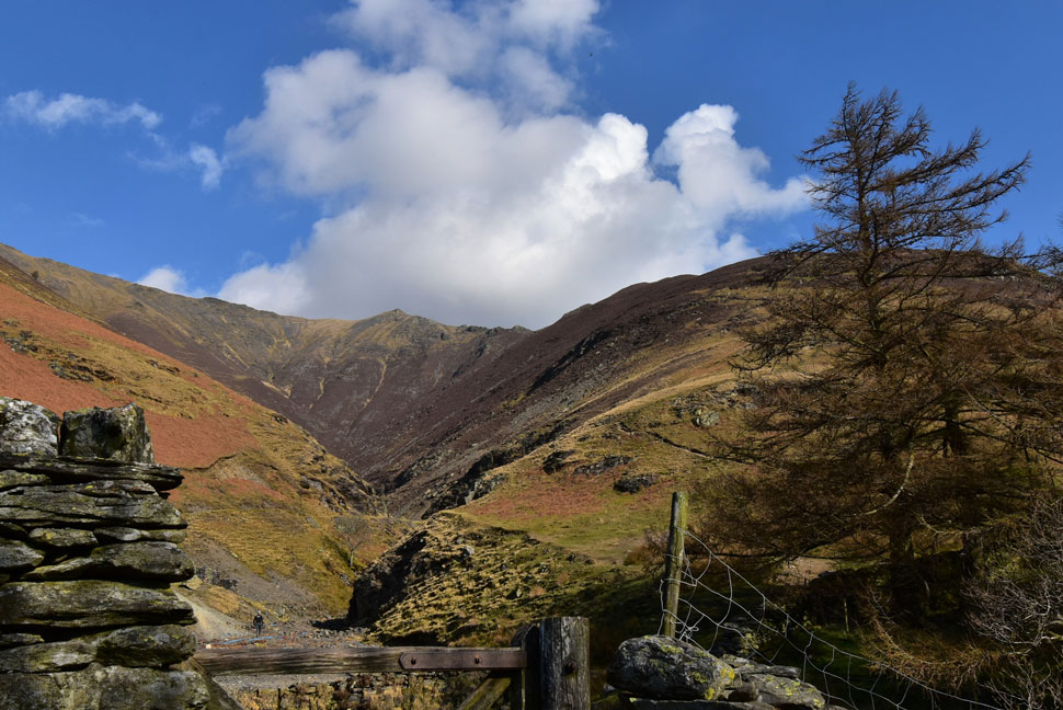
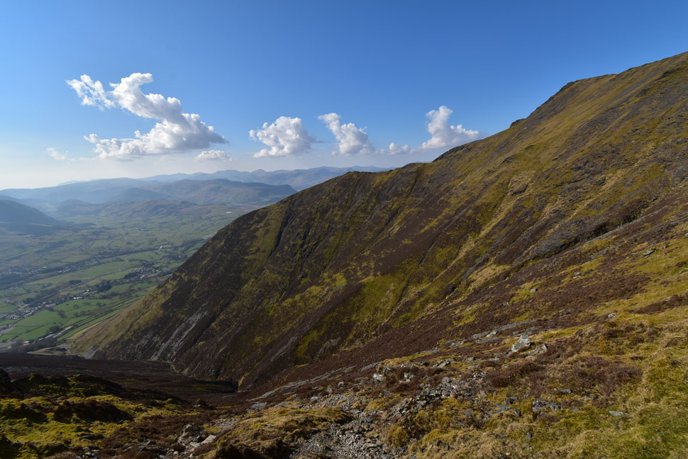
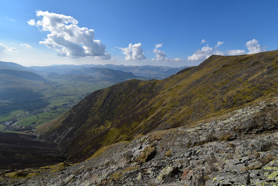
| Distant views towards Threlkeld Knotts, Clough Head and White Pike. |
| Aside the warmth and sunshine it's quite a hazy morning which is unusual for this time of year but I'm not complaining. |
 |
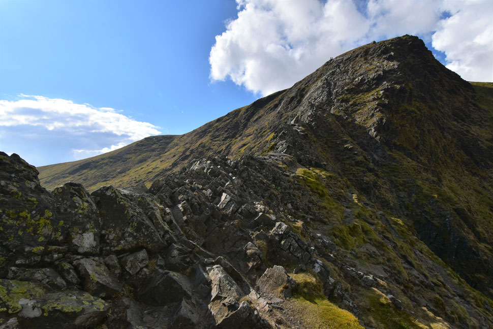
| Hall's Fell Ridge. |
The morning temperature continued to rise and for the first time this year I was using my buff to wipe the sweat away from my forehead which I had conveniently double wrapped over my right wrist. The heat was quite energy sapping so I adopted the 'just pick at it' attitude which takes the pressure off. Ahead two groups a short distance apart who I'd seen from the road earlier had stopped which allowed me to pass with 'mornings'
The second group were a trio of lads who I later found out had been out boozing and thought climbing Blencathra would be a great way to deal with their hangovers made worse no doubt because the heat would have been dehydrating them even more than the alcohol, not a wise decision me thinks. |
 |
| Hall's Fell Ridge. |
| Just below the curve up ahead is where the true spine of the ridge begins. Out of shot an elderly gent climbed the entire spine from here without setting foot on the path and the reason why I know is because I could hear him huffing and puffing his way up long before I could see him, Well done that man. |
 |
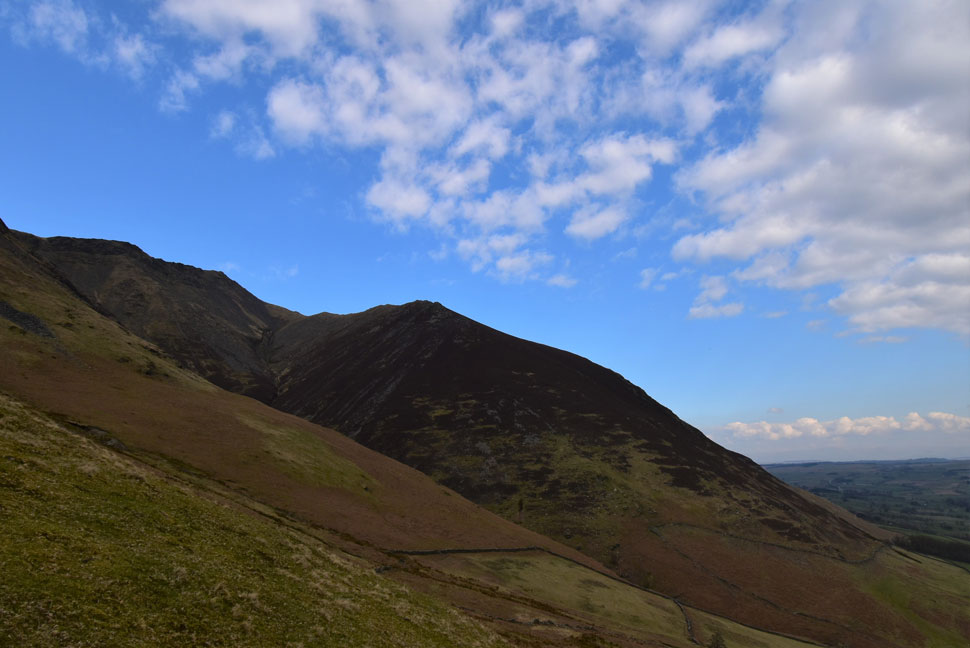
| The view over Doddick Gill. |
| Towards Doddick Ridge, Doddick Fell Top and Scale Fell leading away towards the right. |
 |
| Doddick Gill |
| That's the Doddick Ridge which isn't as exhilarating as the Hall's Fell Ridge but still a classic ascent non the less. Scale Fell can be seen beyond with the Mell Fells almost lost in the haze in the far distance. |
 |
| On the opposite side of Hall's Fell Ridge... |
| ...is Gate Gill, Knott Halloo and the Gategill Ridge which is possibly the steepest way up Blencathra for you sadistics out there. |
 |
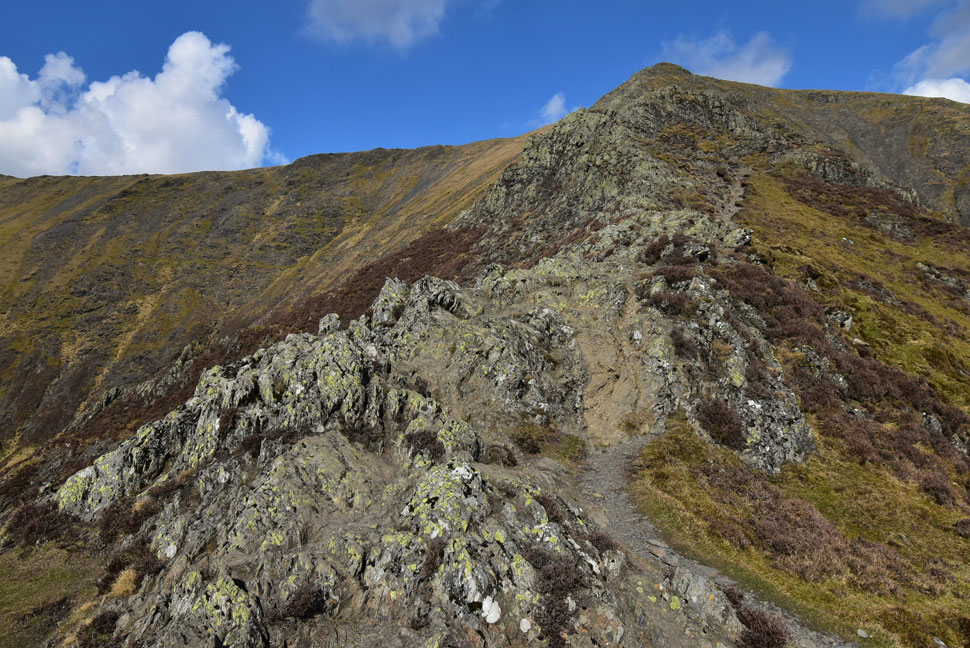
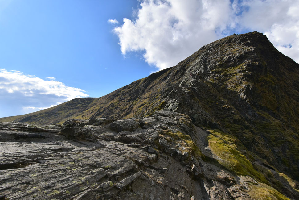
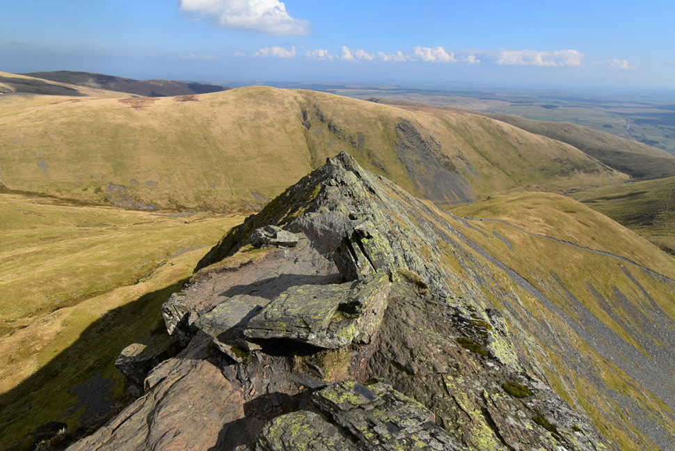
| The curve in the ridge. |
| I'd just overtaken the elderly chap who can be seen below left. Just after the curve is where I joined the spine of the ridge (known as Narrow Edge) which was as dry as a bone today. |
 |
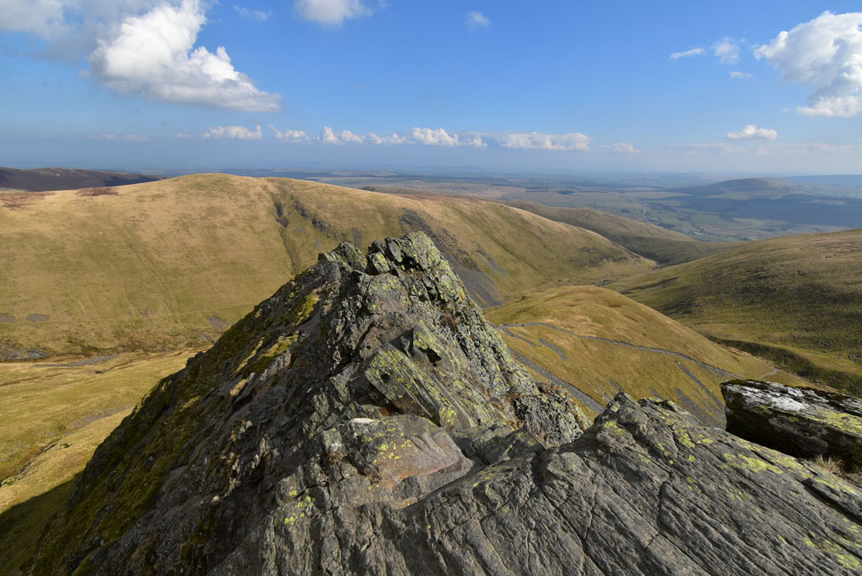
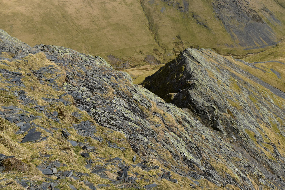
| The rock turret. |
| The rock turret can be flanked but I always enjoy the little scramble to climb it via a series of well positioned foot holes close to the top. |
 |
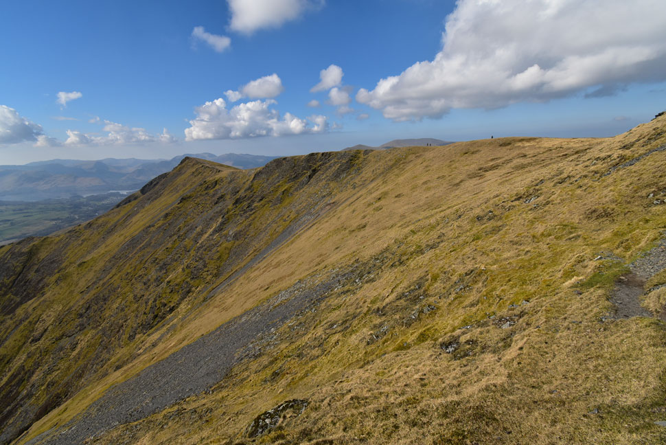
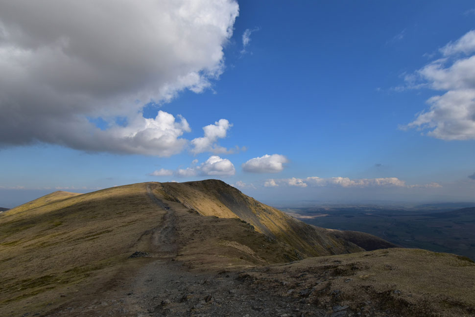
| Views back down Hall's Fell Ridge. |
| From Narrow Edge. |
 |
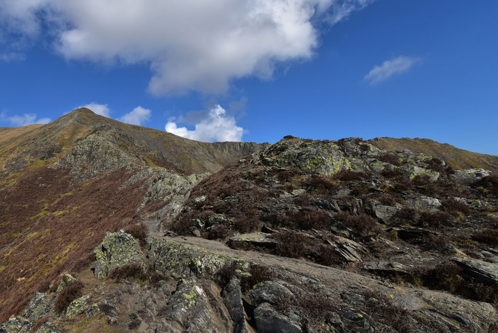
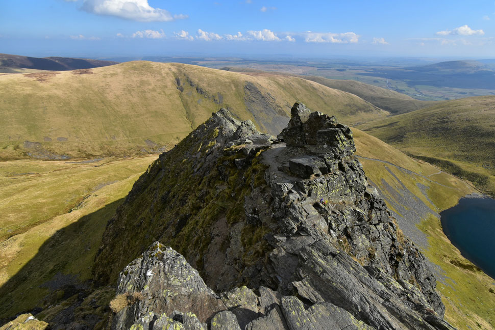
| Knott Halloo looking magnificent today. |
| The short section of ridge between Gategill Fell Top (seen right) and Knott Halloo is up there as one the finest in the district in my opinion. |
 |
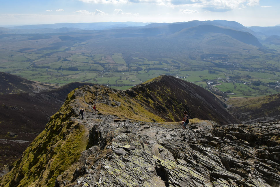
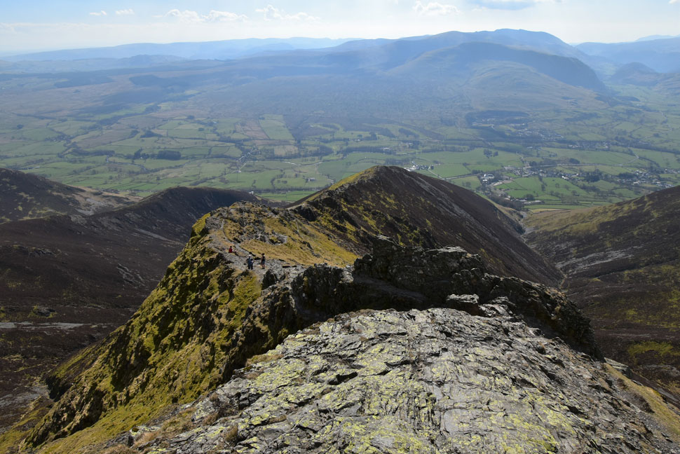
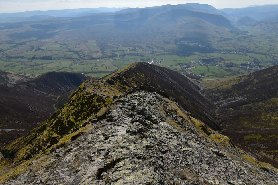
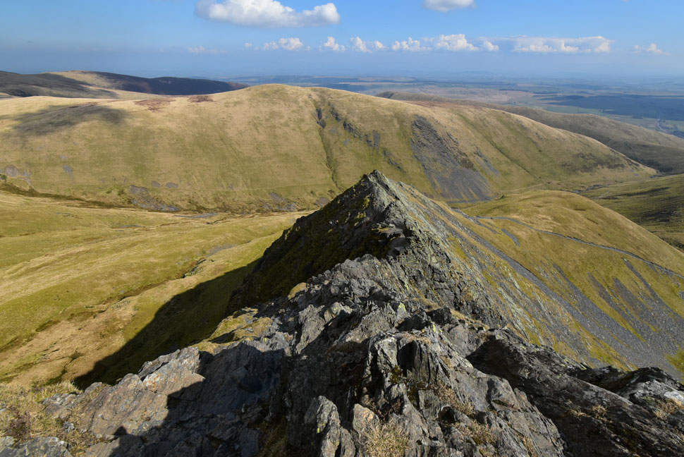
| Almost at the summit now. |
| As Gategill Fell Top continues to draw my attention. |
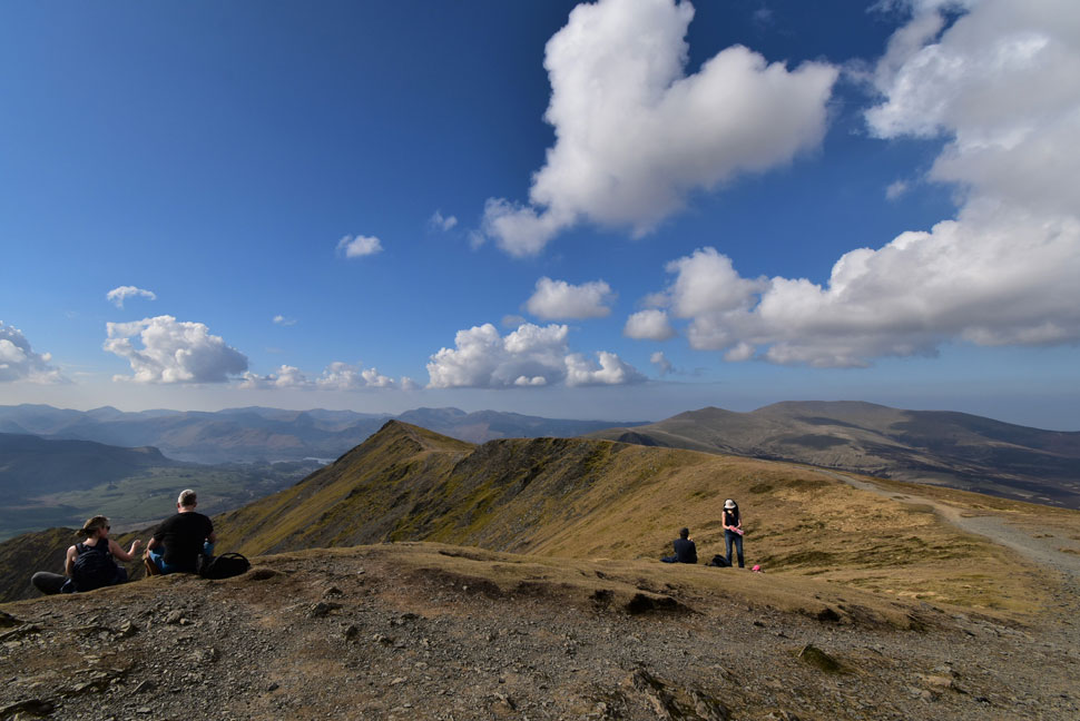 |
| Gategill Fell Top and Skiddaw from Hall's Fell Top (Blencathra summit) |
| For some it was warm enough to sit down and enjoy the views. |
 |
| Blencathra summit. |
| On the odd occasion you can get the summit to yourself but due to the popularity of Blencarthra it is rare. One of my favourite memories from here was during May last year when the summit had received an unexpected coating of snow. I'd climbed up late in the afternoon to watch the sunset during which time I had the whole summit to myself for a full thirty minutes, that kind of memory never leaves you. |
 |
| Doddick Fell Top, The Doddick Ridge and Scale Fell from the top of the zigzags. |
| I could have walked along the Saddle to reach the top of the path seen left but instead I descend the familiar zigzags then cut across from the bottom. |
 |
| Unfolding views... |
| ...towards Doddick Fell Top, Scale Fell, Bannerdale Crags and Souther Fell. |
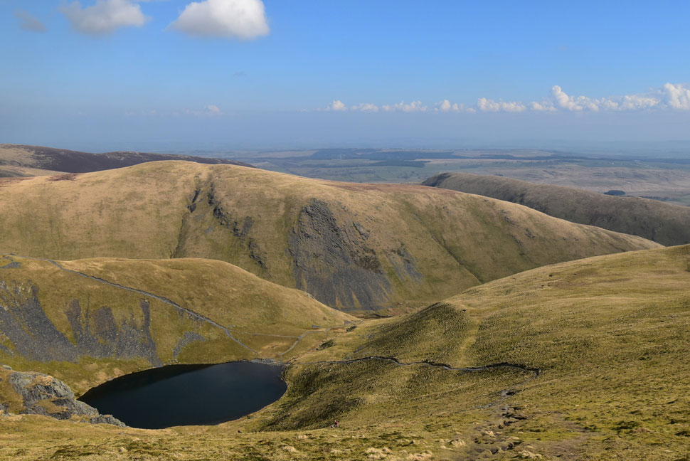 |
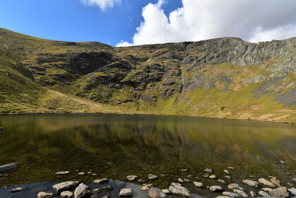
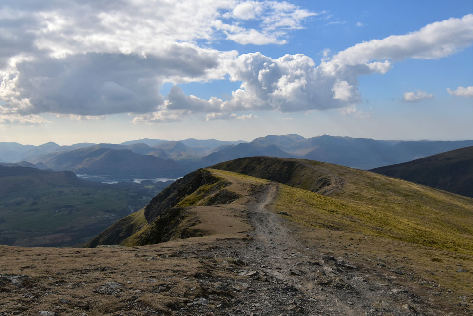
| Scale Tarn, Bannerdale Crags, Souther Fell with Bowscale Fell seen in the distance. |
| My plan now is to keep my eye out to see how many people arrive at Scale Tarn before they make their ascent on Sharp Edge purely because on such a narrow and relatively short edge queues can quickly form. |
 |
| Sharp Edge, Scale Tarn, Bannerdale Crags and Bowscale fell. |
| At the moment I can see three traversing Sharp Edge with a couple and a trio down by Scale Tarn. |
 |
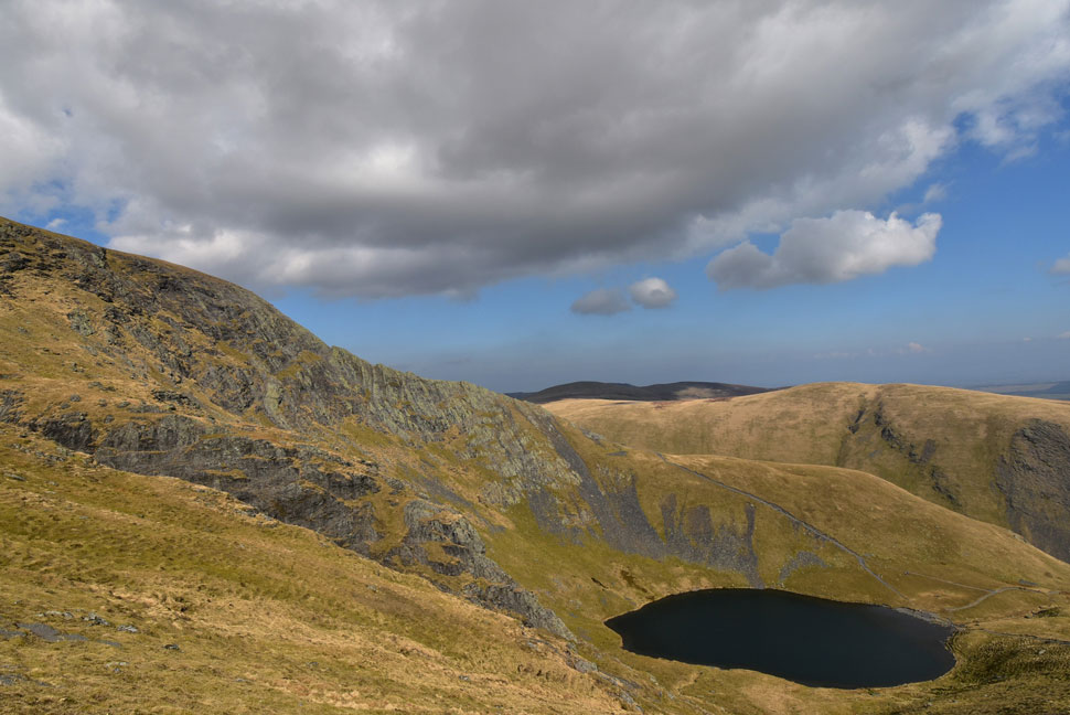
| Tarn Crags from Scale Tarn. |
| I'd almost reached the tarn when more walkers arrived at the tarn, the couple who I'd spotted made their move followed by two pairs who'd just arrived, that's six people all leaving at the same time. It's time for a quick sandwich to allow them get a good head start on me. |
 |
| Ascent on Sharp Edge. |
| After twenty minutes or so the six were making good progress across the ridge so I made my move. |
 |
| Sharp Edge. |
| The cairn ahead marks the start of the traverse. No matter how many times I've traversed this ridge If this view doesn't stir your nerves you're not human! |
 |
| Sharp Edge and Foule Crag. |
| With my walking poles collapsed and tied to my pack I began the traverse taking in as much of the spine of the ridge as nerves allowed. |
 |
| Sharp Edge and Foule Crag. |
| Most of the walkers had cleared the crux up ahead and were by now starting their ascent on Foule Crag which meant I practically had the ridge to myself. |
 |
| Sharp Edge and Foule Crag. |
| It's not all scrambling and clutching at rock with white knuckles here the rock is smooth and polished in places, perfect for a confident traverse when the rock is as dry as it was today. |
 |
| Looking back along Sharp Edge. |
| |
 |
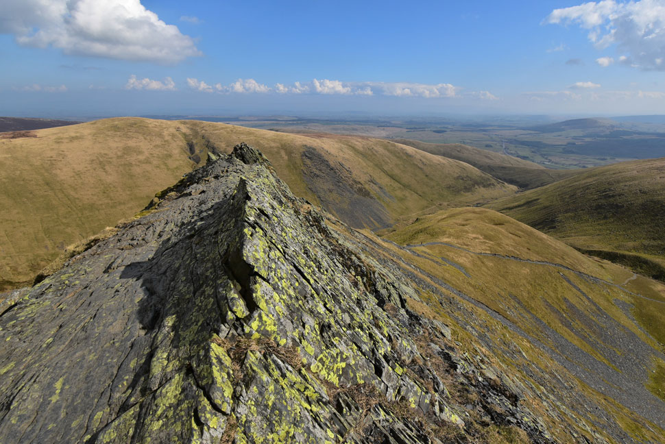
| Sharp Edge. |
| With Bannerdale Crags, Bowscale Fell and Carrock Fell in the distance. |
 |
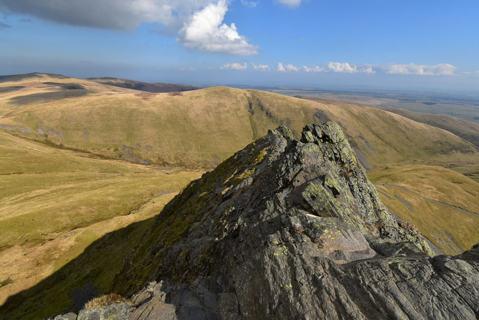
| Sharp Edge. |
| In truth there are two Crux's on Sharp Edge this being the first and easiest to negotiate. |
 |
| Sharp Edge. |
| |
 |
| The Crux, Sharp Edge. |
| The second crux is a little more technical due to the exposure on both sides. Just twenty minutes ago there was a queue forming here. |
 |
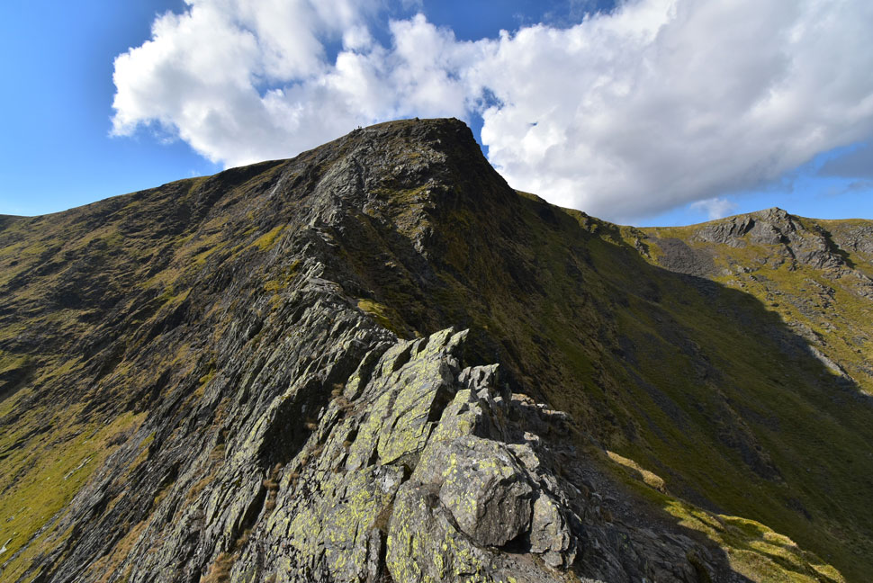
| Sharp Edge from the base of Foule Crag. |
| One of the most enjoyable features of traversing Sharp Edge is the scramble up Foule Crag, the view of Sharp Edge from here is really rewarding. |
 |
| Sharp Edge from Foule Crag. |
| There's now't like getting the grit of Foule Crag under your finger tips. |
 |
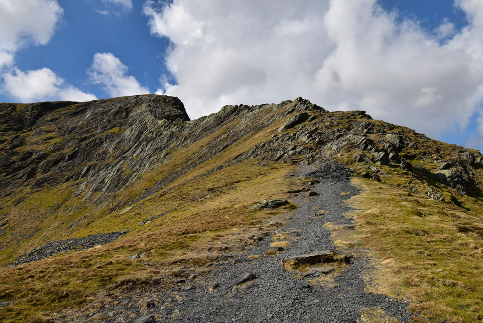
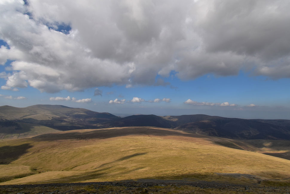
| Great Calva, Knott, High Pike (Caldbeck) Coomb Height and Bowscale Fell from Atkinson Pike. |
| After reaching the top of Foule Crag rock gave way for grass and I continued towards Atkinson Pike summit cairn where I stood for a few minutes taking in the views. |
 |
| Fabulous Mungrisdale Common from Atkinson Pike. |
| With Skiddaw Little Man, Skiddaw, Bakestall, Little Calva, Great Calva and Knott in the distance. |
 |
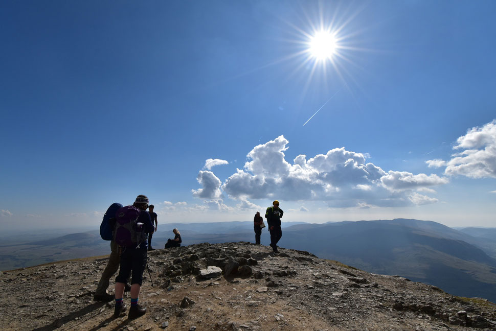
| Arriving back at Blencathra summit. |
I left the cairn at Atkinson Pike and crossed The Saddle passing between the memorial crosses and familiar summit tarn where a dog paddled watched on by its owners. Ahead the summit was still as busy but I made sure the tip of my walking pole tapped the circular trig for the second time today.
It did cross my mind to descend via the Gategill ridge and Knott Halloo but after remembering how steep the descent from Knott Halloo is I changed my mind figuring my feet have had enough fun for one day. |
 |
| Views towards Lonscale Fell, Skiddaw Little Man, Skiddaw and Bakestall. |
| |
 |
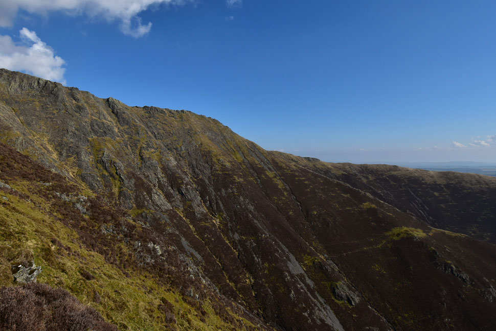
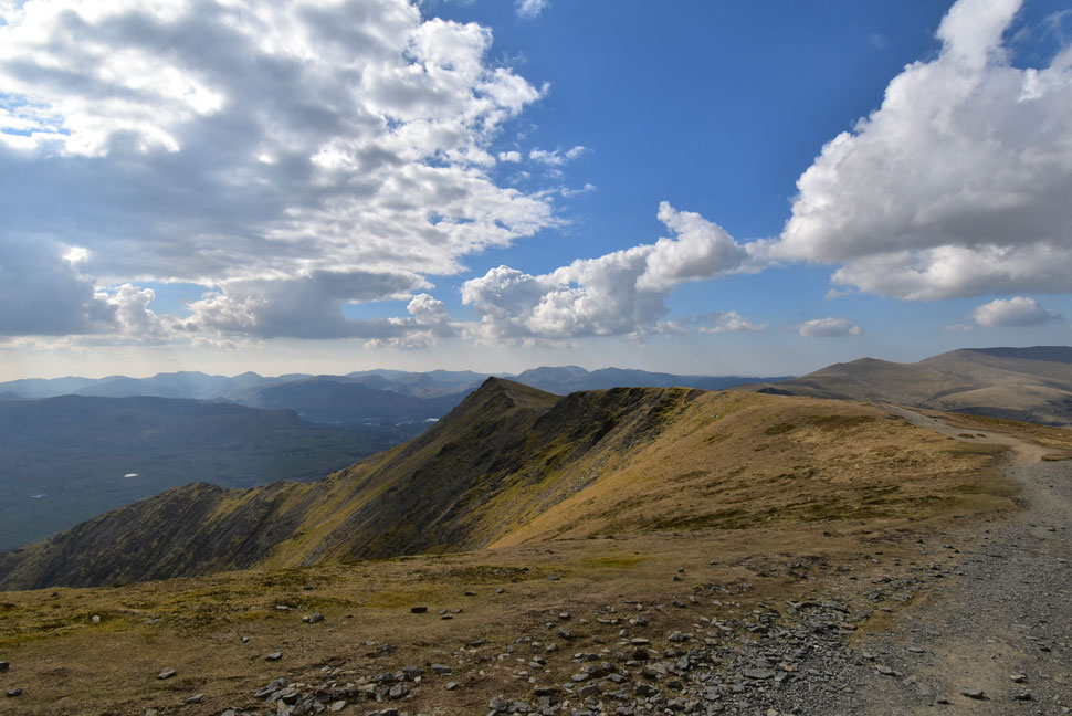
| Looking back on Gategill Fell Top. |
| With Atkinson Pike seen beyond The Saddle. |
 |
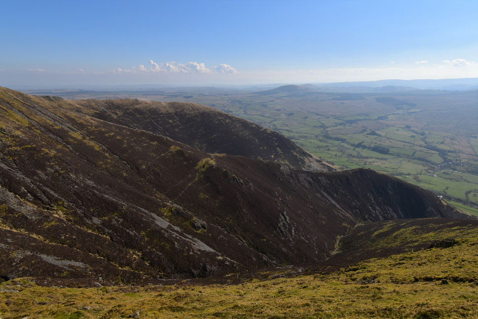
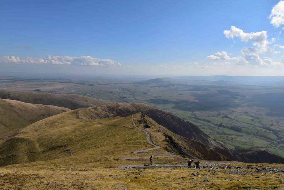
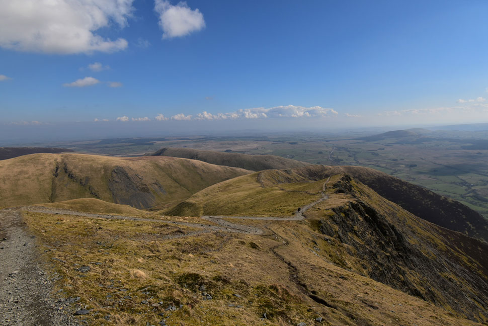
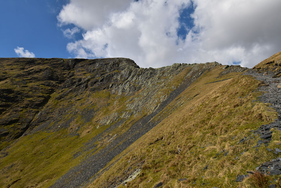
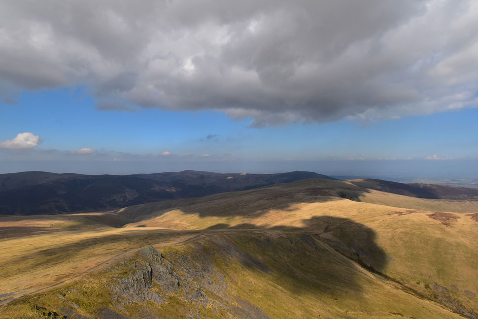
| What a view! |
| As forecasted it had started to cloud over I still had this magnificent view seen as I made my way over Knowe Crags from which I'd begin my descent via Blease Fell. |
 |
| Gategill Fell Top, the Gategill Ridge and Knott Halloo. |
With Knowe Crags summit behind me I began the descent of Blease Fell via the popular zigzags passing two couples in ascent where 'hi's' are exchanged. At the base of the zigzags the path steers right towards the Blencathra Centre while I opted to go left via a worn path over the steep grassy fell side above High Row Farm.
The roof tops of Threlkeld come into view while being greeted by the sound of traffic travelling along a busy A66 below. The path turned east whilst the gradient slackened my view is filled by Knott Halloo and Gate Gill. Cloud had gathered leaving anything south of Keswick in shade whilst directly above the sky remained a deep blue.
The path followed the last 100ft of stone wall towards two gates and Blease Gill falls where I followed a narrow footpath before crossing an infant Kilnhow Beck via a wooded footbridge. Now just minutes away from the outskirts of Threlkeld the footpath passes through pockets of daffodils as I follow a herd of sheep onto Blease Road car park. Visitors pack nearby benches soaking up the afternoon sunshine as I kick my feet into the backs of my dust covered boots before passing Threlkeld Primary School who's children played games in an adjacent field. Spring was alive in the village with Daffodils blooming in every garden, bee's went about their humble business and yet as I type this Winter returned to the fells overnight leaving the higher summits under a couple inches of snow. |
|
| |
| Back to top |
 |
|