Helvellyn from Swirls

2nd April 2022

i was meant to be working today after which my plan was to head over to Black Combe and, if the forecast allowed maybe turn it into a sunset walk. That was until a colleague of mine walked into my office asking would I mind he swap my Saturday...you don't have to ask me twice.

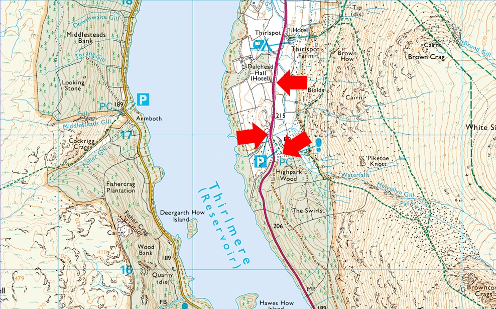
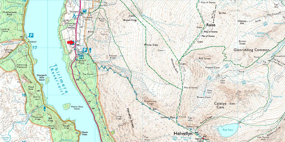
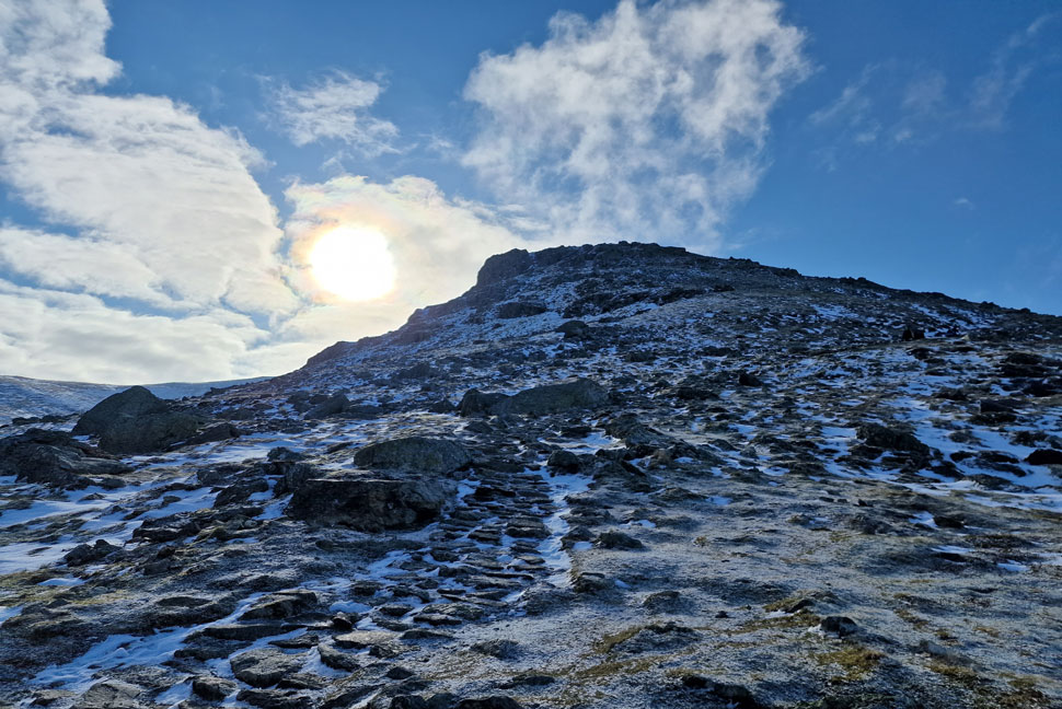
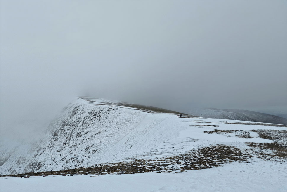
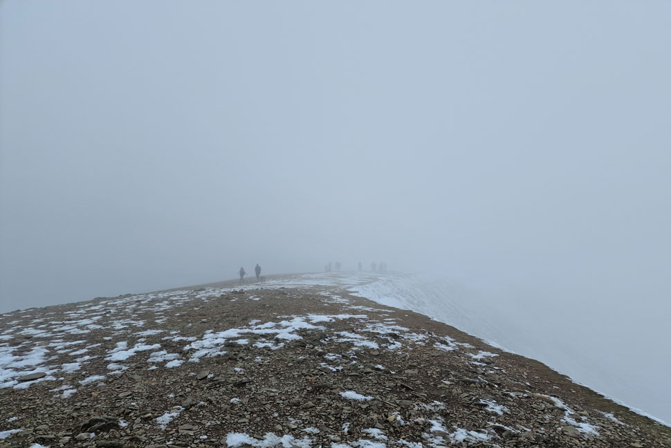
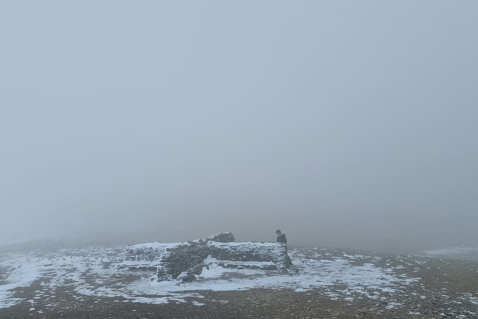
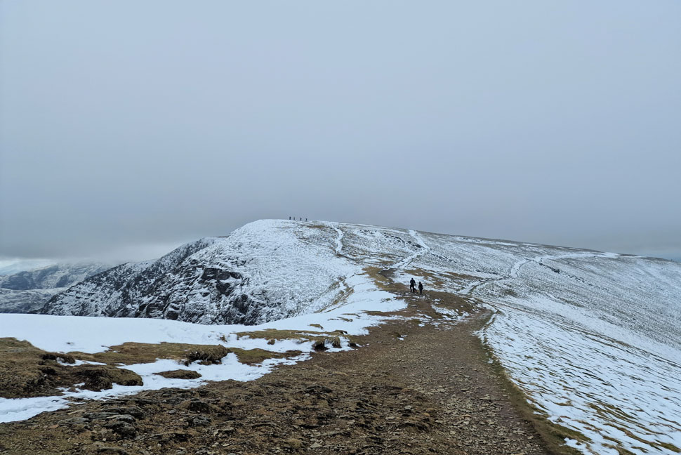
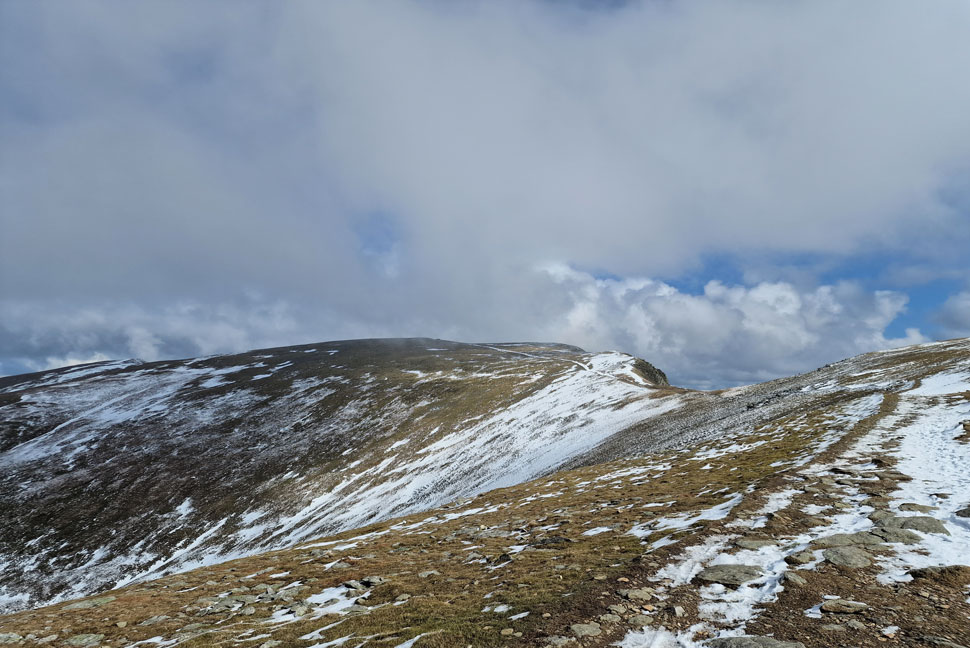
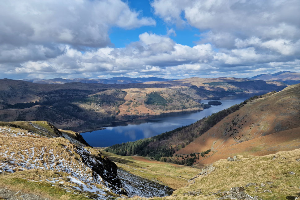
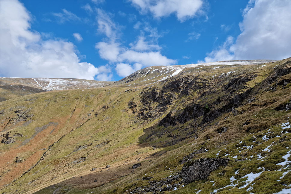
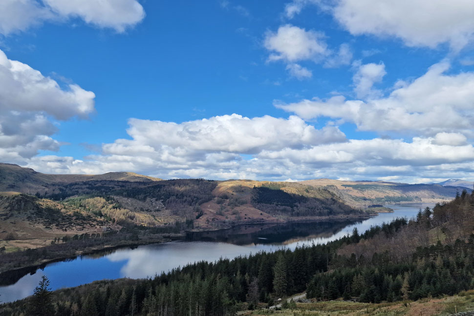
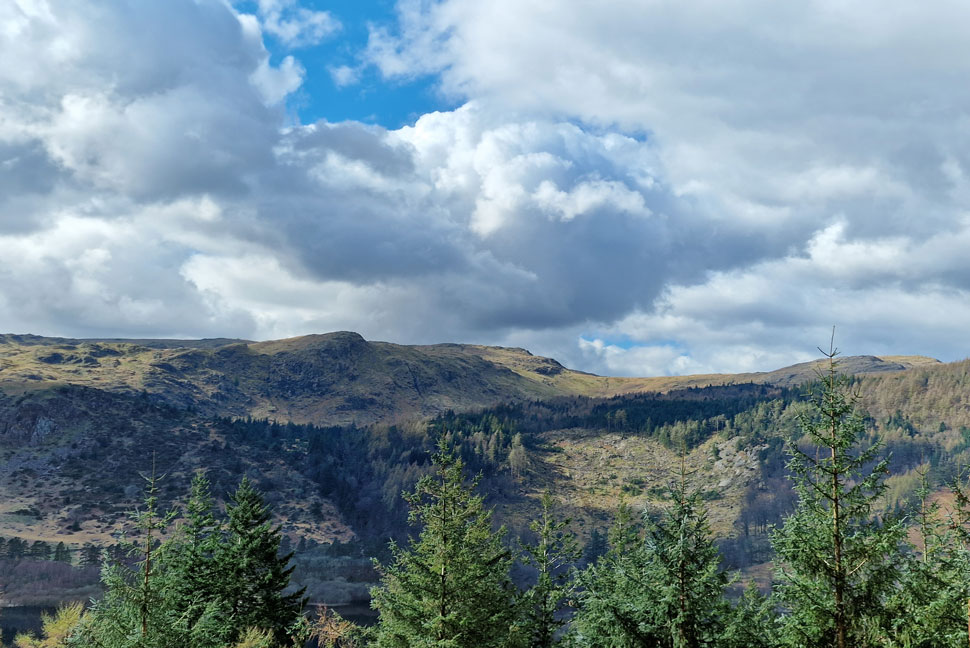
Both Tim and Rod had contacted me during the week which of course I had to tell them I was working so I emailed them back saying I was now free and did they fancy heading up Helvellyn from Swirls, a walk believe or not I'd been meaning to do since before Christmas last year but due to either working or the weather I was unable too, Tim and Rod both jumped at the chance.

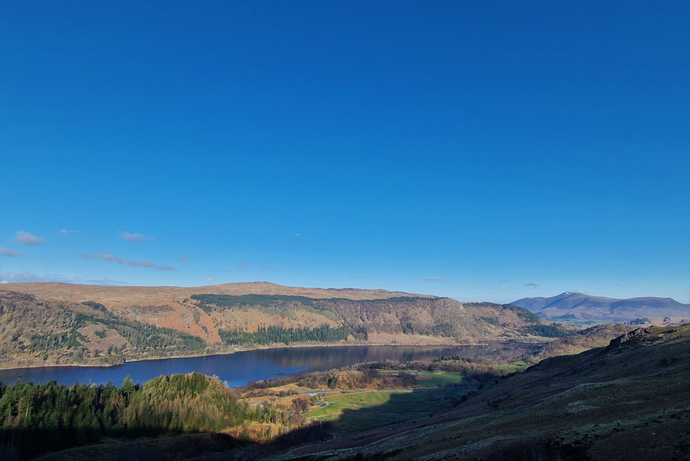
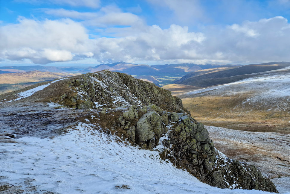
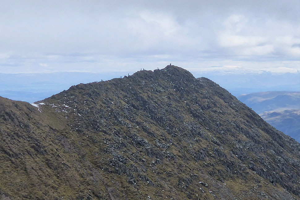
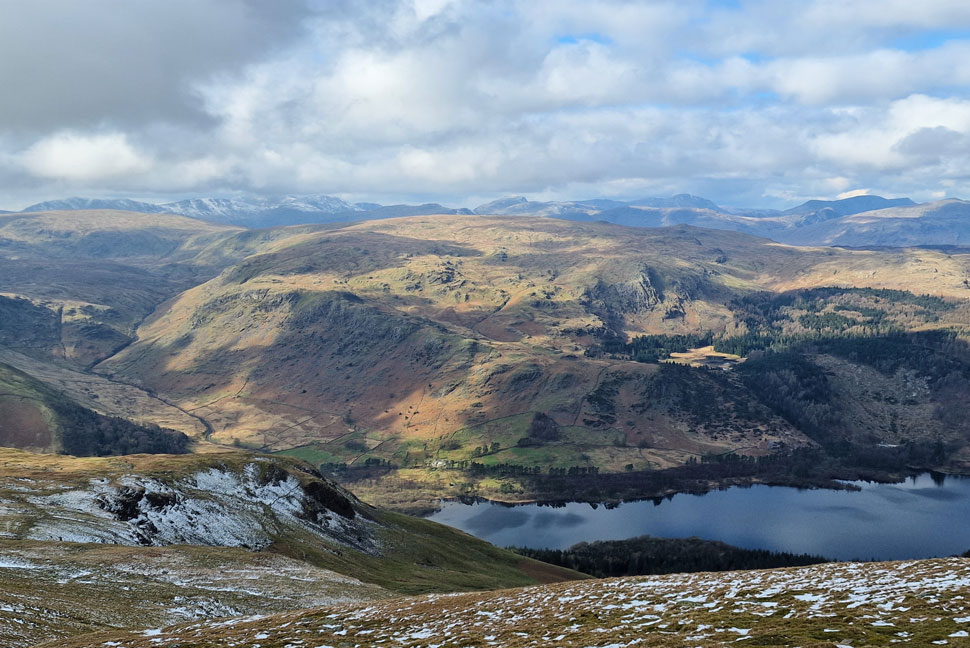
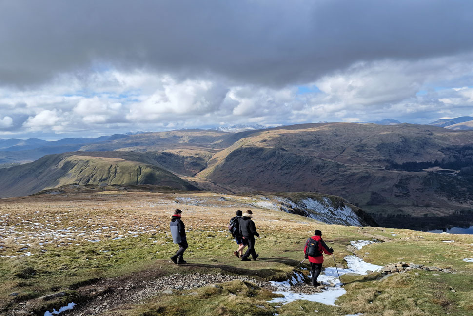
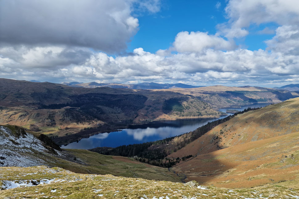
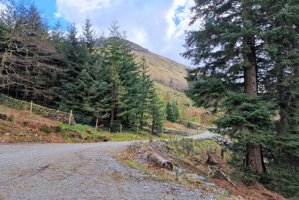
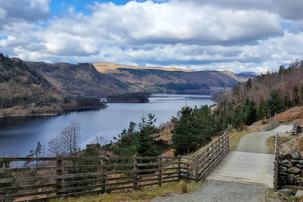
Speaking as we walked the forestry track back to Swirls we all agreed that todays route might not match an ascent from Grisedale or Glenrididng but it certainly comes very close,

 
Wainwright Guide Book Two
The Far Eastern Fells
For Helvellyn is the great magnet that draws the crowds to Nethermost Pike
 

Overview
Ascent: 2,872 Feet - 876 Metres
Wainwrights: 2, Helvellyn - Nethermost Pike
Visiting: 2, Browncove Crags - Helvellyn Lower Man
Weather: Sunshine To Start With Intermittent Summit Cloud Arriving Late Morning. Brighter Spells PM Highs of 10°C Lows of 0°C
Parking: Lay-by Opposite Swirls Car Park
Area: Eastern
Miles: 7
Walking With: Rod Hepplewhite, Tim Oxburgh, Henry Oxburgh & James Oxburgh
Ordnance Survey: OL4
Time Taken: 5 Hours
Route: Swirls – Helvellyn Gill - Brown Cove Crags – Helvellyn Lower Man – Helvellyn – Nethermost Pike – Birk Side – Comb Crags – Wythburn - Forestry Track - High Park Wood - Swirls
 

Parking Details and Map
Nearest Post Code: CA12 4TW
Grid Reference: NY 316 416
Notes: The car park at Swirls is a very popular car park all year around and is owned by United Utilities. There is a toilet block on the car park with easy access onto Helvellyn via Browncove Crags. On the opposite side of the A591 a smaller car park can be found overlooking Thirlmere Reservoir. Parking charges apply at both car parks, however a short distance north (upper arrow) a lay-by can be found where it is free to park.


Map and Photo Gallery


Browncove Crags and Helvellyn Lower Man from the A591 Lay-by north of Swirls Car Park 08:00am 0°C

We had arranged to meet at 08:15am for an 08:30am start. Rod arrived first soon followed by myself with Tim and his two sons Henry and James arriving bob on 08:15am Tim had travelled from Saltburn on the east coast where it had been bucketing down when he left but thankfully the forecast remained as true as it said it would. We kitted up under cloudless skies despite the fact the temperature was hovering around zero we were back to wearing full Winter gear with temperatures predicted to fall as low as -8°C at 900m which wasn't enough to put Tim off who arrived wearing running shorts as usual.

It had turned 08:25am by the time we left the lay-by during which time a young couple had parked up and had just left just before us. We joined a quiet A591 for a few moments before passing a dead badger left on the roadside, I tried not to look.


Stunning views over Thirlmere towards High Tove, High Seat Armboth Fell, Raven Crag, Bleaberry Fell, Skiddaw and Lonscale Fell.
Swirls Car park was starting to fill from where we could see the young couple who had left before us starting thier ascent with a second couple higher up the path. Deep in conversation we crossed Helvellyn Gill and began our own ascent stopping once in a while to admire the views back over Thirlmere.

Browncove Crags domineering the skyline.
After half an hour of climbing the sun breached the ridge and instantly spilled light over the fell side bringing with it a little warmth too.

Looking north...
...towards Brown Crag on Whiteside (foreground) Stybarrow Dodd, High Rigg, Blencathra, Great Calva, Lonscale Fell the Skiddaw massif and finally Raven Crag far left.

Looking across Helvellyn Gill towards...
...White Side whose summit has a thin layer of cloud on top, I wonder if it's a sign of things to come?

Entering the snow line.
The ground began to freeze underfoot, at approximately 600m we entered the snow line which was soft and powdery and was mostly confined to the sides of the path. Even though we had packed them not at any point did we have to consider wearing micro spikes.

Browncove Crags summit.
We had managed to over take the couple from the lay-by and then a second couple below Browncove Crag summit. A solo walker caught up with us as we stopped to hydrate who also agreed that he hadn't expected as much sunshine as we'd had this morning ... I think by saying that we just cursed ourselves!

Helvellyn Lower Man from Browncove Crags.
The solo walker left as our attention was turned to the building cloud over Helvellyn and surrounding summits. Oh well there's now't we can do so we continue towards Helvellyn Lower Man.

White Side from Helvellyn Lower Man.
We climbed into a thin cold layer of cloud which obscured views in every direction. Although no one spoke of it I guess we were all feeling sorry for Henry and James right now who were summiting Helvellyn for the first time today.

Helvellyn seen across Brown Cove.
At least it's very atmospheric!

Helvellyn summit.

We left Lower Man and joined the main highway towards the summit trig point arriving the same time as a couple who were taking pictures of their very well behaved Alsatian.

The couple left and we too had our turn taking pictures non of which made it to the website mainly because the summit was so busy. We left the trig point and stopped to admire Red Tarn, sadly both Swirral and Striding Edge(s) were completely engulfed by cloud with the exception of dark crags or a faint outline of ridge.


Henry inspecting the summit cross shelter.
We joined Henry who we found trying to re-asemble a slate memorial plaque which had been broken into pieces (we hoped not on purpose) but had to give up because pieces were missing. We stared at the memorial in silence and left in silence.

Nethermost Pike comes into view.
Henry is a full time air cadet in the RAF and was very interested to read the plaque representing the landing of an aircraft on Helvellyn back on 22nd December 1926 which was the first ever aircraft to land on a UK mountain.

Striding Edge close up.
Taken from the top of Swallow Scarth / Nethermost Cove.

Nethermost Pike summit.

While Tim, Henry and James continued to admire the view of Striding Edge Rod and I began the easy ascent on Nethermost Pike and arrived at a rather bleak looking summit cairn surrounded by a layer of cloud just above the summit itself.

Eyes however, were averted towards the chinks of blue sky directly above our heads which continued to break "it's gonna clear" we both agreed "if only it wasn't twenty minutes earlier" we nodded.


Nethermost Pike East Ridge, St Sunday Crag and Birks from Nethermost Pike summit.

James and Henry held a snowball fight while Tim joined myself and Rod who by now were admiring the view over St Sunday Crag towards a distant High Street whose snow capped summit glistened beyond.

Tim was reminded of the time he ascended St Sunday via Pinnacle Ridge when he was around 19 years of age who then made a phone call to his father who proceeded to bollock him for making the ascent alone and for not using a rope!


Long distance view of the Grisedale Valley.
Towards a distant Place Fell.

Helvellyn as we link back up with Birk Side path.
Jokingly I was blamed for not hanging around on Helvellyn which if we had we'd have had sunshine above our heads instead of grey murk!

Descending Birk Side.
As High Raise (Langstrath) Ullscarf, Wytburn, Nab Crags and the southern tip of Thirlmere come into view.

James, Henry, Tim and Rod descending Birk Side.
Here Steel Fell also comes into view over on the left.

Thirlmere from the top of Comb Crags.
What a spectacular view.

Thirlmere from the top of Comb Crags.
We can also see the forestry track below where we'll stop to eat lunch.

Middle Tongue and Nethermost Pike.
With Comb Crags below.

Amazing views of Thirlmere.
Which was just like a millpond today.

Lunch with a view.

Leaving Birk Side and Comb Crags behind we continued our descent as the path twisted its way within ear shot of Comb Gill where the sunshine again brought warmth but we waited until we stopped for lunch until we de-layered. I'm not sure why but I'm a huge fan of the forestry tath between Wythburn and Swirls which isn't without its gradient never the less I always look forward to walking after the descent of Nethermost Pike.

We break for lunch and spread ourselves out between two convenient felled logs whilst Tim played pub quiz host making up most of the questions as he went along, non of us had a cat in hells chance!


Across the tree tops.
The area of woodland surrounding Harrop Tarn including Tarn Crags, Standing Crag and Bell Crag.

Thirlmere, Fisher Crag, High Seat, Raven Crag and Bleaberry Fell.

The forestry track descends into Highwood Park before arriving back at Swirls where James spotted a semi-dried pool filled with thousands of Tadpoles and he wondered their plight "hopes it rains soon" "rain is due in the week I'm sure they'll be fine" we replied. By now broken cloud had filled the skies but it was pleasant enough to walk back in just base-layers and when the sun did break through it warmed the back of your neck. With Swirls car park reached James went to spend a penny in the toilets whilst the rest of us scoured the path below Browncove Crags which was still busy with people both in ascent and descent. James rejoined us and we left the car park and joined the A591 by which time our view was filled with Castle Rock, Blencathra and the cliffs and gills of Bam Crag below Clough Head "I still need to explore that area" I said to Tim as we walked the final yards back to the lay-by which by now was full from one end to the other.

Tim had parked a few cars down from Rod and I so he unlocked his car so Henry and James could change while we went over the highlights of the day which for me was the light and shifting cloud over St Sunday Crag followed by the sunlight reflecting from a snow capped High Street summit. I returned to my car and packed up only to be joined by Tim and Rod before sharing hearty handshakes. At this time of year the crowds are drawn to Windermere and Ambleside which can cause traffic chaos so I'd set myself up to travel to Penrith and join the M6 from there which would add an extra 10 miles to my journey but you know what, I was in the mood for fell gazing and maybe a little people watching so I drove south along the A591 and took the scenic route instead.


Back to top