|
Extended Round of Marchlyn Mawr |
 |
 |
12th February 2023 |
 |
|
We baby sat for our granddaughter yesterday leaving Sunday the available walking day. My plan was to visit Snowdonia to walk the Carneddau (Pen yr Ole Wen - Carnedd Dafydd - Carnedd Llewelyn) Three 3,000 footers starting from the Ogwen Valley the lowest summit being Pen yr Ole Wen which is equal in height to Scafell Pike so I knew I was in for a tough day. With good conditions forecast I'd been psyching myself up for the walk for the last 48 hours.
Rewind back to Saturday Teatime when our daughter called to say her best friends Dad had suddenly passed away that morning which rocked us all to the core. We had known Paul since the girls were young and to say this came to us as a shock would be a understatement. I still planned to walk the Carneddau and set off from home at 05.20am but I knew I was still coming to terms with Pauls death.
Conditions were perfect for such an undertaking but in my heart of hearts it just didn't feel right. My head was no longer in it and the closer I got to Snowdonia the more I talked myself out of it. I needed familiar territory and despite being just five minutes away from the Ogwen Valley I turned around on reaching Bethesda and set my sat-nav for Marchlyn. |
|
| Explorer 17 |
 |
| Snowdon/Conwy Valley |
|
|
|
| |
|
Overview |
|
|
| Ascent: |
2.700 Feet - 822 Metres |
| Summits Over 3,000ft: |
2, Elidir Fawr - Foel-goch |
| Visiting: |
3, Elidir Fach - Mynydd Perfedd - Carnedd y Filiast |
| Weather: |
Cloud Clearing Leaving Bright Sunshine. Freezing Above The Summits. Highs of 9°C Lows of 8°C Feels Like -2°C |
| Parking: |
Roadside Parking, Access Road Marchlyn Mawr Reservoir, Deiniolen |
| Area: |
Snowdonia National Park |
| Miles: |
8 |
| Walking With: |
On My Own |
| Ordnance Survey: |
OL17 |
| Time Taken: |
4 Hour 30 Minutes |
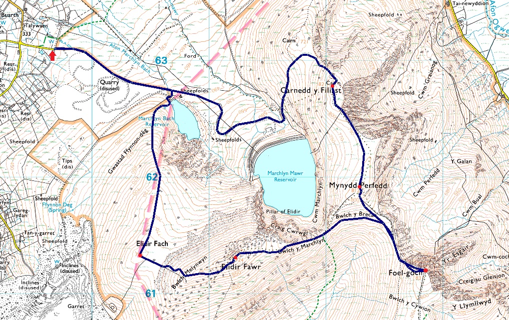
| Route: |
Access Road Marchlyn Mawr Reservoir - Elidir Fach - Bwlch Melynwyn - Elidir Fawr - Bwlch y Marchlyn - Bwlch y Brecan - Foel-goch - Bwlch y Brecan - Mynydd Perfedd - Carnedd y Filiast - Marchlyn Mawr Reservoir - Access Road Marchlyn Mawr Reservoir |
|
| |
|
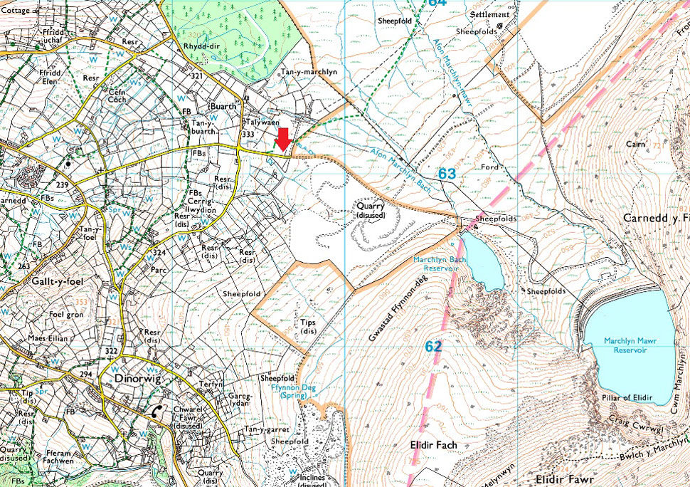
Parking Details and Map |
|
|
| Nearest Post Code: |
LL55 3NA |
| Grid Reference: |
SH 596 630 |
|
| |
|
Map and Photo Gallery |
|
|
 |
| |
| |
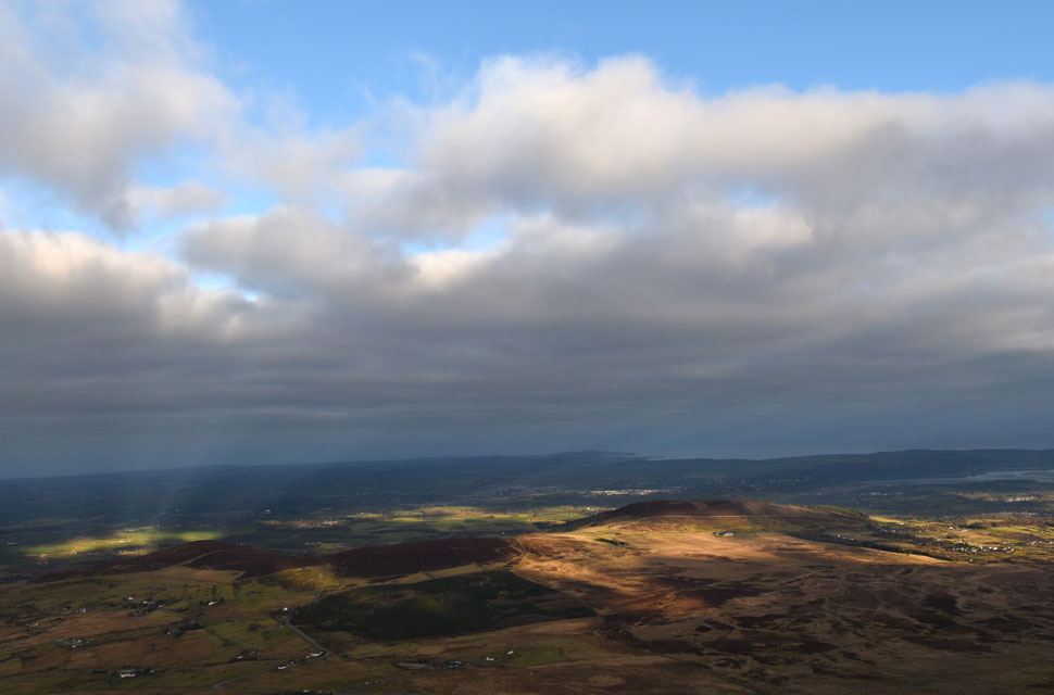 |
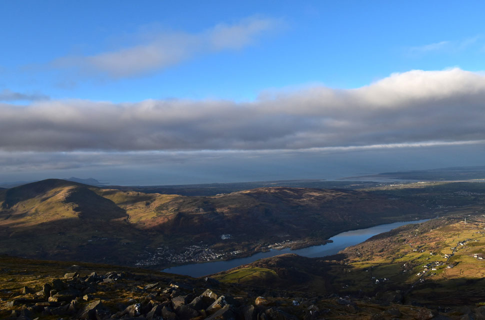
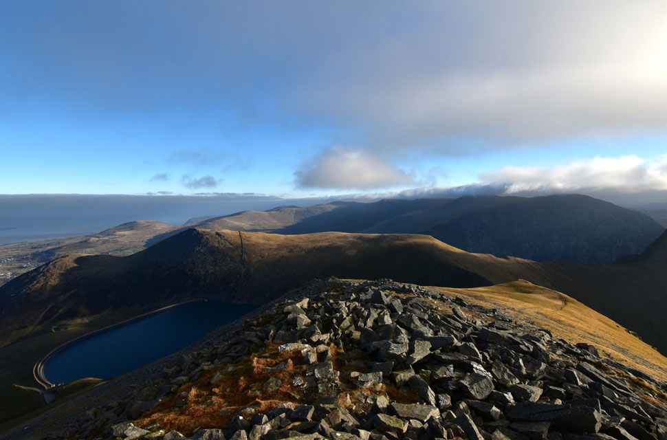
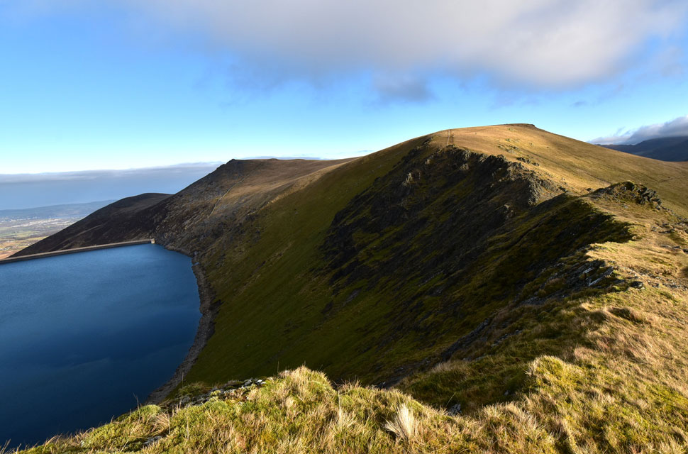
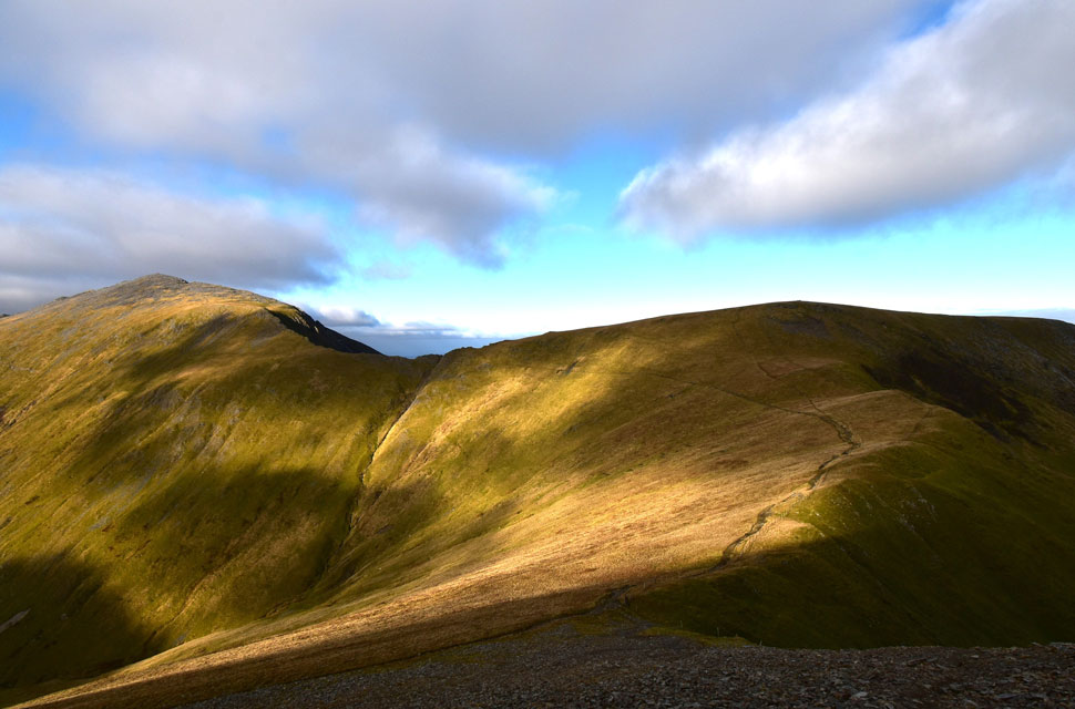
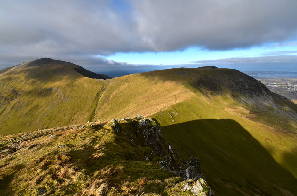
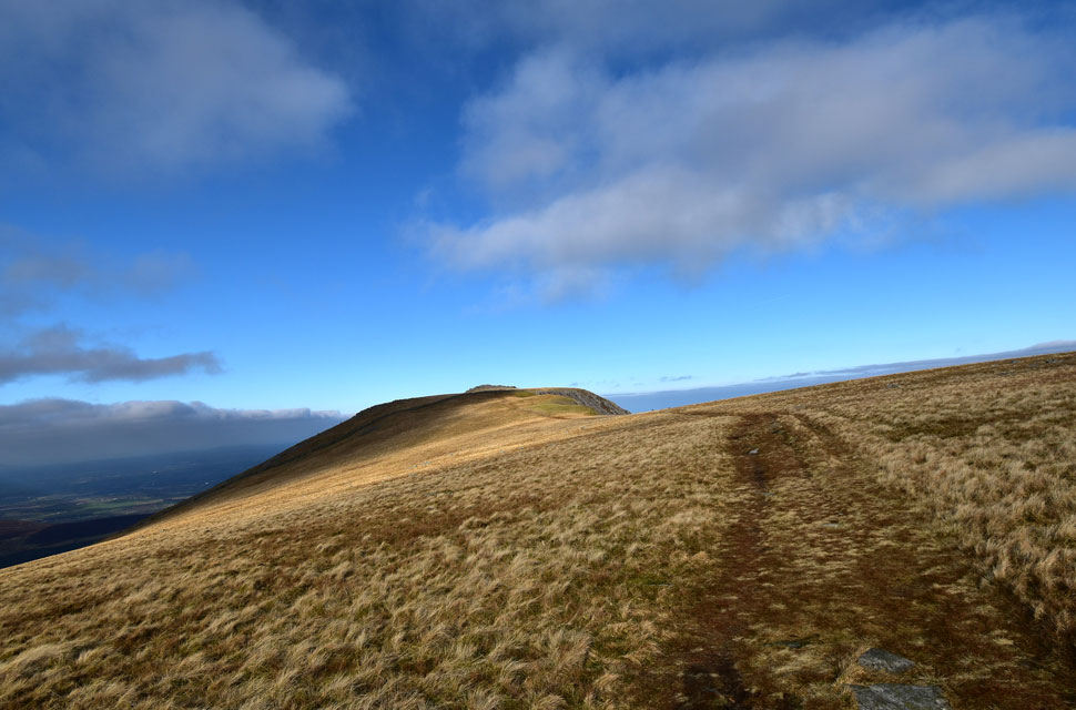
| Looking back on Moel Rhiwen, Moelyci and the Menai Straight from Elidir Fach North Ridge 8°C 08:45am |
| It was only a ten minute diversion from Bethesda to Marchlyn and I arrived at Marchlyn Mawr Reservoir access road around 08:10am and began to kit up immediately. Besides me there was three or four other cars one of whom would have belonged to the two guys I could see heading towards the Reservoir. A Fiesta pulled up its driver spinning around behind me before parking up behind the rest of the cars.
Even though the sun had risen over half an hour ago it was still low in the sky leaving the valley feeling cold and largely in shadow. After a quick sweep of the boot I locked my car and began the hike towards Marchlyn Bach Reservoir whilst wondering how I can change todays walk from my last visit here back in November. I'd never climbed Elidir Fack previously always flanking it for the direct route onto Elidir Fawr from the Reservoir and fancied the change so on reaching Marchlyn Bach (the smaller of the two reservoirs) I began the steep ascent of Elidir Fach's north ridge. |
 |
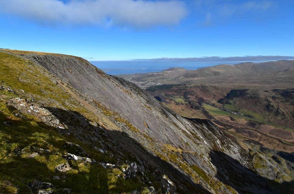
| Looking down Elidir Fach North ridge. |
| I knew how to gain the north ridge after watching walkers descend it previously but was pretty unprepared for how steep the initial ascent was which seemed odd given how much conditioning I'd done in preparation for the Carneddau walk.
The ground was soft underfoot but not wet and I purposely held off the gas allowing time for the cloud to clear and for the sun to rise high enough to clear Elidir Fawr ahead. |
 |
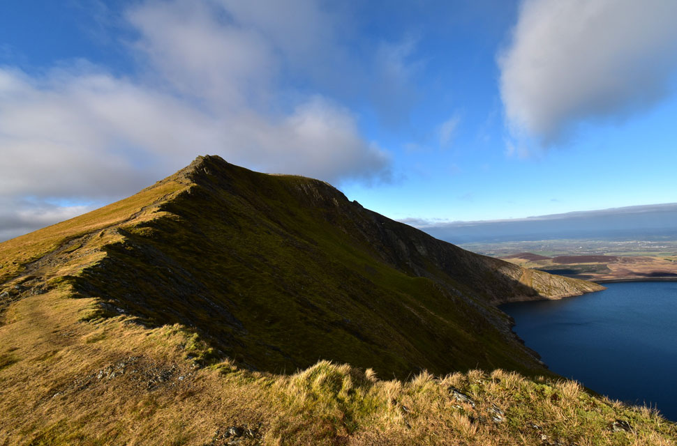
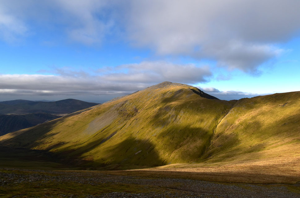
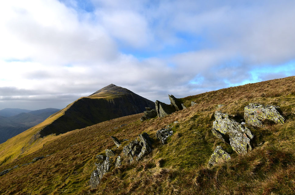
| Elidir Fach (Elidir Fawr parent peak) summit. |
| With the steepness behind me I followed the north ridge but forgot to head east to view the impressive rock slabs which descend to Marchlyn Bach Reservoir below. As I was looking back I noticed a guy wearing a green jacket about 400 yards away having just shouldered the ridge. "Where did he come from" I muttered. |
 |
| Elidir Fawr from Elidir Fach summit. |
| Perfect timing. |
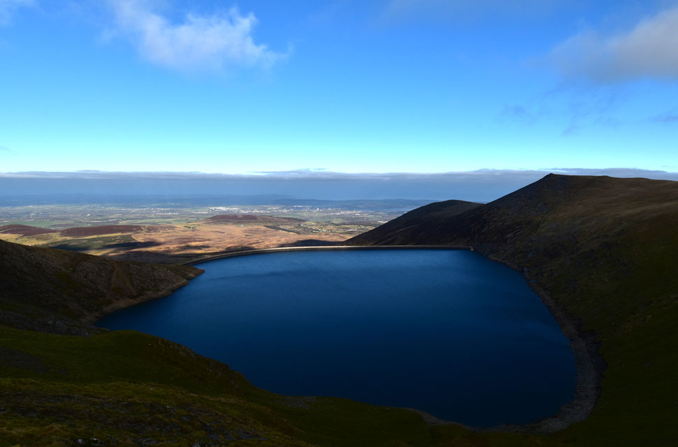
 |
| Llyn Pardarn (Llanberris) |
| With Moel Eilio, Foel Gron and Foel Goch forming the Llyn Dwythwch horseshoe over on the left. It was time to pull myself away from Elidir Fach summit now and start my ascent on its bigger brother. |
 |
| Looking down on Elidir Fach from my ascent on Elidir Fawr. |
| Spending time on Elidir Fack summit allowed green jacket guy to catch up who by now is just about to start his ascent on Elidir Fawr. |
 |
| Elidir Fawr summit comes into view with Marchlyn Mawr and Carnedd y Filiast in the distance. |
| It was another steep but enjoyable ascent arriving at the western spur which meant a rocky traverse across the spine of the summit. |
 |
| Looking back along the spine of Elidir Fawr. |
| With views towards Elidir Fach and Conwy Bay beyond. |
 |
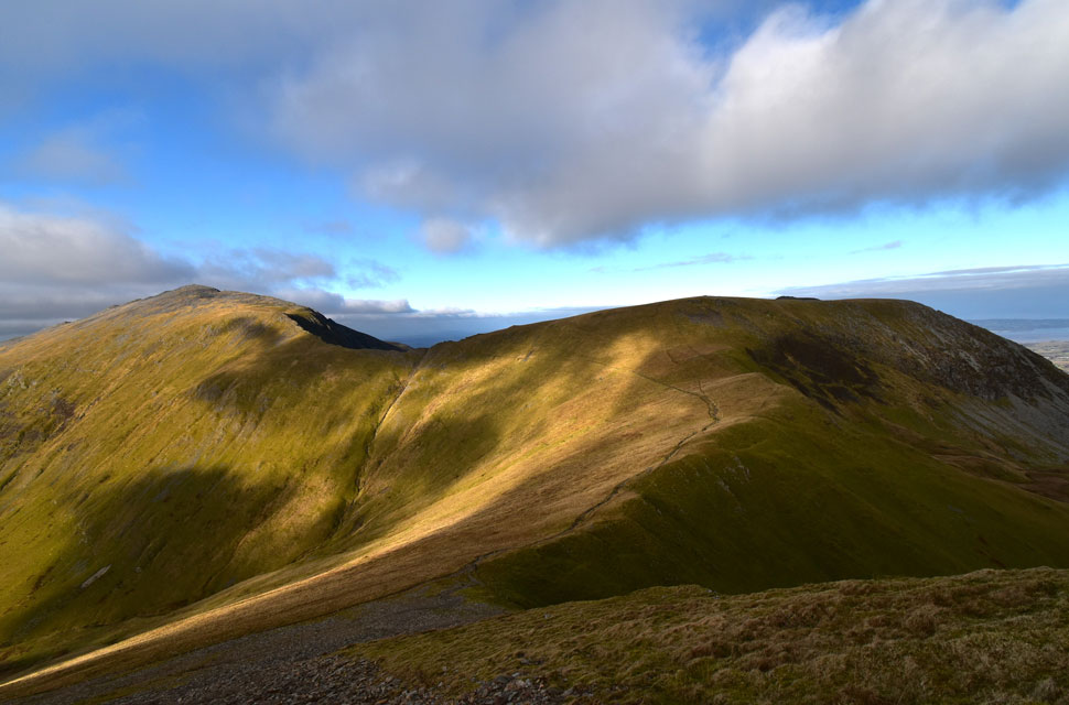
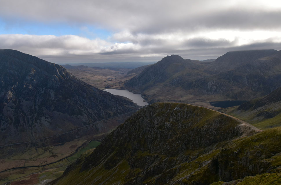
| Marchlyn Fawr Reservoir, Carnedd y Filiast, Mynydd Perfedd and the high Carneddau beyond. |
| After scurring over boulder I arrived at Elidir Fawr summit in sunshine but feeling bitterly cold. To the east Foel-goch, Y Garn and the Glyders were still below cloud as was the Carneddau in the distance. |
 |
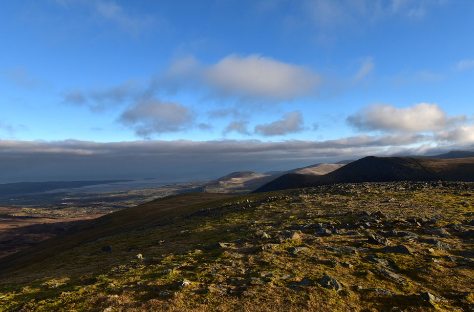
| Descending towards Bwlch y Marchlyn with views towards Mynydd Perfedd, Bwlch y Brecan, Pen yr Ole Wen and Foel-goch. |
| The sun continued to shine over Elidir Fawr but it was sporadic to say the least over surrounding summits. I had an interesting conversation with two guys from Cheshire who had parked their camper van in Llanberris ready for a traverse of Crib Goch but were forced to abandon after finding all the car parks full at 7am this morning. I struggled to digest how busy Snowdon and indeed Llanberris can get especially on a nice weekend which is the sole reason why I have never bothered to climb Snowdon yet.
The lads drove to Marchlyn, parked easily and decided to head up Elider Fawr instead. I explained that I was newish to Snowdonia which prompted one of the lads to ask "was I new to hiking" After explaining I'd been walking the Lakeland fells for some years the other lad asked me about Lord's Rake on Sca Fell and had I been up there "know it well along with the West Wall Traverse and Deep Gill too" I replied "keep to the right of the gully" I added but didn't bother to mention the website. Right at that time a woman appeared with two collies one of whom came over and well, you know me and dogs. |
 |
| The view from Bwlch y Marchlyn over Marchlyn Mawr Reservoir towards Carnedd y Filiast and Y Fronllwyd |
| After leaving the guys from Cheshire I bumped into a local chap who waited as I descended a narrow part of the Bwlch y Marchlyn ridge where we got talking on how fine a day it was "not so lucky for those on the Glyders I said" "Give it till 11am the cloud will lift I'm sure of it, but by then I'll be home cooking Sunday dinner" he laughed. |
 |
| Mynydd Perfedd, Bwlch y Brecan, Pen yer Ole Wen and Foel-goch from Bwlch y Marchlyn. |
| Purely because I've found my walking legs I decided to include a summit of Foel-goch seen over on the right although I'm not sure if my legs and lungs will thank me owing to the steepness of ascent. |
 |
| Marchlyn Mawr Reservoir, Y Fronllwyd, Carnedd y Filiast and Mynydd Perfedd from Bwlch y Marchlyn. |
| It seems such a shame to lose out on the full ridge but it's time to commit to Foel-goch which I do by descending a little further down once the outcrop of rock is reached in the foreground. |
 |
| Looking back on Elidir Fawr from Bwlch y Marchlyn. |
| If you follow the north ridge line down you might be able to make out the Pillar of Elidir about half the way down. |
 |
| Elidir Fawr from Bwlch y Brecan. |
| Up until now I hadn't seen green jacket guy since I shouldered Elidir Fawr summit but I watched him commit to the traverse of Bwlch y Brecan and I wondered was he also heading for Foel-goch. |
 |
| Foel-goch from Bwlch y Brecan. |
| Not so much daunting as it is steep. |
 |
| The view over Bwlch y Brecan towards Elidir Fawr, Bwlch y Marchlyn and Mynydd Perfedd. |
| This view alone is worth every step of steep path as I make my ascent on Foel-goch. |
 |
| Elidir Fawr and Bwlch y Marchlyn. |
| What incredible light. |
 |
| Bwlch y Brecan towards Elidir Fawr, Bwlch y Marchlyn and Mynydd Perfedd |
| There's no getting away from the steepness with the exception of the zigzagged path which keeps the mind active and legs pushing forward. |
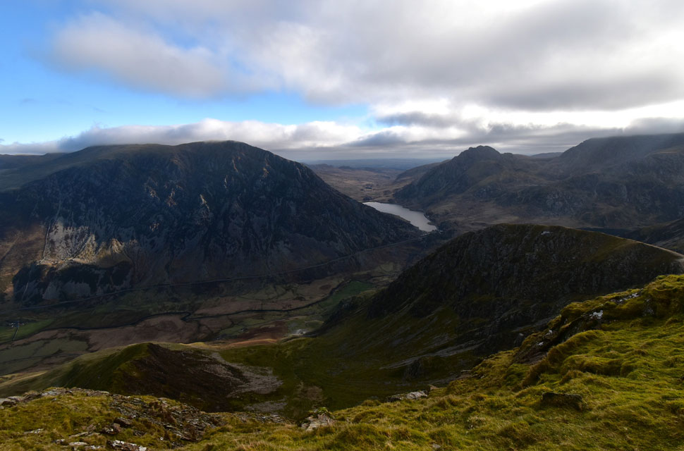 |
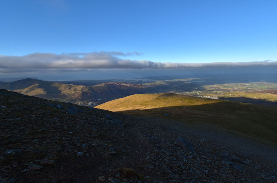
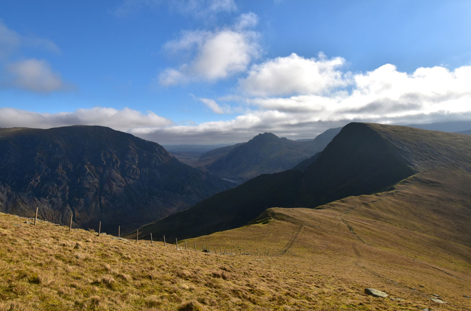
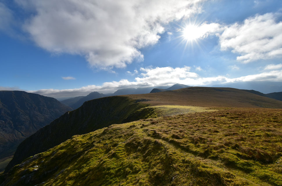
| The view from Foel-goch over the Ogwen Valley towards Pen yr Ole Wen, Carnedd Dafydd, Llyn Ogwen, Tryfan and Glyder Fach. |
| with the cloud now peeling away from my surrounding summits I thought I'd earned myself a rest so I found myself a spot overlooking the Ogwen Valley and tucked into half my lunch. |
 |
| Those with a keen eye might be able to spot Llyn Idwal together with a glimpse of Cwm Bochlwyd. |
| Glyder Fach summit is still below cloud. |
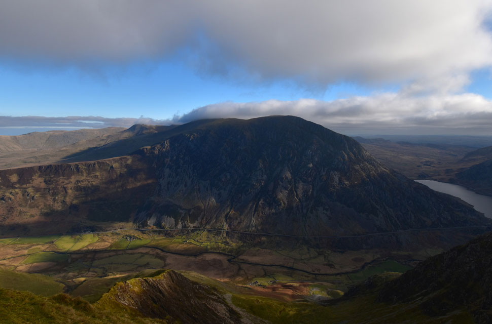 |
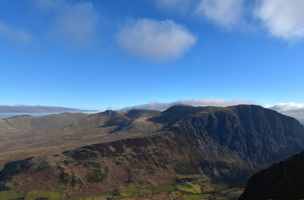
| Pen yr Ole Wen, Carnedd Dafyyd, Yr Elen and Carnedd Llewelyn (behind Carnedd Dafyyd) forming the High Carneddau. |
| At 978m (3,210ft) Pen yr Ole Wen is the same height as Scafell Pike but only the seventh highest in the Snowdonia National Park with Carnedd Dafyyd ranking fourth at 1,044m (3,425ft) and Carnedd Llewlyn coming in a close third at 1,064m (3,491ft) |
 |
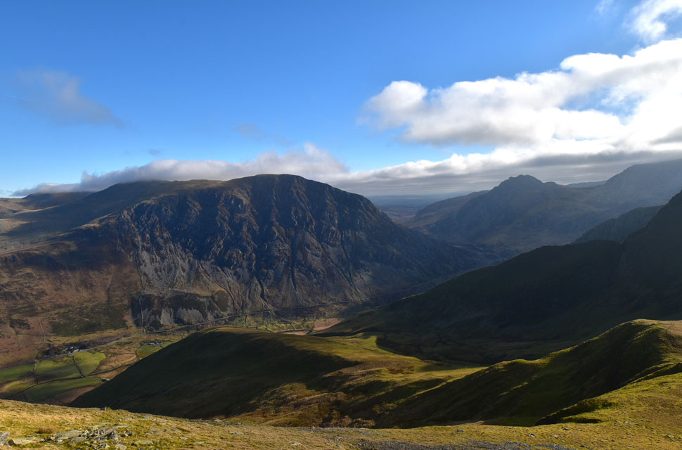
| Glyder Fawr, Y Garn and the Snowdon group (below cloud) from Foal-goch, |
| After a bite to eat it was time to head down where I thought I'd bump into green jacket guy but there was no sign of him. |
 |
| Lovely light over Mynydd Perfedd. |
| With the rock tor forming Carnedd y Filiast summit seen beyond. |
 |
| The view over Bwlch y Brecan towards Elidir Fawr, Bwlch y Marchlyn, Mynydd Perfedd and Carnedd y Filiast. |
| With the shadow of Foel-goch dominating the fell side below. |
 |
| Pen yr Ole Wen, Tryfan and Foel-goch seen over Bwlch y Brecan. |
| With Yr Esgair forming the steep ridge below Foal-goch, |
 |
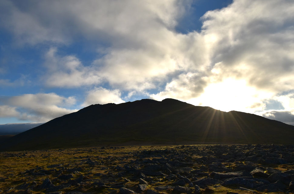
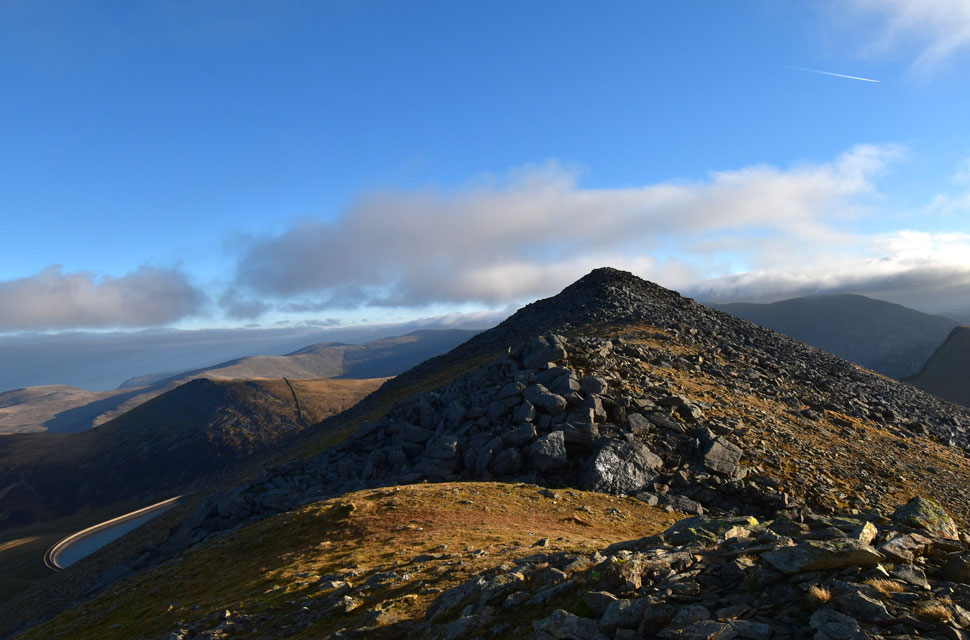
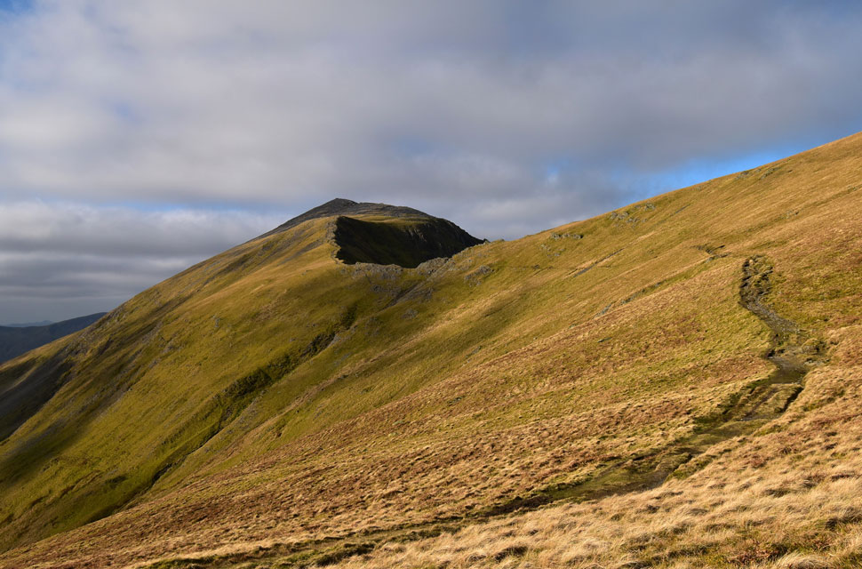
| Classic view of Elidir Fawr. |
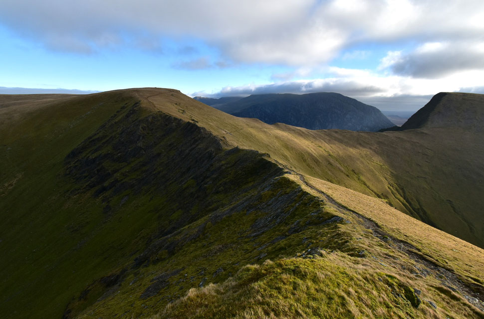
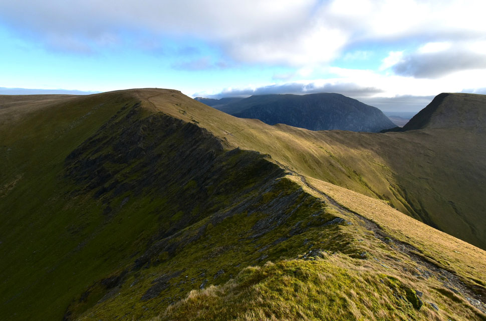
| With Foal-goch behind me I began my ascent on Mynydd Perfedd when for the first time I felt the slight sensation of burning calfs. A small price to pay when you have views as good as this. |
 |
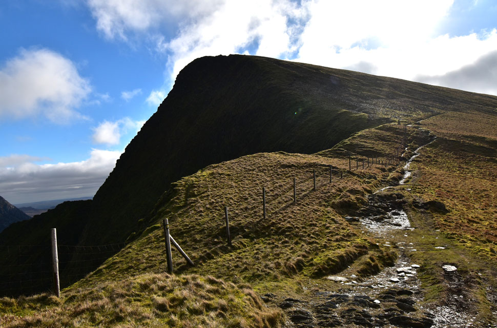
| Looking back on Y Galon (foreground L) Yr Esgair (foreground R) , Pen yr Ole Wen, Carnedd Dafydd, Tryfan and Glyder Fach. |
| The summit of Carnedd Perfedd was just minutes away but before I summited I divert right towards a small outcrop of rock which overlooks the valley. |
 |
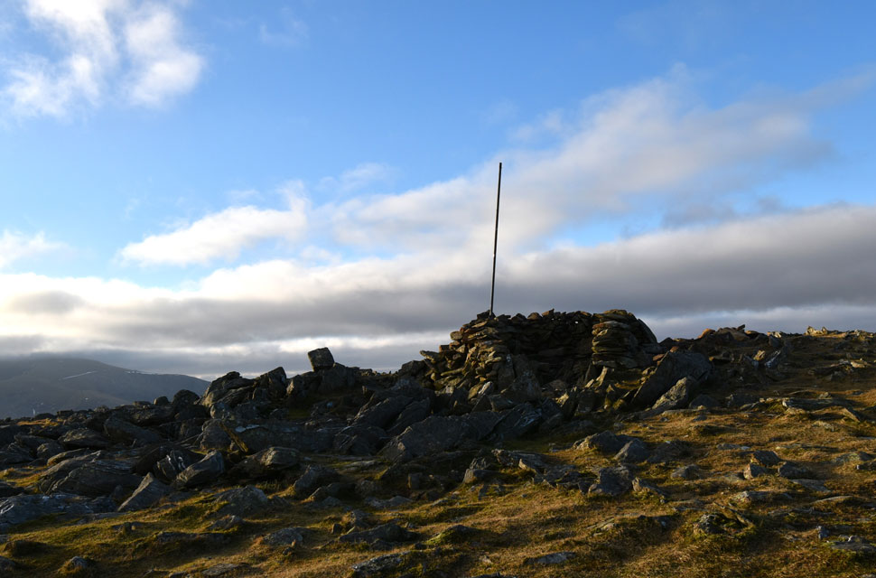
| Carnedd y Filiast. |
| Carnedd y Filiast means the cairn of the greyhound bitch. The greyhound bitch was an important symbol in Celtic mythology |
 |
| The Atlantic Slab, Carnedd y Filiast. |
| Once the bed rock of the Atlantic Ocean the rock is here rippled, formed on a beach, by waves or fast flowing water, hardened into rock by sedimentary processes then uplifted by tectonic forces. The Atlantic Slab is thought to be one of the most fascinating geological features in whole of Snowdonia. |
 |
| I take a last look towards Mynydd Perfedd before summiting Carnedd y Filiast. |
| Gone is the windchill replaced by what feels like Spring sunshine. |
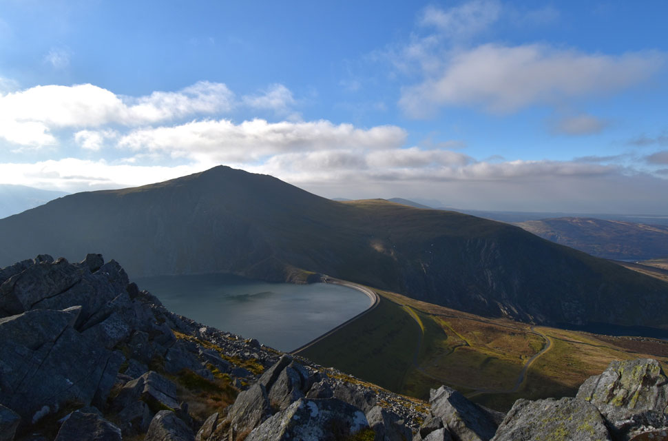 |
| Marchlyn Mawr, Elidir Fawr and Elidir Fach from Carnedd y Filiast. |
| Still facinated by the Atlantic Slab I made my way over to Carnedd y Filiast summit just as a group of four lads had left leaving the summit to myself. |
 |
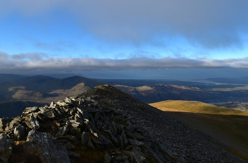
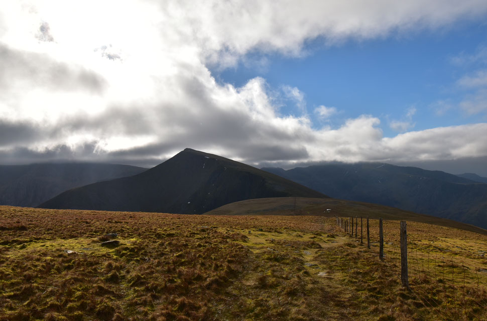
| Pen yr Ole Wen, Carnedd Dafydd, Yr Elen and Carnedd Llewelyn. |
Summit time was short and before I started to make my descent I wanted to take in the view of the high Carneddau before I left. I've viewed the Carneddau many times before from the exact spot but never felt like those mountains were the ones that got away today. My heart had that sinking feeling, I knew I'd be back I knew I'd claim those summits and even knowing it was for the best, I left Carnedd y Filiast with a bloodied lip.
Under midday sunshine I began my descent not before de-layering my hat and gloves then taking long sips of Summer fruit from my bladder valve knowing I could gulp at will. The descent is loose and sometimes steep but I kept a constant speed and arrived at the col linking Carnedd y Filiast with Y Fronllwyd in good time. Pairs of walkers were passed as was a large group of teenagers corralled by two overly motivated mountain leaders. More walkers are passed by which time I'd collapsed my walking poles into the side pockets of my pack and even added a pair of sunglasses for the walk back to the car.
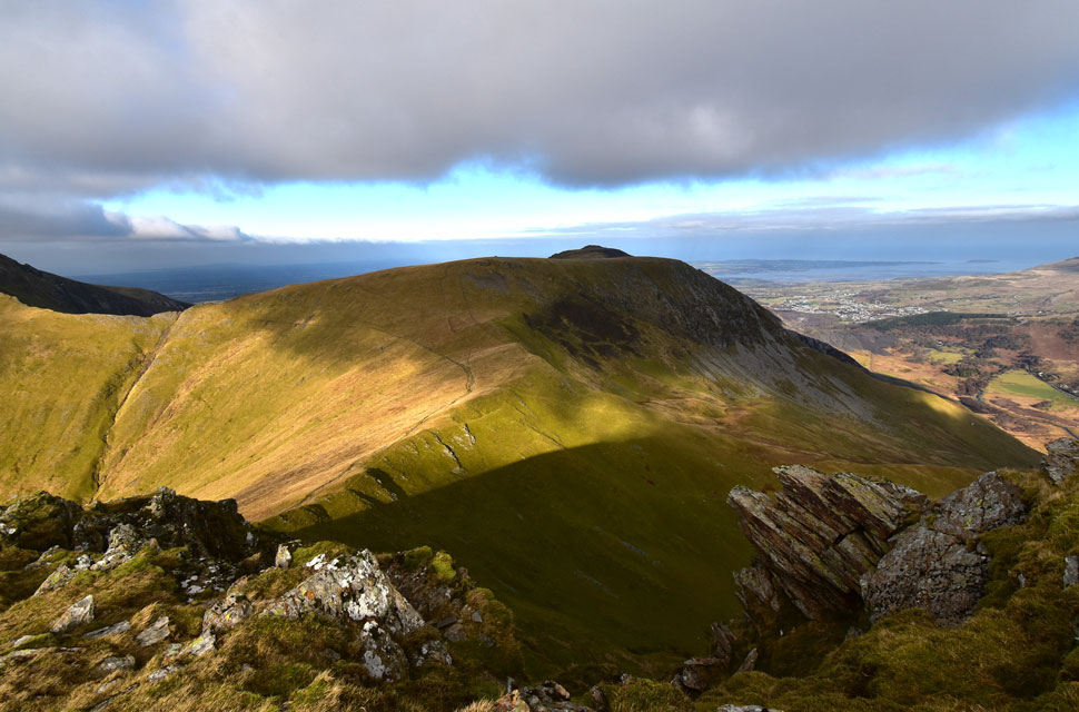
The sun was still beaming down with a whole afternoon ahead the walkers kept coming but not as I imagined, on a Snowdon scale. I took one last look back at Carnedd y Filiast and Y Fronllwyd both tops dappled in the sunlight as was Colywn Bay towards the west where she merged into the Menai Straight. |
|
| |
| Back to top |
 |
|