|
The Langdale Pikes from New Dungeon Ghyll |
 |
 |
Overview |
 |
|
| Ascent: |
2,810 Feet - 856 Metres |
| Wainwrights: |
7, Loft Crag - Pike O'Stickle - Harrison Stickle - Pavey Ark - Thunacar Knott - High Raise (Langstrath) - Sergeant Man |
| Visiting: |
Pike Howe |
| Weather: |
Predominently Overcast, Flat Light. Feeling Brisk At Height With Little Wind. Highs of 6°C Lows of 3°C Feels Like -1°C |
| Parking: |
Car Park, New Dungeon Ghyll |
| Area: |
Central |
| Miles: |
7 |
| Walking With: |
On My Own |
| Ordnance Survey: |
OL4 - OL6 |
| Time Taken: |
5 Hour 30 Minutes |
| Route: |
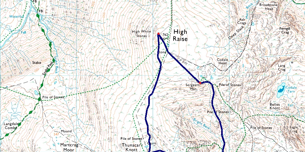
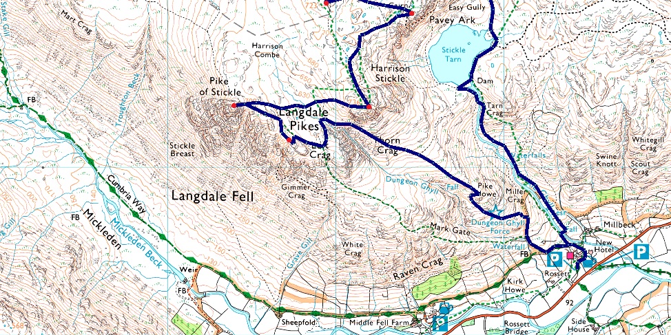
NDG - Pike How - Loft Crag - Pike O'Stickle - Harrison Combe - Harrison Stickle - Pavey Ark - Thunacar Knott - High Raise (Langstrath) - Sergeant Man - Stickle Tarn - Stickle Ghyll - NDG |
|
| |
|
Parking Details and Map |
|
|
| Nearest Post Code: |
LA22 9JX |
| Grid Reference: |
NY 294 306 |
| Notes: |
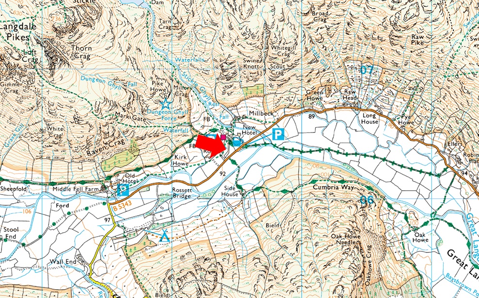
A large National Trust car park can be found at New Dungeon Ghyll with ample parking all year around. There are toilet facilities and of course New Dungeon Ghyll Hotel and Stickle Barn close by.Parking is free for Trust members but charges apply to non members. |
|
| |
|
Map and Photo Gallery |
|
|
  |
| |
| |
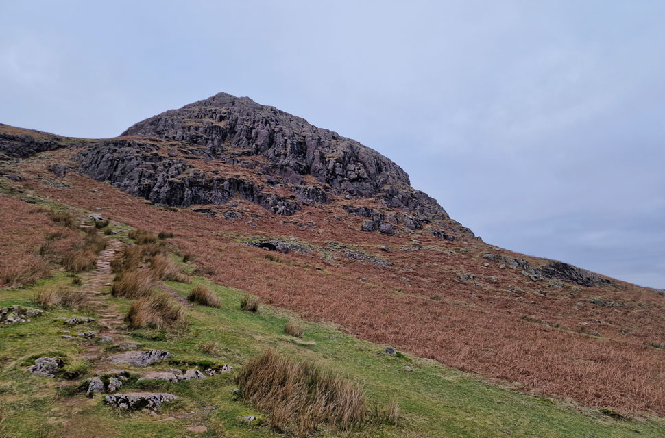 |
| Pike Howe above New Dungeon Ghyll 4°C 08:15am |
Both MWIS and Weatherline had got the forecast totally wrong forecasting sunshine through to lunchtime. I arrived at Stickle Barn around 07:45am under grey skies which showed no promise of improvement. which meant a jostle between which camera to use, DSLR or mobile phone? After taking a few test shots using my DSLR and with thickening skies overhead I opted for my mobile phone. The car park was already half full mainly with camper vans down one side and cars down the other. I parked opposite the ticket machine finding the surrounding bays strewn with litter. After emptying eight pound coins into the machine I picked up the litter and placed it in a bin next to Stickle Barn.
It's quiet with just two other walkers setting up one of whom I'll meet on the fell later but for now I finish kitting up. I debated whether to add gaiters after all the forecasters had predicted a hard frost from dawn but it's clearly milder. I leave my gaiters in the hope it'll be frozen up top. Adding my beanie and fingerless mitts I leave the car park, pass through the gate and turn left spotting three walkers fifty yards up the path. The path is rocky and slow until a style is reached where the trio stop to remove layers, they had every right too, boy it felt mild. I passed the three with a 'morning' noting that they were ascending via Mark Gate, a direct ascent on Loft Crag. I'm also heading for Loft Crag but I prefer the Pike Howe ascent owing to the views into Dungeon Ghyll ravine. |
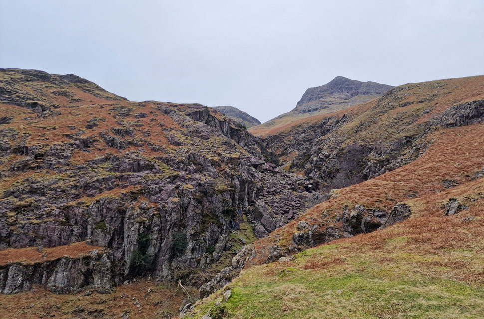 |
| Thorn Crag and Harrison Stickle from Dungeon Ghyll lower ravine. |
| The stone path climbs steeply before straddling the ravine for a short distance just below Pike Howe summit. |
 |
| Thorn Crag and Harrison Stickle from Dungeon Ghyll lower ravine. |
| I watch the trio on the Mark Gate path disappear as I continue towards Pike Howe. |
 |
| Thorn Crag from Dungeon Ghyll lower ravine. |
| The air is mild and I'm starting to boil over so off comes the beanie and gloves, for now at least. |
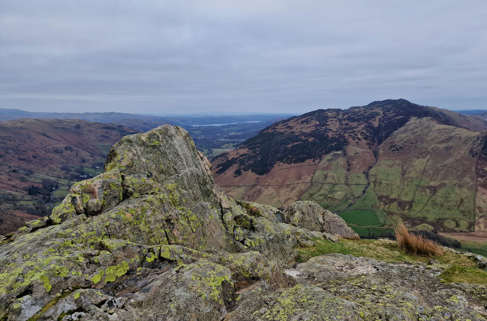 |
| Silver How and Lingmoor Fell from Pike Howe. |
| A worn shortcut through withered bracken allowed a direct ascent on Pike Howe where I was able to take in the view over the Langdale Valley. Still no signs of any sunshine. How can the forecasters get it so wrong. |
 |
| Thorn Crag, Dungeon Ghyll and Harrison Stickle from Pike Howe. |
| Loft Crag can't be seen from here which is directly behind Thorn Crag over on the left. After traversing the head of the ravine, it's a simple case of striding over a youthful Dungeon Ghyll via a couple of well-placed stepping stones. |
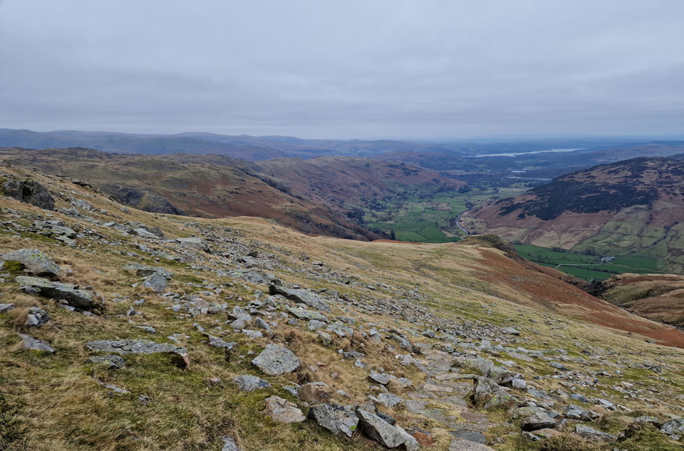 |
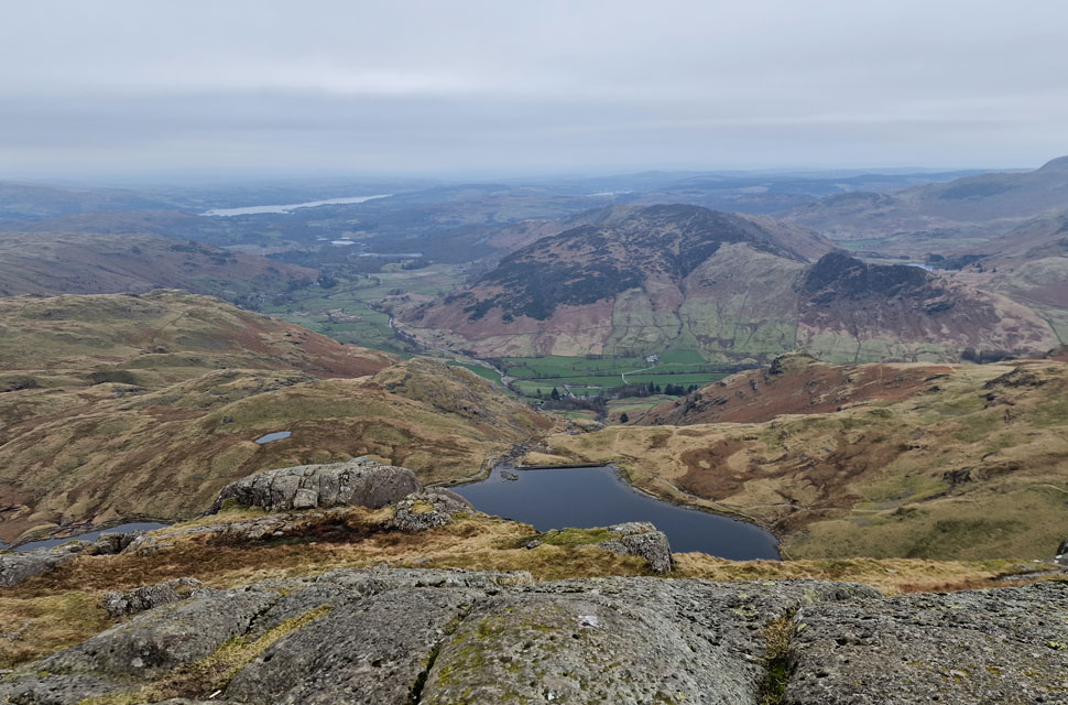
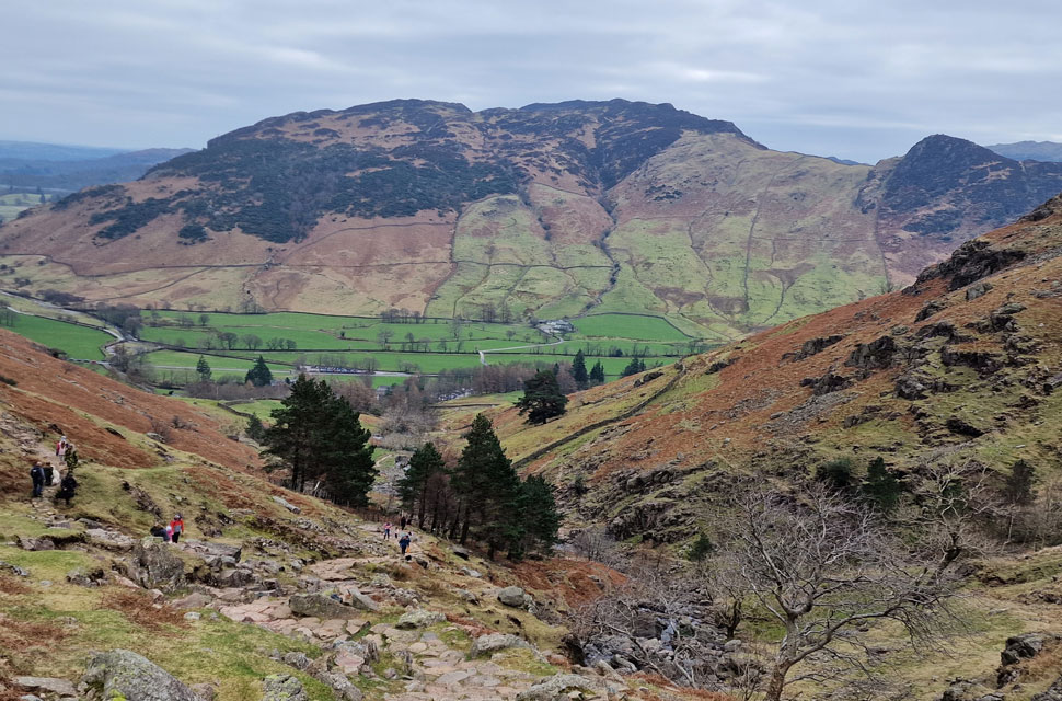
| Looking down on Pike Howe and the Great Langdale Valley. |
| With a distant Windermere seen beyond. |
 |
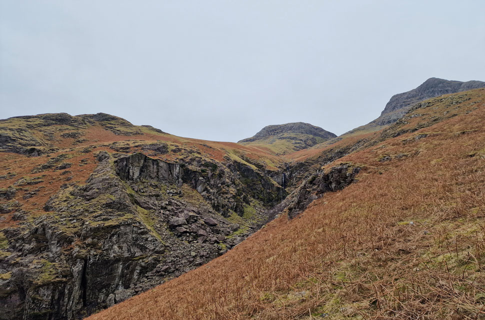
| Dungeon Ghyll upper ravine. |
| I dropped off the path to take this photo which traverses up, and across the crags to the right. |
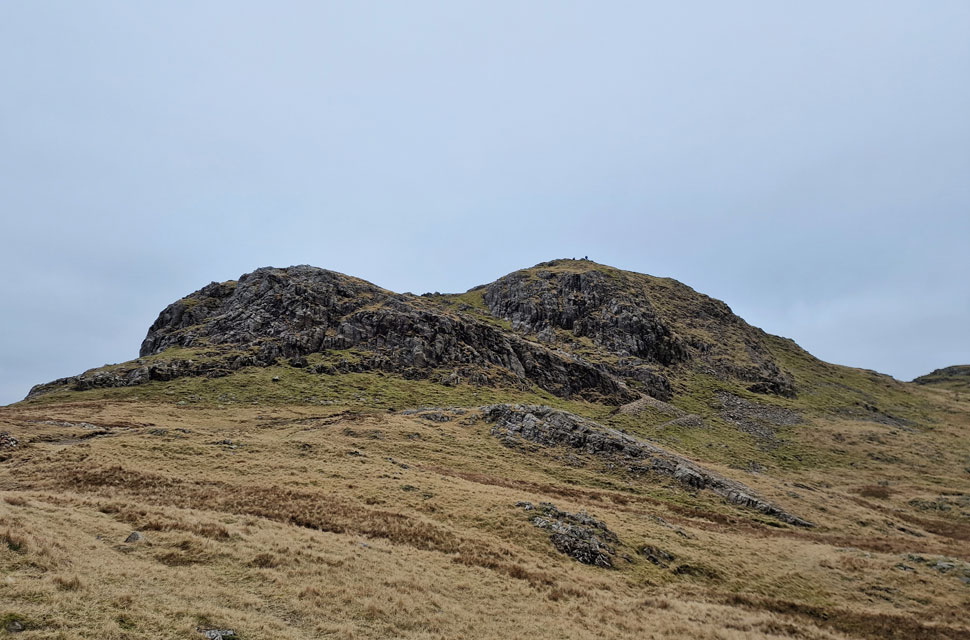 |
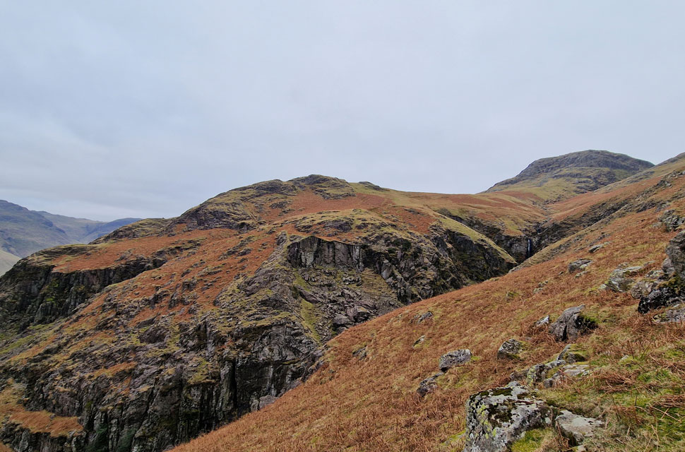
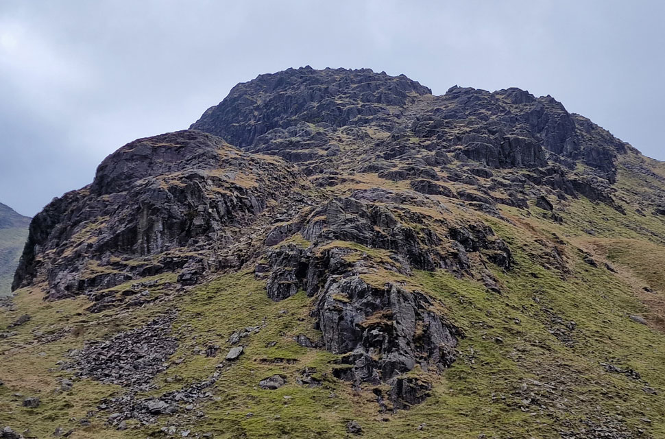
| Loft Crag finally comes into view. |
| After traversing across the top of the ravine, I turned left and crossed Dungeon Ghyll via the stepping stones, then followed the path, which hooks right towards the base of the crags. My final ascent was made via a loose gully between the two crags, where I spotted the trio at the summit. |
 |
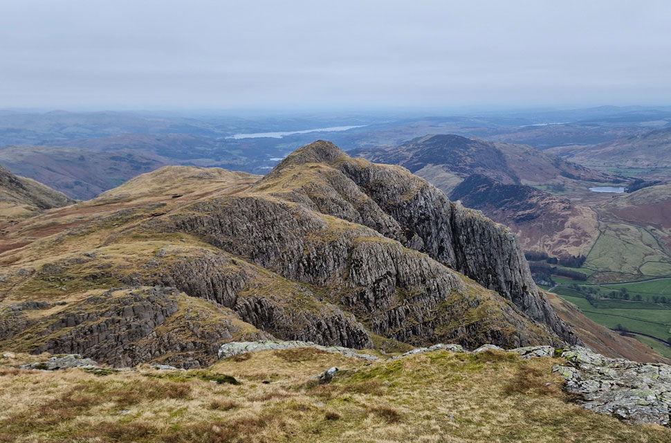
| Pike O'Stickle from Loft Crag summit. |
| The trio had left by the time I had reached the summit, and for now, it looks like I'm going to be chasing their tails as we summit the Pikes. That's the Mickleden Valley over on the left, with Bow Fell and Esk Pike below cloud. At the head of the valley is Rossett Pike while beyond are Allen Crags, Great End, and Glaramara. |
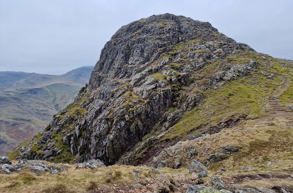 |
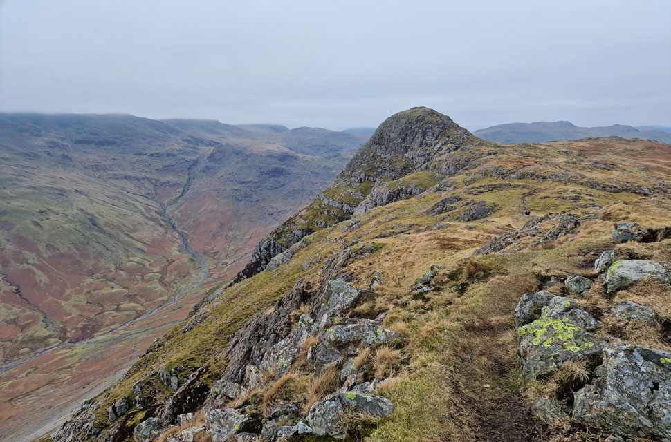
| Pike O'Stickle. |
| Seen here as I cross the head of the great scree gully. |
 |
| The mass of Bow Fell from Pike O'Stickle summit. |
| With Three Tarns and Shelter Crags (Crinkle Crags) towards the left and Rossett Pike, Esk Pike, Great End and Allen Crags over on the right. |
 |
| Loft Crag from Pike O'Stickle. |
| With Lingmoor Fell, Side Pike and Blea Tarn over on the right. |
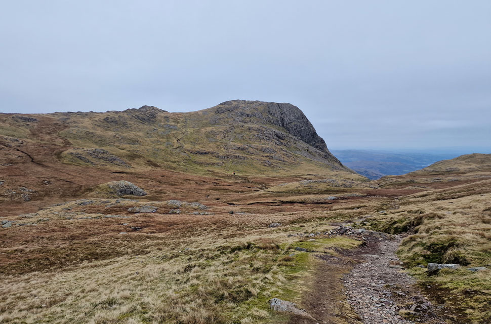 |
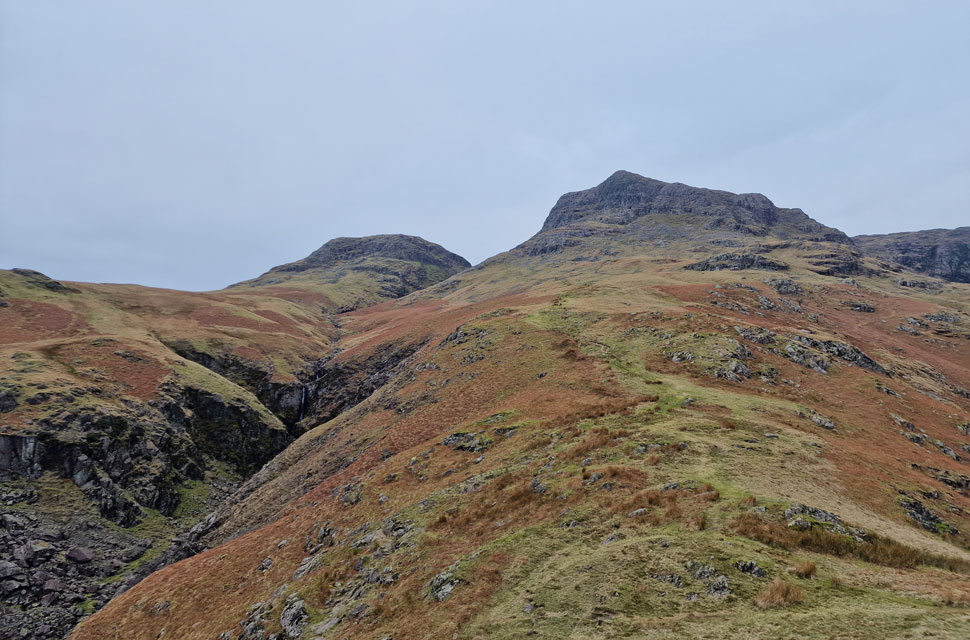
| Harrison Stickle from Harrison Combe. |
| Unlike the scramble I had ascended Pike O'Stickle by I descended using a less scrambly route twisting over boulder before joining the path through Harrison Combe. You can just see the trio starting their ascent on Harrison Stickle in the distance. |
 |
| Loft Crag and Pike O'Stickle over Harrison Combe. |
| Taken from the ascent of Harrison Stickle. |
 |
| Sergeant Man, Pavey Ark, Blea Rigg and Stickle Tarn from Harrison Stickle summit. |
| With the distant eastern fells looking gloomy in the flat light. |
 |
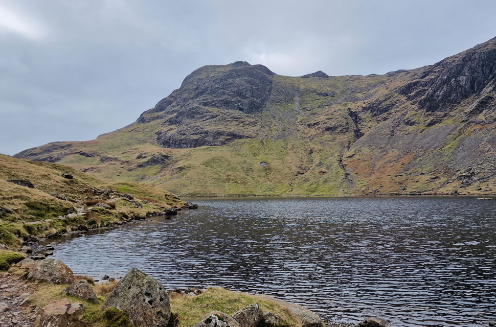
| Pavey Ark and Stickle Tarn. |
| I caught a glimpse of the trio as they began their descent towards the direction of Thunacar Knott. From Harrison Stickle I took the ridge path that links Harrison Stickle with Pavey Ark. |
 |
| Looking back on Harrison Stickle from the ridge path. |
| You can just see the path in the centre of the photo, which then traces onto the ridge. In recent times, faint paths have cropped up that also link the summits. The path I used was clearly marked with cairns, just like the one in the foreground. |
 |
| Stickle Tarn, Lingmoor Fell and Great Langdale from Pavey Ark summit. |
| The last time I was here was back in 2018 when Tim and I climbed Jack's Rake after vowing never to climb it again. I could hear climbers in the rake below, two of whom, a young lad and his girlfriend, arrived at the summit shortly after, and despite being vaguely interested in what conditions were like in the rake, I left setting my sights on Thunacar Knott. |
 |
| Views towards Sergeant Man and Coldale Head from Pavey Ark summit. |
| |
 |
| Thunacar Knott from Pavey Ark summit. |
| From Pavey Ark Thunacar Knott looks like a straight line of ascent, but on paper, after you've weaved through the boulders and bogs, your line of ascent might look like a two year old has drawn it! |
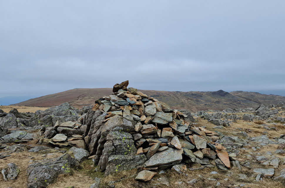 |
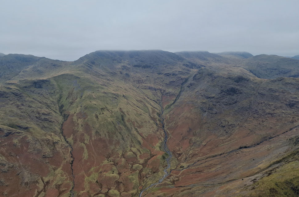
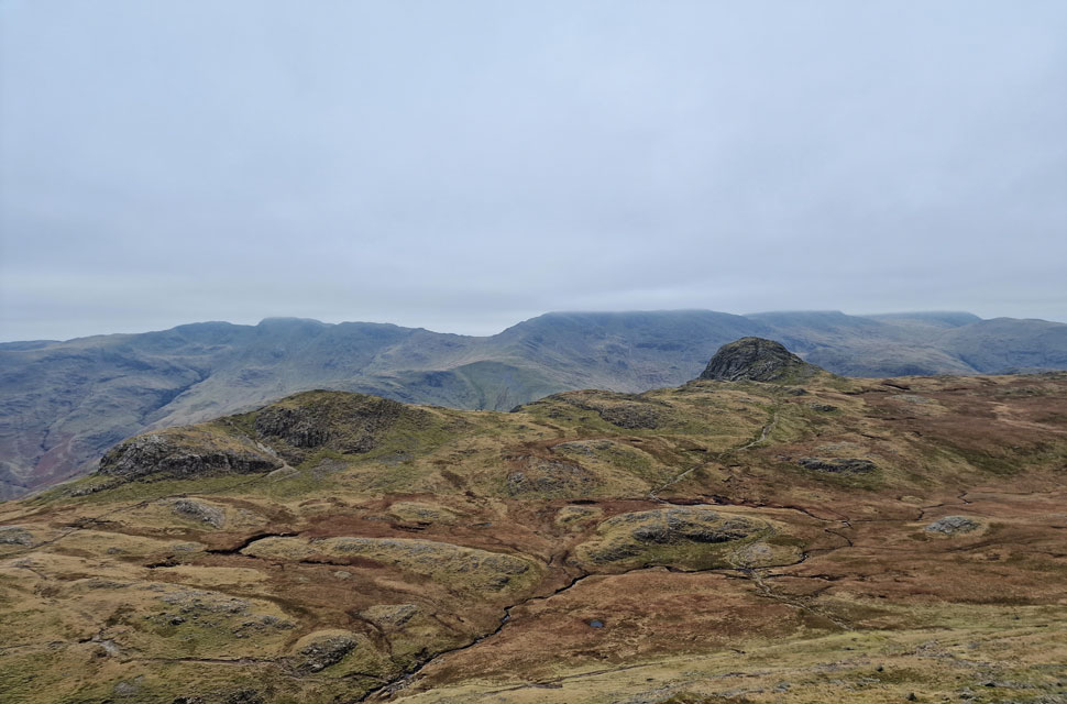
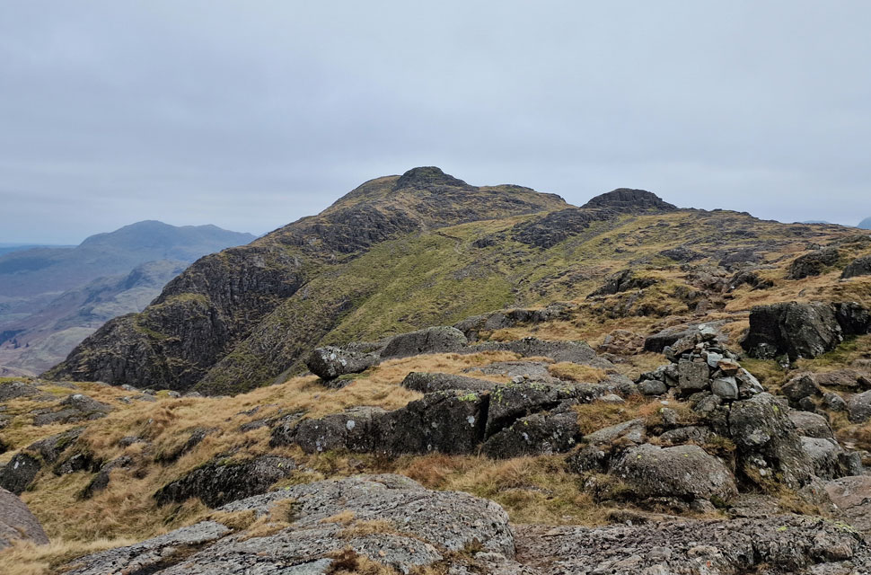
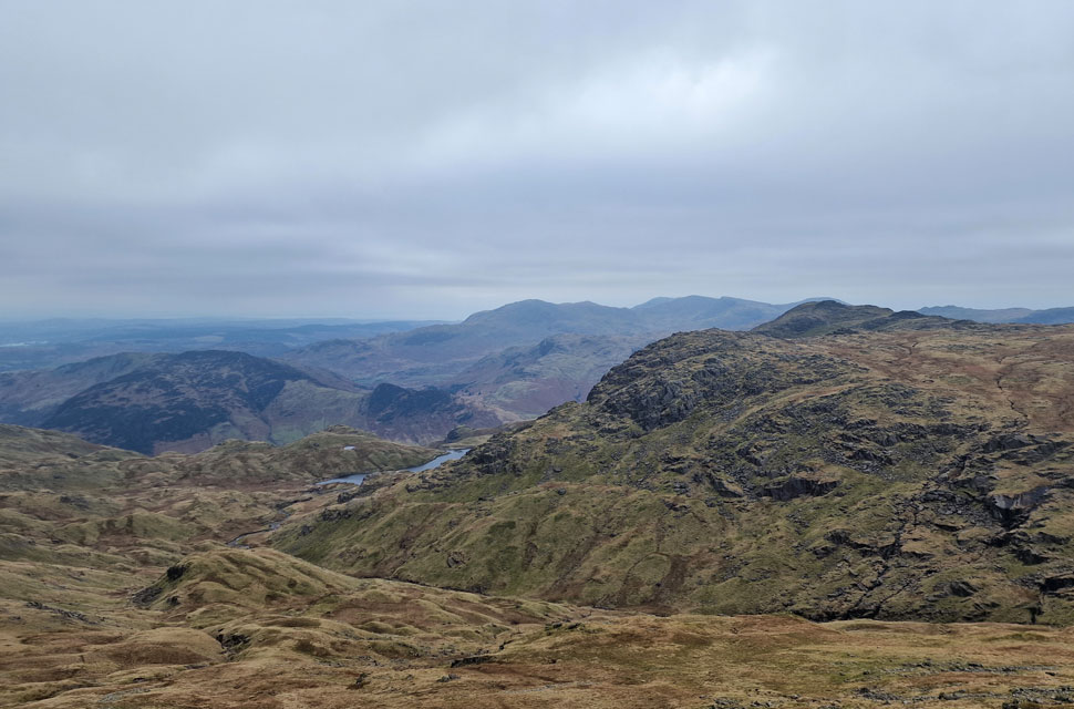
| High Raise (Langstrath) and Sergeant Man from Thunacar Knott. |
| I left Pavey Ark knowing I'd also be leaving any rough paths behind too, which made up for how wet the crossing was. It was here I met the two walkers I'd passed this morning in the car park, and after a quick chat I left bound for High Raise. |
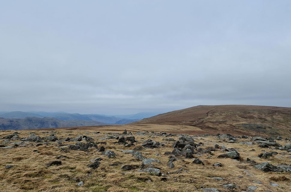 |
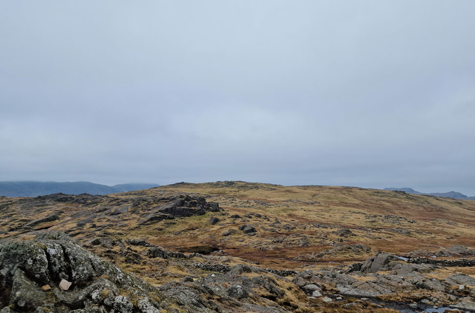
| High Raise (Langstrath) |
| One of the main reasons I included High Raise was to walk this lovely section of ridge that links it with Thunacar Knott. Even in the low light, this really is walkers territory. |
 |
| I look back on Pavey Ark, Harrison Stickle and Pike O'Stickle. |
| |
 |
| Fleetwith Pike and the North Western fells seen beyond the Langstrath valley. |
| It had been way too long since my last visit and time spent at the summit reflected this. |
 |
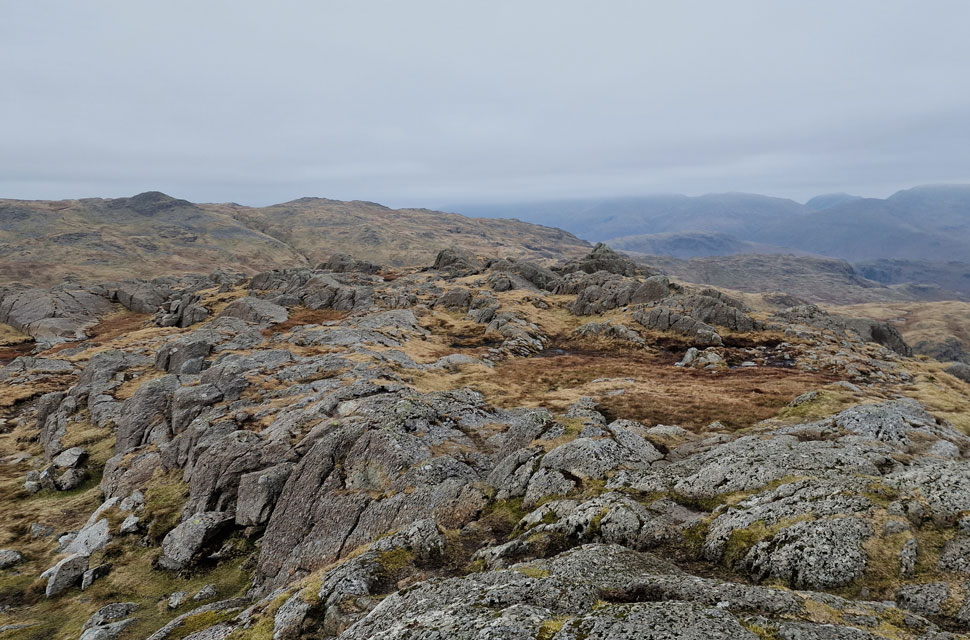
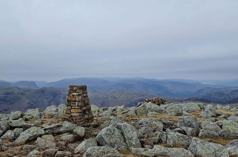
| Ullscarf and Low White Stones from High Raise (Langstrath) |
| I had the summit to myself and thought I'd earned myself a cup of hot Vimto so out came the flask, which I enjoyed whilst sitting next to the summit cairn in tranquility. |
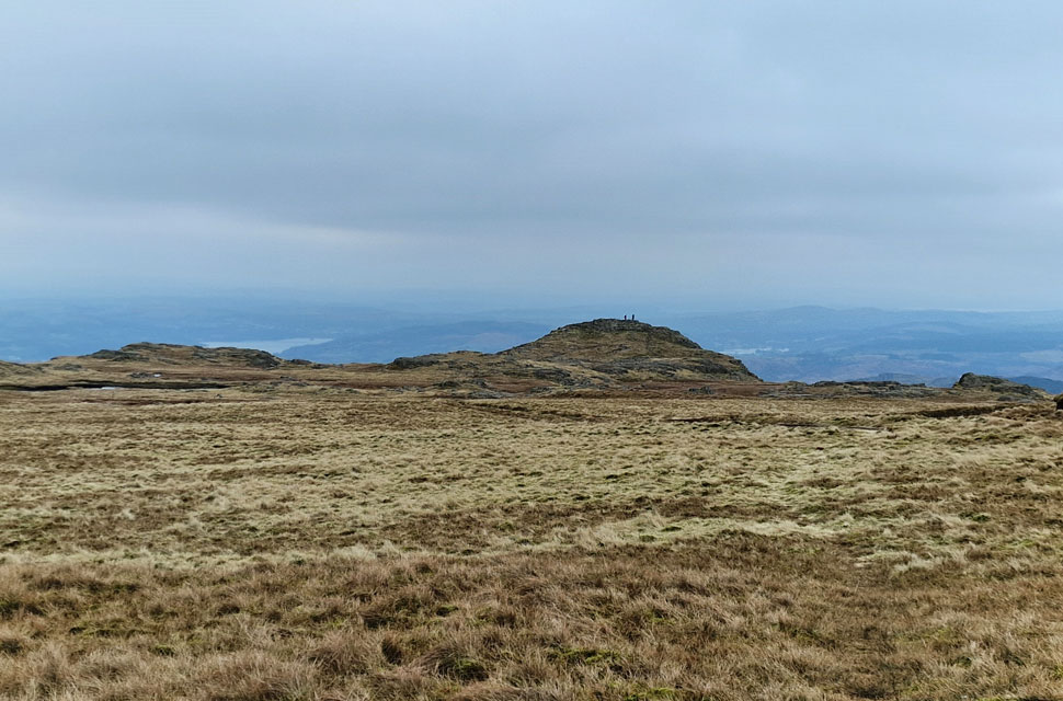 |
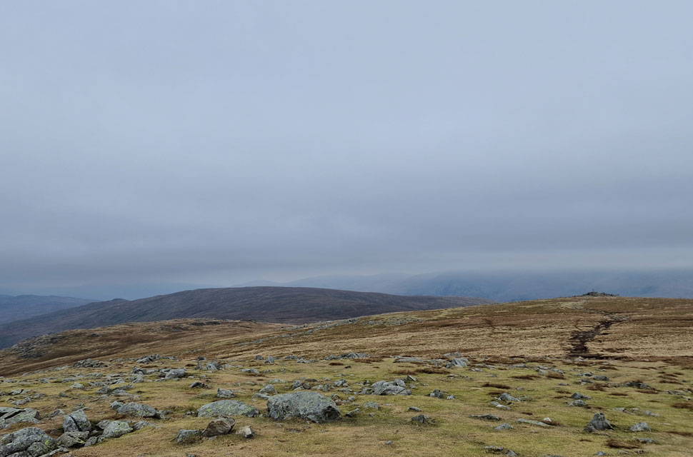
| Sergeant Man. |
| From High Raise I took the direct path, which after around one hundred yards forks off towards Coldale Head. I continued ahead then linked up with a second path that crosses High Raise's southern shoulder above Bright Beck. There are two people standing at the summit of Sergeant Man but it's about to get a whole lot busier. |
 |
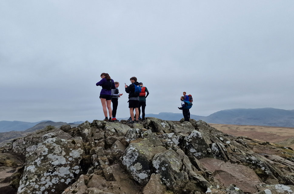
| Lingmoor Fell, the Coniston group, Harrison Stickle and Pavey Ark from Sergeant Man summit. |
| No sooner had the two walkers left was I joined by two more walkers, then a group of young walkers right afterwards. In terms of busy summits, Sergeant Man won the prize today, with most walkers ascending from Grasmere via Easdale Tarn. |
 |
| Sergeant Man summit. |
| It's lunch time, and my stomach is stirring, but I'll find a quieter spot as I descend towards Stickle Tarn. |
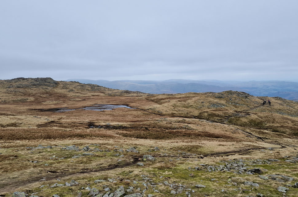 |
| Coldale Head from Sergeant Man. |
| After the short descent of Sergeant Man I begin the steep descent back to Stickle Tarn via a narrow footpath that follows the outflow of the tarn over on the left. It's a quiet but steep path, the base of which provides access to Pavey Ark's north gully route. |
 |
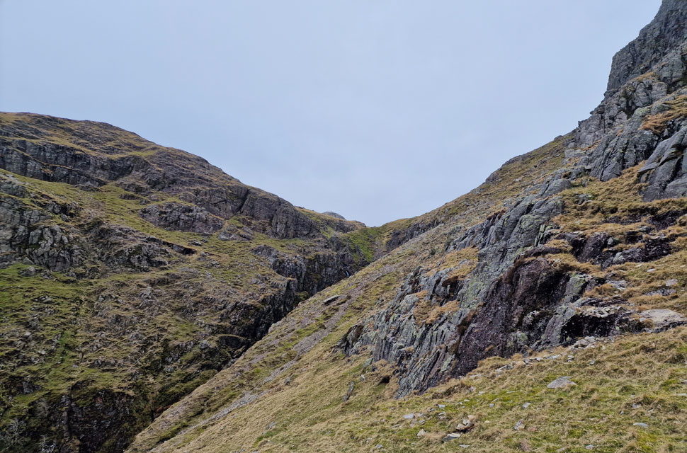
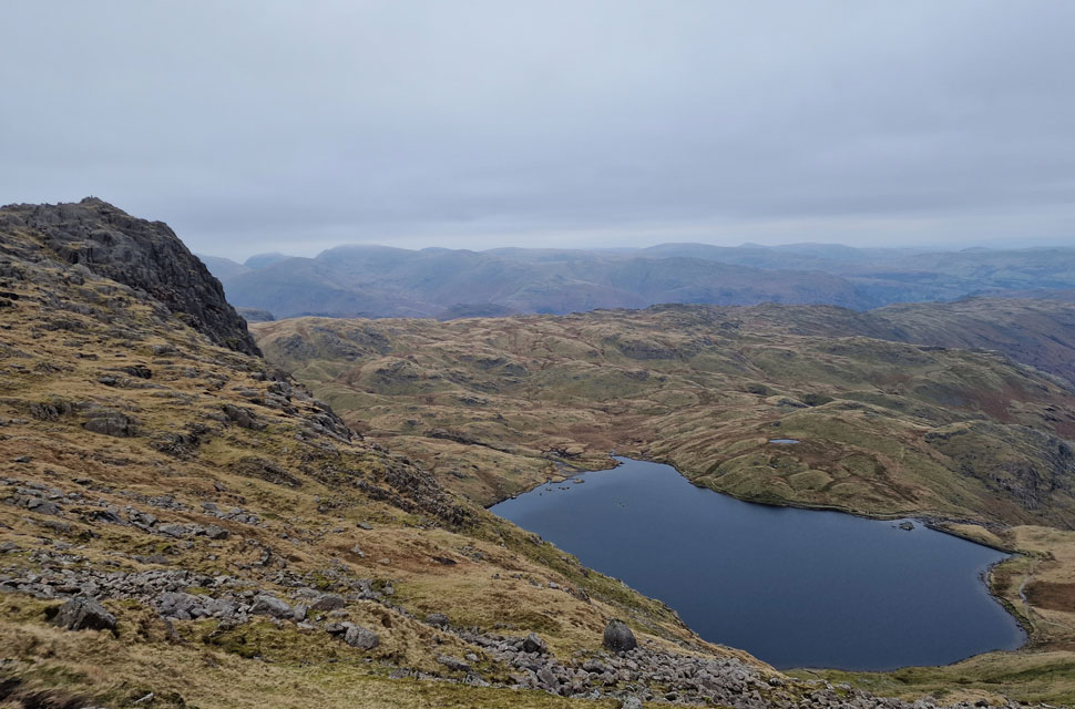
| Lunch with a view - Pavey Ark North Gully. |
| The north gully is Pavey Ark's more common means of ascent and is accessed from the east side of Stickle Tarn. The ascent begins on the other side of the bottom left buttress before accessing the gully at the col seen in the centre. |
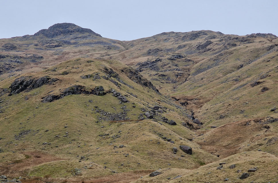 |
| Looking back on Sergeant Man. |
| You might be able to pick out my line of descent over on the right. |
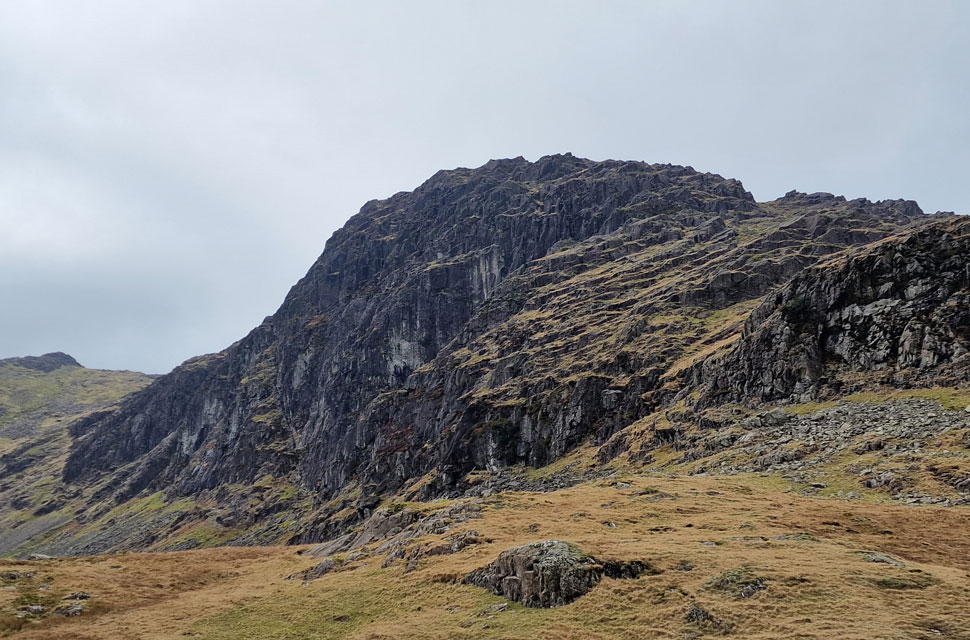 |
| Pavey Ark. |
| Stood at the summit earlier you can be forgiven for having no idea of the cliffs, crags and buttresses directly below. |
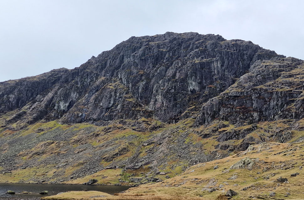 |
| Pavey Ark from Stickle Tarn. |
| From here you get the brilliant prospective of a natural V which forms Jack's Rake over on the left and Easy Gully on the right. |
 |
| Harrison Stickle from Stickle Tarn. |
| |
 |
| Descending Stickle Ghyll. |
Rounding Stickle Tarn came the crowds, most of whom were heading for the north gully while others sat on the dam wall eating lunch. Making sure I didn't make a hash of it, I crossed the tarn outflow watched on by many, then stood and took one last look at the impressive Pavey Ark. Tiny walkers crossed the ridge path as I had done earlier, which seems like a lifetime ago now. I began the rough descent directly from the tarn keeping to the right then crossing Stickle Ghyll at the familiar stepping stones.
I had been passed by many in ascent none of whom I would refer to as a fell walker but enjoying their time on the hill nonetheless. After crossing the Ghyll I began my descent, finding rhythm and descending quickly, my knees feeling the brutality of the day as were my feet. I read the path like a book knowing where I was going to place my boots three to four steps ahead, until a large family stepped onto the path right in front of me bringing my descent to a stall. While the parents vaped small children ran a-mock towing dogs on leads at full length. I kept my calm and politely asked to pass, but it seemed like too much trouble, so I continued off the path. I'd completely lost my rhythm kicking the edges of stones now, but once through the trees, the path levelled out and there were fewer people.
I crossed the footbridge and took a look back up the steep sided Ghyll flanked by Pike Howe now directly above. Continuing the last hundred yards I felt the mildness of the afternoon hit me and I started to overheat. Looked on by the dozens leaving the car park which was bursting at the seams not helped by two full size coaches, funny though no matter how busy the car park looked I'd only seen about a dozen walkers during my time on the hill. |
|
| |
| Back to top |
 |
|