|
Cat Bells, High Spy & Rigghead Quarry |
 |
 |
25th March 2023 |
 |
|
I worked last Saturday, which was just as well as the forecast was for another weekend of low cloud, mist, and gloom. That said, I did manage to walk an unrecorded, eight mile tour of Winter Hill in light so poor it wasn't worth getting my camera out, but still, it was nice to get out in the fresh air.
This Saturday looked much the same, with low cloud, showers, and intermittent sunshine forecast. The trio has some great walks planned, but given the poor forecast, we're having to stick below the cloud cover until Spring decides to finally arrive.
It had rained all week, and as a result, the ground is saturated and rivers are swollen, so today's walk strays as much as possible from any swollen ground, which worked out well with the exception of how wet the descent through Rigghead Quarry was.
The Cat Bells to High Spy Ridge is one of the best walks Lakeland has to offer, where we were treated to warm sunshine, bursts of rain while being surrounded by swirling cloud. |
|
| Wainwright Guide Book Six |
 |
| The North Western Fells |
| Words cannot adequately describe the rare charm of Catbells, nor its ravishing view. But no publicity is necessary: its mere presence in the Derwent water scene is enough. |
 |
|
|
|
| |
|
Overview |
|
|
| Ascent: |
2,780 Feet - 847 Metres |
| Wainwrights: |
3, Cat Bells - Maiden Moor - High Spy |
| Visiting: |
Skelgill Bank |
| Weather: |
Scattered Showers & Brief Spells of Sunshine. Highs of 11°C Lows of 7°C Feels Like 0°C |
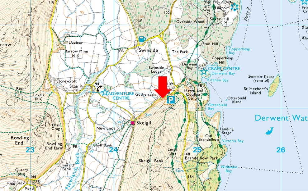
| Parking: |
Parking Spaces, Gutherscale |
| Area: |
North Western |
| Miles: |
9.2 |
| Walking With: |
David Hall & Rod Hepplewhite |
| Ordnance Survey: |
OL4 |
| Time Taken: |
5 Hour 40 Minutes |
| Route: |
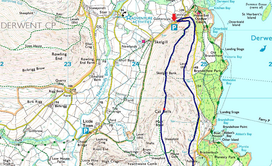
Gutherscale - Skelgill Bank - Cat Bells - Hause Gate - Maiden Moor - Narrow Moor - High Spy - Rigghead Quarry - River Derwent - Grange - Manesty - Catbells Terrace - Gutherscale |
|
| |
|
Parking Details and Map |
|
|
| Nearest Post Code: |
CA12 5UE |
| Grid Reference: |
NY 246 121 |
| Notes: |
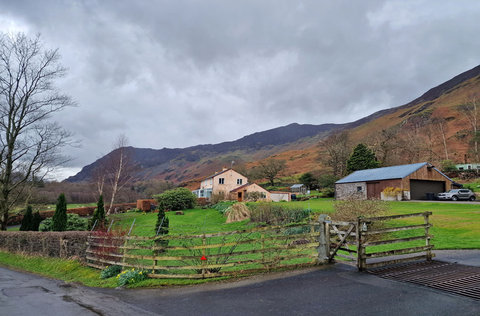
There is room for around ten well parked cars at Gutherscale which is perfectly postioned for a quick walk up Cat Bells or a full day on the Newlands Fells. Leave the A66 for Portinscale and pass through the village before the entrance to Nicol End (Derwent Water) appears on the left, continue to follow the road which forks right signposted (Stair and Newlands Valley) Keep left here and continue to follow the road which sweeps around a right hairpin bend before passing over a cattle grid. The parking spaces will appear around 300 yards further on the left. Parking is free. |
|
| |
|
Map and Photo Gallery |
|
|
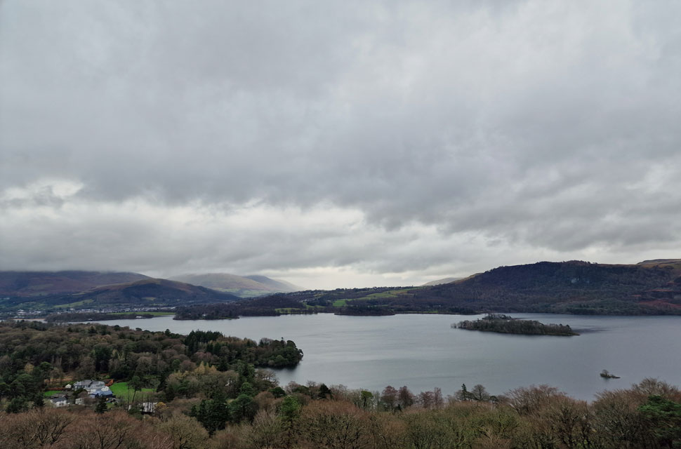 |
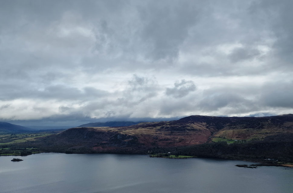
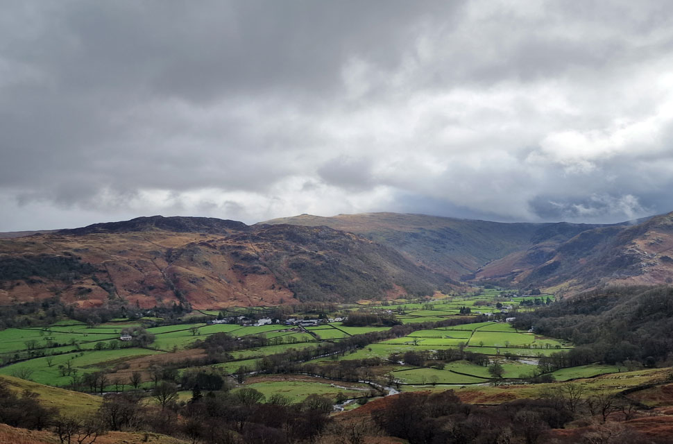
| Lonscale Fell, Latrigg, Blease Fell, Blencathra, Walla Crag and St Herbert's Island from Gutherscale 08:30am 7°C |
Not only had it rained all week, but it had been windy, especially across the summits, where wind speeds up to 65mph had been recorded on Helvellyn by the Fell Top Assessor. It was raining when I left home, which continued throughout my drive north, subsiding slightly as I reached Keswick. We had arranged to meet at Gutherscale at 8:15am. David was already there when I arrived around 8:00am, soon followed by Rod a few minutes later, leaving just one space, which was taken up by two girls and their West Highland White Terrier.
Even though it wasn't raining, there was a squawly feel to the morning air, topped up by a light wind and brooding skies, it felt like it was about to rain at any given minute. We decided with waterproof over trousers from the off and left Gutherscale for the fell side and soon we were treated to our first view of Derwent Water and a cloud topped Skiddaw and Blencathra. |
 |
| Cat Bells and Skelgill Bank. |
| Despite Cat Bells being labelled the family fell its initial ascent is steep and winding, which at least got the calfs working, the chilled morning breeze helped to keep things cool. |
 |
| Views over Newlands... |
| ...towards Wandope, Knott Rigg, Ard Crags, Crag Hill, Sail, Causey Pike, Rowling End, Outerside and finally Stonycroft Gill. |
 |
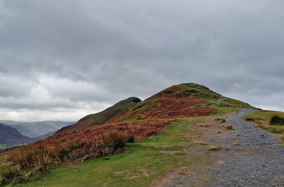
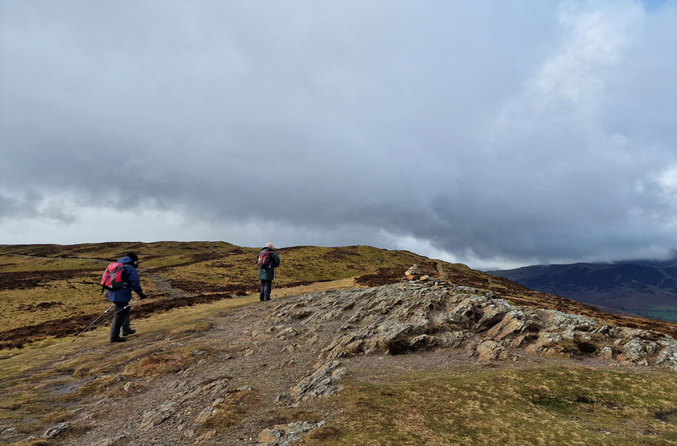
| Cat Bells, Maiden Moor, Hindscrath and Robinson from Skelgill Bank. |
| With the zigzags behind us we scrambled up past the memorial plaque taking care on the wet rock and emerged on Skelgill Bank. It looks like we have the place to ourselves but there's three pairs of walkers up ahead including one Westie. |
 |
| Views over Derwent Water towards Walla Crag and Bleaberry Fell. |
| Two more summits that have escaped the cloud which will probably be just as busy as Cat Bells later. |
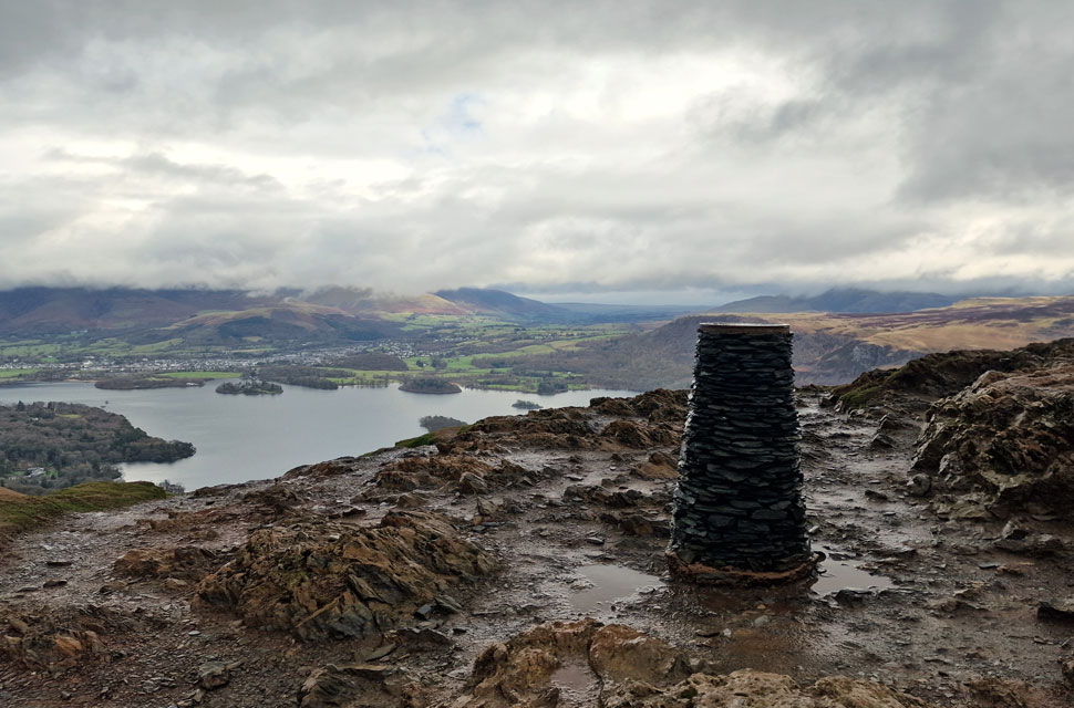 |
| Derwent Water from Cat Bells summit. |
After crossing the ridge, we began the ascent towards the summit, each taking our own line enjoying the odd scramble over wet rock. My usual line of ascent would be to head left just below the summit, but the path has been fenced off due to erosion, forcing every walker to make a direct ascent over wet rock.
We soon arrived at the summit, finding a young couple who we'd spotted earlier having a discussion about the best way back down, Rod advised to continue towards Hause Gate then descend via the terrace path. |
 |
| Views over Hause Gate and Yewthwaite Comb towards Maiden Moor, High Crags and Hindscarth. |
| Just in case you were thinking "blimey it looks wet across there" you'd be absolutely right. |
 |
| We pass the viewing cairn on as we head towards Maiden Moor summit. |
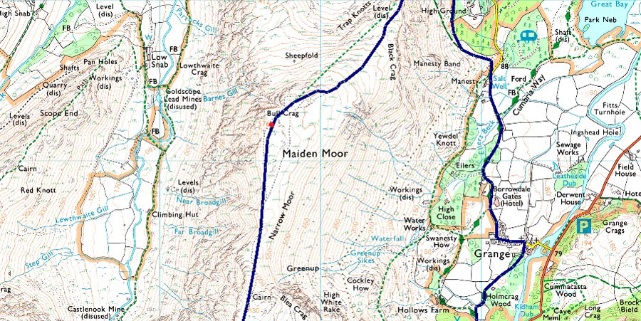
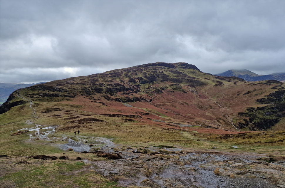
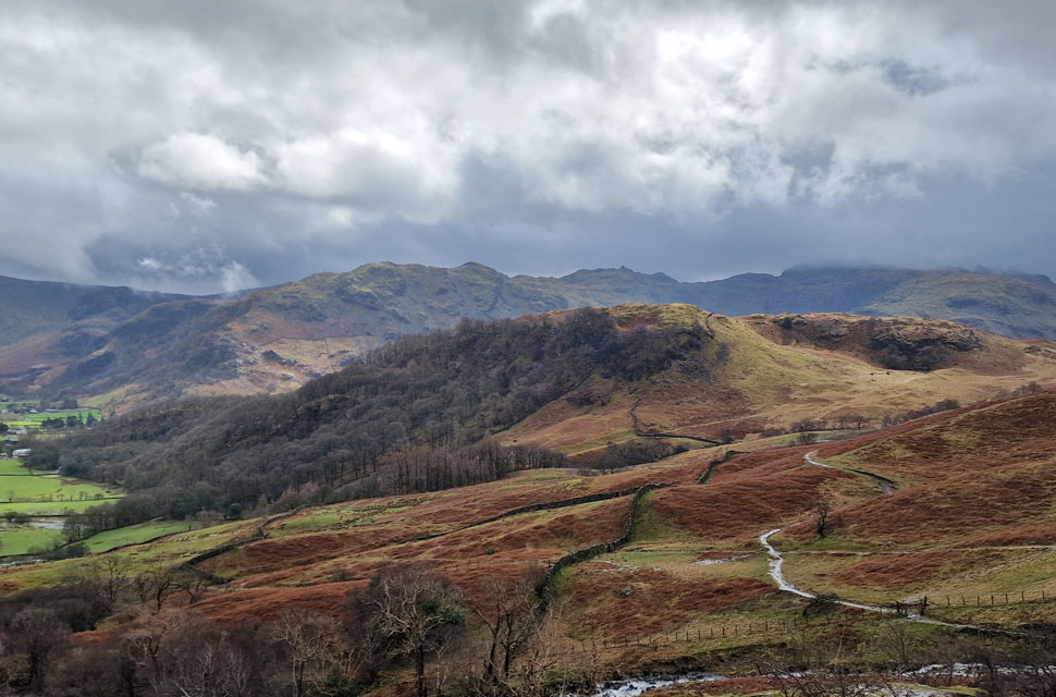
We crossed a saturated Hause Gate then began the steady ascent on Maiden Moor which David thinks always takes longer than it looks, and he'd be correct. We had passed a trio who had ascended from Little Town, and 'mornings' were shared as we continued our ascent before taking a quick break at the viewing cairn.
By now, more walkers had joined the path, and upon reaching the viewing cairn, all stopped for a few minutes before taking the left path across Narrow Moor. The actual summit of Maiden Moor is reached by following the path to the right, not far from where Bull Crag is located on the map. |
 |
| Minutes later, the sun came out. |
| Allowing us to take in this fantastic view over Yewthwaite Comb and Cat Bells. |
 |
| Skiddaw and Blencathra from Maiden Moor summit. |
| Blimey it looks like the cloud is in for the day over on Skiddaw and Blencathra. Note the walkers gathered on the viewing cairn, sadly none of them visited the actual summit. |
 |
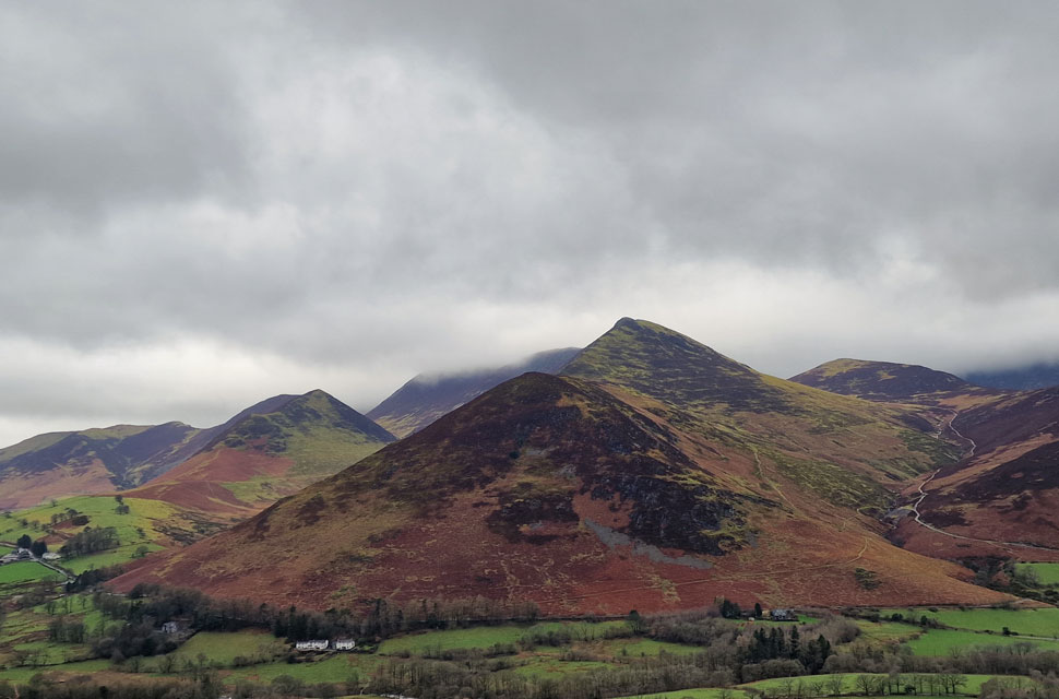
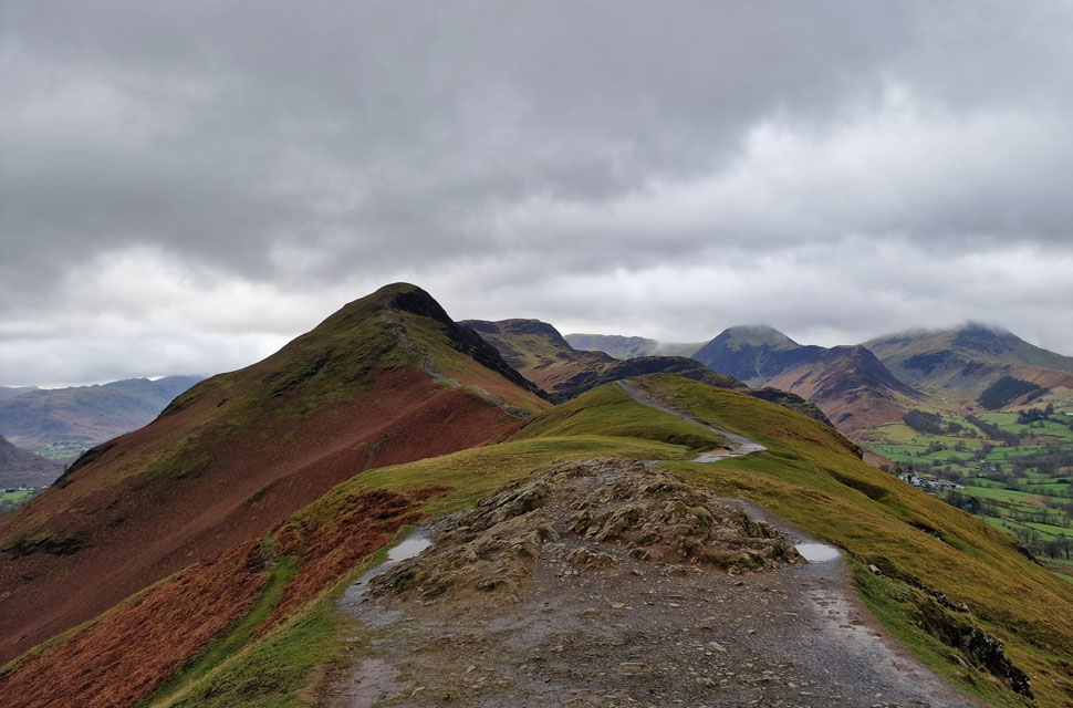
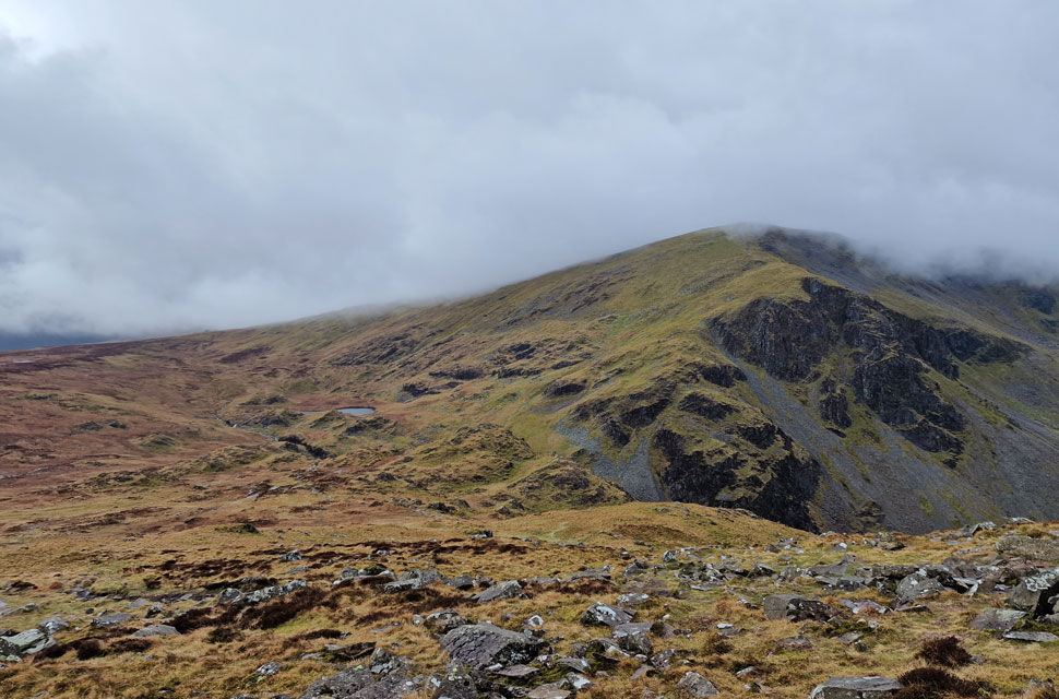
| Blea Crag seen beyond Narrow Moor. |
| With all the hard work behind us we can enjoy the brilliant ridge linking Maiden Moor with High Spy. |
 |
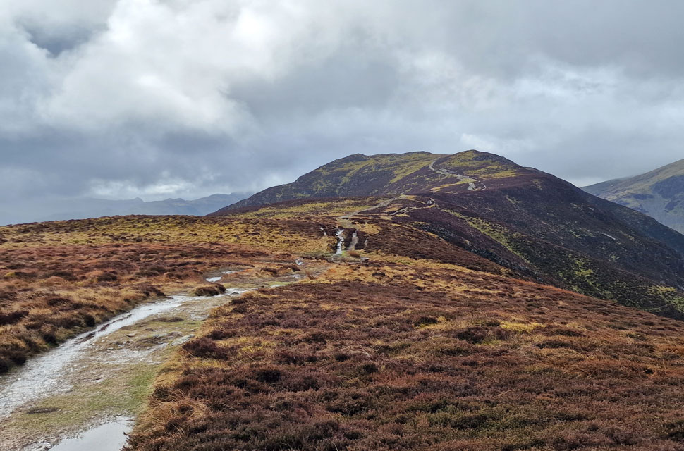
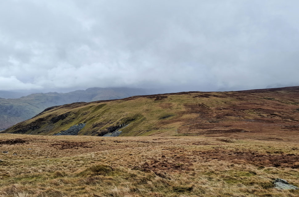
| High Spy comes into view. |
| There's quite a load of cloud dramatics going on in the distance I wonder what's in store for us. |
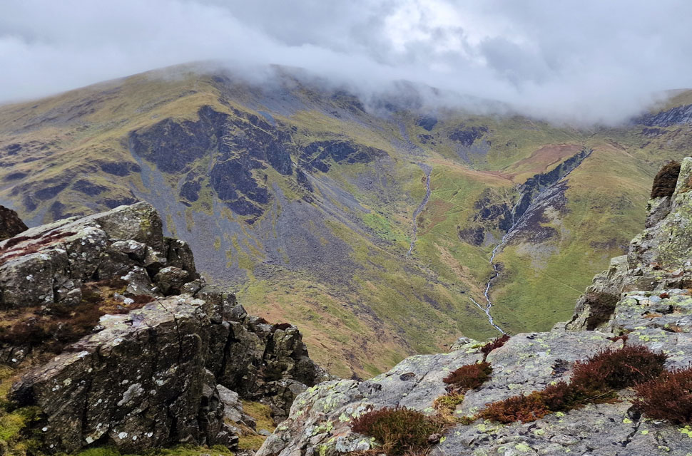 |
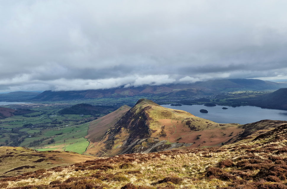
| Dale Head and Dalehead Crags from High Spy. |
| Those with a keen eye might be able to spot the zigzags of the miners track in the centre of the photo with Fat Tongue Gill seen (and heard) to the right. |
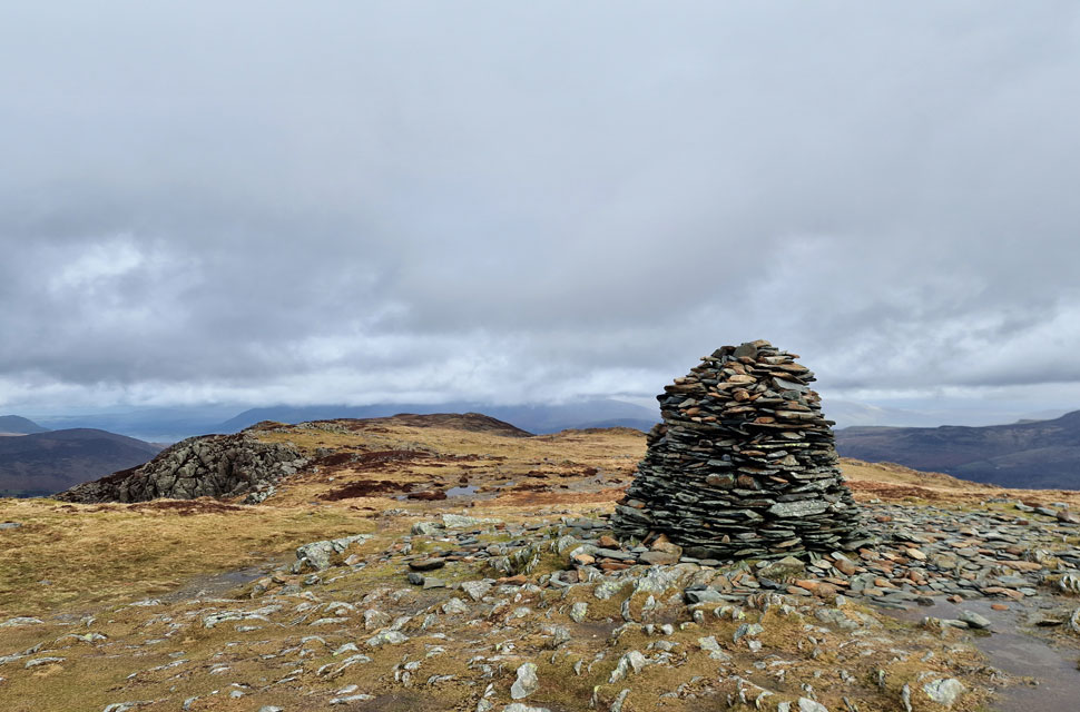 |
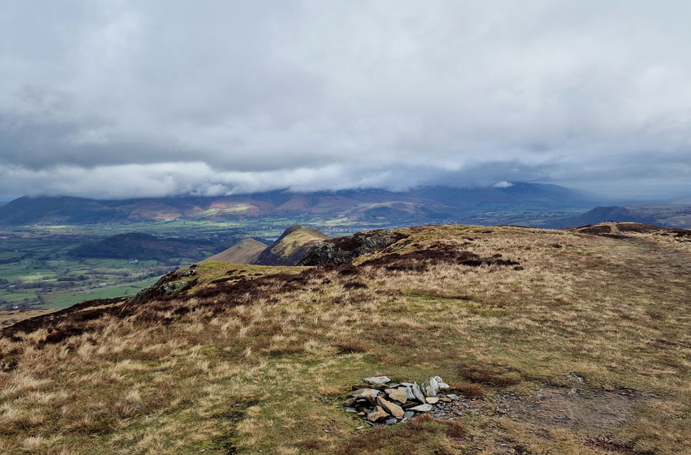
| High Spy summit. |
| The sun made the briefest appearances as we arrived at High Spy but within minutes was overshadowed by cloud. Considering most summits around us are below cloud and, despite the odd downpour we've been lucky with views up to now. |
 |
| Views towards Dale Head and Dale Head Tarn. |
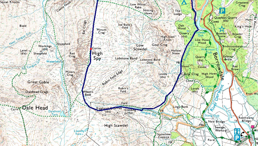
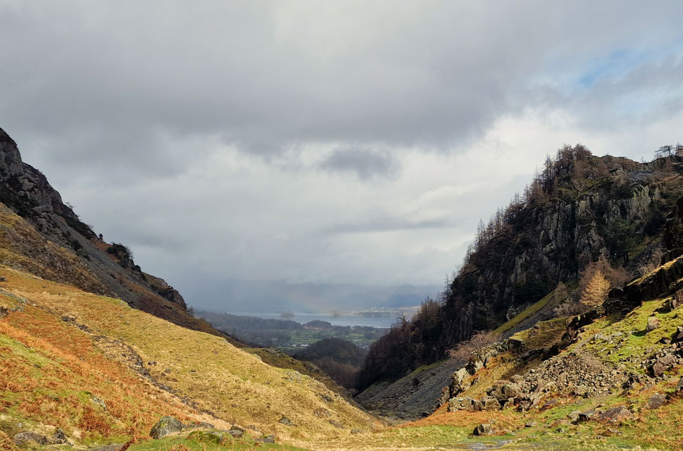
| The group who had been following us closed in during our time at Dale Head and we let them have their time at the summit. We started our descent following the main path towards Dalehead Tarn before branching left for a narrow footpath which will lead us towards the familiar fence line above Rigghead Quarry. |
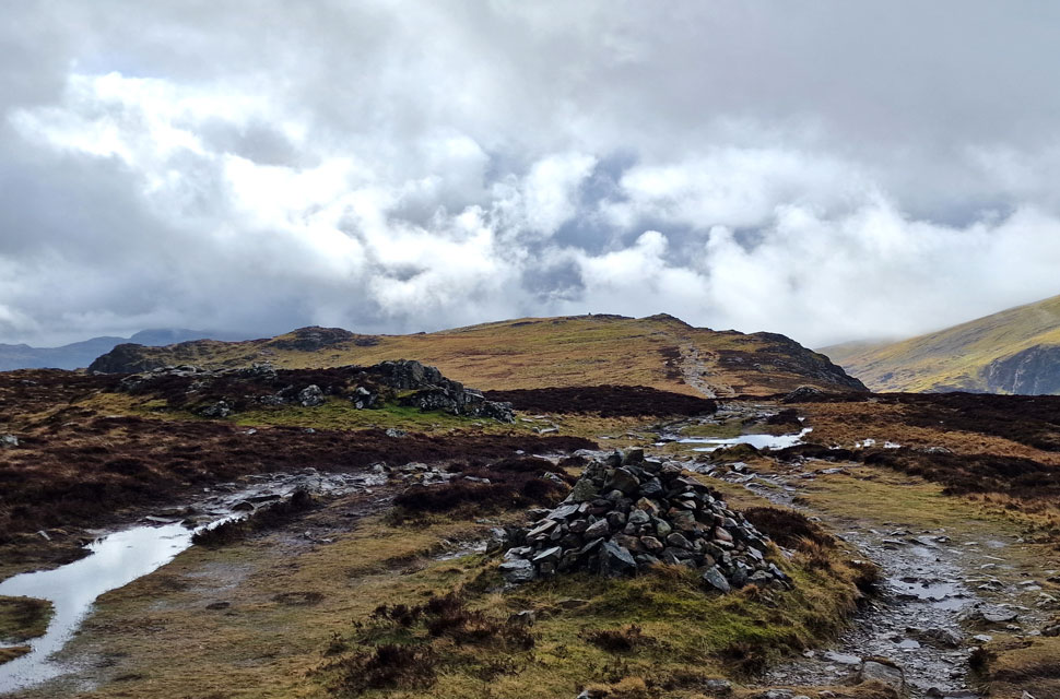
 |
| Descending towards Rigghead Quarry. |
| If we'd managed to keep our boots dry up until now, all that was about to change as we descended towards the fence. The ground became more and more saturated until the path we were following started to resemble a stream, which was the start of things to come. |
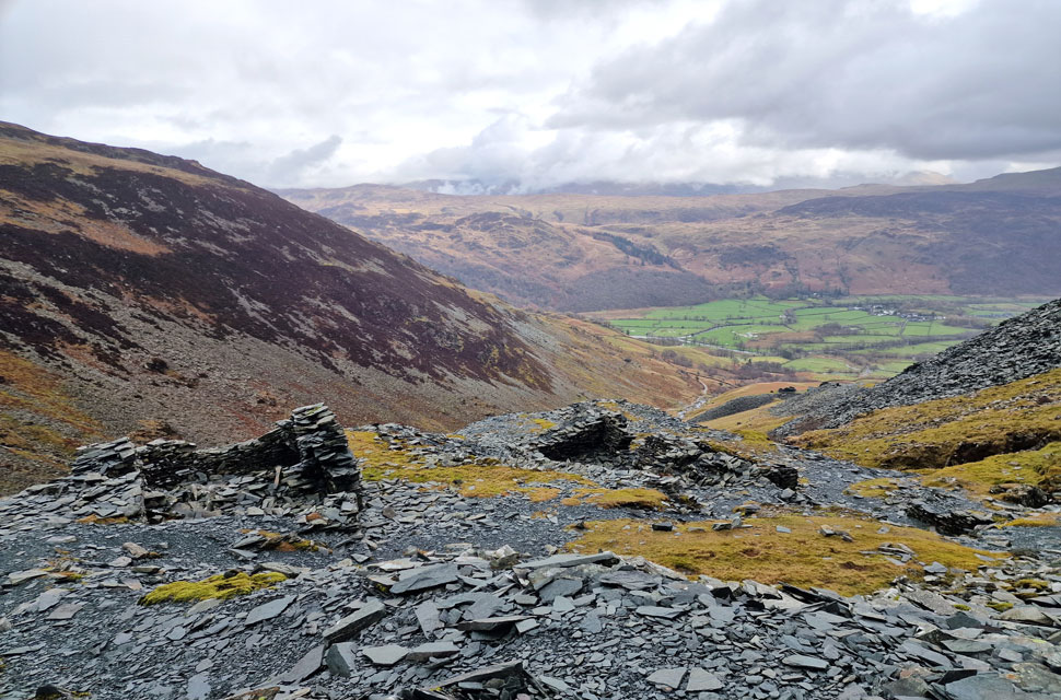 |
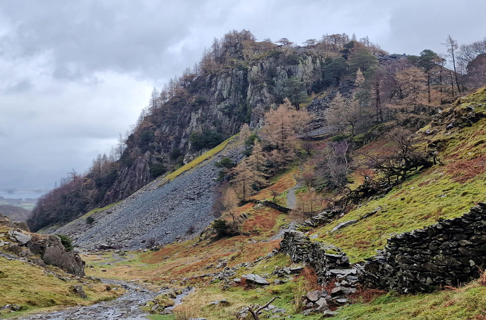
| Descending Rigghead Quarries. |
| We passed through the fence and immediately began the steep descent through the quarry workings and slag heaps. The quarry would have been a really interesting place to explore but it started to rain heavily and the only thing on our minds was to continue with the descent where extra care had to be taken due to the wet rock. |
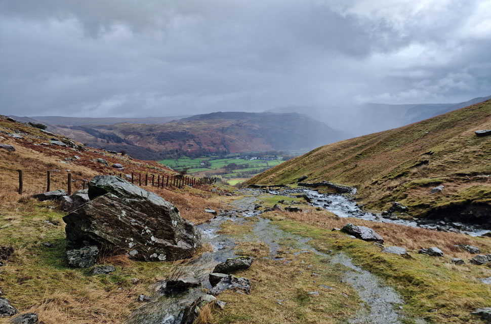 |
| Views towards Kings How and Grange Fell from Tongue Gill. |
Our descent was slowed by the constant rain, not helped by one particular section of descent over rock that slowed us down to a crawl, adding to this was the path, which for the most part, was flowing like a stream. Half the way down Tongue Gill, we came across three guys repairing the path, who we assumed were Fix the Fells. After trying to avoid the working area, we were asked to pass through it rather than "take the risk with the wet grass" We thanked him, but it just seemed like a very 'risk assessment' thing to ask us.
We continued our descent and crossed Tongue Gill via a series of heavily submerged stepping stones, which gave the boots a good swilling, not like they needed it mind. On firmer ground now, still swollen and flowing like a stream, we watched a shower pass through Borrowdale narrowly avoiding us, but I don't think we could have got any wetter if we'd tried. |
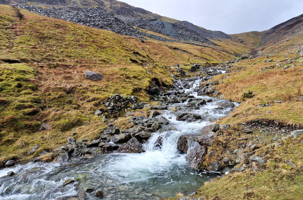 |
| Rigghead Quarries and Tongue Gill, Borrowdale. |
| |
 |
| The shower passing left some bright spells. |
| Where we took in the views over Borrowdale towards Kinds How, Grange Fell, Low White Stones, High White Stones, Greenup Edge, High Raise (below cloud) Eagle Crag and Stonethwaite. |
 |
| Looking South. |
| That's High Dote in the foreground with Thorneythwaite Fell, Rosthwaite Fell and Glaramara (below cloud) over on the right. |
 |
| Castle Crag comes into view. |
| Just as the sun made another brief appearance. |
 |
| Castle Crag. |
| It's not very often you can walk through here and not pass another soul but that's exactly what we did, the rain seemingly putting most folk off. |
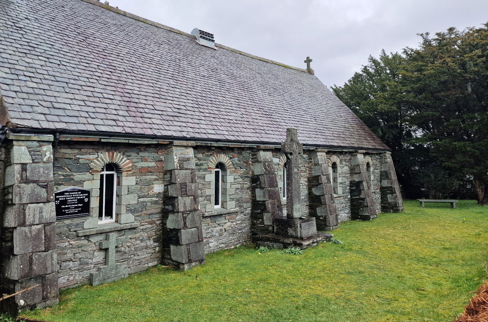 |
| Holy Trinity Church, Grange. |
| We left the steep cliffs of Castle Crag and descended towards the River Derwent in the rain before the rain cleared as we reached the hamlet of Grange. It was lunchtime now and bellies were starting to rumble, so we found this nice, quiet bench within the church yard and ate a peaceful lunch while folks on the other side of the stone wall went about their business. |
 |
| Passing through Manesty with views of Nitting Haws. |
| With lunch packed up we still had the best part of four miles to walk which we split between pleasant road walking and the Cat Bells terrace path. |
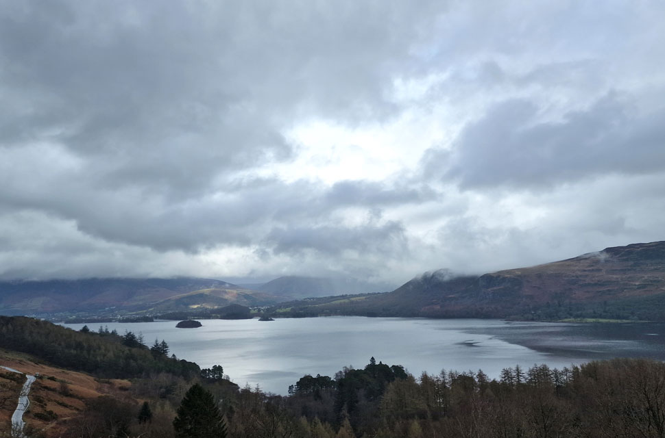 |
| Derwent Water from Catbells Terrace Path. |
| Note how the cloud has descend on Walla Crag on the opposite side of Derwent Water. |
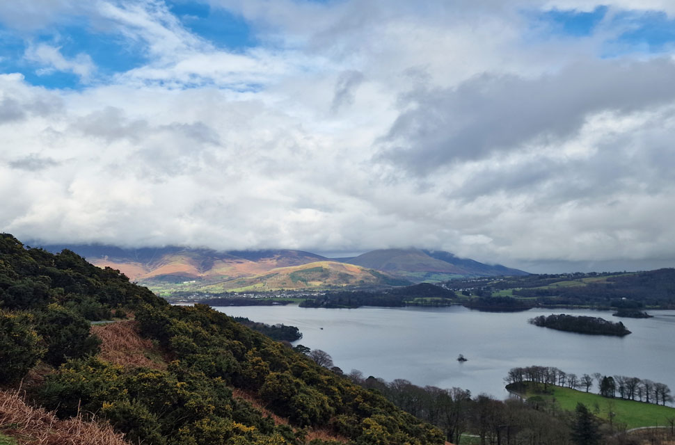 |
| Latrigg, Skiddaw and Blencathra from Catbells Terrace Path. |
Shortly after passing through Manesty we joined the terrace path, which required a two hundred foot steady slog right about the time my leg muscles were getting used to the smooth tarmac. We took in the ascent and only stopped when the terrace path levelled behind woodland. Hoards of people were ascending and descending Cat Bells now those in descent continuing towards the road below. The sun came out and it felt Spring like but we were too close to the cars to start shedding layers now.
We were soon to be overtaken by a young girl who we first sighted descending Nitting Haws her pink jacket was too distinctive to miss. Blimey this girl had some wind in her sails, was fully equiped, and knew the area like the back of her hand. I really admired that. We began the last descent back to Gutherscale and joined the narrow road linking it with Grange. There were people everywhere, some day trippers and others regular walkers just like us. We walked the final few yards back to the parking spaces, the tarmac underfoot, pot-holed and flowing with water "This road floods in drought," one of us joked, ahh tha not wrong theer we laughed. |
|
| |
| Back to top |
 |
|