|
The Silva Lakes Traverse by Tim Oxburgh |
 |
 |
Saturday 1st April 2023 |
 |
|
The coach juddered to a stop at a set of lights above Whitehaven, the Hensingham junction. I remembered having a job interview there some twenty years before, and how nervous I was on that day. Today I was nervous for a different reason, I had dozed on the coach from Shap but couldn’t get comfortable or warm. Yet again I checked that hadn’t lost my car key or phone during my light sleep, and having located those items I stretched against the stiff seat and let my eyes view the sleeping houses and quiet fields that passed by, taking us ever closer to St.Bees.
The SILVA NORTHERM TRAVERSE and the SILVA LAKES TRAVERSE events follow the long-established route that Alfred Wainwright’s Coast to Coast (C2C) route from St. Bees on the Irish Sea through to Robin Hoods Bay on the East coast. The former picks its way through and links the 3 National Parks - The Lakes District, The Yorkshire Dales, and finally The North Yorkshire Moors, before descending into the cool waters of the East coast at Robin Hoods Bay. The latter covers the first 100k and ends in Shap, and that way traverses the Lake District. Soon to be given National Trail status, generating amongst other things income and tourism, but also the comfort of the regular way marked acorn signposts that we all enjoy seeing when on these amazing trails.
The C2C is no small undertaking and people spend years completing it in bite sized chunks. It attracts people from all over the world. The word ‘great’ is overused but in New Zealand certain tracks are in a ‘Great Walk’ category. I have had the privilege of walking sections of some of NZ’s Great Walks, and I truly believe that The C2C should be held in high regard as one our nation’s premier walking routes, encompassing some of the best scenery in the country, ranging from coastlines beaches to mountain passes and empty moors, balancing unrestricted tourism with conservation. |
|
|
|
| |
|
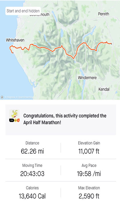
Overview |
|
|
| Elevation Gain: |
11,007 Feet - 3,354 Metres |
| Distance: |
62.26m |
| Moving Time: |
20 hours 43 minutes |
| Average Pace: |
19:58 /mi |
|
| |
|
Photo Gallery |
|
|
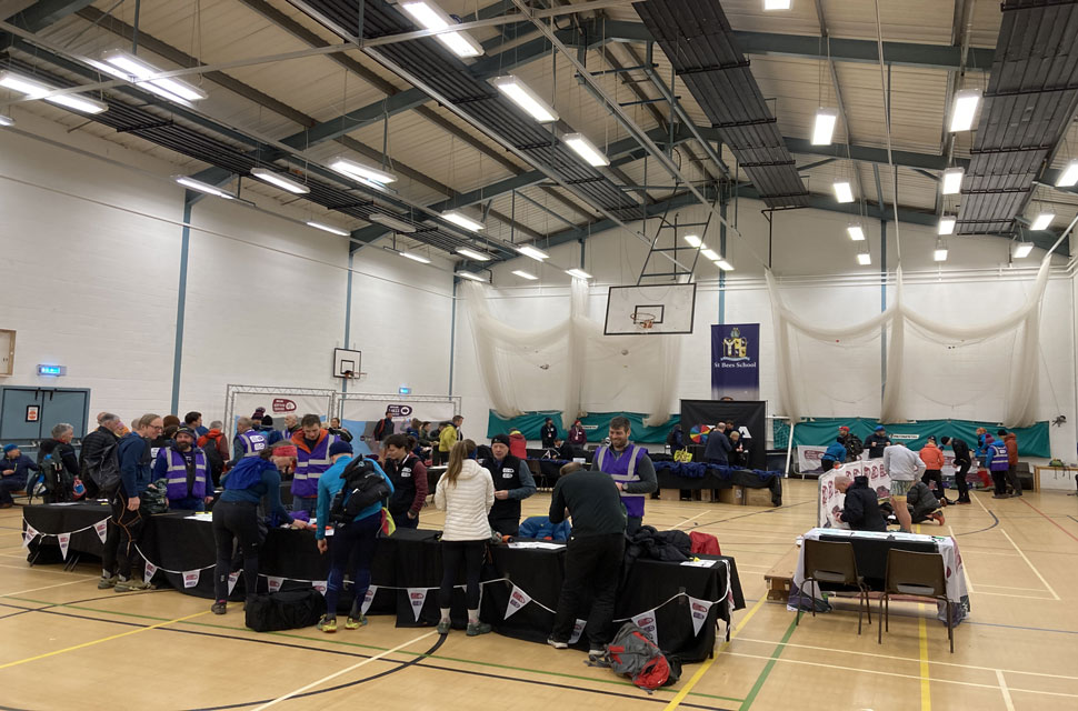 |
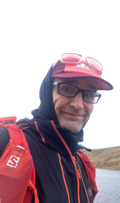
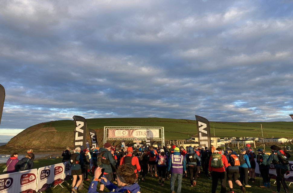
| Registration, St Bees School 7:53am |
I had broken a rib back in January, and at that point sincerely retired myself from running: enough was enough, nothing to run for, what was the point? Nothing to prove…what was I doing all this for anyway?? As the rib began to heal, I started walking again which obviously inevitably lead back to running. This coincided with the arrival of some trainers I had ordered in late 2022, which if truth be told I hoped wouldn’t arrive. It was around this time that I ran a Punk Panthers half marathon in a good time (for me). I entered the Lakes traverse on a whim, a 0200hr scroll that ended up with me tapping ‘confirm entry’ back in mid-Feb. I have mapped my year ahead out in runs and needed something for April, I needed a focus and a goal. The Lakes Traverse is something I have always coveted but previous editions saw me being deterred by the logistics of a point-to-point event.
This year the event saw a coach being provided that ferried the participants from Shap to St.Bees. Training hadn’t been great; limited time for long runs, and I was banking on my afterwork runs in the Clywdian Hills, regular jaunts along the Cleveland Way and the local hills and trails being enough. We would soon find out. I had tapered well. Pack was ready to go a good few days before and I even bought a new pair of sunglasses for the event. I was as ready as I was going to be. I had set my alarm for 0130 and another for 0145 and another for 0200 (in case I slept through the first two) as I was travelling from the Northeast Coast. I had packed The Old Lady (my tired, but faithful and much-loved Corsa) the night before. I went to bed early and didn’t sleep easy, but I rose with the second alarm. I was up and out in no time. Quiet roads led me across the Pennines and saw me drop into Shap before 4am. I was early for the bus by an hour. The kind marshal ushered the Old Lady and its occupant onto a field. The Old Lady’s headlights flickered their disapproving stare at the field we had to drive across. My car is not keen on anything other than the smoothest of tarmac, she certainly isn’t keen on wet long grass. We parked up and I patted the Old Lady’s steering wheel as way of thanking her for yet another journey completed safely. I impatiently rested in the car until 0450. I gathered the belongings I required and off I went. The coach was waiting for us. I sat at the front, and I thought first off, first through kit check. I ate my breakfast. The prompt 0500 departure was welcome.
Registration was in St.Bees school. I had a stammer as a kid – it’s largely gone, but when nervous I struggle to say my name. I find that as hard as any part of any event registration. Thankfully I wasn’t asked my name, just my event number – much easier to say. The kit check and the tracker being attached to my pack were over in a flash. I settled in a corner, ate some more breakfast, and drank my juice. One of my knees cracked as I stood up; I think they knew what kind of day was about to unfold. Participants were ushered out and to the cold St.Bees morning. |
 |
| Start Line, St Bees Head. |
| A ten-minute walk in a bracing cold wind certainly nipped at the fingers. Gloves were put on. As I often do, I wandered away from the throng at the excited start line and had a few minutes to myself… don’t go off too fast Tim, eat every hour Tim, drink regularly Tim. I redid my shoelaces. A flurry of good luck messages came through all of them appreciated. For me to get through today, I was going to have to draw on all my outdoor experiences. I wanted to make as much progress as I could in the light without being flogged by the time light was fading. I knew much of the route but had never pieced the paths I had been on before like this and certainly not at night. |
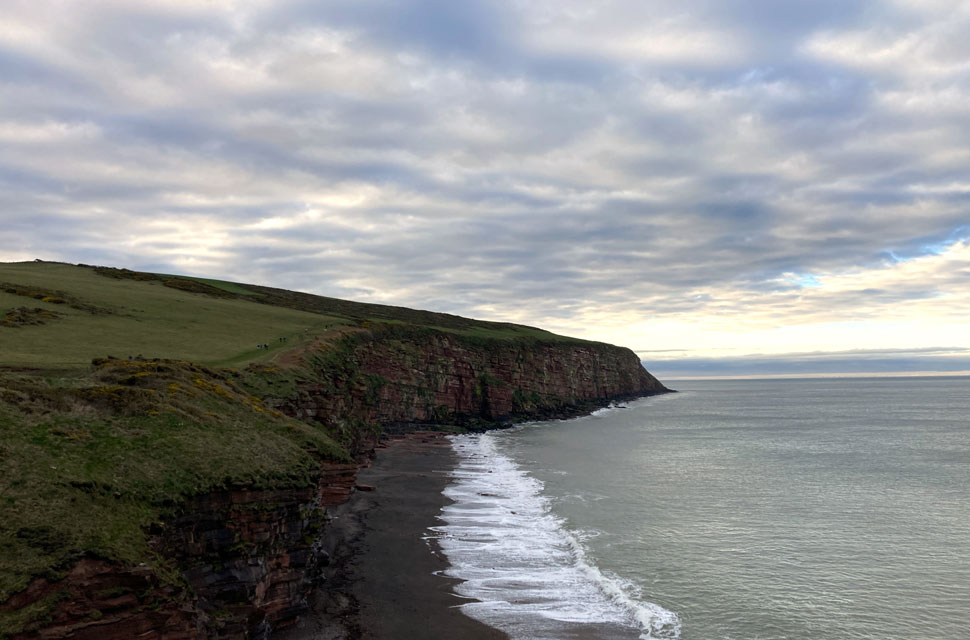 |
| Coastal Path. |
| |
 |
| Heading inland. |
At the 5 mile point, and the coastal section done, the path of the C2C turns inland. With the town of Whitehaven on my left we followed sections of farmland, with some roads crossings, boggy fields, cycle ways, and some cinder track - very much reminiscent of Punk Panthers events with the variation in the terrain. The Lake District fells were slowly getting bigger as we approached.
Skiddaw was as impressive as she always is. I always looked at a Skiddaw as a child and I remember hanging over my grandmother’s gate in Keswick and being in awe of Skiddaw, its always a good day when I see Skiddaw – her shapely and familiar rounded shoulders I find very pleasing and comforting. Today was no different. She has been and is a very real constant throughout my life linking golden childhood memories to the present day. |
 |
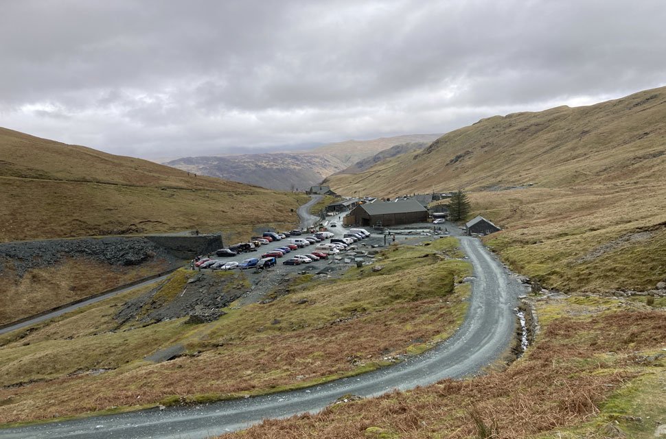
| Ennerdale Bridge. |
One of the challenges of the day was the significant distances between check points. The sun began to warm the land and I was either too hot or too cold. I had wanted to get to the first check point, which was about 30 miles into the event and marked the halfway point, in around 7.5hrs. With water flask content already being consumed I was conscious about not drinking for drinking sake. I had prehydrated for the previous few days and understood I had good levels within. The paths gave way to a lovely section of running that went round the bottom of Flat Fell, it was very reminiscent of the Shropshire Long Mynd with its friendly sheep and emerging fern and a tinkling beck on the valley floor.
The event was thinning its participants out along its length, and I found myself for the first time by myself in places. Checking the map and using some good old fashioned common sense got me to the village of Ennerdale Bridge. Whilst I don’t know this area of the Lakes as well as I ought, I knew the way down to the Ennerdale itself and I was excited to see the views. |
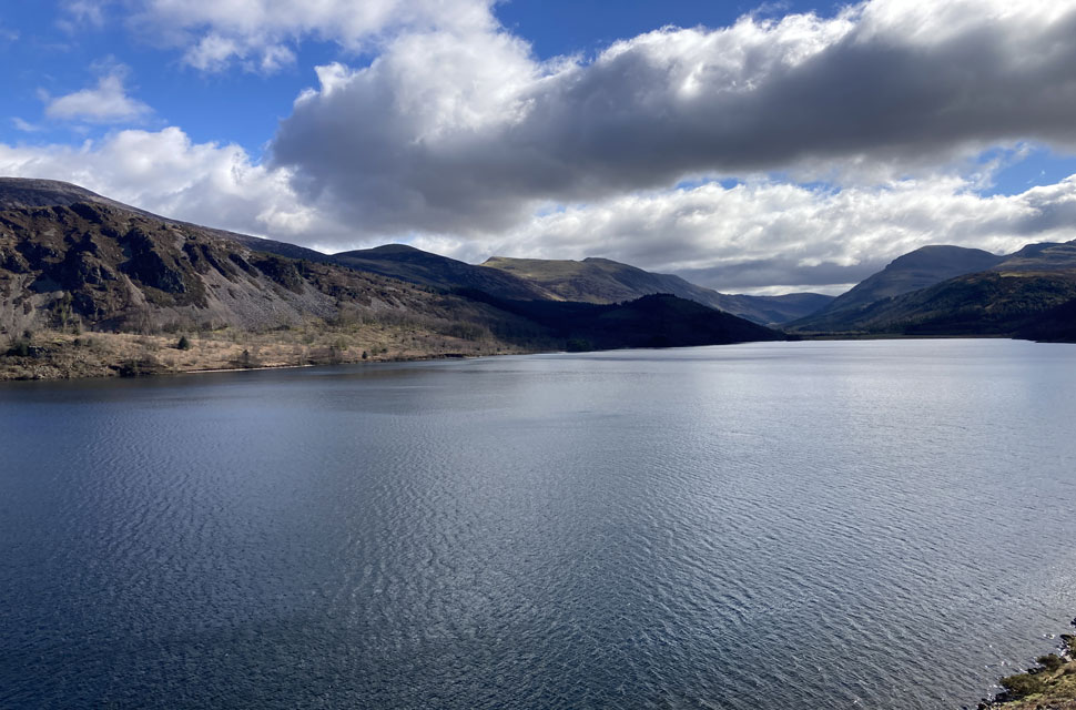 |
| Ennerdale Lake. |
The last time I was at Ennerdale was a few summers before, where my youngest son and daughter and I explored its banks, and what started as a paddle ended in a full swim - precious memories. No time for paddling today. The C2C route follows the path on the far side of the lake with its rocky path. I got over Fisher Crag without much bother and continued. I am never fast at the best of times, but on such uneven ground I was slowed to a steady march. I met many sanitized walkers and family parties, some of which asked questions about how far we were going.
I stopped halfway along the shoreline to re-adjust my pack. I remembered how when my eldest son was tiny, I carried him in a backpack on this same path. I texted him to let him know I was thinking of him. It didn’t send. At this point the first runners from the longer NORTHERN TRAVERSE event danced past me. I marvelled at how easily they moved over the challenging ground. They made it look very easy. It wasn’t. |
 |
| The Gables and Kirk Fell at the head of the Ennerdale Valley. |
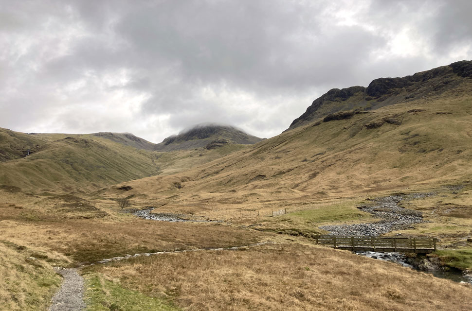
The sun was higher and was shining down from above fells that separate Ennerdale and Buttermere. Ennerdale twinkled and was bejewelled by the sparkling light. The rocky ground turned into softer pasture at the head of the Lake and we crossed the bridge that meant I had a long 3.5 miles of forest road to the Black Sail Hut. This was delicious, a lovely road, all of it runnable.
I trotted along and passed under the Pillar massif to my right, eyes fixed on the fabled Pillar Rock. I know this land, knowing that Red Pike, High Stile and High Crag were over my left shoulder. I made out what I thought to be the line of Pillar’s Shamrock Traverse and promised myself I will return there soon. 12 summers have been and gone since I last trod that wonderful path. Great Gable beckoned me forward and soon enough I was at Black Sail. |
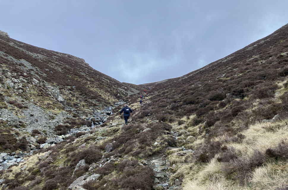 |
| Ascent on Loft Beck. |
This was the first of 4 significant ascents. It was a steep and unrelenting wind up the path that follows Loft Beck. Rocky steps interjected crumbled path. My fell walking experiences have always been the bedrock of my outdoor adventures; my ability to pick a route and hop from rock to rock was schooled over many years on these and many surrounding fells, and once again I called upon that experience as I moved steadily up the stiff incline. At the top, when we were on the grassy skirts of Brandreth, I came across a dejected bunch of DoE school children. They had enormous packs and they were sat in silence, I guessed their adventure was wearing thin. The path was still rocky and far from straight forward. Every step had to be considered but I moved quicker here. The Honnnister tramway was calling me. |
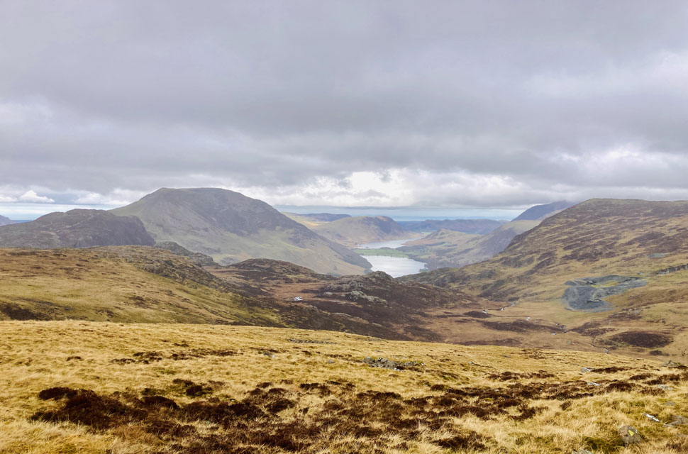 |
| Views into the Buttermere valley. |
I stopped for a second to take in the grand views of Buttermere and beyond. I was on Fleetwith Pike a few weeks ago and it was lovely to see her again so soon. Haystacks was to my half left and the significance of being on Wainwright’s C2C route within touching distance of Haystacks, his favourite fell, was not lost on me. |
 |
| Descending to Honnister. |
| Haystack’s prominence from this vantage point left me in no doubt that Wainwright would have worked his route to include this wonderful Fell in some way. Down I went to Honnister, through the car park with its collection of day trippers, passing more walkers coming up the same path I was descending. I was gathering speed and momentum as I headed into Borrowdale, and the welcoming warmth of Rosthwaite. It was here I had my first slip, a steep wet slope and I found myself on my arse. I got up and carried on soaked to the skin, and I was glad that I would have some warmth soon. |
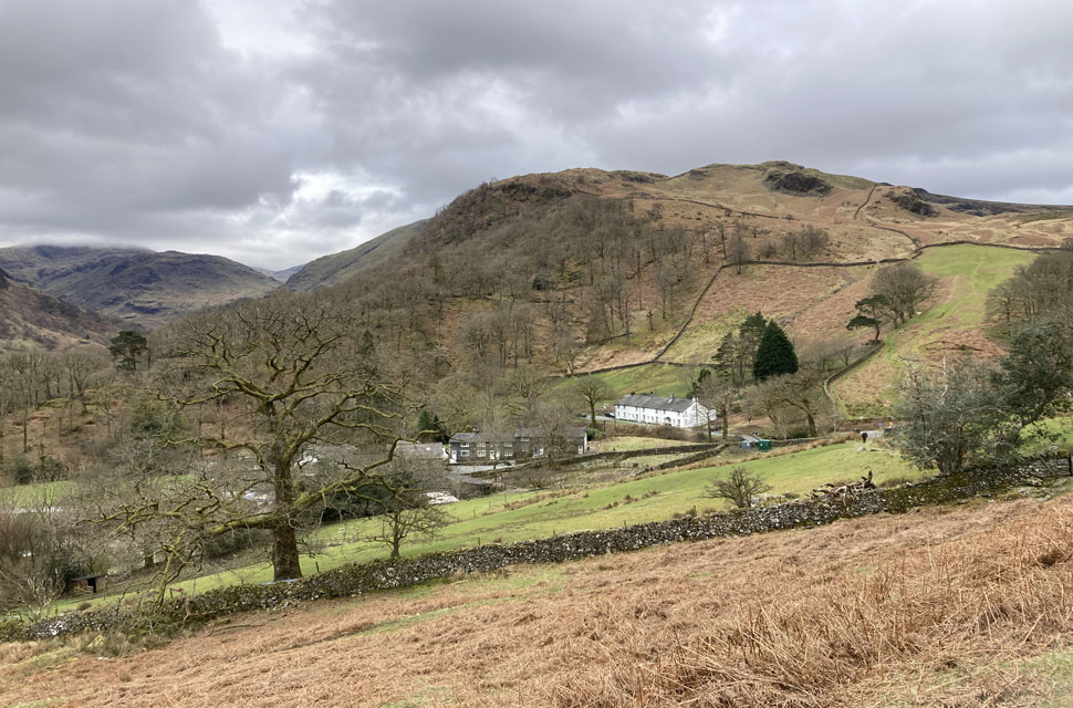 |
| Bearing down on Seatoller. |
| It was at Rosthwaite that I met my support crew, Cath. Her day had been given up supporting my adventure and I was so pleased to see her. Much needed smiles and hugs were exchanged. The Check point was well stocked, and I had a mixed and varied mix all shovelled in with my special spork. A wet layer of clothing was deposited into the boot of Cath’s car (Dora!) and off I went. Fuelled up and ready for the next leg and the steep 2nd significant assent, and ‘only’ 15 miles to the next check point. I needed this need to get going. Every minute I wasn’t moving would mean longer in the dark later. Stonethwaite Beck was noisy, and I spied many a swim spot for the future sorties, but today I had the challenge of Greenup Edge. This was not an easy ascent. I tired quickly and stopped and rested on my feet at several points. It seemed unyielding; a tricky scramble on wet rock led to the summit and Eagle Crag watched on looking foreboding, she was passively goading me. At the top, slabs of smooth rock have been laid since I was last there, and they provided much comfort for my feet as I had a spirt of speed along them. Mist came and went, and before I knew it I was heading under Calf Crag. The path was far from easy to negotiate, but at least it was all down. Softer grass and then road as I turned towards the virtual Grasmere check point. I could feel my legs now the fatigue was taking it’s toll. Knees, hips and ankles were all in good shape. |
 |
| Greenburn and Steel Fell seen before descending into Far Easedale. |
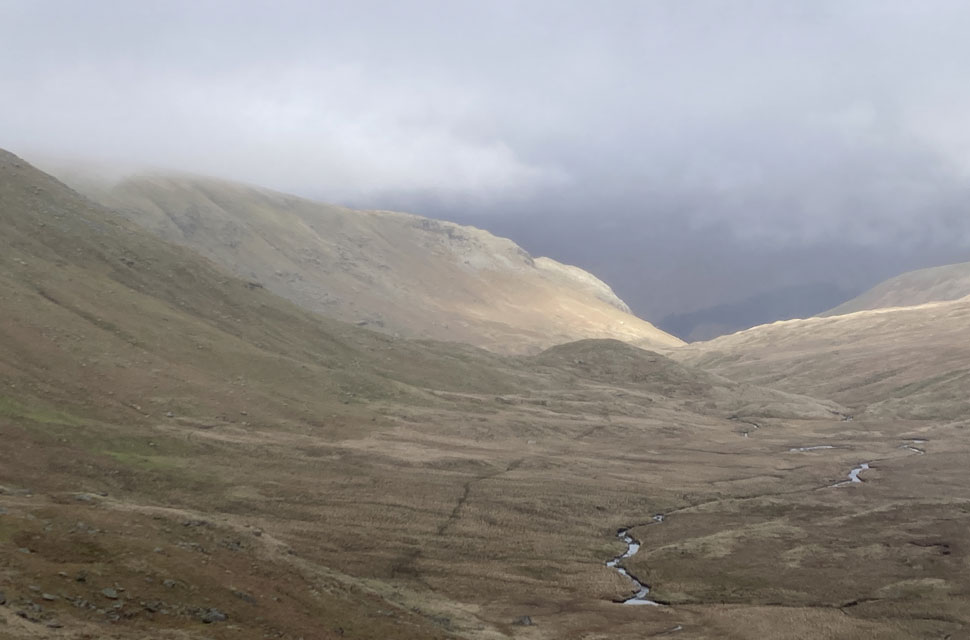
Crossing the A591 lead immediately to the start of the 3rd climb of the day, a steady incline to Grisedale Tarn via Tongue Gill, a largely pleasant path hidden between Seat Sandal and Great Rigg. Seat Sandal is one of my least favourite fells, I have never had a good experience with it and whichever way you ascend it it hurts and is unwelcoming. I last found my way up Seat Sandal on my Bob Graham 3-day walking expedition in 2012. Back then it comes off a tricky decent from Fairfield, and on shaky legs I scraped my way up. We didn’t enjoy each other’s company on that day. Today, although shrouded in mist I scuttled past as quickly as could, avoiding Seat Sandel’s uncompromising and disapproving glare. |
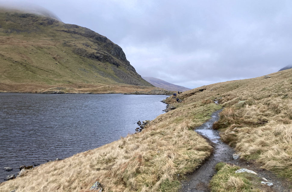 |
| Grisedale Tarn. |
| The light was beginning to fade, as were my legs. I paused at this point sheltering behind a large boulder thrown down by Seat Sandal in the decades before… I got my poles out and as they snapped taught. I ate, I drank, and I eyed Gavel Crag and the battle ahead to gain its top. Grisedale Tarn was distracted by the buffeting winds as I picked my way past, the wind and the darkness both encroaching. With fading light, I carried on Spout Crag towards Ruthwaite Lodge with St. Sundays Crag intimidating crags looking large overhead. I remembered as a younger man battling to cling onto Pinnacle Ridge - I will never go there again; the impunity of youth meant that I didn’t think twice about needing a rope or a helmet – my father rightly chastised me for attempting, let alone completing that route alone without any safety equipment; I still miss his voice. I shuffled forward. Brief conversations with various people along the way all of us keen to get off the fells and into the warmth of the check point. Despite being in such an open place the clag covered fells flanks on either side made for an oppressive atmosphere. Headtorch was found, and although I didn’t put it on I was pleased that it was in place and ready to go. The wooded tarmac path was welcome relief, and its smart new metal railings glinted back at me in torchlight. My hot feet were ready for Patterdale which was only a few minutes away. 75k down, just the final 25 to go. |
 |
| Gate, Satura Crag 10:30pm |
A friendly marshal was talking to Cath. Again, hugs and smiles were exchanged. I was shown to the Marshall tent. I was cold, very cold. I was shivering and spiralling into self-doubt. I was presented with chips and lasagne. I filled water bottles. I was shaking more, and I felt rough. I forced the food in, put my thick jacket on, buff on, and painkillers ingested, and I swapped wet gloves for dry. I pocketed a sachet of peanuts, downed and had some more flapjack and sweets. All washed down with some flat coke, and still visibly shivering, I headed to the car park for one final hug. Supportive words countered the tired legs, and I hoped I would warm soon and stop shivering. I told myself, give it 15mins Tim and press on, and thankfully I did. This was the final climb of the event, and with that knowledge the fuel I took on in Patterdale kicked in and I was beyond the White Lion pub and over Goldrill Bridge quickly, I thought of my friend Paul Sharkey as I ascended the steady path heading up to Angletarn Pikes. This is the same path that he and I ascended on his first completion of all 214 Wainwrights.
It was fully dark now - people passed me and I used my poles to pull myself up. Eventually the path flattened out and lead to Angle Tarn, not that I could see it visibility with the mist and gloom no more than 5m. The map suggested I was right next to the water’s edge; I saw no water, however I knew there was some water out there somewhere as the event had obviously unsettled some geese and they let their feelings on the matter be known. Satura Crag was somewhere nearby but I couldn’t see anything. It took some doing getting up to The Knott Summit. It’s hard to describe just how bleak those moments were, I wasn’t uncomfortable or frightened on there, but I am so glad for my outdoor experiences, drawing from that well of knowledge and that ability to navigate and work with and through the terrain made everything more palatable. As you may know the path follows an ancient wall line, but it is slow going and boggy and far from a straight. I finally joined another few participants and we worked together to get to the summit of The Knott. I was reassured by being in their company. We collected another participant on the fell who for reasons had no way of navigating. We put him firmly in the middle of the pack and headed endlessly upwards.
It was cold up there and we wasted no time sunbathing on the summit. Straight off and round to Kidsty Pike by 2330hrs. A lady with me marched to what I knew was a treacherous drop off the flank of Kidsty - I’ve been up this fell numerous times I know which way to avoid. I called her back and we all made our way down, this unlikely band. The path down starts off relatively and is set back from the northern face of Kidsty and was quite easy to begin with, but I had forgotten the perils of Kidsty Howes. Scramble after scramble down wet foot-worn rock. Quickly tiring, the truth of the matter was that we hadn’t half the distance to the final check point yet, a grim realisation. I lost track of time. My hope for a midnight finish had long gone and it was simply now a case of crawling to the end. The smooth slopes off the path were sloppy, and I hopped from tuft to tuft and finally saw headtorches ahead of me moving along the Haweswater lakeside path. Just the one slip there, I fell on my side. No damage sustained. I know this lakeside path, I have completed the Lakeland50 event on several occasions and it passes this way on the route to Mardale and its normally warmer and certainly lighter, however its always rough, undulating, with rocky outcrops and an unpleasant camber. This time the I was heading the other way, with the quite frankly enormous Haweswater on the right, it went on for an eternity. I will never underestimate the length of that lake again.
The Haweswater Hotel had its lights on and I wondered if any of the residents were watching the dots of light moving on the other side of the lake. I was beyond tired now; I was using energy that I just didn’t have. I was not picking up my feet, I was sploshing through streams and pools of water, I just didn’t care now…One foot in front of the other, my hands were getting weary from the poles. The lake just seemed to go forever, but eventually it gave way to a smoother path and the hamlet of Burnbanks, through a wood with its muddy trails. I was hurting now, well on the way for 20hrs on the move and I had been awake for well over 24hrs. There was one last sting in the tail. In my mind these few miles back to Shap were going to be on road, but how wrong I was. There was some road and then back to the waterlogged fields. Navigating was hard; one field looked like another, stiles and gates were hard to find, there was no clear route. A steep bank down to a sheep trail path seemed enormous. I passed a younger man than myself and he muttered to me that he had a gut full. I couldn’t disagree. Some more sploshing around fields, the lateral movement really hurt my hips now. I eventually passed the silhouetted Abbey ruins, I had been fossil hunting there as a boy, never since, and tonight I was not stopping for a reminisce. The Abbey path led back to tarmac and round a bend and then just a trudge to the Village Hall and the end of my journey. It was 0400 by the time I got there, the village was in darkness, and I followed the white lines in the middle of the road. The village Hall itself seemed to take forever to arrive, but it did arrive, finally. I was met by a huge smile and congratulatory hug from Cath. I couldn’t be happier to have finished an event. I couldn’t have been happier to see a familiar face, and their energy was infectious. A medal was placed round my neck, and I ate some delicious minty chocolate cake. |
A few days have passed now and my legs are recovering. I am already thinking about my next event in May, my 50th Ultra marathon. I am very proud of what I achieved. I am in awe of what the people on the longer event have achieved. They are incredible. I need to thank everyone who texted and sent me messages throughout the day.
Thank you to my 4 children; the glow that I got for making them proud of me is something that will sustain me without end. Everyone who followed my dot, I thank you. I especially need to thank Cath for her unwavering support on the day and night. I am truly grateful. There is so much to reflect on and take away. I entered this event for many reasons, one of which was to see if I was capable of the longer event next year. I got my answer. |
|
| |
| Back to top |
 |
|