 |
High Carneddau - Pen yr Ole Wen, Carnedd Dafydd & Carnedd Llywelyn |
 |
 |
6th June 2023 |
 |
|
I'm about half way through climbing the Welsh 3,000 footers claiming seven of the sixteen summits, or fifteen if Crib Goch isn't included. I won't be travesering Crib Goch or at least I don't have any plans to do so. This airy arete falls on the wrong side of my comfort zone, or at least I think it does.
I'm in no rush to complete this personal goal, and many times I have returned to the Glyderau to walk similar routes purely out of fondess. One particular area that I hadn't climbed was the Carneddau range, which includes seven 3,000 footers three of which will be collected in today's walk, Pen yr Ole Wen, Carnedd Dafyyd, and Carnedd Llywelyn. I could have included a fourth with Yr Elen which forms the north-west shoulder of Carnedd Llywelyn but Yr Elen was a mountain too far today.
As always, when visiting a new area, I try to research it as much as I can. As it turns out, there are a few walk reports out there, but they are not as detailed as I'd like them to be, which I hope to change with this report. There are two areas of slight concern along the route that involve a scramble up Pen yr Ole Wen's west ridge, with the second being a scramble down Craig yr Ysfa, a crag made up of steep ledges and rock grooves located on the eastern spur of Carnedd Llywelyn. Conditions had to be perfect. |
|
| Ordnance Survey OL17 |
 |
| Snowdon |
The High Carneddau
The High Carneddau includes the largest contiguous areas of high ground (over 2,500 feet (762 m) or 3,000 feet (914 m) in Wales and England. |
|
|
|
| |
|
Overview |
|
|
| Ascent: |
3,285 Feet - 1,001 Metres |
| Summits Over 3,000ft: |
3, Pen yr Ole Wen - Carnedd Dafydd - Carnedd Llywelyn |
| Visiting: |
Carnedd Fach |
| Weather: |
Above the Clouds At Height, Otherwise Bright Sunshine. Feeling Cool In The Summit Breeze. Highs of 22°C Lows of 10°C |
| Parking: |
A5, Lay-by Llyn Ogwen |
| Area: |
Carneddau Range, Snowdonia National Park |
| Miles: |
9.5 |
| Walking With: |
On My Own |
| Ordnance Survey: |
OL17 |
| Time Taken: |
6 Hours |
| Route: |
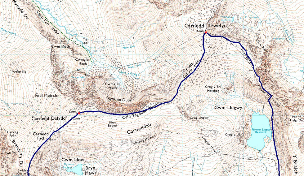
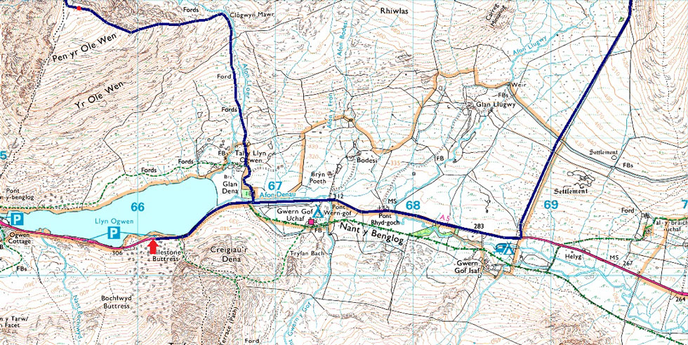
Llyn Ogwen - Afon Lloer - Pen yr Ole Wen East Ridge - Pen yr Ole Wen - Carnedd Fach - Carnedd Dafydd - Cefn Ysgolion Duon - Bwlch Cyfryw-drum - Carnedd Llywelyn - Penywaun-wen - Craig yr Ysfa - Bwlch Eryl Farchog - Ffynnon Llugwy Reservoir - Reservoir Road - Llyn Ogwen |
|
| |
|
Parking Details and Map |
|
|
| Nearest Post Code: |
LL57 3LZ |
| Grid Reference: |
SH 661 602 |
|
| |
|
Map and Photo Gallery |
|
|
  |
| |
| |
 |
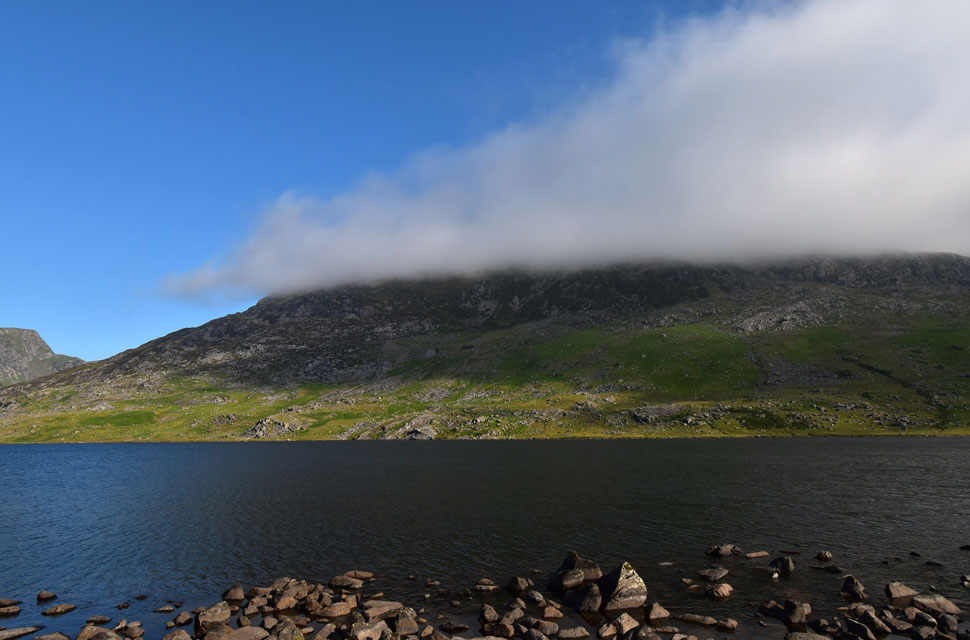
| Foal-goch, Mynydd Perfedd and Pen yr Ole Wen South West ridge from Llyn Ogwen 12°C 7:45am |
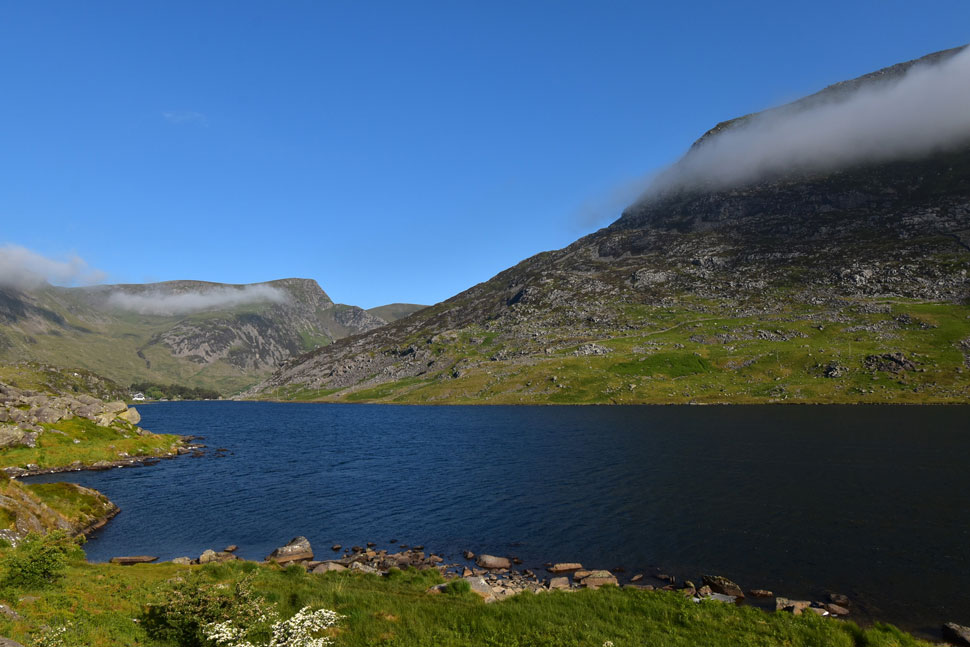
It goes without saying that parking can be a nightmare in the Llanberis and Ogwen valleys during peak seasons, when even locals struggle to park before 7:30am in the morning. Local HIghways Departments have clamped down, issuing parking fines and even towing vehicles away that are found to be illegaly parked. I didn't have any issues parking this morning at one of two F.O.C lay-bys located on the A5 on the shores of Llyn Ogwen from where I took this photo. I had packed for a hot weather day conditioning my body over the last 24 hours with litres of water topped up this morning with a couple bottles of Lucozade Sport.
The sun was out when I arrived and already climbing into a cloudless sky but that didn't stop the shock the moment I opened the car door, encountering a chilled breeze as it blew down the valley. I thought the sunshine would take the edge off as I laced up in shorts and a technical T but no, moments later I returned to my boot to slip my Alpkit windproof on. I'm parked at the foot of Tryfan and walkers are taking to its crags and ridges already, two of whom I watch as I kit up; blimey, they were covering some ground. |
 |
| Pen yr Ole Wen from the shores of Llyn Ogwen. |
| With the car locked, I was almost ready to leave when it dawned on me that a low band of cloud was lying exactly over Pen yr Ole Wen's east ridge (right) which is where the scramble was located. I like to cover all angles, especially when I'm walking a new area on my own. This is when I start to overthink things, which can only be a good thing as it means I'm conscious of what lies ahead. |
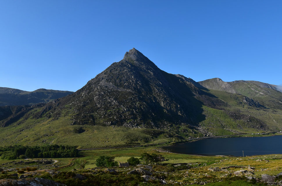 |
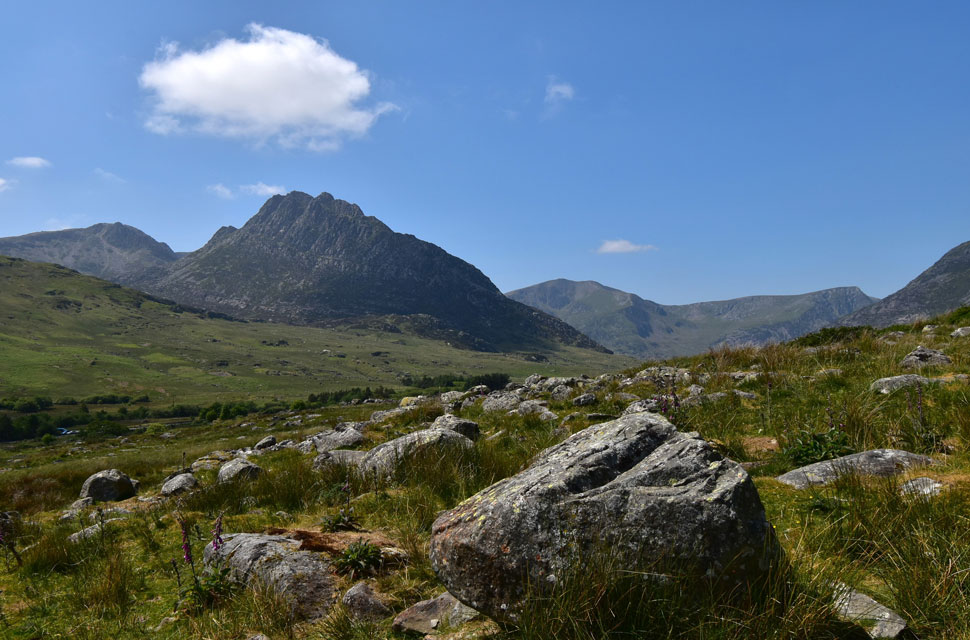
| Looking back on Llyn Ogwen, Tryfan, Bristly Ridge and Glyder Fach. |
| I left the car park and walked along the A5 towards the coppice of trees, where I turned left onto the track. As the track veered right, I passed over a wooden sty and picked up a defined footpath, which ascends alongside the course of Afon Lloer (River Lloer) |
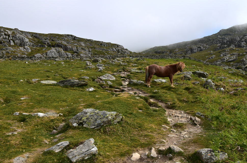 |
| Ascending towards the stone wall/col. |
| I was accompanied by the sound of Afon Lloer which would eventually flow into Llyn Ogwen below. The path was steady, and the further I climbed, the steeper it got, encountering two wild fell ponies as I neared the stone wall. |
 |
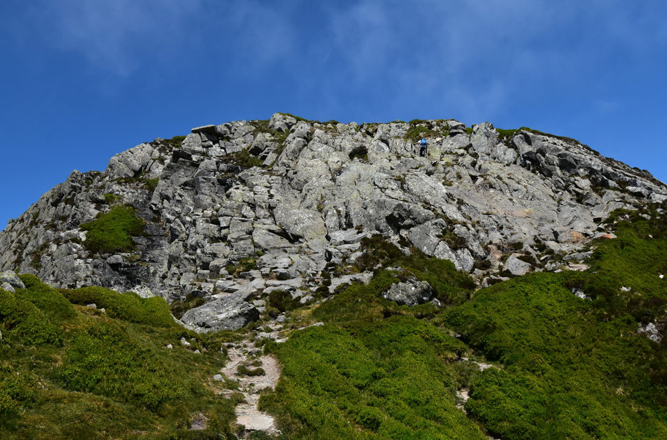
| The scramble section Pen yr Ole Wen. |
| I arrived at the col and seemingly had ascended into the bank of cloud, which was thankfully beginning to break up with blue skies appearing beyond, which was great news. |
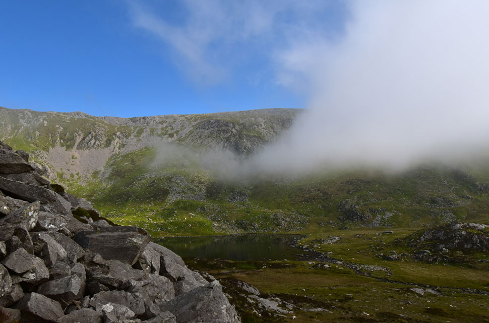 |
| Ffynnon Loer appears as I near the base of the scramble. |
| The great news was what cloud there was I was climbing out if it, the better news was the cloud seemed to part of an approaching inversion from the east. Incidently Ffynnon Loer translated is Welsh for Source of the Moon. |
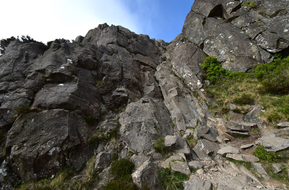 |
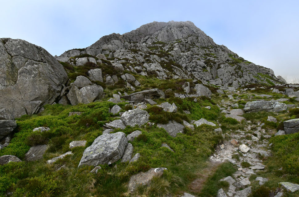
| Scramble section, Pen yr Ole Wen. |
| A stone footpath led to the base of the scramble, which, after getting my breath back, I studied at length. Here I look at the lower section of the scramble, which veers right (out of sight) further up. Once ready, I took on the scramble, finding good hand and foot holes a plenty. If I were to compare it to somewhere in the Lakes it would be the scramble below Glaramara summit, enjoyable and not too technical at all. |
 |
| The summit of Pen yr Ole Wen and Carnedd Fach (right) come into view. |
| With the scramble behind me I climbed out of the cloud and feasted at the blue skies above, the incredible thing was all the action was behind me. |
 |
| The view over Ffynnon Lloer towards Carnedd Dafyyd. |
| Blue skies were being replaced by the advancing inversion with only the highest peaks would be escaping the cloud. |
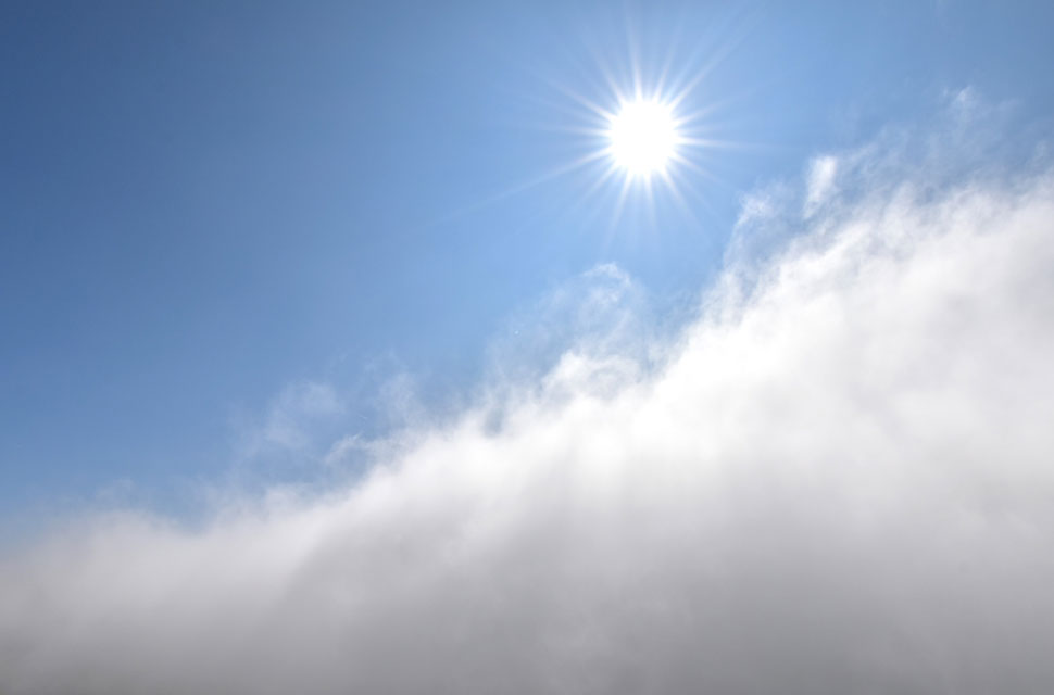 |
| Inversion inbound. |
| As part of my research I had triple checked all forecast even those I don't often trust. There was no temperature inversion forecast for this area which would have caught a lot of folk by surprise. |
 |
| Pen yr Ole Wen summit appears. |
| I continued to climb away and [above] the inversion, which was still sneaking up on my rear. As great as inversions are, it dawned on me that I could potentially lose visibility, but if the weather gods are on my side, I'll stay above it. |
 |
| Pen yr Ole Wen. |
| At 3,208 feet (978 metres) Pen yr Ole Wen is exactly the same height as Scafell Pike and is Wales seventh highest mountain. |
 |
| Tryfan and Glyder Fach from Pen yr Ole Wen. |
| At 2,726 feet (830 metres) Tryfan is about to succumb to the inversion. |
 |
| Beyond Ffynnon Lloer I take in the view towards Carnedd Dafyyd and Carnedd Llewelyn. |
| With more height gained I can now see the extent of the inversion which stretches as far east as the eye can see. |
 |
| Looking down Pen yr Ole Wen East ridge. |
| The ridge eased as I ascended the final push as the path zigzagged towards the summit, which was where two fell runners appeared from nowhere. They were too far to my left to hear me, and friendly waves were exchanged instead. |
 |
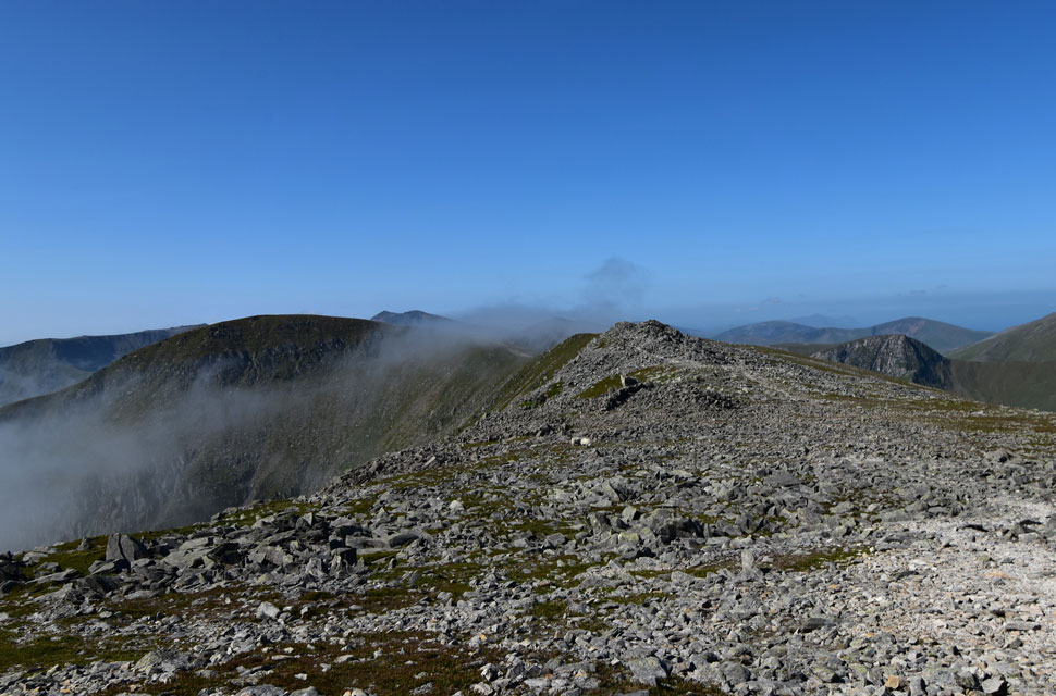
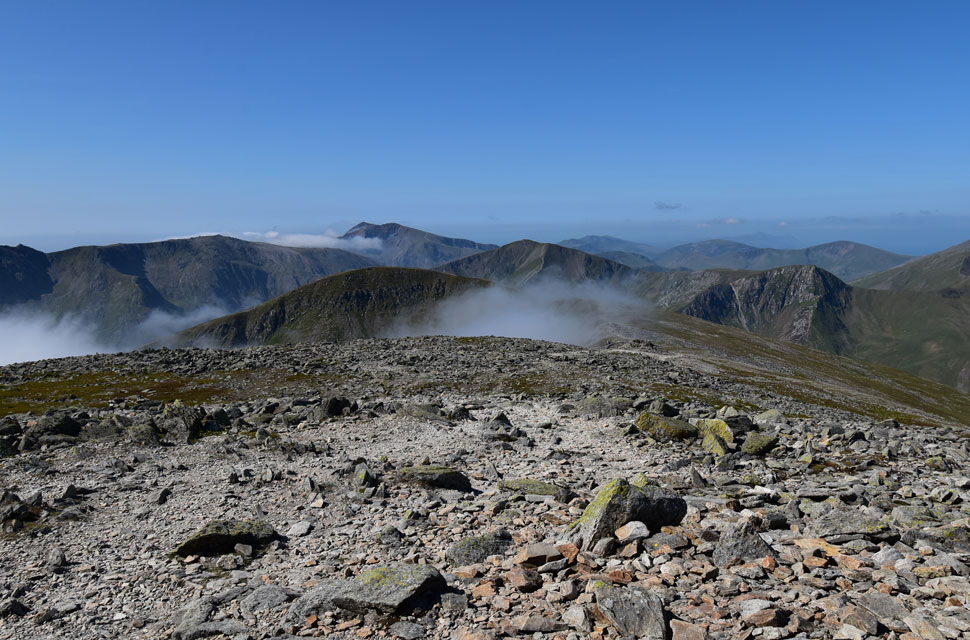
| Carnedd Dafyyd and Carnedd Llewelyn from Pen yr Ole Wen summit. |
| There was a pile of stones to mark the summit and a few sheep who scattered as I approached. If this view of the inversion was anything to go by I should be high enough to keep above it. |
 |
| Foal-goch, Elidir Fawr, Mynydd Perfedd and Carnedd y Filiast from Pen yr Ole Wen summit. |
| Here looking to favoured ground and an area of the Glyderau where I often gaze over the summits of the Carneddau. |
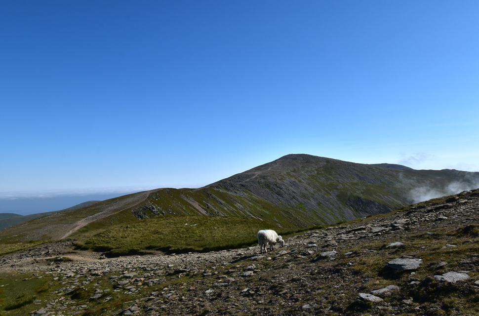 |
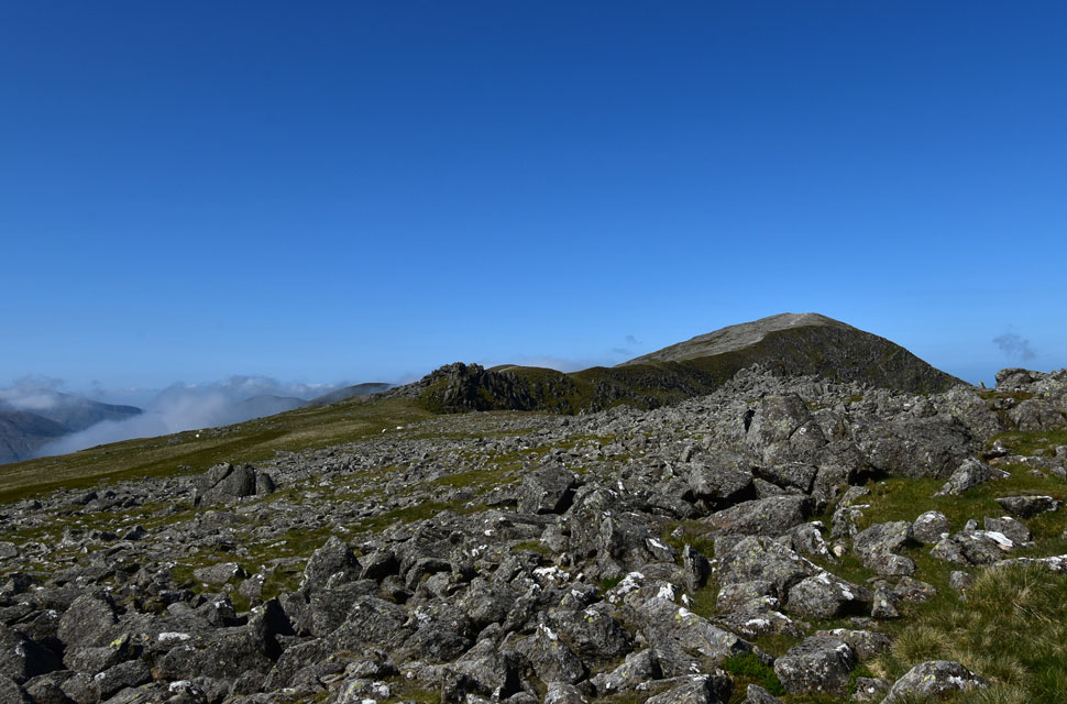
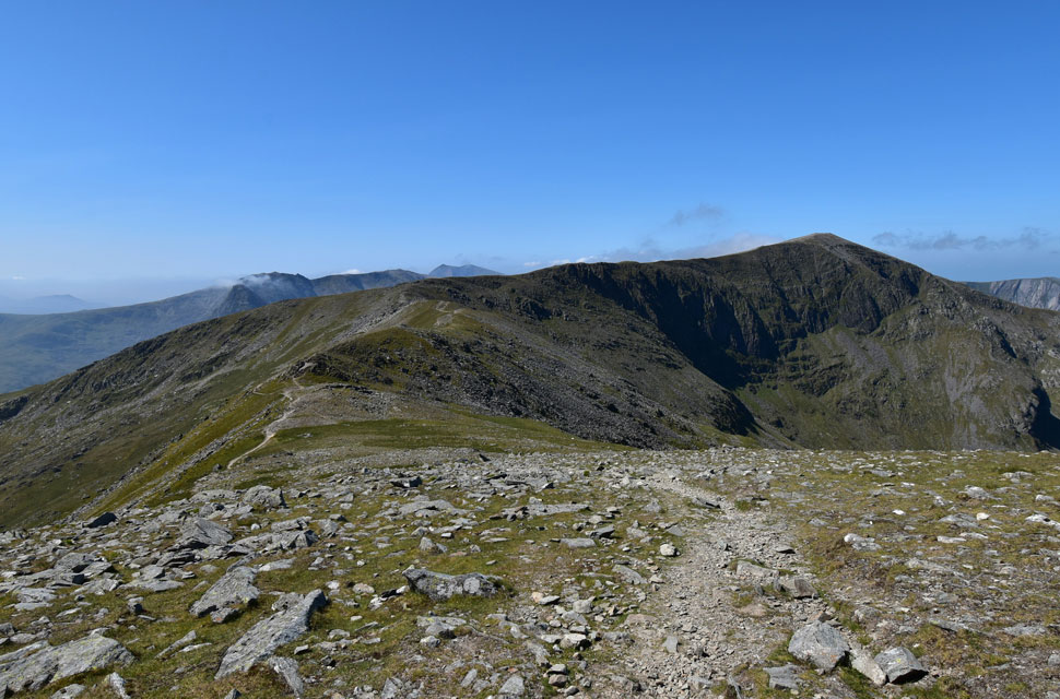
| Carnedd Dafyyd from Pen yr Ole Wen. |
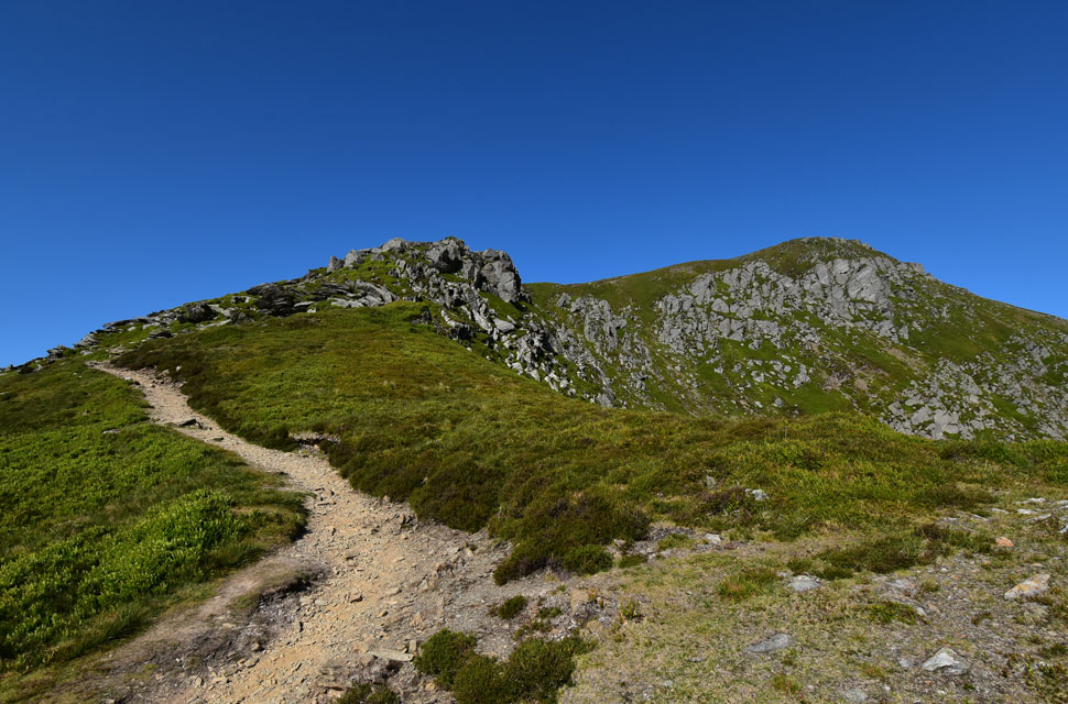
| You might be able to see the mountain of shattered rock along the ridge which forms Carnedd Fach which is where I'm heading next. |
 |
| Looking down Pen yr Ole Wen East ridge. |
| With Ffynnon Lloer below. |
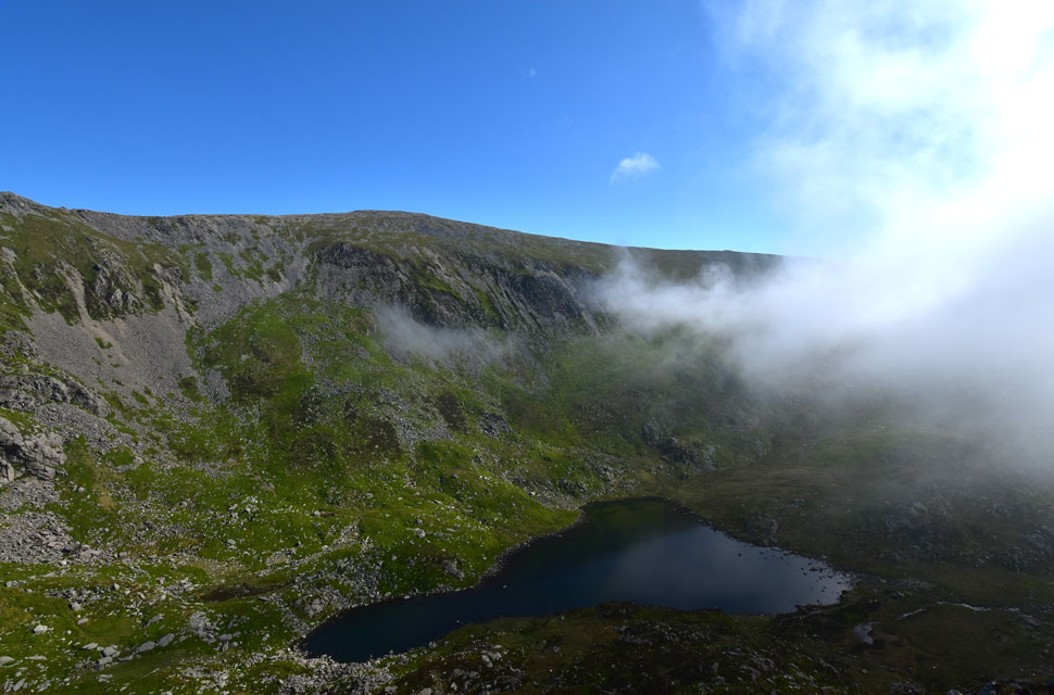
 |
| The extent of the cloud inversion. |
| I feel incredibly lucky to be on the fringes of the inversion with the bluest of skies over head. |
 |
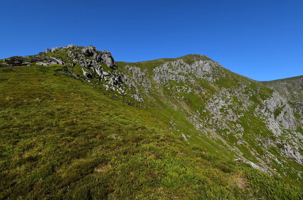
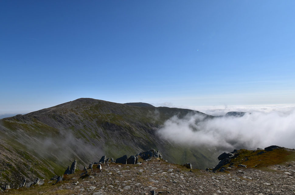
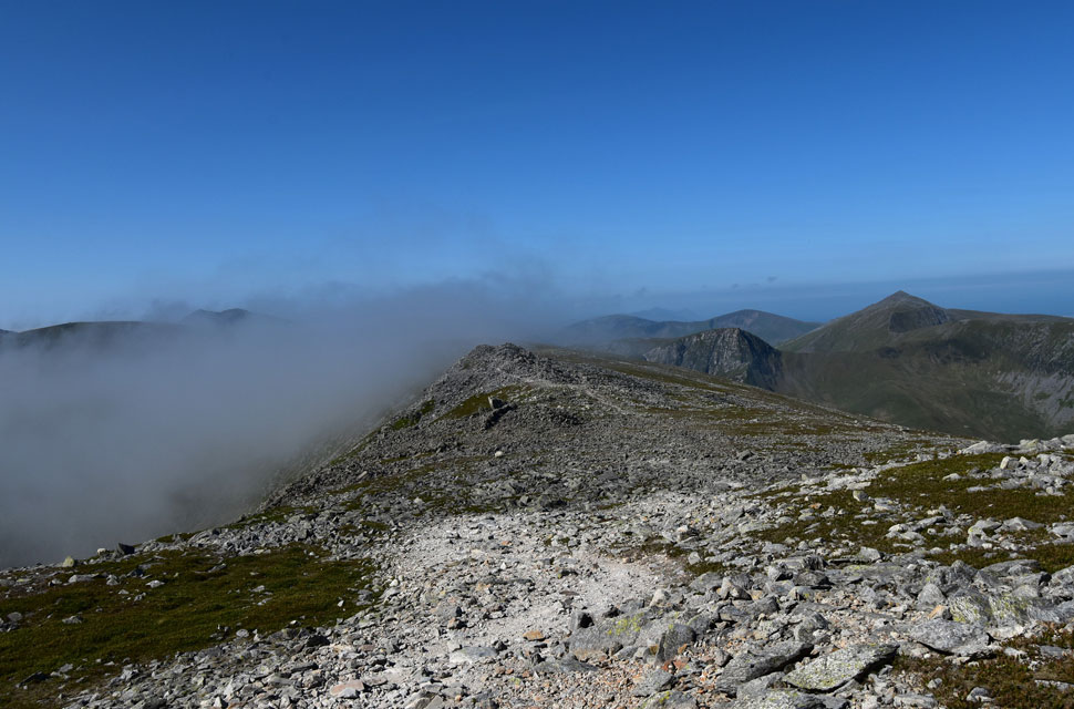
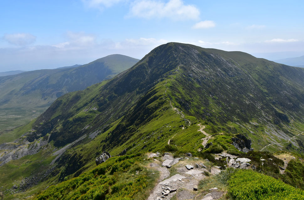
| Carnedd Dafyyd. |
| As far a high level ridge walking goes I'm in heaven here, what an incredible place. |
 |
| Looking back on Carnedd Fach and Pen yr Ole Wen. |
| It looks like the cloud inversion is pushing towards the ridge now. |
 |
| There she goes. |
| |
 |
| Utterly amazing! |
| What great timing. |
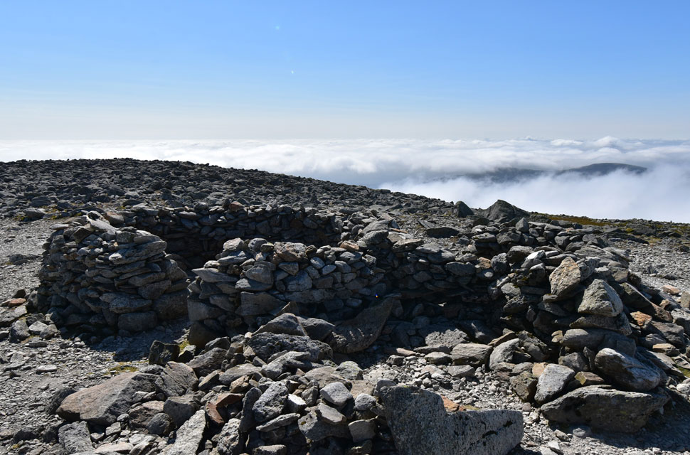 |
| Carnedd Dafyyd twin summit shelters. |
| At 3,425 feet (1,044 meters) Carnedd Dafyyd is Wales fourth highest mountain and 216 feet (66 metres) higher than Scafell Pike although linking the summits was much easier than I thought as the ridge maintains a constant altitude over 2,500 feet (762 metres) |
 |
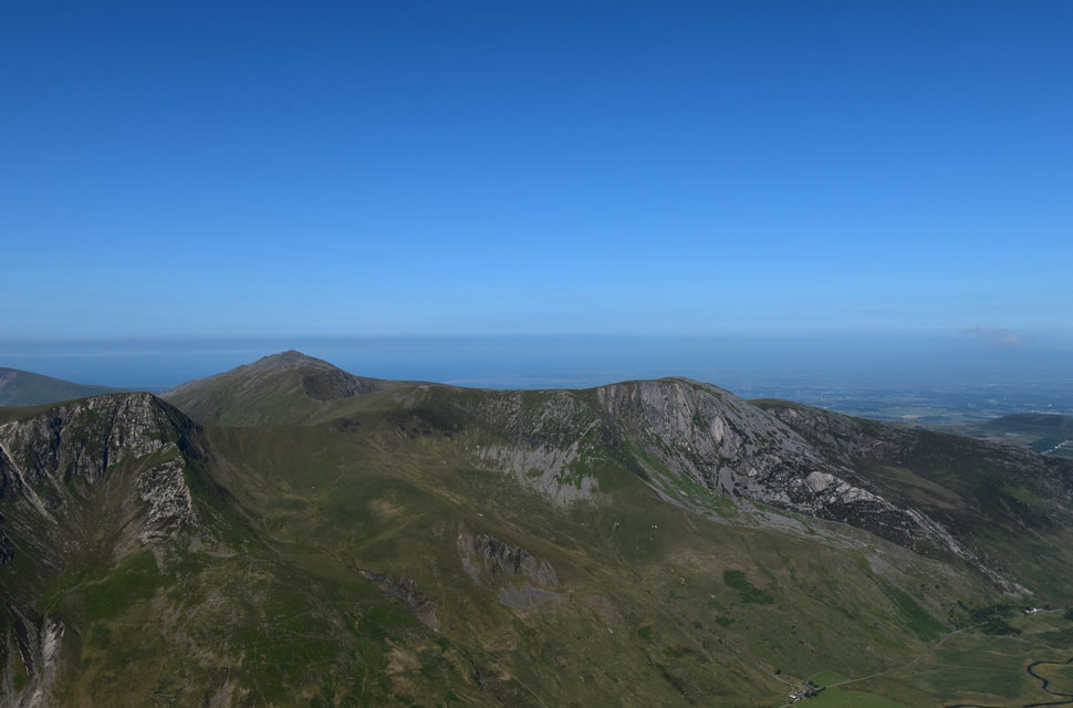
| Glyder Fawr, Snowdon, Y Garn and Foal-goch from Carnedd Dafyyd summit. |
| with all the bad press that these mountains get it's incredible to think that I've only seen two fell runners all morning. |
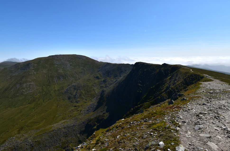 |
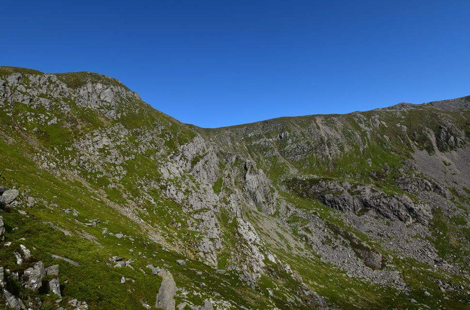
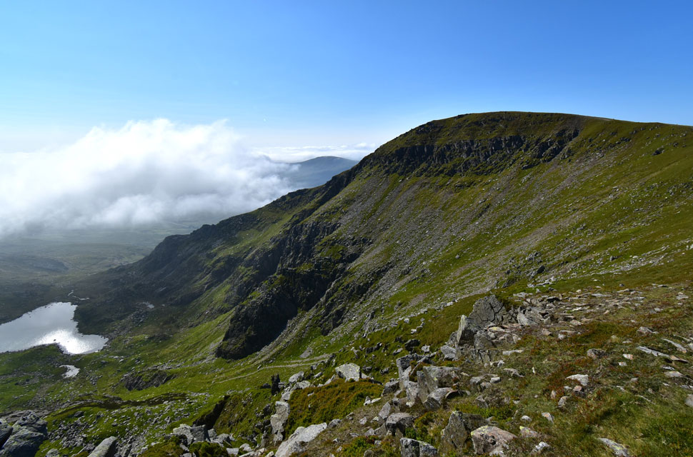
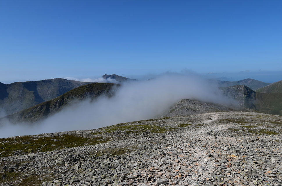
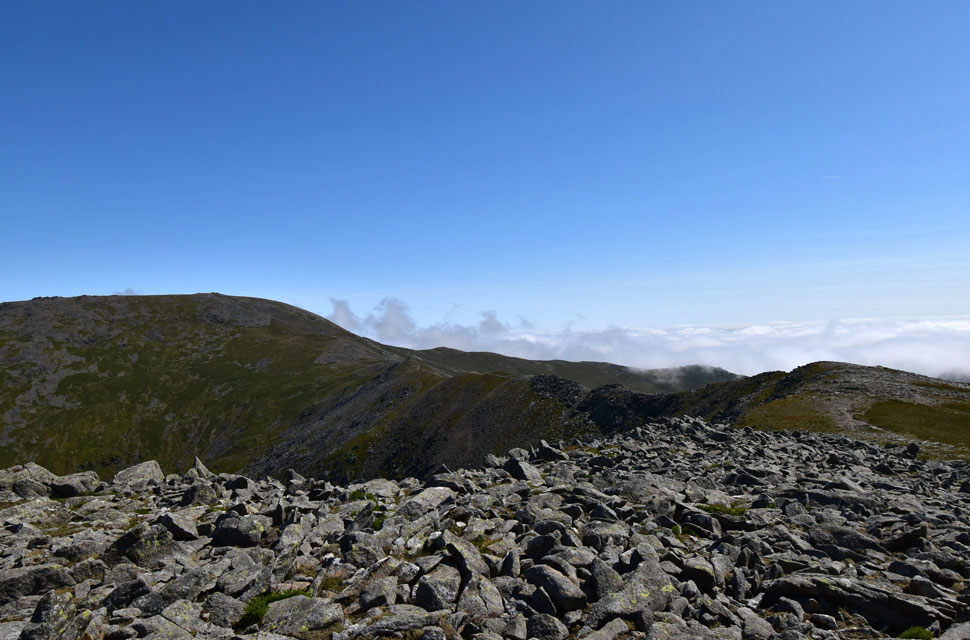
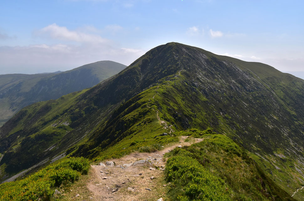
| The view across Cefn Ysgolion Duon and Bwlch Cyfryw-drum towards Carnedd Llewelyn. |
| The high level ridge crosses Cefn Ysgolion Duon which is also known as 'The ridge of the black ladders' referring to the north facing crags and buttresses seen on the left. |
 |
| Cefn Ysgolion Duon. |
| The ridge of the black ladders. |
 |
| Looking down on Aafon Llafar (River Llafar) from Cefn Ysgolion Duon. |
| With Yr Elen seen over on the right. |
 |
| Looking back on, Carnedd Dafyyd from Cefn Ysgolion Duon. |
| I strayed off the path to take in the view of the crags and gullies below before finding myself on bouldery ground, which meant a lot of rock hopping was required before I returned to the path. |
 |
| Carnedd Dafydd and Bwlch Cyfryw-drum from Cefn Ysgolion Duon. |
| Translated Bwlch refers to 'gap' and Cefn refers to 'back or rear' |
 |
| Yr Elen and Carnedd Llewelyn from Bwlch Cyfryw-drum. |
| Yr Elen looks incredibly close to miss; in fact, I spotted a narrow path that flanks the waist of Carnedd Llewelyn and makes a direct ascent on Yr Elen, but I had to resist the temptation and stick to my original route. |
 |
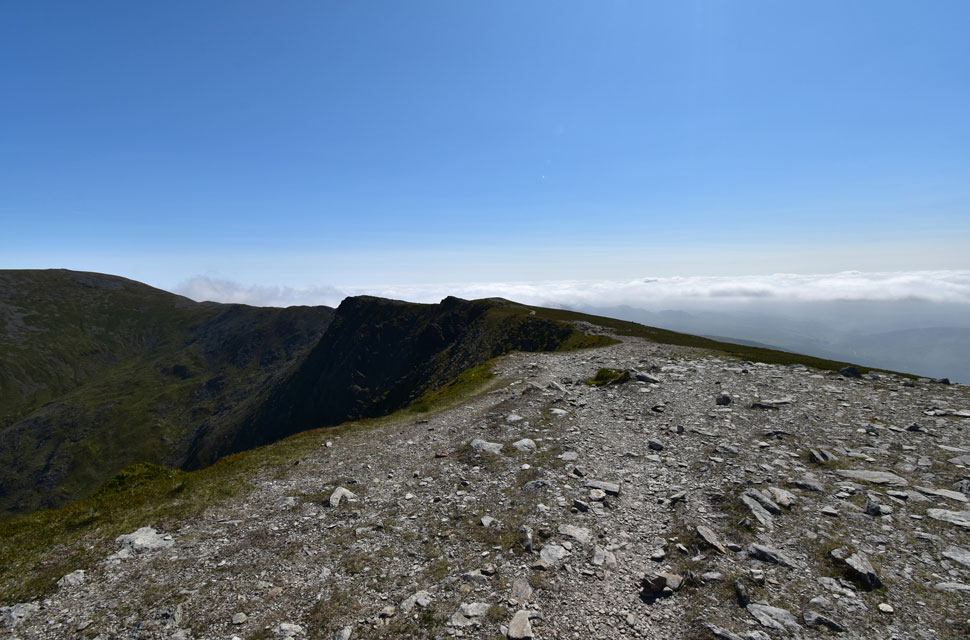
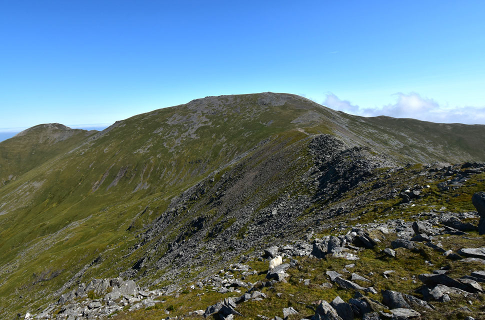
| Looking back along Bwlch Cyfryw-drum and Cefn Ysgolion Duon towards Carnedd Dafyyd. |
| As I crossed Bwlch Cyfryw-drum I spotted Ffynnon Llugwy Reservoir along with the zigzag path that left Bwlch Eryl Farchog ridge which was my route back to the Reservoir Road. |
 |
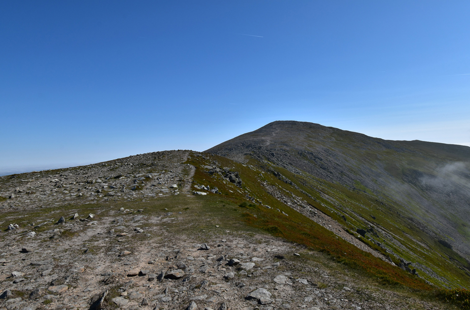
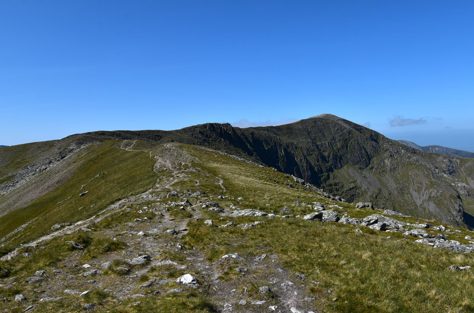
| Incredible views. |
| Seen again as I take on the ascent towards Carnedd Llewelyn summit. |
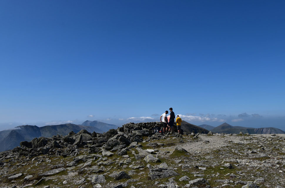 |
| Carnedd Llewelyn summit. |
The summit was reached with ease, and feeling a tad warm, I figured it was time I delayered; in fact, it was well overdue. I reached the shelter to find two walkers already there and two more approaching from the direction of Foal Grach who all turned out to be from London.
As mentioned in my previous walk report, I thought it was time I treated my feet to a pair of gel insoles, which had felt sore lately, no doubt not helped by the paper-thin original insoles of my Meindl boots, which, to be fair, hadn't been giving me any trouble up until now. The new insoles seem to be working a treat as I summited today's final and third-highest mountain in Wales Carnedd Llewelyn. |
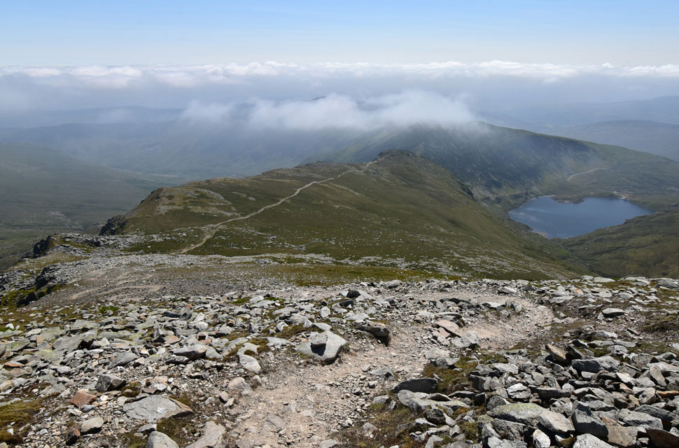 |
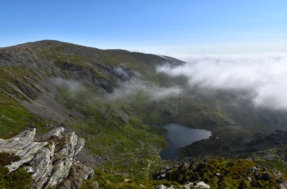
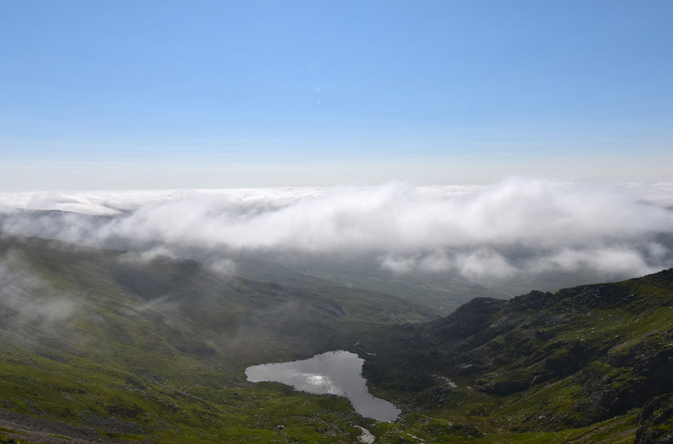
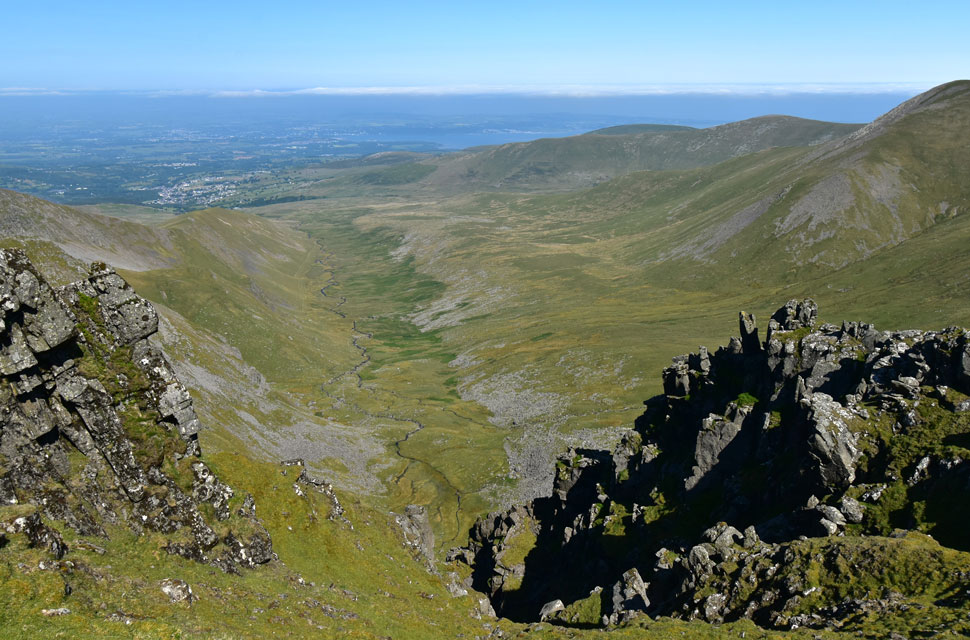
| The view down to Penywaun-wen with Ffynnon Llugwy Reservoir over on the right. |
| Feeling much fresher in the cool breeze I began my descent down Carnedd Llewelyn east ridge crossing the grassy ridge named Penywaun-wen on my map which will eventually lead to Craig yr Ysfa, todays final scramble. |
 |
| Y Braich from Craig yr Ysfa. |
| With Carnedd Llewelyn behind me I crossed the grassy spur as my nerves began to rise slightly, I knew there was a scrambly descent ahead of me and no matter how much I researched it I couldn't get a full handle of the severity of Craig yr Ysfa. |
 |
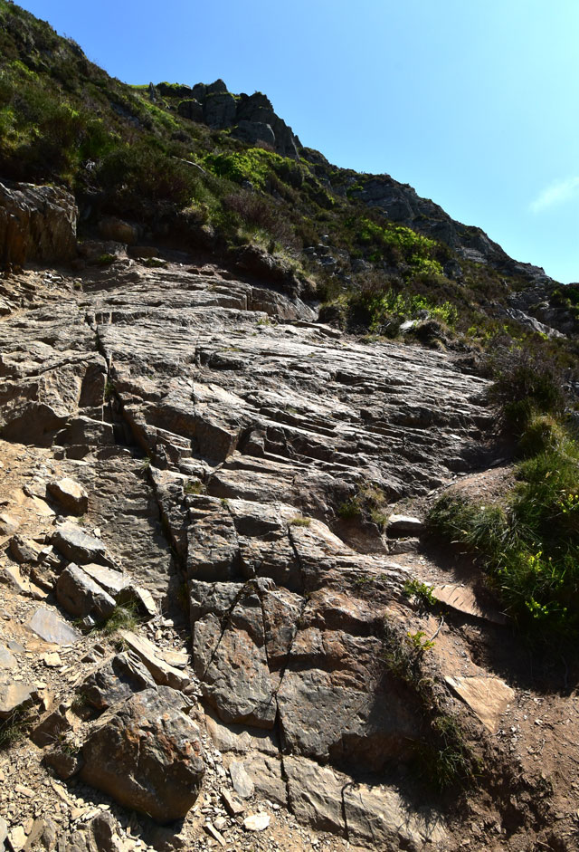
| Craig yr Ysfa. |
The first signs of the scramble appear further back, with two or three rock grooves to descend, which I would compare to the rock grooves found on Wetherlam Edge. I can't compare the final scramble down Craig yr Ysfa because there is nothing in the Lakes that I can compare it to. I descended from the right (left if you're looking from the ridge where I took this photo) where I found slight exposure but plenty of hand and foot holes. For the last section, I threw my poles to the ground, chickened out, and shimmied down a groove.
I must have been enjoying myself because I found the time to have a chat with the chap seen right, who also warned me about an awkward slab located on the steep Reservoir path below. He was a friendly chap, and had we not been in the position we were in, we could have had a good natter. After retrieving my poles, I joined the ridge before looking back at my route down, thinking, "You f-in idiot." Why didn't I scramble left just as the chap is? But I was reminded of the steepness of the rock and that there was more purchase on the right. In all a very enjoyable, but slightly technical scramble. |
 |
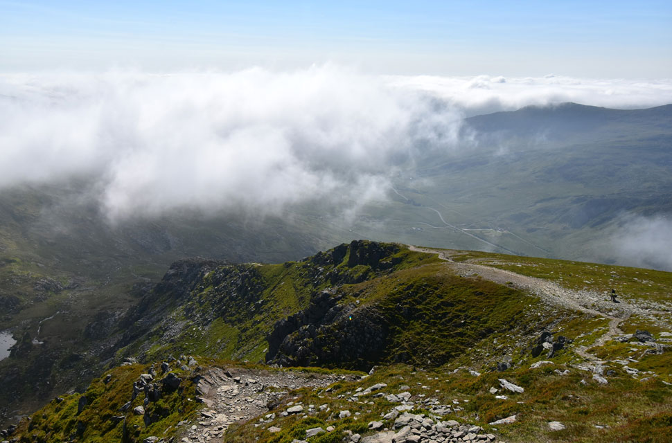
| Y Braich from Bwlch Eryl Farchog. |
| I follow the ridge until the reservoir path is reached which is located in the low point ahead. |
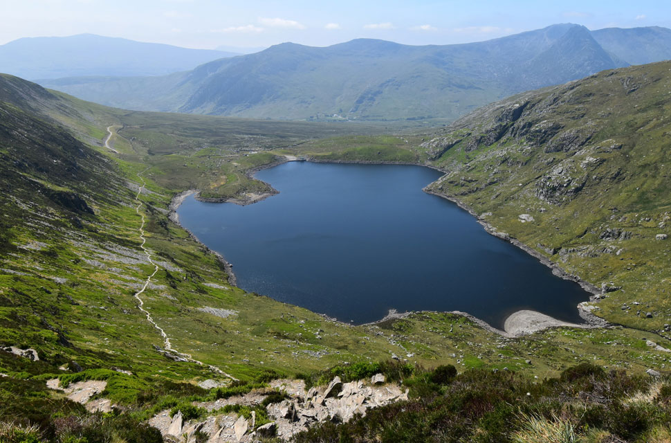 |
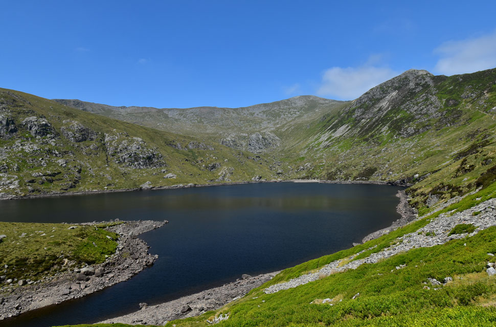
| Ffynnon Llugwy Reservoir. |
| The reservoir path descends steeply winding its way down to the path seen over on the left. |
 |
| The awkward slab. |
| When the chap was describing the slab, he really took his time, to the point that I butted in and asked, "Is it smooth?" The chap twisted his head, looked up at me, and replied, "It's of a peculiar angle." Absolutely bob on; it was quite a test to get around it - what sound advice. |
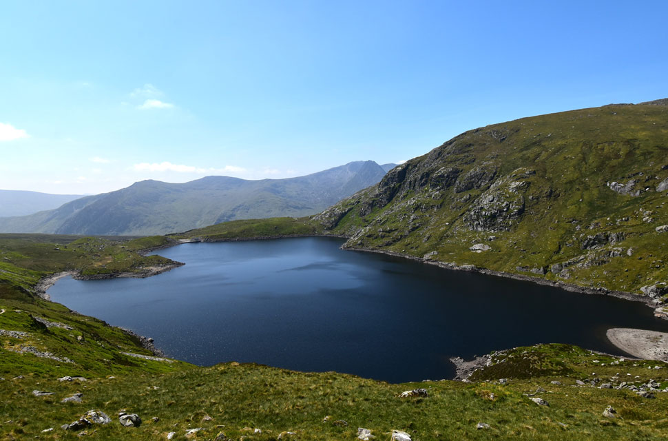 |
| Ffynnon Llugwy Reservoir. |
| At a depth of 146 feet the lake has additionally acted as a reservoir for Bangor and eastern Anglesey, which required the laying of an 11-mile pipeline to the water treatment works at Mynydd Llandegai. |
 |
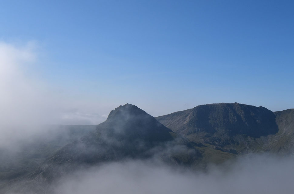
| Carnedd Llewelyn, Bwlch Cyfryw-drum and Craig yr Ysfa from Ffynnon Llugwy Reservoir. |
| |
 |
| Glyder Fach, Tryfan Far South Peak, Tryfan, Y Garn and Foal-goch from the Reservoir Road. |
With Ffynnon Llugwy Reservoir behind me, I joined the narrow Reservoir Road, which at 1,817 feet (554 metres) is one of the highest mountain roads in the country. With a maximum gradient of 15% it's also one of the steepest. Despite the gel insoles, my feet were beginning to ache, so I popped an ibuprofen tablet and washed it down with half my lunch, accompanied by long sips from my bite valve. The road swerves to the right and passes through several gates, where I was passed by a young girl heading towards the Reservoir who was panting through her smile, and no wonder, at two and a half miles long, this road was also long, and I dreamed of what speeds I could get up to on my mountain bike. I passed through more gates flanked by sheep and their young lambs. I could hear the traffic travelling along the A5 where, through a slight haze, Tryfan towered above. It was a biblical sight. A5 now and walking along a gravel pavement, not against, but with the flow of traffic.
The gravel pavement ended and I joined the carraigeway where the only thing separating me from an 18-wheeler travelling at 50 mph was a line of white paint. I was anxious to leave this road as soon as possible. I was passed by two separate cyclists; the first one ignored me, but I got a nice hello from the second. I reached Gwern Gof Isaf Campsite, which had an uninterrupted view of Tryfan - no powerlines, just mountain and I could clearly make out the Heather Terrace Path. I'd reached the cones that deterred anti-social parking, and I knew I was close to Llyn Ogwen now, perhaps half a mile or so, where I was passed by another cyclist and another 'hi' was shared. Next, I passed the coppice of trees where I officially started the walk six hours earlier, only now the air was hot and my lips had turned gooey through dehydration. I hadn't rested all day, and the thought of sitting on the wall next to where my car was parked filled my soul. Car park came, amazingly less than half full, with the windscreen from my car glinting away in the sunshine as was the surface of Llyn Ogwen. I unlocked the doors and sent the windows down to let the hot air escape. In went my gear, and out came my Karrimor mids. Wall, sunshine, feet aching - what a powerful day on the hill. |
|
| |
| Back to top |
 |
|
