|
High Level Circuit of Troutbeck |
 |
 |
10th August 2023 |
 |
|
Today's walk is the sole reason why I didn't include Catstye Cam when I traversed Striding Edge yesterday, wanting to conserve as much energy as I could as I joined David, Rod, and Michael on an epic high-level circuit of Troutbeck. David initially walked this route back in April and enjoyed it so much that he couldn't wait to complete it again, only this time with company. The only slight change David made from his previous walk was that instead of descending St Raven's Edge into Woundale, today we're going to make a direct descent via Broad End, which will lead us directly onto Kirkstone Pass and Baystones thereafter.
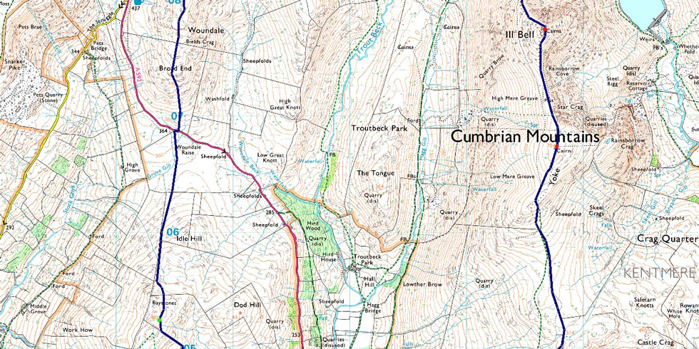
Despite feeling in good shape, I've overdone it with the Lucozade Sport, one of which I'll drink before the walk, two during, and the last one once the walk is complete, which I feel adds that extra kick and also aids against cramp, which my calfs tend to suffer from during long walks. The forecast was looking great, but as per usual, it changed at the last minute, leaving high-level clouds and breaks of sunshine that would come later in the day. It has been a while since I last walked the III Bell Ridge, and what finer way to include it than in an epic such as this. |
|
| Wainwright Guide Book Two |
 |
| The Far Eastern Fells |
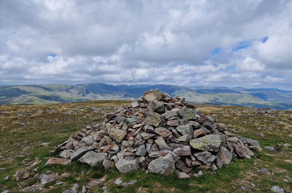
| Occupying a commanding position overlooking four valleys, Thornthwaite Crag is one of the better-known fells east of Kirkstone, owing not a little of its fame to its tall pillar of stones, a landmark for miles around. |
 |
|
|
|
| |
|
Overview |
|
|
| Ascent: |
4,251 Feet - 1,296 Metres |
| Wainwrights: |
5, Yoke - III Bell - Froswick - Thornthwaite Crag - Caudale Moor |
| Visiting: |
3, Stony Cove Pike - Idle Hill - Baystones |
| Weather: |
A Bright Start, Replaced By Thick, Murky Cloud - Brightness Returning PM. Feeling Very Humid Throughout. Highs of 26°C Lows of 16°C |
| Parking: |
Church Bridge, Troutbeck |
| Area: |
Far Eastern |
| Miles: |
14 |
| Walking With: |
David Hall, Rod Hepplewhite & Michael Cox |
| Ordnance Survey: |
OL5 -OL7 |
| Time Taken: |
8 Hours |
| Route: |
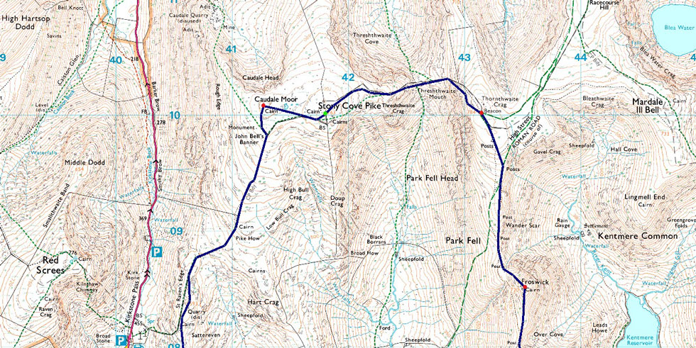
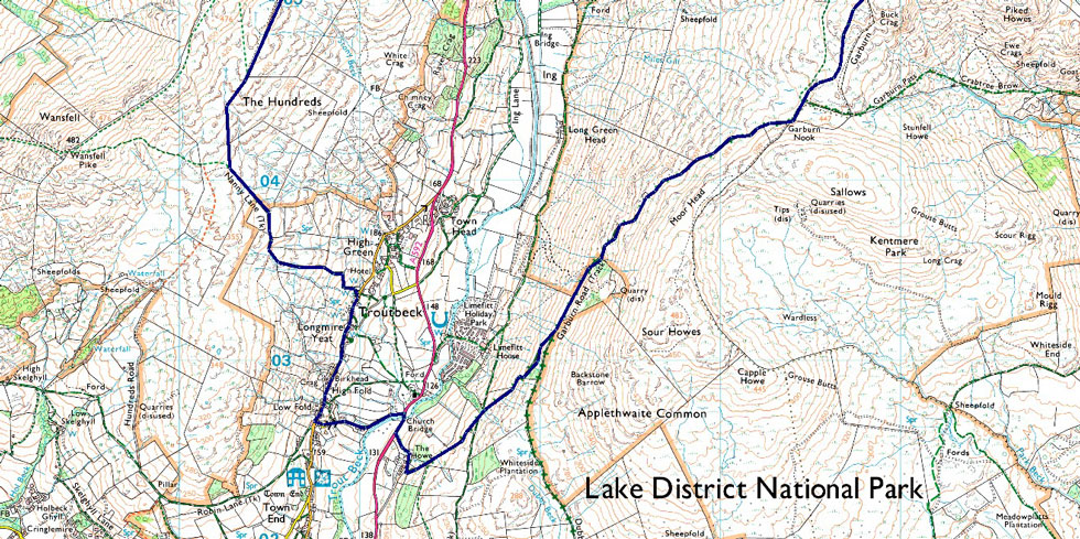
Church Bridge - Garburn Road - Top of Garburn Pass - Yoke - III Bell - Froswick - Thornthwaite Crag - Threshthwaite Mouth - Stony Cove Pike - Caudale Moor - John Bell's Banner - St Raven's Edge - Broad End - Kirkstone Pass - Idle Hill - Baystones - Nanny Lane - Troutbeck - Church Bridge |
|
| |
|
Parking Details and Map |
|
|
| Nearest Post Code: |
LA23 1PE |
| Grid Reference: |
NY 412 202 |
| Notes: |
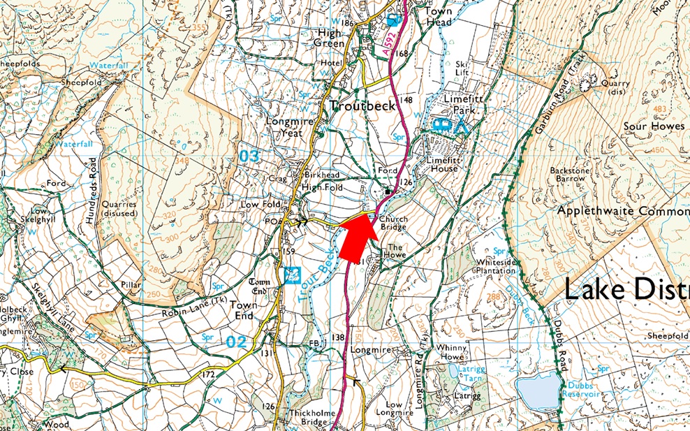
The parking spaces at Church Bridge can be found between Jesus Church and Church Bridge, if travelling from the A592 the car park will appear on the left immediately after crossing Church Bridge. This is a small car park popular with walks around Troutbeck or the higher fells of the III Bell ridge meaning availability can be tight during peak seasons. Parking is free. |
|
| |
|
Map and Photo Gallery |
|
|
 |
| Preparing for bailing, opposite Church Bridge car park, Troutbeck 8:10am 16°C |
The first thing I did when I got home yesterday was remove the gel insoles from my boots and replace them with Meindl's standard insoles for now until the slimmed-down versions arrive, which David recommended from Amazon. We had arranged to meet at Church Bridge car park on the banks of Trout Beck, where I arrived to find David, Rod, and Michael kitting up. Surprisingly, there was only one parking space left after two camper vans had parked selfishly, one of which took up the space of three cars. I backed my car between the other camper van and a large tree and came to a stop on the river bank.
After a quick greeting, I returned to my car to complete my kit up and drained the remains of my first Lucozade Sport between conversations, most of which were spent chatting about how glorious a morning it was. With that said, at this precise moment, most summits are well below cloud, which we confirmed during our drive in. With my car locked, we left the car park and crossed Church Bridge before crossing the road before making our way towards the bottom of Garburn Road (Pass) |
 |
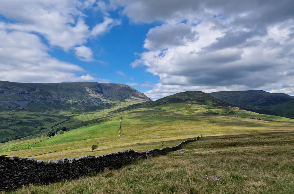
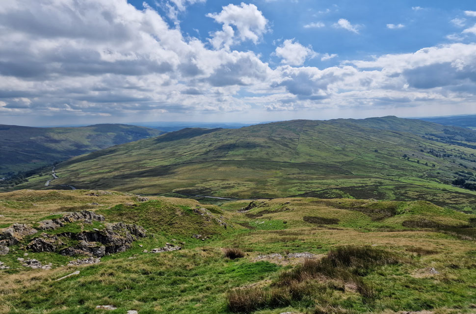
| Views over Troutbeck towards Wansfell (left) and Baystones (right) |
| Within the time it took us to gain Garburn Road (pass) clouds had rolled in and we were left in the shade. It happened so quickly that we couldn't believe that just a quarter of an hour ago all of this was under blue skies. That's Baystones over on the right, today's final summit. |
 |
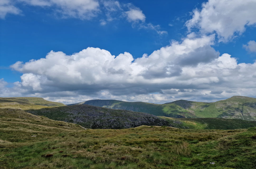
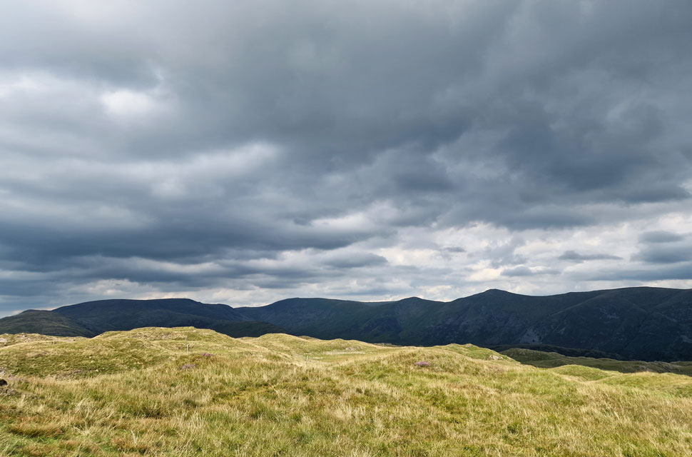
| Looking towards Troutbeck Tongue, St Raven's Edge, Caudale Moor, Thresthwaite Mouth, Thornthwaite Crag, Froswick, IIl Bell and Yoke. |
| As we joined Garburn Pass the views opened out over much of todays route with Caudale Moor and Thornthwaite Crag below cloud for now. |
 |
| Looking back on Sallows and Sour Howes. |
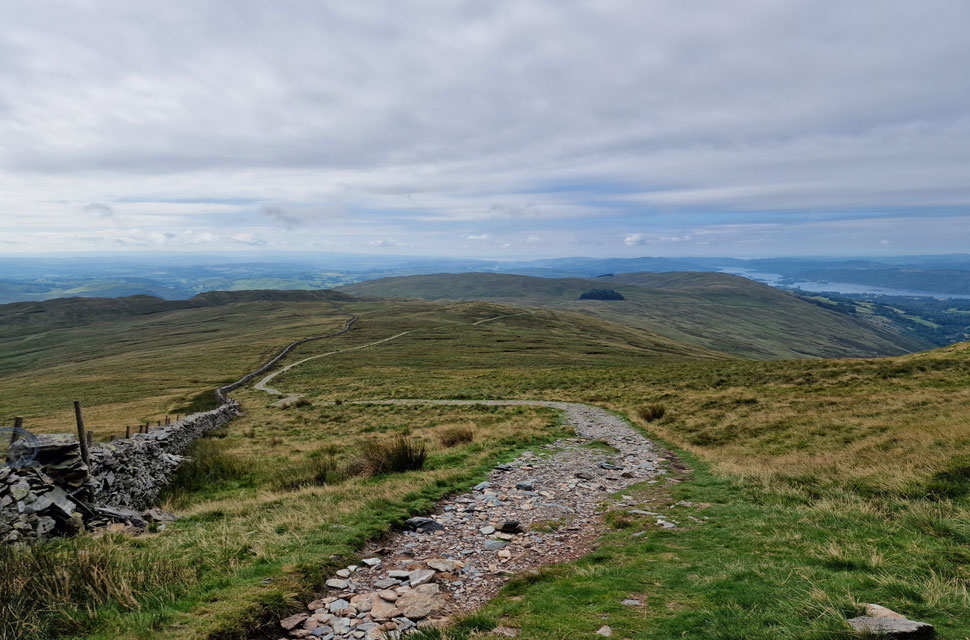
| We crossed the top of Garburn Pass and began the long continuous ascent on Yoke, which was the perfect leg stretcher after walking two out of the three previous days. |
 |
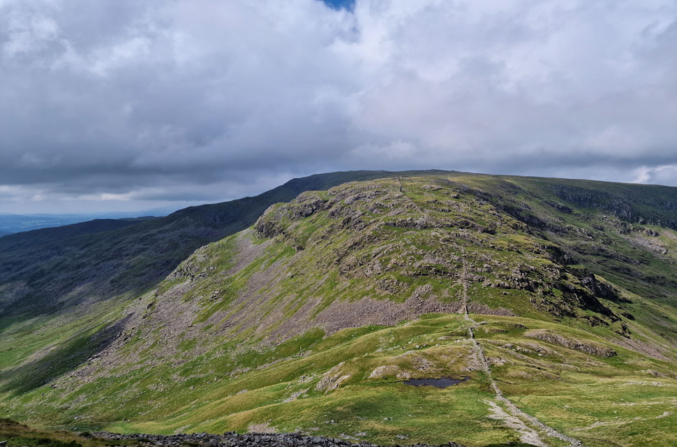
| III Bell from Yoke. |
| We summited Yoke just as the sun began to poke through the clouds, hinting that we might be in for some brightness later. Initially, we had taken today off work so that we could wildcamp on Yoke tonight and hopefully catch the Perseid meteor shower, but given the forecast, it wasn't to be. |
 |
| The view over Rainsborrow Cove towards Kentmere Reservoir, Lingmell End, Mardale III Bell, the top of Nan Bield Pass and Harter Fell. |
| Come on sunshine keep trying! |
 |
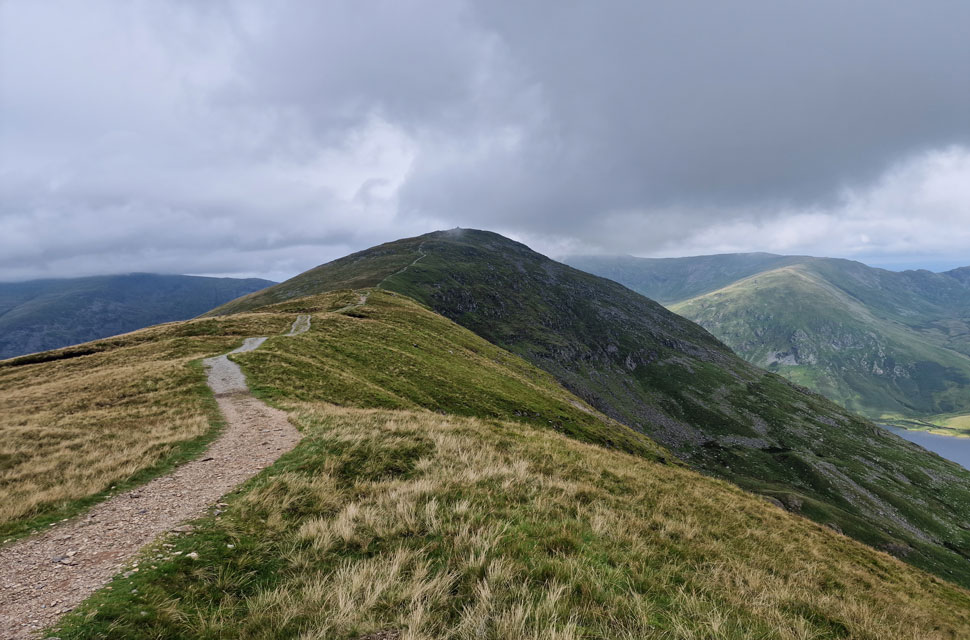
| Froswick, Caudale Moor (Stony Cove Pike) Thresthwaite Mouth, Thornthwaite Crag and Froswick from III Bell. |
| With Yoke behind us, we began our ascent on III Bell, whose summit was in and out of cloud, where we were joined by the fell runner below, who asked us how far Froswick was, to which David replied, "about the same length from Yoke to III Bell, or thereabouts." "Oh well," she replied, "I'll give it a go." "Are you heading as far as Thornthwaite Crag? I asked. "Been there, done that, upside down, and all around. "No, I'm not going to Thornthwaite Crag," and off she went. |
 |
| III Bell back in cloud. |
| Despite it appearing like the middle of Autumn it's actually incredibly humid! |
 |
| The view into Hall Cove from Froswick. |
| We summited Froswick and watched as the cloud sank lower over Thornthwaite Crag and into Hall Cove. It was midmorning, stupidly humid, and the cloud was showing no signs of lifting for now, but what a great show. |
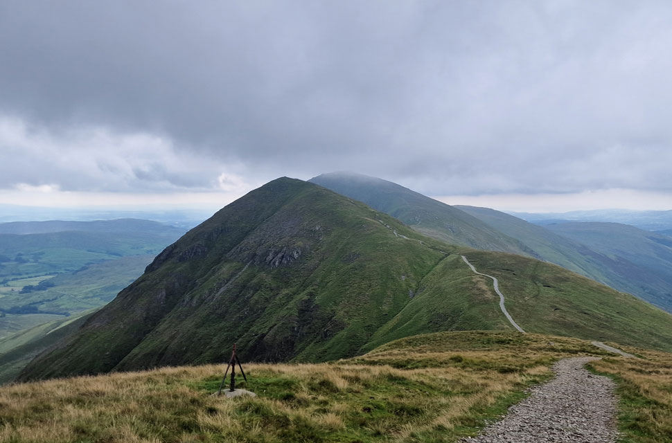 |
| Looking back on Froswick, III Bell and Yoke. |
| With the III Bell ridge behind us, we watched the fell runner descend Froswick before second-guessing whether she was on the correct path before committing to Scot's Rake and the Troutbeck valley. Up ahead, we spotted a solo walker appear from the direction of High Street, walking off the path. As the walker drew closer, we could see it was an elderly lady carrying camping kit and wearing full winter clothing, including two fleecy hats and over trousers. As we passed, she muttered something about how cold and windy it had been on High Street, and before we could reply, she'd walked past. We found this quite a strange encounter and wished the elderly lady well. |
 |
| Thornthwaite Crag summit. |
| Two fell runners appeared from Thresthwaite Mouth and stopped for summit photos before heading off in the direction of Gray Crag. We summited next and watched the cloud formations over the Kentmere Valley, which appeared to be breaking up. Let's hope so; we've been in this cloud long enough now. |
 |
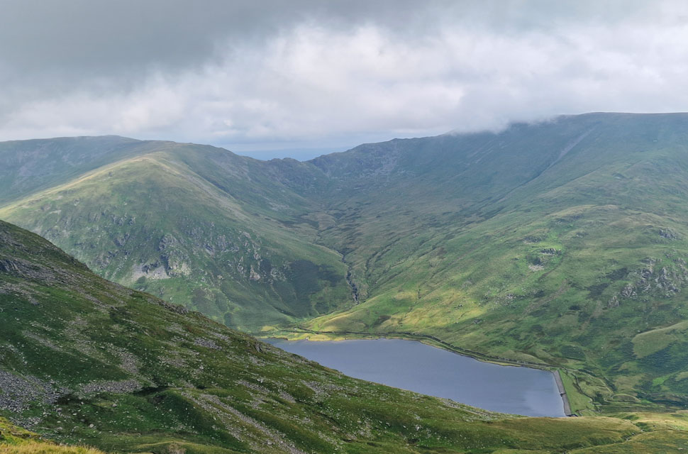
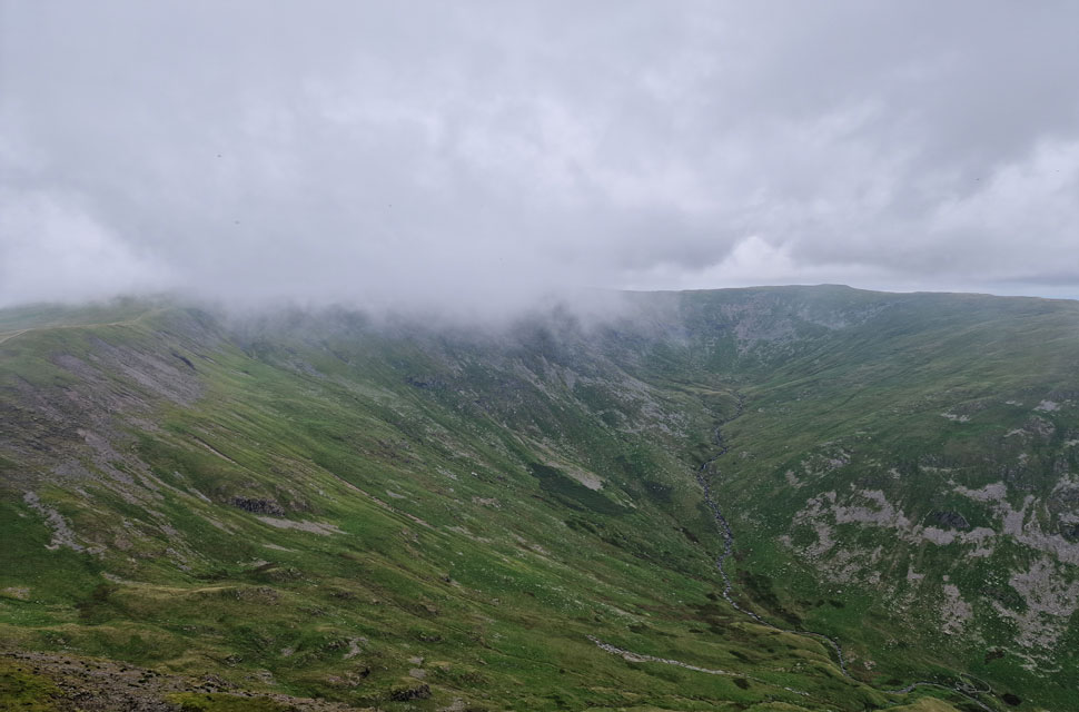
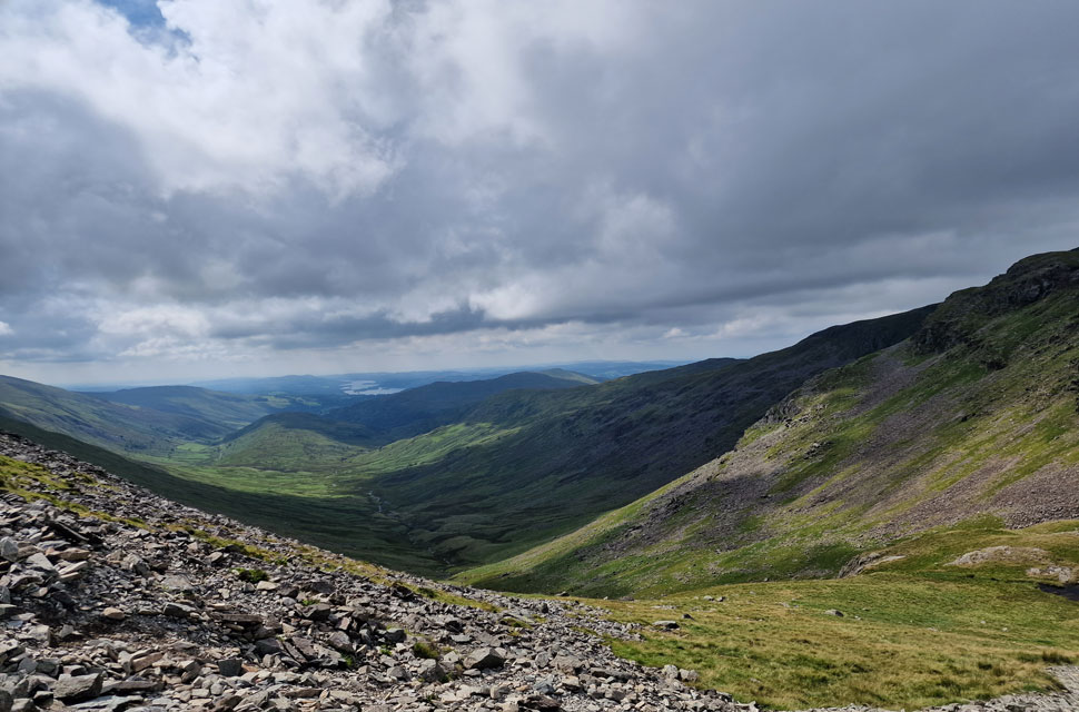
| Views over Pasture Bottom towards Raven Crag and Hartsop Dodd from Thresthwaite Mouth. |
| We were right the cloud was beginning to lift as we began our descent into Thresthwaite Mouth. It was here that we were passed by a couple in ascent but a good deal apart, I'm not sure if this upset the lady who returned our hellos with rude looks in silence; jeez, if looks could kill, we'd all be dead! |
 |
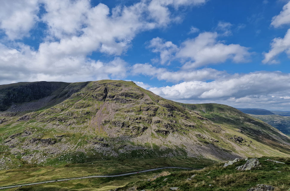
| Caudale Moor and Stony Cove Pike seen over Thresthwaite Mouth. |
| |
 |
| Looking South into Troutbeck from Thresthwaite Mouth. |
| With Windermere seen in the distance. |
 |
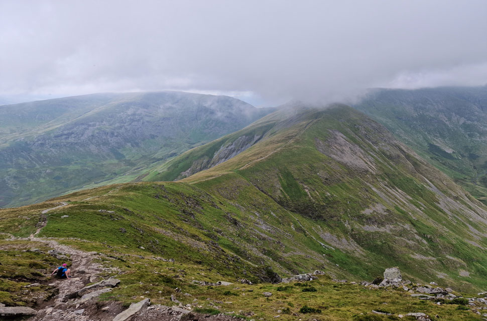
| Looking back on Thresthwaite Mouth towards Thornthwaite Crag. |
| We crossed Thresthwaite Mouth passing the odd walker who we had seen descending from Stony Cove Pike with more on their way down. With lunch approaching, we figured it would be a great time to refuel once Caudale Moor was reached. |
 |
| Lunch with a view, here looking towards Caudale Moor summit (right) and Red Screes (left) |
| It was during the ascent of Stony Cove Pike that I started to notice the effects of my previous walks, with my hamstrings starting to twitch, accompanied by a dull ache in my thighs but nothing too serious. We passed Stony Cove Pike summit cairn, then picked up the wall that straddles Caudale Moor's summit, opting to stop at a nice spot behind the wall and break for lunch and maybe take a couple of painkillers. |
 |
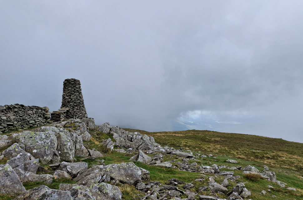
| Caudale Moor summit cairn. |
| After lunch, I drained a second bottle of Lucozade before reshouldering packs and making the short walk to Caudale Moor summit, from where views extended towards the Fairfield and Helvellyn ranges, and I wondered if the seagull was still scavenging walkers lunches! |
 |
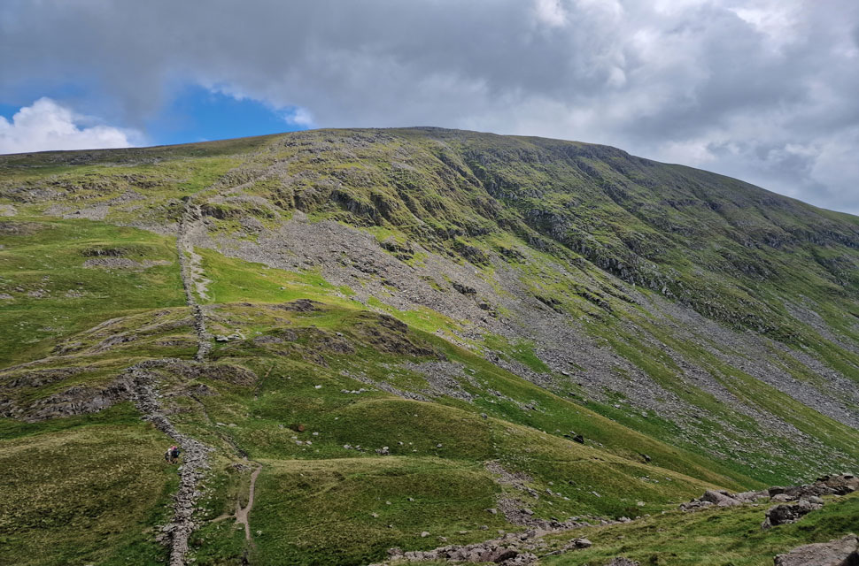
| St Raven's Edge comes into view as we descend Caudale Moor. |
| With Pets Quarry below Snarker Pike seen off to the right. |
 |
| Looking back on Caudale Moor from St Raven's Edge. |
| Gone was the cloud replaced by hot afternoon sunshine. |
 |
| Views over the top of Kirkstone Pass towards... |
| ...Red Screes and Middle Dodd. |
 |
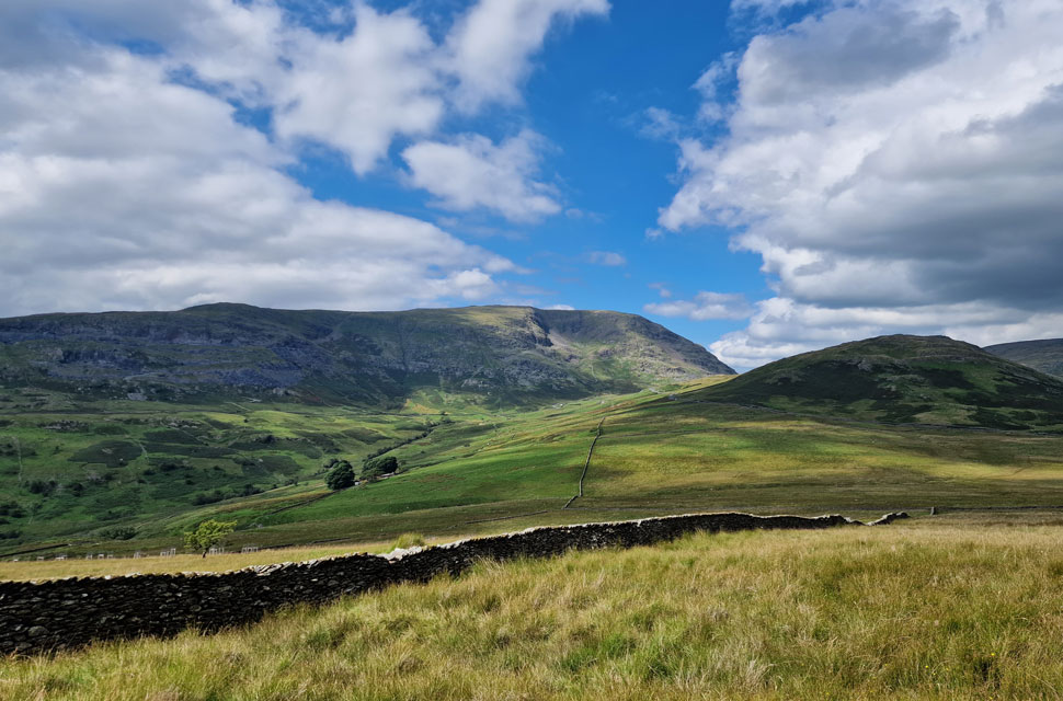
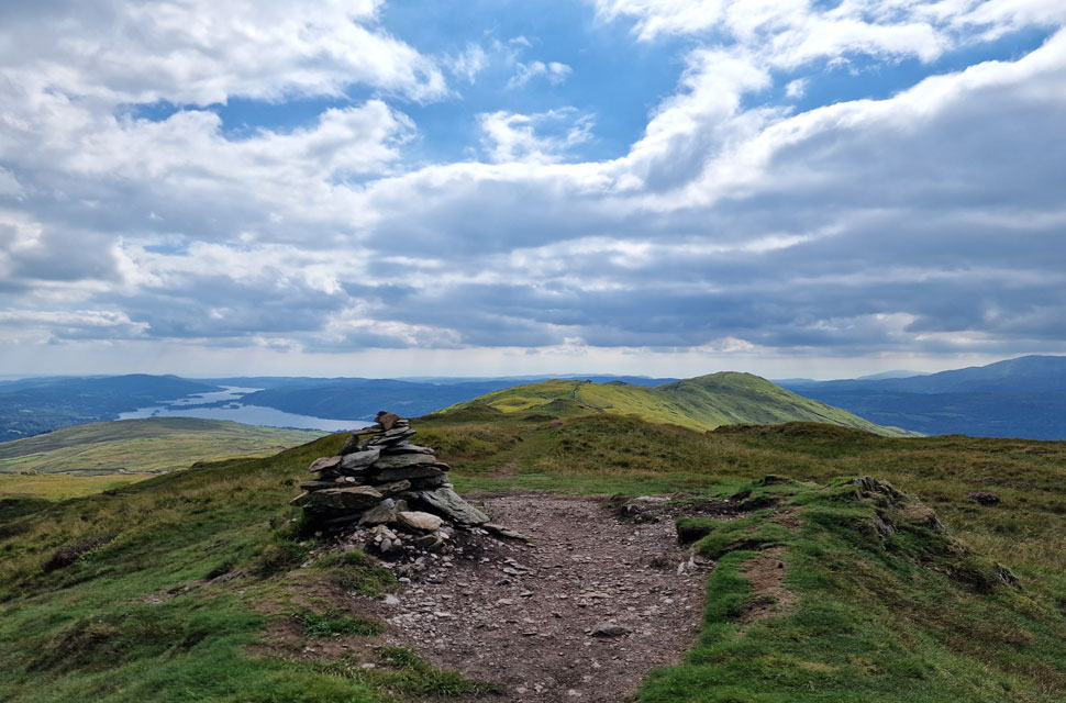
| Our view from St Raven's Edge. |
| Towards Stony Cove Pike, Thornthwaite Crag, Froswick and III Bell, the ridge seen centre is High Crag which descends right towards High Great Knott. |
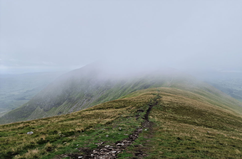
 |
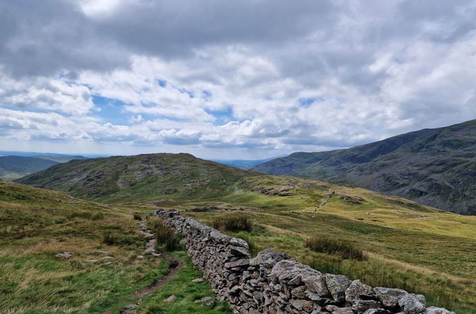
| Descending Broad End on St Raven's Edge. |
| With views towards Idle Hill, Baystones, and Wansfell Pike. From the road, this looks like a potentially difficult descent, but we found a grassy rake that descended gently all the way to Kirkstone Pass. |
 |
| Kirkstone Pass. |
| There was only a few yards of road walking until we reached the small gate in the wall just ahead of where Rod and Michael are stood. |
 |
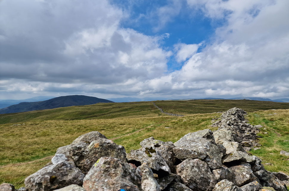
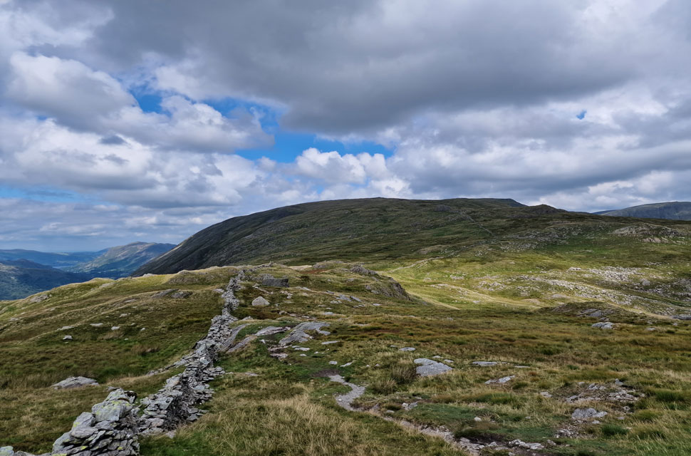
| Looking back on Snarker Pike, Red Screes and Broad End on St Raven's Edge. |
| The mood was jubilant as we gained Idle Hill, and despite the saturated ground underfoot, the views back were delightful, accompanied by hot sunshine. |
 |
| Wansfell Pike and Windermere from Baystones summit. |
| Despite no one admitting it, this little hill required our full attention, and we gained the summit in almost silence as we dug deep in our own separate ways. By now I was clutching the third bottle of Lucozade Sport, which I finished as the final summit approached. Hot sunshine came and went, and knowing we'd earned ourselves a rest, packs were de-shouldered and used as backrests as we took in the views back along the route. |
 |
| Taking it all in. |
| |
 |
| Descending back to Troutbeck via Nanny Lane. |
Summit time at Baystones was extensive as we pondered when and if we should make a move. "We nod off now, and it'll be midnight when we wake up," Michael joked, he wasn't wrong. A few more minutes were spent soaking up the sunshine and surveying the route before it was time to leave. Packs shouldered, we left the summit before making our way to the top of Nanny Lane and began the long walk back to Troutbeck as I glanced over to the III Bell ridge, which had been in shade for the last half hour now. We are passed by a dumper tractor with one gear and no suspension, struggling against the incline of the lane. The infamous tree on the corner of Nanny Lane was reached, and we knew Troutbeck was close we could smell it. The rooftops of Troutbeck come into view as we left Nanny Lane behind and join the tarmaced lanes of Troutbeck while dreaming what we could do with a lottery win here.
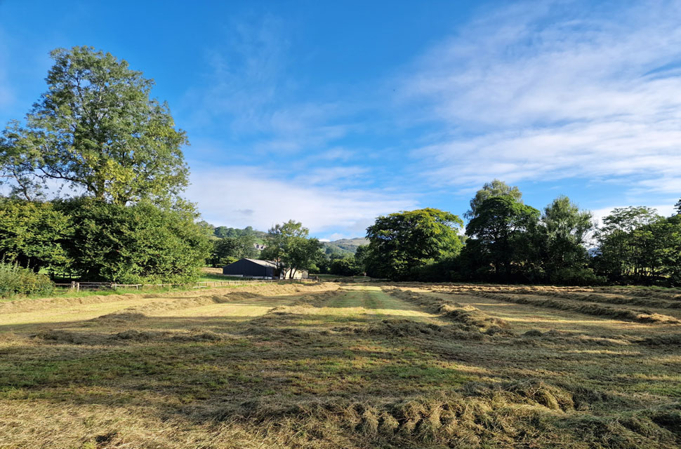
It's almost 4pm and we've been on our feet for almost eight hours, but no one mentions it. Instead, we take in the views beyond the fields and over to the III Bell Ridge, which by now is glowing in the afternoon sunshine. Silence as we continue our descent towards Church Bridge with our cars reached. I look left and notice the hay lying in the field this morning has now been bailed as a Landrover Discovery leaves the field. At a guess, we figured it was the farmer's wife dropping off bate for the farmer. It's exactly 4:10 pm now, and we timed our walk at exactly 8 hours. It's been ages since we have walked so many miles and for this duration. There comes a point in the day when you're normally off the fell and on your way home. At that point, we were on the summit of Caudale Moor with miles still to go. |
|
| |
| Back to top |
 |
|