|
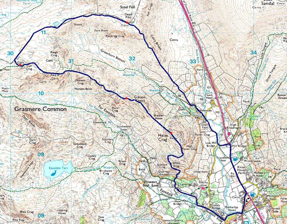
The Greenburn Horseshoe |
 |
 |
7th November 2023 |
 |
|
I'd booked a couple of days off work, and as far back as a week ago, I'd set my heart on walking one of two walks: Harter Fell and Hard Knott from Jubilee Bridge or Yewbarrow from Overbeck Bridge. I don't like to be predictable, but anyone familiar with the website will know I try to walk Yewbarrow during the month of November, but now it's got more personal it being the first walk I walked after the death of my father. The forecast, however, wasn't playing ball; in fact, it was all over the place, which isn't unusual when putting your trust in the forecast is the most hit and miss thing you can do at this time of year.
According to the Met Office, Central and Eastern Lakeland looked like the best forecast, although MWIS (Mountain Weather Information Service) predicted less than a 30% chance of cloud-free summits. Weatherline, however, had raised the bar to 90% for the east of the park. The Met Office forecast for Grasmere stuck forecasting sunshine from dawn through mid-afternoon, when rain would arrive from the west. It's kind of like spinning plates with the weather gods, so I put my trust in the Met Office and returned to a walk, which in 2016 had almost seen me benighted due to deep snow; today there was no chance of that; in fact, I was lucky enough to experience a classic autumnal walk were, by pure chance, the forecast paid off. |
|
| Wainwright Guide Book Three |
 |
| The Central Fells |
| The familiar pyramid of Helm Crag, rising sharply from the green fields of Grasmere, is the terminus of a ridge that curves away westwards to culminate finally in the rocky crest of a lesser known eminence, Calf Crag. |
 |
|
|
|
| |
|
Overview |
|
|
| Ascent: |
2,277 Feet - 694 Metres |
| Wainwrights: |
4, Helm Crag - Gibson Knott - Calf Crag - Steel Fell (Dead Pike) |
| Weather: |
Squally Showers & Sunshine. Rain Turning Heavy PM Highs of 9°C Lows of 8°C |
| Parking: |
Parking Spaces, A591 Grasmere |
| Area: |
Central |
| Miles: |
8.1 |
| Walking With: |
On My Own |
| Ordnance Survey: |
OL5 - OL7 |
| Time Taken: |
4 Hour 45 Minutes |
| Route: |
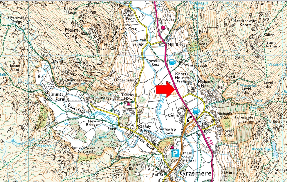
A591 - Grasmere - Easdale Road - Lancrigg - White Crag - Helm Crag - Bracken Hause - Gibson Knott - Pike of Carrs - Calf Crag - Steel Fell Tarn - Steel Fell - Cotra Breast - Ghyll Foot - Underhelm - A591 |
|
| |
|
Parking Details and Map |
|
|
| Nearest Post Code: |
LA22 9RF |
| Grid Reference: |
NY 337 408 |
| Notes: |
Possibly the most convenient, and popular layby in Lakeland! The layby is found just outside Grasmere in between the village and the Swan Hotel. Despite this being a rather long layby parking here is very popular mainly because of the position and access to Helm Crag, Far Easdale and the Fairfield fells. Parking is free. |
|
| |
|
Map and Photo Gallery |
|
|
 |
| |
| |
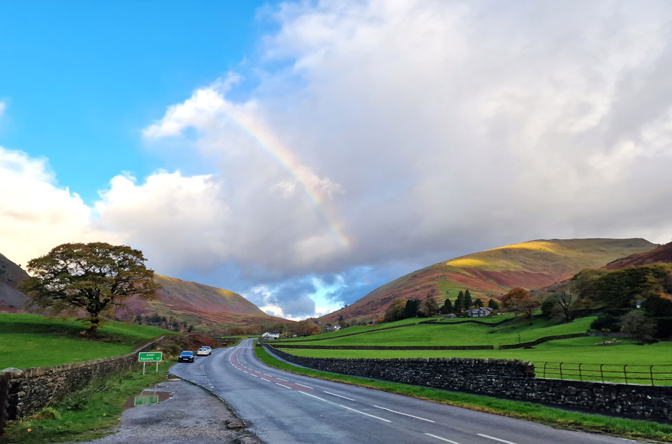 |
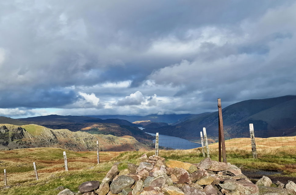
| Steel Fell, Dunmail Raise and Seat Sandal from the layby outside Grasmere 9°C 8:15am |
It had rained heavily through the night, both at home and in Lakeland, and I was expecting a wet walk underfoot, more so given where I was walking which even in the summer is still quite boggy. It was a grey drive north, but after several sharp showers as I drove between Ambleside and Grasmere, the clouds parted, revealing blue skies and even a rainbow beyond. It had stopped raining by the time I'd parked up, but there were still droplets in the air as I began my kit up, adding gaitors and my waterproof jacket from the off. In hindsight, I should have been wearing my windproof, fleece-lined trousers instead of a regular pair, which will probably get folded away for winter after today.
Despite the blue skies, the treat of rain never seemed far away, and moments after turning right onto Pie Lane and Broadgate, the heavens opened, forcing me to put my hood awkwardly over my beanie, and moments later, as quick as the rain arrived, it had stopped again. I kept my hood up as I passed White Bridge Forge, where a metal worker was measuring a length of steel with a tape measure while Jackie Wilson's 'Your love keeps lifting me higher' played in the background. Unbeknown to me, said song would be my earworm for the rest of the day. I hate it when that happens. |
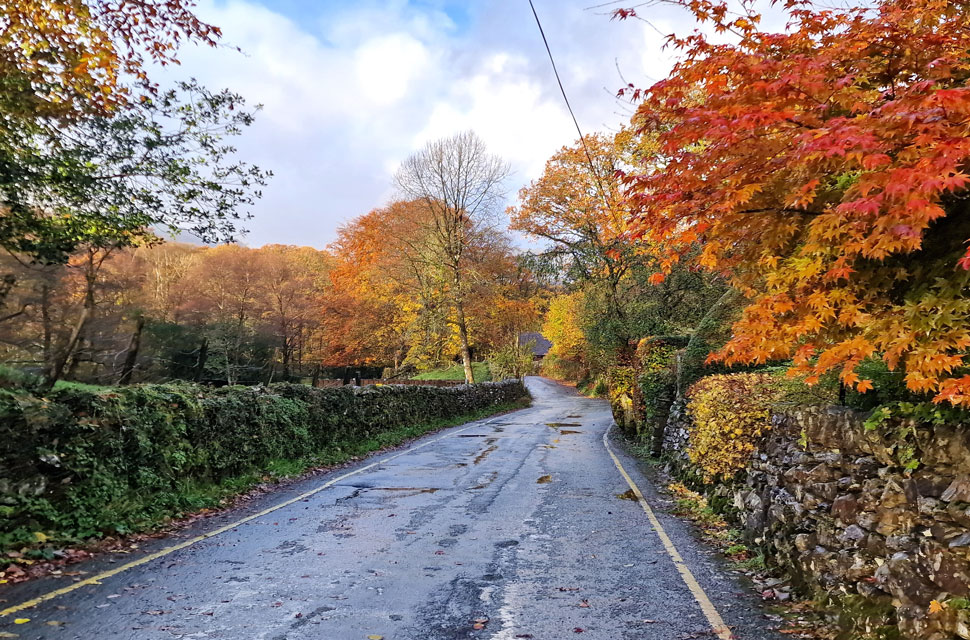 |
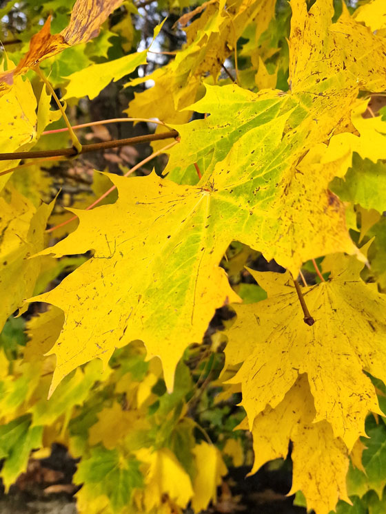
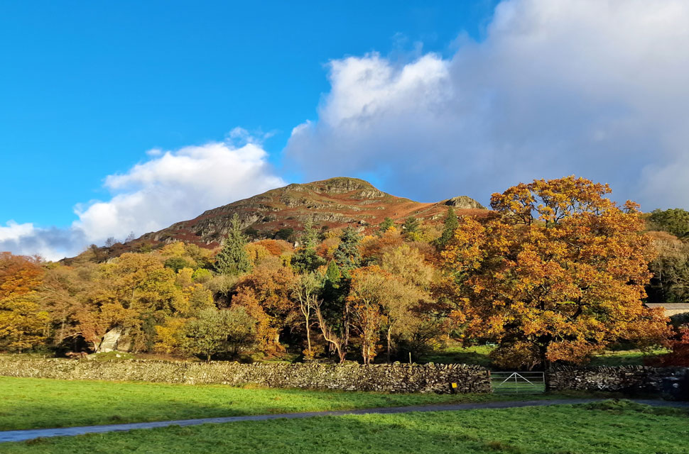
| Autumn colours, Easedale Road, Grasmere. |
| With Broadgate behind me I passed through Butharlyp Howe where it started to rain again this time more heavily and up went the hood again. The tree canopy acted like a huge umbrella keeping me relatively dry until the woodland path ended at Easedale Road where I turned right towards Goody Bridge. |
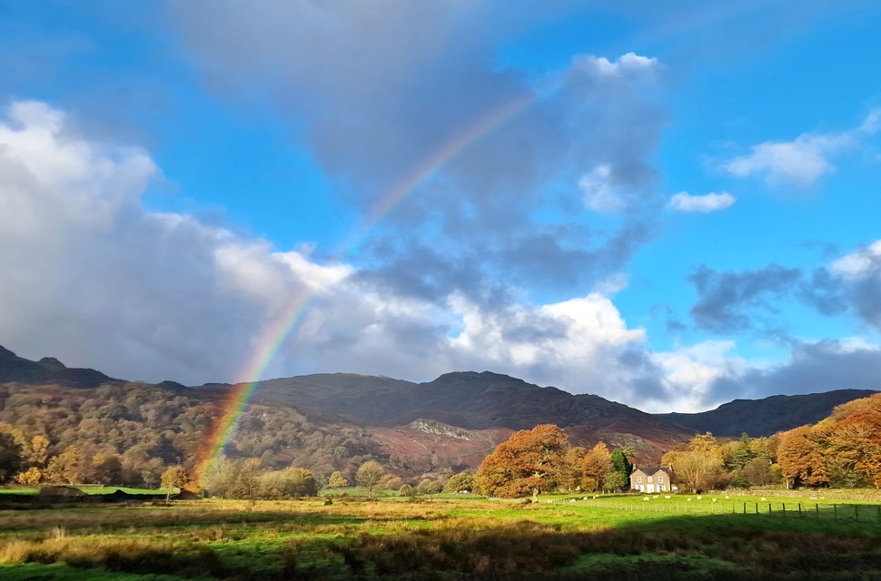 |
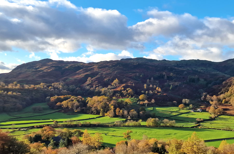
| Tarn Crag (Easedale) and Codale Head from Easdale Road. |
| To my amazement after Goody Bridge was passed the views opened out over Lancrigg towards Tarn Crag and Codale Head where I was even treated to blue skies and another rainbow. |
 |
| Tarn Crag (Easedale) and Codale Head. |
| Anyone who knows me knows I love a bit of sunshine especially after a rain shower when the colours just pop out at you. |
 |
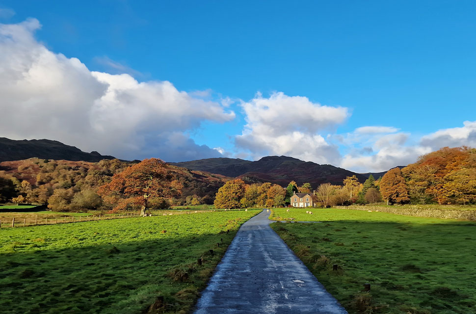
| Helm Crag appears. |
| Beyond the woodland at Lancrigg. |
 |
| Views over Easedale towarss Silver How and Lang How. |
| The autumn sunshine continued as I passed Lancrigg Hotel, then followed the walled track before turning right from where I picked up the path for Helm Crag. It was a steep start, and in the sunshine, it felt like hot work, but the views more than made up for it. |
 |
| Views extending over Brimmer Head Farm towards Blea Rigg, Codale Head and Tarn Crag (Easedale) |
| The warm sunshine soon got me overheating but who's to complain when the views are as good as this. |
 |
| Taking in the view towards Seat Sandal, Great Tongue, Fairfield and Great Rigg. |
| The steep ascent continued until the fellside plateaued above White Crag where the summit crags came into view. Meanwhile on t'other side of the A591 Seat Sandal, Fairfield and Great Rigg dominated my view eastward. |
 |
| The view over Far Easedale... |
| ...towards Tarn Crag, Easedale Tarn, Blea Rigg, Harrison Stickle, Pavey Ark and Codale Head. |
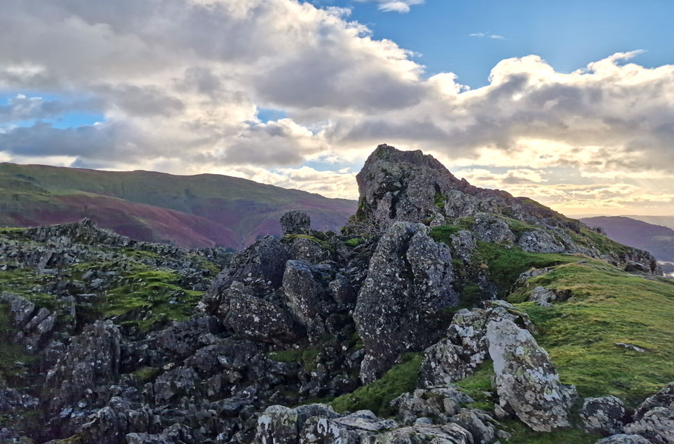 |
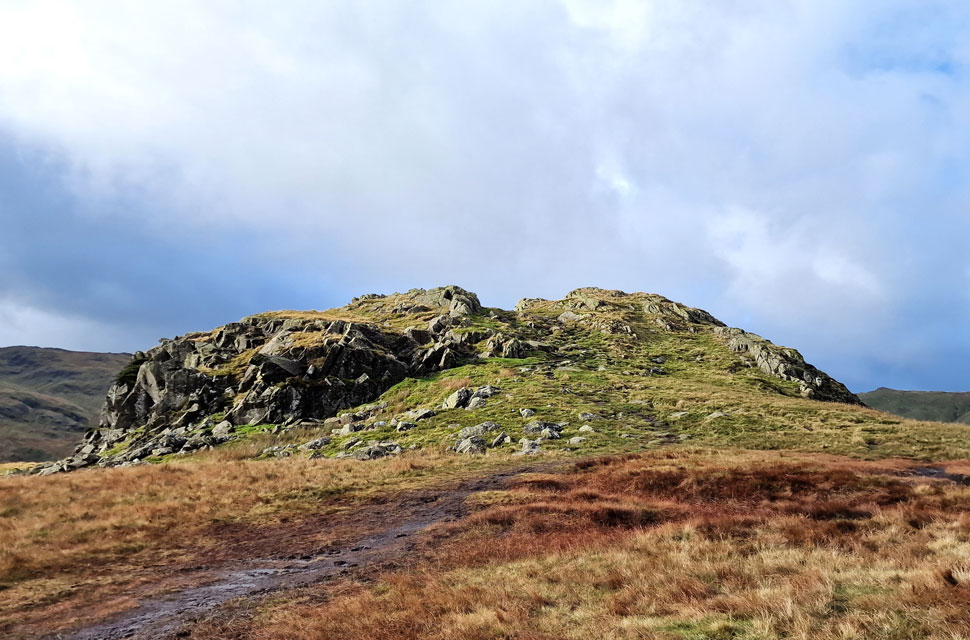
| The Lion and the Lamb, Helm Crag. |
| Cloud was beginning to build again and with it I lost the sunshine and gained an easterly wind. Ten minutes ago I was sweating it out now I'm zipping up and pulling my beanie down over my ears. |
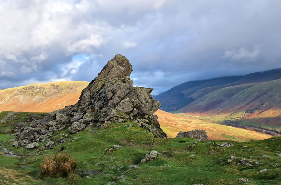 |
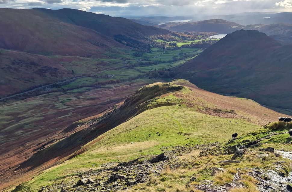
| Steel Fell and Cotra Breast from The Howitzer. |
| Notice how Steel Fell is in sunshine while on the other side of Dunmail Raise the Helvellyn range remained below, or in cloud all day. |
 |
| Wowzers. |
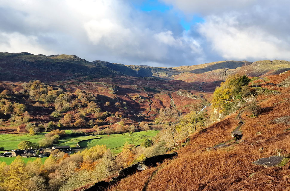
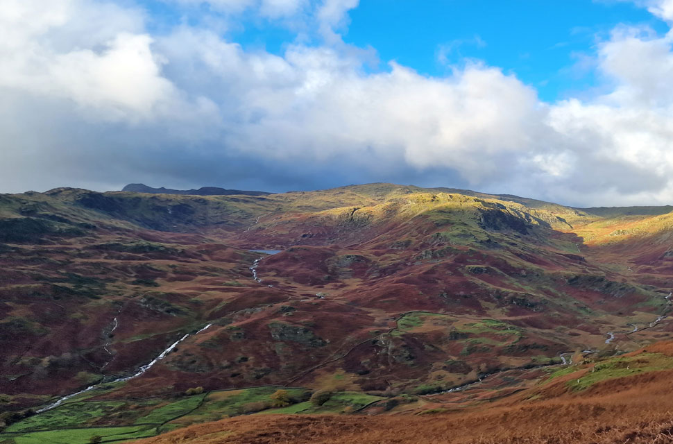
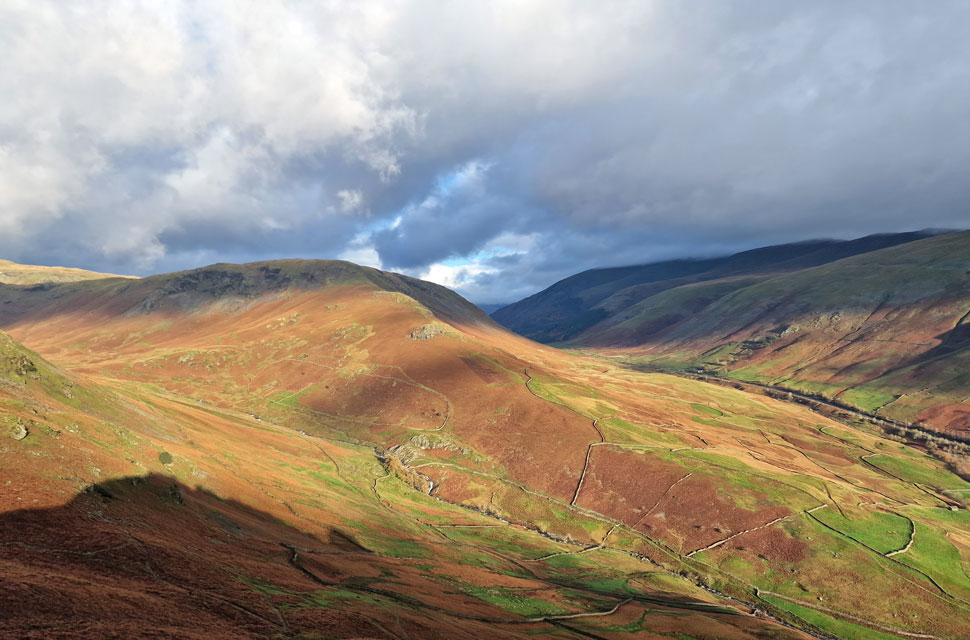
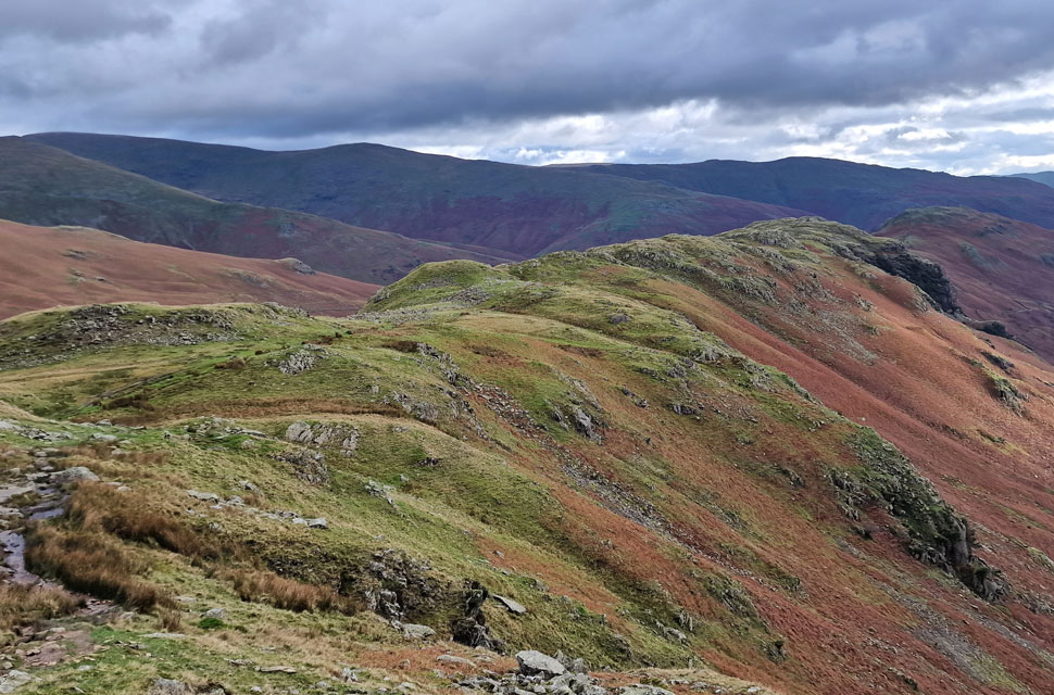
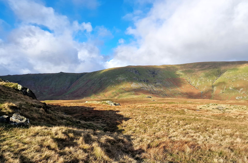
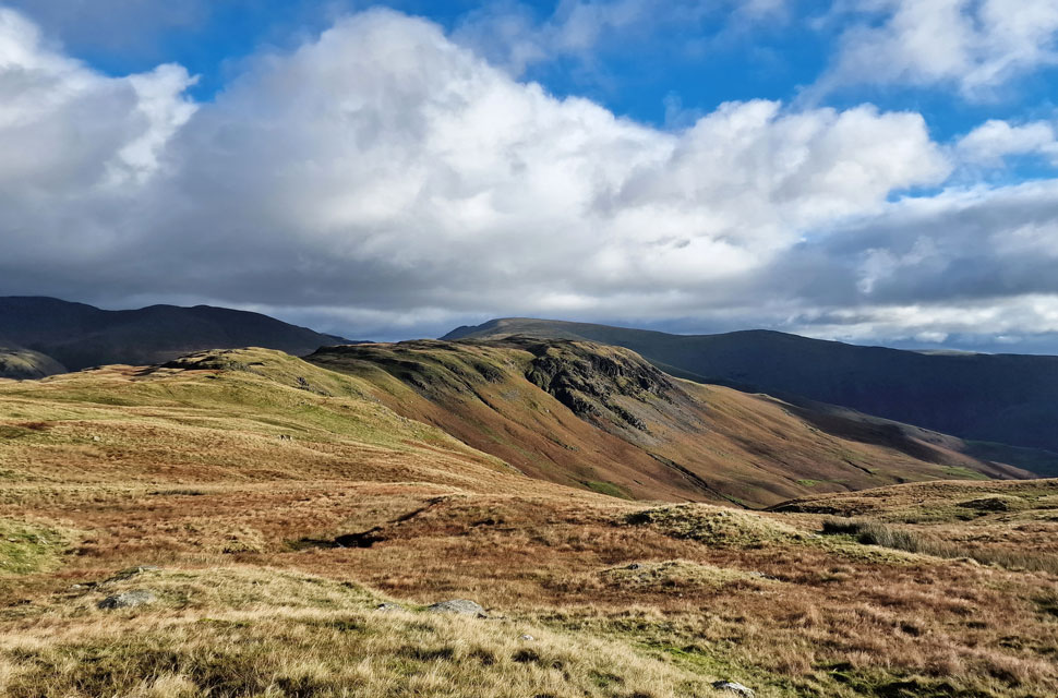
| Autumnal colours into Far Easedale with Gibson Knott seen right foreground and Calf Crag seen at the far end of the ridge. I was in my element here but the sunshine wasn't to last. |
 |
| Another view over Greenburn towards Steel Fell and Cotra Breast. |
| Viewed as I descend Helm Crag's summit towards Bracken Hause. |
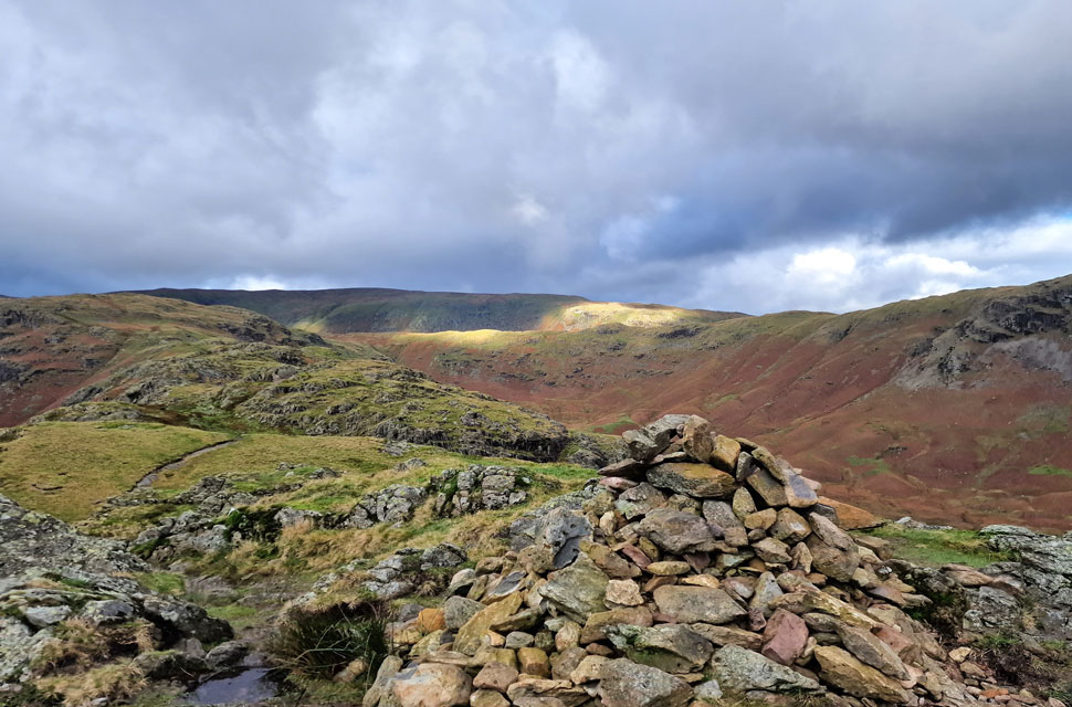 |
| Moment Crag from Gibson Knott summit. |
| Conditions remained cloudy as I crossed Bracken Hause and threaded my way across the ridge encountering swollen ground underfoot which in truth, didn't effect my pace, in fact I was lapping it up enjoying every minute. |
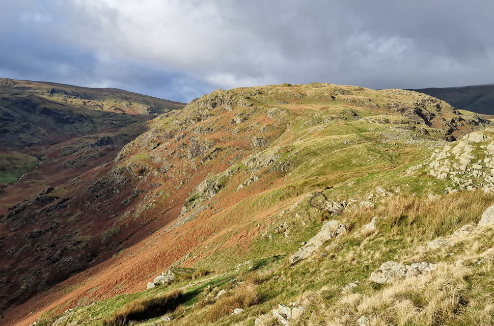 |
| Pike of Carrs appears. |
| The sunshine started to return illuminating the ridge ahead as Pike of Carrs came into view. Moments earlier I thought I'd seen a flock of sheep just below Pike of Carrs summit which turned out to be a pack of hounds two of which passed me further down the ridge, the rest had gone over into Greenburn in the time it had taken me to cross the next section of ridge. |
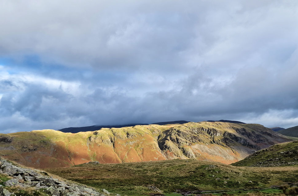 |
| Steel Fell illuminated in sunshine. |
| |
 |
| Looking back on Moment Crag, Gibson Knott and Helm Crag. |
| After the hounds had descended into Greenburn below I spotted a figure standing on Gibson Knott summit and presumed it was the huntsman confirmed a few moments later when I heard a blast from his horn. |
 |
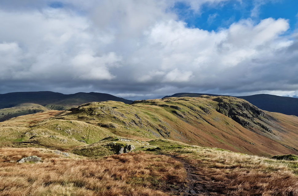
| Approaching Calf Crag summit. |
| Not only could I hear the horn in the distance I was now joined by the sound of a helicopter which seemed to be coming and going from the direction of Thirlmere. Due to the craggy outcrops obscuring my view I could only hear the helicopter as it was flying so low and presumed it was air-lifting stone in for Fix the Fells. |
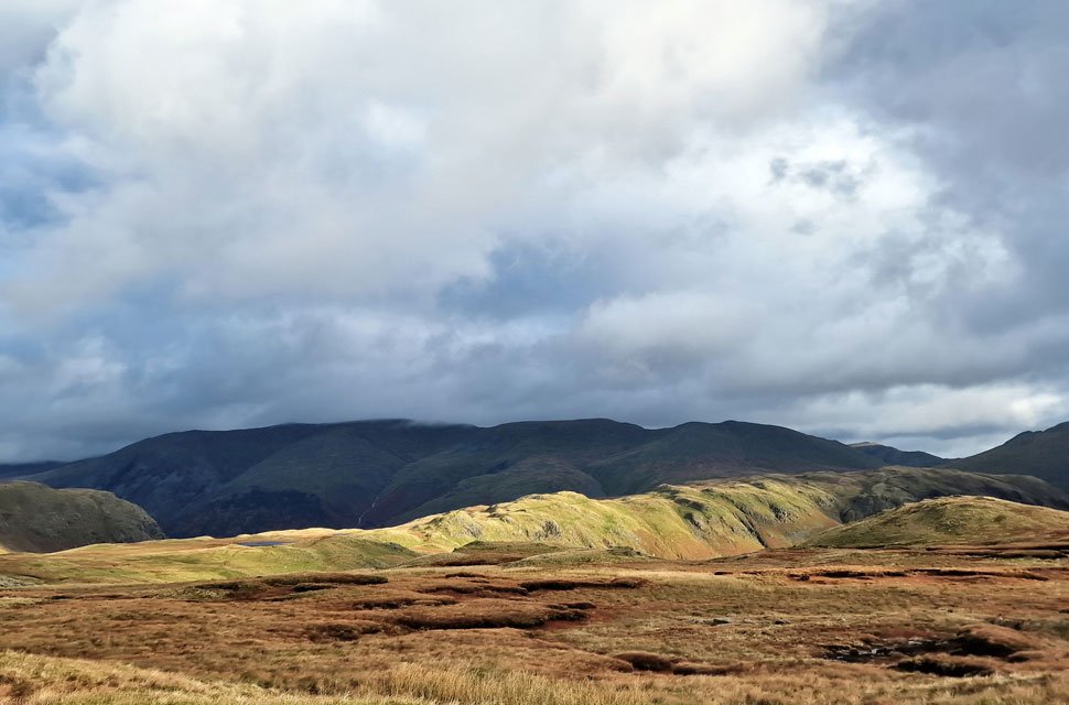 |
| Distant views of the Helvellyn range still in shade and below cloud. |
| Those with a keen eye might be able to spot the tarn (s) to the left which are really an idyllic spot when the sun is shining. |
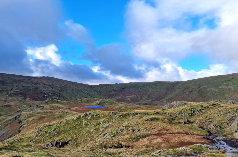 |
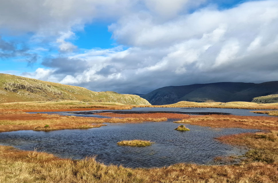
| Brownrigg Moss and Brownrigg Tarn from Calf Crag summit. |
| The helicopter (now on its third pass) was landing beyond the crags on the other side of the tarn and looked to be air-lifting panels of wood not stone which got me wondering! |
 |
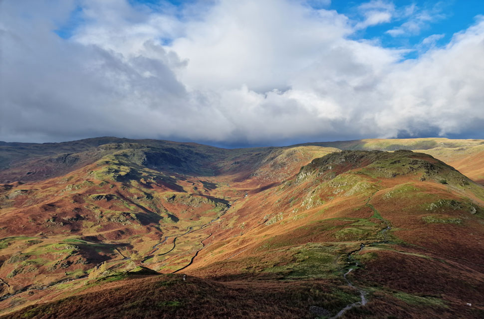
| Greenup Edge, Green Comb and Ullscarf. |
| Now in lovely sunshine I left Calf Crag summit and followed the narrow path northwards towards Steel Fell tarn noticing a woman heading towards me who must have been the same figure I'd seen ascending Cotra Breast while I was heading towards Gibson Knott earlier. Our paths did not cross as she was on a parallel path a little further west but we did manage a wave to one another. |
 |
| Soaking up the sunshine. |
| The great views continue as I head towards the tarns. |
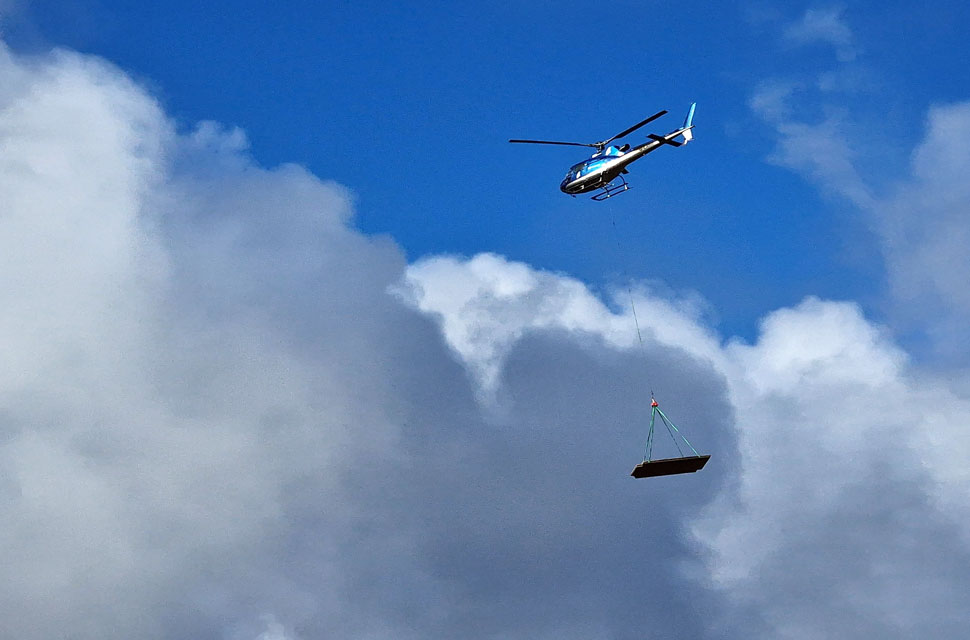 |
| Another low pass. |
| This must be the fifth or sixth pass still air-lifting the wooden panels. |
 |
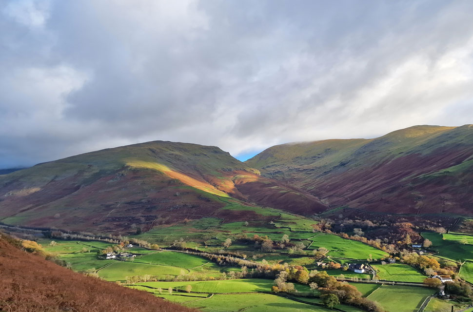
| Steel Fell seen over Greenburn. |
| With Nethermost Pike, Dollywagon Pike, Grisedale Hause, Fairfield and Great Rigg beyond. |
 |
| Outstanding. |
| |
 |
| Steel Fell Tarn. |
| The tarns were quickly reached where I was surprised to find a chap just over my shoulder with his head engrossed in a map, after numerous attempts to catch his attention I left, the chaps head still lost in the map. |
 |
| Steel Fell appearing closer. |
| Not only had I seen the chap back at the tarn but I had also been passed by a middle aged woman and a young girl about ten minutes afterwards. It would seem the Greenburn Horseshoe was proving very popular today. |
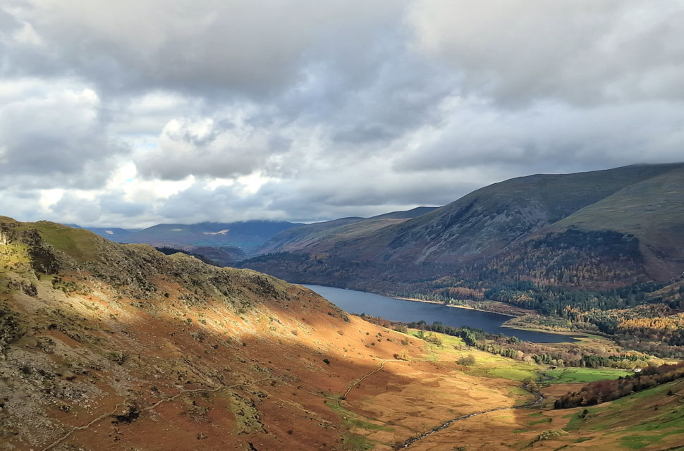 |
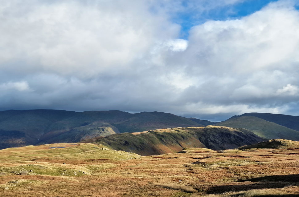
| The view over Wythburn towards the southern end of Thirlmere. |
| With Browncover Crags and Whelp Side seen to the right while in the distance, Blencathra is well below cloud. |
 |
| Thirlmere from Steel Fell summit. |
| Notice High Rigg in sunshine beyond. |
 |
| Descending Cotra Breast. |
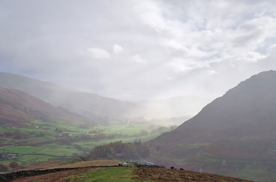
| The time between dark clouds gathering and the sun shining was getting shorter now as I spotted a shower over Far Easedale which was heading towards Grasmere. In the sunlight the rain sparkled leaving tunnels of light before the cloud grew thicker and the shower heavier. Just one valley over and the sun was still shining but it wouldn't be for long. |
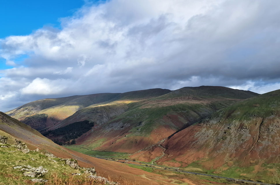 |
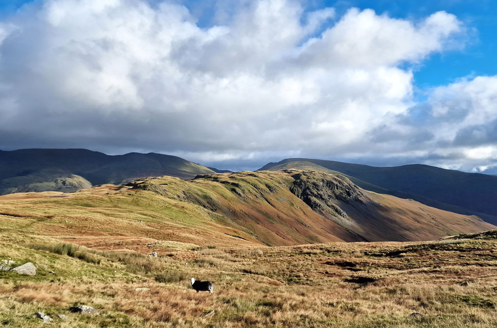
| Views over Dunmail Raise towards Browncover Crags, Helvellyn, Nethermost Pike, Dollywagon Pike and the bulk of Seat Sandal. |
Watching where the rain was heading, I continued my descent before passing a solo chap, and after a brief hello, we stopped to chat. As it turned out the chap, whose name I forgot to ask, was originally from Manchester but has since moved to Arnside, north of Morecambe Bay.
We shared a similar interest and had picked up plantar fascilitis due to our passion for fell walking, and he'd even visited the website for a walk or two. If you are reading this, I hope you enjoyed the rest of your walk on the Greenburn Horseshoe. It was really nice to meet you. |
 |
| In for the day. |
Both the chap and I watched the rain scuttle east, expecting it to stop just as quickly as it started, but the rain spread, and after parting ways I noticed my jacket was being pelted by rain drops. I looked back up the ridge, but in the time it had taken the rain to spread both myself and the chap had covered some ground, and he was out of sight. I couldn't help but feel sorry, not just for him but for the three solo women, one of whom was just a young girl taking a soaking right now. I really thought the rain was going to ease, but it didnt ; in fact, it got heavier, and by the time Ghyll Foot was reached, I was soaked through.
Once again, a canopy of trees came to my aid as I descended from Ghyll Foot towards Low Mill Bridge, where I was passed by another young girl who'd stopped to wipe her glasses before saying hello. Rainwater was draining in the gutters carrying along pine needles and leaves. Low Mill Bridge was passed from where I headed left towards the A591 and the Travellers Rest. With the A591 reached, it was safer to walk back to Grasmere on the opposite side of the carriageway, which at least afforded me a view up a raging Tongue Gill, the white water almost drowning out the traffic over my shoulder. The sound of water cascading down the hillside faded as I passed the Traveller's Rest before taking in the view towards Stone Arthur. While below, during a fleeting few seconds of sunlight, the woodland shone in autumnal glory. |
|
| |
| Back to top |
 |
|