|
Yewbarrow - South to North |
 |
 |
11th November 2023 |
 |
|
The trio were off to do their own walks this weekend with David enjoying two great walks covering the Scandale Valley from Rydal and on Saturday an early morning walk over Haystacks while Rod, Michael and Louise climbed Blencathra's Halls Fell ridge from the Blencathra Centre which left me to fall back on what is fast becoming one of November's 'go to walks' Not only do I have a 'go to walk' list but I also categorise them by which months I like to walk them and this month came the turn of Yewbarrow.
My total ascents for Yewbarrow may have not reached into double figures but it's up there as one of my favourite western summits and the only reason why I don't climb Yewbarrow more is logically Wasdale is not so much difficult as it is long distance to drive to which I guess is the same for most folk if you dont live in the west of Cumbria, ahh that's why the say west is best and there's definitely some truth to that.
Today I return not just because Yewbarrow is a western favourite of mine but because it packs an emotional pull. Yewbarrow was the first Lakeland fell I summited after my fathers death and during that ascent a couple of years ago I was reminded of the happier times and a closeness to my father that I hadn't felt all the time he had been sick. |
|
| Wainwright Guide Book Seven |
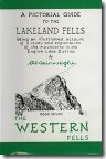 |
| The Western Fells |
| Many mountains have been described as having the shape of the inverted hull of a boat, but none of them more fittingly than Yewbarrow. |
 |
|
|
|
| |
|
Overview |
|
|
| Ascent: |
1,950 Feet - 595 Metres |
| Wainwrights: |
Yewbarrow |
| Visiting: |
2, Yewbarrow North Top - Stirrup Crag |
| Weather: |
Bright Autumn Sunshine Highs of 9°C Lows of 2°C Feels Like 2°C |
| Parking: |
Car Park, Overbeck Bridge |
| Area: |
Western |
| Miles: |
4.5 |
| Walking With: |
On My Own |
| Ordnance Survey: |
OL5 |
| Time Taken: |
3 Hours 50 Minutes |
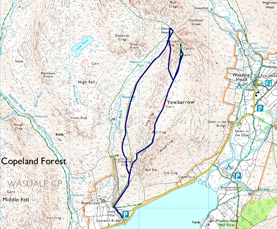
| Route: |
Overbeck Bridge - Dropping Crag - Bell Rib - Yewbarrow South Top - Yewbarrow North Top - Top of Stirrup Crag - Dore Head - Over Beck - Overbeck Bridge |
|
| |
|
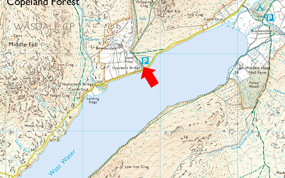
Parking Details and Map |
|
|
| Nearest Post Code: |
CA20 1EX |
| Grid Reference: |
NY 168 206 |
| Notes: |
A small car park with room for around a dozen well parked cars can be found next to Overbeck Bridge. There is an honesty box close to the entrance to the car park on the right hand side. |
|
| |
|
Map and Photo Gallery |
|
|
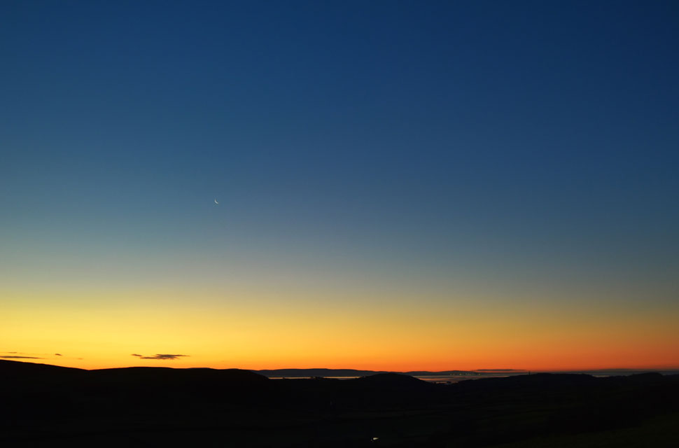 |
| Sunrise over the Duddon Estuary from Grizebeck. |
| The sunrise was unfolding in my rear view mirror so I stopped at the top of the brow between Gawthwaite and Grizebeck to take in the view watched on by a herd of cows in a nearby field. If these skies were anything to go by I'm in for a treat today. |
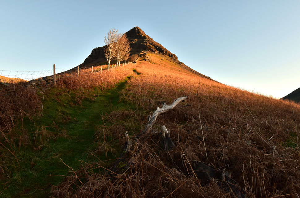 |
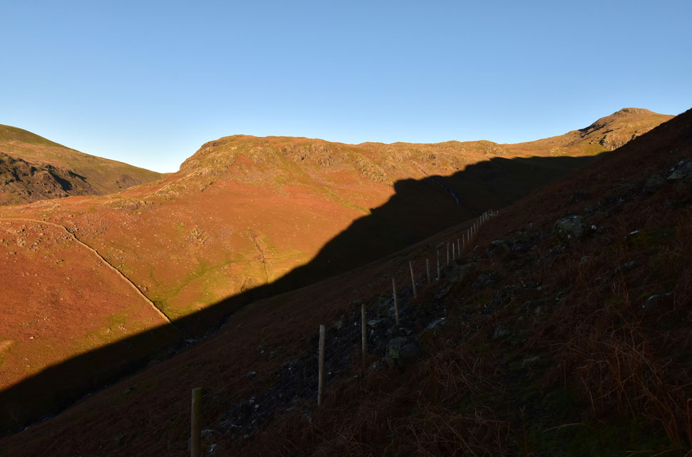
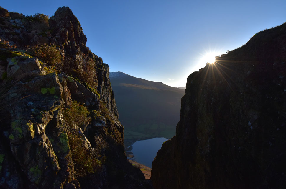
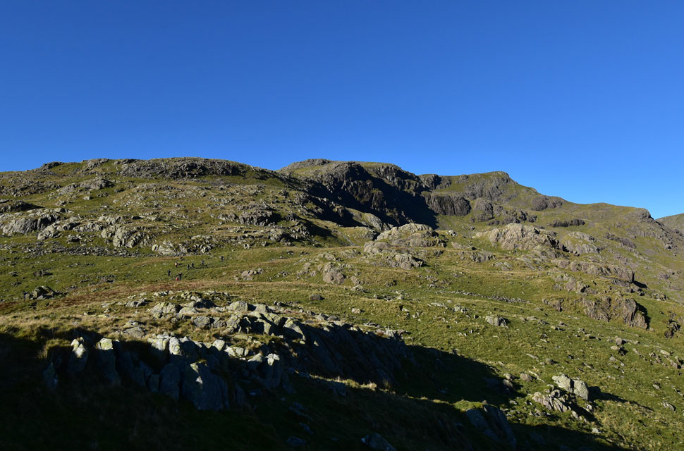
| Dropping Crag and Bell Rib from my ascent on Yewbarrow's South ridge 2°C 8:15am |
The stars were out when I left home and the sunrise revealed nothing but clear skies Venus and a Waning Cresent moon. Snow had fallen on Thursday night bringing a dusting of snow to the highest summits across the park. The car park was less than half full when I arrived at the sametime a large walking group were leaving for what turned out to be an ascent on Red Pike.
On the other side of the car park a young lass locks her car, shoulders her pack and heads out of the car park in the direction of Bowderdale and I wondered of her route. I let ten minutes pass to let the walking group create a gap before locking my own car and picking up the footpath alongside a spated Over Beck as streaks of sun light began to the fill the valley. |
 |
| Light filters through the Wasdale valley. |
| Here looking back on Wast Water, Illgill Head, Whin Rigg and Irton Pike on the lower skyline. |
 |
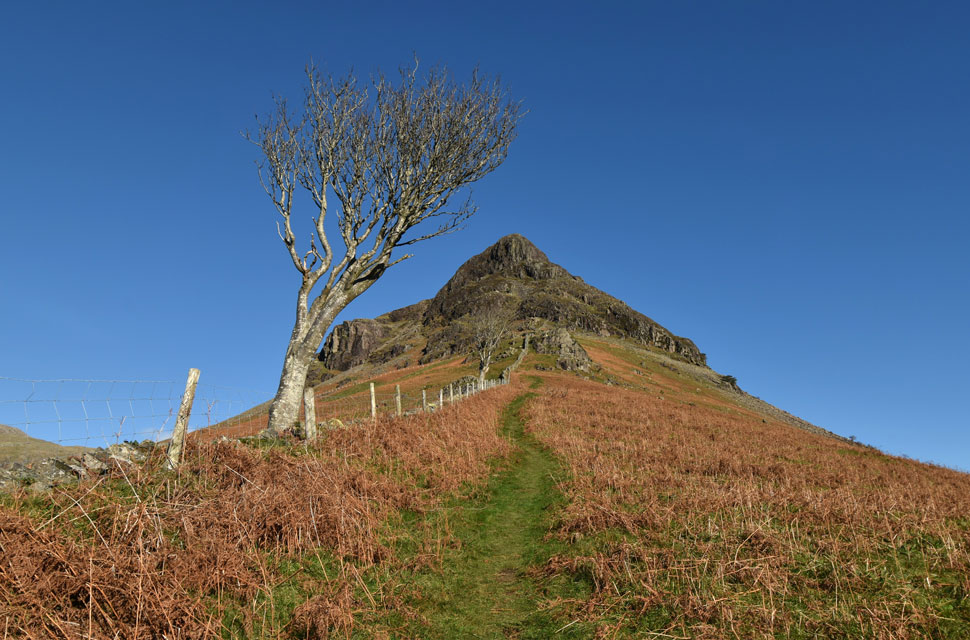
| Yewbarraw South ridge. |
| It's a steep start from the off and with the large walking group having already passed over the ladder style directly below Bell Ribb It would seem me holding back has paid off finding I now have the ridge to myself. |
 |
| Light and shadow. |
| Here as I look beyond Bowderdale towards Middle Fell. |
 |
| Knott Ends and Red Pike (Wasdale) |
I continued up the steep south ridge until I too had reached the ladder style, from where I could see the walking group who where making their way through Overbeck towards Dore Head and Red Pike beyond.
After crossing the style I followed the path until it forked right towards a wooden gate ahead, after passing through the gate the steepness continues as I followed the stone path as it threaded its way between Dropping Crag and Bell Ribb. |
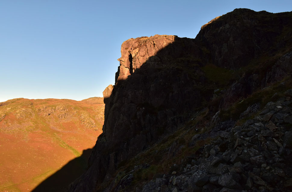 |
| Dropping Crag in the morning light. |
| The stone path abruptly stops below a shattered rock gully where the path forks left to avoid the worst of the crag but if you've got a bit of bounce in you as I had this morning I scrambled up the crags instead. |
 |
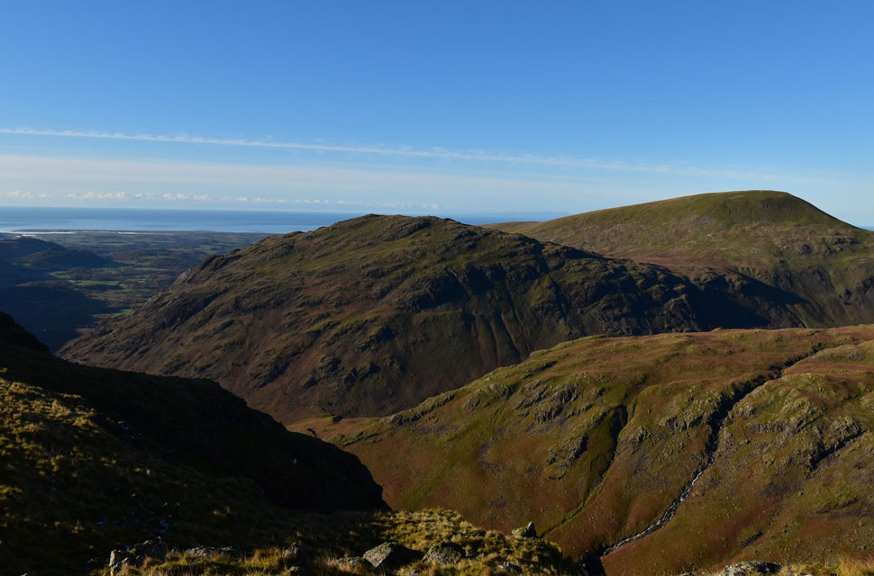
| Looking down on Dropping Crag. |
| Towards Bowderdale and Middle Fell with Wast Water coming into view over on the left and the Cumbrian coast in the distance. |
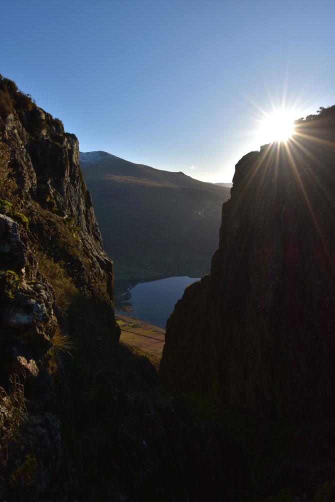 |
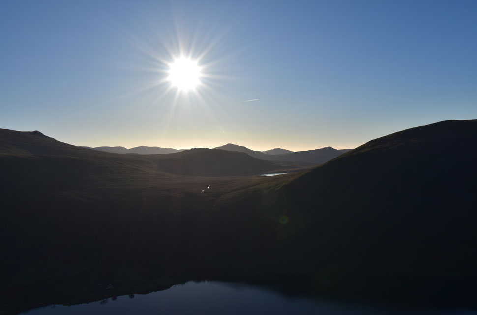
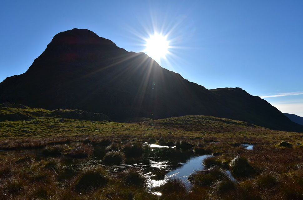
| Great Door sunrise. |
| At the head of the gully the path forks left and right again, left ascends via the traditional route while right ascends via a steep grassy rake directly towards Great Door. What a view! |
 |
| Sca Fell and Slight Side from Great Door. |
| The view from Great Door is magical but with the rock so slippery underfoot it pays to test every step first especially if your concentrating on the view. |
 |
| Sun rising over Burnmoor Tarn. |
| With Slight Side and Great How just beyond. |
 |
| Bull Crag ahead. |
| The vast majority of the hard work is behind me now as I take on Bull Crag under brilliant sunshine. |
 |
| Looking down on Wast Water from below Bull Crag. |
| Great Door is almost out of view now at the end of the ridge, with an unmanned cleft directly below that looks impassible, but a grassy ridge connects the crossing with ease, with the exception of a rock step that reminds me of the rock step on Cofa Pike in that it's narrow and there's a tricky shoulder-height boulder to the right that can easily throw your upper body off balance. |
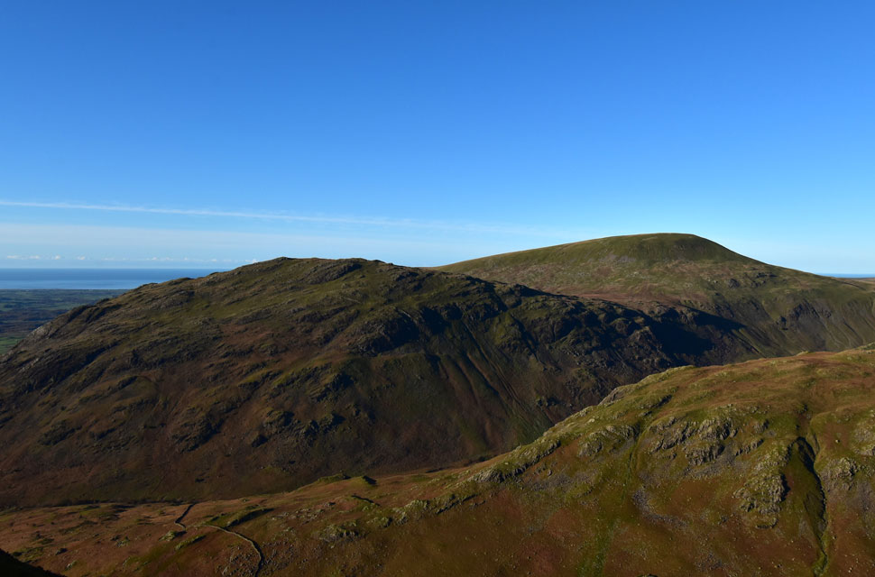 |
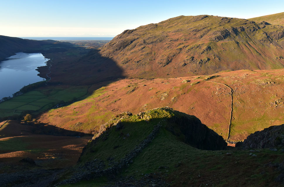
| Views over Knott Ends towards Middle Fell and Seatallan. |
The stone wall seen below Knott Ends is the same wall that drops steeply into Overbeck then ascends even steeper up on to Dropping Crag summit. The stone wallers of Lakeland weren't just masters of their craft, they were great climbers too. |
 |
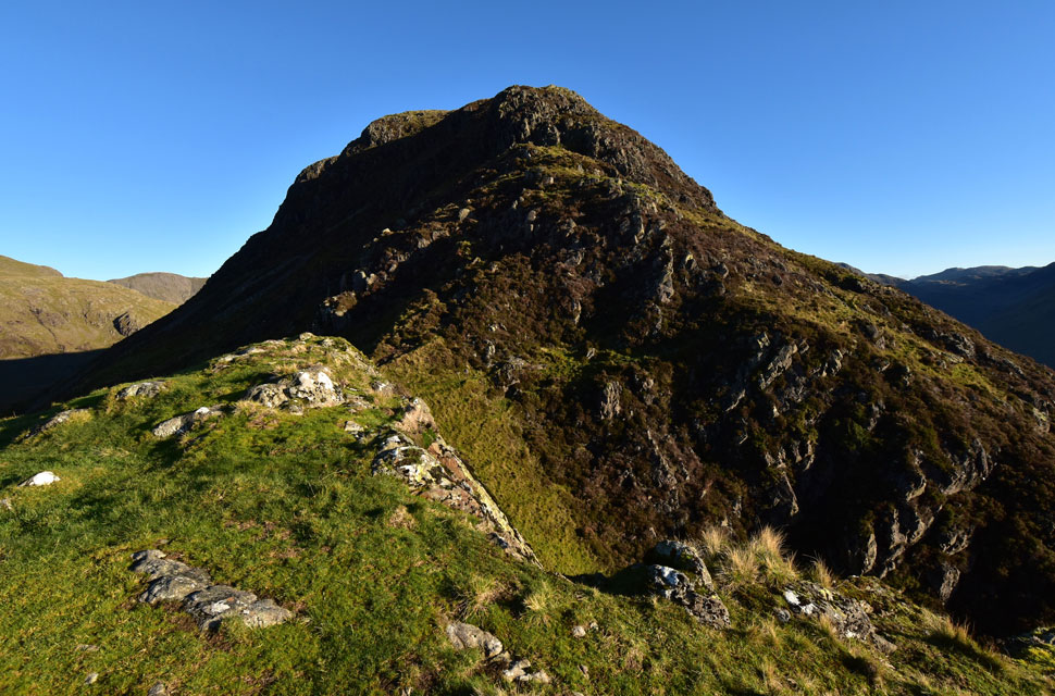
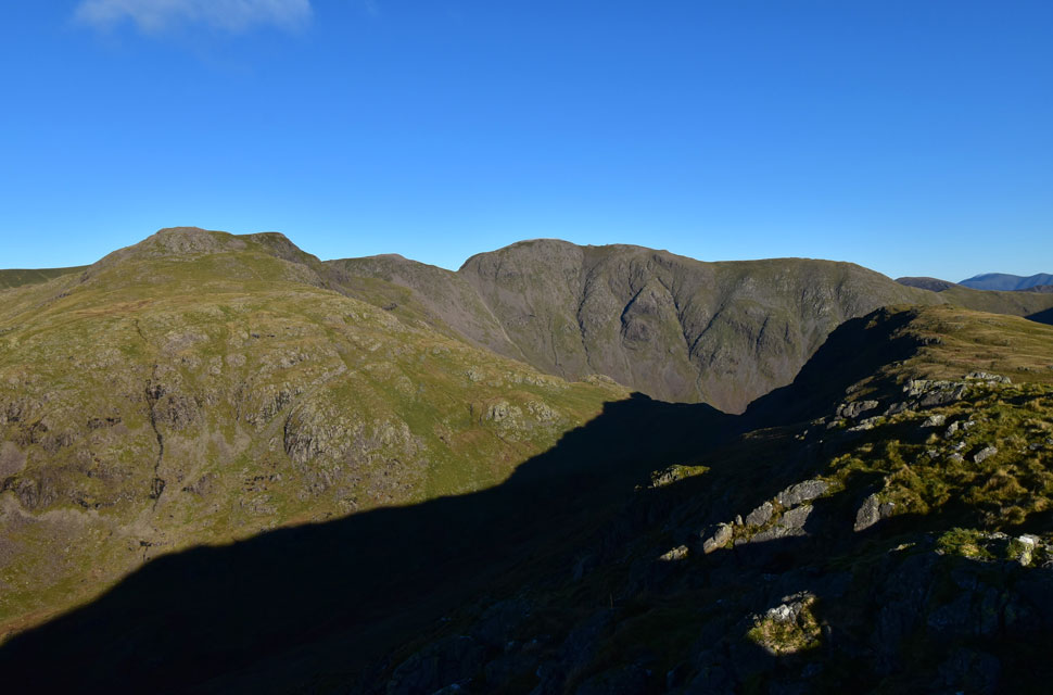
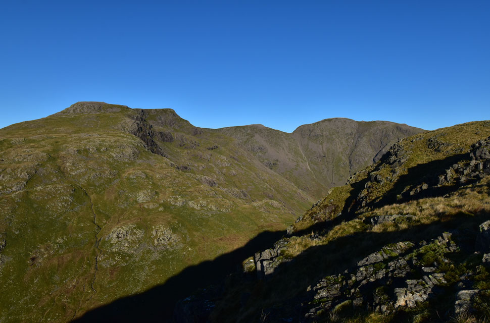
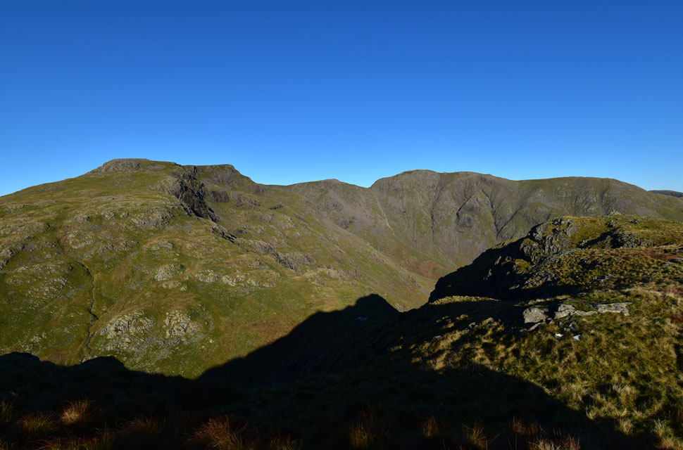
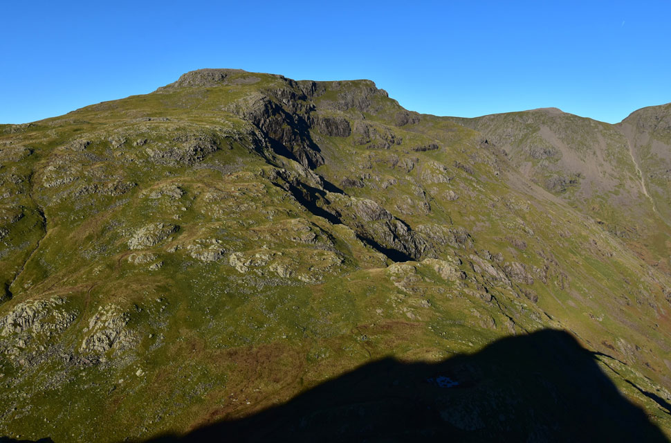
| Yewbarrow summit comes into view as I top out on Bull Crag. |
| With Red Pike, Scoat Fell, Black Crag, Wind Gap, Pillar and Looking Stead seen to the left. |
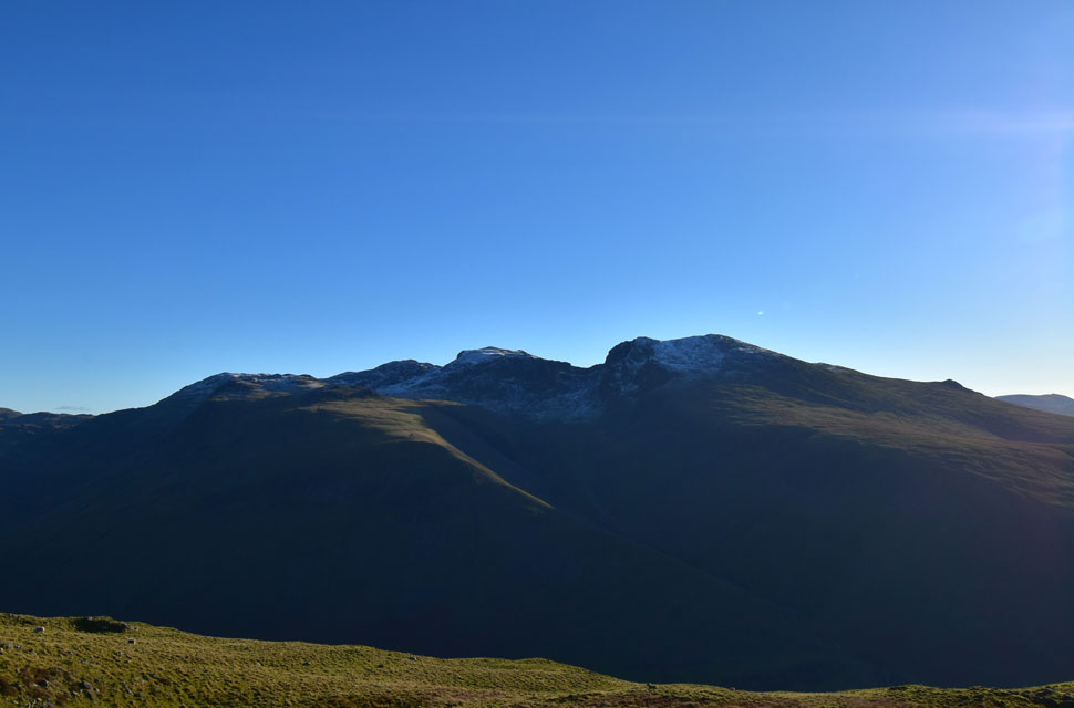 |
| Looking towards Lingmell, Broad Crag, Scafell Pike, Mickledore, Sca Fell and Slight Side. |
| I wasn't lucky enough to encounter any snow; in fact, I was so layered up, I was beginning to overheat. |
 |
| Here taking in the view over Knott Ends towards Middle Fell and Seatallan. |
| Almost at the summit now as I take in the views criss-crossing the saddle from east to west. |
 |
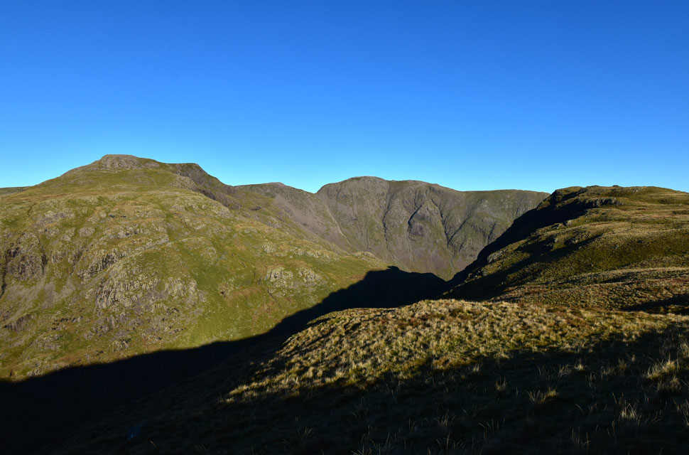
| Red Pike (Wasdale) Scoat Fell, Black Crag, Wind Gap and Pillar from Yewbarrow summit. |
| What a glorious day to be out on the hill. |
 |
| Pillar, the top of Black Sail Pass and Kirk Fell from Yewbarrow summit. |
| Time to leave the summit now as I continue exploring the views. |
 |
| Red Pike (Wasdale) Scoat Fell, Black Crag, Wind Gap and Pillar from Yewbarrow. |
| The clarity was so clear I was able to spot three walkers heading from Scoat Fell to Black Crag in the distance before thinking how early had they set off to gain such height as it's only just past 10:00am |
 |
| Red Pike (Wasdale) Scoat Fell, Black Crag, Wind Gap and Pillar. |
| The view that never disappoints. |
 |
| Red Pike (Wasdale) Scoat Fell, Black Crag, Wind Gap and Pillar from Yewbarrow. |
| Yewbarrow's north cairn comes into view, time to head to t'other side of the summit now. |
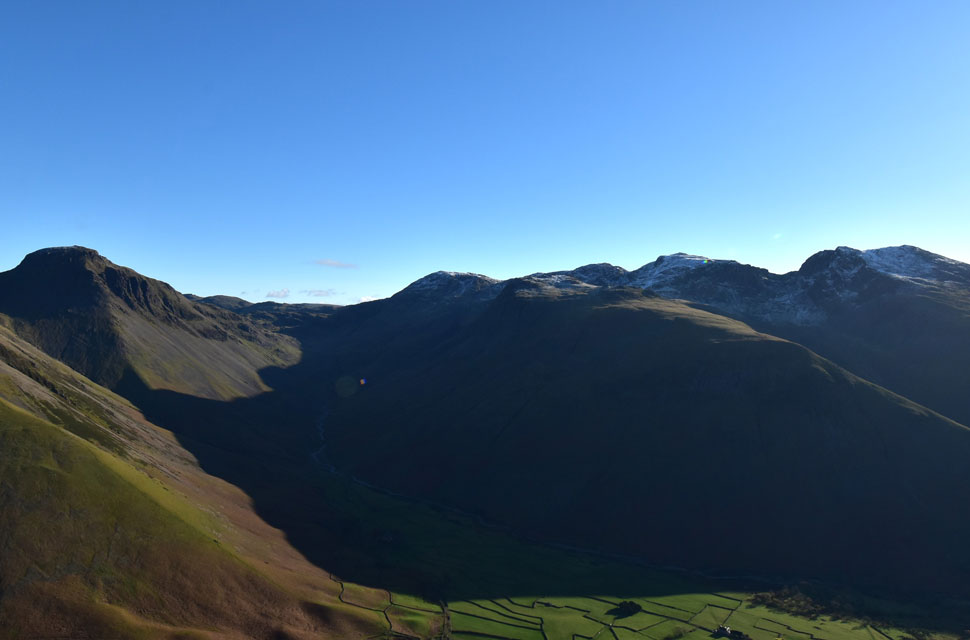 |
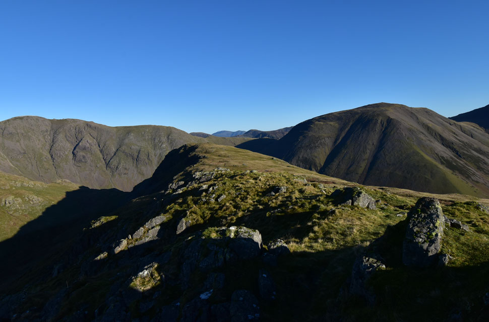
| Looking north towards Great Gable, Sty Head, Great End, Lingmell, Broad Crag, Scafell Pike and Sca Fell. |
| Here I take in the views directly over Wasdale Head towards England's highest ground. |
 |
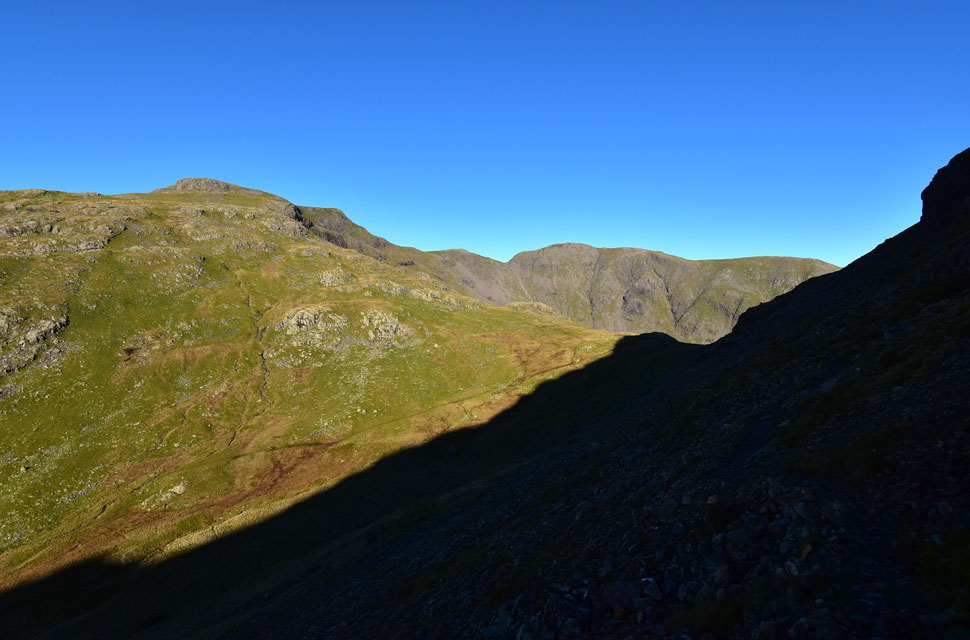
| Red Pike (Wasdale) Scoat Fell, Black Crag, Wind Gap, Pillar and Looking Stead from the Stirrup Crag summit. |
| The distinctive northern tip of Yewbarrow over shadowing Dore Head below, I'll be down there soon. |
 |
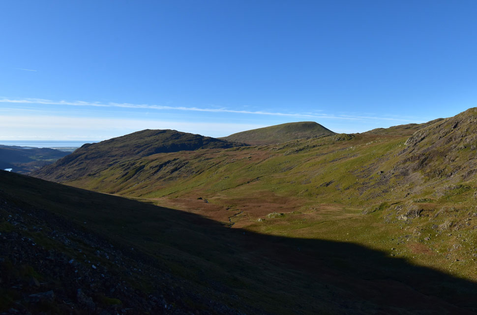
| Kirk Fell broad side. |
| Given how nice the forecast is I expected to see dozens of walkers in the Mosedale valley below but only sighted three walkers stood on Looking Stead summit seen over on the left. |
 |
| Red Pike (Wasdale) seen over Dore Head. |
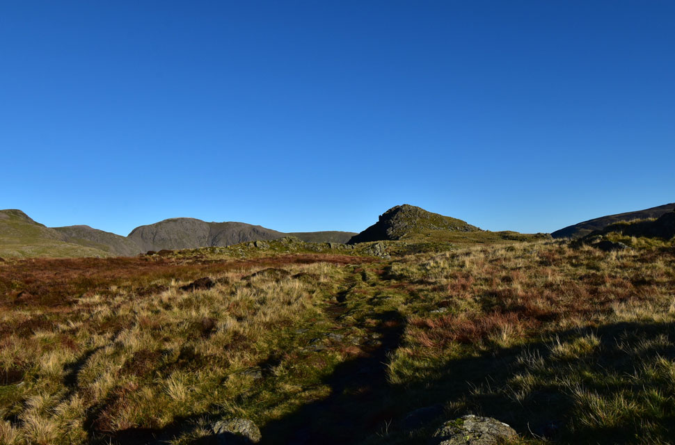
| From the north cairn I dropped down onto Stirrup Crag's summit to get a clearer view of Mosedale before returning to the north cairn via a slightly different path. |
 |
| Descending towards Dorehead. |
| I wouldn't be comfortable descending Stirrup Crag when the rock is so wet and greasy and as a result I retraced my steps to about half the way across the summit saddle before taking the rocky diagonal path back towards Dore Head. |
 |
| Overbeck. |
| You can't see them but there's another large walking group walking through the valley half of which will make it to Dore Head before I do. |
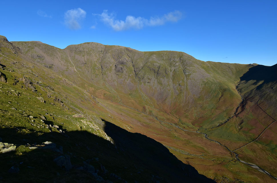 |
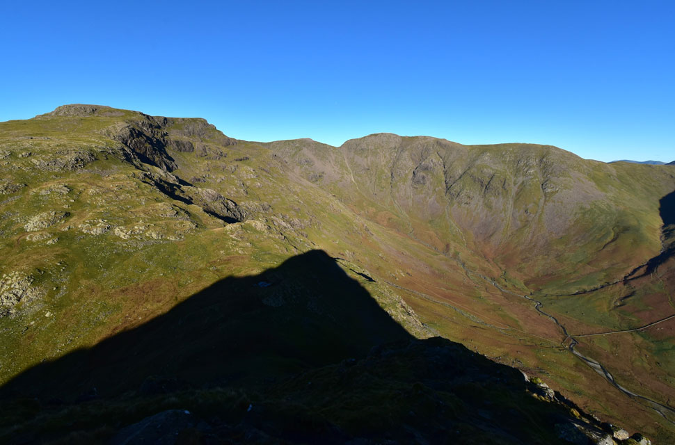
| Black Crag, Wind Gap, Pillar, Looking Stead and the top of Black Sail Pass seen from Dore Head. |
| It's difficult to look down on Mosedale without being reminded of the day I climbed Red Pike directly via the stone wall seen below. To this day it's up there with one of the most steepest and direct ascents I've undertaken but thoroughly enjoyable all the same. |
 |
| Red Pike (Wasdale) |
| You can still make out the large group of walkers making their ascent on Red Pike. |
 |
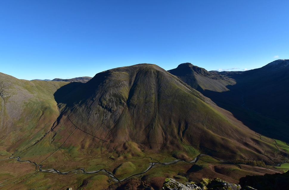
| Yewbarrow from Dore Head. |
| Taken from a favoured pool at Dore Head which was semi-frozen this morning. |
 |
| Looking back on Dore Head from Overbeck. |
| I watched the walking group begin their ascent on Red Pike and couldn't help but look on with envy, but, I've promised Paula I'd be home early so I'm not moaning that I'm tired when we meet with family later! |
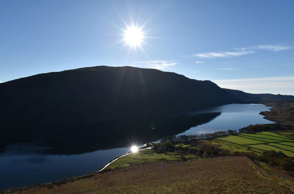 |
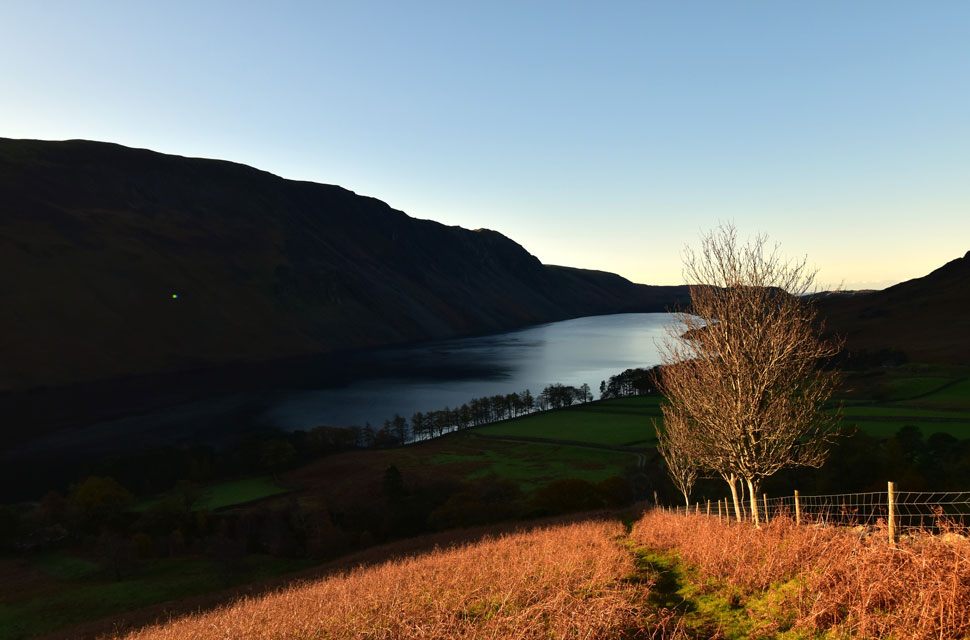
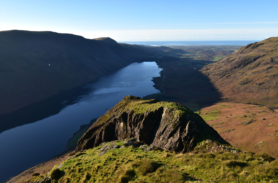
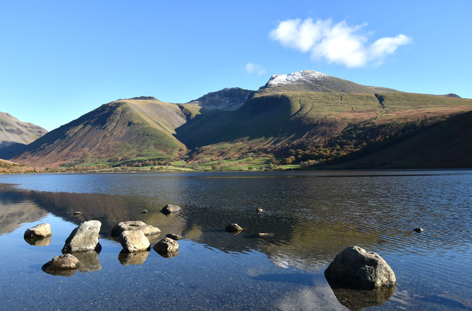
| Wast Water reflections. |
| Seen as I leave Overbeck behind and link back up with the south ridge ready for my descent back to the car park in the trees below. |
 |
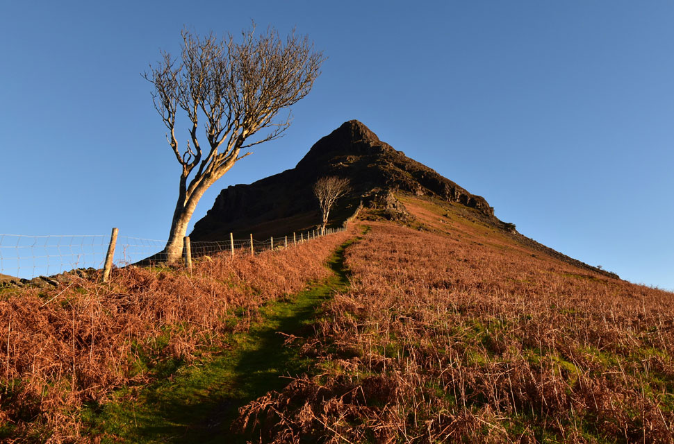
| One last look up the South ridge. |
| Because I had too. |
 |
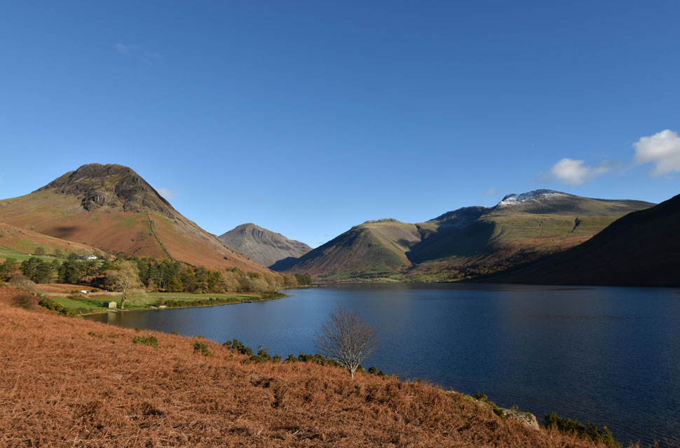
| Lingmell and the Scafells from the shores of Wast Water. |
The sun was warm now, and truth be told, I should have de-layered because I was beginning to overheat, but the car was too close, so I stuck with it instead. I passed a young couple close to the ladder style, both wearing T-shirts and even a sun hat, and smiles were exchanged as I crossed over the style and began my descent down the south ridge, not really thinking about the steepness of the incline as I had this morning.
I was about ten minutes ahead of where I needed to be as I descended through a thinning treeline flanked by Over Beck to my right I entered a bustling car park but ignored my car and instead continued just a little further to the shoreline where views of the first snow of Winter reflected onto Wast Water below. |
 |
| Yewbarrow, Great Gable, Lingmell, Scafell Pike and Sca Fell from Wast Water. |
| |
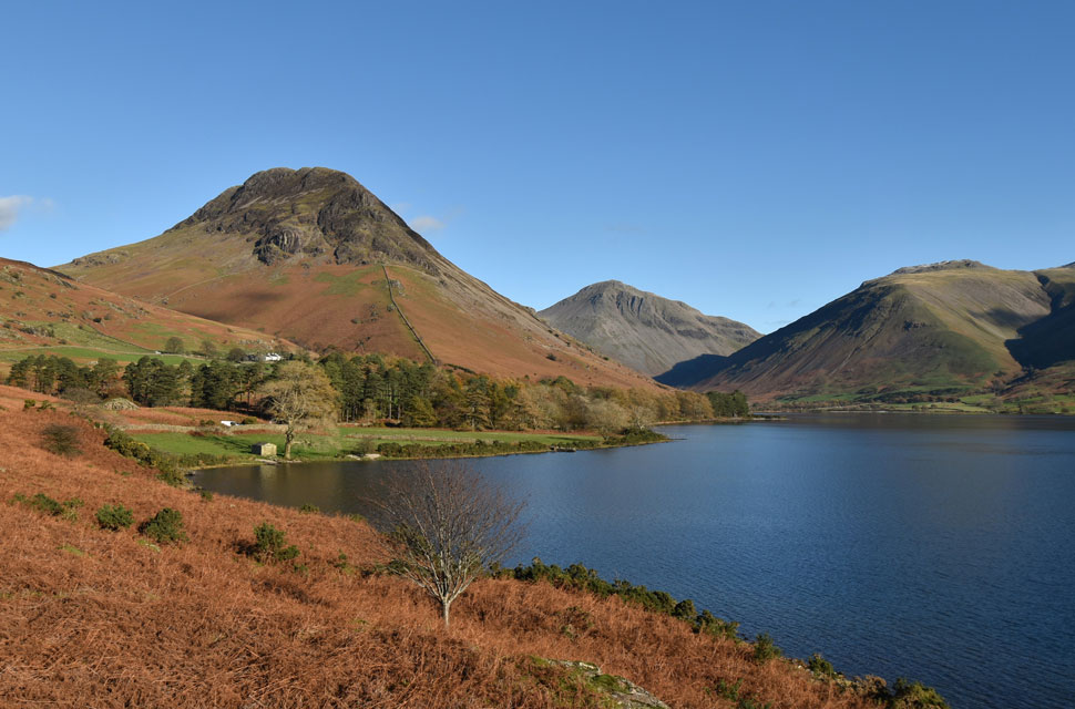 |
| Yewbarrow, Great Gable and Lingmell from Wast Water. |
|
|
| |
| Back to top |
 |
|