|
Cat Bells, High Spy & Nitting Haws |
 |
 |
3rd August 2024 |
 |
|
|
| |
|
Overview |
|
|
| Ascent: |
2,447 Feet - 745 Metres |
| Wainwrights: |
3, Cat Bells - Maiden Moor - High Spy |
| Visiting: |
2. Skelgill Bank - Nitting Haws |
| Weather: |
A Bright Start With Mixed Sunshine & High Level Cloud - Feeling Brisk At Height. Highs of 16°C Lows of 14°C Feels Like 8°C |
| Parking: |
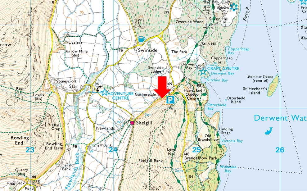
Parking Spaces, Gutherscale |
| Area: |
North Western |
| Miles: |
8 |
| Walking With: |
On My Own |
| Ordnance Survey: |
OL4 |
| Time Taken: |
4 Hours 30 Minutes |
| Route: |
Gutherscale - Skelgill Bank - Cat Bells - Hause Gate - Maiden Moor - Narrow Moor - High Spy - Nitting Haws - Drove Path - Cockly How - Swanesty How - Manesty - Gutherscale |
|
| |
|
Parking Details and Map |
|
|
| Nearest Post Code: |
CA12 5UE |
| Grid Reference: |
NY 246 121 |
| Notes: |
There is room for around ten well parked cars at Gutherscale which is perfectly postioned for a quick walk up Cat Bells or a full day on the Newlands Fells. Leave the A66 for Portinscale and pass through the village before the entrance to Nicol End (Derwent Water) appears on the left, continue to follow the road which forks right signposted (Stair and Newlands Valley) Keep left here and continue to follow the road which sweeps around a right hairpin bend before passing over a cattle grid. The parking spaces will appear around 300 yards further on the left. Parking is free. |
|
| |
|
Map and Photo Gallery |
|
|
  |
| |
| |
 |
| View over Gutherscale towards Rowling End, Causey Pike, Outserside and Barrow 14°C 7:00am |
I had to miss the fells last weekend due to a rather nasty case of Covid which seemed to go on forever, suffering with loss of taste and smell, a total lack of appetite, and headaches that lasted for days, to say it knocked me for six would be an understatement and although I'm free from Covid, I'm far from fit. I have some leave coming up, and as usual, I wanted to plan those bigger walks yet despite the routes being in my head, there was no way my body would allow me to do them, so I'm starting to regain my fitness and walk what I consider to be a classic Lakeland ridge route from Cat Bells to High Spy with a hidden kick, descent via Nitting Haws. I left home around 5am and arrived at the parking spaces at Gutherscale around 6:50am to find just three spaces left.
I'd followed a couple driving a Nissan X-Trail from Portinscale, and as I kitted up the woman looked over and dissapointingly said, "It's sad that it's got to this now." I knew instantly what she was referring to, having to time our arrivals much earlier due to the popularity of the Lakeland fells which seems to be growing year on year. As it turns out, the couple were from Holmefirth which is on the doorstep of the Peak District, and I had to reply, "You've left a beautiful part of the country already" I replied, "Yes, but we do prefer the Lakes." I'd left home at 5am and this couple had left at 4am, During the course of this walk, I would meet people who'd left earlier. With my car locked, I left the car park and began the steady ascent through wet bracken, which spread a nice damp patch across the front and sides of my shorts, nice! |
 |
| Sunrise over Derwent Water. |
| It only took me fifty paces to realise just how unfit I was feeling. By the time I'd reached the first twist in the path, I was blowing like an old steam engine; my chest heaved and my nose began to run. I knew I'd been poorly, but I didn't need a doctor to tell me how much it had taken it out of me. Cat Bells was doing a great job. With the morning sunshine bearing down on me, I continued while trying to regulate my breathing and coughing up whatever had been on my chest for the last two weeks. I never questioned myself about why I shouldn't be here; it was just that the engine hadn't been fired for a couple of weeks. I was bound to cough and splutter at first, I thought. |
 |
| Views over Newlands towards Ard Crags, Knott Rigg, Rowling End, Causey Pike, Sail, Eel Crag (Crag Hill) Sand Hill and Grisedale Pike. |
| The bright start had been overtaken by high level cloud some of which sat on the higher Grasmoor summits. |
 |
| Cat Bells, Hindscarth, Robinson and Eel Crag (Crag Hill) from Skelgill Bank. |
| It was around 7:20am by the time I'd reached Skelgill Bank from where I could take in the views all the way to Cat Bells summit, it would appear I have the fell to myself but I suspect there's a heap of folk behind me. |
 |
| Cat Bells, Hindscarth and Robinson. |
| Two fell runners did catch me up, which eased the pressure because I thought it was the couple I'd been talking to back at the car park but after a quick scan around they'd just gained Skelgill Bank behind me. Up ahead, I can see two people at the summit, Okay I don't have the place to myself, but it felt like I did for about twenty-three seconds. |
 |
| Looking back on Skelgill Bank in lovely contrasting light. |
| The cloud was thickening but not enough to actually shroud the fells just yet. Here I take in the view back along the ridge towards a cloud topped Skiddaw and Bassenthwaite Lake. |
 |
| Hindscarth and Robinson from Cat Bells summit. |
| The two people I'd seen turned out to be a fell runner who asked me about my route, replying with "enjoy your day" followed by a burley chap from Hull who'd set off at 3am to secure his parking spot. I'm not sure why he felt he had to explain that he wasn't fit because I certainly wasn't questioning him, and after some general chitchat, we too bid each other to enjoy the rest of our days. Nice chap. |
 |
| Maiden Moor across Hause Gate. |
| With Hindscarth seen far right. |
 |
| Wild-Campers, Bull Crag on Maiden Moor. |
| By now I'd began to regulate my pace and breathing and aside my snurching nose I was actually starting to feel like myself again. With height came a drop in temperature and I was glad I was wearing the new long-sleeved Alpkit base-layer I treated myself too. The wild-campers came as a surprise one of whom had a kettle on the boil and I couldn't but help envy what a great location this was, albeit a tad wet underfoot. |
 |
| Narrow Moor and Blea Crag (High Spy) from Maiden Moor. |
| I soon arrived at Maiden Moor summit just as the sun came out bringing with it some much needed warmth! The couple from the car park aren't far behind but instead of following me to the summit they make their way across Narrow Moor. |
 |
| Skiddaw, Blencathra and Cat Bells from Maiden Moor. |
| The sun might be shining and it might be August but it's bloody chilly up here this morning. |
 |
| Views over Newlands Beck towards Squatt Knotts on Hindscarth with Robinson in the distance. |
| |
 |
| Fabulous Narrow Moor with Gable Crags on Dale Head seen over on the right. |
| Out of shot and approaching from the left are the couple from the carpark who smile and wave as they get ahead of me. |
 |
| High Spy summit. |
| The sun had dipped behind cloud for the duration it took me to reach High Spy summit just yards behind the couple from the car park. They arrived at the same time as a lad who seemed to appear from no-where who left as I approached. The couple told me that he'd asked them was this Grange Fell? My mouth dropped as the husband replied to the lad "you're not only at the wrong summit your on the wrong range" The lad saw the funny and the couple sent him on his way. |
 |
| Descending towards Nitting Haws. |
I last visited Nitting Haws in the Spring of 2022 on a very wet grey day with David and Rod and I was gripped by the area and vowed that I'd return on a clearer day. From High Spy I back-tracked back along the path until I reached the cairn at NY 235 167 and veered steeply down the fell side.
Goat Crag (seen far right) initially domineers the descent until Nitting Haws comes into view seen in the centre of the photo. The path is steep in places but clear and easy to follow. It was here I spotted movement below, a lone figure wearing all black - it looked like the lad who'd mistaken High Spy for Grange Fell but I couldn't be sure. |
 |
| Nitting Haws. |
| The path veers towards the left but I wanted to summit Nitting Haws and so continued a little further towards the rocky outcrop. From here the summit just looks like a rocky knoll but from below, it's a very bold feature. |
 |
| Blea Crag from Nitting Haws. |
| It looks like the heather is out and in full bloom. |
 |
| Views over Grange, Derwent Water towards Skiddaw, Blencathra, Walla Crag and Bleaberry Fell. |
| These are the views we'd missed on that rain-soaked Spring day back in 2022 I'm so pleased I made the effort to return. |
 |
| Views over Hollows Farm campsite towards the tree rich Kings How and Grange Fell. |
| With the River Derwent snaking through below. |
 |
| Looking back towards Minum Crag from Nitting Haws. |
| Wainwright described this area as a spacious hollowed amphitheater, unseen from the summit and valley below. |
 |
| Blea Crag from Nitting Haws. |
| With Cockley How, my descent route seen below right. |
 |
| Blea Crag from Nitting Haws. |
| What a place! |
 |
| Blea Crag. |
| From Nitting Haws I returned to the path before passing this huge swath of heather below Blea Crag as I joined the old drove path towards Cockley How. |
 |
| Descending the drove path towards Cockley How seen over on the right. |
| |
 |
| Stunning views over Cockley How towards Derwent Water. |
| The path descends to the left of Cockley How before crossing Swanesty How on the outskirts of Grange below. |
 |
| Looking back at Blea Crag. |
| Stunning views in the sunshine. |
 |
| Nitting Haws, Blea Crag and Cockley How from Swanesty How. |
| |
 |
| Nitting Haws and Blea Crag from Manesty. |
The sound of traffic travelling through the Borrowdale valley along with tent poles being hammered into the ground at Hollows Farm Campsite brought me back to civilization as I took in the sun-dazzled views into Borrowdale from Swanesty How, where Castle Crag dominated the near skyline. I was just yards away from the road that links Portinscale with Grange, and I could see it was starting to get busy. The footpath ended at a sty opposite the Borrowdale Gates Hotel, where I turned left ready for the two and a half-mile road walk back to Gutherscale. The traffic was quiet, and I was able to walk in the shade of the trees without seeing a single car sometimes for ten minutes or more. Couples came and went, and despite being under the weather, I managed to overtake them all. When I first penned this walk, it included a return to Gutherscale via the Cat Bells terrace path, which I could see beyond the woodland was getting busy but I didn't see any point in spoiling the peace and quiet I had by the roadside.
Flanked by Cat Bells footfall began to get busier, and so did the parking where dozens of cars had parked over the double yellows. Little did the owners know there was a traffic warden in high-viz at Hawes End about to ticket them all. The road climbed for the last time, where I was treated to a wide open view across Derwent Water. Its surface was busy with sailboats and paddle boarders under the approaching midday sunshine. I'd never seen so many little boats moored off St Herbert's Island. Gutherscale was just around the corner and I wondered how busy it would be as one car crept towards the parking spaces, narrowly missing the door mirrors of the cars whose owners had parked downwind from the spaces; first one car, then the next; christ, it's midday and they're still coming. I started to feel anxious. With the parking spaces reached the owners of another car must have spotted me collapsing my walking poles and waiting patiently for me to kit down. It was my first walk in two weeks, but it felt longer according to my aching limbs. |
|
| |
| Back to top |
 |
|