|
Helvellyn, Dollywaggon Pike & The Grisedale Valley |
 |
 |
31st August 2024 |
 |
|
|
| |
|
Overview |
|
|
| Ascent: |
3,108 Feet - 947 Metres |
| Wainwrights: |
3, Helvellyn - Nethermost Pike - Dollywaggon Pike |
| Visiting: |
High Crag |
| Weather: |
Bright & Sunny With Light Winds Across The Summits. Highs of 21°C Lows of 7°C |
| Parking: |
Patterdale Village |
| Area: |
Eastern |
| Miles: |
10 |
| Walking With: |
On My Own |
| Ordnance Survey: |
OL5 |
| Time Taken: |
5 Hours 30 Minutes |
| Route: |
Patterdale - Grisedale Lane - Grisedale Brow - Hole-in-the-Wall - Red Tarn - Swirral Edge - Helvellyn - Nethermost Pike - High Crag - Dollywaggon Pike - The Tongue - Ruthwaite Lodge - Grisedale - Elmhow - Grisedale Lane - Patterdale |
|
| |
|
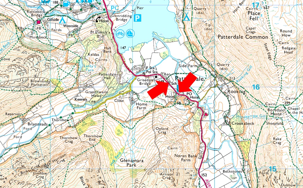
Parking Details and Map |
|
|
| Nearest Post Code: |
CA11 0NW |
| Grid Reference: |
White Lion Hotel - NY 395 315 - Patterdale Primary School NY 394 516 |
| Notes: |
Patterdale alongside Glenriddging acts as a hub for the eastern and far eastern fells yet unlike Glenridding Patterdale doesn't have a centralised car park. With this said parking in Patterdale, especially during the height of Summer can be a problem with only two main sites to leave your car. The first is very popular with fell walkers which is just opposite the White Lion Hotel, here you will find a short layby with room for up to five parked cars. Parking is free. The second place to park is found just outside Patterdale Primary School where you can park on the kerb right outside the School, here you will find spaces for around three to four well parked cars. Parking is free. |
|
| |
|
Map and Photo Gallery |
|
|
 |
| Ullswater cloud inversion from Kirkstone Pass 06:45am |
| It had been a clear drive north under cloudless skies with the sun rise inching skyward as I arrived in Lakeland. Red Screes was doused in first light and had there not been a couple of cars behind me I might have stopped to take a few photos. I drove over the top of the pass and began my descent only to witness a cloud inversion that stretched from Ullswater all the way to the bottom of the pass at Hartsop, needless to say I stopped at Red Pit car park to grab a few photos. |
 |
| St Patrick's Church, Patterdale 07:05am 7°C |
| I managed to grab one of two remaining parking spaces outside of Patterdale C.E Primary School and immediately began my kit up adding a windproof just to take the edge off the cool morning air. Curious sheep poked their heads through the metal railing on the opposite side of the road with just the odd car passing for now. A solo fell runner broke the silence with the tips of his running poles skirting past with a 'morning' before silence resumed, not even the birds were singing. Pack shouldered and car locked I strode out crossing the road where St Patrick's Church loomed from the mist. I'm aware that there's a short cut that passes around the back of the Church, past the cricket field towards Grisedale Lane but I'm going to swerve it because the grass was very wet and well, it looked a bit spooky. |
 |
| Sunrise over Boredale Hause. |
The mist was so thick anyone driving between Patterdale and Glenridding did so using their fog lights which thinned as I gained height on Grisedale Lane. Through the tree canopy I could see the summit of Birkhouse Moor and the further I climbed the clearer the visibility got. I had passed Patterdale Cricket ground which doubles as a carpark where I was surprised to find just three cars parked up, mind you it's still early. Prior to crossing Grisedale Beck I passed a dad and daughter duo the same pair I'd seen leave the George Starkey Hut in Patterdale as I kitted up.
They were at dawdling speed taking in the views which I liked, no rush. After crossing the bridge I passed through the gate before passing through a field bound for the path for Hole-in-the-Wall. It was here I just so happened to glance back to get this superb view of the sun rising over Boredale Hause casting rays of light over Grasswaite How and Patterdale. |
 |
| Views over the Grisedale Valley towards St Sunday Crag, Fairfield, Seat Sandale, Dollywaggon Pike and Nethermost Pike. |
| I'm not sure if I've mentioned it but todays objectives are Swirral Edge and Dollywaggon Pike, as Helvellyn is on the way I'll include that too! |
 |
| Dollywaggon Pike and Nethernost Pike await. |
I'd had a hankering for Swirral Edge, more so Dollywaggon Pike for a couple of weeks which was so strong it replaced the Coniston walk which I've put on back burner for me to pick up another day. It's been four years since I last stepped foot on Dollywaggon Pike and I'm really looking forward to returning this morning.
The original plan was to ascend by The Tongue which divides Cock Cove over on the left with Ruthwaite Cove in the centre. I've descended The Tongue with David and Rod a few years back but not all the way back into the valley, back then we went onto explore Ruthwaite Cove, Hard Tarn and even ventured into Nethermost Cove. |
 |
| The Grisedale Valley. |
| The morning temperature was begining to rise so I de-layered, rolled up my sleeves and enjoyed the ascent. |
 |
| The patches of heather smelled gorgeous. |
| The heather was few and far between but when passed the smell of lavender really hit me. |
 |
| Dollywaggon Pike seen beyond Nethermost Pike East Ridge. |
| I'd studied my descent route at length and no matter how much thought I put into it I knew it would be steep; seen in the photo as the shaded gully. From here I spotted a couple of shelf routes on Spout Crag that I might try in the future. |
 |
| Hole-in-the-Wall. |
| I soon joined the stepped path below Hole-in-the-Wall by which time I was getting a proper sweat on, no cool mountain air just yet but I won't have to wait long. |
 |
| Birkhouse Moor from Hole-in-the-Wall. |
| The only two people I'd seen were the dad and daughter who were still a good distance behind me. With Hole-in-the-Wall reached I thought I'd meet walkers heading up from Glenridding via Birkhouse Moor but as you can see it's completely deserted. |
 |
| Striding Edge, Helvellyn, Swirral Edge, Little Man and Catsye Cam from Hole-in-the-Wall. |
| I didn't have to climb up to Hole-in-the-Wall today but the views you get from here were worth the extra effort. |
 |
| Helvellyn, Swirral Edge and Catstye Cam. |
| After a quick scout around I could see three walkers about to traverse Striding Edge and one walker and their dog descending Catstye Cam who I assume had been up for the sunrise, other than those four it felt like I had the place to myself. This is of course, my reward for setting off early! |
 |
| The view across Red Tarn Beck towards... |
| ...Raise, Stybarrow Dodd, Great Dodd, White Stones and Hart Side. |
 |
| Helvellyn reflections. |
| I soon reached Red Tarn where I found no less than four tents picthed around the tarn's circumference. At the side of the tarn two lads from one of the tents were eating breakfast who told me they'd just got back from a circuit of Helvellyn via Swirral and Striding Edge's and were about to go in for a dip...before you do lads let me grab a couple of photos. |
 |
| Striding Edge reflecting in Red Tarn. |
| There wasn't a ripple on Red Tarn it was so clear you could clearly see the bottom for a good way out. |
 |
| Ascent on Swirral Edge. |
| I left the lads back at Red Tarn and sure enough from my ascent on Swirral Edge I looked back to see the them waist deep in Red Tarn, rather them than me. |
 |
| Swirral Edge. |
| Having reached the base of Swirral Edge I was passed by a solo walker who commented "the summit's dead, there's no one around" He went onto say that he'd left early so he wouldn't run into the crowds but didn't expect to have the summit all to himself "good on yer" I replied. Not seen in the photos are the hundreds of orange triangle markers left in place for tomorrows Helvellyn Triathlon which I guess advises the competitors of the quickest and safest ascent.. My rule for Swirral Edge is to start from the right then switch to the left half way through the ascent and visa-versa during descent but each to their own I guess. |
 |
| Swirral Edge. |
| Time to switch to the left now. |
 |
| Views over Browncove towards Lower Man, White Side with Stybarrow Dodd in the distance. |
| Not long until I reach the summit now. |
 |
| Helvellyn summit. |
| I passed three more walkers as I reached the cairn at the top of Swirral Edge and glanced over to see how busy the summit was, just seven walkers, five of whom would have left the summit by the time I arrived at the trig point. |
 |
| Amazing stuff. |
| Helvellyn summit almost to myself on a glorious Saturday morning. |
| |
 |
| Descending towards Nethermost Pike. |
| I did pass on a 'morning' to a couple sat in the cross shelter before begining the descent towards Nethermost Pike. |
 |
| Looking back on Helvellyn from the ascent on Nethermost Pike. |
| The air was tempered by a light cross-wind where in places the temperature had dropped enough to see your breath but these pockets were few and far between and on the whole, I couldn't have asked for more perfect conditions. |
 |
| Dollywaggon Pike (L) and High Crag (R) from Nethermost Pike summit. |
| Incredibly the summit of Nethermost Pike was busier than Helvellyn had been with a couple sat not far from the summit, a pair of young lads heading down then two fell runners who all headed off towards Helvellyn. Just in case you were wondering that's Great Rigg in the distance with the Coniston fells seen through haze over on the right. |
 |
| Dollywaggon Pike ((L) and High Crag (R) |
| Seen here over Ruthwaite Cove. |
 |
| Views over Ruthwaite Cove towards Nethermost Pike East Ridge. |
| That's Hard Tarn below which is named due its isolated and difficult to reach location...not today mind, spotting two tents as I crossed the top of the cove. |
 |
| Dollywaggon Pike comes into view. |
| With The Tongue, my descent route seen to the left. |
 |
| Hazy views towards the Central, Southern and Western fells. |
| There was no mention of haze in todays forecast which is only affecting long distant views. |
 |
| Views towards High Crag, Nethermost Pike, Helvellyn and Catstye Cam from Dollywaggon Pike summit. |
| With Hard Tarn seen in the centre above the hanging valley of Ruthwaite Cove. |
 |
| Time to begin the descent of The Tongue. |
| The start of descent begins with this narrow grass ridge walk. |
 |
| Looking back on the summit. |
| The narrow ridge soon drops off the summit via a series of rock ledges and grassy shelf's non of which are exposed but care must be taken due to the steepness of the ground. |
 |
| High Crag, Ruthwaite Cove. |
| Once down the main length of the ridge my plan was to descend a steep grassy gully but to reach it I needed to drop onto a wide grassy shelf above Ruthwaite Cove which will lead me down the remainder of the ridge towards the head of the gully. |
 |
| Incredible views. |
| Here towards Nethermost Pike East Ridge with Striding Edge beyond. |
 |
| The gully appears. |
| There's still another 100 feet of steep almost pathless descent before the head of the gully is reached, I do this by keeping to the left of the scree below. |
 |
| Nethermost Pike over Ruthwaite Cove. |
| |
 |
| Looking back up the gully. |
I won't pretend to admit that that wasn't a steep and sometimes difficult descent not helped by how loose the dirt was at the head of the gully which caused me to lose traction more times than I could count! I swerve to my left and use the grass to aid descent but this is marred by hidden boulders underfoot which shifted under my weight. |
 |
| High Crag and Nethermost Pike. |
| I could still hear the occupants of the tents chatting away. If I wasn't on such steep ground and over half a mile away I couldn't have joined in their conversation! |
 |
| The Grisedale Valley from Ruthwaite Lodge. |
| With Ruthwaite Lodge now in view I had something to aim for. I continued descent and stepped over a stream which flowed into cascades below. I was now following a path with the Grisedale Valley below. |
 |
| Looking back on Falcon Crag, Spout Crag, The Tongue, Dollwaggon Pike and High Crag. |
Of the many walkers coming and going below, no one could see me during my descent, not until I arrived back at Ruthwaite Lodge, where I de-shouldered to take a Snickers bar from my pack before passing on a 'morning' to the two lads resting there. Kicking the heels into the backs of my boots, I began my descent through the valley remembering last winter when I only made it to the Lodge after being forced back during a snowstorm. Today it felt like a proper summers day, which was bringing out the best in people. Strangers chatting and passing on their mornings is great camaraderie on the fells. With the heat bearing down, I continued my descent, reaching the little wooden footbridge over Grisedale Beck, where I contemplated taking the alternative path back through the valley but changed my mind at the last minute. Two elderly walkers did, but they were stood chatting for so long I soon lost sight of them. I passed dozens of more walkers, mostly heading into the valley, and one large group whose leader was telling a tale quite loudly. One woman at the rear of the group rolled her eyes and smiled as we passed.
I stopped on several occasions to look back on Dollywaggon, sighting walkers as small as ants crossing the top of Ruthwaite Cove. By the time I'd reached the old barn at Elmhow, I could feel myself slowing down. I'd only eaten two bananas and a Snickers bar all morning, and my stomach was growling but I was too close to Patterdale to stop now. Grisedale Lane came; more and more walkers some kitted out for the fell and others who clearly had no intention of walking further than Elmhow Plantation. I began the plod down the lane and couldn't believe my eyes when I saw how busy it was at Patterdale Cricket Club with cars parked not just at the top of the pitch but down one side too. It was a similar story for Patterdale, where it took me a minute to spot a gap in the traffic so I could cross from one path to the other. Volunteers were mowing the lawns at St Patrick's; in fact, the whole church is run by volunteers who I could see took pride in their work. The mist had lifted and the grass had that 'first cut' smell to it. The sound of petrol mowers faded into the distance replaced by traffic, every view was a camera shot and despite how busy Patterdale looked, it still had that picture postcard feel to it. |
|
| |
| Back to top |
 |
|