St Sunday Crag & Fairfield from Patterdale

18th January 2024


Overview
Ascent: 3,255 Feet - 992 Metres
Wainwrights: 3, Birks - St Sunday Crag - Fairfield
Visiting: Cofa Pike
Weather: Cloud & Sunshine With Significant Wind Chill at Height. Highs of 4°C Lows of 3°C Feels Like -9°C
Parking: Patterdale Village
Area: Eastern
Miles: 9
Walking With: On My Own
Ordnance Survey: OL5
Time Taken: 5 Hours 40 Minutes
Route: Patterdale - Grisedale - Thornhow End - Birks - St Sunday Crag - Deepdale Hause - Cofa Pike - Fairfield - Hause Gap - Grisedale Tarn - Grisedale - Ruthwaite Lodge - Elmhow - Patterdale
 

Parking Details and Map
Nearest Post Code: CA11 0NW
Grid Reference: White Lion Hotel - NY 395 315 - Patterdale Primary School NY 394 516
Notes: Patterdale alongside Glenriddging acts as a hub for the eastern and far eastern fells yet unlike Glenridding Patterdale doesn't have a centralised car park. With this said parking in Patterdale, especially during the height of Summer can be a problem with only two main sites to leave your car. The first is very popular with fell walkers which is just opposite the White Lion Hotel, here you will find a short layby with room for up to five parked cars. Parking is free. The second place to park is found just outside Patterdale Primary School where you can park on the kerb right outside the School, here you will find spaces for around three to four well parked cars. Parking is free.


Map and Photo Gallery


Access gate leading to Thornhow End from Grisedale Lane, Patterdale 3°C 07:12am

I went to bed last night feeling rather grotty with a stuffed head and runny nose. I didn't feel half as bad when my alarm woke me at 04:30am but during the drive north I had a couple of sneezing fits in the car and the grottyness returned. The fell forecast was too good to miss though with cloud inversions forecast above 700m I couldn't miss the opportunity especially in January. It was pitch black in Patterdale when I arrived with just the lights from the Patterdale Hotel in the distance I kitted up head torch fixed in full Winter gear minus the crampons with last weeks snow thawing due to a rise in mid week temperatures. It was a chilled kit up the breeze making the morning air feel much colder than it actually was so there was no hanging about. With Rod venturing out onto the northern Fells David had arranged to walk Place Fell with Kayleigh from this very spot but I'd be long gone by the time they would arrive at 07:30am. I was expecting a cloudy morning but as I looked north between the gaps in the cloud, I could see the stars.

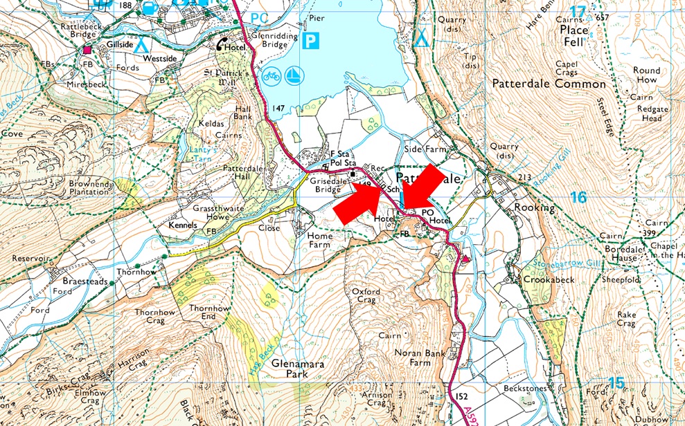
No traffic had passed me as I locked the my car, crossed the road my head torch lighting the way as the bell at St Patricks Church chimed at 7am. With a lot less cloud than I anticipated I began to ask myself was I feeling fit enough for the whole route, it's not good doubting yourself so early into the walk but I like to think I'm a planner not a doubter and besides, I can always duck out at Deepdale Hause should my fitness or the weather go against me. After passing St Patricks I crossed the road my head torch illuminating the reflective road signs which shone back at me. The base for Patterdale Mountain Rescue looked quiet as I crossed the road again before joining Grisedale Lane. The lane looked eerie my head torch iluminating the white washed familiar cottage its occupants nowhere to be seen, the cottage sadly looking unloved. Accompanied by the sound of Grisedale Beck below I'm passed by a fell runner his head torch illuminating the wall then the trees as his head swayed from left to right. Soon after I arrived at the gate bound for Thornhow End where my head knew I'd be in for a steep climb ahead, I just needed to convince my lungs the same.


Ascending Thornhow End 07:26am
After passing through the gate I ascended the grassy bank which led me directly onto the path for Thornhow End, somehow the location of this path had eluded me remembering that it started opposite a large mature tree which I'd questioned David about during a mid-week email "aye look out for the tree" David replied.

Large patch of snow, Thornhow End 07:35am

I had continued to ascend the by the now, familiar stone staircase whilst spotting the head torches of fellow walkers ascending towards The Hole-in-the-Wall on Helvellyn and others at the col at the top of Mires Beck on Birkhouse Moor. Every now and again I would glance back on Patterdale and further afield, Ullswater where I spotted what appeared to be an blinking orange light on the end of a pier.`

I reckon David and Kayliegh would be kitting up right about now for their Place Fell adventure and I wondered if they had spotted my head torch as Thornhow End was visible from Patterdale. The further I climbed the more snow patches I came across some small enough to pass with the exception of this one which was frozen but easily avoidable.


St Sunday Crag from Birks summit.
Despite sunrise being forty minutes away by 07:40am it was light enough to ascend without my head torch which had been spookily illuminating the eyes of dozens of sheep (or at least I hoped they were sheep) during the steeper section of Thornhow End before I emerged almost breathless atop of Black Crag. With the short but devilishly steep ascent behind me I could finally put some thought into the route ahead and what was happening overhead now that I had light.

This is good.
No sooner had I left Birks summit did the cloud dramatics begin, it looks like the forecasted cloud inversion is forming.

Gavel Pike and St Sunday Crag.
The cloud cleared revealing St Sunday Crag ahead but I wasn't convinced the inversion was capped at 700m as forecasted, with St Sunday Crag at 841m it's looking more like 900-1,000m at the moment.

Here comes the sunrise 08:21am
Adding to the cloud dramatics came the sunrise which illuminated the cloud in fiery orange.

To the North West.
Cloud capped Hole-in-the-Wall, Striding Edge and Helvellyn with clear skies above.

And to the East.
The inversion appears to be settling over Hartsop and surrounding fells.

Looking back on Birks.
I was in heaven; my blocked head long forgotton as I climbed higher; my rewards the ever changing cloud and light blessed with blue skies beyond.

Back to the East.
The cloud was still settling on what I first thought was High Street but was in actual fact Rest Dodd with Rampsgill Head and High Raise beyond.

Cloud Inversion forming over the Grisedale Valley.
The inversion was forming thick and fast circulating my surrounding fells leaving St Sunday Crag for now, in a cloud free pocket.

More views over the Grisedale Valley towards Ullswater.
 

Looking back from St Sunday Crag north summit cairn at NY 369 136
Still in my element I shouldered the summit and looked back on the cloud inversion hoping that the summit itself would stilll be above the cloud.

Cloud clearing for now.
I continued towards the summit mostly in cloud with just the odd break forming long enough so I could take a photo. I was still unconvinced where the inversion was capped at, it certainly wasn't 700m as I approached the summit I was engrossed in a thick layer of cloud causing the temperatures to plummet.

Looking back on the inversion.
While in other areas the height of the cloud layer seemed correct.

Descending St Sunday Crag.

I made my way towards the summit encountering rime ice (black ice) covering the rock strewn plateau accompanied by winds in excess of 25mph which brought on a severe wind chill of -9°C

After the relative calm of Thornhow End and indeed the ascent of St Sunday Crag conditions had flipped dramatically causing my nose to run like a tap. I was well in the cloud with only the odd sign of brightness poking through momentarily which did nothing to deter the drop in temperature.


Nearing Deepdale Hause.
There was the slightest of hints the cloud was only just above my head and by the time I passed the cairn at Deepdale Hause I'd already made my mind up, I was heading for Cofa Pike and Fairfield.

Looking back on Deepdale Hause.
If one view questioned me continuing onto Cofa Pike it was this one. I had heard voices but due to cloud cover I couldn't see diddly squat; had they descended to Grisedale Tarn I didn't know until three fell runners emerged from the cloud highly spirted all wearing shorts while I struggled to keep my hood drawn in the wind. They passed with a cheery 'morning' before ascending onto Cofa their voices fading as quickly as they had come.

Low Spying How on Striding Edge poking out from above the inversion.
With the trio of fell walkers well ahead of me I concentrated on my ascent on Cofa Pike encountering rime ice whilst still battling the icy wind. It wasn't the best combination when your nose is running like a tap but needs must!

Oh my...
The view back towards St Sunday Crag from Cofa Pike.


The view back from Cofa Pike summit.

I had heard the voices of the three fell runners catching sight of the last one before she joined the other two soon after leaving Cofa Pike summit. The views were mesmerising but it was time to concentrate on conditions which were worsening underfoot. With this in mind I summited Cofa Pike but I didn't continue off the other side instead I doubled back to take the lower flanking path which I knew involved getting around the 'awkward rock'

After dropping down I found myself facing the awkward rock which straddles the path and juts out enough to throw the walker of balance. I took one look at the other side, the rock was sheer black - I had no doubt I'd pass the jutting rock safely but the rock underfoot on the other side, I wasn't taking any chances and dropped down even lower before regaining ground on the other side of the pike.


Fairfield summit.

It's fair to say I was pleased to have Cofa Pike behind me, as a year round fell walker nothing really surprises me as I come prepared for all conditions but Cofa Pike stuck two fingers up at me today after giving me a bloodied lip. Still deep within the cloud layer I began my ascent on Fairfield the icy wind still at large freezing the snot that had formed on the end of my nose.

The three fell runners passed me again their legs red raw and not quite so chatty as the last time I'd seen them. I passed two more walkers and a solo girl all heading for Cofa Pike and in conversation I gave them advanced warning on how icy it was. The summit shelter appeared but there was no one around and was about as uninviting as Cofa Pike had been. In all my time as a fell walker I couldn't help but note how severe the conditions felt. It was time to make my descent.


Descending Fairfield.
Conditions seemed to worsen as I began my descent the wind chill could potentially strip away thought process and I needed to make sure I was descending in the right direction, my GPS confirmed this but others would fall foul of the conditions who I would later meet further down the path.

Grisedale Tarn.

The good news was there was no where near as much rime ice on the west side of the summit as there had been on the east which made for a quick descent. Shortly after leaving the summit I had spotted a walker who kept stopping to check his phone no doubt checking on his location then continued too far south which would put him in the vicinity of the area over looking Tongue Gill. OK I thought he must know where he's going. As I continued my descent I noticed walkers in ascent were staring at me and after a quick look down I discovered the lower half of my jacket, sleeves and trousers were covered in ice, this of course was frozen air droplets followed by questions "is it cold up there?"

It was odd how the droplets only froze on the lower half of my body so I took a photo and was going to post it until the Mrs said certain parts of my body were sticking out due to the dampness of my trousers!


Views beyond Eagle Crag towards Striding Edge.

The walker I'd seen earlier suddenly appeared behind me while I was checking my frozen trousers and we shared a laugh about the conditions 'up top' complaning that his bite valve had frozen me replying that I wish it was just my bite valve that had frozen! He descended quickly and I soon lost sight until I spotted him again chatting to three mountain bikers carrying their bikes on their shoulders who, after taking one look at me one asked "how cold it was at the summit?" it's not so much the cold you need to be worried about but the ice underfoot, be careful I replied, One chap replied f#ck me that doesn't bode well. I left the guys to it and continued my descent soon arriving at Hause Gap where I turned right expecting to see Grisedale Tarn but I couldn't see anything except cloud. The further I descended the tarn soon came into view its waves lapping gently against the shoreline of this popular beauty spot which was deserted and quite eerie if I'm honest. I crossed half a dozen well placed stepping stones and adjusted my clothing for the four mile march through the valley. My jacket and trousers began to thaw leaving my trousers feeling heavy but they still did a great job of keeping the wind out.

I descended with pace where I could passing the odd pairs of solo walkers heading for Grisedale Tarn some wintered up some wearing track suit bottoms, I stayed quiet and passed with a hi. Ruthwaite Lodge was reached which was busy with more walkers and mountain bikers hence no photo. I descended further and crossed the footbridge over Grisedale Beck and peered back into Ruthwaite Cove where hints of blue disturbed the grey. I could have been potentially looking through the inversion but I wont know until I descend further into the valley. Continuing to follow the valley floor I spotted my fellow walker who I shared a laugh with during the descent of Fairfield who had crossed Grisedale Beck onto the footpath on the north side of the valley, his distinctive red waterproof visible for miles. I passed below Eagle Crag from where I heard two roped climbers ascending the crag one of whom appeared to be staring back at me. Next I passed a photographer peering up at the same crag or was he like me, transfixed at a patch of blue sky forming above Helvellyn.


Back to top