|
The Fairfield Horseshoe |
 |
 |
13th March 2025 |
 |
|
|
| |
|
Overview |
|
|
| Ascent: |
3,356 Feet - 1,024 Metres |
| Wainwrights: |
8, Nab Scar - Heron Pike - Great Rigg - Fairfield - Hart Crag - Dove Crag - High Pike - Low Pike |
| Visiting: |
2, Erne Crag - Rydal Fell |
| Weather: |
Bright Sunshine, Bitterly Cold Winds at Height. Highs of 7°C Lows of 2°C Feels Like -14°C |
| Parking: |
Roadside Parking, Rydal Church |
| Area: |
Eastern |
| Miles: |
10 |
| Walking With: |
David Hall |
| Ordnance Survey: |
OL5 |
| Time Taken: |
6 Hours |
| Route: |
Rydal Church - Rydal Mount - Nab Scar - Heron Pike - Erne Crag - Rydal Fell - Great Rigg - Fairfield - Link Hause - Hart Crag - Dove Crag - High Pike - Low Pike - Low Sweden Bridge - Rydal Park - Rydal Mount - Rydal Church |
|
| |
|
Parking Details and Map |
|
|
| Nearest Post Code: |
LA22 9LR |
| Grid Reference: |
NY 364 706 |
| Notes: |
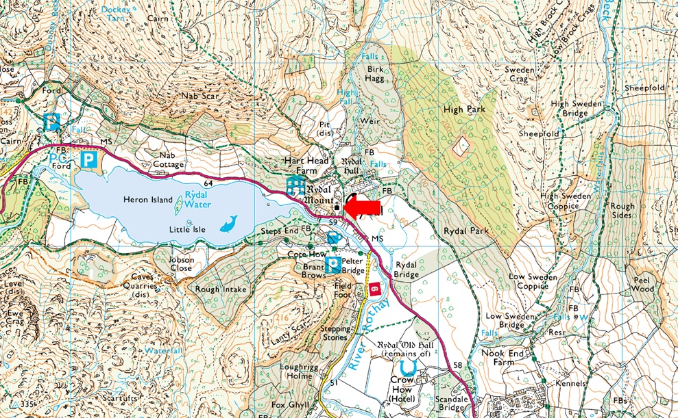
The roadside parking at the side of Rydal Church has always been a very popular place to start your walk especially those walking the Fairfield Horseshoe of visiting Loughrigg Fell, Rydal Hall and Rydal Tarn. There once was room for up to twenty cars plus but this was limited after Storm Desmond during the Winter of 2015 when the road and the drains where damaged resulting in limited parking. If you arrive early you shouldn't have any problems parking but if left late you may struggle. At the side of the Church there is an Honesty Box. |
|
| |
|
Map and Photo Gallery |
|
|
 |
| First Light over Nab Scar 07:00am 2°C |
It was during last Saturdays superb walk did David mention he fancied walking the Fairfield Horseshoe adding that he'd probably walk it during the week and that "it only had to be dry" This was somewhere on the Gatescarth Pass where I stopped to mention that I'd had a day off in the week too due to not being available for a walk on the weekend of the 22nd. It was like two worlds just collided "fancy it then" We let the weekend pass to see how the weeks forecast would pan out and by Tuesday we agreed Thursday looked the best day with sunshine forecast until late morning, perfect. We had arranged to meet at the parking spaces outside Rydal Church at 07:00am where I arrived even more early than normal at 06:30am, the same time I was reminded that I'd be getting ready to leave for work right about now. David arrived about ten minutes later by which time I was lacing up at the back of the car. Given the hour we had no trouble parking and completed our kit up under clear skies and chilled morning temperatures.
It was a cold start and nothing like last weekends tropical highs, this morning it was back to the O'l routine, layers, hats and gloves. We were ready to move off within five minutes and began the steep climb passing Rydal Mount - calfs screaming, lungs busting...Okay I exaggerate but for anyone who has walked this steep lane I'm sure you would agree it can be a bit of a lung buster straight from the car. Five minutes later we opened a wooden gate onto open fell side where through the trees Nab Scar was dabbled in bright morning sunshine. With height gained the trees gave way for uninterrupted views of vibrant fell side right at the same time the sun was inching above Wansfell Pike over our shoudlers. I didn't think the dead bracken could look so alive but it did, especially when set against the bluest of skies. |
 |
| Views over Rydal Water towards Loughrigg Fell. |
| We continued our ascent over frozen ground noticing how clear the air was, distant views looked so close as if you could touch them. |
 |
| Here looking over Rydal Water, towards LoughRigg Fell, Grasmere, Silver How, Lingmoor Fell and the Coniston group. |
| While over to the right Pike O'Blisco, Crinkle Crags and Bow Fell come in to view. |
 |
| The climb up towards Heron Pike from Nab Scar. |
| The summit cairn is just over our left shoulder while the cairn you see centre marks the path Alcock Tarn bound. |
 |
| A dusting of snow overnight has blanketed the highest fells. |
| With the Scafells below cloud for now. |
 |
| Rydal Fell, Great Rigg, Fairfield, Link Hause and Hart Crag from Erne Crag summit. |
| The firm ground meant we could keep up a good pace but as we approached the ridge proper we were met by a fierce windchill being served face on by 30mph winds, queue the brain freeze. |
 |
| The Fairfield Horseshoe. |
| Despite the chill we couldn't have asked for more perfect conditions. |
 |
| Great Rigg, Fairfield, Link Hause and Hart Crag from Rydal Fell summit. |
| As I said to David "you can put up with the cold when the views are as good as this" |
 |
| Rydal Head and Hart Crag forming the head of the Rydal Valley. |
| It was while vewing the Rydal valley below did David mention he'd walked through the valley via the wall before returning via a trod alongside Rydal Beck at the end of last summer. |
 |
| Heading for Great Rigg... |
| ...and the snowline. |
 |
| The view over Greenhead Gill towards Stone Arthur, Grasmere, Silver How, Lingmoor Fell, The Coniston Fells and Pike O'Blisco. |
| With Coniston Water seen in the distance. |
 |
| Did I mention it was really clear. |
| Here looking towards Helm Crag, Gibson Knott, Tarn Crag (Easedale) Easedale Tarn, Blea Rigg, High Raise (Langstrath) Sergeant Man, Pavey Ark, Harrison Stickle, Bowfell, Esk Pike, Great End, Great Gable, Crinkle Crags and Pike O'Blisco...quite a mouthful but what a view! |
 |
| The wider view. |
| With the grassy south western spur below leading towards Stone Arthur. |
 |
| Looking back on Rydal Fell, Erne Crag and Nab Scar. |
| With distant views of Windermere, Esthwaite Water, Coniston Water and Grasmere. |
 |
| Fairfield ahead. |
| For an unknown reason my hamstring muscles began tightening up resulting in me slowing down - the only way I could combat the discomfort was to shorten my stride during my ascent on Fairfield which wasn't the best combination while trying to keep warm. |
 |
| A broad view of Seat Sandal from Fairfield. |
| |
 |
| Views over Hause Gap towards Dollywagon Pike, Nethermost Pike and Helvellyn. |
| With a glimpse of Grisedale Tarn below. |
 |
| Helvellyn from Fairfield summit. |
| We'd made Fairfield without seeing a single soul all morning, isn't mid-week walking brilliant! |
 |
| We leave Fairfield for Link Hause. |
| Right about the same time as a layer of cloud drifts over the summit not thick enough to lose visibility but enough to lose the sunlight causing the windchill to plummet further, |
 |
| Views towards St Sunday Crag. |
| Over an area north east of the summit known as Black Tippet with Black Buttress appearing below. |
 |
| Hart Crag seen from Link Hause. |
| If we didn't think the windchill could drop any further it did whilst we crossed Link Hause in the face of 35-45mph winds the windchill hovered around -14°C across here. |
 |
| The view over Rydal Head towards a snow capped Great Rigg. |
| With the Coniston Fells beyond. |
 |
| Looking East... |
| ...towards Hartsop above How, Birks, Arnison Crag, Place Fell, Boredale Hause, Angletarn Pikes, Brock Crags and Rest Dodd. |
 |
| Views back over Hart Crag towards Link Hause and Fairfield. |
| As with Fairfield summiting Hart Crag was mind numbingly cold at a point when a layer of thick cloud obscured the sunshine causing another drop in temperature. We summited, took in the view for a minute or so and left without a word spoken, mind you we couldn't have heard ourselves speak owing to the strength of the wind. |
 |
| Windermere from Dove Crag summit. |
| We descended Hart Crag and arrived at the grassy col seen in the previous photo where conversation returned. It was from the col did we spot a solo walker heading up from the direction of the Deepdale Valley. We at first thought the guy had walked through Deepdale but as it turned out this chap was on an epic route starting from Patterdale. He'd ascended Arnison Crag, Birks, St Sunday Crag, Cofa Pike, Fairfield, Hart Crag, out and back to visit the Priest Hole, Dove Crag, Little Hart Crag, out and back to High Hartsop Dodd, Red Screes and finally Middle Dodd before walking back to Patterdale! Not only were we impressed with the route the lad was only in his mid twenties and was from Norfolk/Suffolk border so not exactly local either. What a guy. |
 |
| Leaving Dove Crag. |
| We still had the elevation but as the morning progressed we were treated to continued sunshine which wasn't on the forecast, |
 |
| Descending towards High Pike (Scandale) |
| It was around this point did we start to see walkers heading towards Dove Crag all of which were ascending by t'other side of the wall. |
 |
| Views over Scandale Head towards Little Hart Crag, Red Screes, Middle Dodd, and The Tongue on Caudale Moor. |
| |
 |
| Low Pike and Windermere from High Pike (Scandale) |
| The frozen ground gave way the further we descended but in truth most of the familiar peaty bogs between High Pike and Low Pike held firm or the ground around them did leaving my boots looking as clean as I'd put them on back at Rydal, for now at least. |
 |
| High Pike (Scandale) and Little Hart Crag from Low Pike. |
| We figured we'd earned ourselves a quick bite to eat so on the other side of the summit we found a spot out of the wind, found a couple of comfy boulders and treated our bellies to some food whilst taking in the views over the sun dabbled Scandale valley and Wansfell Pike beyond. |
 |
| Views over Ambleside, Windermere and Morecambe Bay as we descend towards Low Sweden Bridge. |
With lunch over we re-shouldered and continued the final section of ridge as glimpses of Rydal Park appeared over the wall to our right, Ambleside dead ahead. We soon ourselves atop of the notorious Bad Step where from above we plotted our descent, I at first opted to sway right but found the crag to high to risk a shimmy down, so we both strayed right, crossed the top of the crag and descended into a narrow ravine. In all the times I've ascended this bad step, I've never familiarised myself enough with the crag to find the perfect way up or down instead, always opting for different routes.
We had chosen to descend not quite as far as Low Sweden Bridge where the ridge had been in the sun causing the familiar bogs and marshes to be boggier than we'd seen all morning. Fell runners and walkers appeared in their droves all heading towards Low Pike some or into Scandale - had my legs not covered the mileage I'd have joined them such the temptation of the valley in the Spring sunshine.
We finally left the bogs behind for a great stone path and with Low Sweden Bridge below we hooked a right and descended into Rydal Park. The sun was still blazing but as soon as we joined the path through Rydal cloud had gathered casting the whole park in shade. The path allowed us to walk at pace passing the paths only two other occupants, an elderly couple who we passed with a 'hello' Rydal Hall appeared to our right passing The Grot with its eye pleasing waterfall beyond. Leaving Rydal Park we opened the gate onto Rydal Mount our cars just a few paces away now . It had just turned 1pm the place felt silent with the exception of the traffic travelling on the A591 below seemlessly drowned out by a couple of Blackbirds chirping in the nearby church yard. |
|
| |
| Back to top |
 |
|