Extended Wasdale Horseshoe

25th May 2025


Overview
Ascent: 1,685 Feet - 513 Metres
Wainwrights: Grey Crag
Outliers: 4, Whatshaw Common - Little Yarlside - Great Yarlside - Wasdale Pike
Visiting: Harrop Pike
Weather: Intermittent Sunshine Between Squally Showers. Windy Throughout. Highs of 17°C Lows of 10°C
Parking: Parking Spaces A6 Shap Road Summit
Area: Far Eastern
Miles: 10
Walking With: On My Own
Ordnance Survey: OL5
Time Taken: 4 Hours 10 Minutes
Route: Shap Road Summit - Whatshaw Common - Little Yarlside - Great Yarlside - Harrop Pike - Grey Crag - Return to Great Yarlside - Wasdale Pike - Wasdale Head - Wasdale - Shap Road Summit
 

Parking Details and Map
Nearest Post Code: LA8 9LG
Grid Reference: NY 553 706
Notes: The parking spaces are found about two and half miles south of Shap village at Shap Road Summit where a plaque stands in memorial to the drivers and crews who made the building of the A6 possible over Shap Fell at 1,350ft above sea level. There is room for around eight to ten well parked cars. Lookout for the Repeater Station and the many Electric Pylons which is where you will find the parking spaces. Parking is free.


Map and Photo Gallery


Waiting out the first of many showers, Shap Road Summit 10:15am 10°C

The run of good weather had to come to an end timing it perfectly for the Bank Holiday weekend but lets be honest, we needed the rain. I think the forecast actually suited todays walk perfectly which was one of the reason I went ahead with it, wind and rain on the higher fells is no where near as appealing as it is on the lonely Shap Fells, does that make sense? These fells are probably the last untouched hills of Lakeland, they aren't called the outliers for nothing no bugger, unless the determined or those seeking isolation walk here, if your fond of the latter, these hills are perfect for walking in isolation and despite today being a Bank Holiday Sunday, I saw no one all walk, incredible isn't it.

I left home a little later than I usually would to allow the worst of the showers to pass but it was still chucking it down when I arrived at 09:40am and I waited over half an hour for the rain to stop and skies to clear revealing breaks of blue. Whilst waiting I'd slipped on my over trousers in the car and laced up my boots and by the time the rain stopped I was almost ready to go. I couldn't believe how clear and sunny last weekends walk had been compared to now when I saw myself adding a pair of finger-less mitts to keep the wind out topped up with my baseball cap to keep the wind and rain out of my face and waterproof jacket, within minutes of the rain stopping the sun poked through and I was good to go.


Lord's Seat, Grey Crag, Harrop Pike, Little Yarlside and Great Yarlside from the descent of Whatshaw Common.
Don't be fooled by the periodic sunshine I'd already passed through my second shower - the good news was a bright spell always followed a shower. That's Little Yarslide up ahead with its parent peak beyond. Tickles me how Little Yarlside is the steeper ascent though.

Sunshine and cloud over Little Yarlside and Great Yarlside.
If I'd have come here just two days ago my boots would be bone dry, but after recent rain the bogs have returned soaking up the rain like a giant sponge.

Looking back on Whatshaw Common.
With High House Bank seen across the Crookdale Valley over on the right.

Views into Wasdale Head.
It looks like a new deer fence has been erected since I was last here in April 2024

Great Yarlside.
I'd only been on the hill for an hour or so by which time I stopped counting how many showers had passed over, some lasting minutes, others longer but as previously mentioned they were always followed by brief spells of sunshine such as now when I arrived at the familier gate on the northern spur of Great Yarlside.

What lies ahead...
...is what I consider to be Lakelands greatest mile.

Easy walking, isolation, showers and sunshine.
As Harrop Pike comes into view.

Harrop Pike summit.
It was blowing a royal hooley, and a tad on the cold side with the exposed summit not offering much in the way of shelter passing with a tap to the cairn before crossing over the fence bound for Grey Crag.

Breaks between the showers allows a photo of Grey Crag ahead.
Looking north towards High Street the skies were thickening and turning black through a curtain of rain heading my way.

Grey Crag summit.
Speckles of rain pattered at my jacket increasing as the wind picked up, I foolishly sought shelter on the other side of the cairn on a well placed rock. With my back to the wind and rain I thought about sitting it out before having a 'what are you bloody doing, keep moving' moment. I was right, no point getting wetter and wetter so I stood up and began tracing my steps back towards Harrop Pike.

Returning to Harrop Pike.
 

Sunshine after the showers.
As always I was treated to another spell of sunshine as I watched the shower pass over Crookdale the intense light leaving the soaked ground vivid and alive.

Aye...
...more of a downpour than a shower.

Views over the tip of Burnt Tongue towards Scam Mathew, High Wether Howe and Seat Robert.
 

Looking beyond Burnt Tongue.
Towards Harter Fell (Mardale) High Street, Branstree, Kidsty Pike and High Howes.

One last look at Grey Crag and Harrop Pike.
It's been lucky in that after the last heavy shower I was able to walk back to Great Yarlside in sunshine having not seen a soul since leaving the car.


On route to Wasdale Pike.
There is no direct or short cut such the undulating ground - it was best I traced my footsteps all the way back to Great Yarlside from where I head east towards Wadale Pike.

Views beyond Great Saddle Crag towards...
...Branstree, High Howes, Selside Pike with High Street, Kidsty Pike and High Raise (Martindale) beyond.

The North Pennines from Wasdale Pike.
It had been a glorious mile to reach Wasdale Pike walked mostly in sunshine and constant wind. It looked like the showers might be a thing of the past as I began my descent towards Wasdale Head.

Starting my descent from Wasdale Pike towards Wasdale Head.
With Long Fell beyond.

Long Fell...
...flanked by Shap Pink Quarry on t'other side.

Wasdale Head.
With the ruins of Wasdale Head Farm below.

Wasdale Head from Wasdale Head Farm.

The sun continued to shine as I began my descent flanked by Hazel Bank over to my right. I was heading towards the ruined farm buildings of Wasdale Farm bordered by stone walling and oak trees which would pre-date the old farm. It was warm now and before I reached the track I would delayer and remove my mitts, the showers were a distant memory. I could now hear traffic travelling along the A6 on the other side of the valley but the valley kept its quietude. I reached the track after passing through the ruined buildings engrossed in the old wooden roof beams and the long metal studs that used to hold them in place. The ruins of Wasdale Head Farm deserved more time than I could give but I could sense more rain was on its way. I joined the track proper traipesing through puddles that straddled the track width to width. Suddenly the skies grew darker and without warning it began to chuck it down. I'd de-layered but had thankfully kept my waterproof jacket under the lid of my pack. Whilst re-shouldering I caught a glimpse of four or five deer disappearing from view on Hazel Bank, even in the downpour it was enough to stir the butterflies in my stomach. The track climbed as I watched my tanned hands turn white through cold. Surely the rain would stop, but it didn't.

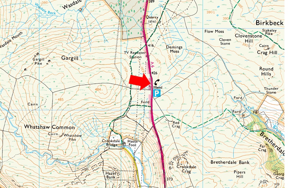
I left the track and crossed Wasdale Beck which was split into two, the first section was easily crossed by a stone bank and stepping stones but the second was wide and I had to take a run up. Ten miles in and I joined the track and passed the shooting tower, my breathing laboured as the track began to climb again and that's when I saw them, those four deer were in fact part a herd just fifty metres up track. The herd had appeared from the woodland on my right, scaled a deer fence like it wasn't there before trotting into woodland to my left, they were closer to the A6 but the trees provided the cover they so eagerly sought. I passed the woodland, not a stir, but they were there, just yards away. The track levelled and I caught sight of the Repeater Station; continuing further I spotted my car which wasn't difficult to miss as it was the only one parked in the lay-by. The track descended onto the same track I started on just over four hours earlier. The rain had eased and I collapsed my poles as I arrived on the A6 with my car just yards away the heavens opened again and I ended up throwing my wet gear into the boot and drove home in wet boots, what a day though.


Back to top