|
Stony Cove Pike via Doup Crag, Troutbeck |
 |
 |
2nd June 2025 |
 |
|
|
| |
|
Overview |
|
|
| Ascent: |
2,820 Feet - 860 Metres |
| Wainwrights: |
Caudale Moor |
| Visiting: |
4, Low Great Knott - High Great Knott - Doup Crag - Stony Cove Pike |
| Weather: |
A Bright Start With Sunny Spells Later. Highs of 16°C Lows of 11°C Feeling Brisk In The Wind |
| Parking: |
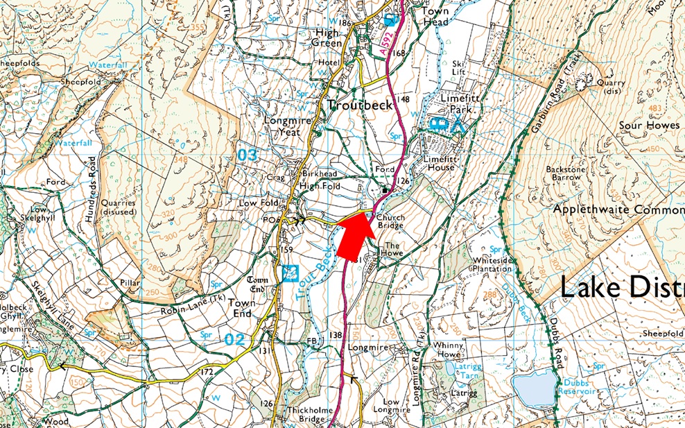
Parking Spaces, Church Bridge Troutbeck |
| Area: |
Far Eastern |
| Miles: |
12.1 |
| Walking With: |
David Hall |
| Ordnance Survey: |
OL5 |
| Time Taken: |
7 Hours |
| Route: |
Church Bridge, Troutbeck - Limefitt Holiday Park - Troutbeck - Long Green Head - Ing Lane - Troutbeck Park Farm - Trout Beck - Low Great Knott - High Great Knott - Sad Gill - Doup Crag - Caudale Moor - Stony Cove Pike - Thresthwaite Mouth - Park Fell Head - Trout Beck - Troutbeck Park Farm - Hagg Bridge - Ing Bridge - Ing Lane - Truss Lane - Permissive Path to Limefitt Holiday Park - Church Bridge, Troutbeck |
|
| |
|
Parking Details and Map |
|
|
| Nearest Post Code: |
LA23 1PE |
| Grid Reference: |
NY 412 202 |
| Notes: |
The parking spaces at Church Bridge can be found between Jesus Church and Church Bridge, if travelling from the A592 the car park will appear on the left immediately after crossing Church Bridge. This is a small car park popular with walks around Troutbeck or the higher fells of the III Bell ridge meaning availability can be tight during peak seasons. Parking is free. |
|
| |
|
Map and Photo Gallery |
|
|
 |
| Jesus Church Troutbeck 06:50am 11°C |
There was no real plan to do this walk until it came up in a e-mail a couple of weeks ago, which to be fair the origins of the route go back a couple of years but were brought up November last year when David and I walked High Street via the III Bell Ridge, David mentioned he'd like to walk the entire length of the Troutbeck valley, gain Stony Cove Pike via Doup Crag and return via the Troutbeck valley, I'd like to add that visiting any summit including Troutbeck Tongue wasn't on the agenda, just the valley walk if that makes sense. I mentioned to David I had some leave coming up and from there all we had to do was keep an eye on the forecast which had forecasted a bright start followed by sunny spells. I'd also like to add that David is not so much recovering, but preventing his plantar fascilitis returning after feeling the twinge a couple of months back, since then he's been keeping the ascent and mileages low and today was his first 'big walk' since that twinge.
We had arranged to meet at the parking spaces at Church Bridge, Troutbeck where I arrived to find a Dutch plated camper van taking up the spaces of four cars, I mean what a totally inconsiderate thing to do when he/she could have reversed the camper just as easily. I managed to park and when David arrived he was forced to tuck his car in behind mine. Minutes later I'd calmed down and kitted up in the cool morning air while the morning sunlight streaked through the tree canopy above our heads. We were soon ready to leave opting to gain the east side of the Troutbeck valley by means of Limefitt Holiday Park. |
 |
| Views towards Troutbeck Tongue, Yoke, III Bell, Froswick, Thornthwaite Crag, Red Scress and Snarker Pike. |
| We left Church Bridge and followed the A592 before turning right when Limefitt Holiday Park was reached. It had been a while since we had passed through the holiday park and it took a minute or so to work out how we gained the valley path before remembering it was located behind the Haybarn Inn. |
 |
| Heading towards Long Green Head, Troutbeck. |
| What a beautiful morning it is. |
 |
| Baystones from Long Green Head, Troutbeck. |
| The intial plan was to walk as far as Troutbeck Tongue on the east side of the valley, cross Hag Beck and head for Troutbeck Park Farm but it just seemed easier to cross onto the west side of the valley when we came across this track where we'd just opened a gate to allow the farmer's Land Rover through. |
 |
| About to head through Troutbeck Park Farm. |
| The shaded ridge line in the distant left is Low Great Knott which is where we're heading next, further to the right is High Great Knott. |
 |
| Clapper Bridge over Trout Beck. |
| Having reached Troutbeck Park Farm we picked up the path behind the farmyard which climbed steadily into woodland where the path underfoot was in full flow, a sign of how quickly recent rain had flooded the fell side. Sunlight glinted through the tree branches until the path began to descend all the while the sound of Trout Beck in flow was never far from ear shot. |
 |
| The Troutbeck Valley from Troutbeck Park. |
| We were back in the sunshine and began to survey the fell side for any paths that may lead us onto the ridge most of which were probably hidden by bracken by now. We opted to stray left and 'climb by sight' dodging marshland where we could although predominently, we had no choice to wade through until higher ground was gained. |
 |
| Views back towards Baystones, Wansfell and a distant Sour Howes. |
| We thought we had spotted what looked like a grassy terrace path but this turned out to be inconclusive leaving us no option than to gain the ridge pathless through wild grass and more bracken. It was only 450ft of ascent but hard work. |
 |
| Views over the Woundale valley towards Broad End and Snarker Pike. |
| Low Great Knott is next. |
 |
| Low Great Knott. |
| With no paths to follow we had no option than to wade through more bracken before Low Great Knott could be gained, thankfully this was the last we'd see of the bracken. |
 |
| Amazing views into the Troutbeck Valley from the ascent of Low Great Knott. |
| This route does involve hopping over stone walls most of which had the odd stone block protruding from the wall at likely crossing places making them easier to step over. |
 |
| Woundale with Hart Crag seen right. |
| Our route won't see us walk as far as Hart Crag instead we'll drop back into the Troutbeck valley about half way along the ridge. |
 |
| Gaining ground on High Great Knott. |
| With the bracken well behind us we left Low Great Knott and made a pathless ascent on High Great Knott via one of two grassy rakes. |
 |
| Hart Crag from High Great Knott. |
| From here we took in the views whilst noticing a drop in temperature brought on by a strengthening wind. |
 |
| Making a pathless descent towards the base of Doup Crag. |
| Where we kept left to contour the high ground before making the final descent. |
 |
| The Doup Crag ridge. |
Before we could begin our descent there were two more walls that required crossing, one of which was chest height luckily it too had protruding stone blocks to gain purchase by. The wall was quite substantial and nothing like we had crossed previously so packs and equipment were removed to prevent any snagging before the leap of faith onto the other side.
The wall was crossed without incident and with packs re shouldered we began our descent towards the base of Doup Crag not before David spotted four Deer high on our left flank, being well out of harms way the Deer just stared back waiting for us to move on. Just one of the many highlights I took from the walk. |
 |
| Staring up at the Doup Crag ridge. |
A second wall required crossing at Sad Gill which descended via High Bull Crag. From a distance this wall crossing looked like a piece of cake instead we were presented with another chest high wall. The wall passed over the gill where a wooded trap on chains prevented large debris from flowing further down the gill.
David had the genius idea to lift the trap up and pass under it but this meant removing our packs again and there was always the chance one of us could slip into the water which although narrow, was deep. Instead we crossed the gill, removed our packs and scaled the wall to find the drop higher on the other side, adding to this it was like a quagmire down there, oh well at least it's going to be a soft landing! |
 |
| Looking across to Pike How (left) Low Bull Crag (centre) and High Bull Crag (right) |
| |
 |
| Stony Cove Pike, Thresthwaite Crag and Thresthwaite Mouth from Doup Crag. |
| Another reason why David had planned this route was to gain Stony Cove Pike via the Doup Crag ridge and now that we were here and with all of the hard work behind us we could enjoy the rest of the ascent at ease, or so we thought. What appeared to look like a pleasant ascent turned into a very steep ascent which included three false summits, here we soak up the sunshine whilst looking at the second false summit. |
 |
| But all the hard work was worth it. |
| When we stopped to look back down the ridge...notice the steep drop beyond the wall. |
 |
| The Eastern fells from Caudale Moor summit. |
| Panting like two labradors on a hot day we crested the shoudler of Doup Crag and instead of heading straight for Stony Cove Pike we made the short stroll to Caudale Moor summit. |
 |
| Looking back on Caudale Moor. |
| From Caudale Moor we lapped up the level ground before making our way towards Stony Cove Pike summit. |
 |
| Rest Dodd, Knott, Rampsgill Head, Kidsty Pike and Gray Crag from Stony Cove Pike summit. |
| We soon reached Stony Cove Pike where we passed two walkers who had just ascended the steep climb from Thresthwaite Mouth. |
 |
| Descending towards Thresthwaite Mouth with views of Thornthwaite Crag. |
| We too began our descent on Thresthwaite Mouth remembering the last time we were here back in November we had to 'hand' Calva down the rock steps due to how slippery the rock was, today the rock was dry and the descent, quick. |
 |
| Views back up to Thresthwaite Mouth. |
| With the descent behind us we wasted no time continuing into the Troutbeck valley via Park Fell Head, another quick descent followed before one us mentioned we were hungry. Best stop for some bait then. |
 |
| Lunch with a view. |
David had been stretching his feet whenever he got the chance, in fact it was so often he apologised because he felt it was holding me up, absolutely no need to apologise I replied. Fed and watered I re-shouldered whilst David said he wanted to remove his boots and give his feet a massage before setting off - with my back turned whilst taking in the view all I heard was "shit" as I span around to catch David coming to a stop on flat rock at a thirty degree angle "what happened I asked!"
After removing my boot I lost my balance, stood in a puddle, got my whole sock wet and tumbled back about six feet! I couldn't help but laugh followed by silence whilst David laced up...So David I sarcastically asked, hows the foot treatment going? We both saw the funny side David still chuckling wet sock an all. |
 |
| Stony Cove Pike, Thresthwaite Mouth and Thornthwaite Crag from Throutbeck. |
| We continued our descent until we reached the valley floor proper remembering to cross the beck so it was on our left for the return leg. Although the sun was now hidden behind cloud I must say that following the beck via a single trod or by no path at all was another great highlight of the walk. |
 |
| Stony Cove Pike, Thresthwaite Mouth and Thornthwaite Crag from Throutbeck. |
| What sounded like a herd of lambs bleating away during our walk through the valley the closer we got to the source I was shocked to find it was just one lamb, agreeing the noise must have been reverberating off the valley crags, what a place. |
 |
| Troutbeck Tongue, Froswick, III Bell and Yoke from Ing Lane, Troutbeck. |
Many of the walls we had crossed extended into the Troutbeck valley and we shared a few laughs at our previous attempts at getting over them, Olympian wall scalers we were not. The sunshine came and went the wind biting at times leaving it feeling like the first few days of Spring rather than the first day of Summer but the brightness eventually returned as we approached the old Clapper Bridge at Troutbeck Park from where we took in last views back down the valley. We turned heel in silence the slate stone wobbling under our weight as we joined the flowing track through the woodland below Troutbeck Tongue's western flanks. Troutbeck Park Farm eventually came into view and with soaking calfs we descended into the farmyard disturbing dozens of swallows and a rather unfriendly farm dog.
The farmyard gave way for the smooth tarmac track of Ing Lane where we were treated to sunlit fields of yellow daisies with extensive views of the III Bell ridge beyond. We crossed Ing Bridge flanked by cows, sheep and lambs all the while ravens squawked overhead. Ing Lane made way for Truss Lane, a narrow lonning that would lead us back onto the A592 not before being passed by a couple riding gravel bikes followed by a young lad and two gorgeous red Spaniels. For the final time today we lowered our walking poles as the track began to climb towards the road where we could hear the odd car pass. We were soon brought back to reality as the top of Truss Lane was reached but David had the idea to turn left and follow the permissive path back to Limefitt flanked by more grazing sheep under warm sunshine. |
|
| |
| Back to top |
 |
|