A Round of Marchlyn Mawr

16th August 2025


Overview
Ascent: 2,149 Feet - 655 Metres
Summits: 4, Elidir Fach - Elidir Fawr - Mynydd Peredd - Carnedd y Filiast
Weather: Hot & Sunny With a Light Breeze Across The Summits. Highs of 24°C Lows of 14°C
Parking: Roadside Parking, Access Road Marchlyn Mawr Reservoir, Deiniolen
Area: Eryri National Park (Snowdonia)
Miles: 6
Walking With: On My Own
Ordnance Survey: OL17
Time Taken: 4 Hours 20 Minutes
Route: Access Road Marchlyn Mawr Reservoir - Marchlyn Bach Reservoir - Elidir Fach - Elidir Fawr - Bwlch y Marchlyn - Mynydd Perfedd - Carnedd y Filiast - Marchlyn Mawr Reservoir - Access Road Marchlyn Mawr Reservoir
 

Parking Details and Map
Nearest Post Code: LL55 3NA
Grid Reference: SH 596 630


Map and Photo Gallery


Y Fronllwyd (L) and Carnedd y Filiast (R) 14°C 6:50am

No Lakeland Fells today as I'm on a bit of a time schedule plus the forecast favoured the Welsh mountains this morning. It was cloudy when I left home at 5:00am but the further west I drove the more the skies cleared and by the time I had reached Conwy dawn had broke leaving blue skies for as far as the eye could see. I arrived at Marchlyn Mawr Reservoir access road at 6:45am finding the parking spaces unusual busy but with that said, there wasn't another soul around and I was able to kit up in peace and quiet with hazy views of the Welsh coastline in the distance.

A pair of croaking crows parted the silence as I locked my boot before beginning the 400ft, three-quarter mile leg strechter up the access road towards Marchlyn Bach Reservoir from where I'll begin my ascent on Elidir Fach.


Elidir Fach ahead.

I marched steadily up the access road and by the time I had reached the right turn for the reservoir I was steaming, mainly due to starting the walk double layered so off came the long sleeved baselayer now that the morning temperatures were starting to rise, I also pulled out my buff which I wrapped around my left wrist which would allow me to wipe the sweat away, I was oozing in it.

Elidir Fawr came into view as the sun continued to climb into a cloudless sky causing a further increase in temperature the higher it climbed. Gaining Elidir Fach is always a steady plod with 900ft to gain before the ridge is reached proper, gaining its parent peak Elidir Fawr always seems the easier option personally. The breeze was a huge welcome as I kicked it down a gear and plodded towards the summit shelter.


Elidir Fawr from Elidir Fach.
Within ten minutes I was standing at the summit shelter making sure I spent a good five minutes absorbing the views surrounded by silence in every direction. I could see that a distant haze might be a factor hampering the views south and west, somehow I thought the strong sunshine would only make it worse.

Views across Elidir Fawr rocky summit towards Moel Ellio, Foel Gron, Foel Goch and Moel Cynghorion.

I left Elidir Fach in great spirits heading for one of two paths that ascend directly onto the summit plateau. It's a steady ascent steepening half way through but by that time the summit rocks are in view enticing the walker to keep going.

It was here I was passed by two local girls in descent who switched from their local dialect after hearing my Lancashire 'morning' the girl in tow apologised for taking her time in descent, I tried to laugh it off by saying 'I'm much the same' which really isn't that far from the truth.


Views over Llanberis towards the Snowdon range.
Within twenty two minutes of leaving Elidir Fach I had reached Elidir Fawr summit, blowing like a steam train proud of the achievement I took in the view while at the same time wondering why the two girls had never mentioned the cloud inversion over the Ogwen valley to the east.

Holly moly.

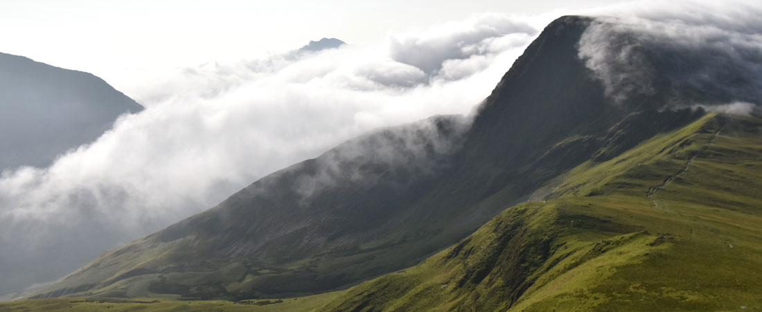
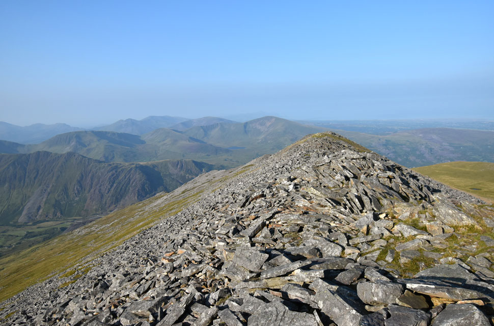
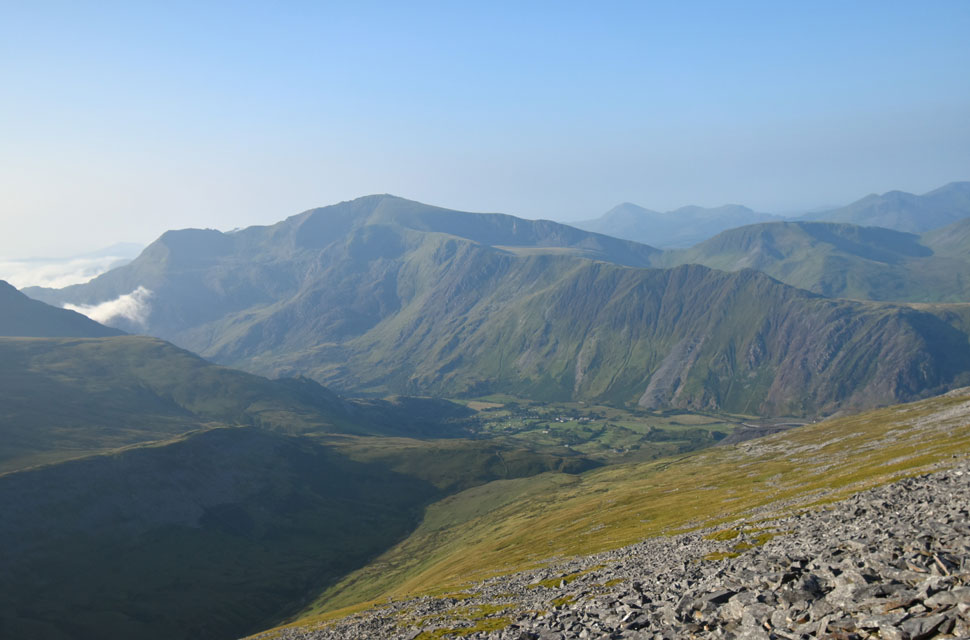
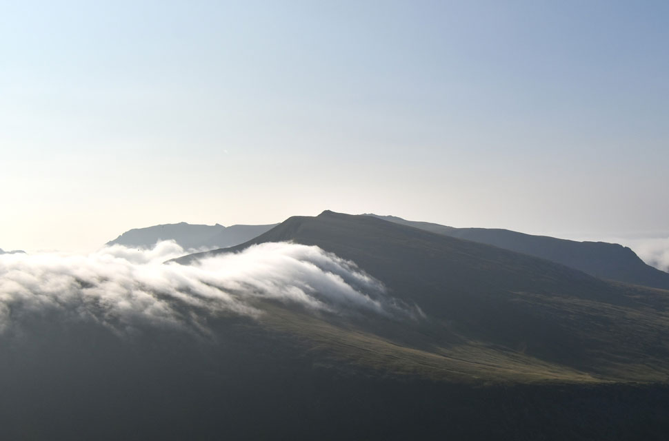
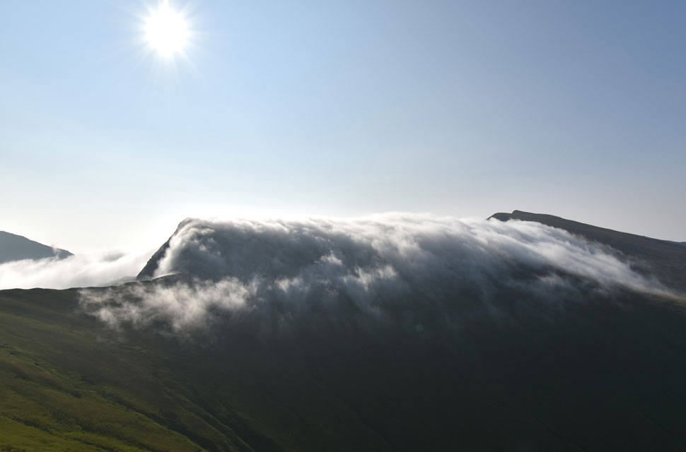
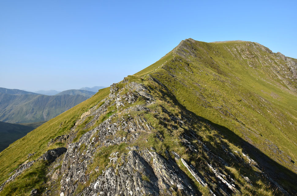
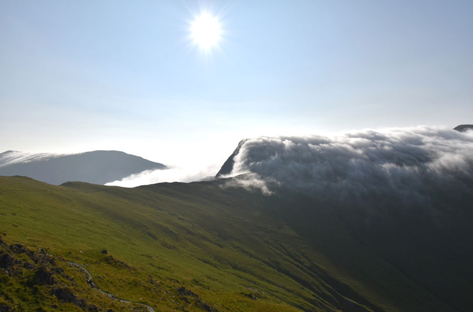
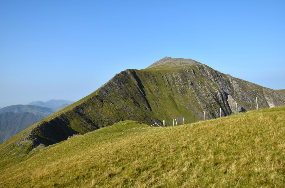
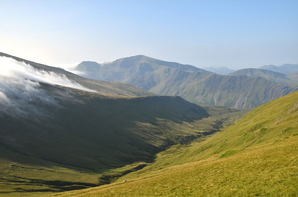
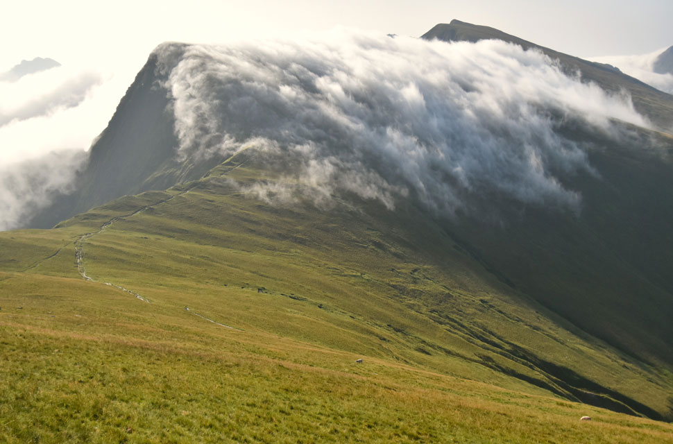
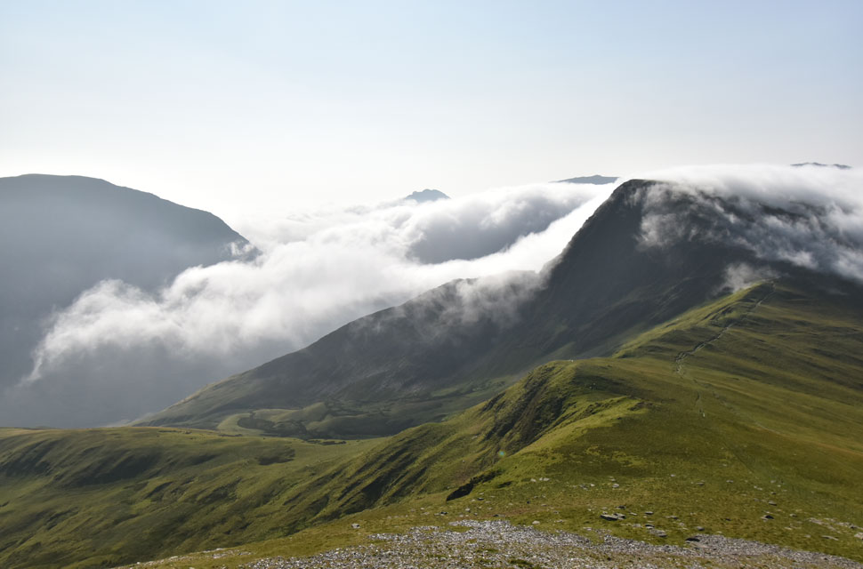
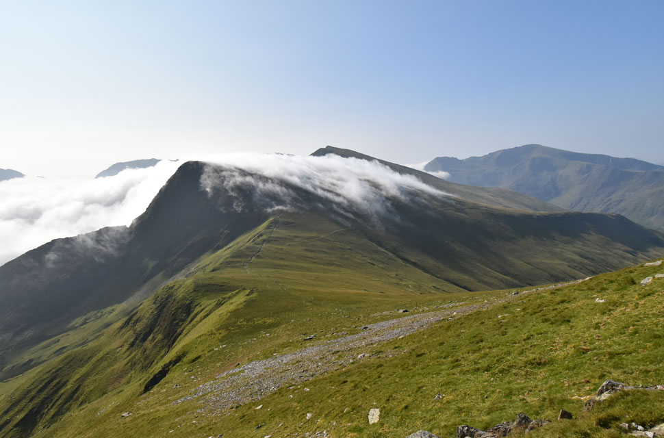
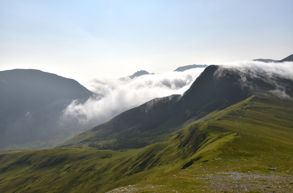
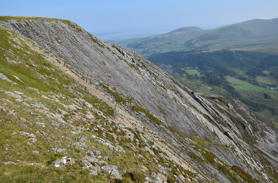
With my breath regained I was able to soak my view over Foel-goch, Y Garn and The Glyders, jeez the cloud rolling down the back of Foel-goch was mesmerising.

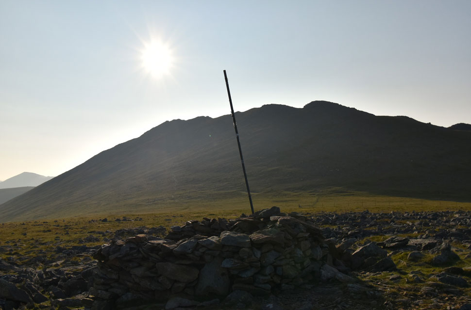
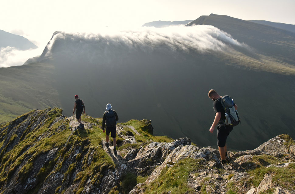
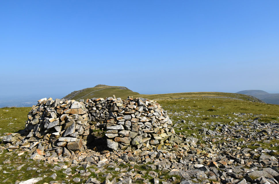
I turned east and began rock hopping over boulder to reach the summit shelter while noticing three lads in ascent, happen we're going to reach the summit at the same time.. The young lads had a couple of minutes on me and were stood on t'other side of the shelter which, on entering the shelter I instantly knew why. "It's covered in dead flying ants" one lad shouted "aye I replied" and I joined them. Two of the lads were stood up whilst one was sat down - One of the lads explained that they were walking the Welsh 3,000 footers so I replied "Oh I'm about three quarters through mine" but I soon learned that they weren't walking them in separate walks, they were doing the Welsh 3,000 footer challenge today.

That's 14,000ft of total ascent spread over 30 miles, my jaw almost dropped out of my mouth. I had nothing but pure admiration for the trio who I learned had already scaled the Snowdon Range after setting off at 4:00am "how long have you given yourselves" I asked? fifteen hours but we're on track to complete in twelve one replied, that said, one of the trio was complaining that he was feeling sick his mates just laughed it off.


Looking over Marchlyn Mawr Reservoir towards Carnedd y Filiast and Y Fronllwyd.
After wishing the trio good luck I left the lads at the summit me laughing that they'd probably overtake me which they soon did as Bwich y Marchlyn was reached.

The lads traversing Bwich y Marchlyn with the stunning cloud inversion peaking on Foel-goch.
The trio asked me if I would take a few snaps using one of their mobiles which I did before I bid them good luck again.

Mynydd Perfedd, Pen yr Ole Wen, Carnedd Dafydd, Carnedd Llewelyn, Yr Elen and Foe-goch.
I had every intention of including Foel-goch into todays walk but I was begining to have second thoughts.

Foel-goch and Y garn seen beyond Bwlch y brecan.
Still mesmeorised by the cloud inversion which left me thinking why summit Foel-goch to be in cloud? I won't see anything and I'll miss out on the stunning views such as this.

Looking back on Elidir from Bwich y Marchlyn.
I kept to the spine of the Bwich y Marchlyn which offers great views back up to Elidir Fawr and over the reservoir below.

That view again.
I'd made my mind up and had decided against a summit of Foel-goch and instead I'll summit Mynydd Perfedd, find myself a nice perch and watch the views literally unfold.

Here taking in the view of Elidir Fawr North Ridge.
With Marchlyn Mawr Reservoir looking particularly low below.

Bwlch y Marchlyn.
With Elidir Fawr beyond.

Elidir Fawr over Bwlch y Marchlyn.
I left the ridge behind in favour of the smooth grassy slopes of Mynydd Perfedd whilst on the look out for a spot to take in the views.

Looking back towards the Snowdon range with the inversion creeping around Crib Goch in the distance and on the left.
Anyone making the traverse of Crib Goch right now might be thinking they've died and gone to heaven!

Foel-goch and Y Garn over Bwich y Brecan.
I found myself a nice cluster of rocks to take in the views mesmerised by a waterfall of cloud descending from Foel-goch's summit.

The view over the Ogwen Valley.
With Pen yr Ole Wen, Tryfan and The Glyders whose summits were just peaking out above the cloud with Foel-goch seen right.

Does it get any better?
The only thing hampering the photos was the reflection from the sun on top of the cloud inversio which reflected back in the photo's as white light.

It looks like the inversion is beginning its retreat.
But that's no excuse to leave.

One last photo.
Unlike me I'd sat and soaked in the view for the last twenty minutes allowing time to half eat my lunch and even allowing for my T-shirt to dry out.

Carnedd y Filiast from Mynydd Perfedd summit shelter.
I was right although the inversion was still present when I pulled myself away it was on the retreat as The Glyders summits emerged as did the lower half of Tryfan and Lynn Ogwen which shimmered in the sunlight below. Unbeknown to me a young girl and her Spaniel had also been sat watching the cloud not far behind me and we reached the summit together remarking on how good the inversion had been and agreeing that it was now in retreat. While the Spaniel posed on request for a summit photo I left, part of me in regret that I had left Foel-goch out, the other part still in elation at what I had just witnessed.

Carnedd y Filiast ahead.
 

The Atlantic Slab on Carnedd y Filiast.
So called because this giant rock slab used to be on the seabed of the Atlantic Ocean.

Elidir Fawr and Elidir Fach from Carnedd y Filiast.
Since leaving Mynydd Perfedd I had only seen the young girl half expecting to see walkers on Carnedd y Filiast I managed to get the summit to myself from where I took in the view over Marchlyn Mawr Reservoir towards Elidir Fawr, the inversion still encroaching on Crib Goch in the distance but I wondered for how long now that the temperature was ramping up.

Marchlyn Mawr Dam wall, Bwich y Marchlyn and Eldir Mawr from the descent of Carnedd y Filiast.

I'd taken a nasty twist to my left ankle during my descent of Carnedd y Filiast so severe it almost twisted my knee at the same time half expecting to hear the snap I somehow arrested the inevitable and walked it off, my ankle I thought, must have rubber joints, I had been especially lucky although while typing this bruising is starting to appear along with some swelling, although unsightly it's my bodies way of healing.

I took the descent easy, forgetting about the discomfort at times as my nose was filled with the scent of heather. I had made great time almost completing the walk in less than four and a half hours before I'd get back to the car passing just three walkers in the opposite direction. My view of the Welsh coastline returned still tinged with haze but extensive nonetheless. With less than a mile to go the feeling of cheating the walk played on my mind 'why didn't I summit Foel-goch' playing over and over but all I had to do was rewind just an hour where my view was of mountain paradise the silence split only by a dozen squabbling ravens below.


Back to top