|
Martindale's Bannerdale Horseshoe |
 |
 |
6th September 2025 |
 |
|
|
| |
|
Overview |
|
|
| Ascent: |
2,780 Feet - 847 Metres |
| Wainwrights: |
5, Beda Fell - Angletarn Pikes - Brock Crags - Rest Dodd - The Nabb |
| Visiting: |
2, Bedafell Knott - Angletarn Pikes South Top |
| Weather: |
Overcast Throughout. Feeling Fresh In The Wind. Highs of 17°C Lows of 11°C |
| Parking: |
Car Park, Martindale New Church |
| Area: |
Far Eastern |
| Miles: |
9.5 |
| Walking With: |
On My Own |
| Ordnance Survey: |
OL5 |
| Time Taken: |
5 Hours 20 Minutes |
| Route: |
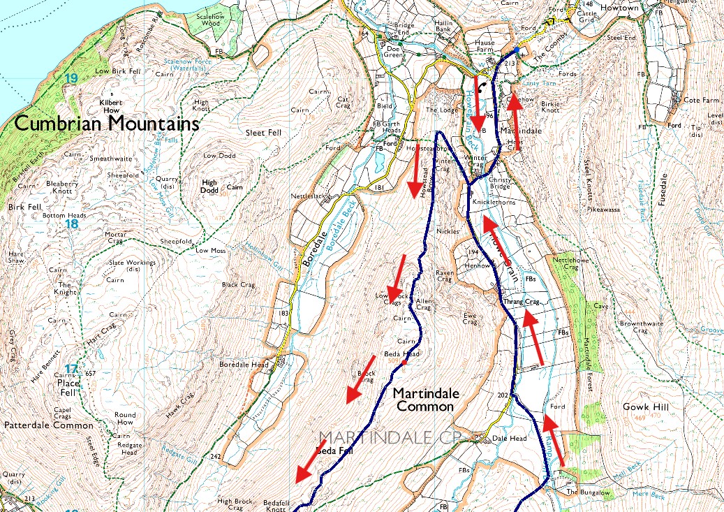
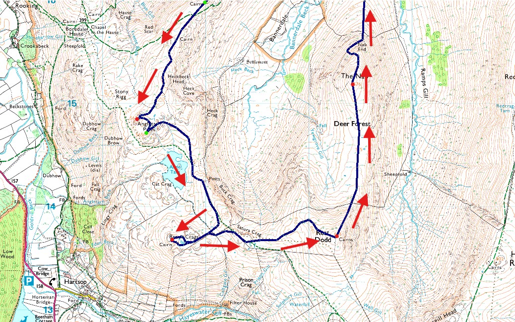
Martindale New Church - Martindale Old Church - Winter Crag - Beda Fell - Bedafell Knott - Heckbeck Head - Angletarn Pikes North Top - Angletarn Pikes South Top - Angle Tarn - Brock Crags - Satura Crag - Rest Dodd - The Nab - Nab End - Martindale - Martindale Old Church - Martindale New Church |
|
| |
|
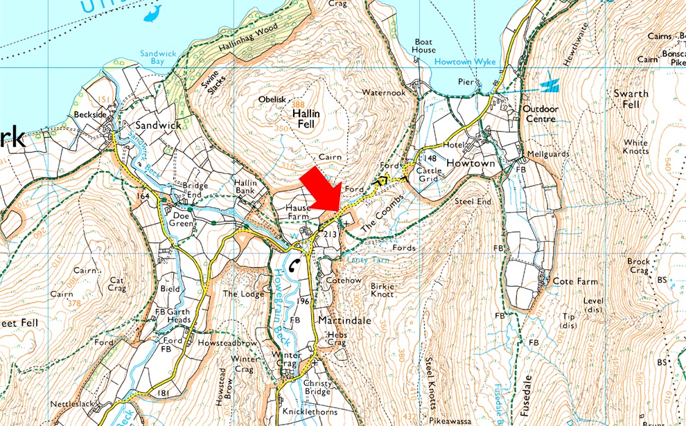
Parking Details and Map |
|
|
| Nearest Post Code: |
CA10 2NF |
| Grid Reference: |
NY 435 619 |
| Notes: |
There are actually two car parks at Martindale New Church one of which is next to the Church itself and on the opposite side to the car park there is off road parking for around half a dozen well parked cars. Parking is free at both sites. |
|
| |
|
Map and Photo Gallery |
|
|
  |
| |
| |
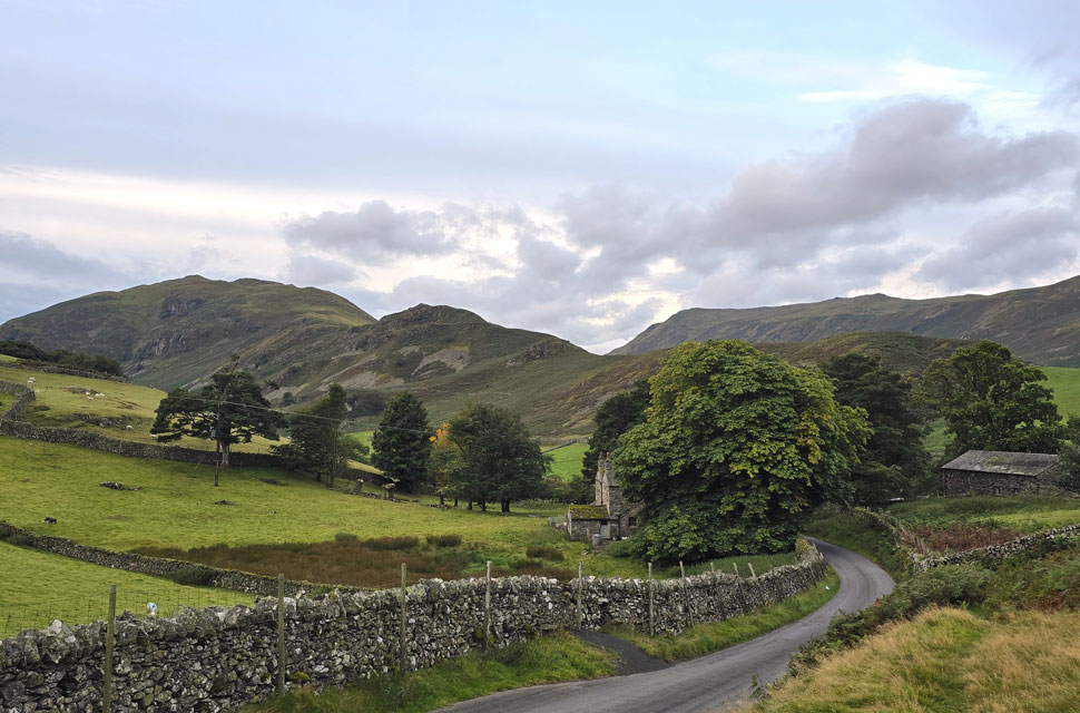 |
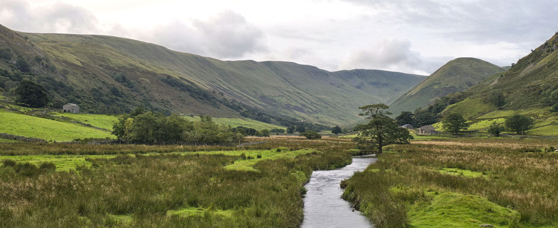
| Beda Fell, Winter Crag and Place Fell from Martindale New Church 11°C 7:00am |
I'd had one of two walks planned for today the first being a round of the Esk Hause fells from Seathwaite but after seeing the forecast I was diverted east of the park. My plan B was the Bannerdale Horseshoe which was still belter; more so because it included two fells Beda Fell and The Nabb which I haven't visited for a while, in fact it was 2018 since I last placed boot on The Nabb and I was really looking forward to the return. Despite the forecast saying the best of the weather would be in the east, or far east of the park it didn't seem that way when I arrived at Martindale New Church under grey skies but there was promise the further north I looked. It's been a busy Summer here in the lakes but this morning it felt like midweek with only one other car parked up, its owner sat in the drivers seat like she was waiting for friends to arrive.
It was a mild start and the only the only thing breaking the silence were the half dozen Ravens squabbling in the trees and beyond that, silent grey cloud scuttled across brooding skies. Within five minutes of arriving I was ready for the off still wearing shorts while I still can topped off by my trusty fleece lined windproof jacket. I left the car park and walked down the hill keeping to the grassy bank which offered elevated views into the Martindale valley, it was at this point did I spot a Red Squirrel running across the stone wall so fast I was unable to get a shot before it disappeared on the other side of the wall. |
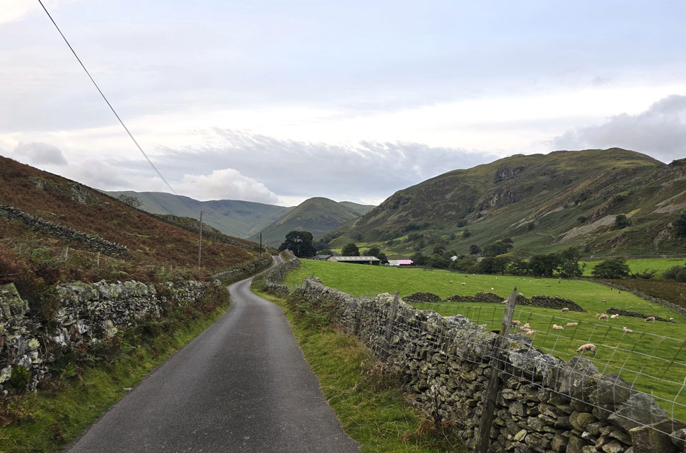 |
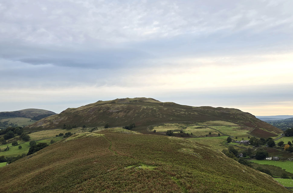
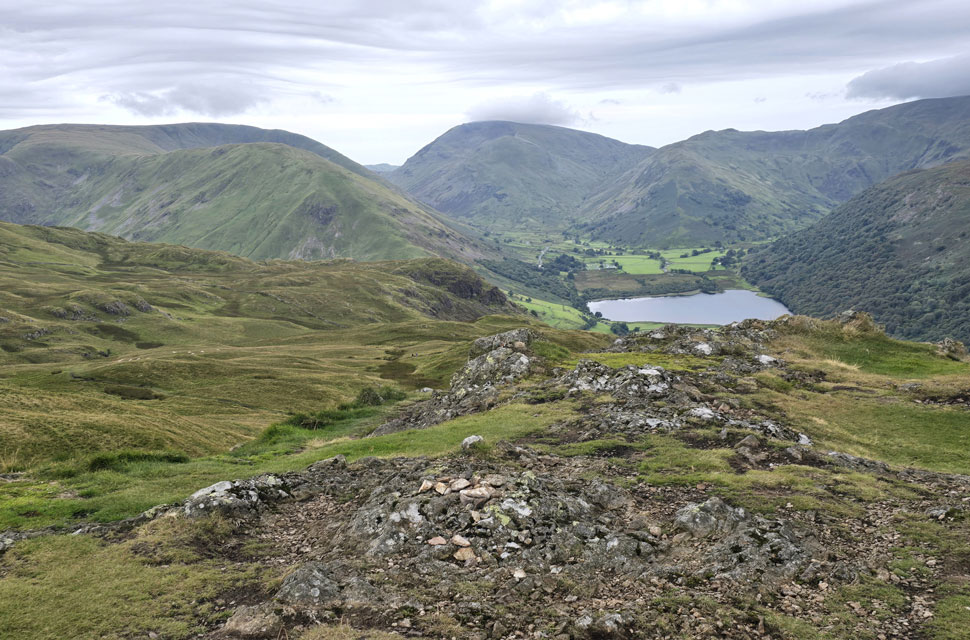
| Distant views of Wether Hill, Ramps Gill, The Nabb and Beda Fell. |
| About half way down the hill I passed the familiar cottage with its wall mounted post box and newly painted railings the silence now being shattered by dozens of sheep ba'hing in a nearby field. I had two choices to gain Beda Fell by, the path via Nickles that ascends through bracken or by Winter Crag - , trouble was there was no signs of the path from here. |
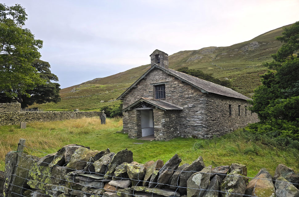 |
| Passing Martindale Old Church. |
| |
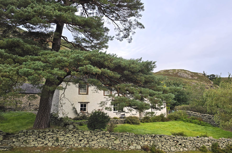 |
| Winter Crag cottage. |
| After passing over Howgrain Beck I arrived at Winter Crag cottage complete with Scotts Pine in the front garden. The key to gaining Winter Crag from here is to take the path that passes behind the outcrop in the distance as opposed to the lower, more prominent path. Located behind the cottage at a bend in the road. |
 |
| Hallin Fell and Little Mell Fell from Howstead Brow. |
| The path was narrow to start but height is gained quickly passing through bracken on the retreat which this morning was thankfully dry. |
 |
| Views into the Boredale valley. |
| With Place Fell seen on the right. |
 |
| Beda Fell from Winter Crag. |
| With Winter Crag now gained my view was now domintated by Beda Fell ahead. You can just see where the top of the path through Nickles converges in the centre of the photo. |
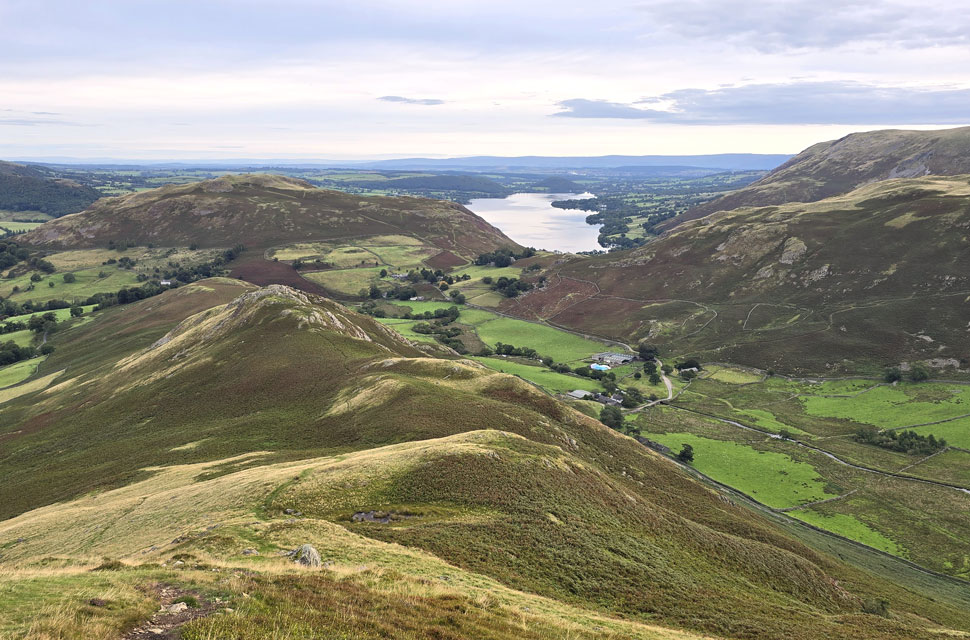 |
| Looking back on Winter Crag, Hallen Fell, Steel Knotts and Bonscale Pike. |
| And of course Ullswater with Dunmallard Hill seen in the distance. |
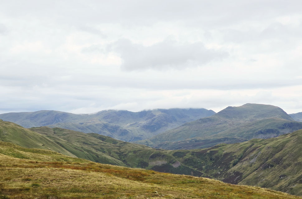 |
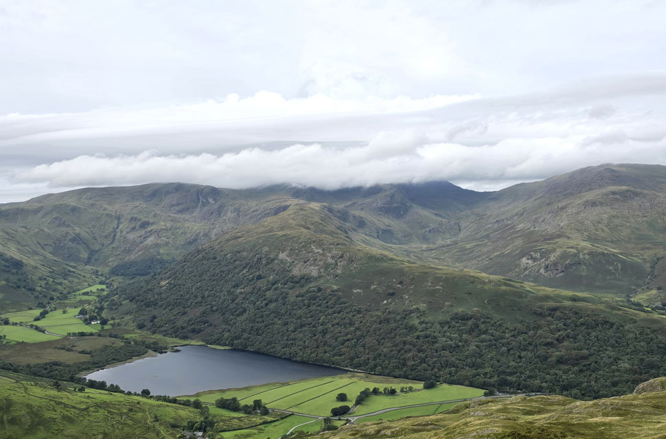
| Views over Boredale Hause towards Hartsop above How, Dove Crag, Hart Crag and Fairfield. |
| The cloud over Fairfield stretches north towards the Helvellyn peaks too, it's a bit doom and gloom at the moment but it's still early with plenty of time for it to lift. |
 |
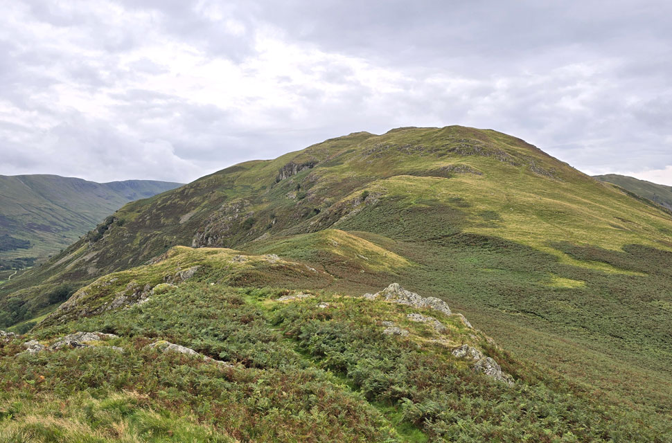
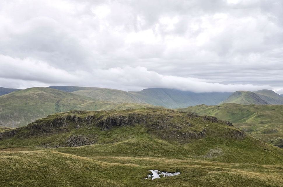
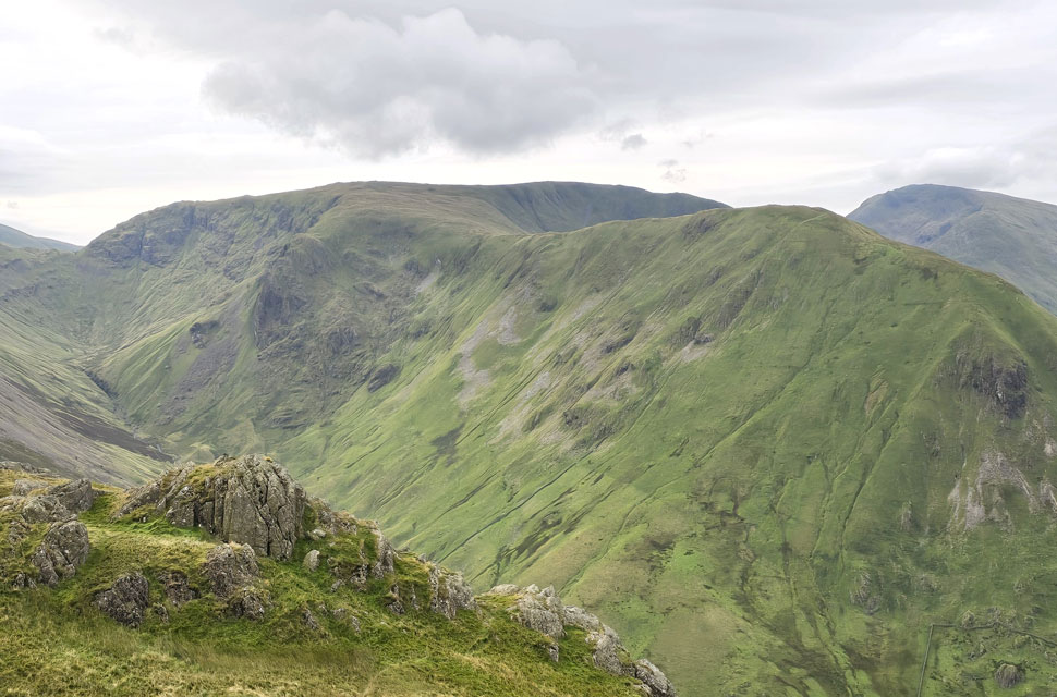
| Heckbeck Head and Bedafell Knotts. |
| From Beda Head (Beda Fell summit) |
 |
| Looking back on Beda Fell and Bedafell Knotts. |
| I had to laugh when for the third time of being here I mistakenly took the right path towards Boredale Hause when what I should have done was continue straight ahead. The last time I did this I had David and Rod with me and we had to regain the path by a pathless grassy ascent. No doubt back then the lads were muttering a few choice words under their breaths! |
 |
| A superb view over Boredale Hause towards Place Fell. |
| |
 |
| Hartsop Dodd, Caudale Moor, Red Screes, Middle Dodd, Little Hart Crag, High Hartsop Dodd and Brothers Water from Angletarn Pikes summit. |
| I hadn't seen anyone until the summit of Angletarns Pikes came into view where I spotted a young girl and her brother standing on the east side of the summit arms outstretched whilst her brother took her photo, soon after they descended joined the rest of their family who were stood waiting on the Angle Tarn path below. |
 |
| Angletarn Pikes South Top from the North Top (summit) |
| Which is where I'm heading next. |
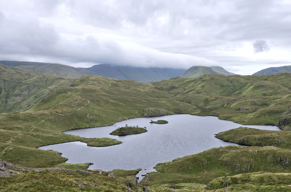 |
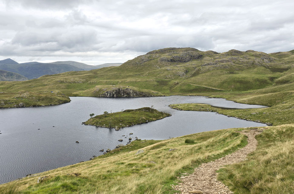
| Angle Tarn from the descent of Angletarn Pikes South Top. |
| Angle Tarn has become quite popular with wild campers over the years, its popularity can be off putting to both fellow wild campers and indeed fell walkers like myself who find it difficult to turning a blind eye to what can be dozens of tents pitched here. It was kind of a 'don't look' moment when Angle Tarn first came into view spotting just two tents (both to the right of the picture) no doubt the forecast putting the less hardened camper off. That was until I began my descent when I spotted three more tents on what can only be described as marshland at the base of the the south top which I found quite odd given how wet the ground was. |
 |
| Brock Crags seen over Angle Tarn. |
| Which is where I'm heading next. |
 |
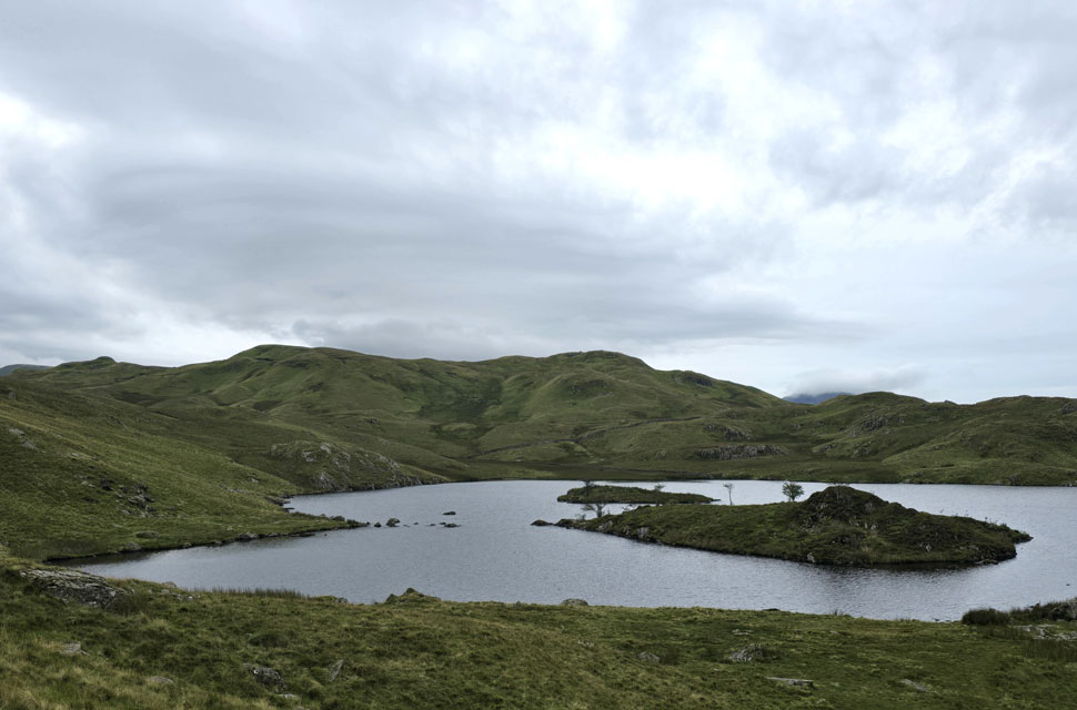
| Looking back on Angletarn Pikes from Angle Tarn. |
| From the south top I descended onto the path where I was joined by a trio and a pair of walkers behind me and another pair up ahead and wondered if the five behind me would follow me onto Brock Crags. |
 |
| Brothers Water, Dove Crag, Hart Crag, Fairfield, Hartsop above How and St Sunday Crag from Brock Crags summit. |
I left the path and branched off right for Brock Crags passing the path at the break in the wall which descends back to Hartsop where memories came flooding back from a walk I did in zero visibility a few years ago, when I struggled to locate said path later learning that its the break in the wall that gives it away.
Swollen underfoot I continued towards Brock Crags arriving at the marshy area where I swerved right if only to avoid getting my boots wetter than they were. It was blowing a gale at the summit, a touch on the cold side too and I wouldn't have blamed anyone for adding a hat or a pair of gloves the wind penetrating my jacket a sure reminder to layer up as Autumn is breached. |
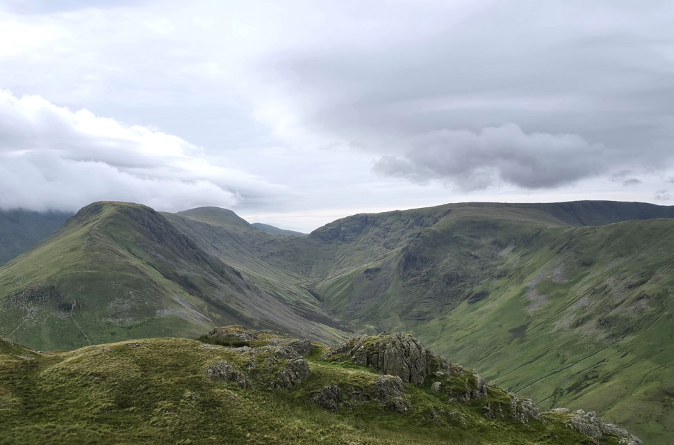 |
| Looking south... |
| ...into Pasture Bottom towards Thresthwaite Mouth with Gray Crag seen left, Thornthwaite Crag further ahead and Stony Cove Pike, Caudale Moor and Hartsop Dodd on the right. |
 |
| Further around... |
| ...I took in the view over Hayeswater towards a cloud topped High Street. |
 |
| Time for one last picture before I leave. |
| Here looking towards the dominance of Hartsop Dodd with Raven Crag, Stony Cove Pike and Causdale Moor seen beyond not forgetting Red Screes and Middle Dodd seen furthest right. |
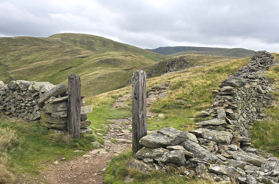 |
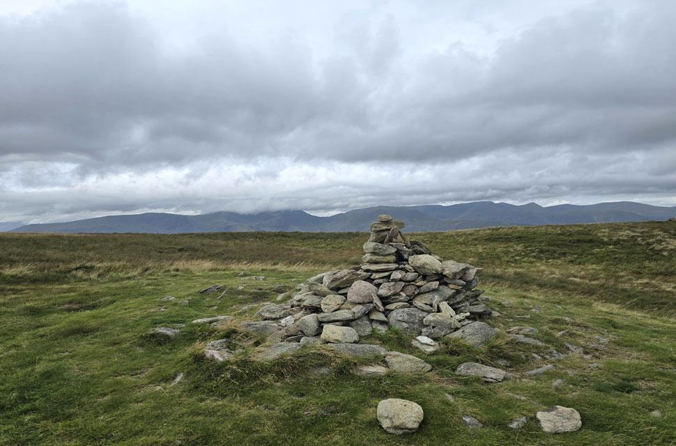
| Rest Dodd, Knott and Rampsgill Head seen from the gatepost atop Satura Crag. |
I left Brock Crags behind shielded by crag I was out of the wind too. I ventured around the right side of the marshy ground keeping my boots dry until I spotted the two familiar gate posts on Satura Crag.
These gate posts are like two beacons to the lost walker which once included myself way back when and they also provide happy memories of my early days as a fell walker from seeing them on David Halls Walkthefells website to actually seeing them for myself for the first time. |
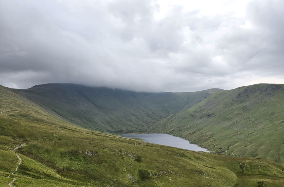 |
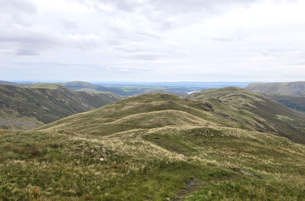
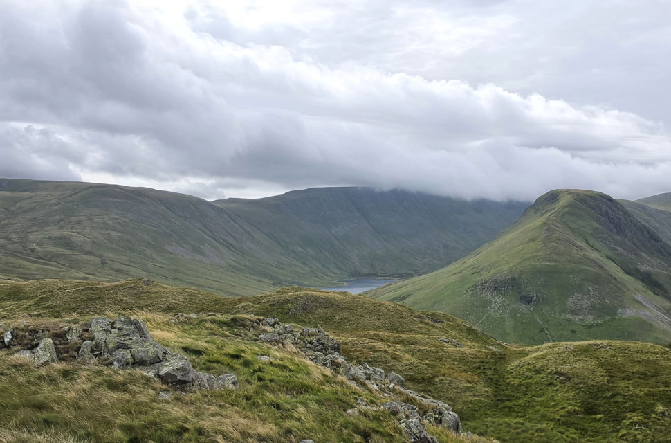
| High Street, Thornthwaite Crag and Gray Crag seen above Hayeswater. |
| After leaving Satura Crag behind I spotted the path bound for Rest Dodd further ahead minutes later I was beginning the gentle ascent from where I spotted half a dozen deer below Satura Crag. I was a good 200 yards away but they'd seen me and were already starting to rise as I drew up my mobile to take a photo by which time all could see was their backsides galloping down the slope into the Bannerdale valley below. |
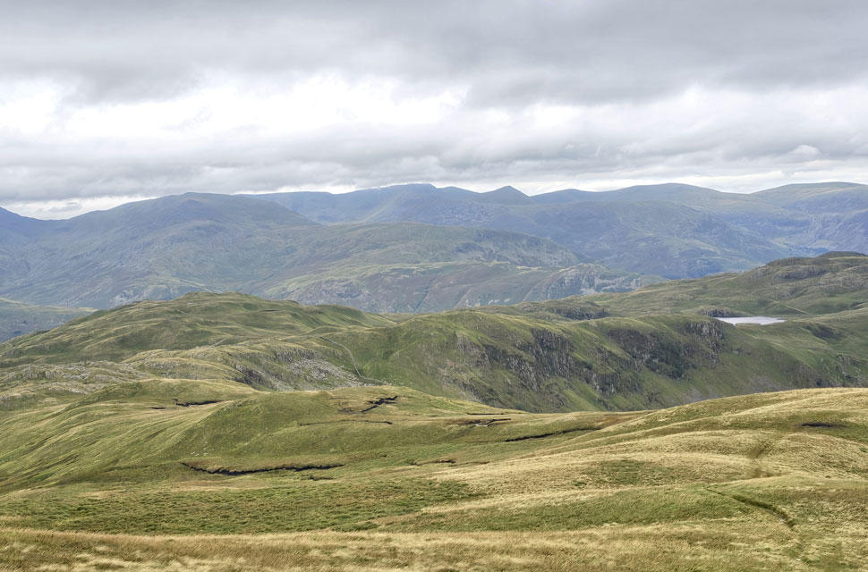 |
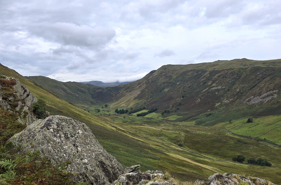
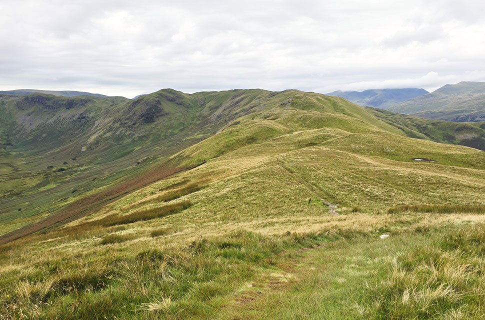
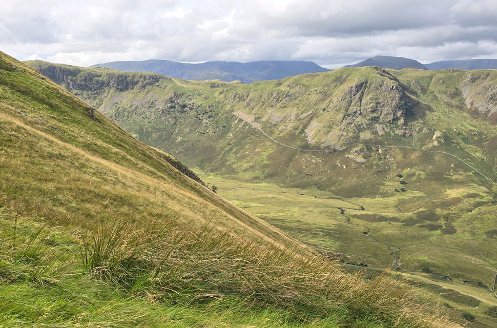
| Looking back on Brock Crags and Angletarn Pikes from the ascent of Rest Dodd. |
| With Buck Crag and Heck Crag forming the head of the Bannerdale valley in the centre of the photo. Angle Tarn can be seen beyond Bannerdale in the distant right. |
 |
| Rest Dodd summit. |
| The last time I ascended Rest Dodd the cloud was down and visibility was down to just feet causing me to miss the path which heads directly onto the summit, today I had no worries only wishing for a little brightness as forecasted. |
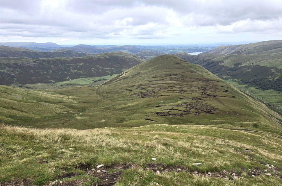 |
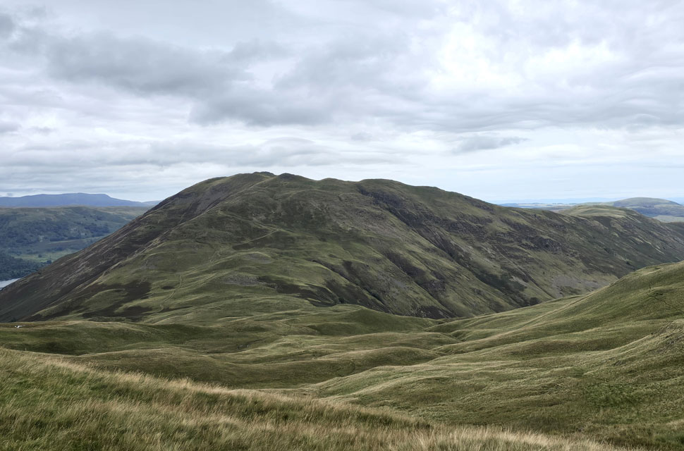
| Looking down on The Nabb from the descent of Rest Dodd. |
| After a few days of rain I'm assuming it's going to be a tad squelchy down there. |
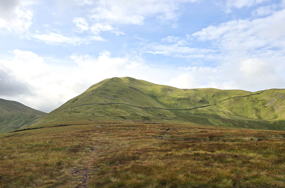 |
| Whoo hoo! the sun has come out. |
| Here as I look back on Rest Dodd. |
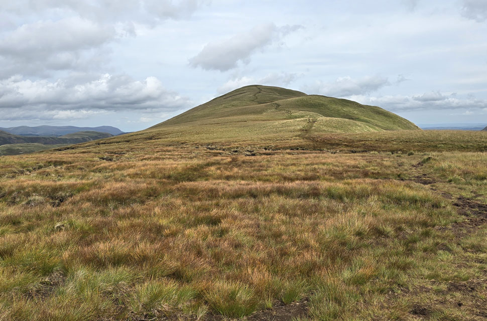 |
| The Nabb is dead ahead. |
| There is a path to the right of the notorious peat bogs but this isn't to say the path doesn't pass through peat hags which can be up to chest height - the key here is plot your way around rather than go in blind. |
 |
| A quick lunch stop above Nab End. |
| Here taking in the view over Bannerdale towards Heck Crag and Heck Cove. |
 |
| The view over Dale Head towards Steel Knotts, Hallin Fell and a distant Little Mell Fell. |
| It goes without saying that the descent of Nab End is best avoided due to how steep the ground is hascent to say there is a path that flanks Nab End to the left but I kept right often coming into and of line with the main path. By the time I'd reached the base, my feet were crying in my boots! |
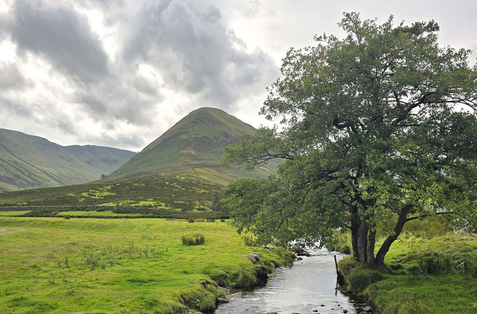 |
| The Nab from Bannerdale Beck / Dale Head. |
| |
 |
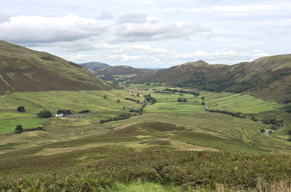
| Wether Hill, The Nabb and Ramps Gill from Howgrain Beck. |
Any brightness that I had whilst back on The Nabb was over shadowed by further cloud but at least the temperature remained in the high teens allowing me to finally remove my windproof prior to passing through a sty at the base of Nab End from where I spotted a family heading towards me. Flanked by retreating bracken on both sides I passed the family and their two dogs, one of which, a Patterdale terrier took a shine to me as I patted its back with warmth. The family pressed on and I wondered of their route before spotting a Land Rover Defender pass below; the driver stopping to allow the passenger to open one of two gates in the valley. In silence the Defender drove off and shortly afterwards I too passed through the same gates, not before delayering that is. Like Swindale Martindale remains one of those untouched and dare I say protected valleys, modernisation has not reached the valley except if you know where to look and long may it continue. I crossed Bannerdale Beck and closed the last gate behind me sighting The Nabb through tree or farm building until it was no longer in view. A couple of miles back through the valley under grey skies but the mildness of midday made it feel like summer again and it was nice to see a healthy count of sheep in the adjoining fields. I passed the Nickles footpath and eyed its route through the bracken and five minutes later I was passing the start of the Winter Crag path too, funny how such a used path doesn't appear as prominent as it should I thow't.
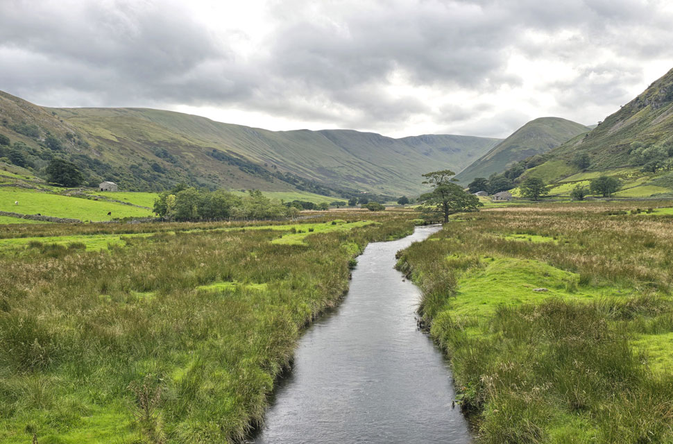
A car waited for me to take this last photo both driver and passenger waved as I crossed the bridge whilst placing my mobile back into pocket. Just half a mile left until Martindale New Church now as the incline on the lane increased, I passed the same barn where the magpie dived in earlier which was when I spotted the dead sheep lying motionless on the back of the farmers quad bike. The lane steepened as I passed the cottage from where I was brought back into reality with the click of two fingers spotting cars doing u-turns unable to park I eased off the gas the shock came to soon. I reached the car park to find it full to bursting, the driver of a minibus patiently waiting to park as she chatted to passing walkers. My car was flanked by half a dozen folk chatting, the other half dozen were on the opposite side of the car park but this didn't stop conversation. I had to excuse myself to reach the boot of my car the group apologised and moved away but I was still in their zone as I began my kit down I thought I could feel thier eyes burning in the back of my head. They were actually nice folk who has it turned out were waiting for the last of the group to descend Hallin Fell. Ready to leave I slumped into the drivers seat and put my car into reverse, again, the group parted all except this one guy who guided me out through my rear view mirror. |
| |
|
| |
| Back to top |
 |
|